TrainWeb.org Facebook Page
WM Photo Tour


Western Maryland Railway
Modern day photo tour

Accompanying each photo below are:

Click a photo to see a larger view. Please send your comments and corrections to Steve.


<< Previous (east) | THIS PAGE: Spring Garden to Westport | Next (west) >>

Atlas 1915
Image courtesy Johns Hopkins University
NEW! mid-Jul 2024

Atlas 1915
Mile: -0.5 to 0.5 Date: 1915
Ease: View: N (up)
Area: IC2:
Map: Ba 42 J 4 (center) Topographic Maps

This tour page heads west (left) from WM's Patapsco River crossing found at the right edge. Once back ashore, the line reached Kloman Street where Baltimore light rail now operates, and a power generating station, since demolished.

Running more north-south in 1915 were rail lines of B&O (adjacent the pond), WB&A (the nearly vertical line) and Maryland Electric Railways (formerly Annapolis Short Line, ASL). The WM yard at center is now used by Vulcan Materials. Many of the streets depicted were never built, and others have since been renamed.


Cable Crossing

Cable Crossing
Mile: -1.0 Date: Feb 2016
Ease: B View: W
Area: B- IC2:
Map: Ba 43 A 4 Topographic Maps

Rather than zig-zagging as CSX currently does, WM had easier access to Port Covington via its Spring Garden Swing Bridge across the Patapsco River. The cable crossing sign is in position for train operators to read -- who have no ability to act upon such information. So, why the cable crossing sign? A similar sign graces the opposite shoreline.

The bridge borrows the name of a summer resort that opened near the base of Howard Street during the early 1800s.

Link: 1986


Swing Bridge

Swing Bridge
Mile: -1.0 Date: Feb 2016
Ease: B View: W
Area: B- IC2:
Map: Ba 43 A 4 Topographic Maps

This photo celebrates the swing bridge's 100th birthday. Once the last WM train left Port Covington sometime during the 1980s, the bridge was turned and left in its open position.

Since then many have wondered what to do with the bridge. When it became clear the big trains were not returning, some suggested repurposing the bridge into a pedestrian trail or light rail crossing. Neither has been done as of the date of this photo, but now that Under Armour has purchased land on both shores here the bridge may finally get a second turn.


Spring Swing

Spring Swing
Mile: -1.0 Date: 2001
Ease: A- View: N
Area: B- IC2:
Map: Ba 43 A 6 Topographic Maps

The bridge was a bit less rusty 15 years prior on a fine spring day. The nearly-1000-foot tall antenna mast poking high at upper left is 6 miles distant atop TV Hill.

Link: TV Hill mast


Signal

Signal
Mile: -1.0 Date: Feb 2016
Ease: B View: W
Area: B- IC2:
Map: Ba 43 A 4 Topographic Maps

closeup Like any self-respecting railroad, the Western Maryland had its own style of signals.

Some WM signals in the area remained in use into the 2000s, but since then new-owner CSX has been on a signal standardization spree, tearing out these old designs just as it has done to the B&O's distinctive CPL signals. The example seen here, not in operating condition, is the last standing in the area.

CSX replaced CPLs along former B&O trackage with an in-line color light signal variety, however it has not installed such replacements along this ex-WM line, at least not within Baltimore City. Instead the line is currently unsignalled.


First

First
Mile: -0.9 Date: Apr 2021
Ease: B View: S
Area: B- IC2:
Map: Ba 43 A 3 Topographic Maps

WM's wooden trestle between land and swing bridge predates everything else man-made in view, the roads, the trucks, the plane, the buildings, etc.


Swing Bridge 2

Swing Bridge 2
Mile: -0.8 Date: Mar 2015
Ease: A View: S
Area: B IC2:
Map: Ba 43 A 4 Topographic Maps

Here's the double-tracked swing bridge as seen from I-95 north. The total pipeline length of the bridge, the swiveling center portion plus wooden trestle approaches, is over 2000 feet. CSX has a similar swing bridge along its Marley Neck Industrial Track south of Curtis Bay that is operational though only single track.

The 1972 aerial photo at right captured the bridge in its closed position. The pipeline north of the bridge foretells the route I-95 would mimic about a decade later. 1972 photo courtesy Johns Hopkins University.


Swing Bridge 3
NEW! mid-Jul 2024

Swing Bridge 3
Mile: -0.6 Date: Mar 2024
Ease: C View: E
Area: C- IC2:
Map: Ba 42 K 4 Topographic Maps

a reverse-to-tour-direction view


Rails
NEW! mid-Jul 2024

Rails
Mile: -0.6 Date: Mar 2024
Ease: C View: W
Area: C- IC2:
Map: Ba 42 K 4 Topographic Maps

Two tracks extend off the bridge's west side and now abruptly end beyond the brush. A short siding had peeled off to the left beyond a forgotten traffic control sign to serve the Westport Generating Station.


Westport Generating Station
Photo courtesy Baltimore Sun

Westport Generating Station
Mile: -0.5 Date: ~1930
Ease: View: E
Area: IC2:
Map: Ba 42 K 4 Topographic Maps

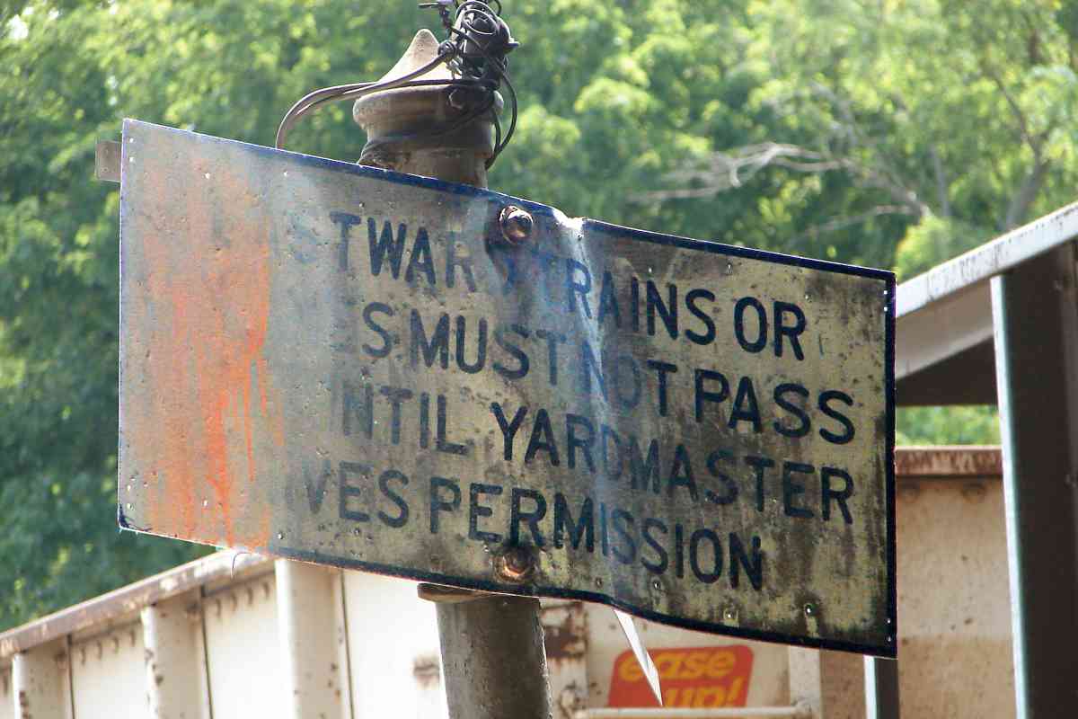
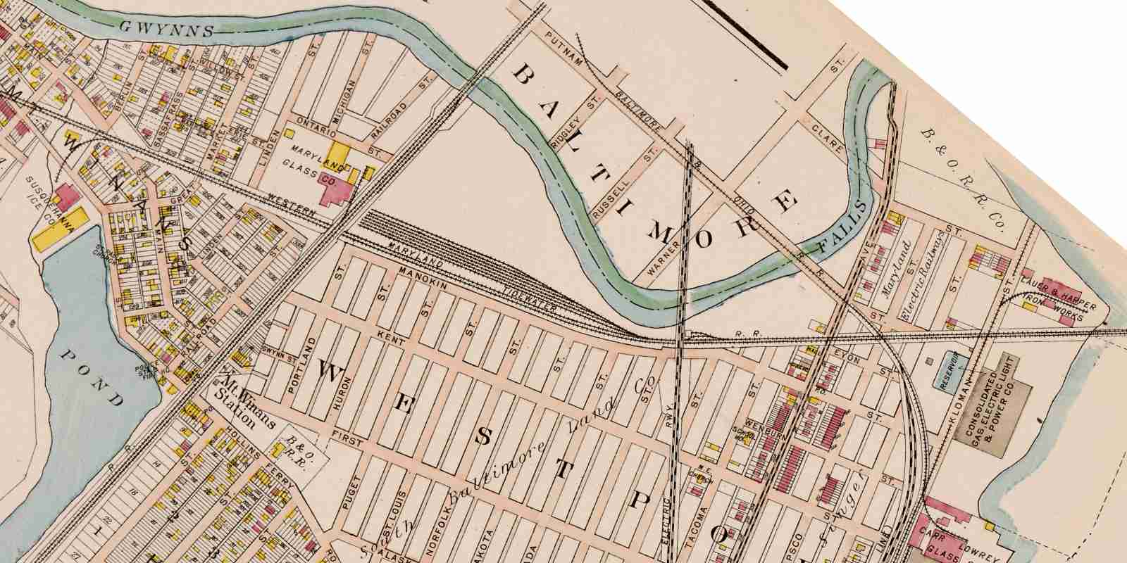
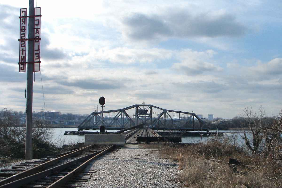
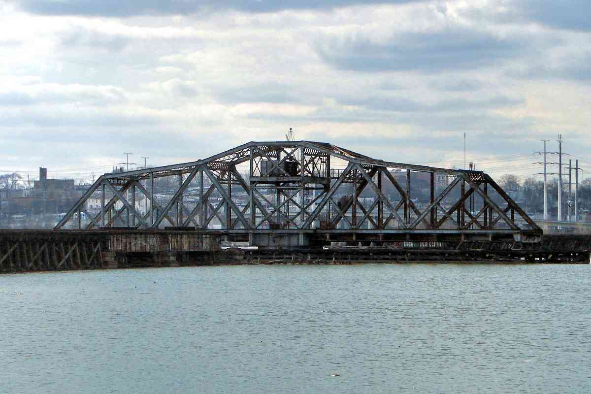
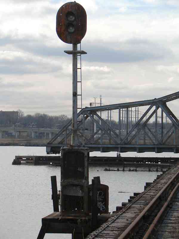
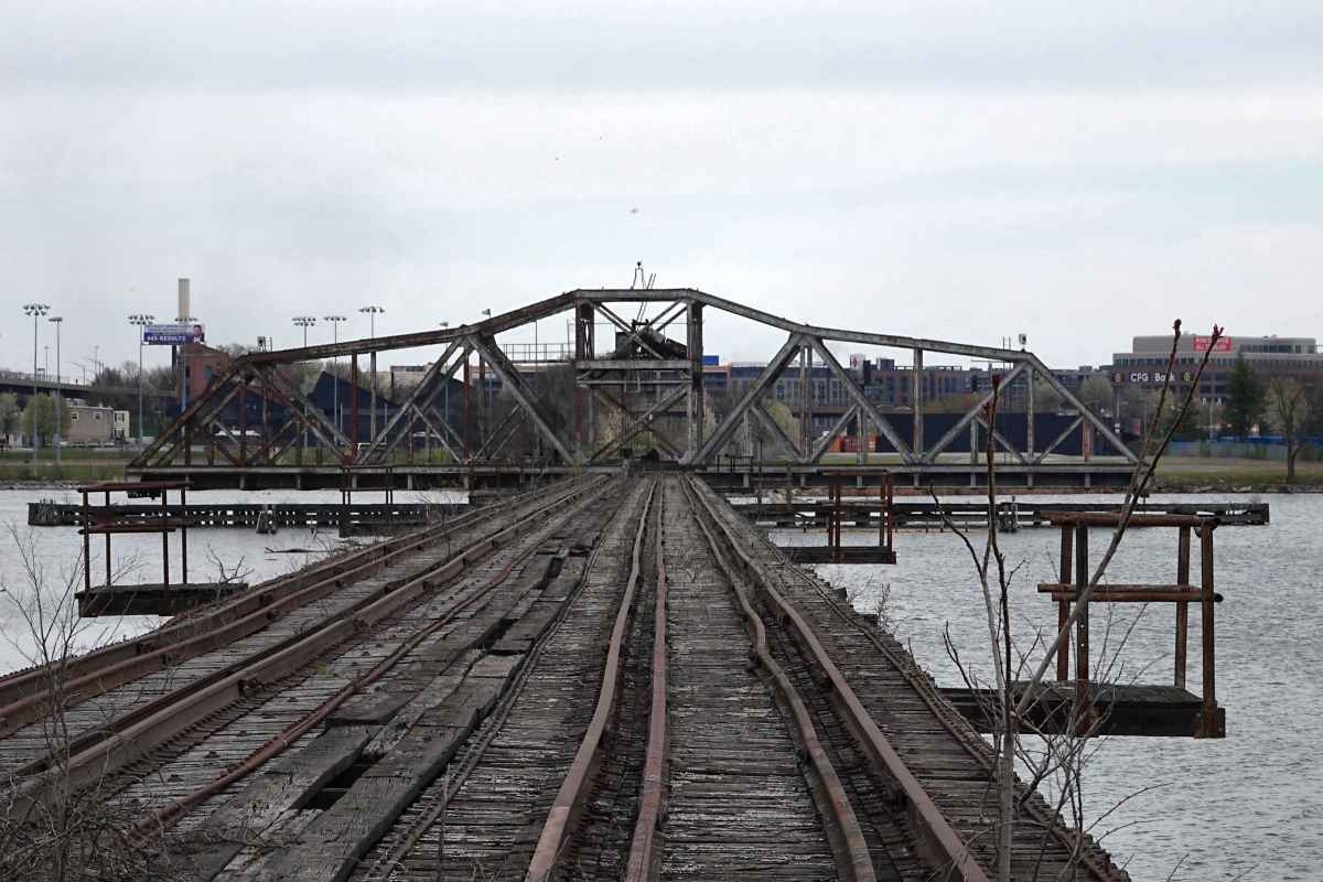
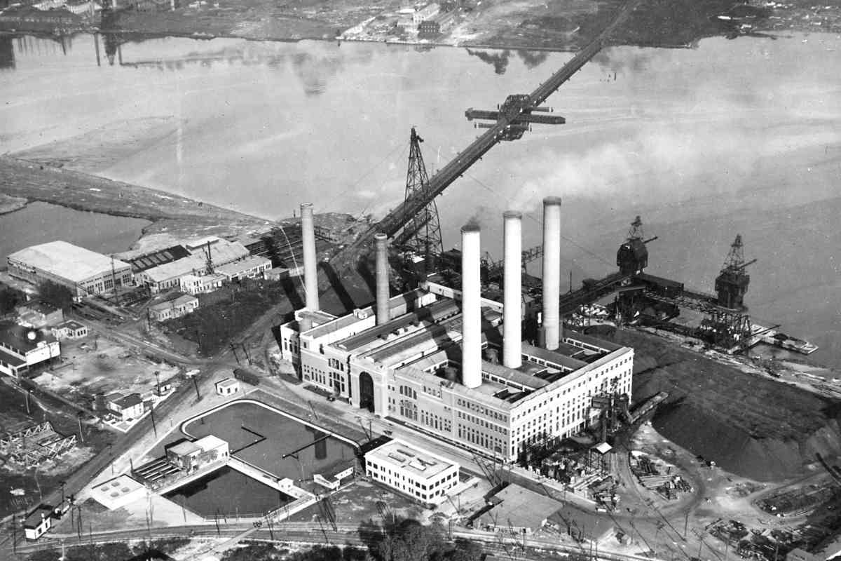
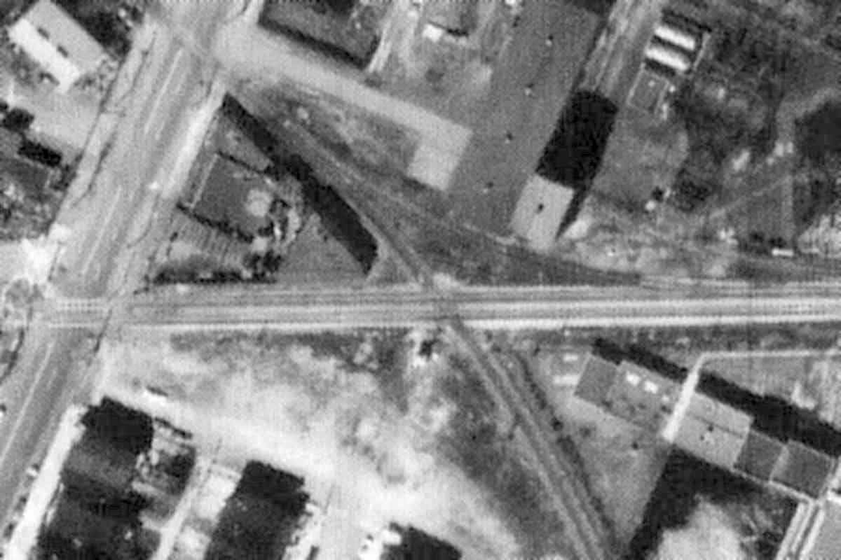
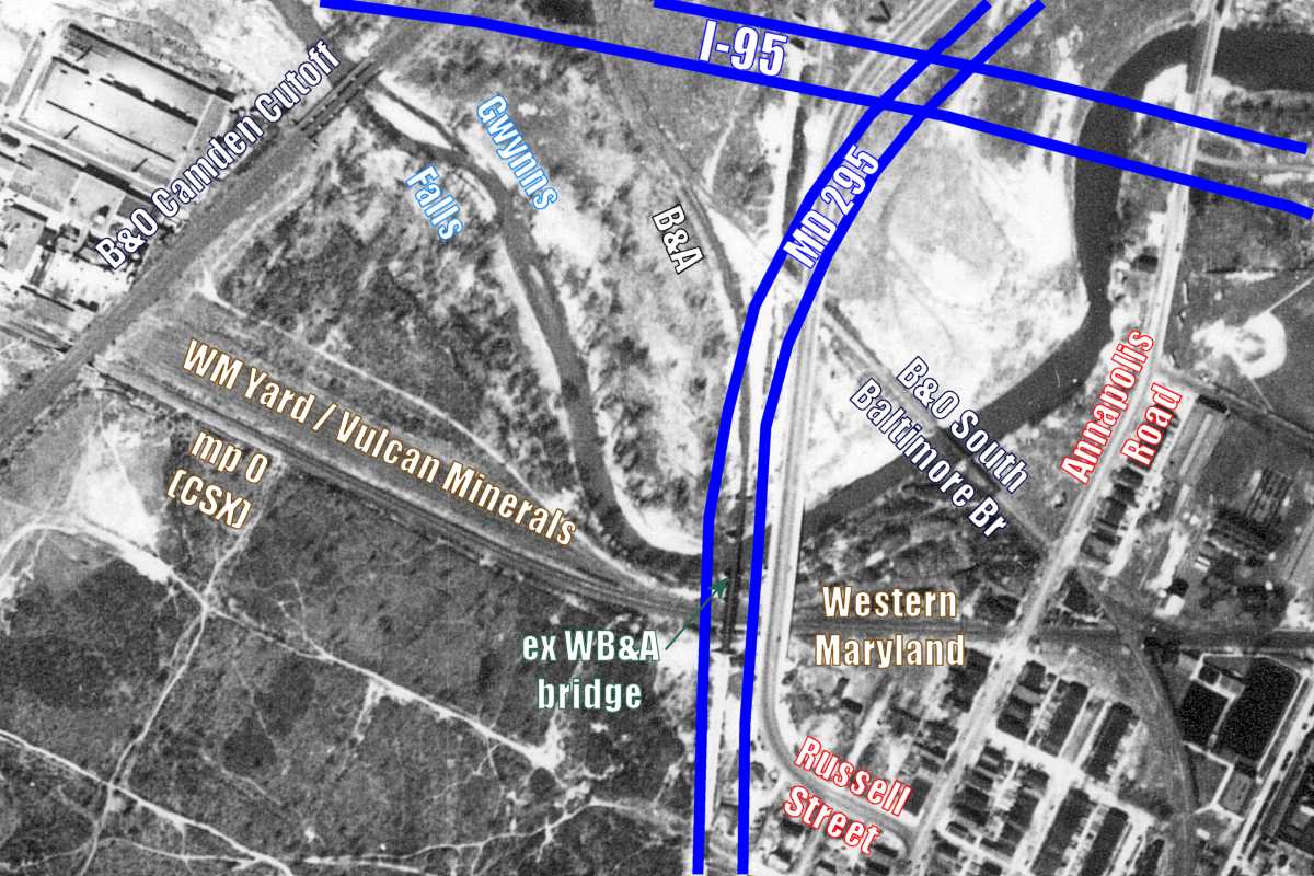
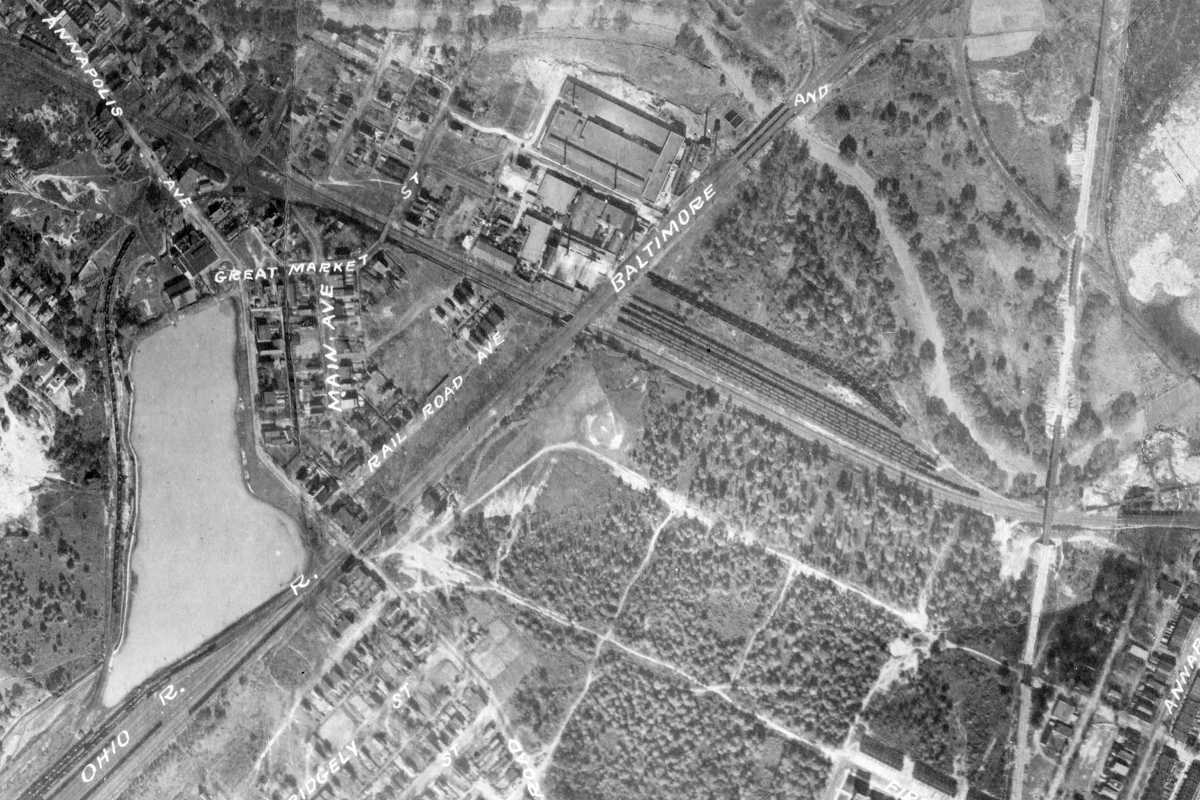
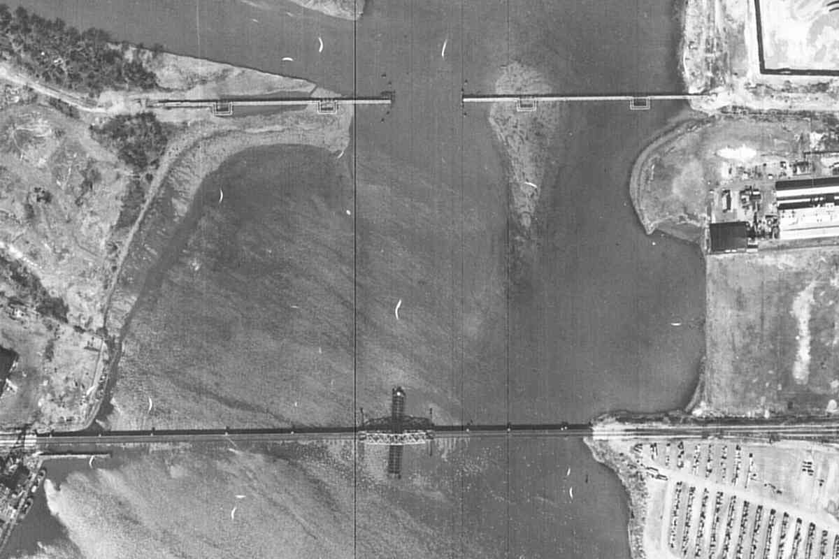
After coming ashore on this, the western side of Spring Garden Bridge, WM trains would pass Consolidated Gas & Electric's Westport Generating Station (power plant). The building was demolished during 2008.

Dual cranes at the shore suggest most fuel coal was delivered by ship rather than by train. The three railcars on a short, curved siding near the pile of coal may have carted away ash. Coal was transported inside via a custom wagon system on rails.

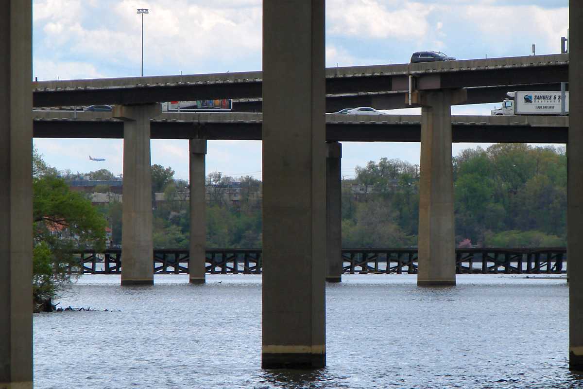
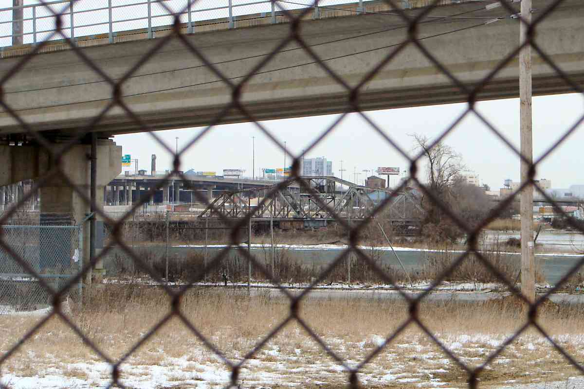
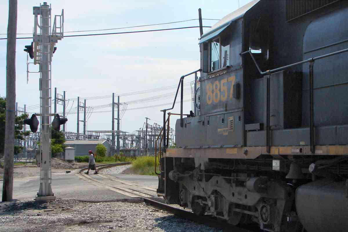
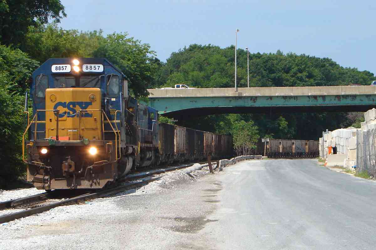
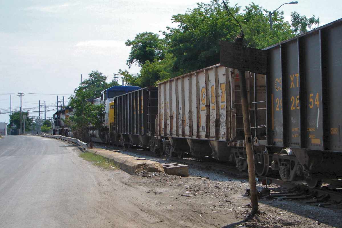
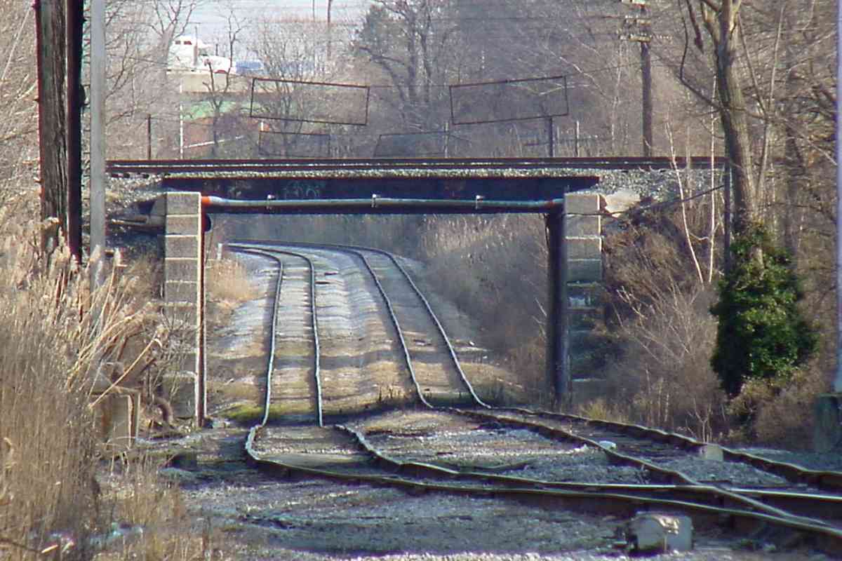
WM and B&O's South Baltimore Branch (SBB) intersect at lower left. After the bridge was closed to rail traffic, CSX curved the former WM line to the southeast so it would join the SBB near the trees at bottom.

Links: aerial by Baltimore Sun, 1996, aerial photo, interior


The Wire
Screen capture (fair use)
NEW! mid-Jul 2024

The Wire
Mile: -0.5 Date: ~2007
Ease: A View: N
Area: D+ IC2:
Map: Ba 42 K 4 Topographic Maps

The final episode of HBO's The Wire visited the Westport Generating Station shortly before it was demolished. WM's tracks ran along the opposite side of this building. The rail embedded in the street at bottom was part of B&O's South Baltimore Branch. The concrete support at upper left belongs to Baltimore's light rail system. No light rail or CSX trains appeared in The Wire.


Power
Photo credit HH Harwood
Updated mid-Jul 2024

Power
Mile: -0.5 Date: 1990s
Ease: A View: N
Area: C IC2:
Map: Ba 42 K 4 Topographic Maps

Electricity distribution continues on the left where ex-ASL Maryland Electric Railways initiated it.

The photographer is standing at the former location of the Western Maryland Railway's tracks here. They were dismantled around 1990 in preparation for light rail's perpendicular, generally north-south track. Light rail gained a second track here during 2004.

Change for: Baltimore Light RailLink tour at this site


MTA 5028
NEW! mid-Jul 2024

MTA 5028
Mile: -0.5 Date: Apr 2021
Ease: A View: SW
Area: C IC2:
Map: Ba 42 K 4 Topographic Maps

The WM line crossed Kloman Street near the vehicle at left. Had those trains kept running, light rail would have extended its bridge toward the camera so as to avoid crossing at grade. Passenger trains are lighter than typical freight trains and thus better able to negotiate steep grades like that seen here.


Fenced

Fenced
Mile: -0.5 Date: Feb 2015
Ease: A- View: NE
Area: D+ IC2:
Map: Ba 42 K 4 Topographic Maps

Bridge viewing from Westport, the west side of the Patapsco, is not as easy because access has been fenced off for years. The concrete ramp in the foreground belongs to the Baltimore light rail system.


Crossings
Photo courtesy Johns Hopkins University
Updated mid-Jul 2024

Crossings
Mile: -0.5 Date: Mar 1972
Ease: View: N (up)
Area: IC2:
Map: Ba 42 K 4 Topographic Maps

WM continues west of the generating station in a straight line across the middle of this view and meets at diamonds with B&O (now CSX). The two railroads connected north of where they met at center; that curved connection no longer exists. It was replaced after 1980 with one south of the center, adjacent the bright area. The replacement revives a connection here between the former WM line and B&O/CSX South Baltimore Branch. The track diamonds are gone since there's no longer a need to head east to the Spring Garden bridge.

Annapolis Road grade crossings of both lines are at photo left, and the generating plant is off photo bottom right.


Join

Join
Mile: -0.5 Date: Feb 2015
Ease: B+ View: SE
Area: D+ IC2:
Map: Ba 42 K 4 Topographic Maps

This is the post-1980 connections spot: the South Baltimore Branch is on the left, the newer curve to the WM track on the right. Previously, the Annapolis Short Line and B&O had joined near here. In the background, light rail leaps over the South Baltimore Branch.

Change for: Baltimore Light RailLink tour at this site, or Annapolis Short Line tour at this site


Split

Split
Mile: -0.5 Date: Feb 2015
Ease: B+ View: NW
Area: D+ IC2:
Map: Ba 42 K 4 Topographic Maps

The view opposite that of the prior photo shows the connection with the WM veering to the west (left). The tracks on the right are part of CSX's South Baltimore Branch (SBB) that leads to the main line and Camden Station.

Before around 1980, the double-tracked WM and B&O South Baltimore Branch met at a double diamond located between the fence and green house at photo right.

Change for: South Baltimore Branch tour at this site


Two Crossings
NEW! mid-Jul 2024

Two Crossings
Mile: -0.4 Date: Jan 2018
Ease: A View: N
Area: C+ IC2:
Map: Ba 42 J 4 Topographic Maps

Annapolis Road had once been busy enough to host a streetcar line, but enough traffic now uses other routes into Baltimore that no gates are warranted at these grade crossings. The nearer is that for the ex-WM line, and includes a WM-vintage warning signal pole at right. The farther is for the B&O/CSX South Baltimore Branch.


Annapolis Road

Annapolis Road
Mile: -0.4 Date: Jun 2015
Ease: A View: SE
Area: C+ IC2:
Map: Ba 42 J 4 Topographic Maps

Now we're looking back toward Port Covington from ex-WM's Annapolis Road grade crossing. In the past, the WM tracks did not veer to the right but plied a straight route off the left edge of this photo on their way to the Spring Garden Swing Bridge.

Link: 1996


CSX 8857

CSX 8857
Mile: -0.4 Date: Jun 2015
Ease: A View: W
Area: C+ IC2:
Map: Ba 42 J 4 Topographic Maps

That's the MD 295 (aka B-W Parkway) overpass ahead. CSX 8857 was formerly CR 6500. CSX 4027 and 7711 trail behind.

Link: in 2001 as CSXRAIL


Map MP 0

Map MP 0
Mile: Date: Apr 1938
Ease: View: N (up)
Area: IC2:
Map: Ba 42 Topographic Maps

Before MD 295 (middle blue) arrived here during the mid-1950s, separate bridges for Russell Street and the Washington, Baltimore & Annapolis Railway (green arrow) spanned both WM and Gwynns Falls, as seen in this 1938 aerial photo. For reference, future Interstate 95 has also been sketched in.

At upper right is Westport Park, a baseball field constructed by B&O for its employees, and where the Baltimore Black Sox played their home games from 1917 to 1920. Westport Park should not be confused with Westport Stadium about two miles south.

Link: Westport Park


Yardmaster

Yardmaster
Mile: -0.2 Date: Jun 2015
Ease: A- View: E
Area: C+ IC2:
Map: Ba 42 J 4 Topographic Maps

Note that several photos on this page, including this one, look back south and east. The View direction ("SE" above, right) states the compass direction in which the photographer was facing. sign

The trackside concrete block parallel to the second coal hopper is a remnant of the Russell Street bridge that had crossed overhead prior to MD 295's arrival.

The faded and stained old WM sign at right has been digitally enhanced to bring out its text, "Eastward trains or engines must not pass (sign?) until yardmaster gives permission".


From MD_295

From MD 295
Mile: -0.2 Date: Mar 2015
Ease: A View: E
Area: C+ IC2:
Map: Ba 42 J 4 Topographic Maps

This is much the same view as the prior photo but from MD 295 / B-W Parkway. The arrow points to the stack of the power station where this WM tour began on the prior tour page.

The aggregates on the left belong to Vulcan Materials.


B&A 205
Photo credit Bob Crockett

B&A 205
Mile: -0.2 Date: May 1947
Ease: B+ View: NW
Area: C+ IC2:
Map: Ba 42 J 4 Topographic Maps

Before MD 295 / B-W Parkway, Baltimore & Annapolis Railroad had bridged at the same location. WM's tracks are below. Gwynns Falls flows between bridge supports unseen beyond.

Change for: WB&A tour at this site


Vulcan

Vulcan
Mile: -0.2 Date: Feb 2015
Ease: A View: W
Area: C+ IC2:
Map: Ba 42 J 4 Topographic Maps

signs Looking west to where WM previously had a small yard, we now find Vulcan Materials. Vulcan maintains several similar operating locations in the region.

More old WM signage stands but is too faded to be deciphered.

As previously described, this is now part of CSX's Hanover Subdivision. CSX places milepost 0 just past the bend ahead at an otherwise unremarkable spot.


Camden Cutoff

Camden Cutoff
Mile: 0.0 Date: Jul 2021
Ease: B View: W
Area: C IC2:
Map: Ba 42 H 4 Topographic Maps

The ex-WM tracks squeeze under those of B&O's Camden Cutoff. Since WM arrived decades after B&O, it had to accommodate B&O: note how its tracks descend to go under the bridge, then rise again beyond.

Change for: Camden Cutoff tour at this site


High Water Detector

High Water Detector
Mile: 0.1 Date: Jul 2021
Ease: B+ View: NE
Area: B- IC2:
Map: Ba 42 H 4 Topographic Maps

That digging under B&O created a low spot at which water would pond. Dan Zink found this now-rusty unit depicted on an old WM track map as a "high water detector". Piping behind it suggests this detector was designed to not only detect the situation but also remedy it. This unit probably incorporated a ditch pump to vacuum water and pump it uphill, such as to a storm sewer like this example had.


2003 Reverse

2003 Reverse
Mile: 0.3 Date: Dec 2003
Ease: A View: SE
Area: C IC2:
Map: Ba 42 H 4 Topographic Maps

Rather than keep the ditch pump operational, CSX decided to regrade the track on the right to be slightly higher, ready for use in damp weather.

Because B&O and WM were competitors, their routes were not designed with optimal connections in mind. That poor connectability now hinders creation of alternate routes around modern obstacles such as the Howard Street Tunnel.

At the left and closer are supports of a nearer bridge, seen next.

Link: 1996


timber bridge

Timber Bridge
Mile: 0.2 Date: Feb 2015
Ease: A- View: S
Area: C IC2:
Map: Ba 42 H 4 Topographic Maps

The Wicomico Street bridge was the only surviving example within Baltimore City of a timber design popular around 1900. It was refurbished during 1960 then closed to traffic around 2000 and removed during 2017.


Wicomico Street

Wicomico Street
Mile: 0.3 Date: Dec 2003
Ease: A View: SE
Area: B- IC2:
Map: Ba 42 H 4 Topographic Maps

Looking from the Berlin Street grade crossing reveals the Wicomico Street bridge looking creaky even back when it was still open to pedestrians. The bridge dated to the opening of WM around 1904. I'd initially thought those WM signals were attached to the bridge, but instead they had their own supports.

CSX pulled up during the first decade of the 2000s most of the tracks veering off to the right, but left a few scattered rail segments. They had connected with B&O's Mt. Winan's Yard thereby giving Port Covington access to/from the B&O Old Main Line and Washington Branch.


1927 Aerial

1927 Aerial
Mile: Date: 1927
Ease: View: N (up)
Area: IC2:
Map: Ba 42 Topographic Maps

That S-shaped interchange connection appears clearly at left curving around the west side of a now-landfilled pond in 1927. An 1882 map labels it the Gebhard Ice Pond. The connection began as a WM stub to the ice pond.

Other highlights are the WM yard that later would be occupied by Vulcan Materials (center), the lack of a Russell Street bridge (right), and the WB&A bridge over B&O's South Baltimore Branch (SBB, upper right).

By the time of the 1938 aerial photo above, ex-WB&A B&A would connect with the SBB, and a Russell Street bridge would span the Gwynns Falls, likely as a WPA project. What was labeled in 1927 as Annapolis Ave is now Hollins Ferry Road, while Great Market St is now Wicomico Street.


Mt. Winan's Yard

Mt. Winan's Yard
Mile: Date: Apr 2001
Ease: B- View: NE
Area: B- IC2:
Map: Ba 42 G 5 Topographic Maps

As seen during 2001 from Mt. Winan's Yard, part of B&O's Camden Cutoff, the connection from/to WM had curved in from the trees on the left. Though currently disused, the right-of-way remains unblocked such that the connection could be revived without much expense.

Change for: Camden Cutoff tour at this site


CSX BR 201821

CSX BR 201821
Mile: 0.3 Date: Jul 2021
Ease: A View: E
Area: B- IC2:
Map: Ba 42 G 4 Topographic Maps

Returning to WM at Berlin Street finds a ballast regulator ambling up weedy trackage. Forty minutes earlier, it had reversed at Bush Street to head south on the South Baltimore Branch where it could soon connect with these tracks.


Berlin Street

Berlin Street
Mile: 0.3 Date: Dec 2003
Ease: A View: E
Area: B- IC2:
Map: Ba 42 G 4 Topographic Maps

West of Berlin Street stood some WM mid-20th century signals, replacements for original semaphore-style signals. Since the time of this photo, these too have been removed, and CSX has left this portion of the line unsignalled.

Berlin Street is the first of three grade crossings within a quarter mile.

Link: some WM signals


Masonry Bridge

Masonry Bridge
Mile: 0.4 Date: Dec 2003
Ease: A- View: NE
Area: B- IC2:
Map: Ba 42 G 4 Topographic Maps

Just west of Berlin Street is the southeasternmost surviving WM masonry bridge. It's an original constructed during the 19-aughts (about 1904) to span Charles Run creek.

The creek represents outflow from an old pond encircled by the aforementioned connection between WM and B&O's Mt. Winan's Yard. The pond shows as partially filled in 1953 aerial photos, completely filled by 1964, and built upon by 1972. Back in 1915, the pond had been a source of ice for the Susquehanna Ice Company.


<< Previous (east) | THIS PAGE: Spring Garden to Westport | Next (west) >>

Or, return to main page for other tours

Copyright Notice