TrainWeb.org Facebook Page
WM Photo Tour


Western Maryland Railway
Modern day photo tour

Accompanying each photo below are:

Click a photo to see a larger view. Please send your comments and corrections to Steve.


<< Previous (east) | THIS PAGE: Mount Winans to OML | Next (west) >>

Map MP 0.5

Map MP 0.5
Mile: Date: (1937)
Ease: View:
Area: IC2:
Map: Ba 42 Topographic Maps

Elevated Interstate 95 now bisects the middle of this area, left to right, and appears in the distance of the next photo.


Begin Tide

Begin Tide
Mile: 0.4 Date: Dec 2003
Ease: A- View: NW
Area: B- IC2:
Map: Ba 42 G 4 Topographic Maps

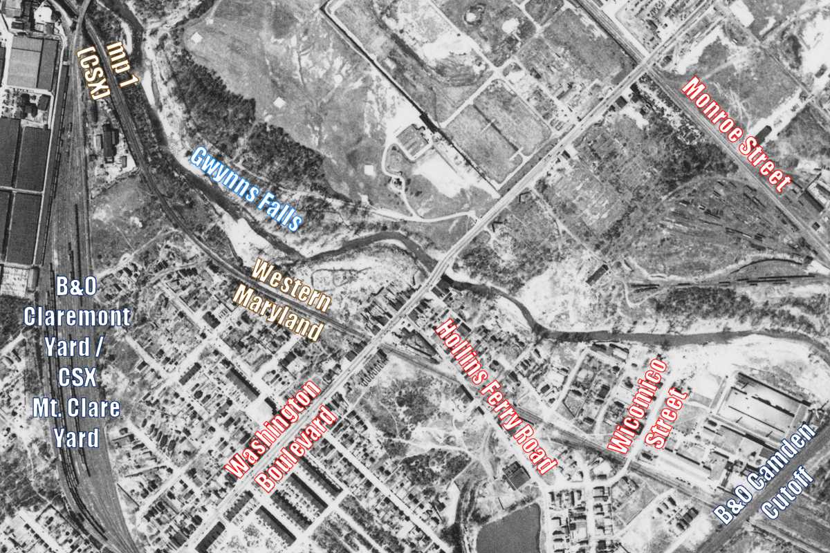
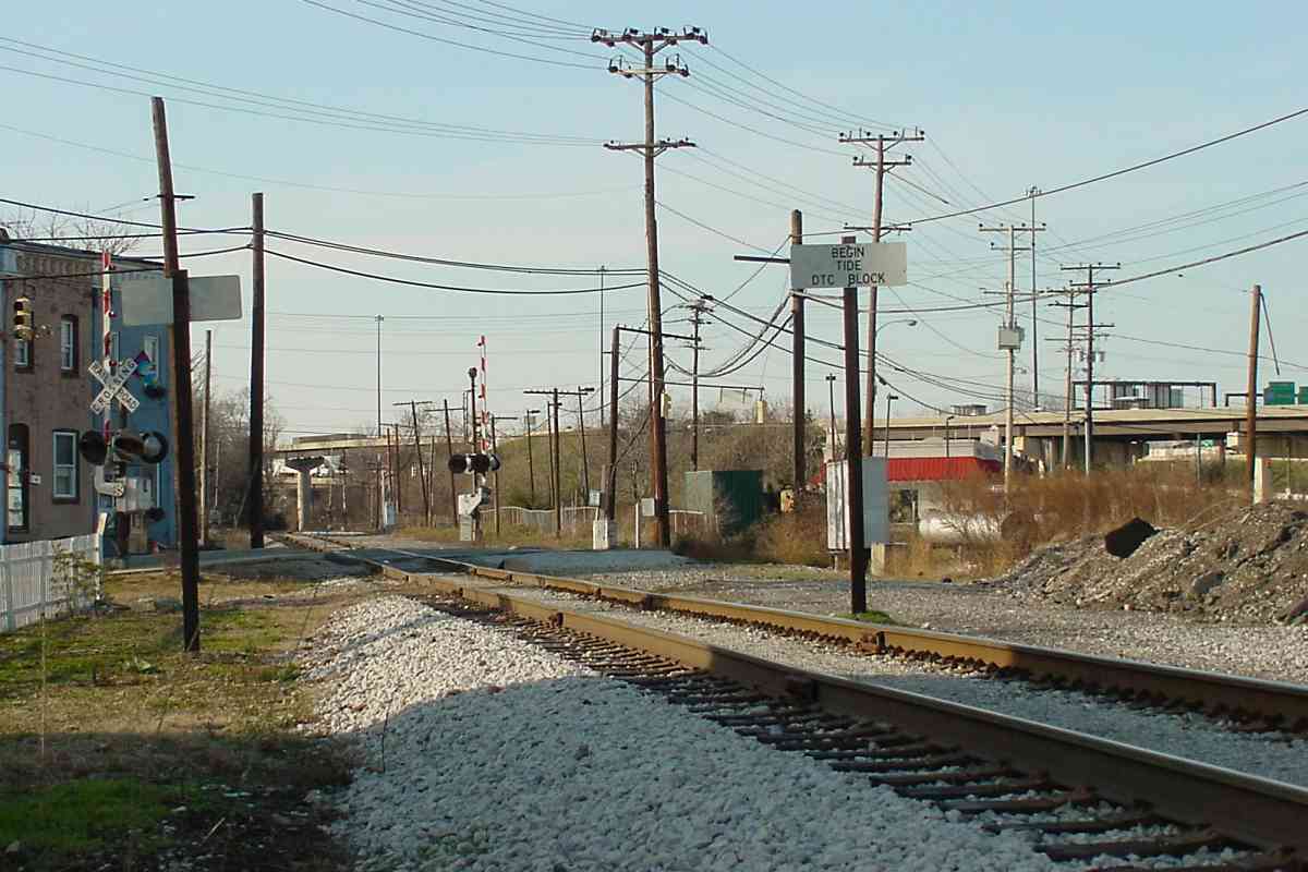
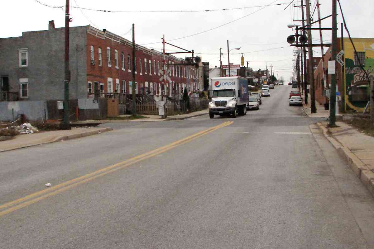
Shortly before reaching Hollins Ferry Road, WM's Tide block began and, per the sign, operated under Direct Traffic Control or Direct Train Control (DTC). Under the DTC system a dispatcher gives direct authority for a train to enter a block of track via radio instead of via a train orders office. A "block" is a length of track that, per operational rule, is to be occupied by no more than a certain number of trains, often just one, so as to minimize the chance of a collision.

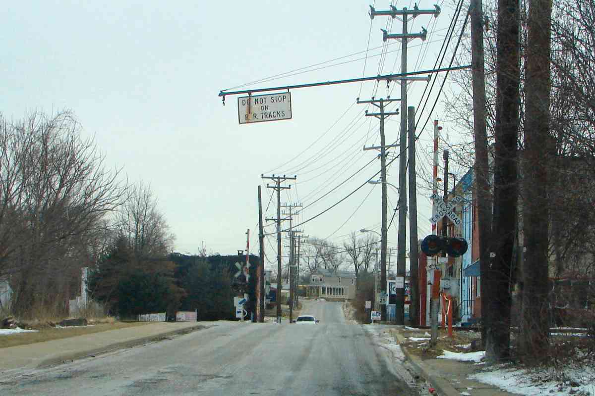
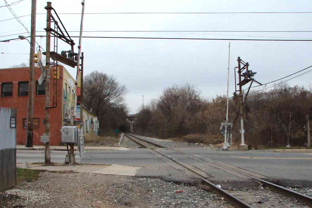
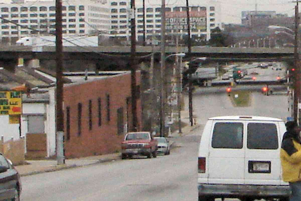
Hollins Ferry Road was so busy as to warrant standard automobile traffic signals (note them hanging at left and right) in addition to the usual ones of railroad style. Beyond the grade crossing, 
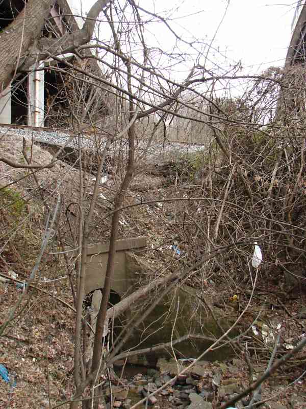
WM had a siding on the left that led to Reynolds Street.

There is scant information online about Hollins Ferry and Hammonds Ferry. According to an 1898 atlas, the latter carried people and goods across the Patapsco River on the downstream side of the subsequent Hammonds Ferry Road bridge.

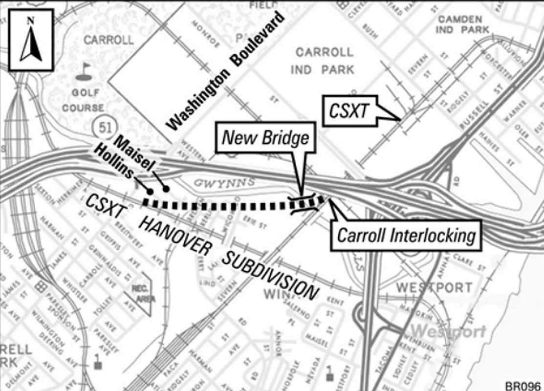
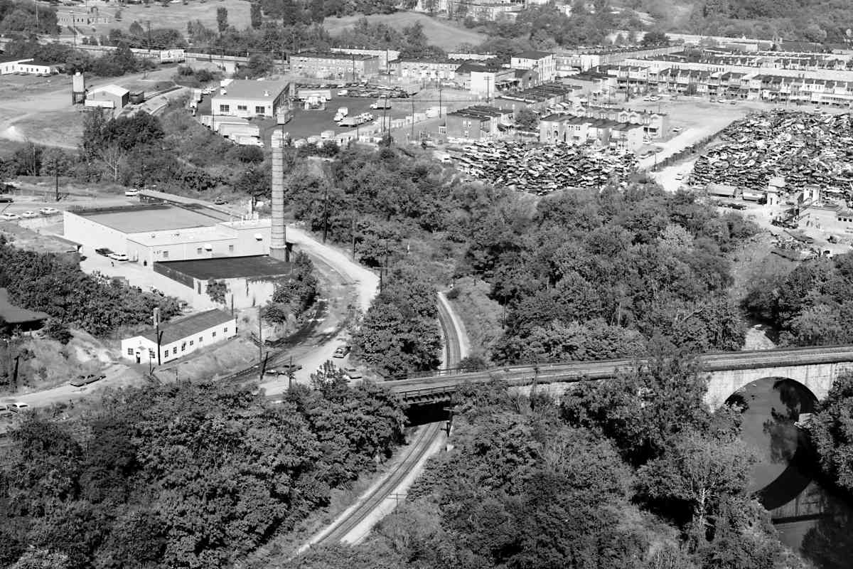
Currently, rail traffic between Locust Point and points northeast travels via the Howard Street Tunnel. If that tunnel is ever closed, an alternate route will be needed. One alternate given consideration is the Locust Point Connecting Track that would join here from the right.

Link: Wikipedia's entry on DTC


Locust Point Connecting Track
Map credit: MDOT

Locust Point Connecting Track
Mile: Date: (2011)
Ease: View: N (up)
Area: IC2:
Map: Ba 42 G 4 Topographic Maps

The Maryland Department of Transportation's (MDOT's) 2011 report describes it thusly:

    "Discontinuing service through the Howard Street Tunnel would require that another way be found for trains to travel between Bay View and Locust Point without reversing. To maintain this access, a connection has been developed linking the Baltimore Terminal Subdivision main line to the Hanover Subdivision. It would begin at Carroll Interlocking, where it would diverge from the Mt. Clare Branch track just after that track diverges from main line Track 1. The connecting track would turn to the northwest and roughly parallel Gwynns Falls waterway until it merges into the Hanover Subdivision, just west of Washington Boulevard.

    "The Locust Point Connecting Track would be located entirely on a new right-of-way, approximately 5,000 feet long. Standard track construction methods would be used. A new bridge, approximately 300 feet in length, would be needed over the Gwynns Falls waterway at the north end of the alignment. The alignment is adjacent to the Gwynns Falls waterway bed for approximately 2,000 feet, and additional wetlands would be crossed. Standard construction environmental safeguards would be used. Light industry involving salvage, reclamation, and storage would be affected. Grade crossings at Maisel Street, Hollins Ferry Road, and Washington Boulevard would be required. These grade crossings would be equipped with warning devices, including flashing lights, gates, and constant time-warning circuitry."

The above plan assumes the additional construction of a tunneled connection between the ex-Western Maryland and ex-Pennsylvania Railroads in the Western/Edmondson/Sandtown vicinity. A far less expensive way to create an equivalent, though slightly longer, route is to revive the disused Claremont Branch and add a wye to it at Mt. Clare Yard. Such an approach eliminates the expense of not only two new bridges but also a new tunnel, plus avoids increasing train traffic at the already busy grade crossing at Hollins Ferry Road.

A postscript: instead of any alternate routes, the parties agreed to increase clearance in Howard Street Tunnel. CSX's cessation of most Locust Point operations also reduced the need for alternate routes to/from there.

Link: 2011 MDOT report (PDF)

Change for: Claremont Branch tour at this site


R. R. Tracks
NEW! late-Oct 2021

R. R. Tracks
Mile: 0.5 Date: Feb 2015
Ease: A View: E
Area: B- IC2:
Map: Ba 42 G 4 Topographic Maps

Old signage tends to hang around awhile, both figuratively and literally. The "R. R." abbreviation is noteworthy as the only one in English with two periods even though it represents a single word. It evolved from "rail road" which was long ago shortened to railroad.

This pole at the line's Hollins Ferry Road grade crossing previously held two automobile-style traffic signals. The backs of those signals can be seen in the "Begin Tide" photo above.


Xing

Xing
Mile: 0.5 Date: Dec 2015
Ease: A- View: NW
Area: B- IC2:
Map: Ba 42 G 4 Topographic Maps

The last of the group of three grade crossings is this one of Washington Boulevard, the primary 19th century route between the cities of Baltimore and Washington. It became part of US 1 when the US Road system began. By 1940, this section was designated Alternate US 1, only to be stripped of any US 1 association around 1950 when traffic was diverted onto Baltimore's then-new Southwestern Boulevard.


Then Natty Boh
Photo credit: Jack Delano

Then Natty Boh
Mile: 0.5 Date: Jun 1940
Ease: A View: SW
Area: B- IC2:
Map: Ba 42 G 4 Topographic Maps

sign Prior to Southwestern Boulevard and subsequent major roads, US 1 was the primary DC-Baltimore connector, and traffic into the cities would sometimes back up for miles. In this 1940 photo vehicles, including a National Bohemian Beer truck, wait to cross a bridge over the Gwynns Falls into Baltimore. The rails parallel to the road belong to Streetcar Line 27 which by 1940 had been superceded by a trolleybus (aka trackless trolley).

Note the striped gates for WM tracks (double-tracked?) and the sign at right that reads "Railroad Crossing - Danger - Look Out For Trains - Stop Look Listen".

Links: WM sign, source photo


Now Pepsi

Now Pepsi
Mile: 0.5 Date: Dec 2015
Ease: A View: SW
Area: B- IC2:
Map: Ba 42 G 4 Topographic Maps

Seventy-five years later I-95 has relieved much of the traffic jam but Baltimoreans remain thirsty. What Baltimore-bound beverage will be lugged through this grade crossing in the future? Check back during 2090 for a photo update no doubt containing flying cars - and flying trains.


Warehouse 1940
Photo credit: Jack Delano

Warehouse 1940
Mile: 0.5 Date: Jun 1940
Ease: A View: NE
Area: B- IC2:
Map: Ba 42 G 4 Topographic Maps

This then-now pair looks to the same WM grade crossing from the opposite direction. Beyond looms a Montgomery Ward warehouse conveniently located adjacent to B&O's Locust Point branch.

On the right, Marie's Inn serves genuine American Ale and Beer while a man on crutches spies the photog. Smile: when the Internet arrives the whole world will be watching.

Link: source photo


Warehouse 2015

Warehouse 2015
Mile: 0.5 Date: Dec 2015
Ease: A View: NE
Area: B- IC2:
Map: Ba 42 G 4 Topographic Maps

The same view 75 years later finds adjacent Marshall's Bar keeping the spirit going -- and the spirits flowing.


Zoom 1940
Photo credit: Jack Delano

Zoom 1940
Mile: 0.5 Date: Jun 1940
Ease: A View: NE
Area: B- IC2:
Map: Ba 42 G 4 Topographic Maps

The post-Prohibition era witnessed the rebirth of beer, well, beer advertising since the actual stuff was never all that far away. "Homemade Gunther's - Maryland's Leader - because it's dry and beery". I'm not sure that style of slogan would work well now: "iPhone, because it's i and phoney."

Link: Gunther's coaster


Zoom 2015

Zoom 2015
Mile: 0.5 Date: Dec 2015
Ease: A View: NE
Area: B- IC2:
Map: Ba 42 G 4 Topographic Maps

Gunther's is gone, as is Montgomery Ward, but both live on in some fashion. I-95 now bisects the scene ahead. Between the Interstate and the warehouse lies the Carroll Park Golf Course.


CSX 9019
Photo courtesy Dave Hiteshew

CSX 9019
Mile: 0.5 Date: Jun 2011
Ease: A View: N
Area: B- IC2:
Map: Ba 42 G 4 Topographic Maps

The crossing flashers at Washington Boulevard look rusty enough to be of WM vintage.

Supplemental traffic signals had been found at many/most/all the grade crossings in this vicnity.

Link: same scene within video (youtube)


Mural

Mural
Mile: 0.5 Date: Dec 2015
Ease: A- View: SW
Area: C+ IC2:
Map: Ba 42 G 4 Topographic Maps

Don't forget the streetcars.

By the time of the "then" photos above the streetcars had been supereceded by trolleybuses powered by electricity supplied from overhead. One bound for Baltimore is pictured in the photo linked below, snapped at the intersection of Washington Boulevard and Whistler Avenue, just a few blocks southwest of this WM grade crossing.

Link: 1940


Foamer Barbie

Foamer Barbie
Mile: 0.6 Date: Dec 2015
Ease: B+ View: NW
Area: C+ IC2:
Map: Ba 42 G 3 Topographic Maps

"My hair looks fabulous! Let's go railfanning!" Maybe Foamer Barbie can hack it, but Malibu Barbie would lose her head over what lies ahead...

Link: Barbie Travel Train Vehicle Playset


Trash

Trash
Mile: 0.6 Date: Dec 2015
Ease: B View: NW
Area: C IC2:
Map: Ba 42 G 3 Topographic Maps

Abandon all hope, ye who enter here. Trash litters much of the route ahead. Discarded household furnishings hang from trees or are left on the tracks for trains to demolish.

Much of the remainder of the ex-WM alignment within Baltimore City, the 6 miles or so ahead, traverses some of the roughest neighborhoods in any east coast US city. This helps explain why so few modern pictures of this route are online. If crumbling houses by the thousands, homeless people, gunfire, and the scent of decaying flesh give you pause you should not venture here in person. While the chance of you becoming a victim is low, ahead it is higher than most other places in the region, and in addition to the normal dangers posed by moving trains.


I-70 Ramp

I-70 Ramp
Mile: 0.7 Date: Dec 2015
Ease: B View: E
Area: C IC2:
Map: Ba 42 F 3 Topographic Maps

Interstate 70 was halted just a few miles short of connecting with Interstate 95, as it would have done via a ramp on the leftmost support. The arrival of the interstate prompted the cleanup of the large automobile junkyard that had been here since the 1940s.


I-95

I-95
Mile: 0.7 Date: Dec 2015
Ease: B View: NW
Area: C IC2:
Map: Ba 42 F 3 Topographic Maps

Layers of graffiti cover most every vertical surface. The worst of it has been digitally scrubbed from this and a few other photos.

On December 17, 2016 icy roads sent a fuel tanker careening off the interstate and down to the tracks here where it exploded.


between

Between
Mile: 0.8 Date: Dec 2015
Ease: B- View: E
Area: C- IC2:
Map: Ba 42 F 3 Topographic Maps

Hidden between the ramp and I-95 proper is this circa 1900 masonry culvert for a Gwynns Falls tributary. To make room for WM, the Falls itself was redirected northeast into what had been the millrace of Mount Clare Mills.


Greaser

Greaser
Mile: 0.9 Date: Dec 2015
Ease: B View: N
Area: C- IC2:
Map: Ba 42 F 3 Topographic Maps

WM left behind a now-empty mechanical grease dispenser.


Milepost 1

Milepost 1
Mile: 1.0 Date: Dec 2015
Ease: B+ View: NW
Area: C IC2:
Map: Ba 42 F 3 Topographic Maps

Near milepost 1, WM "tunneled" under B&O's Old Main Line near its milepost 1 just west of the Carrollton Viaduct.

Off photo-right is the Carroll Park Golf Course, which could fit well in an Under Armour sports complex. Getting here could happen via a shuttle train from Port Covington that would cross a restored Spring Garden Swing Bridge, plus pause at Westport for passenger exchange with Baltimore's light rail. Passengers then arriving here would cross a pedestrian bridge already in place off photo-right that carries the Gwynns Falls Trail over that stream.

Provided CSX would permit a shuttle running along/aside this segment of the ex-WM, implementing such a rail route is likely less expensive than any alternative requiring creation of new rights-of-way.

Change for: Old Main Line tour at this site


From Plane
Photo courtesy Library of Congress

From Plane
Mile: 1.0 Date: 1971?
Ease: View: NW
Area: IC2:
Map: Ba 42 F 3 Topographic Maps

This view from the air captured WM at center shortly before it became part of the Chessie System.

That's B&O's Carrollton Viaduct at right. Piles of old autos await metal recycling at upper right.

Link: LoC source photo


<< Previous (east) | THIS PAGE: Mount Winans to OML | Next (west) >>

Or, return to main page for other tours

Copyright Notice