TrainWeb.org Facebook Page
URR Photo Tour


Union Railroad
Modern day photo tour

Accompanying each photo below are:

Click a photo to see a larger view. Please send your comments and corrections to Steve.


<< Previous (west) | THIS PAGE: Union Railroad East | Next (south) >>

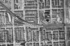
Aerial 1927
Photo courtesy Johns Hopkins University

Aerial 1927
Mile: 94.2 to 93.7 Date: 1927
Ease: View: N (up)
Area: T6:
Map: Ba 35 F 10 (center) Topographic Maps

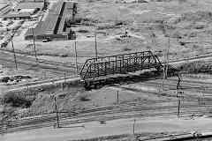
East of the intersection of Baltimore's Biddle and Washington Streets, which is just off the top left corner, Union Railroad (URR) had built grade crossings. Pennsylvania Railroad (PRR) in 1893 funded all the grade separations seen in this photo -- just in time for the Panic of 1893, a four-year economic downturn that was called the Great Depression until the bigger downturn of the 1930s. That work involved a combination of raising the tracks and lowering the streets.


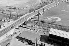
Aerial 1972
Photo courtesy Johns Hopkins University

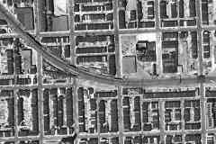
Aerial 1972
Mile: 94.2 to 93.7 Date: Mar 1972
Ease: View: N (up)
Area: T6:
Map: Ba 35 F 10 (center) Topographic Maps

Only the center of the three sidings in the 1927 view remained operable by 1972. Coal was dropped from hoppers via gravity into a coal yard. As demand for coal for heating diminished, part of the property was converted for auto sales by 1969.


Aerial 2023
Photo courtesy Google

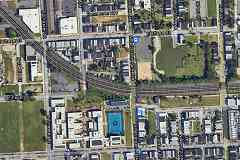
Aerial 2023
Mile: 94.2 to 93.7 Date: 2023
Ease: View: N (up)
Area: T6:
Map: Ba 35 F 10 (center) Topographic Maps

Various forces combined in a perfect storm that preciptated the abandonment of many homes, hence the now-empty areas where there had been full blocks in 1972. The filming location for The Wire's "Hamsterdam" was not far from here.


Eager Street

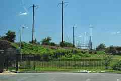
Eager Street
Mile: 94.0 Date: Jun 2018
Ease: A View: E
Area: C+ T6:
Map: Ba 35 F 11 Topographic Maps

After decades of area decline, during the 2010s the surrounding neighborhood started to gentrify, being propped up by nearby Johns Hopkins Hospital that has been buying abandoned houses, rehabbing some, and selling them to employees at deep discount.

The tracks turn left to head east along what was previously Eager Street.

Link: JHH Eager Park


Patterson Park Avenue

Patterson Park Avenue
Mile: 93.9 Date: Jun 2018
Ease: A View: N
Area: C+ T6: 292
Map: Ba 35 F 11 Topographic Maps

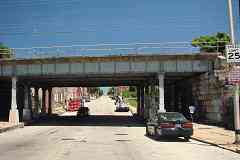
The line continues its straight run east as an elevated structure for another half mile, in the process spanning Lakewood, Kenwood and Luzerne Avenues, which PRR's self-published history reports were not grade separated until the second Union Tunnel tube opened during the 1930s.

Link: The Wire here (scroll down)


Milton Avenue

Milton Avenue
Mile: 93.7 Date: Jul 2024
Ease: A View: N
Area: B- T6:
Map: Ba 35 G 11 Topographic Maps

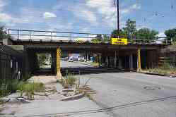
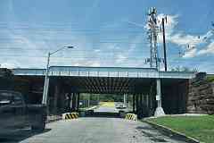
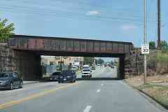
Milton Avenue curiously gets a low clearance sign rather than a original specific height limit number.

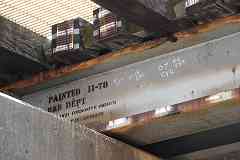
Only the supports for a disused fifth track along the north side exhibit the diagonal bracing used during the 1890s, as seen at right. The rest of the bridge received new support beams during the 20th century (probably in 1978) as seen below.

Link: 1965


Painted 1978

Painted 1978
Mile: 93.7 Date: Jul 2024
Ease: A View: NW
Area: B- T6:
Map: Ba 35 G 11 Topographic Maps

Amtrak's B&B Department (building and bridges) did an exceptional job at Milton Avenue back in 1978 since 46 years later there's only a bit of rust at the edges. The other dates and initials represent bridge inspections.


Lakewood Avenue

Lakewood Avenue
Mile: 93.6 Date: Jul 2024
Ease: A View: NE
Area: B- T6:
Map: Ba 35 G 11 Topographic Maps

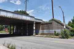
PRR's 1930s grade separations like this one at Lakewood Avenue can be identified by concrete rather than stone supports. All of them offer room for the addition of a track along the south side. The extra room falls outside the catenary coverage which suggests it was intended to support a siding for diesel-powered rail traffic.

There was for about 50 years a fifth track under the wires on the north side to serve industry between Patterson Park Avenue and Edison Highway.


Linwood Avenue

Linwood Avenue
Mile: 93.4 Date: Jul 2024
Ease: A View: N
Area: C+ T6:
Map: Ba 35 G 11 Topographic Maps

Linwood Avenue's stone masonry suggests it dates to 1893. This is an odd location for a grade separation since the road dead ends at the yellow wall. East of here, the line transitions to at-grade operation for a stretch as it nears Edison Highway.


Edison Highway
Photo courtesy Library of Congress

Edison Highway
Mile: 93.3 Date: 1974
Ease: B View: SE
Area: C+ T6:
Map: Ba 35 H 11 Topographic Maps

This Edison Highway bridge apears to date from the 1950s (the exact year it replaced the prior version has proved elusive). It spans the tracks just west of where PRR's second alignment diverged from URR's original. URR's original is represented here by the closest track, which long before photo time had been repurposed as a siding to local industry. Brick manufacturing companies had excavated clay in this vicinity during the 1800s; their dig site later became a landfill.

Link: source photo


AMTK 2014

AMTK 2014
Mile: 93.0 Date: Aug 2016
Ease: B View: W
Area: C+ T6:
Map: Ba 35 J 11 Topographic Maps

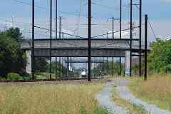
Amtrak 2014 is about to leave the bridges behind. Its straight run ends east of the Edison Highway bridge, however URR's original alignment, marked by the gravel path, had continued straight toward the camera and behind it.


Map 1877
Image courtesy Johns Hopkins University

Map 1877
Mile: 92.7 (center) Date: 1877
Ease: View: N (up)
Area: T6:
Map: Ba 35 J 11 (center) Topographic Maps

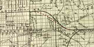
The original alignment (black) and second alignment (red dashes) go their separate ways near "R. R." Most of the streets depicted existed merely as plans at map time.


Map 1915
Image courtesy Johns Hopkins University

Map 1915
Mile: 92.7 (center) Date: 1915
Ease: View: N (up)
Area: T6:
Map: Ba 35 J 11 (center) Topographic Maps

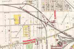
URR's original alignment is shown more clearly on this 1915 map. Dashed lines represent not-yet-built streets that may have been surveyed at the time. The Dreadnaught Tire and Rubber Company saw rail service along URR's original route at top.

Property boundaries are represented by solid thin lines. They recall URR's route past the Steiner Mantel Company at the easternmost bit of URR track that remained operational in 1915. Beyond that, note the right-of-way's extra width along the main line, a remnant of URR's adjacent original alignment.

Orangeville Station, a small shelter, was not on the main line because it was used primarily by railroad employees to access the nearby repair shops. Locating it between the main line and leg to Canton would have permitted trains on both lines to serve it.

"LP" marks Leonard Paper's home since 1979, sited between URR's original line and leg south to Canton. The property line west of LP is curved to match the former leg. Their meeting point, called both Canton Crossing Junction and Canton Junction by PRR, was moved south when the second alignment was constructed during 1893.


Haven Street

Haven Street
Mile: 92.7 Date: Aug 2016
Ease: A View: SE
Area: C+ T6:
Map: Ba 35 K 11 Topographic Maps

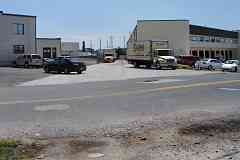
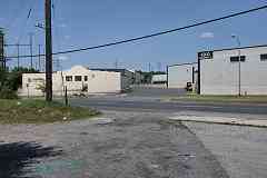
The original alignment crossed Haven Street at grade here. A straight crack in pavement, like that seen ahead between the Leonard Paper Company trucks, is often found where rails lie underneath.


Aerial 1938
Photo courtesy Johns Hopkins University

Aerial 1938
Mile: 92.6 to 92.2 Date: Apr 1938
Ease: View: N (up)
Area: T6:
Map: Ba 35 K 12 (center) Topographic Maps

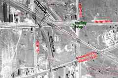
The next road after Haven Street is Monument Street, seen here a few years after it was paved. What the two dark lines are is unknown.


Monument Street

Monument Street
Mile: 92.5 Date: Jul 2024
Ease: A View: NW
Area: C+ T6:
Map: Ba 35 K 11 Topographic Maps

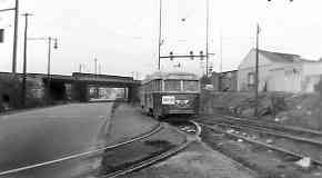
Looking back toward Leonard Paper finds where URR would have crossed Monument Street at grade had that street been more than a path through the weeds during the 1800s. When a two-lane Monument Street was built during the 1930s, a trolley line repurposed the URR right-of-way into a car turnaround loop, as seen in the 1947 photo below.

Link: 1960


BTCo PCC
Photo credit Jerry Kelly

BTCo PCC
Mile: 92.5 Date: 1947
Ease: A View: W
Area: C+ T6:
Map: Ba 35 K 11 Topographic Maps

A Baltimore Transit PCC car reaches the loop at URR's former right-of-way. Trolley service would end here within a year and give way to the twinning of Monument Street. The PRR alignment that replaced URR's original bridges is in the background.

Link: source photo


Ballast

Ballast
Mile: 92.5 Date: Jul 2024
Ease: A View: SE
Area: C+ T6:
Map: Ba 35 K 11 Topographic Maps

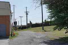
This path behind the former Tony's Place club marks the original URR alignment. A few patches of stone ballast remain, but might have originated with the tarmac rather than the railroad. Note the utility poles that still follow URR's route. The tallest poles are part of the second alignment, now Amtrak's line. The two alignments grow closer in the distance.


Vestiges
Photo courtesy Johns Hopkins University

Vestiges
Mile: 92.2 (center) Date: 1927
Ease: View: N (up)
Area: T6:
Map: Ba 36 A 12 (center) Topographic Maps

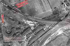
This 1927 aerial suggests the original URR alignment was repurposed as a Bay View access road, seen as a bright line adjacent PRR's newer alignment. The dashed red lines at upper left lead to that access road, but not before reaching a rectangular shadow at Philadelphia Road, now Pulaski Highway and US 40. The shadow matches others at railroad bridges, so is likely from the sides of a yet-to-be-removed old bridge over the former URR, or vice versa. Elevation data supports the idea that URR had there passed under Philadelphia Road.

B&O/CSX bridges over the line at right.

The white puffs at center are steam clouds from locomotives outside the Orangeville Roundhouse (lower left). Equipment repairs were made there from 1911 into the 1970s. The concrete pads of the roundhouse, its longest-surviving relics, were removed during the 2010s.

Link: Orangeville info


Deep Zoom

Deep Zoom
Mile: 92.6 Date: Aug 2018
Ease: A View: SE
Area: C+ T6:
Map: Ba 35 K 11 Topographic Maps

Back along the second alignment, the Monument Street bridge is closest. Deep zoom shows how the tracks descend after they pass over the next bridge, Pulaski Highway, ex-Philadelphia Road. That's so they can rejoin the original alignment and match the lower elevation that began with Philadelphia, Wilmington & Baltimore (PW&B) at Bay View Junction.


Pulaski Highway

Pulaski Highway
Mile: 92.4 Date: Jul 2024
Ease: A View: NE
Area: B- T6: 295
Map: Ba 35 K 12 Topographic Maps

The former Philadelphia Road, now Pulaski Highway and US 40, squeezes under the second alignment. Philadelphia Road had been one wide lane in each direction, with sidewalks on each side, one of which was lost when the lane quantity was doubled. Stonework tells us this bridge dates to the 1893 realignment. Prior to that, URR's original alignment crossed underneath (or over) immediately beyond.

Link: Hobo Stobe


Side By Side

Side By Side
Mile: 92.3 Date: Jul 2024
Ease: A View: SE
Area: B- T6: 295
Map: Ba 35 K 12 Topographic Maps

Southeast of Pulaski Highway, URR's original alignment ran along this side of the existing alignment, probably at the camera's elevation. The Bay View access road that replaced it was blocked by the 1930s addition of a siding leading to drop bins, the concrete structures at distant left. If URR artifacts are hiding in the brush, a winter site visit will be the best time to find them.


Converge

Converge
Mile: 92.2 Date: Aug 2018
Ease: B- View: E
Area: C+ T6:
Map: Ba 36 A 12 Topographic Maps

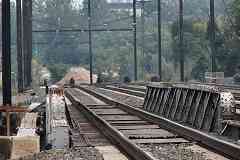
This is the "extra wide" stretch marked on the 1915 map above. The width suggests this is approximately where the second alignment (right) met URR's orginal (left). The blue bridge in the distance carries B&O's / CSX's tracks to Sparrows Point. Bay View Junction is beyond it.

Change for: B&O Sparrows Point Branch tour at this site


Bay View Junction
Photo courtesy Library of Congress

Bay View Junction
Mile: 91.9 Date: 1974
Ease: View: N
Area: T6: 295
Map: Ba 36 B 12 Topographic Maps

CSX's blue bridge was preceded by this B&O original. Note the ponding water along the far side of the tracks where URR's original alignment had been. Railroads sometimes mine old alignments for fill dirt. That's the same area illustrated by the Converge panel above.

This is where URR (left) met Philadelphia, Wilmington and Baltimore Railroad's (PW&B's) main line (bottom) to its station at President Street. This completes the tour of URR's east-west route. The leg south to Canton will be toured via a future update.


This is a logical place to change for the President Street Branch tour at this site.
You may also enjoy the related Canton Railroad tour at this site.

<< Previous (west) | THIS PAGE: Union Railroad East | Next (south) >>

For more tours here, select from the map: clickable map

Or, return to main page

Copyright Notice