TrainWeb.org Facebook Page
URR Photo Tour


Union Railroad
Modern day photo tour

Accompanying each photo below are:

Click a photo to see a larger view. Please send your comments and corrections to Steve.


<< Previous (west) | THIS PAGE: Union Railroad West | Next (future) >>

Union Railroad (URR) - Brief Historical Background:

Map 1876
Image courtesy Johns Hopkins University

Map 1876
Mile: Date: 1876
Ease: View: N (up)
Area: T6:
Map: Ba 44 B 4 (center) Topographic Maps

This tour begins at Baltimore's Union Station at the letter P near upper left, and proceeds east (right) along Union Railroad, then passes N on its way to Bay View Junction near BB. The rail distance is roughly 3.6 miles.

Union Station was variously known as Charles Street Station, Union Depot and later Pennsylvania Station.


West Zoom
Image courtesy Johns Hopkins University

West Zoom
Mile: 96 to 94.5 Date: 1876
Ease: View: N (up)
Area: T6:
Map: Ba 35 C 10 (center) Topographic Maps

"Charles Street Union Depot" appears in the upper left quadrant.

Like many of its kind, Green Mount Cemetery (their preferred spelling) is sited on a hill. That hill was one reason railroads had not been built in the vicinity prior to the Civil War. URR began tunneling under adjacent Hoffman Street in 1867, but money for the expensive undertaking soon ran out. Construction resumed in 1870 when PRR, relatively unscathed during the war, supplied needed funds.

Links: source photo, ~1900


Station 1875
Photo courtesy FA Wrabel collection

Station 1875
Mile: 95.8 Date: ~1875
Ease: View: NE
Area: T6: 236
Map: Ba 35 B 11 Topographic Maps

Charles Street Station was tucked into the Jones Falls Valley, and thus appears lower than its surrounding structures.

Though some references say the station was built by B&P, and others NC, all the railroads that initially served it were within PRR's sphere of influence. B&P and Union Tunnels also opened during the summer of 1873, creating a new route through Baltimore, one that broke B&O's control of long-distance railroading to/from Maryland.


Union Station 1905
Photo courtesy Maryland Hist. Soc.

Union Station 1905
Mile: 95.6 Date: ~1905
Ease: View: N
Area: T6: 237
Map: Ba 35 B 10 Topographic Maps

The station at Charles Street proved so popular that just 13 years later this second, larger Union Station, opened.

Links: photo source, ~1900


Aerial 1917
Photo credit Detroit Publishing Company,
via Shorpy

Aerial 1917
Mile: 95.5 Date: 1917
Ease: View: NW
Area: T6:
Map: Ba 35 B 10 Topographic Maps

Twenty-five years after the second version, in 1911 this third Union Station opened. It was not named so much for Union Railroad as for B&P, PW&B, Northern Central, Western Maryland, and Maryland and Pennsylvania railroads that served it. Additionally, "Union" was a popular name following the US Civil War that saw Union forces victorious.

Links: source DPC photo, similar 1952?


Aerial 1958
Photos courtesy Baltimore Sun

Aerial 1958
Mile: 95.7 Date: 1958
Ease: View: N
Area: T6:
Map: Ba 35 B 10 Topographic Maps

The 1911 version was still standing in 1958 (and 2024), now named Pennsylvania Station. This photo captures the construction of the Jones Falls Expressway, now I-83, that was threaded through during the 1950s. In tight areas like this, it was built over the Jones Falls. This portion stands one concrete segment away from completion at bottom center. The building on the right handled parcels for the US Post Office Department.

Link: source photo


Union Junction Tower
Photos credit Library of Congress

Union Junction Tower
Mile: 95.5 Date: 1983
Ease: View: NW
Area: T6: 313, 319
Map: Ba 35 B 10 Topographic Maps

That's the USPOD parcel handling facility at upper left. Union Junction Tower was built east of Union Station during 1910. Its powered interlockings upgraded Greenmount Junction Tower at the same location. The tower is no longer extant. levers

The tower was upgraded again in 1935 to handle changes brought by the line's electrification. Most of the 95 electro-pneumatic switch levers installed at that time endured until the tower was removed during the 1980s to give way to train control from Philadelphia, Pennsylvania. Since in this system compressed air at approximately 80 psi was moving the track switches, the operator did not need leverage supplied by long levers.

Link: 1969


Union Tower Board
Photos credit Library of Congress

Union Tower Board
Mile: 95.5 Date: 1983
Ease: View: "N"
Area: T6: 313, 319
Map: Ba 35 B 10 Topographic Maps

Union Tower oversaw traffic east of Penn Station. Penn Station is at the left edge, and Union Tunnel is off the right edge. Another board like this was found in B&P Tower on the west side of Penn Station.

Link: LoC source photo


Aerial 1953
Photos courtesy Johns Hopkins University

Aerial 1953
Mile: 95.5 (center) Date: Feb 1953
Ease: View: N (up)
Area: T6:
Map: Ba 35 B 10 Topographic Maps

This is what the stretch looked like while the JFX was in planning stage. Find Penn Station in the upper left quadrant, and Union Tower at center. If the tracks seem to disappear towards the right, it's because they go underground via Union Tunnel.


Hill

Hill
Mile: 95.5 Date: Jun 2018
Ease: C View: E
Area: B- T6: 230, 325
Map: Ba 35 B 10 Topographic Maps

This hill was the reason no railroad had connected east and west without street running until a determined Union Railroad began in 1867 to pierce it with a tunnel.

The first through train arrived on July 25, 1873 -- just two months before the start of the transformative Panic of 1873, an economic downturn precipitated by railroad overbuilding. Of the country's 364 railroads, 89 went bankrupt within the next few years. This depression temporarily halted PRR's expansion and led to a rate war that caused many transport fares to drop by 50%. Fare wars prompted competing railroads to team up for the first time, beginning a process that would culminate in the formation of Norfolk Southern and CSX during the 20th century.

The treed area on the left is part of Green Mount Cemetery.

Link: 1947


Niblings

Niblings
Mile: 95.3 Date: Jun 2018
Ease: C View: NE
Area: B- T6: 230, 325
Map: Ba 35 B 10 Topographic Maps

Double-tracked Union Tunnel (left) proved insufficient during the Roaring Twenties, so houses on the south side of Hoffman Street were demolished during the next decade to make way for a supplementary tunnel underneath. The concrete new tunnel was not given its own name. Its portal is partly obscured by equipment boxes in this view.

Links: 1946, 1978


Weaving
Image courtesy Johns Hopkins University

Weaving
Mile: 95 to 94 Date: 1876
Ease: View: N (up)
Area: T6:
Map: Ba 35 F 10 (center) Topographic Maps

A then-new Union Tunnel returned to open air at Bond Street (left edge), where trains would soon turn southeast in order to avoid a hill near the big 7 on the map. The depiction of two tracks is likely correct; more tracks would not arrive until later.

URR grade separated the line east to Biddle Street (center) where development gave way to open land at map time.


AMTK 2003

AMTK 2003
Mile: 94.6 Date: Jun 2018
Ease: A- View: S
Area: D+ T6:
Map: Ba 35 E 10 Topographic Maps

URR 1871 Both portals of the original Union Tunnel are topped with a URR keystone. They are the only trackside surviving evidence of the Union Railroad name/initials. Boosted by PRR funding, tunnel work restarted May 1, 1871 and was completed July 1873. I have never seen a photo of the tunneling in progress.

The keystone is not only appropriate due to being a PRR symbol but also because the tunnel was the central key for connecting the city's west and east. The Union Railroad name continued to appear on maps into the 20th century, well after it had been acquired by NC/PRR.

Link: 1870s engraving


Union Tunnel

Union Tunnel
Mile: 94.6 Date: Jun 2018
Ease: B+ View: W
Area: D T6:
Map: Ba 35 E 10 Topographic Maps

URR Tunnel keystone Union Tunnel lacked sufficient clearance for the overhead electricity PRR wanted to add. To rectify the situation during the 1930s, PRR built a separate tunnel along the south of the original (left).

That new tunnel had room for two tracks with wires above. Then the floor of the original was lowered and trackage was reduced to a single, centered one as seen here. This two-tunnels-with-three-tracks-total configuration has persisted into the 21st century.


With Train

With Train
Mile: 94.6 Date: Jun 2018
Ease: B+ View: W
Area: D T6: 230, 326
Map: Ba 35 E 10 Topographic Maps

Both tunnels make a straight run of about 2/3rds of a mile; one can see light from the opposite end of the original tunnel. AMTK 634, which is emerging from the newer tunnel, is the same unit seen above emerging from the west portal. The photos were made on different days.

The two gray color boxes above AMTK 634 appear to be communications related. Lest The Wire left you thinking vacant houses were a uniquely circa 2000 thing in Baltimore, the two 1977 photos below include windowless, boarded-up houses.

Links: 1977, 1977, 2011


AMTK 634

AMTK 634
Mile: 94.6 Date: Jun 2018
Ease: B+ View: E
Area: D T6:
Map: Ba 35 E 10 Topographic Maps

Broadway Tower had controlled switching at this end of the tunnel until its functions were transferred during the 1920s to Union Junction Tower at the other end of the tunnel. The tower probably stood on the left.

Link: 1947


Atlas 1894
Photo courtesy Johns Hopkins University

Atlas 1894
Mile: 94.4 (center) Date: 1894
Ease: View: N (up)
Area: T6:
Map: Ba 35 E 10 Topographic Maps

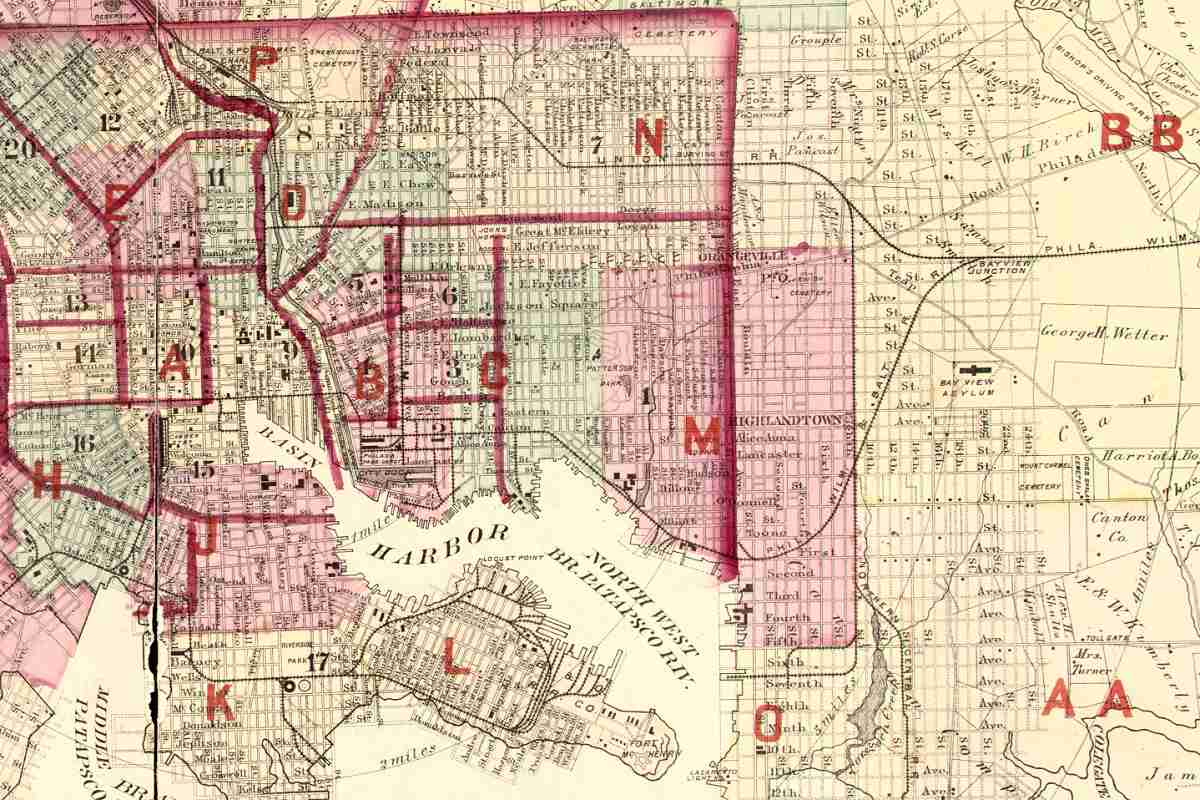
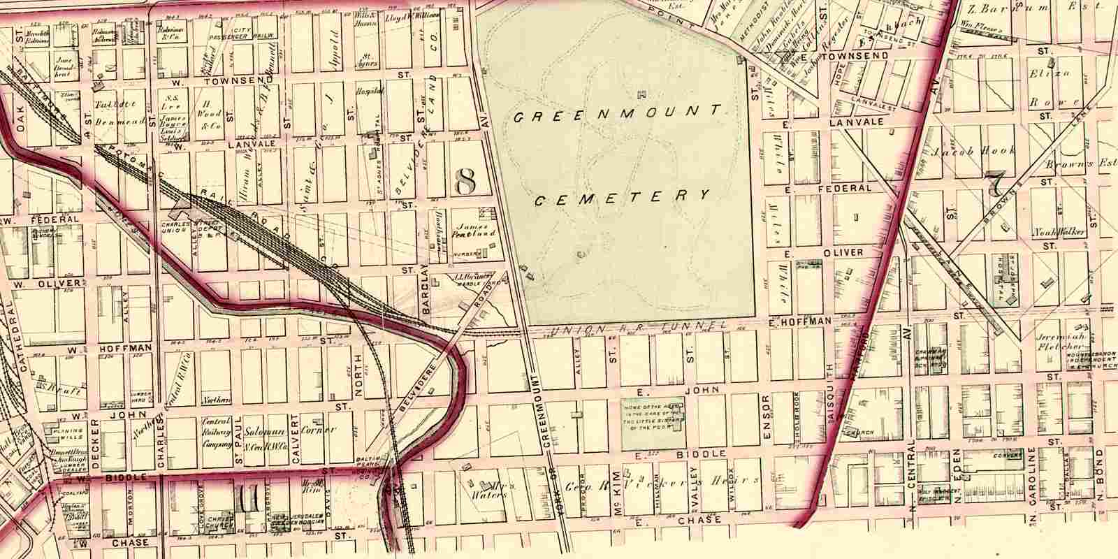
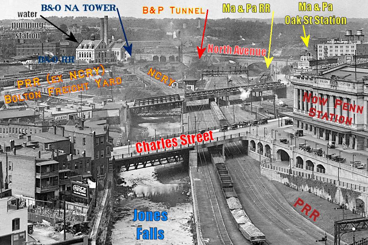
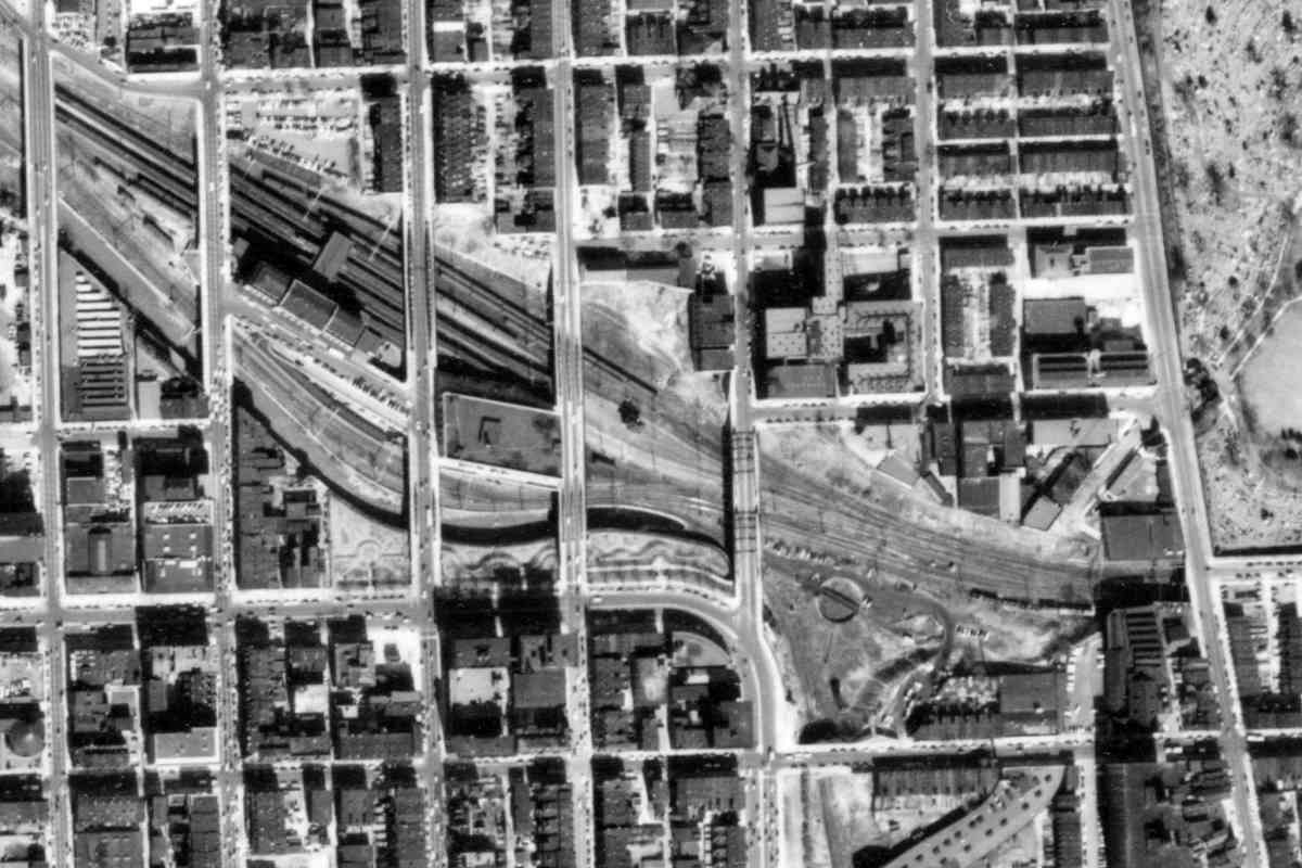
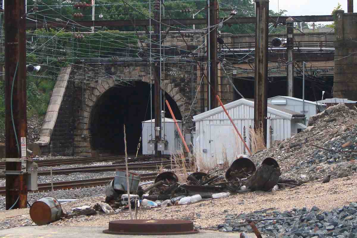
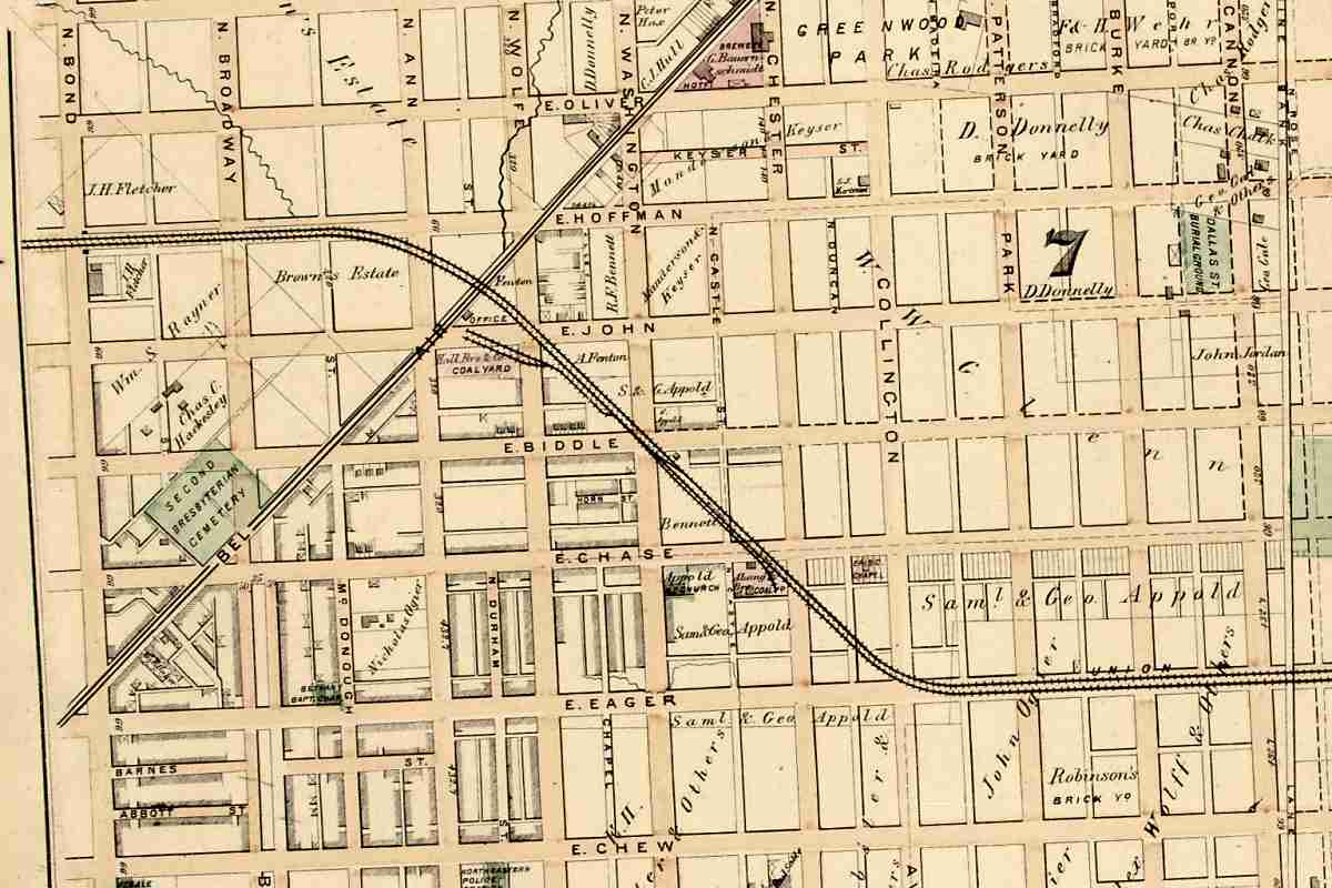
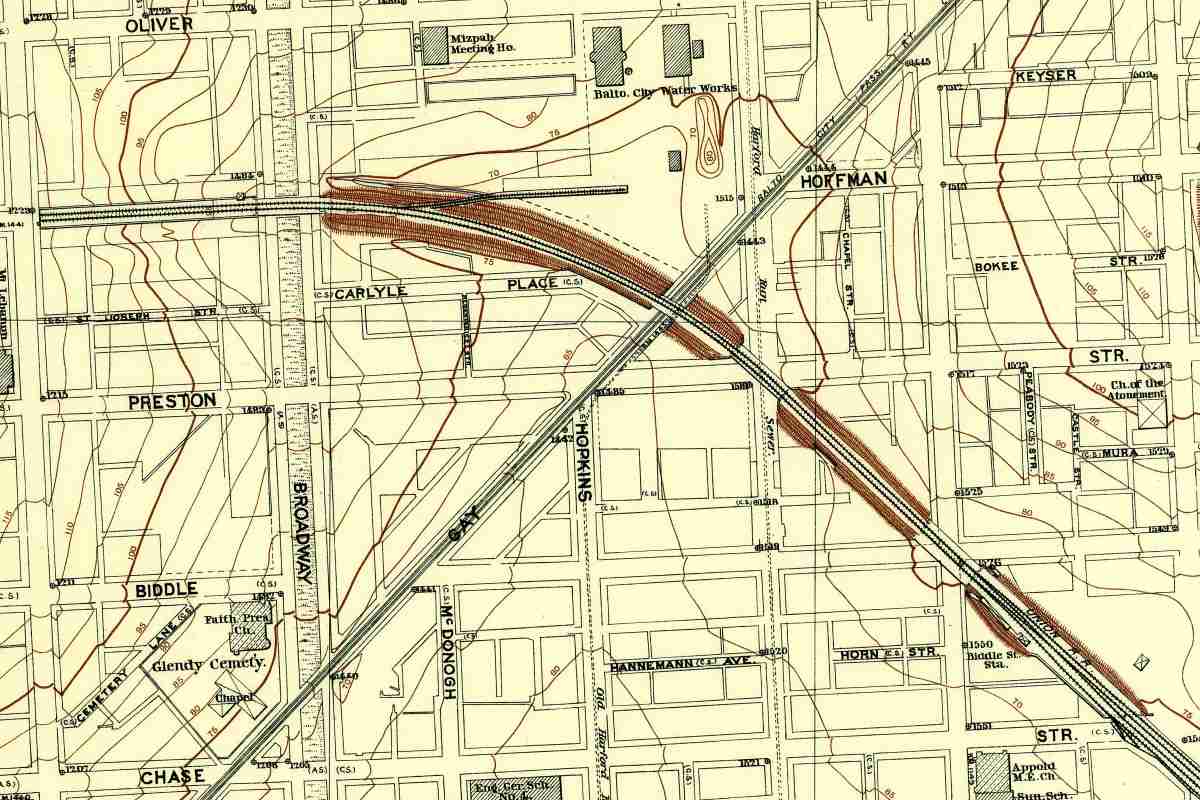
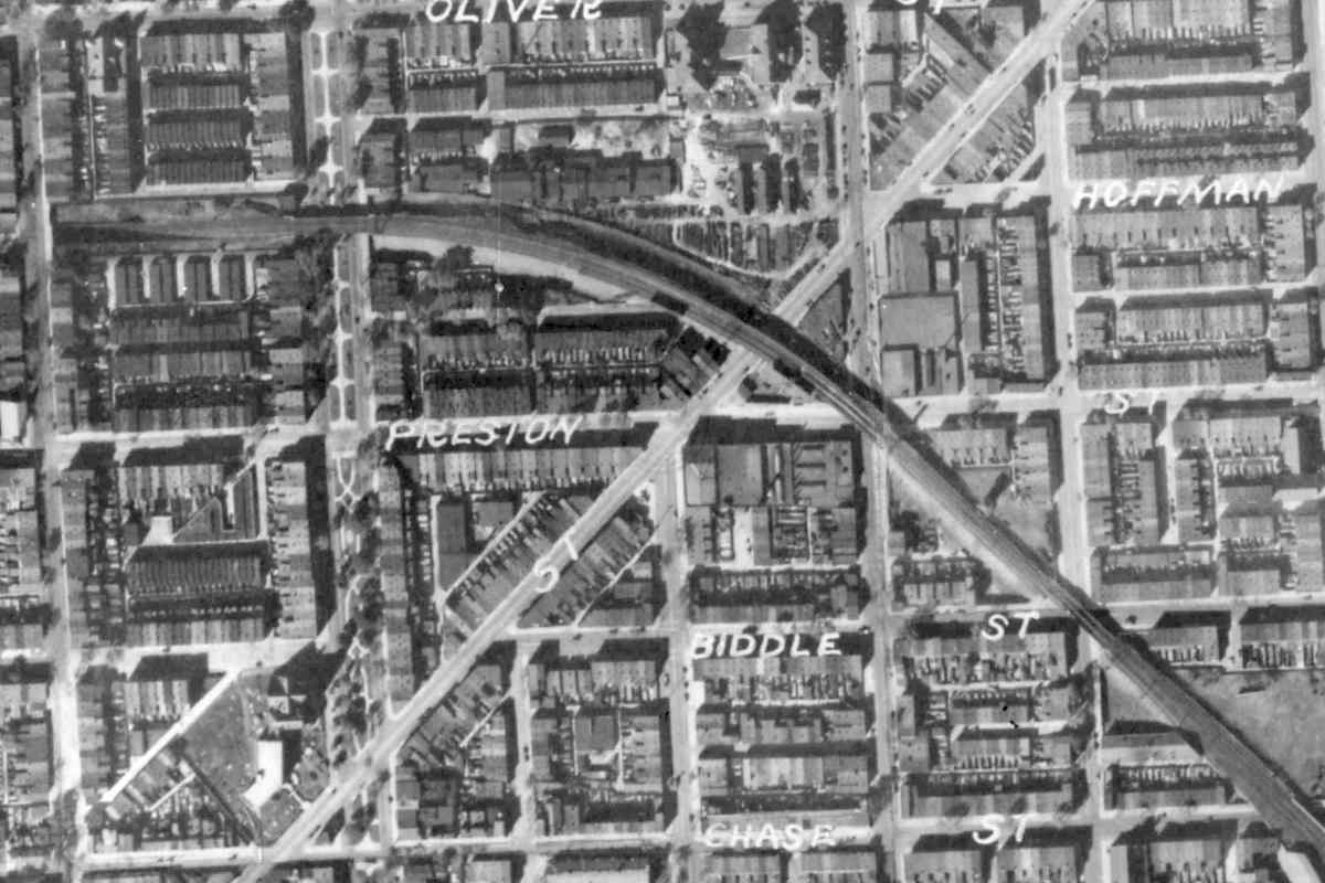
On this detailed map from 1894, Union Tunnel's east portal is at left, sandwiched between Oliver and Preston Streets. An X in a box in the northwest quadrant of Broadway might represent Broadway Tower.

A siding had continued due east from there to serve the Baltimore City Water Works facility (top center) between Oliver and Hoffman Streets. It is no longer extant.

The Maryland Central Railroad hoped to extend that siding northeast along the diagonal that instead became the Gay Street trolley. Maryland Central evolved into the Maryland and Pennsylvania Railroad, which instead connected at Union Station.

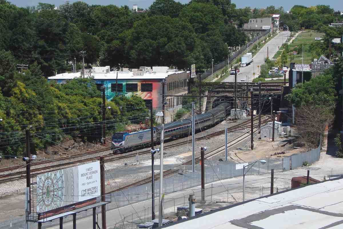
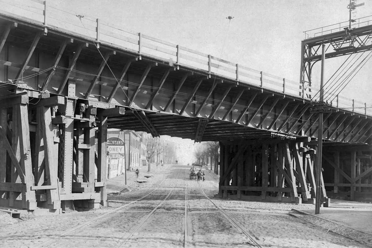
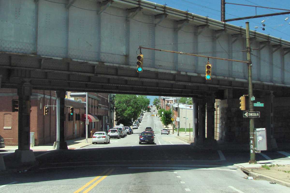
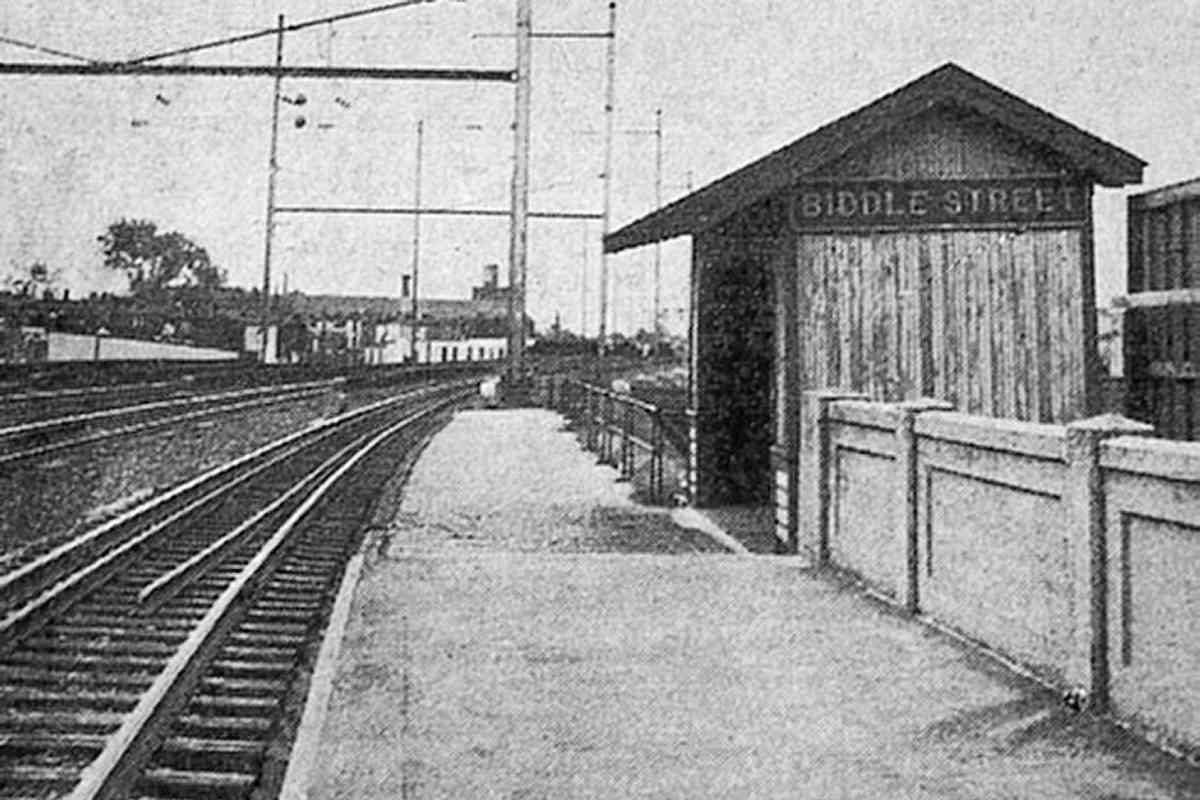
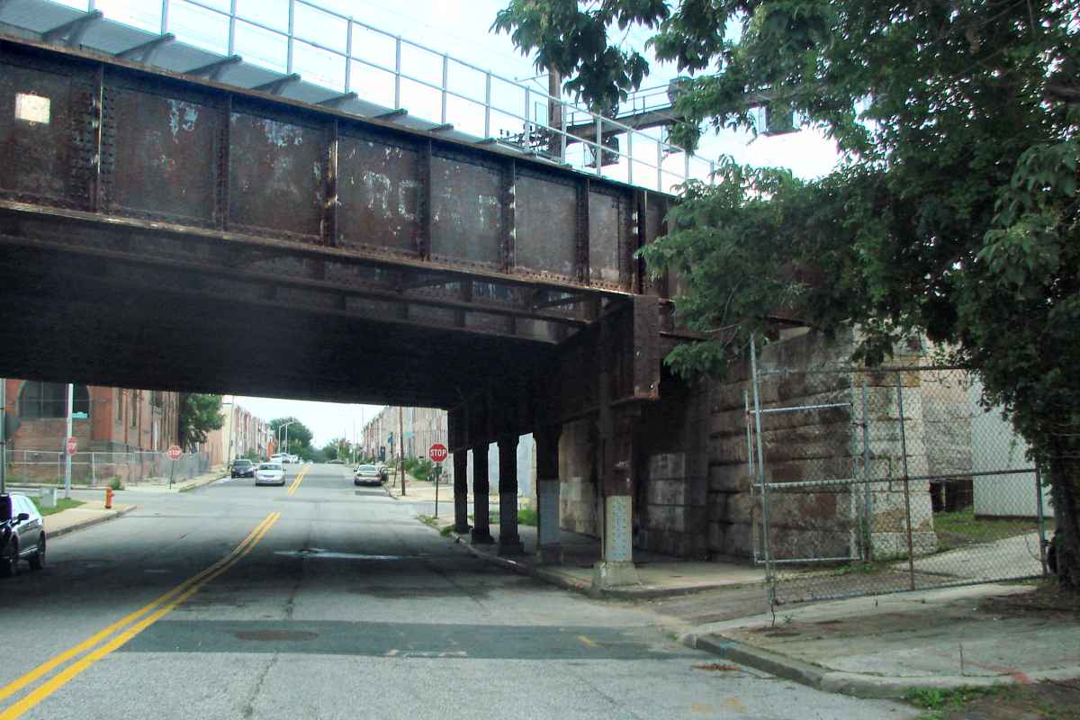
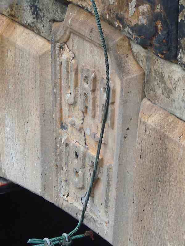
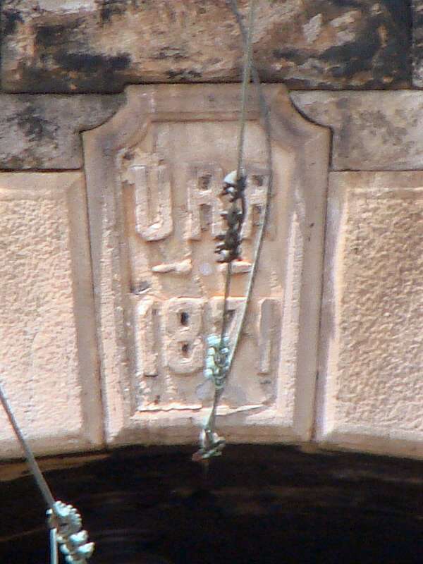
URR grade separated its line east to Biddle Street Station (lower right), but east of there the tracks ran at ground level through an area that was not densely populated before the 1900s.


Aerial 1927
Photo courtesy Johns Hopkins University

Aerial 1927
Mile: 94.4 (center) Date: 1927
Ease: View: N (up)
Area: T6:
Map: Ba 35 E 10 Topographic Maps

By 1927, the area had filled in with small, low-cost housing units. The double-wide, vertical street towards the left is Broadway.


AMTK 621

AMTK 621
Mile: 94.6 Date: Jun 2018
Ease: A- View: E
Area: D T6:
Map: Ba 35 E 10 Topographic Maps

An S curve begins east of Broadway, the widest of the street crossings. The south side abutment seen here is a concrete addition from the 1930s, while the north side is original 1870s stone masonry. the wire

If this view looks familiar, you have seen it in a few Season 4 episodes of The Wire (screen cap at left, fair use) where Marlo and his henchmen discuss plans as Amtrak trains roll by. Johns Hopkins Hospital is about a half mile south of here where their Emergency Room receives its share of gang violence victims.


Broadway

Broadway
Mile: 94.5 Date: Jun 2018
Ease: A View: S
Area: D+ T6:
Map: Ba 35 E 10 Topographic Maps

URR lowered Broadway in order to grade separate its rails. Though many wide Baltimore streets like it had hosted trolleys along their medians, Broadway never did in this section.


Preston Street 1915
Photo courtesy Baltimore Streetcar Museum
and Digital Maryland

Preston Street 1915
Mile: 94.3 Date: 1915
Ease: A View: E
Area: D T6:
Map: Ba 35 F 10 Topographic Maps

electric latern Outdoor electric light fixtures were still in their infancy at photo time. Former kerosene lamps were converted with wires and hung on the supports, as seen in the zoom on the left.

Like Broadway, Preston Street has been grade separated from URR's beginning, according to PRR's self-published history. I have found no record of the bridge materials URR used, with wood or iron the likely possibilities. The steel bridge here is not the original at this location. The supports seen here made of both steel and wood (rather than just steel) suggest the bridge was being modified at photo time.

Link: photo source


Preston Street 2018

Preston Street 2018
Mile: 94.3 Date: Jun 2018
Ease: A View: W
Area: D T6: 309
Map: Ba 35 F 10 Topographic Maps

The reverse view a century later found less wood and more traffic signals.


Biddle Street Station
Photo courtesy Adam Paul

Biddle Street Station
Mile: 94.2 Date: 1959?
Ease: C View: SE?
Area: C- T6:
Map: Ba 35 F 10 Topographic Maps

Though Nicholas Biddle was the third president of the Second Bank of the United States, Baltimore's Biddle Street is more likely named for a different Nicholas Biddle, the first casualty of Baltimore's Civil War riots.

PRR had a station at Biddle Street, but this photo contains a puzzle: it shows the tracks bending to the right. The problem: whether you look northwest or southeast from Biddle Street, in reality the tracks bend to the left.

The detailed 1894 city atlas shown above puts Biddle Street Station a half block southeast of the intersection of Biddle and Washington Streets. My best guess is the curvature is an optical illusion caused by a siding that did bend slightly right on its way over Chase Street. "Biddle" remains the name Amtrak uses for this location.

Links: Biddle Street Station


Chase Street

Chase Street
Mile: 94.1 Date: Jun 2018
Ease: A View: E
Area: C- T6:
Map: Ba 35 F 10 Topographic Maps

The start of the siding at Chase Street remains extant; it even has faint Pennsylvania Railroad lettering, the only surviving example in Baltimore.

Stone piers likely date to the 1893 grade separation. The concrete came later (probably 1930s) when PRR added tracks and expanded Union Tunnel.

The east part of URR's route will be toured in a future update.


You may enjoy the related Canton Railroad tour at this site

<< Previous (west) | THIS PAGE: Union Railroad West | Next (future) >>

For more tours here, select from the map: clickable map

Or, return to main page

Copyright Notice