TrainWeb.org Facebook Page
B&O Photo Tour


B&O Sparrows Point Branch
Modern day photo tour

Accompanying each photo below are:

Click a photo to see a larger view. Please send your comments and corrections to Steve.


<< Previous (west) | THIS PAGE: Bayview to Canton Junction | Next (east) >>

Sparrows Point Branch (SPB) - Brief Historical Background:

Bayview Yard

Bayview Yard
Mile: -0.7 Date: Nov 2016
Ease: C View: W
Area: C RBL:
Map: Ba 36 B 11 Topographic Maps

As seen from I-895, entering from the distant right is ex-B&O Belt Line trailer trackage, now part of CSX's Baltimore Terminal Subdivision. After crossing over Pulaski Highway the main line continues northeast to Philadelphia, while the topic of this tour -- the Sparrows Point Branch (SPB) -- spurs off to the left.

In between Bayview Yard hosts various items, including a "Safety is a Way of Life" [..CSX..] trailer, and on the left a blue-roofed Yard Office.

Link: 1996


Bayview Wye

Bayview Wye
Mile: -0.7 Date: Jul 2016
Ease: C View: S
Area: C RBL:
Map: Ba 36 A 12 Topographic Maps

As seen from the yard, the SPB (right) heads south. This section of its route predates the Howard Street Tunnel and associated Belt Line. It originated when the B&O floated passenger and freight cars from Camden Station across to Canton on east side of Baltimore Harbor where the cars could continue to Bayview then points northeast such as Philadelphia and New York. This tour page begins in the opposite direction, that is, from Bayview toward Canton.

The catenary beyond belongs to Amtrak's Northeast Corridor over which the SPB will cross directly. There's a tangle of trackage in this Bayview Junction area.

Link: 1977 B&O 6944


Old Span
Photo courtesy Google

Old Span
Mile: -0.6 Date: 2014?
Ease: View: N (up)
Area: B- RBL: 109
Map: Ba 36 A 12 Topographic Maps

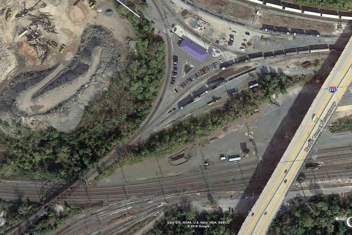
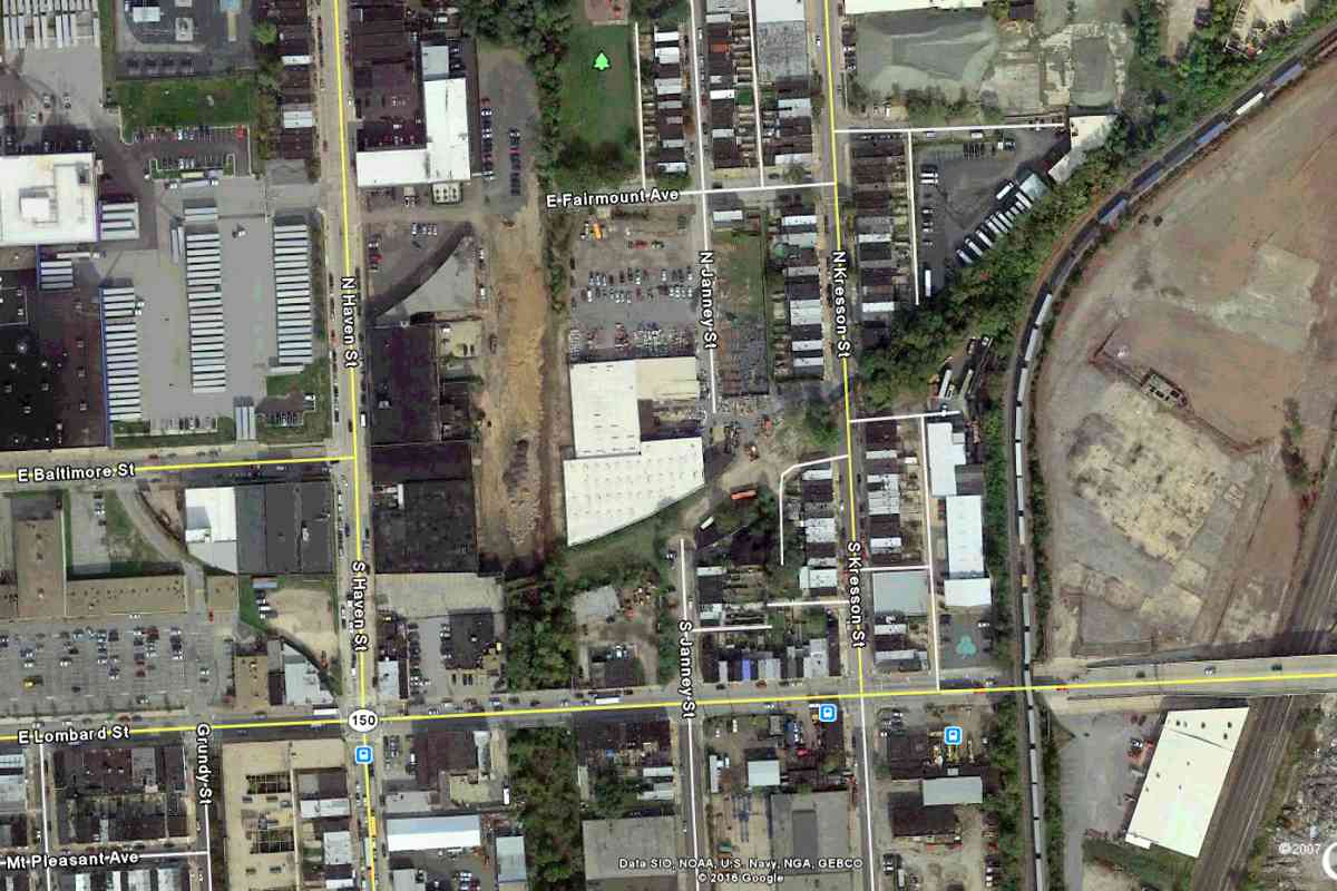
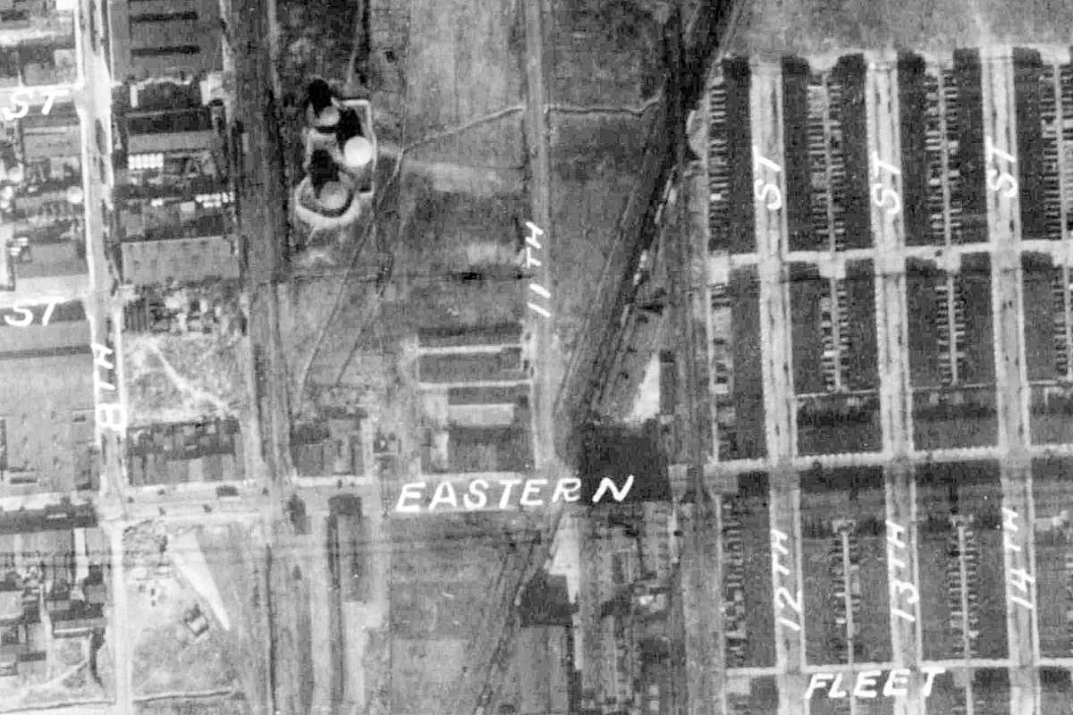
The original B&O bridge spanning the Northeast Corridor was still around when this view from above was snapped during 2014 or so. The CSX yard office's blue roof appears purple in some aerial views. South of that is Norfolk Southern's Bayview Yard through which passes the Northeast Corridor, marked by catenary.
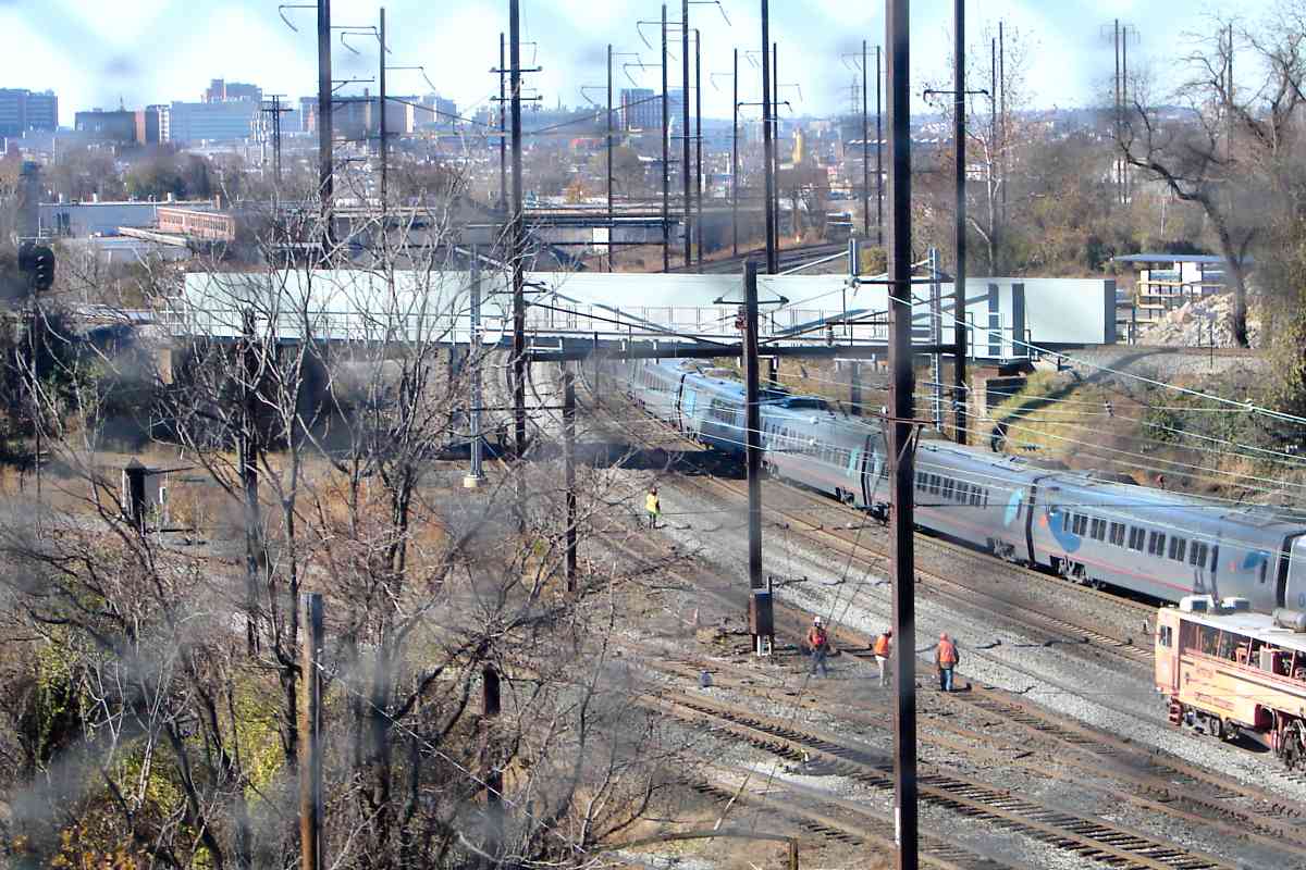
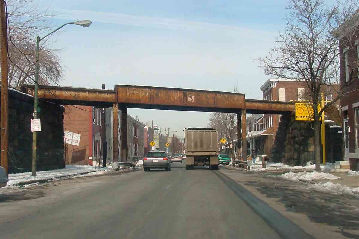
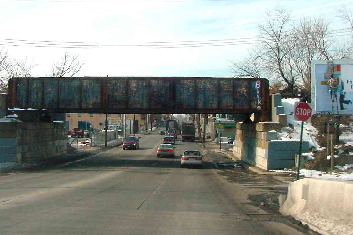
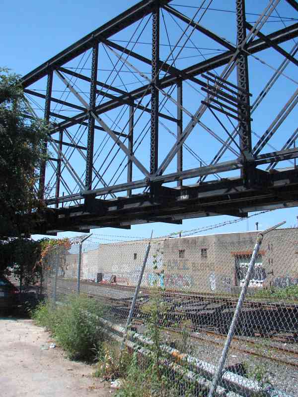
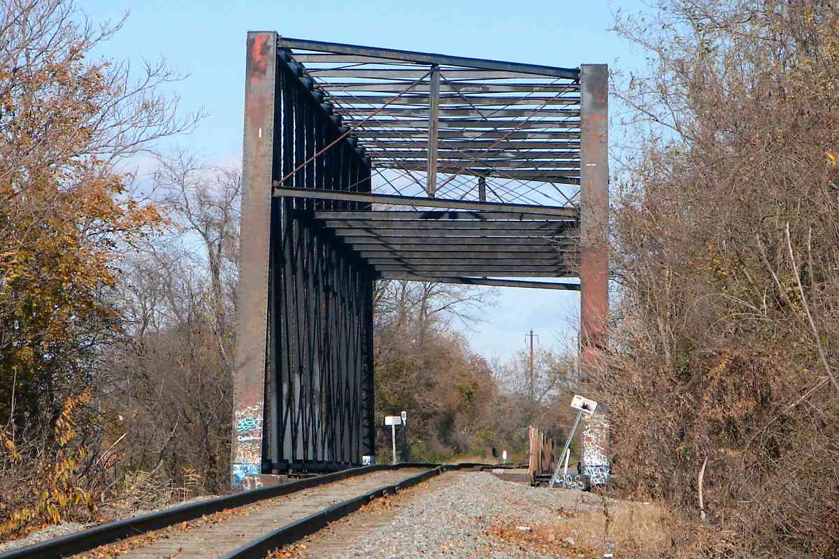
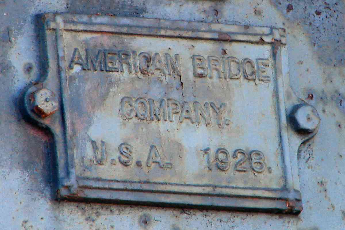
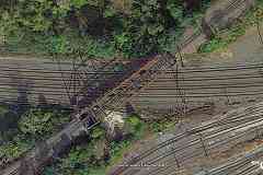
closeup At bottom left the SPB crosses over Amtrak. About 1885 the line received this Whipple truss bridge that stood until replacement during 2016. It had been one the last two Whipple truss rail bridges in Maryland. The other survives (as of 2017) and will be seen later in this tour.

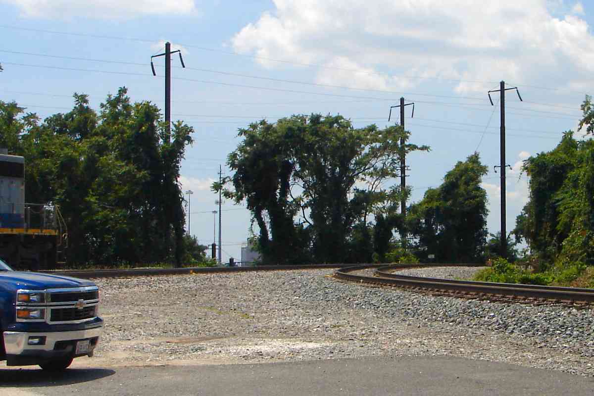
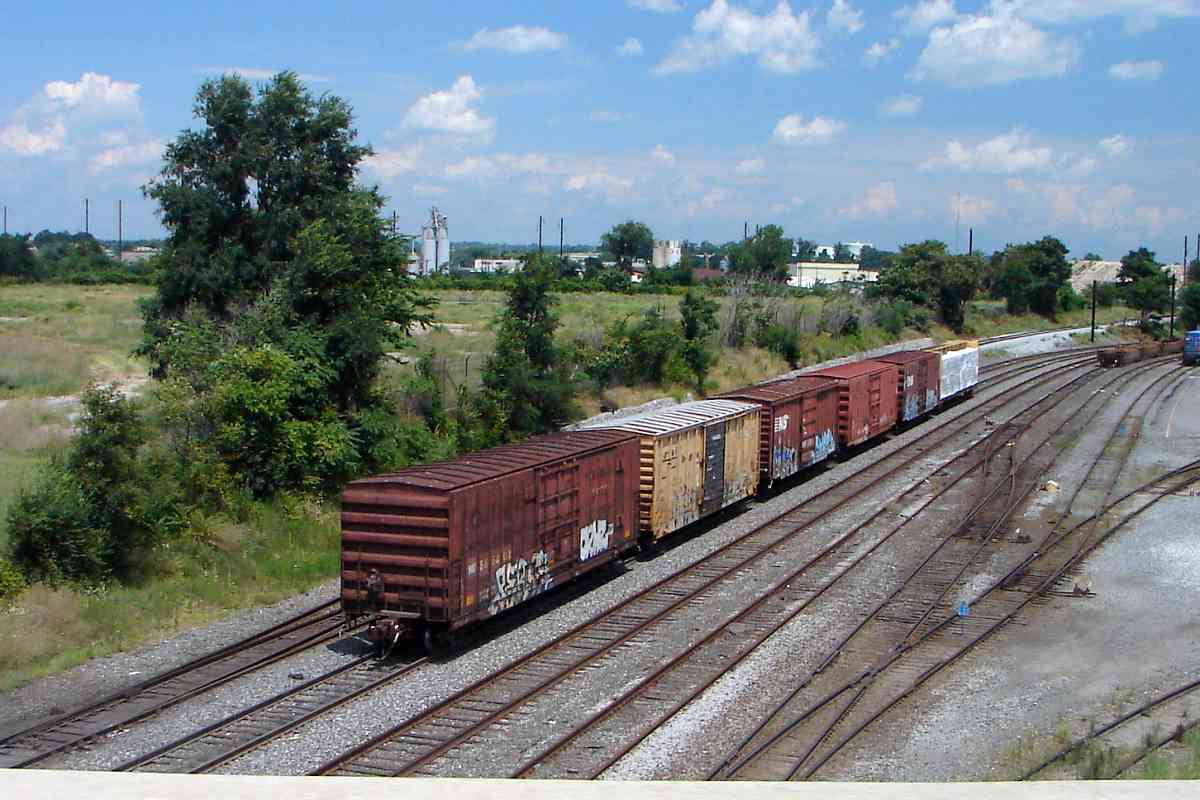
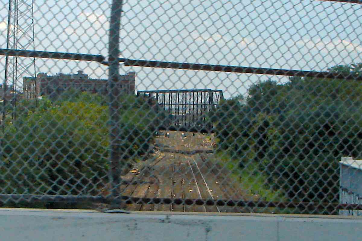
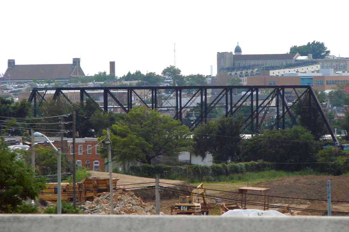
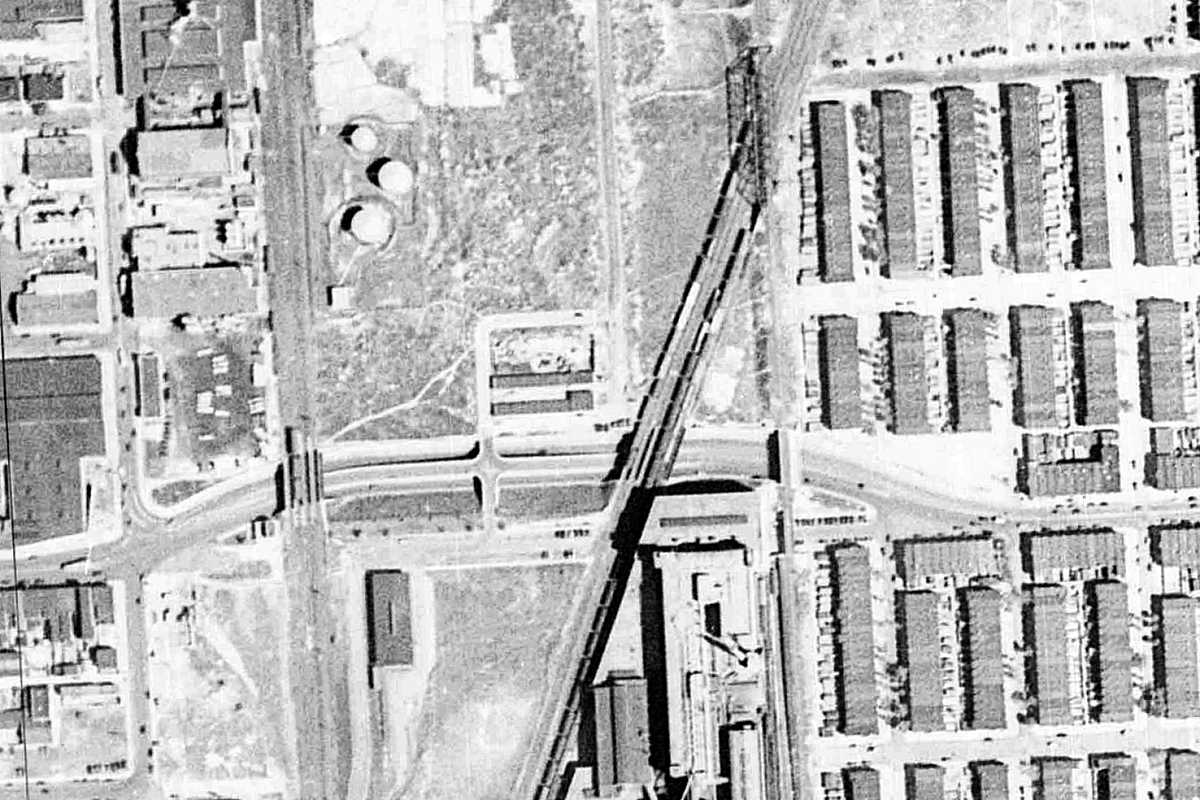
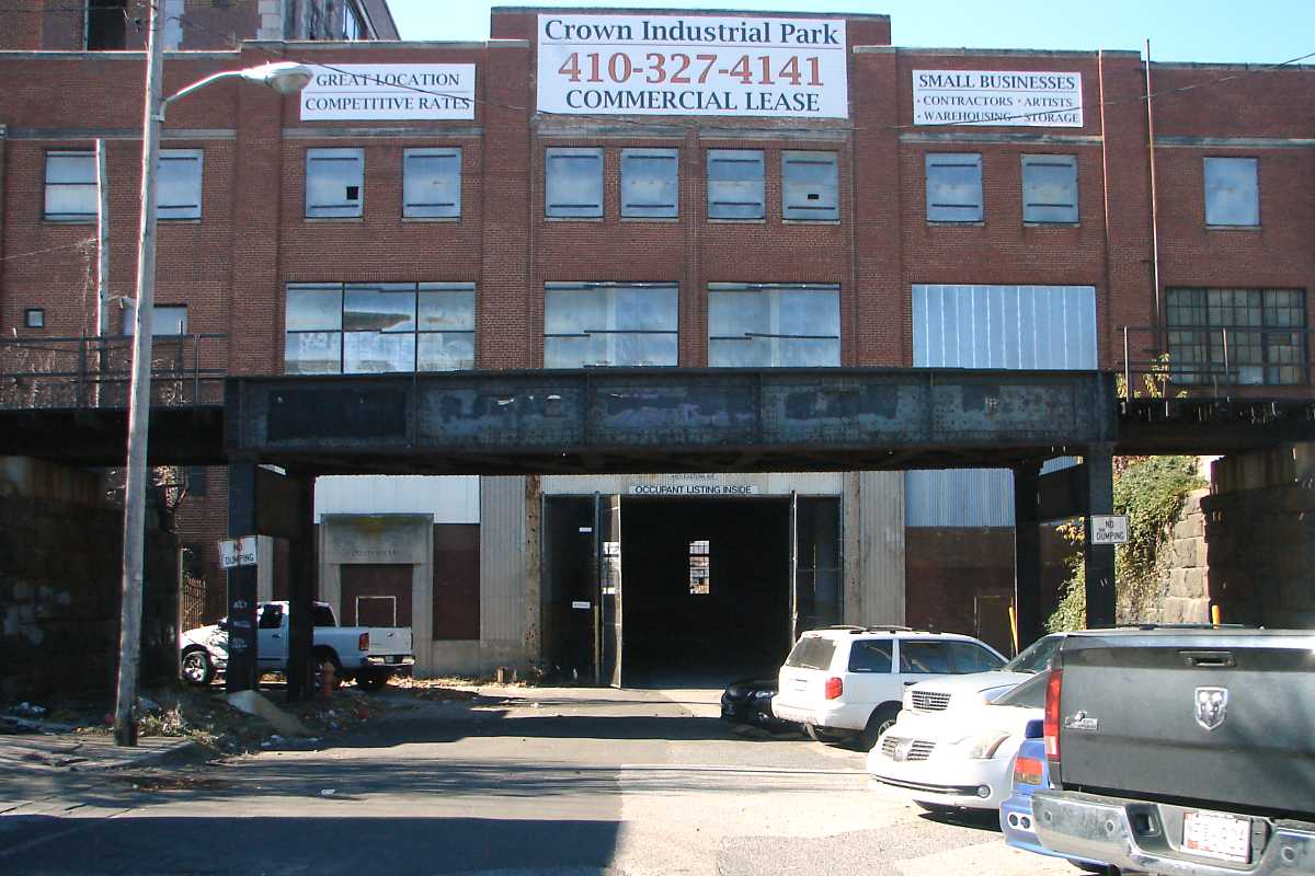
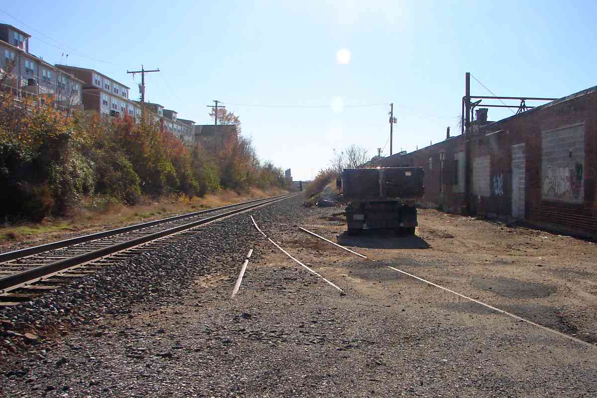
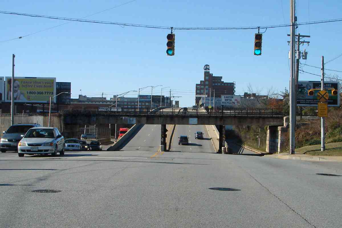
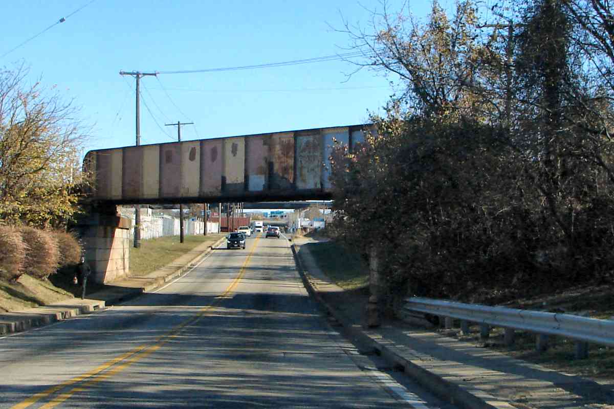
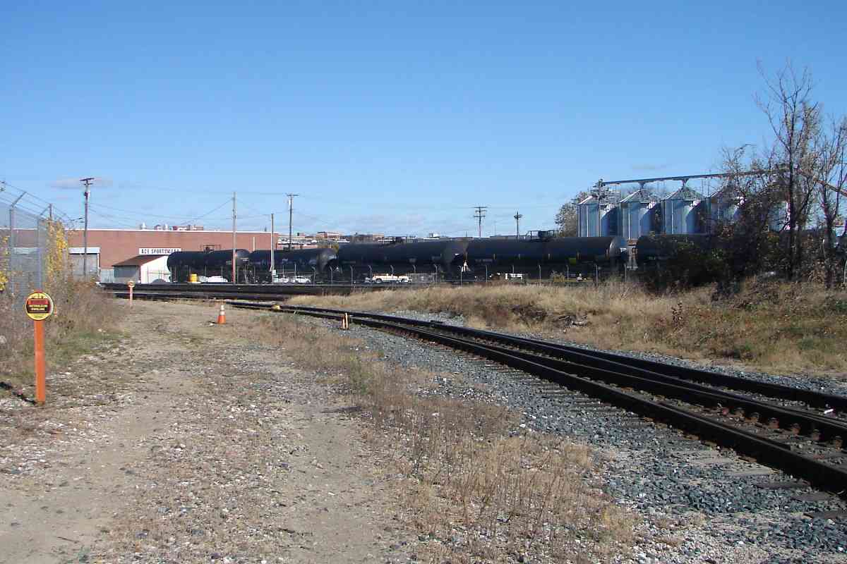
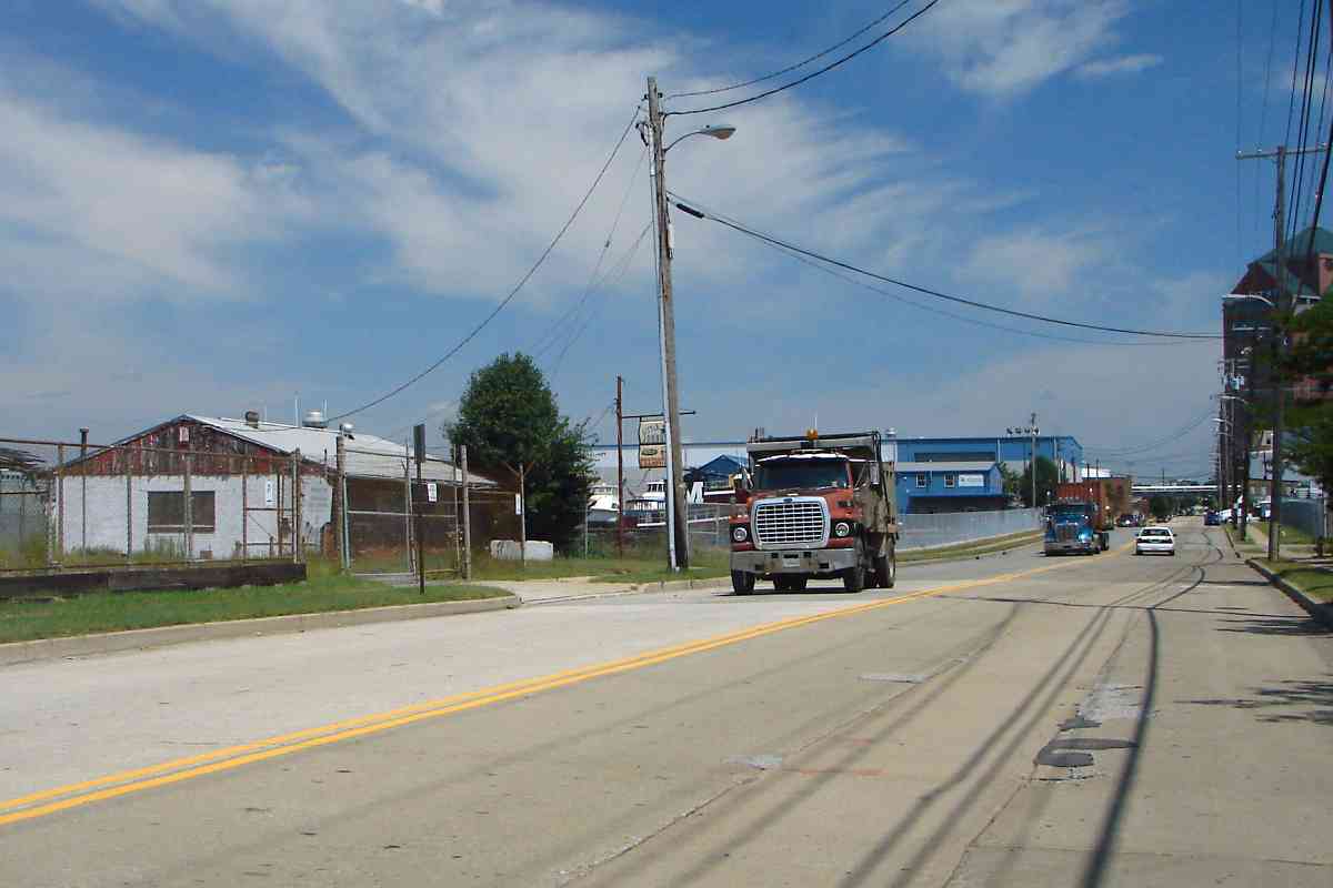
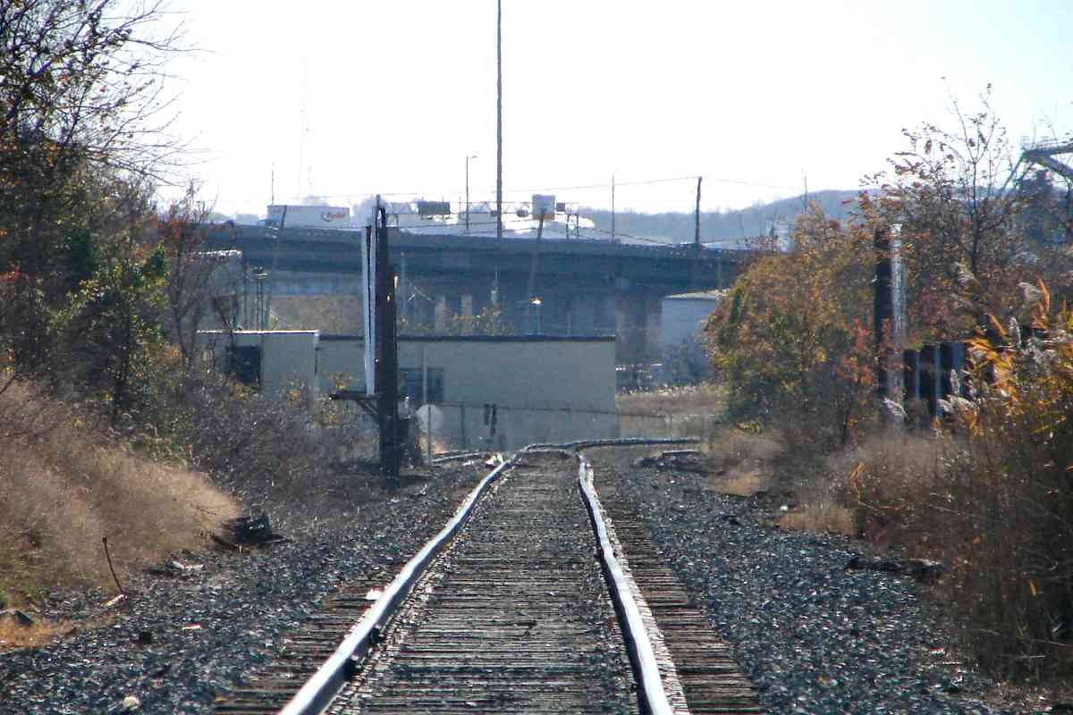
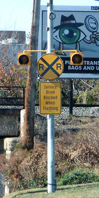
Surrounded by industry and active rail yards, this is an exceptionally difficult area to reach on foot. The easiest views come from satellite photos, trains, and from elevated I-895...

Links: 1977 LoC, 1977 LoC, 1979, more pics of this bridge, 2016


New Span

New Span
Mile: -0.6 Date: Nov 2016
Ease: C View: W
Area: C+ RBL:
Map: Ba 36 B 12 Topographic Maps

From I-895 you'll be looking through fencing but at least you can glimpse the action. The new SPB bridge is of the plate girder variety with what appear to be tall sidewalls made of or coated by white concrete, perhaps as protection from fallen catenary.

On the Northeast Corridor tracks below, a Plasser American MoW vehicle assists Amtrak employees. The passenger train is moving away from the camera, its next stop Baltimore's Penn Station.


Interchange

Interchange
Mile: -0.1 Date: Jul 2016
Ease: A View: N
Area: C RBL:
Map: Ba 36 A 13 Topographic Maps

The SPB runs along the distant edge of this open field. The leftmost visible track, hidden somewhat by these six railcars, connects it with the former Pennsylvania (now Norfolk Southern) freight spur to Canton as seen in the foreground from the Lombard Street bridge.

Link: at Wikipedia


1927 Aerial

1927 Aerial
Mile: -0.2 Date: 1927
Ease: View: N (up)
Area: B- RBL:
Map: Ba 35 K 12 Topographic Maps

The prior photo was snapped looking north (up) from where Lombard Street meets the right edge of this 1927 aerial view. At that time the Pittsburgh Mill Steel Company, served by both the B&O and PRR, occupied what is now the open field.

Where the SPB bends south tracks split off to serve businesses via a partially elevated spur known as the Highlandtown Branch.


Curves
Photo courtesy Google

Curves
Mile: -0.2 Date: 2014?
Ease: View: N (up)
Area: B- RBL:
Map: Ba 35 K 12 Topographic Maps

Wherever you see a building with a curved exterior wall you can be near certain a railroad had run. Though most of the elevated spur has been pulled up, several such buildings near Baltimore and Haven Streets retain their curves. The SPB is "with train" on the right.


Kresson Street

Kresson Street
Mile: -0.2, 0.1 Date: Feb 2004
Ease: B- View: N
Area: C RBL:
Map: Ba 35 K 12 Topographic Maps

Since the time of this photo the spur's rusty bridge over Kresson Street has received a coat of bright red paint.


Tanks

Tanks
Mile: -0.2, 0.1 Date: Aug 2016
Ease: B- View: E
Area: C RBL:
Map: Ba 35 K 13 Topographic Maps

There's still some rail hardware atop the Kresson Street bridge. A short siding of the spur remains active: left of the fixed-black tank behind the foliage sits a railcar tank.


Gone

Gone
Mile: -0.2, 0.1 Date: Aug 2016
Ease: B View: SW
Area: C RBL:
Map: Ba 35 K 13 Topographic Maps

The shadow seen in the 1927 aerial suggest the spur sat on mounded soil rather than a steel structure that squeezed between the buildings ahead. Whatever it had been, it's gone now.


Disused

Disused
Mile: -0.2, 0.2 Date: Aug 2016
Ease: B View: W
Area: C RBL:
Map: Ba 35 K 13 Topographic Maps

Beyond the mound this overgrown bridge remains extant to cross what had been a Northern Central Railway line to docks at Canton that had run between and parallel to Haven and Janney Streets. Until 1993 an Esskay Meat factory had been on the other side; Esskay is easier to pronounce than the original company name of Schluderberg-Kurdle.

Link: 1984 abandonment


Lombard Street

Lombard Street
Mile: -0.1 Date: Feb 2004
Ease: A View: W
Area: C- RBL:
Map: Ba 35 K 13 Topographic Maps

Beyond the spur, the main SPB crosses over Lombard Street via this bridge. This section of the SPB is so difficult to access the man on the right has brought a ladder for a better view. Or maybe it's to change the billboard ad, probably one of those two.

Link: CSX 6929 here


From Lombard Street

From Lombard Street
Mile: -0.1 Date: Jul 2016
Ease: B+ View: S
Area: C- RBL:
Map: Ba 35 K 13 Topographic Maps

To the left (relative to the prior photo) one can glimpse the SPB's next crossing, that over the ex-Pennsy spur to Canton.

It does so via a Whipple truss bridge contemporary to the one over the Northeast corridor removed during 2016.


From I-895
NEW! late-Aug 2018

From I-895
Mile: -0.1 Date: Aug 2018
Ease: A View: W
Area: B RBL:
Map: Ba 36 A 13 Topographic Maps

Perhaps the easiest view of the entire bridge comes from the Harbor Tunnel Thruway, just south of the Lombard Street exit.


CSX 8-87

CSX 8-87
Mile: 0.1 Date: Aug 2016
Ease: A View: NW
Area: C- RBL:
Map: Ba 35 K 13 Topographic Maps

Though this Whipple truss, now the only survivor of its kind in Maryland, isn't tough to get close to, you then can't view it all at once. This is the last extant truss bridge of the B&O's 1880's route to Philadelphia.

As you can see, CSX continues to use it. Bridgehunter.com lists only four Whipple truss bridges remaining in railroad use within the United States.

Link: more pics of this bridge


From Gough Street

From Gough Street
Mile: 0.1 Date: Aug 2016
Ease: A View: SW
Area: C- RBL:
Map: Ba 35 K 13 Topographic Maps

Squire Whipple patented his first bridge design in 1841, from which this bridge evolved. To see it you can drive to where Gough Street ends at the tracks. Whipple's bowstring truss was the first to employ cast iron for compression and wrought iron for tension members.

Link: 2018


From Eastern Avenue

From Eastern Avenue
Mile: 0.2 Date: Nov 2016
Ease: View: N
Area: RBL:
Map: Ba 43 K 1 Topographic Maps

This view from the south at Eastern Avenue shows CSX plants BAL milepost 0 just north of the bridge at a spot the railroad refers to as Becks.


1927 Eastern Avenue

1927 Eastern Avenue
Mile: 0.2 Date: 1927
Ease: View: N (up)
Area: B- RBL:
Map: Ba 43 K 1 Topographic Maps

Though the B&O had the foresight to grade separate its line from the busy Eastern Avenue (between 11th and 12th Streets), the Pennsy did not for either of the its two lines here. One crosses this map diagonally, the other is less easy to see, occupying what would be 9th Street.

Furthermore an "electric railroad" as it was known at the time, or trolley as we call it now, ran along Eastern Avenue. In 1930 Eastern Avenue would be rerouted into a cut for grade separation purposes.

The Whipple truss bridge is difficult to pick out at photo top, right of center.


1937 Eastern Avenue

1937 Eastern Avenue
Mile: 0.2 Date: 1937
Ease: View: N (up)
Area: B- RBL:
Map: Ba 43 K 1 Topographic Maps

With better light and resolution this equivalent 1937 photo makes the Whipple truss bridge and its webby shadow easier to find. Eastern Avenue has been rerouted, with three bridges added for the railroads, plus one for Janney Street with awkward ramps down to Eastern Avenue.

Link: ~1950


Eastern Avenue

Eastern Avenue
Mile: 0.2 Date: Jul 2016
Ease: A View: W
Area: C RBL:
Map: Ba 35 K 13 Topographic Maps

The closest bridge is that of the SPB while the other is now employed by Norfolk Southern. Two more bridges span beyond the curve. Though Eastern Avenue continues to follow the reroute established during the 1930s the roadway has been reconfigured a couple times, once in 1958 to remove the Janney Street center-lane automobile ramp.

Plaques at each end read, "City of Baltimore Department of Public Works; Bureau of Highways; William F. Broening, Mayor; Charles F. Goob, Chief Engineer; Nathan L. Smith, Highway Engineer; Catalano and Specora Construction Co., Contractor; The J.E Greiner Co., Consulting Engineers. 1930."

Link: 2018


Old Eastern Avenue

Old Eastern Avenue
Mile: 0.3 Date: Nov 2016
Ease: A View: W
Area: C- RBL:
Map: Ba 43 K 1 Topographic Maps

plaque Once the new route was open, the Crown Cork and Seal Company built over the old, turning it into a loading dock of sorts.

Shortly before that rerouting activity, the B&O redid its bridge over the old Eastern Avenue. It has remained in service into the 21st century.


View South

View South
Mile: 0.3 Date: Nov 2016
Ease: B View: S
Area: D+ RBL:
Map: Ba 43 K 1 Topographic Maps

South of Eastern Avenue the SPB escapes the high-density confines of city living, but that doesn't mean all the industrial turf is behind...


Sidings

Sidings
Mile: 0.5 Date: Nov 2016
Ease: A View: S
Area: D+ RBL:
Map: Ba 43 K 1 Topographic Maps

mega zoom At the SPB's first grade crossing (Fait Avenue) one finds disused sidings that had served the Crown Industrial complex.

Mega zoom shows the tracks bend west (right) before I-95 which is a mile distant. Closer than that are billboards, seen edge on, at O'Donnell Street.


O'Donnell Street

O'Donnell Street
Mile: 0.7 Date: Nov 2016
Ease: A View: W
Area: C RBL:
Map: Ba 43 K 2 Topographic Maps

crossing O'Donnell Street dips under the SPB. There's probably a B&O herald hiding behind the faded rectagular CSX plaque on the bridge. Now part of Baltimore lore, there's no hiding the distant Natty Boh neon sign. Q: "What happened to Mr. Boh's other eye?" A: "Gunther's got it." That, or maybe it's on the billboard at right.

The special, and relatively new, crossing sign at right alerts drivers to trains along the lower-level service drive, except judging by aerials there have not been nearby tracks in use there since grade separation around 1960. The closest are NS tracks under the bridge. This puzzle begs for more exploration.

Links: 2017, more about Mr. Boh


Boston Street

Boston Street
Mile: 0.9 Date: Nov 2016
Ease: B View: E
Area: C RBL:
Map: Ba 43 K 2 Topographic Maps

B+O herald Mar 2023 After O'Donnell Street the SPB bends west to meet Boston Street at an oblique angle. The previous incarnation of this bridge employed, yes, a Whipple truss design. A faint B&O herald endures despite rust.

The bend brings the tracks toward the water at Canton where, prior to the Belt Line opening during the 1890s, the B&O floated rail cars to and from Locust Point.


Canton Junction

Canton Junction
Mile: 1.0 Date: Nov 2016
Ease: A- View: NE
Area: C- RBL:
Map: Ba 43 K 2 Topographic Maps

Before reaching the water the B&O met with the Pennsy's spur to the waterfront, approaching the camera from the area of the tanks at right. I am not sure which RR got here first, but what used to be a busy crossing is a now mere shadow of its former self.

The trees and vines at the right shroud an interesting artifact...


Last Semaphore
Photo courtesy Todd Sestero

Last Semaphore
Mile: 1.0 Date: 1972
Ease: A- View: E
Area: C- RBL:
Map: Ba 43 K 2 Topographic Maps

semaphore 2016 This signal was one of the last semaphores in operation in the region, still on the job into the 1970s. The signal was taken down when its crossover was removed, but as of 2016 its A-frame mast pole was still standing (left), the last of its kind in the Baltimore area -- possibly because vines keep it hidden from dismantling crews. To see more than leaves you need to visit during winter. Both photos look generally east.

Link: see this at Todd's site


Sibling Semaphore
Photo courtesy Todd Sestero

Sibling Semaphore
Mile: 1.0 Date: 1972
Ease: A- View: S
Area: C- RBL:
Map: Ba 43 K 2 Topographic Maps

semaphore 2016 Across Pennsy's tracks this sibling kept the other company, however unlike the other the pole for this one has since disappeared. The photo at right gives another year-2016 view of the surviving semaphore. These photos both look generally south into a small yard now shared by CSX and Norfolk Southern.

The B&O tracks had crossed left-to-right via multiple diamonds as seen in the 1972 photo and continued west (right) where they would cross Haven Street at grade.


Tank Cars

Tank Cars
Mile: 1.0, 0.1 Date: Jul 2016
Ease: A View: SE
Area: C- RBL:
Map: Ba 43 K 3 Topographic Maps

Haven Street (pavement at bottom) is the spur's final grade crossing into this fenced petrochemical facility. The tracks now end within the facility but during the 1800s they had continued along what is now Danville Avenue, and across Clinton Street to the B&O Locust Point car float operation at the waterfront, per the map below.


Car Float

Car Float
Mile: 1.0 Date: 1937
Ease: A- View: N (up)
Area: C RBL:
Map: Ba 43 K 3 Topographic Maps

Before the Howard Street Tunnel and Belt Line opened, the tracks cutting across the center were the B&O's main line between Baltimore and Philadelphia. Technically, they belonged to the Baltimore and Philadelphia Railroad, a subsidiary of the B&O.

Cars of freight and passengers were ferried across the harbor between the Clinton Street docks at left and Locust Point. By the time of this 1938 aerial photo that route had been relegated to a spur of the Sparrows Point Branch that curves along the right side. During the 1800s a Bollman Bridge Works factory had been adjacent, north of the B&O docks.

The car float facilities remained available for special purposes into the 1960s. For example, the link below tells of a BGE generator too large to fit through the Belt Line tunnels, so during 1960 the B&O ferried it across the harbor.

Link: Giant Generator Floated by B&O


Clinton Street

Clinton Street
Mile: 1.0, 0.5 Date: Jul 2016
Ease: A View: N
Area: C RBL:
Map: Ba 43 J 4 Topographic Maps

The B&O's car float operation was located ahead, near the pipes that cross over Clinton Street. Though all vestiges of it are gone, Norfolk Southern still has tracks here to the waterfront where cars can be on/off loaded from ships. There's a pic of them on this site's miscellaneous page, linked below.

Fans of The Wire will recognize the building on the left, Little Johnny's, as the filming location of the drug dealmaking of The Greek and his lieutenant Spiros Vondopoulos.

Links: Norfolk Southern's surviving tracks to the water, Little Johnny's


CSX 3222

CSX 3222
Mile: 1.0 Date: Nov 2016
Ease: A- View: S
Area: C- RBL:
Map: Ba 43 K 2 Topographic Maps

Back at the unnamed, shared yard CSX 3222 and NS 9686 play a rail version of chicken: who's gonna stop first before reaching the switch? The road signage beyond tops I-95.

Continue this tour to see several unusual grade crossings, a unique signal, a swing bridge, and scenes out of a dystopian movie...


<< Previous (west) | THIS PAGE: Bayview to Canton Junction | Next (east) >>

Or, return to main page

Copyright Notice