TrainWeb.org Facebook Page
Old Main Line Photo Tour


B&O Old Main Line
Modern day photo tour

Accompanying each photo below are:

Click a photo to see a larger view. Please send your comments and corrections to Steve.


<< Previous (spur) | THIS PAGE: Halethorpe | Next (west) >>

B&O 5074
Photo credit Art Campbell
NEW! late-Mar 2025

B&O 5074
Mile: 5.5 Date: Jan 1981
Ease: A View: N
Area: B IC2:
Map: Ba 42 B 11 Topographic Maps

B&O 5074 was an EMD model NW2. It will soon deliver CR 209346 and others to customers along the former fairgrounds spur. This view illustrates how much fill B&O added to raise its tracks above a shallow, damp valley.


Baltimore Terminal

Baltimore Terminal
Mile: 5.6 Date: May 2009
Ease: B+ View: SE
Area: B IC2:
Map: Ba 42 B 11 Topographic Maps

CSX's Baltimore Terminal Subdivision encompasses all the trackage this tour had followed southwest out of downtown Baltimore, plus its yards and operations, as well as the portions northeast to the Philadelphia Subdivision. It's a nice touch that the Subdivision has echoed for their symbol the B&O's Capitol herald.

I'd been mistaken that the metal rod attached to the utility pole was somehow related to a nearby Cab Signal Test Slip station. Reader Dave Witty kindly clued me in:

    "The telescoping metal rod attached to the utility pole is called a brake stick. We use it to apply and release handbrakes on freight cars per recent operating rules. It has nothing to do with Cab signal test slips. Cab signal test slips are carried by engineers in their 'grip'. Once a cab signal test has been completed, the engineer puts the completed form into a cab signal box (which looks like amailbox) located at many places along the right of way."
Cab Signals are part of a safety system that displays on-board to the engineer the state (stop, proceed, etc.) of trackside train signals. The system is tested periodically.

Detour: Philadelphia Branch tour at this site


Halethorpe Station
Photo courtesy B&O Railroad Museum
NEW! late-Mar 2025

Halethorpe Station
Mile: 5.7 Date: 1927
Ease: B View: SW
Area: B IC2:
Map: Ba 42 B 11 Topographic Maps

Visitors arriving at B&O's Fair of the Iron Horse by train would disembark at Halethorpe Station. A passenger waiting shack like this, instead of a large station building, was typical at lightly-used stops. The Fair attracted thousands of visitors, but its duration was so brief B&O merely lengthened Halethorpe's platforms. At over 1000 feet, these platforms were the longest in the region. HX Tower stands at distant right.

After the Fair, the semaphore signals at right would give way to CPLs on an adjacent signal bridge. This semaphore's concrete foundation is visible at the top of the next photo.

Link: ~1930s CPL installation


Modified Culvert

Modified Culvert
Mile: 5.7 Date: Jan 2018
Ease: B View: SE
Area: B IC2:
Map: Ba 42 B 11 Topographic Maps

closer A creek and various drains lead to this culvert, one easily overlooked because its outlet end was sewered underground when this area was developed for industry starting after World War II. Its exterior masonry is not of granite, so it was probably lengthened to support more tracks above during 1875 when B&O performed other such efforts in this vicinity.

The trackside concrete block had supported a semaphore signal bridge. Another to its right held CPLs that CSX removed around 2007 as part of a resignalling project.


Halethorpe

Halethorpe
Mile: 5.8 Date: Feb 2000
Ease: B View: NE
Area: B IC2: 245, 386, 387
Map: Ba 42 A 11 Topographic Maps

Before the centralization era (train control from one headquarters), HX Tower did the controlling here, switching "southbound" and westbound traffic between the OML and the Washington Branch. Trains still switch tracks in this vicinity, but switch settings are controlled remotely from CSX operations in Jacksonville, Florida.

Extra trackside width is a remnant of long passenger platforms B&O erected in 1927 for use by Fair of the Iron Horse attendees. The small Halethorpe Station shelter seen above had stood at the east end of the platform beyond the distant signal bridge.

B&O opened HX Tower in 1917 when it took the place of RX Tower about a mile west in Relay. When it closed October 1, 1985, this tower was the last active along the OML. Crews continued to use it into the 2000s. Presently this area is industrial and very busy. During the later 2010s, people broke into the tower and homeless took up residence. With its torn windows letting in moisture, the tower's days are numbered.

Links: 1956, 1976 interior, 1978, CSX 118 in 1989, 1995, more HX Tower pics at this site


Halethorpe Farms Road
Photo courtesy B&O Railroad Museum
NEW! late-Mar 2025

Halethorpe Farms Road
Mile: 5.8 Date: Sep 1927
Ease: A View: NW
Area: B IC2:
Map: Ba 42 A 11 Topographic Maps

HX Tower was there to witness B&O's Fair of the Iron Horse. Visitors stream under the original Halethorpe Farms Road bridge that was of stone arch construction.


Bridge 8A

Bridge 8A
Mile: 5.8 Date: Jan 2018
Ease: A View: N
Area: B IC2:
Map: Ba 42 A 11 Topographic Maps

Around 1950, Halethorpe Farms Road received this steel bridge with greater clearance. Where utility lines still follow their original route, the old stone arch might be hiding under soil and brush. An 1898 atlas places a US Cattle Quarantine pen on the right.

There's a B&O herald under the bridge's faded CSX sign.


Aerial 1953
Photo courtesy Johns Hopkins University

Aerial 1953
Mile: 5.9 Date: Feb 1953
Ease: View: N (up)
Area: IC2:
Map: Ba 42 A 11 Topographic Maps

By the early 1950s, the post-WW II economic recession had been replaced by expansion. At the time of this photo, various industries had taken up residence within the former B&O fairgrounds at bottom right, and more were to come. The white line running north-south is Halethorpe Farms Road.

At photo center, curving north of B&O, where farm fields and ball fields had been, an industrial spur spreads its sidings. Only one of those pieces survived into the 21 century: the one basically east-west just right of photo center where three railcars appear to be positioned. That's the siding seen in the next photo.


Offloading

Offloading
Mile: 5.8 Date: Apr 2009
Ease: A- View: SW
Area: B IC2:
Map: Ba 42 A 11 Topographic Maps

On the siding, plastic pellets are vacuumed off hoppers and sucked into a nearby building where presumably they go into injection molding machines. During the 1950s, additional sidings had peeled off to the right from this one.

When I was age 10, my dad took me to his workplace and demonstrated the pneumatic tube message transport system there. I was fascinated! If Elon Musk has his way, similar technology will be employed in a Hyperloop along the Northeast Corridor.

Transport of people via underground pneumatic tube was demonstrated by Beach Pneumatic Transit in New York City around 1870, long before the city had subways.

Link: Beach Pneumatic Transit


Milepost 6

Milepost 6
Mile: 5.9 Date: Apr 2009
Ease: B View: SW
Area: B IC2:
Map: Ba 42 A 11 Topographic Maps

Between the siding that serves factories along Halethorpe Farms Road and the main line tracks is a concrete foundation, a remant of the signal bridge that stood at this location for the better part of a century. It was obviated by the newer signals beyond milepost 6, here haloed by the lights of approaching CSX 7926. Beyond the signals are bridges of US 1, and I-195.

This spot is perhaps more notable for what does not appear. Beginning in the 1870s and lasting for a century, B&O planned to build on the left an alternate alignment to bypass the Thomas Viaduct's curves. The alignment would have remained on the south side of US 1 (then the Washington turnpike) and joined the Washington Branch near Paradise Avenue in Elkridge. The railroad acquired the necessary property, and graded both ends using material excavated from the Howard Street Tunnel in Baltimore. Financial trouble in 1896 halted the work, and ultimately the plan was never fulfilled. A portion of the route adjacent to the Calvert Distillery was sold in 1972 to Seagram, but much of the land remains in possession of CSX even now.

Change for: Thomas Viaduct bypass tour at this site


Gadsby's Run

Gadsby's Run
Mile: 6.0 Date: Feb 2000
Ease: B+ View: N
Area: B IC2: 37
Map: Ba 42 A 11 Topographic Maps

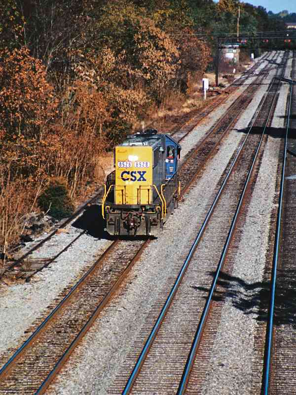
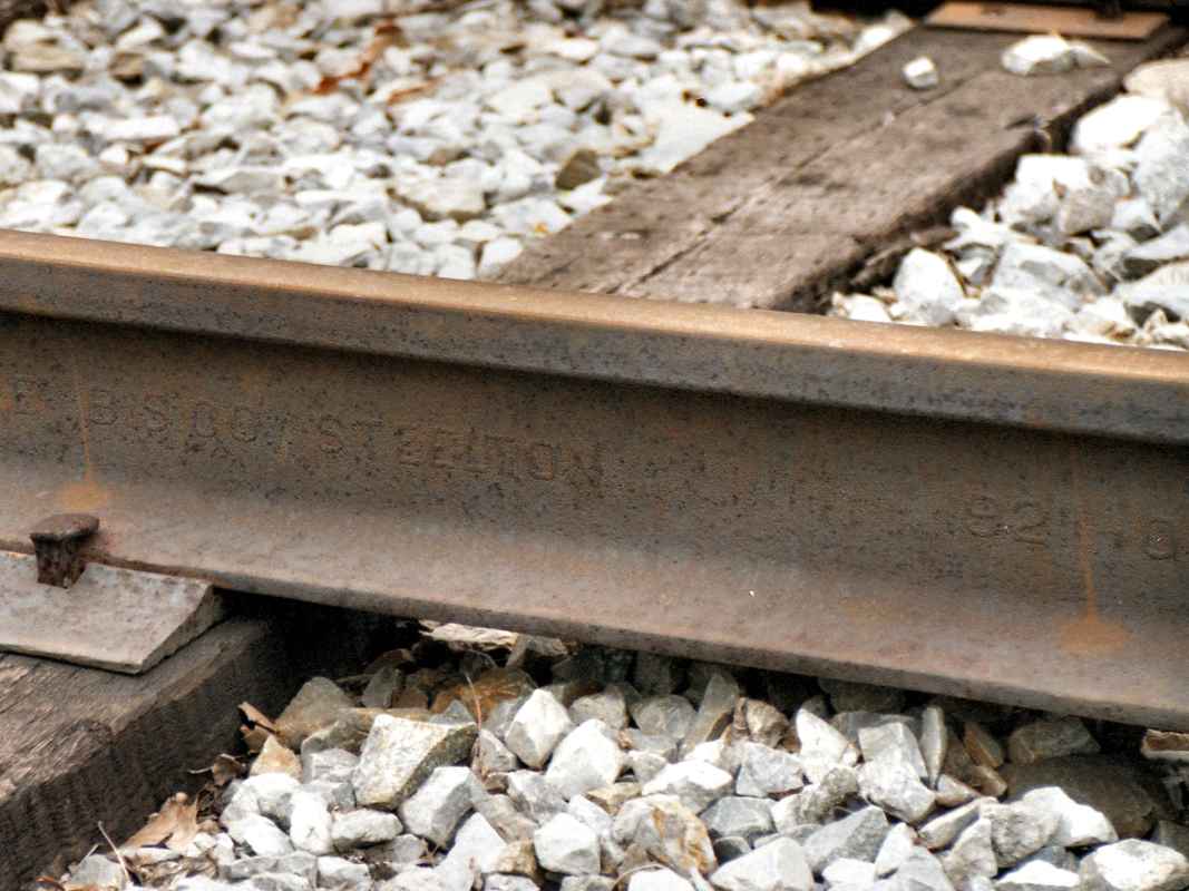
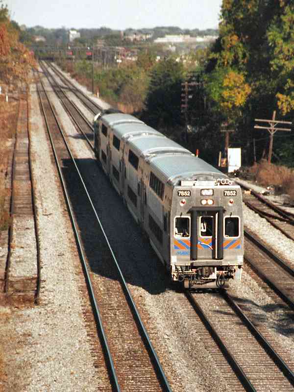
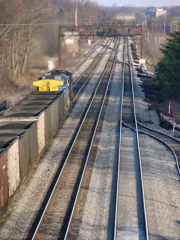
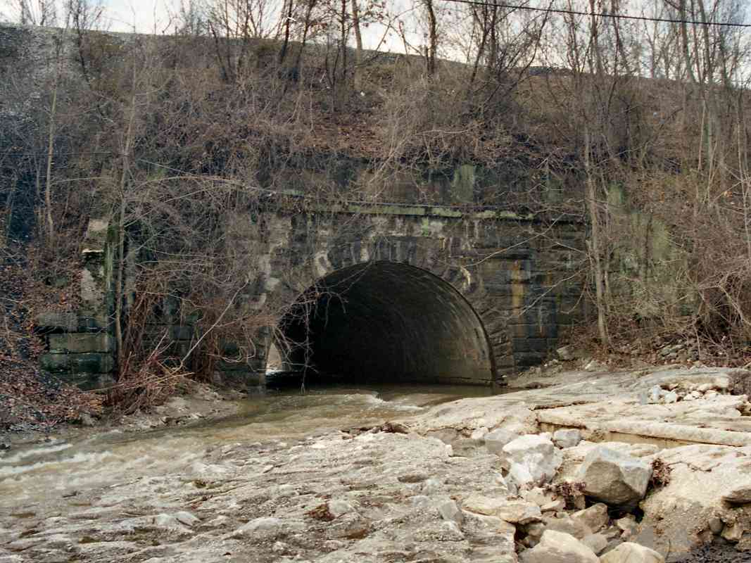
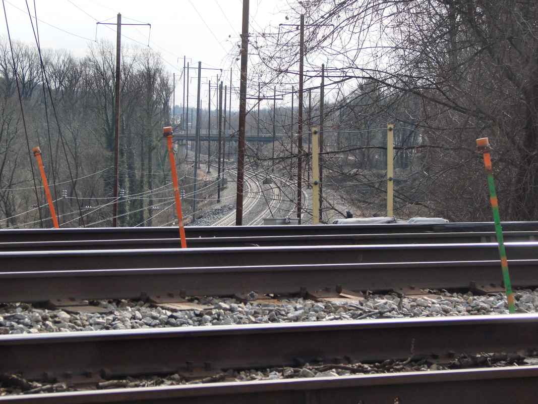
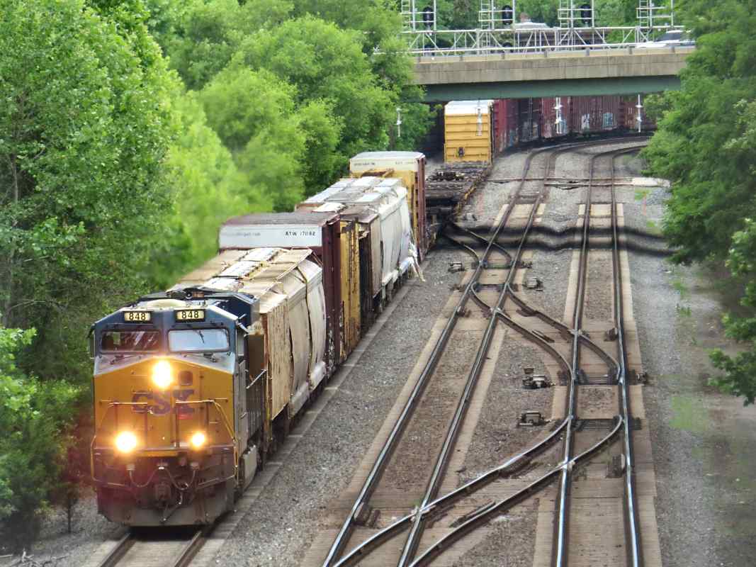
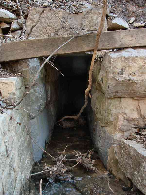
The B&O's early engineers were overly concerned about keeping their railroad level. They feared the steel wheels of steam engines would 
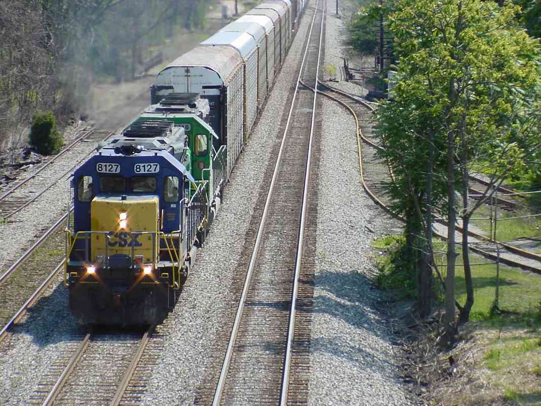
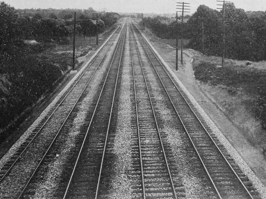
slip on steep grades, so they restricted the OML to a mere 0.7% grade. To keep things that flat, substantial fills were needed at certain locations, such as Gadsby's Run (also known as Herbert's Run). Here a 57-foot fill was built over a small arched bridge. As at the Deep Cut, all the ncecessary earth moving was done by hand.

built 1828 
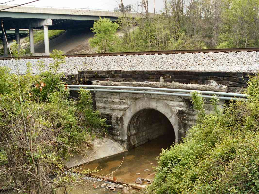
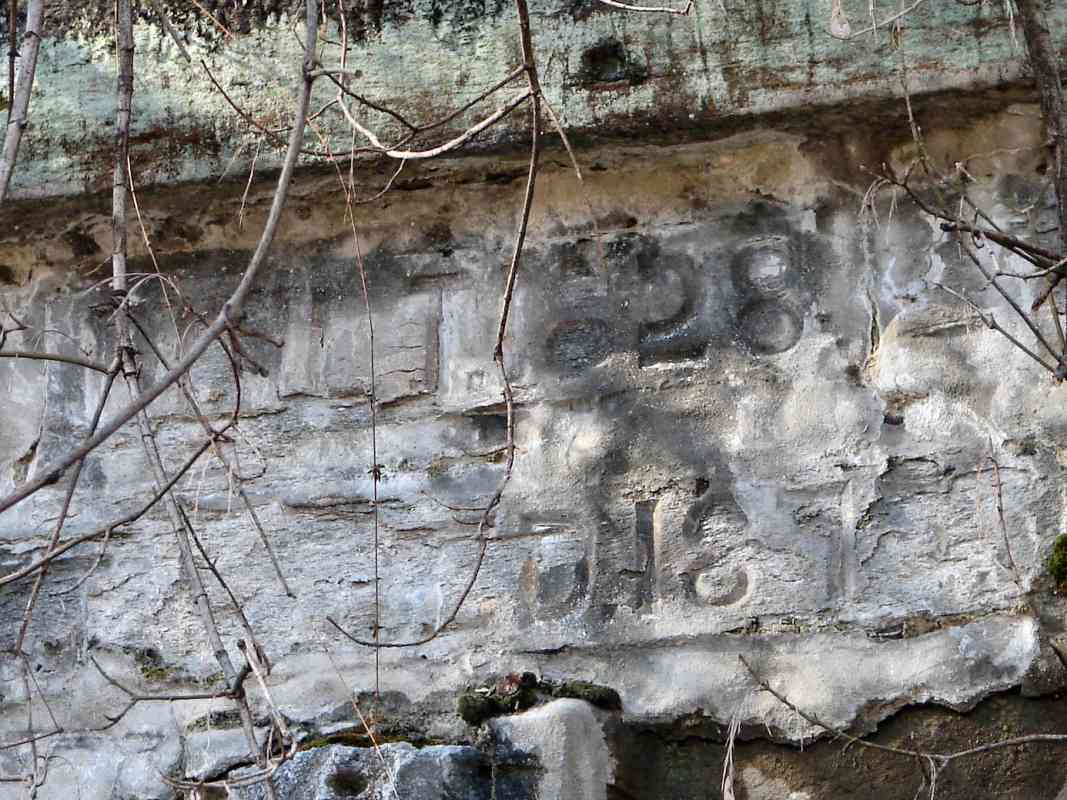
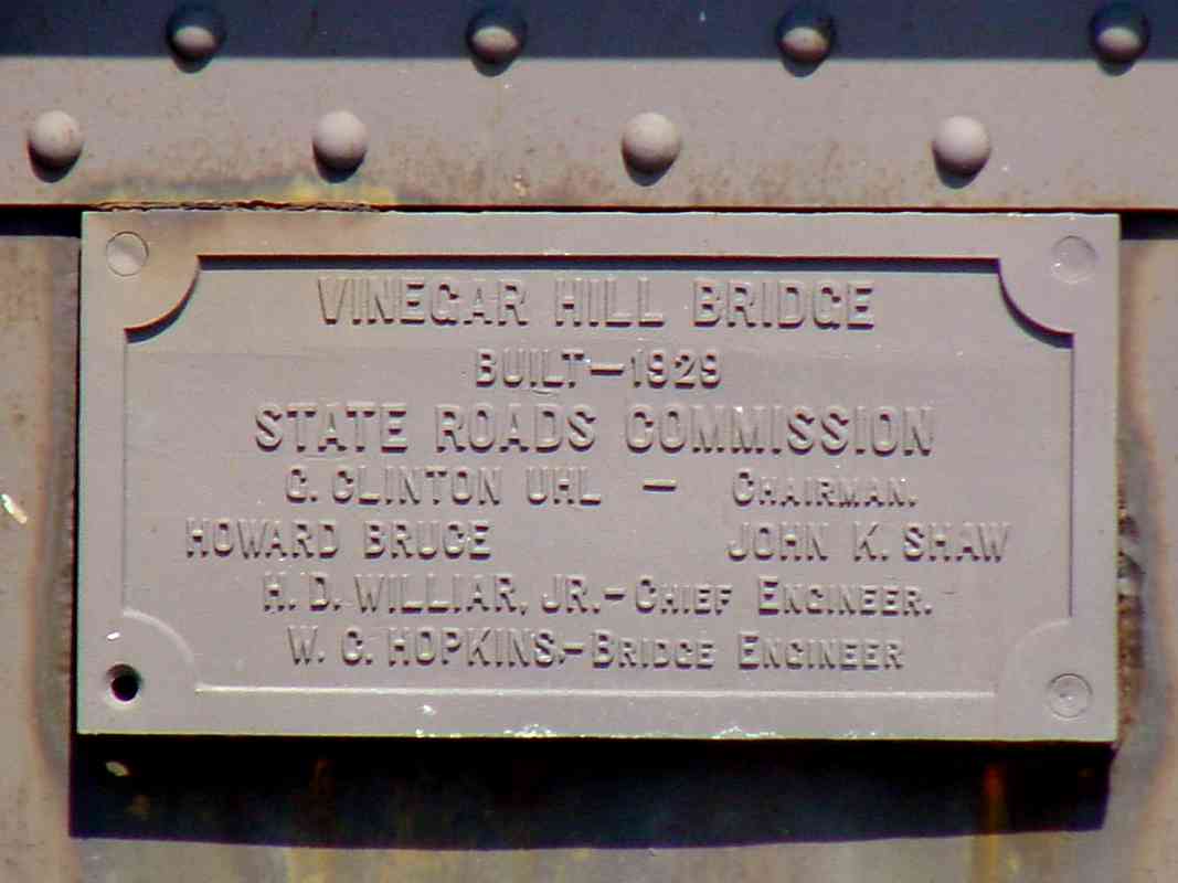
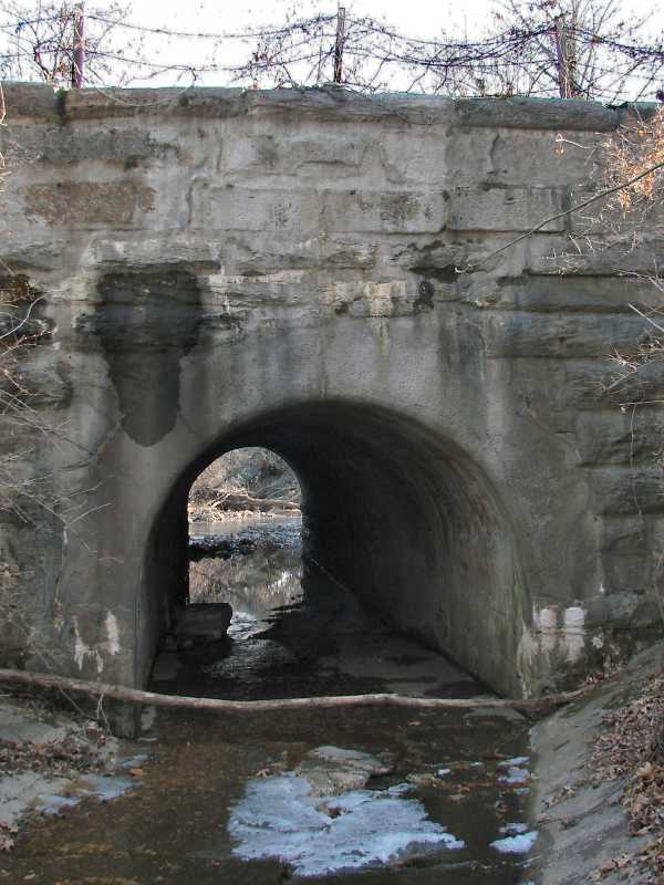
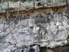
This is the only B&O stone bridge to display 3 construction dates, the oldest 1828, the next 1875 when it was widened to support more tracks, and the third (not shown) 19??. The digits look to be formed by hand in a surface layer of concrete. The third date is embossed in concrete that has not survived well, leaving its last two digits tough to decipher. The third date might coincide with B&O's preparation of this area to host 1927's Fair of the Iron Horse.

rebuild 
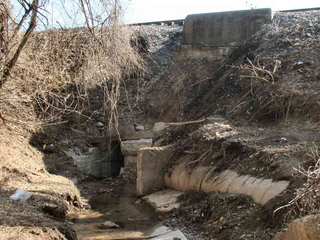
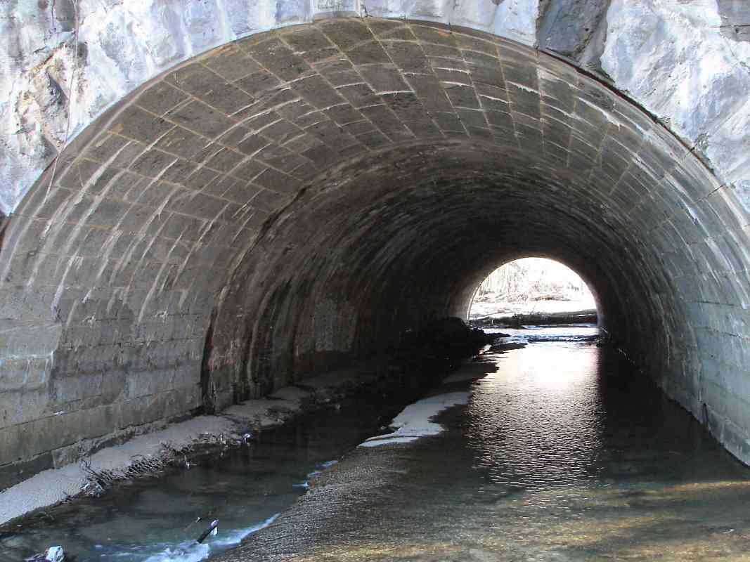
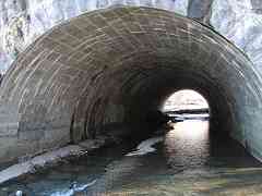
In an act of preservation, for the 1875 widening the new portion was built inside, and the original stone arch retained and moved outward. It's easy to see this by walking part way into the tunnel. In the foreground, an inexplicably odd assortment of rocks embedded in concrete litters the streambed, perhaps remnants of a concrete path from the grounds of the Fair of the Iron Horse. This is one of the easiest OML arched stone bridges to access. Simply drive to the west end of Hollins Ferry Road, and walk a short distance toward the stream.


Pennsylvania Crossing

Pennsylvania Crossing
Mile: 6.1 Date: Apr 2000
Ease: B View: N
Area: B IC2:
Map: Ba 42 A 11 Topographic Maps

The electric catenary indicates these are not B&O tracks. This is the view from the B&O bridge over the ex-Pennsylvania tracks, the Penn Line / Northeast Corridor, as a high-speed passenger train zooms toward Washington on Easter Sunday.

During the 20th century, CSX and Amtrak reviewed this location as a possible connection point between the former B&O and PRR rail systems, but that would lead to a mix of Amtrak passenger and CSX freight on the same lines. Though such a connection would allow freight to bypass Baltimore's problematic Howard Street Tunnel, mixing freight with passenger traffic is not conducive to the high speed passenger service Amtrak envisions.

Change for: Penn Line tour at this site


Winans Arch
Photo credit Dr. Charles J. Kokoski
NEW! late-Mar 2025

Winans Arch
Mile: 6.1 Date: ~1930
Ease: B View: S
Area: B IC2:
Map: Ba 42 A 11 Topographic Maps

Winans Arch 1927 B&O and Pennsy were fierce competitors when the latter muscled into the region via its Baltimore and Potomac Railroad (B&P) affiliate. The stone Winans Arch had room for two B&P tracks underneath four of B&O.

Unfortunately, the resolution of the 1927 aerial view (left) is insufficient to provide much useful information.


MARCs

MARCs
Mile: 6.2 Date: Apr 2023
Ease: B- View: N
Area: B IC2:
Map: Ba 41 K 12 Topographic Maps

When PRR expanded to three tracks underneath in 1934, Winans Arch was obviated by this longer steel bridge, here being put to use by a Camden Line train led by MARC 30 and MARC 35.

Track curvature and aerial photos suggest this bridge was built adjacent the east side of Winans Arch while the Arch was kept in service. It might still exist, hidden by fill.


Orange Markers
NEW! late-Mar 2025

Orange Markers
Mile: 6.2 Date: Feb 2019
Ease: B View: S
Area: B IC2:
Map: Ba 42 A 11 Topographic Maps

If Winans Arch still exists, albeit covered by fill, it would probably be marked topside to alert maintenance crews. Indeed, these orange poles stand at the spot. I have seen similar poles only one other place: where B&O's Belt Line crosses over B&P Tunnel under North Avenue.


Aerial 1938
Photo courtesy Johns Hopkins University
Updated late-Mar 2025

Aerial 1938
Mile: 6.2 Date: Apr 1938
Ease: View: N (up)
Area: IC2:
Map: Ba 41 K 12 Topographic Maps

Winans Arch portals The B&O/PRR crossing is in the upper right quadrant of this 1938 aerial. The portals of Winans Arch might still be visible west (left) of the PRR tracks. The zoom view suggests the portals (arrows) were perpendicular to PRR's route, however that is not corroborated by the 1927 zoom seen a few panels above.

During 1933, Maryland Distillery opened between the railroads, the first legal distillery in Maryland after Prohibition ended. Several of its buildings seen here have remained in use into the 2000s.


Calvert Whiskey

Calvert Whiskey
Mile: 6.3 Date: ~1960 (Aug 2018)
Ease: View: S
Area: IC2:
Map: Ba 42 A 11 Topographic Maps

Seagram bought Maryland Distillery during the 1930s and began making Calvert Whiskey here, as the sign indicates. Seagram called this its Relay facility, even though nearby Elkridge and Catonsville are better-known town names. That's the Penn Line at upper left, but it was B&O that served the distillery.


Seagrams

Seagrams
Mile: 6.2 Date: Feb 2019
Ease: B View: W
Area: B IC2:
Map: Ba 42 A 11 Topographic Maps

Seagram made ill-fated diversification into entertainment during the 1990s. It sold its Relay facility to Diageo in 2000. A deacde or so later, Diageo consolidated operations elsewhere, then shuttered this plant at the end of 2015. CSX has let the spur retain the Seagrams name.

Vinegar Hill Bridge The east-looking, over-the-tracks photos that follow below were shot from the bridge at distant right that carried US 1 (Washington Boulevard) over the trains. The Vinegar Hill Bridge was the oldest US 1 steel bridge in the area. Its moniker originated with Irish laborers who had camped here while they built railroad for B&O circa 1830. The rest of the bridge plaque reads "Built 1929 - State Roads Commission, C. Clinton Uhl - Chairman, Howard Bruce John K. Shaw, H.D. Williar, Jr. - Chief Engineer. W.C. Hopkins - Bridge Engineer".


CSX 8127

CSX 8127
Mile: 6.3 Date: Jun 2001
Ease: B- View: NE
Area: B IC2:
Map: Ba 41 K 11 Topographic Maps

In this reverse-view photo from the US 1 bridge, a CSX train is passing the industrial spur leading to the distillery on the right.


Guinness

Guinness
Mile: 6.3 Date: Aug 2018
Ease: A View: S
Area: B IC2:
Map: Ba 41 K 12 Topographic Maps

Guinness bought the Relay distillery property from Diageo and remade it into the vodka valves Guinness Open Gate Brewery & Barrel House that opened August 2018. Here GATX 224432 is unloading raw materials for the brewery. Tanks like this have a capacity of about 30000 gallons, or some 110000 liters.

We arrived a day before the facility opened to the public, but Guinness allowed us to wander inside anyhow, thus initiating the world record for number of railfans at a Guinness brewery in America. If you like your potent potables to flow at world-record rates, this is a place to visit.

Link: Guinness Brewery


B&O 4611
Photo courtesy HH Harwood collection

B&O 4611
Mile: 6.3 Date: 1941
Ease: B View: SW
Area: B IC2:
Map: Ba 41 K 11 Topographic Maps

This eastbound is passing the distillery, the boxy buildings of which can be seen at distant left. The Vinegar Hill bridge that carries US 1 over B&O is at distant right.


From US 1
Photo credit B&O RR

From US 1
Mile: 6.3 Date: ~1930
Ease: B- View: NE
Area: B IC2:
Map: Ba 41 K 11 Topographic Maps

This view looks back toward Halethorpe. It dates to before the spur to the distillery, though on the right that might be some grading for the spur.


CSX 8528

CSX 8528
Mile: 6.3 Date: Oct 2000
Ease: B- View: E
Area: B IC2:
Map: Ba 41 K 11 Topographic Maps

Despite its unmaintained appearance, the leftmost track remains in active use to serve industry at Halethorpe. That track is a leftover from the first half of the 20th century when the Old Main Line was double tracked its entire length.

In 2008 CSX reconnected the leftmost track with the one adjacent as part of a track and signal upgrade in this vicinity.

Links: 1981, 1983


92 Rail

92 Rail
Mile: 6.1 Date: 2000
Ease: B View: SE
Area: B IC2:
Map: Ba 42 A 11 Topographic Maps

Prior to the reconnection, the leftmost track contained this rail segment. At first I thought the 92 at right represented a forging year of 1892, a period when two year digits would suffice because there had been no railroading in 1792. Upon closer inspection, at left note BS CO, representing Bethlehem Steel Company, which in 1892 had not yet been established.

So, the 92 likely means the rail weight, 92 pounds per yard -- except 92 is not a standard weight. It's certainly possible this segment was made to a custom specification, but why not just use 90 weight rail, which is standard? Anyone know?


MARC

MARC
Mile: 6.3 Date: Oct 2000
Ease: B- View: E
Area: B IC2: 245
Map: Ba 41 K 11 Topographic Maps

It's not only CSX that employs this route, MARC (Maryland Area Regional Commuter) Camden Line trains do as well. This train is actually heading toward the camera on a trip from Baltimore to Washington, DC. The locomotive pushing at the rear is being remotely controlled from end/lead car 7852.

Link: 1964


Coal

Coal
Mile: 6.3 Date: Dec 2003
Ease: B- View: E
Area: B IC2: 245
Map: Ba 41 K 11 Topographic Maps

Track 3 hosts a mile-long eastbound coal drag, its dual engines CSX 216 in the lead working to pull the heavy load up the small incline. Heat distortion from the engines' exhaust obscures part of the B&O's CPL signal bridge as well as HX tower back at Halethorpe. In the view above, the engines are crossing over Amtrak's Northeast Corridor.

The track on the right that curves toward the distillery marks where the Thomas Viaduct bypass mentioned earlier would have connected.

Links: (Railfan.net ABPR Archive) 1977, 1982


Tarps

Tarps
Mile: 6.3 Date: Aug 2019
Ease: B View: NE
Area: B IC2:
Map: Ba 41 K 11 Topographic Maps

A multi-year project swapped out 1929's Vinegar Hill bridge for a longer, higher one. The pedestrian sidewalk was moved from the bridge's east to its west side. This teardown photo shows the old bridge after its east-side pedestrian walkway had been removed. Below, tarps help protect the concrete cross ties from falling debris. The new bridge's northbound lanes would be erected bewteen the old bridge and CSX's signals.


Signals

Signals
Mile: 6.3 Date: Aug 2018
Ease: B+ View: W
Area: B IC2:
Map: Ba 41 K 11 Topographic Maps

Westbound switching is regulated by these signals. Contee Road import Trains bound for Washington, DC will employ, or switch to, the left two tracks, while those headed directly for points west will ride the rightmost tracks to follow the Old Main Line.

At photo time, the equipment box at left was labeled Contee Road, having been recycled from a spot about 16 miles southwest. Also at photo time, demolition of the 1929-built Vinegar Hill Bridge that carries US Route 1 had not yet commenced.


Construction

Construction
Mile: 6.3 Date: Dec 2020
Ease: B+ View: NW
Area: B IC2:
Map: Ba 41 K 11 Topographic Maps

Originally, the Washington turnpike and B&O had met at grade here. A two-lane bridge was built over the tracks around 1900, followed by a four-lane model in 1929.

After a year plus of construction, the third bridge at this location reached this point. At photo time, auto traffic was still riding the prior bridge which can be glimpsed behind the new. As can be seen in this photo, the new one will be about 120 feet longer to make room for additional CSX tracks below, and four feet higher so double-stack consists will fit under.

The bridge was to open during 2021, but in 2022 was found to be 1.5 inches too low, resulting in delays. The bridge finally opened to four lanes of traffic during November 2023. CSX and the State of Maryland agreed to a plan to address the low clearance should it become an issue in the future.


CSX 3161
NEW! late-Mar 2025

CSX 3161
Mile: 6.3 Date: Jul 2024
Ease: B View: W
Area: B IC2:
Map: Ba 41 K 11 Topographic Maps

CSX 3437 In the shadow of the new US 1 bridge, CSX 3161, 3463 and 7292 team up to lead a long coal drag off the Old Main Line toward Baltimore. The new bridge has clearance for double-stack consists, though less clearance than is standard.

This nearly-two-mile-long train received assistance from double-DPUs CSX 3437 and 577 seen at right. The new US 1 bridge has a walkway on its other side that permits through-fence views to the west.


CSX 848

CSX 848
Mile: 6.3 Date: May 2023
Ease: A- View: W
Area: B IC2:
Map: Ba 41 K 11 Topographic Maps

Below lies the Baltimore area's only CSX trackage that uses concrete ties. Such ties are better suited to trains switching tracks at high speed, something they do along the half-mile stretch west from here to St. Denis. The distant bridge carries I-195.


Arched Bridge

Arched Bridge
Mile: 6.6 Date: Apr 2000
Ease: B View: NW
Area: B IC2:
Map: Ba 41 J 12 Topographic Maps

Jan 2018 West of US 1, this small, circa 1830 arched bridge is almost lost in the shadow of I-195 (seen in the background).

This outlet side is original, but the north side (right, January 2018) was lengthened to make room for more tracks on top, and exhibits a masonry style similar to the bridge over Gadsby's Run.


RDC
Photo courtesy B&O History Collection
NEW! late-Mar 2025

RDC
Mile: 6.7 Date: 1960s
Ease: B View: E
Area: B IC2:
Map: Ba 41 J 12 Topographic Maps

A B&O Budd Rail Diesel Car rolls past the future site of MD 166 / I-195. The house on the right would soon be removed to make way for that road.

Link: I-195


CSX 817

CSX 817
Mile: 6.7 Date: Jan 2023
Ease: A View: E
Area: B IC2: 299
Map: Ba 41 J 12 Topographic Maps

Looking back from I-195, with luck you might see an approaching train.

Link: 1978


<< Previous (spur) | THIS PAGE: Halethorpe | Next (west) >>

Or, return to main page

Copyright Notice