TrainWeb.org Facebook Page
WM Photo Tour


Western Maryland Railway
Modern day photo tour

Accompanying each photo below are:

Click a photo to see a larger view. Please send your comments and corrections to Steve. Aerial photos courtesy Johns Hopkins University.


<< Previous (east) | THIS PAGE: Pedicord to Mosher | Next (west) >>

Trail

Trail
Mile: 1.1 Date: Dec 2015
Ease: B View: W
Area: D+ IC2:
Map: Ba 42 F 3 Topographic Maps

The Gwynns Falls hiking / biking trail (overhead) is a city revitalization effort. Its 15 miles of paved path snake through city streets and Leakin Park, generally following its namesake stream. Crime concerns leave the trail underused.

Link: trail info


Map MP 1.5

Map MP 1.5
Mile: Date: (1937)
Ease: View: N (up)
Area: IC2:
Map: Ba 42 Topographic Maps

The height of the Brunswick Street's bridge over WM and Gwynns Falls is revealed by its shadow (photo center). After three decades of heavy trucks had shaken it the Brunswick Street bridge was removed around 1960 rather than repaired. Maryland 295 downstream picked up some of the slack.


Brunswick Street

Brunswick Street
Mile: 1.1 Date: Dec 2015
Ease: B View: NW
Area: D+ IC2:
Map: Ba 42 F 2 Topographic Maps

These tall stone structures supported Brunswick Street's crossing of the Gwynns Falls and WM.

Brunswick Street here traces over part of the Susquehannock Indians' route from Pennsylvania to the Chesapeake Bay at least as far back as the 1600s. During the 1800s, Millington Mill had occupied the east bank of the Falls here (right).

Link: American Indian crossing


Gwynns Falls Bridge

Gwynns Falls Bridge
Mile: 1.2 Date: Dec 2015
Ease: B View: W
Area: D+ IC2:
Map: Ba 42 F 2 Topographic Maps

The padding on top of the bridge is leftover stuffing of a sofa. I have yet to see a photo with this bridge double-tracked. It may never have been.

A short distance upstream (left) the Baltimore Iron Works built its Gwynns Falls Furnace about 1723. WM called this location Pedicord or Peddicord after a local landowner.

One of the contending routes for a Howard Street Tunnel bypass brings a new alignment down from CSX's Mt. Clare Yard, then over a new bridge across the Gwynns Falls, to join these ex-WM tracks on the left. It is named the "West Baltimore to Hanover Subdivision" option.


WB to HS
Map credit: MDOT

WB to HS
Mile: Date: (2011)
Ease: View: N (up)
Area: IC2:
Map: Ba 42 G 4 Topographic Maps

The West Baltimore to Hanover Subdivision alignment is described in the Maryland Department of Transportation's (MDOT's) 2011 report:

    "At West Baltimore, the alignment continues on the Baltimore Terminal Subdivision, following Tracks 3 and 4 along the north side of Mt. Winans Yard to Curtis Bay Junction, then following the Mt. Clare Branch for a short distance. The alignment would pass through Mt. Clare Yard. In order to accommodate the curvature criteria of the new alignment, Mt. Clare Yard would be realigned and reconfigured. Sufficient tracks would be provided to continue the current level of operations.

    "At the north end of the yard, the alignment would turn to the northwest, away from the existing alignment and cut into a bluff on the west side of the yard, where it would begin to descend to meet the CSXT Hanover Subdivision. The alignment would pass between two existing buildings in a cut-and continue under Wilmarco Avenue as it descends. It would cross over Gwynns Falls to meet the CSXT Hanover Subdivision just south of Wilkins Avenue.

    "The alignment between the yard and the Hanover Subdivision would be new. From the yard, the new alignment would be in a cut approximately 30 feet deep, which would probably require retaining walls and potential underpinning of adjacent buildings. It is anticipated that conventional braced excavation construction methods would be used (soldier piles, wales, lagging, and struts). Other methods include slurry walls and sheet piling. The new alignment would also pass under Wilmarco Avenue, which would require a new bridge for the overcrossing. From there, the new alignment would cross the Gwynns Falls on a bridge about 300 feet long. Mt. Clare Yard could serve as a staging area for this construction."

Link: 2011 MDOT report (PDF)


Wilkens Avenue

Wilkens Avenue
Mile: 1.3 Date: Dec 2015
Ease: B- View: N
Area: D IC2:
Map: Ba 42 E 2 Topographic Maps

The tracks follow a disused millrace under Wilkens Avenue where the bridge was rehabbed a few years before this photo. The bridge appears to have room for double track should a Howard Street Tunnel bypass come through here.


Gehenna

Gehenna
Mile: 1.4 Date: Dec 2015
Ease: B View: SE
Area: D- IC2:
Map: Ba 42 E 2 Topographic Maps

"Midway on our life's journey, I found myself - In dark woods, the right road lost."

If you've seen The Wire you've seen West Baltimore. Though the intersection of Warwick and Longwood is fictitious, streets of those names are near here. Given the, umm, fragrance - in December, no less - there's more than old matresses and TVs being buried here.

It's not people from DC or Philly driving here to discard. It's sad to see local residents dumping on their own neighborhood. If they can transport it this far is there a reason why not a bit further to an official city dump?

By the time WM built through, an old mill race that began here perhaps during the 1700s had been disused.

Link: Art of The Wire


Frederick Avenue Then
Photo courtesy WM WestSub

Frederick Avenue Then
Mile: 1.6 Date: Jan 1919?
Ease: B+ View: N
Area: D+ IC2:
Map: Ba 42 E 2 Topographic Maps

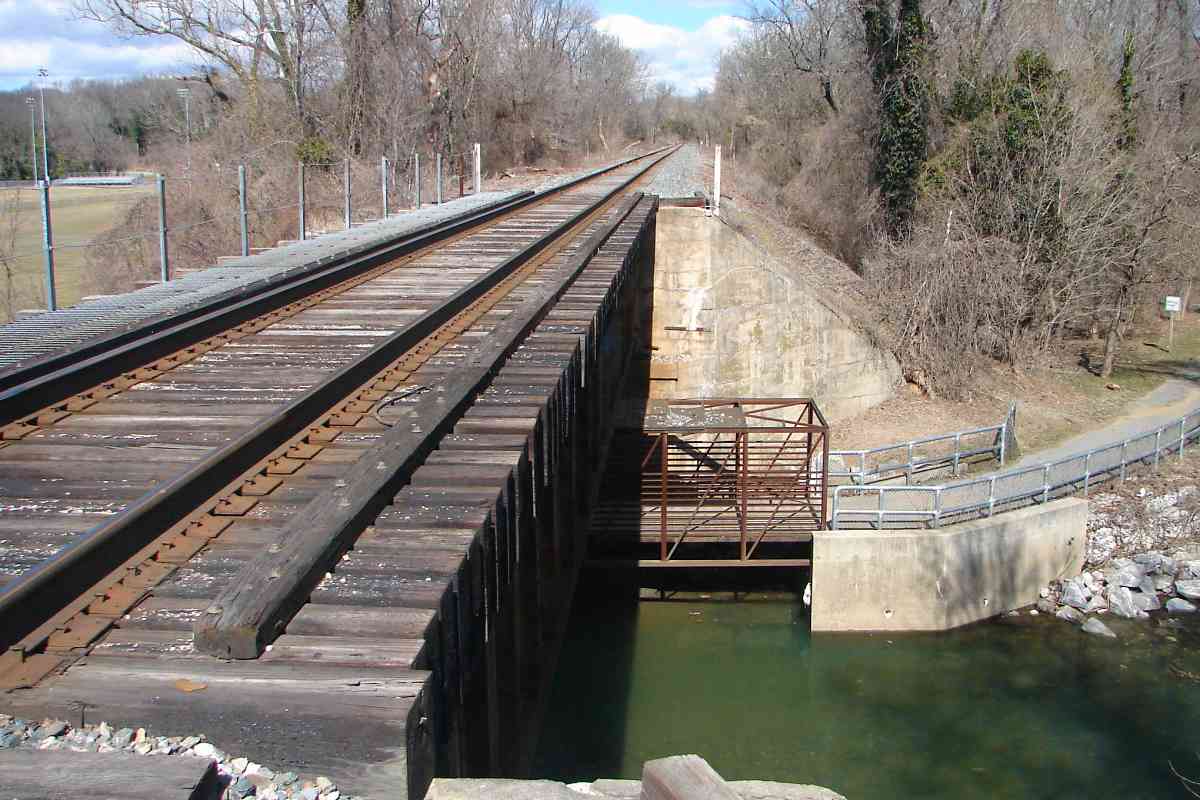
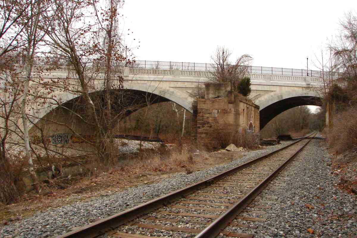
Frederick Avenue led to the Maryland town of Frederick and the first National Road to the west that originated during the early 1800s. As such, various incarnations of bridges have spanned the Gwynns Falls here ever since, including a covered one, as well as an iron one created by Wendell Bollman, the man who crafted iron railroad bridges for B&O. Those 
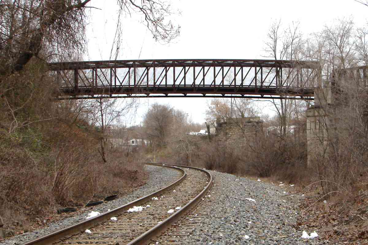
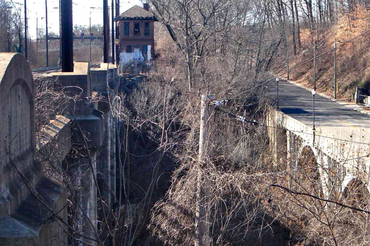
bridges sat atop the stone pillars in the foreground.

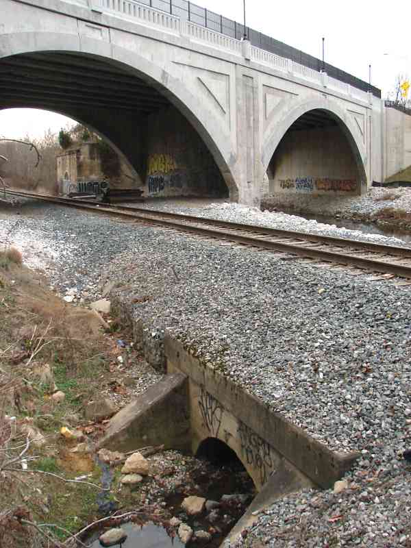
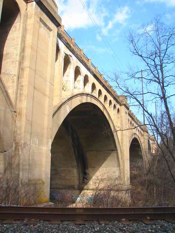
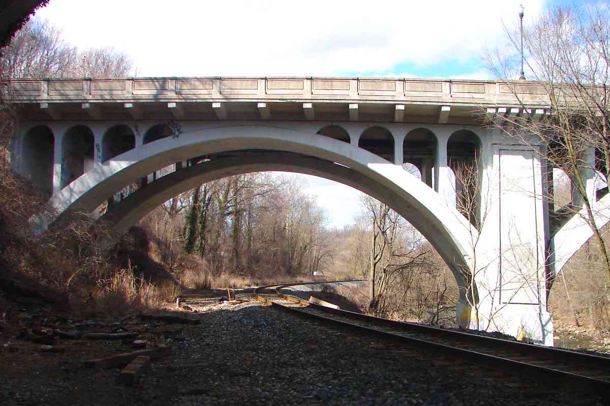
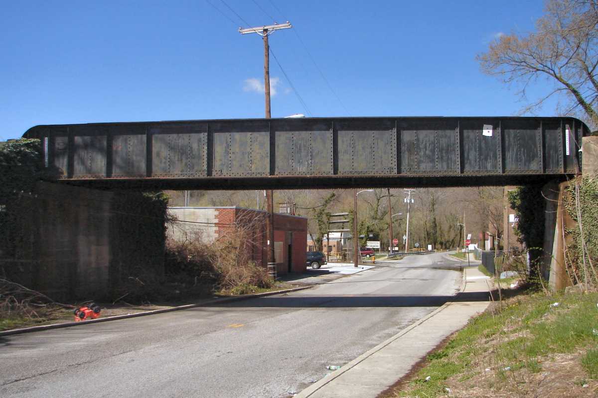
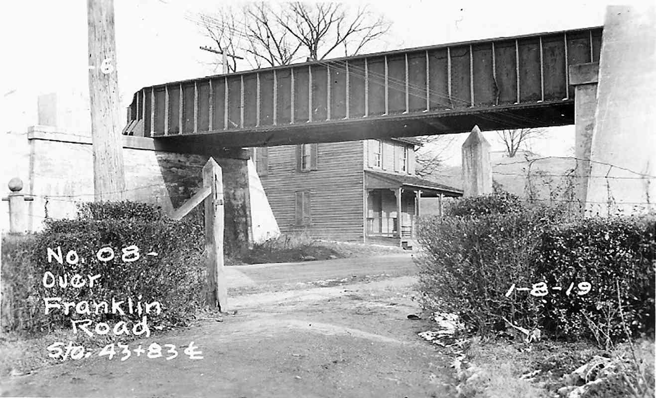
Exactly when the bridge location shifted upstream onto adjacent pillars is uncertain. State records indicate a bridge was built here in 1930. The bridge in this photo looks identical to the one present after 1930, but this photo purports to date from 1919. So, one of the following is true: 1) the state's 1930 date is wrong, 2) a pre-1930 bridge was replaced or rebuilt in 1930 to look the same, or 3) the photo date is wrong. By the time of this photo, whenever it was snapped, billowing exhaust from steam engines had left smokey marks on the structure.

Links: covered bridge info, status report, 2013 teardown with train


Frederick Avenue 2015

Frederick Avenue 2015
Mile: 1.6 Date: Dec 2015
Ease: B+ View: N
Area: D+ IC2:
Map: Ba 42 E 2 Topographic Maps

Some pillars from the 1800s remain extant.

The prior bridge, whether built in 1930 or earlier, worn by decades of traffic was torn down in 2013. This doppelganger soon took its place, opening to traffic a few months before posing for this photo. The arched and detailed structure is attractive but seen by few people other than crews of the infrequent trains.

Links: reverse view 1991, replacement info, replacement pics


Culvert

Culvert
Mile: 1.6 Date: Dec 2015
Ease: B+ View: SW
Area: D+ IC2:
Map: Ba 42 E 2 Topographic Maps

Frederick Avenue marks the first of several arched (and graffitied) bridges we'll encounter along the way. Culverts, meanwhile, are surprisingly few, so this small one makes it into the photo tour. The water here had been mill race outflow of the Three Mills complex built by the Ellicott Brothers.

Link: 1930 same culvert, but image is mirrored


Gwynns Falls

Gwynns Falls
Mile: 1.8 Date: Dec 2015
Ease: B View: N
Area: C IC2:
Map: Ba 42 E 1 Topographic Maps

The main contending route for a Howard Street Tunnel bypass diverges to the right from the ex-WM line here and dives into a new tunnel that would be bored into the stream valley hillside beyond the trees on the right.

New tunnels, however, are very expensive, consequently during 2016 focus shifted back to enlarging the Howard Street Tunnel rather than bypassing it. Stay tuned, but don't hold your breath.

Link: enlarge the tunnel


Switch Banks

Switch Banks
Mile: 1.8 Date: Dec 2015
Ease: B View: N
Area: C IC2:
Map: Ba 42 E 1 Topographic Maps

Here the line crosses the Gwynns Falls again. The bridge is the WM original dating to the early 1900s.

The trees here along the waterway are strewn with thousands, perhaps millions, of plastic bags of all sorts and sizes. The improperly discarded bags blow down from nearby city streets, get picked up by water rising after a heavy rain, then snag on overhanging branches. Though this photo shows only a little at the bottom left corner, it looks as if some wild high school party has toilet-papered the valley.

Link: this bridge? 1912


Gwynns Falls Viaduct

Gwynns Falls Viaduct
Mile: 2.0 Date: Dec 2015
Ease: B- View: W
Area: C IC2:
Map: Ba 42 E 1 Topographic Maps

1913 The grand Gwynns Falls Viaduct stretches 580 feet across the valley, 85 feet above the stream. The Philadelphia, Baltimore and Washington Railroad component of the Pennsylvania Railroad crafted this open-spandrel arch to replace a double-tracked iron bridge at the same location. At left is bridge construction as WM trains witnessed it from below during 1913.

Link: 1872 drawing


Spalling

Spalling
Mile: 2.1 Date: Feb 2016
Ease: B View: NE
Area: C- IC2:
Map: Ba 34 E 13 Topographic Maps

1913 As you might guess from the arch indentation, the new bridge was constructed in halves while WM operated below. First the north half was added adjacent to the 19th century iron bridge, then trains were switched onto it. Next the old bridge was torn down and a new south half built with two more tracks, seen at left under construction.

After more than a century the concrete is spalling and the bridge will need repair if not total replacement during the 21st century. This is now part of Amtrak's Northeast Corridor linking Washington and Boston.

Link: Railway Review article


Baltimore Street

Baltimore Street
Mile: 2.1 Date: Feb 2016
Ease: B View: N
Area: C- IC2:
Map: Ba 34 E 13 Topographic Maps

Standing almost in the shadow of the railroad bridge is this circa 1930 one for West Baltimore Street. Originally the bridge was to parallel the railroad on the downstream side, but that would have created the need for a grade crossing, or another bridge, west of the valley.

Link: Bridgehunter report


Between

Between
Mile: 2.1 Date: Jan 2016
Ease: B- View: W
Area: D+ IC2:
Map: Ba 34 E 13 Topographic Maps

From above and between the two bridges I'd hoped to show you the train running on the ex-WM tracks below but the lighting and tree branches would not cooperate. You'll have to imagine the boxcars rolling by down there. On the left is a disused and deteriorating Gwynn Tower originally belonging to the Pennsylvania Railroad.

Change for: Pennsylvania Railroad at this spot


Quarry

Quarry
Mile: 2.2 Date: Feb 2016
Ease: B View: NW
Area: D+ IC2:
Map: Ba 34 D 13 Topographic Maps

Back down in the valley, we next find the remains of a quarry that began operation here around 1850. The railroad's arrival assisted with transport of stone materials. Now water fills the quarry pit (left), and the grounds appear to be used by the city for storage of road salt.

Former property owners include Levi Hoffman / Hoffman Quarries (1876), The Gwynns Falls Stone Corporation (1937-1940), Harry T. Campbell & Sons Company / The Flintkote Company (1940-1986), GenstarStone Products Company / Redland Genstar, Inc. (1986-1997), followed by Potts & Callahan, Inc. This sign was erected by Genstar.


Ties

Ties
Mile: 2.4 Date: Feb 2016
Ease: B View: N
Area: D+ IC2:
Map: Ba 34 D 13 Topographic Maps

Ties of a long-ago disused quarry siding still litter trackside.


Foundation

Foundation
Mile: 2.5 Date: Feb 2016
Ease: B View: NE
Area: D+ IC2:
Map: Ba 34 D 13 Topographic Maps

loading This concrete pad had supported a conveyor system that transported stone from the quarry to hoppers waiting on the siding, as seen at the center of the 1972 aerial photo at left.

Stone from here was used to construct the Edmondson Avenue bridge seen next on the tour.


Edmondson Avenue

Edmondson Avenue
Mile: 2.7 Date: Feb 2016
Ease: B- View: NE
Area: D IC2:
Map: Ba 34 D 12 Topographic Maps

The last of the series of multi-arched masonry bridges carries Edmondson Avenue across the valley. It was built during 1907 and received a facelift during 1970; another round of repairs began during 2017. Downstream, but not visible from Edmondson, are ruins of Three Mills Dam. At its peak during the 1800s Gwynns Falls had powered 26 mills. bottles

At the base of the bridge lies a sea of thousands of plastic bottles washed down from city streets above. Nearby a WM-original culvert of insufficient capacity causes rainwater to pond, then drain slowly, stranding whatever had been floating. The photo at left captures but a tiny portion of this "sea of bottles" spectacle. Without this sink the bottles would float out to the Chesapeake Bay.

Links: reverse view 1912, another 1912, Bridgehunter report


From Bridge

From Bridge
Mile: 2.7 Date: Jan 2016
Ease: A- View: NW
Area: D IC2:
Map: Ba 34 D 12 Topographic Maps

During leaf season you'd hardly know the bottles, or the tracks, are present.


Trail Again

Trail Again
Mile: 2.9 Date: Feb 2016
Ease: B View: N
Area: D+ IC2:
Map: Ba 34 D 12 Topographic Maps

The railroad, Gwynns Falls, and peripatetic trail all meet again here near milepost 3. The milepost number square is barely discernable in the distance on the right side of the tracks, visually left of the nearer white post at the right corner of the bridge.

Some of the current mileposts are adjacent decades-old markers, which suggests CSX has retained the Western Maryland's milepost placement.

A 1927 map shows a siding diverging to the right ahead, but a 1927 aerial photo does not agree, and I saw no siding remnants there.


Bridge Over Road

Bridge Over Road
Mile: 3.1 Date: Feb 2016
Ease: B+ View: N
Area: D IC2:
Map: Ba 34 D 11 Topographic Maps

Thus far on the tour this WM line has bridged over rivers but not roads. That changes ahead. Here the line begins ascending out of the Gwynns Falls valley, gaining elevation that necessitates bridges over roads, such as Franklintown Road ahead.

Link: replacement info,


Franklintown Road

Franklintown Road
Mile: 3.1 Date: Mar 2016
Ease: A View: W
Area: D IC2:
Map: Ba 34 D 11 Topographic Maps

plaque The bridge is the WM original, built in 1903 by the Pennsylvania Steel Company, of Steelton, PA as its plaque attests. I know of no older bridge of this design in the Baltimore/Washington region.

Bethlehem Steel purchased the Pennsylvania Steel Company during 1917, and now via mergers is part of ArcelorMittal.

Link: Steelton history


Bridge Then
Photo courtesy WM WestSub

Bridge Then
Mile: 3.1 Date: Jan 1919
Ease: A View: NE
Area: D IC2:
Map: Ba 34 D 11 Topographic Maps

Franklintown Road, formerly Franklin Road, is a 19th century connection between Baltimore and the old mill villa of Franklintown. The town lies about 2 miles west of here near the decomissioned eastern terminus of Interstate 70.


Bridge 2016

Bridge 2016
Mile: 3.1 Date: Mar 2016
Ease: A View: NE
Area: D IC2:
Map: Ba 34 D 11 Topographic Maps

The building on the right prevents access to where the photographer stood for the 1919 photo, thus denying a more similar "now" view.

Behind and on the left lies Leakin Park, Baltimore's unofficial cemetery. It's an exaggerated title because since 1990 the bodies of only about 1% of the city's few hundred annual murder victims are discovered dumped within. The park is a beautiful but relatively desolate area adjacent to some rough neighborhoods. The downhill slide in these areas took decades to occur, so the climb back up will likely take at least as long, but is worth the effort.

Links: bodies of Leakin Park, 2016 homicides


<< Previous (east) | THIS PAGE: Pedicord to Mosher | Next (west) >>

Or, return to main page for other tours

Copyright Notice