TrainWeb.org Facebook Page
WB&A Photo Tour


Washington, Baltimore and Annapolis Railway
Modern day photo tour

Accompanying each photo below are:

Click a photo to see a larger view. Please send your comments and corrections to Steve.


<< Previous (south) | THIS PAGE: Baltimore | End of tour || main index

Aerial 1948
Photo courtesy Johns Hopkins University
NEW! Jan 2025

Aerial 1948
Mile: Date: 1948
Ease: View: W (up)
Area: EH:
Map: Ba 42 K 3 Topographic Maps

The top of this photo and the next are toward the west. Russell Street is the \ diagonal across center, while the arc above it traces WB&A's original alignment. Bright areas, like that above the arc, reveal where the ground has been recently disturbed and cleared of plants. That area suggests WB&A's mounded alignment that fell into disuse during the 1930s was not smoothed out until photo time (1948). The bright area ends at right at Bush Street.

The panel below looks over the same area roughly 30 years later and from a lower altitude.


I-95 Construction
Photo courtesy Baltimore Sun
NEW! Jan 2025

I-95 Construction
Mile: Date: 1976?
Ease: View: W
Area: EH:
Map: Ba 42 K 3 Topographic Maps

Interstate 95 was layered over what was already a busy transportation corridor by the 1970s. WB&A (green) in 1908 trestled over this swampy tongue of land embraced by Gwynns Falls. The area has been so subsequently bulldozed that nary a mound of dirt survives to hint where the trains had run before WB&A surrendered to the Great Depression in 1935.

The Baltimore and Annapolis (B&A) reorganization exchanged WB&A's trestle and elevated steel for a shared route to Camden Station along B&O's main line. The dashed green line shows the reroute that B&A trains followed to connect with B&O's South Baltimore Branch south of CX Tower.

Link: source photo


Trestle
Photo courtesy Annapolis RR History
NEW! Jan 2025

Trestle
Mile: Date: ~1930
Ease: View: S
Area: B- EH:
Map: Ba 42 J 3? Topographic Maps

This reverse view looks back over WB&A's original trestle that spanned B&O's South Baltimore Branch and swampy ground nearby. The photog's location is just to the right of the word "trestle" in the I-95 construction panel above; a modern photo from this spot would find I-95 extending left-right across the middle. The distant bright square at upper left is a quite new Russell Street bridge crossing Gwynns Falls, about 2000 feet from the photog. CX Tower at Carroll Junction lies behind the photog.


Carroll Junction
Photo courtesy HH Harwood collection
NEW! Jan 2025

Carroll Junction
Mile: Date: Nov 1941
Ease: B View: N
Area: C+ EH:
Map: Ba 42 J 3 Topographic Maps

This dates to after B&A had arranged to share part of B&O's route to Camden Station. Pictured here adjacent B&O's CX Tower (left) is a two-car B&A fantrip using BLA 92 and BLA 325, an ex-Long Island Railroad open-platform el car the B&A operated as a mail car. The next photo may have been shot from CX Tower's stairway.

Links (CX Tower): ~1940, ~1950, 1970s, 1978, ~1980, board, levers


B&A 94
Photo courtesy Annapolis RR History
NEW! Jan 2025

B&A 94
Mile: Date: ~1950
Ease: B View: NE
Area: C+ EH:
Map: Ba 42 J 3 Topographic Maps

Approaching BLA 94 is entering B&O's South Baltimore Branch in order to reach its track at Westport. Car 94 was built by the Wason subsidiary of Brill in 1913 for Annapolis Short Line. In Wason's employ was the same Milton Bradley that later published board games, including ones with a railroad theme. Note the ten pipeline connections that pass under the tracks at photo bottom that mechanically connect CX Tower's switch levers (unseen at left) with ten respective track switches.

Many electric railcars from the early 1900s lacked exterior lighting. The round object left of 94's end door is not a lamp but rather a mechanism for reeling in the arm that reaches up to overhead power. If 94 were scheduled to operate after dark, portable lamps would be affixed to it.

Construction of B-W Parkway would in 1950 sever B&A's route through Westport, and end B&A's passenger operations. Nevertheless, the persistent company exchanged freight with B&O until 1985 at Cliffords about two miles south of here.

Links: at Carroll Junction ~1940, 1947 color


Main Line

Main Line
Mile: Date: Mar 2015
Ease: B+ View: NE
Area: B- EH: 17
Map: Ba 42 J 3 Topographic Maps

WB&A had passed near the rental truck on the right and transitioned to an elevated structure that extended to and beyond the distant ABC sign. Such grade separation from Bush and Bayard Streets endured until 1936. Much of that old route remains unoccupied, hence the substantial width parallel to what is now part of CSX's main line through Baltimore.

When B&A picked up WB&A's pieces, it obtained B&O permission to serve Camden Station by operating through here. Carroll Junction Tower, visible in the 1940s photos linked below, previously stood behind the photographer.


Corridor
NEW! Jan 2025

Corridor
Mile: Date: Jun 2021
Ease: A- View: NE
Area: C+ EH:
Map: Ba 42 J 3 Topographic Maps

I initially thought the gap between CSX tracks at photo middle had been occupied by WB&A, but instead WB&A had run along the right side of all the tracks in this view.

On its way to downtown Baltimore (distance), WB&A had curled in from the other side of the trees at right, then ran atop mounded dirt visually beyond the red stop sign. It passed immediately to the right of the lone tree at photo center where a brightly-painted building now stands. There it transitioned onto a roughly 1600-foot-long elevated steel structure that began this side of Bush Street, which is the first CSX grade crossing beyond the signal bridge.


Competition
Photo courtesy Baltimore Streetcar Museum
and Digital Maryland
NEW! Jan 2025

Competition
Mile: Date: ~1910
Ease: A- View: NW
Area: B- EH:
Map: Ba 42 K 3 Topographic Maps

WB&A's transition from mound to steel happens beyond the leftmost trolley pole in this United Railways and Electric (UR&E, foreground tracks) photo. WB&A's white-painted slogan is "The Electric Line To Washington & Annapolis". Tall utility poles parallel a Bush Street that had not yet been paved.

Link: photo source


Quickest Cleanest Best
Photo courtesy Annapolis RR History
NEW! Jan 2025

Quickest Cleanest Best
Mile: Date: ~1930
Ease: A View: E?
Area: B- EH:
Map: Ba 42 K 3 Topographic Maps

An -est word not associated with WB&A is "modest." This photo was probably made near where WB&A crossed over Bayard Street.


To Scott Street
Photo courtesy Baltimore Streetcar Museum
and Digital Maryland
NEW! Jan 2025

To Scott Street
Mile: Date: 1915
Ease: A- View: N
Area: B- EH:
Map: Ba 42 K 3 Topographic Maps

Northeast of Bayard, WB&A crossed over B&O by means of the bridge seen end-on in this view from the south. The Bromo-Seltzer Tower is at distant right. Many photos of this time period depict more haze and smoke than are common during the 21st century.

Link: photo source


Dismantling
Photo credit R.K. Henry

Dismantling
Mile: Date: May 1936
Ease: B+ View: S
Area: B- EH:
Map: Ba 42 K 2 Topographic Maps

The Great Depression prompted disassembly of WB&A's disused elevated structure for sale as scrap. This photo captures that process underway. "The Electric Line To Washington & Annapolis" had been painted on the other side.


Looking Back

Looking Back
Mile: Date: Feb 2011
Ease: B+ View: SW
Area: B- EH:
Map: Ba 42 K 2 Topographic Maps

Seventy-five years later, and turned to look southwest, this was the appearance.


over
Photo credit R.K. Henry

Over
Mile: Date: May 1936
Ease: B+ View: E
Area: B- EH: 17
Map: Ba 42 K 2 Topographic Maps

Marley Creek WB&A bridged over the curving B&O at Scott Street and descended from the elevated structure to street operation. Originally, Scott Street plus an adjacent creek (the combination of Schroeder's Run and Chatsworth Run, per city topographical maps of 1896) had passed under the curving B&O.

A similar bridge was restored during the 1990s along the B&A trail at Marley Creek. Though unlikely, it could be a bridge that originally belonged to WB&A.


Curve

Curve
Mile: Date: Feb 2011
Ease: B+ View: E
Area: B- IC2: 217
Map: Ba 42 K 2 Topographic Maps

M&T Bank Stadium looms in a modern view of the same curve.


1927 Aerial
Photo courtesy Johns Hopkins University

1927 Aerial
Mile: Date: 1927
Ease: View: N (up)
Area: EH: 17
Map: Ba 42 K 3 Topographic Maps

The overhead view prior to dismantling shows WB&A bending north and crossing over the B&O to reach Scott Street.


Scott Street

Scott Street
Mile: Date: Jul 2011
Ease: A View: N
Area: B- EH:
Map: Ba 42 K 1 Topographic Maps

WB&A operated the remainder of the way at street level, turning east (right) here onto McHenry Street. Asphalt entombs artifacts all too well. The B&O Railroad Museum stands two blocks to the left.

Trains veered from McHerny to Portland Street, turned north on Greene Street, east on Lombard, then northeast on Liberty to the terminal at Marion.

The route pondering done by railfans might reduce their risk of developing Alzheimers, as it seems to be doing for other geographic navigators like taxi drivers. That's the speculation of a large medical study published in 2024 (info at link below).

Link: few taxi drivers develop Alzheimers


First Terminal
Photo courtesy HH Harwood collection

First Terminal
Mile: Date: ~1920
Ease: A View: W
Area: B- EH: 24
Map: Ba 35 B 11 Topographic Maps

WB&A trains negotiated the city streets to their first Baltimore terminal, one that endured from 1908 to 1921 at Liberty and Marion Streets. These quarters were tight and offered no room for railcars to turn around, a limitation that would be addressed at the second terminal.


Equitable Trust
Photo courtesy Google

Equitable Trust
Mile: Date: Oct 2017
Ease: A View: W
Area: B- EH:
Map: Ba 35 B 11 Topographic Maps

Trains begat trusts of the Equitable Trust Company. The building remains standing as of 2017.

Baltimore streetcar line number 17 had largely replicated the WB&A's route between Westport and here. Bus route K did similar between Westport and Baltimore Highlands.

Link: 1941 BTC maps


Spork
Photo courtesy Johns Hopkins University
NEW! Jan 2025

Spork
Mile: Date: 1927
Ease: View: N (up)
Area: EH:
Map: Ba 43 A 1 Topographic Maps

The first terminal (block at upper right corner) became overloaded in 1921 when WB&A absorbed Annapolis Short Line. A new terminal was rushed into service that year a short distance at the south end of the diagonal Liberty Street within the block bounded by Howard, Eutaw, Lombard and Pratt Streets.

WB&A already had a freight handling station there. It's the block below photo center with the train turning loop that resembles a spork (a spoon + fork combo). B&O's more expansive Camden facilities are off photo bottom, below the word Camden.


Freight Service
Photo courtesy Baltimore Museum of Industry
NEW! Jan 2025

Freight Service
Mile: Date: ~1930
Ease: View: N
Area: EH: 91
Map: Ba 35 A 13 Topographic Maps

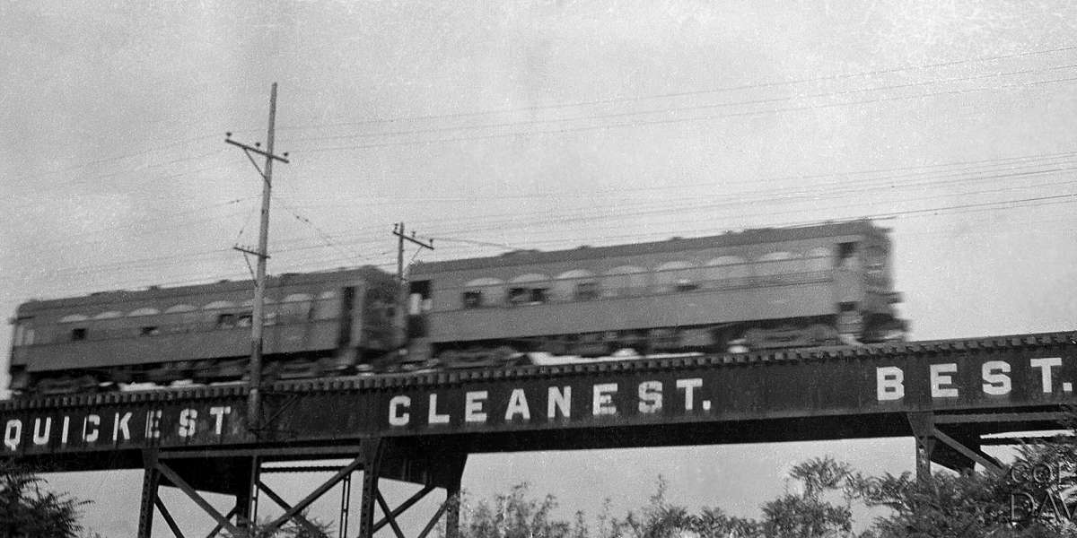
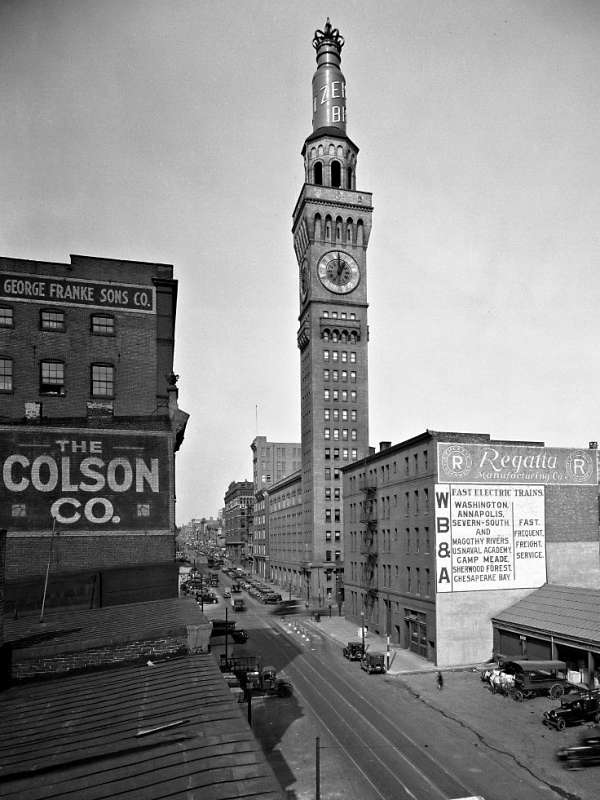
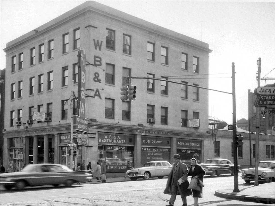
"WB&A Fast Electric Trains - Washington, Annapolis, Severn-South, and Magothy Rivers, U.S. Naval Academy, Camp Meade, Sherwood Forest, Chesapeake Bay - Fast, Frequent, Freight, Service."

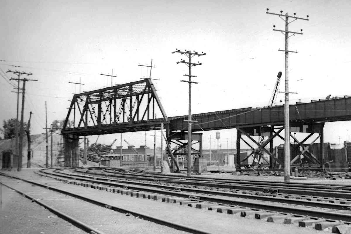
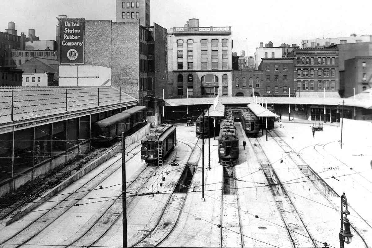
This side of the second terminal faced Eutaw Street and handled freight. A 1912 contract to carry goods for American Express provided an unexpectedly large income stream -- until the contract ended in 1923. Southeastern Express Company (SECO), affiliated with Southern Railway, acquired most of that carriage business. SECO's complex arrangements with WB&A eventually made WB&A's freight handling for SECO unprofitable. SECO is remembered for employing a swastika in its logo before another group appropriated that symbol.

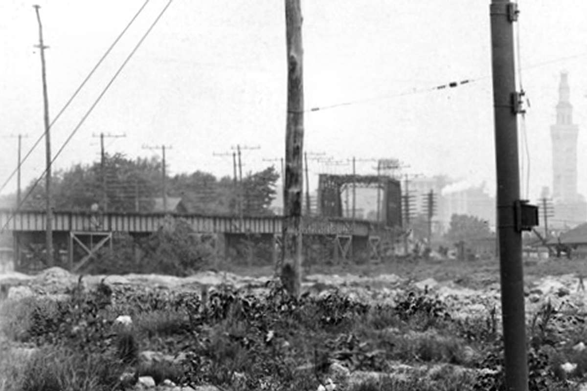
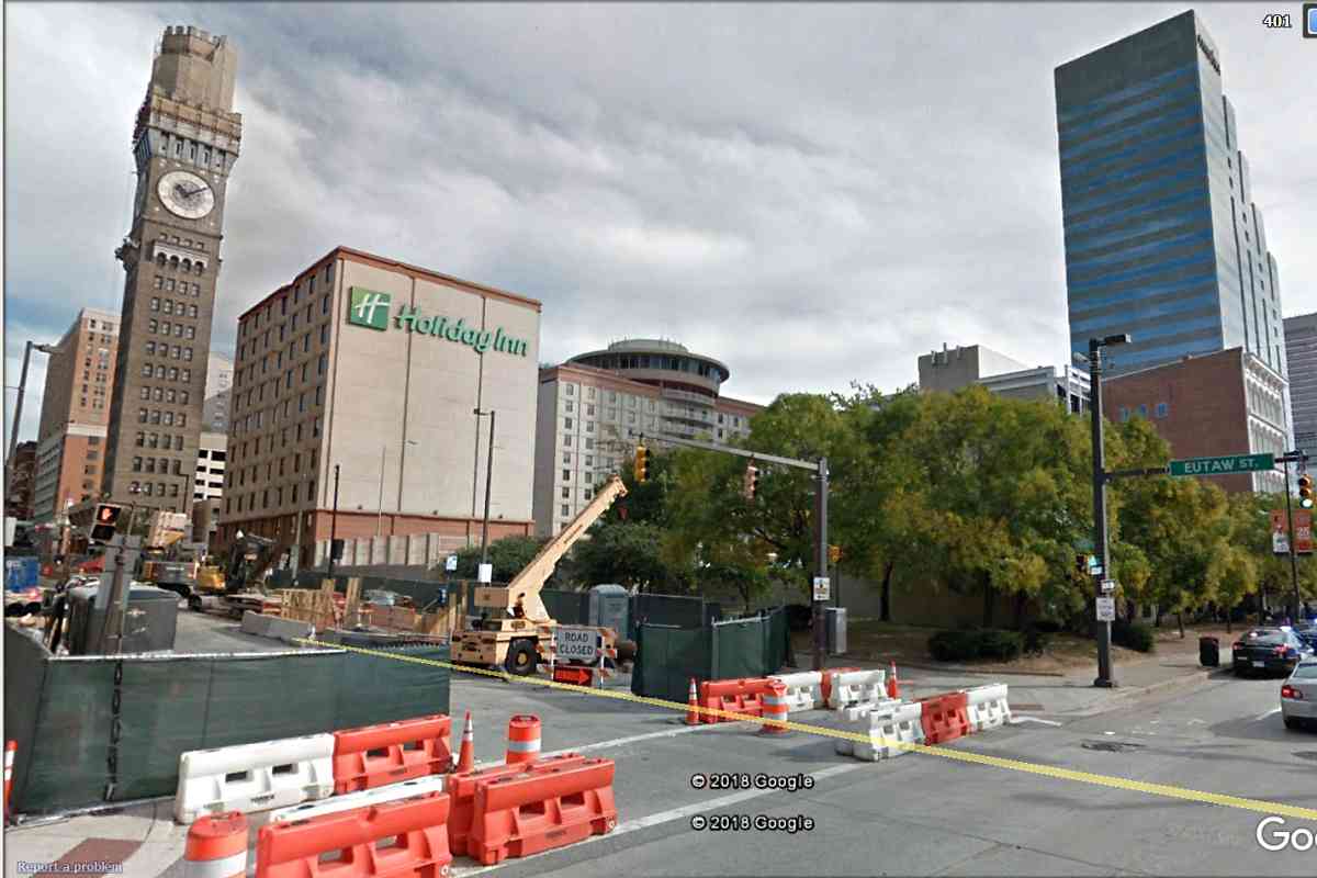
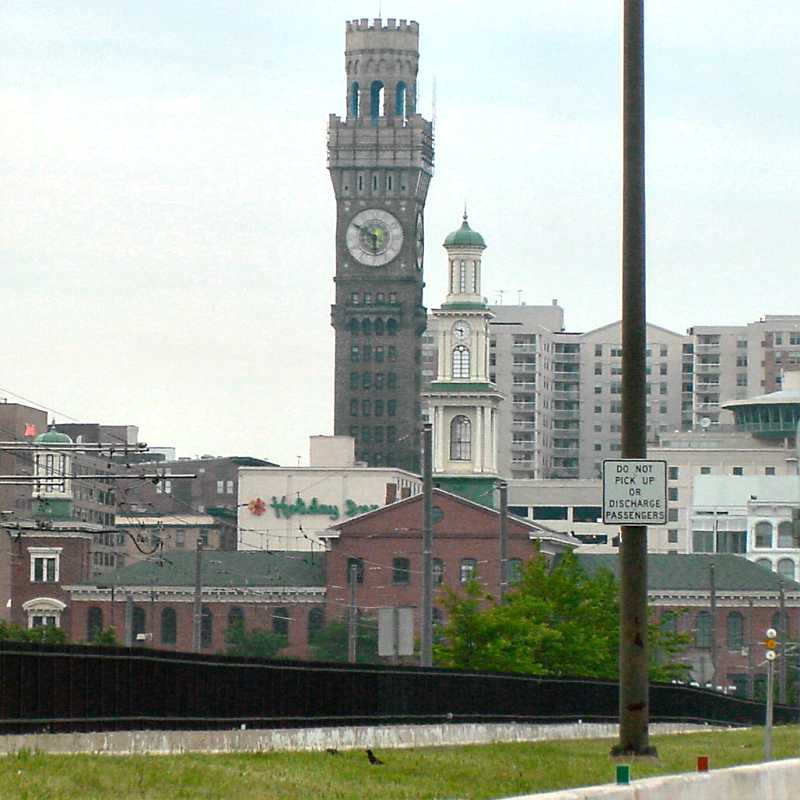
The Bromo-Seltzer (Emerson) tower's rotating, big blue bottle would be removed in 1936, the year after WB&A shuttered. Some sites claim the tower's clock faces were the world's largest when built, except that can't be correct since London's Big Ben clock predates this tower and has clock faces 2 feet wider. Instead, this might have been the largest clock in the US when it was built.

Link: tower info


Second_Terminal
Photo courtesy HH Harwood collection

Second Terminal
Mile: Date: ~1930
Ease: A View: N
Area: B BLR: 28
Map: Ba 43 B 1 Topographic Maps

The Bromo-Seltzer clock tower extends off the top edge of this view.

With freight sequestered on the left, the remainder of the terminal focused on passengers. Offices were off photo right in the building shown by the next panel.


WB&A Restaurant
Photo courtesy Annapolis RR History
NEW! Jan 2025

WB&A Restaurant
Mile: Date: ~1960
Ease: A View: SW
Area: B EH: 133
Map: Ba 35 A 13 Topographic Maps

WB&A's terminal offices stood at the corner of Lombard and Howard Streets (the two closest people are crossing the latter). After WB&A ceased railroad operation, entrepreneur Harry Pappas opened a restaurant within a few of the busier stations. Another was in Glen Burnie.

Web searching "fountain service" now returns information about repairing water fountains. During the 20th century, it meant the establishment could serve you various beverages dispensed via taps, often colas and other bubbling liquids.

GE Streamline, Sep 2004 General Electric Streamline model traffic and pedestrian signals, installed widely in Baltimore during the 1950s, guard the crossing. The one shown at left hung on at Calvert and Chase Streets into the 2000s. The rightmost pole in the main photo held trolley wire, as evidenced by the disused wooden insulators still hanging from it. This WB&A restaurant endured until the early 1960s when Holiday Inn company purchased and redeveloped the site.

Link: GE Streamline signals


Holiday Inn
Photo courtesy Google

Holiday Inn
Mile: Date: Oct 2017
Ease: A View: NE
Area: B EH: 135
Map: Ba 43 A 1 Topographic Maps

A space-age-style Holiday Inn took the place of the terminal during the early 1960s, its flying saucer rooftop echoing WB&A's train-turning loop trackage; it has become almost as iconic as the nearby Bromo-Seltzer tower during the decades that followed.

Link: ~1920, ~1930


From I-395

From I-395
Mile: Date: Jun 2002
Ease: A View: N
Area: B+ EH:
Map: Ba 43 A 1 Topographic Maps

Here's the view from I-395 a few years before the Holiday Inn was refurbished and given new, stylized signage. B&O's Camden Station in the foreground illustrates the former proximity of the two railroad stations.


Many of the routes established by WB&A during the early 20th century
live on in the form of 21st century transportation corridors.
Thanks for following along!

<< Previous (south) | THIS PAGE: Baltimore | End of tour || main index

For more tours here now, select from the map: clickable map

Or, return to main page

Copyright Notice