TrainWeb.org Facebook Page
A&ER RR Photo Tour


Annapolis & Elk Ridge Railroad
Modern day photo tour

Accompanying each photo below are:

Click a photo to see a larger view. Please send your comments and corrections to Steve.


<< Previous (west) | THIS PAGE: Odenton | Next (east) >>

Ft. Meade Yards

Ft. Meade Yards
Mile: 3.7 Date: Apr 2003
Ease: B View: E
Area: B EH:
Map: AA 12 C 3 Topographic Maps

On the left multilane MD 32, built in the 1980s, squeezes between the site of Fort Meade's disused rail yard (even farther left) and these power lines. On the right, Fort Meade's non-iron horse stables endured until about 2009.

Reader Dave Witty wrote to say:

    "I really enjoy your website! I wanted to clear up the question though, of where the Annapolis and Elkridge ROW goes through Fort Meade. Multi-lane MD 32 was not built on top of the right of way east of the MD 198 interchange. The A&ERR actually goes through the Army Base itself. The BG&E poles mark 90% of the ROW through the base and are visible from the highway (32) although you should pay attention to the traffic instead of looking towards the base (like I do). Some of the pole line has been relocated east of the 198 interchange. If you take the exit ramp from westbound 32 to 198 you will see a 'cut' on the left side as the ramp parts ways with 32. Along the way through the base the ROW passes a building that looks like a railroad station. I do not know anything about the building except that it sits in the vicinity of the old Admiral Station... who knows, maybe it IS the Admiral Station?"

Link: Fort Meade service


MD 32

MD 32
Mile: 3.9 Date: Nov 2002
Ease: A View: E
Area: B EH:
Map: AA 12 C 3 Topographic Maps

East of MD 198, little of the A&ER is visible from MD 32. What on the 1878-dated map above is labeled Harman Station had been located near the transmission tower at left. At the dip ahead, MD 32 crosses Rogue Harbor Branch.


Rogue Harbor
Photo courtesy anonymous
NEW! late-Dec 2020

Rogue Harbor
Mile: 4.0 Date: 1980
Ease: A View: S
Area: B EH:
Map: AA 12 C 3 Topographic Maps

The A&ER timber trestle over Rogue Harbor (sometimes called Midway Branch) resembles the one that had spanned Dorsey Run. Strictly speaking, the wooden portion is not an A&ER bridge, instead it is likely a project of B&O and/or PRR when they upgraded the line to support Camp Admiral / Fort Meade. The bridge was demolished not long after this photo; I do not know if stone abutments survive here as they do back at Dorsey Run.


Admiral Station
Photo courtesy Google
Updated late-Dec 2020

Admiral Station
Mile: 4.1 Date: Apr 2016
Ease: A View: N (up)
Area: B EH: 60
Map: AA 12 D 3 Topographic Maps

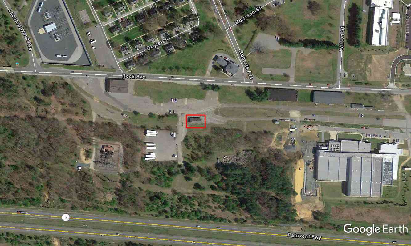
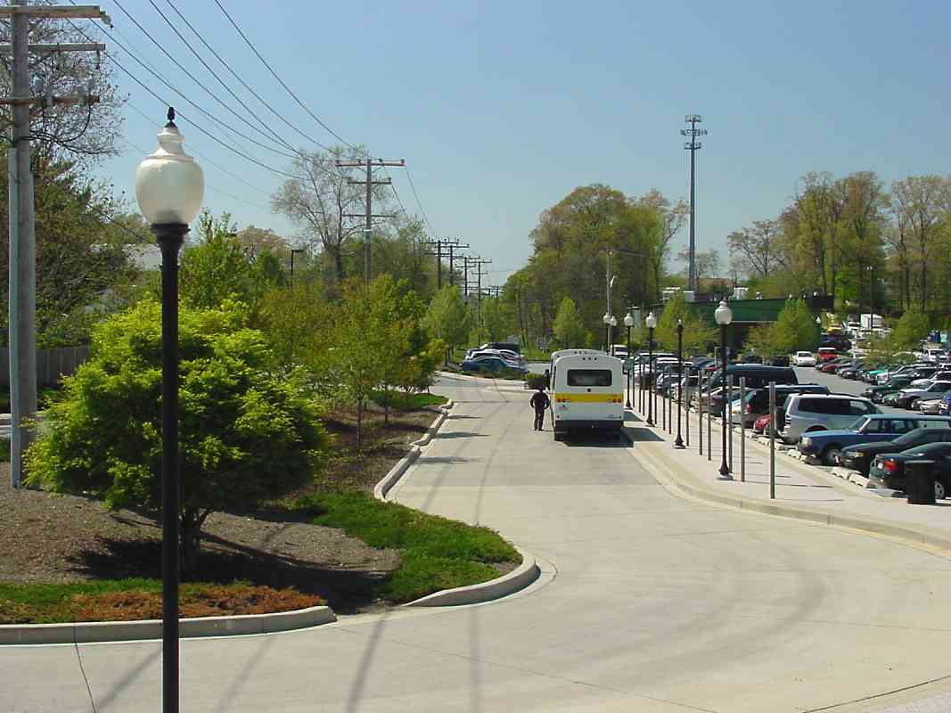
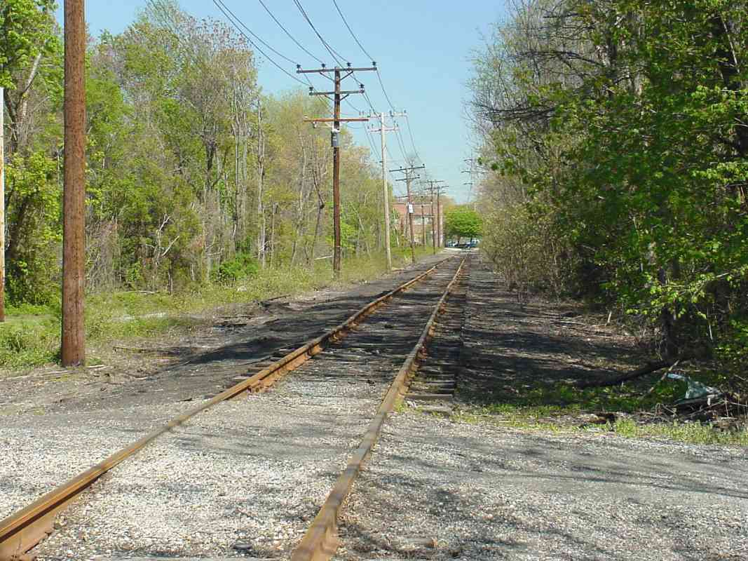
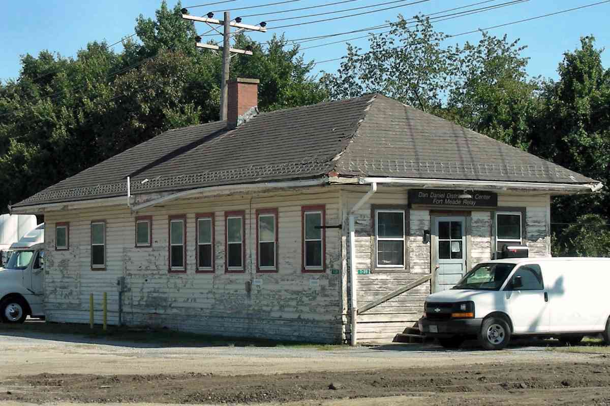
Harman Station, marked by the red rectangle, was likely renamed to Admiral Station in 1917 upon the opening of Camp Admiral, predecessor 
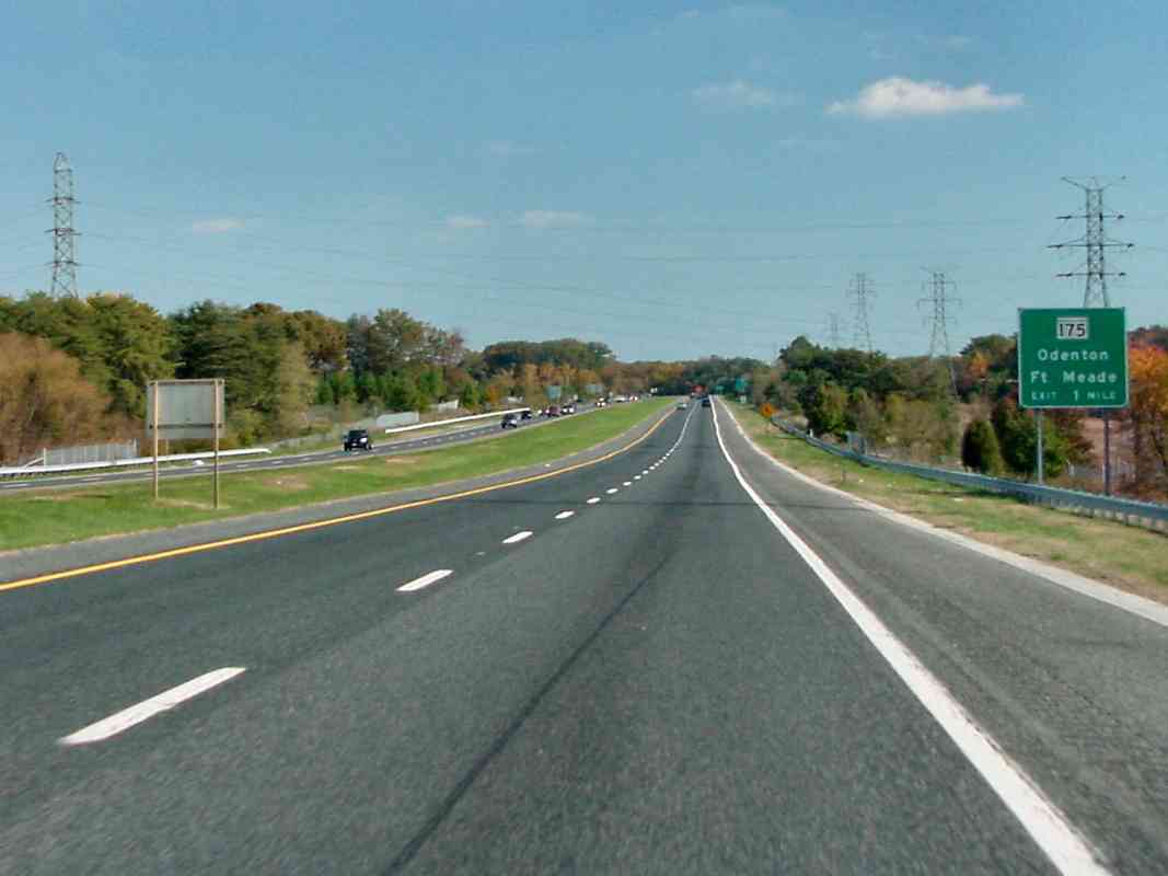
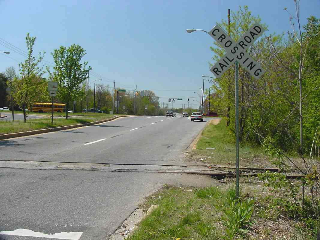
of Fort Meade. To the west (left) arcs in the pavement reveal the former locations of spur tracks to Midway Station and Loop Station. Admiral Station 2009 by anon

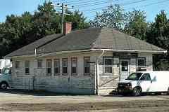
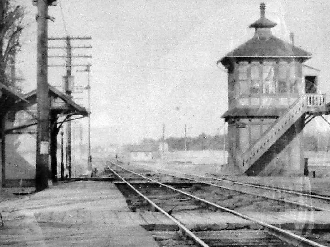
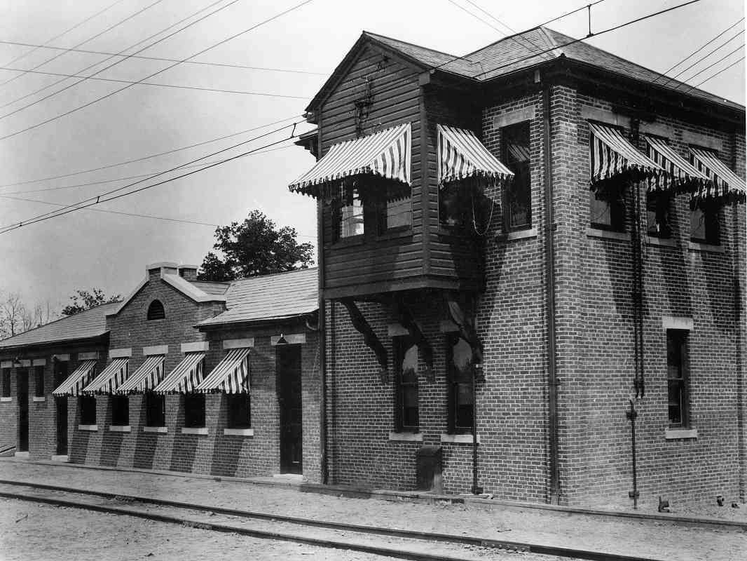
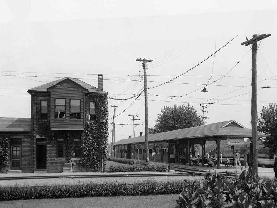
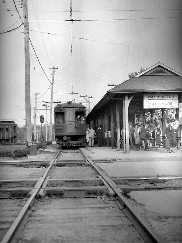
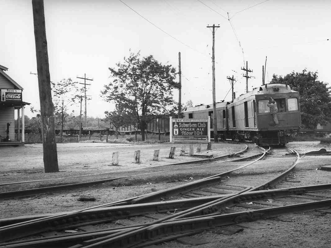
My understanding is with tight cropping, the contributed photo of Admiral Station at right is OK to display here as historical documentation. The tracks ran along the far side of the building. I'm told it was still signed the "Dan Daniel Distribution Center - Fort Meade Relay" as of 2019.

Reader Tim Moriarty gives a first-hand account:

    "After completing a three-year Army enlistment in January 1978, I joined the Army Reserve and started coming out to Fort Meade in April of that year. Having originally enlisted as one of the last active duty Army railroaders, I naturally took an interest in the railway on post. I remember it was in poor shape, and on the east side of the post, near the connection with the NEC at Odenton, there was a US Army GE 80-ton centercab locomotive as well as a boxcar and a flatcar, also Army-owned. I continued to come to Fort Meade for monthly drills until the summer of 1980, when I transferred to AFROTC. Two years later I got commissioned in the Air Force and left the area, and by 1984 I was back in Germany. After returning to the States, I came out to Fort Meade in September 1990 to visit my old USAR unit, which 
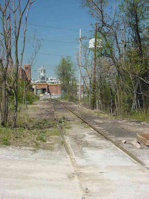
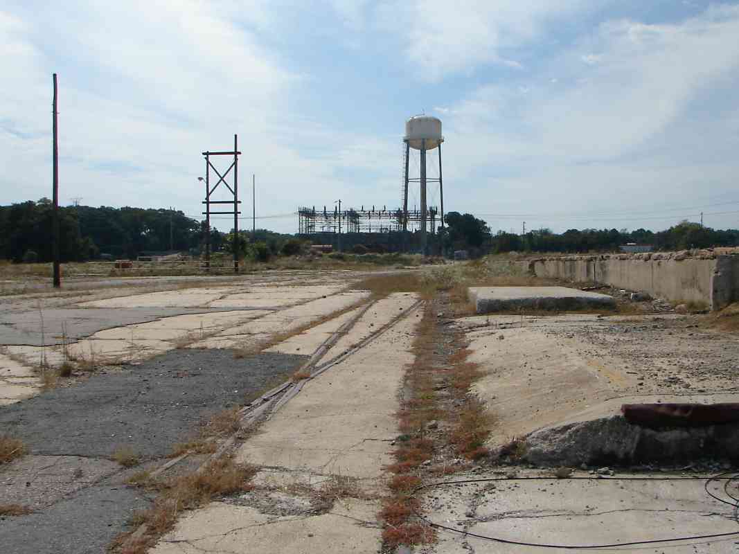
was about to be inactivated. I noticed that the tracks were then mostly torn up, but some rails are still in place in selected locations. (A couple of years ago an employee in what used to be the post's railway station said a Reserve engineer company came in during its two-week summer training and pulled up the rails some years ago. It appears they didn't finish the job within two weeks and the post hasn't bothered to finish it since then.)

    "I have a partial copy of the Fort Meade newspaper article from July 25, 1974 that covers the post railway. The part I have indicates the three rail employees had been there since the Korean War. I'm trying to get a complete copy of the article from the post's public affairs office. When I do, I'll be sure to send a copy of the article to you for possible use on your website. I'd also like to find a subsequent article indicating when the line was closed. I know the switcher was later moved to McAlester Army Ammunition Plant, OK, but the boxcar and flatcar were probably scrapped in place."

Links: SoundOff! article Tim mentioned, station photo


Old Odenton Road

Old Odenton Road
Mile: 5.4 Date: Apr 2003
Ease: A View: W
Area: B+ EH: 44
Map: AA 12 H 3 Topographic Maps

We're getting close to Odenton now, but this view looks back toward Fort Meade. The cut through the forest plus track-like shadows from the utility pole wires hint a railroad had plied this route, for some 150 years in fact.


From Odenton Station

From Odenton Station
Mile: 5.8 Date: Apr 2003
Ease: A- View: W
Area: B+ EH:
Map: AA 12 H 3 Topographic Maps

About 1870, Baltimore and Potomac (B&P) railroad built track that crossed the A&ER at diamonds where the photographer is standing, and a town grew around the intersection. B&P later became part of the Pennsylvania Railroad, and the town was named Odenton, a name derived from that of Maryland governor and B&P Railroad president Oden Bowie.

The east-west A&ER and north-south B&P mainlines met at track diamonds, and had connections in at least 3 of the 4 quadrants. This view looks west from the platform of Odenton's MARC station. I believe the northwest quadrant connection between the two railroads had been near where the bus is located in this picture.


Track Diamonds

Track Diamonds
Mile: 5.8 Date: ~1900 (Oct 2017)
Ease: A- View: NE
Area: B+ EH:
Map: AA 12 H 3 Topographic Maps

The aforementioned track diamonds can be glimpsed at photo center just beyond the end of the passenger platform. The A&ER runs left to right in this view, with Annapolis Junction about 6 miles to the left, and Annapolis about 14 miles to the right. The tall trackside structure at right is a B&P interlocking tower. This circa 1900 photo hangs inside MARC's Odenton Station that opened during 1943.

Change for: Pennsylvania RR tour at this site


Odenton Station

Odenton Station
Mile: 5.8 Date: Apr 2003
Ease: A- View: NE
Area: B+ EH:
Map: AA 12 H 3 Topographic Maps

About a century later, this was roughly the same view from the same spot as the prior photo. Odenton's adopted Pennsy heritage is displayed in bright red at the Odenton MARC commuter rail station. These tracks are now part of Amtrak's electrified Northeast Corridor.

Railroad historian Herb Harwood shared this interesting info:

    "When the PRR electrified its line in 1935, the ex-A&ER crossing at Odenton became an engineering problem, since a turntable by GM Leilich 1200-volt DC line had to cross a (then) double-track 11,000-volt AC line. The solution was to place the 1200-volt WB&A wire at a lower level than the PRR catenary with a break over the PRR tracks. This break was bridged, when needed, by a form of turntable [photo at left] placed at the bottom of an overhead bridge over the Pennsy track. Turntable photo credit George M. Leilich.

    "When a WB&A train needed to cross, the turntable was lowered and rotated to form the 1200-volt bridge across the Pennsy track. I'm not sure I've made this clear, but maybe you can get a crude idea. The device only lasted a few months before the WB&A quit, and I doubt if it was used too much, since the Annapolis passenger trains terminated at Naval Academy Junction and normally wouldn't cross the PRR. I suppose there was some interchange freight to/from the B&O and Fort Meade, though."

Link: Odenton RR history, with pictures


Acela

Acela
Mile: 5.8 Date: Apr 2003
Ease: B- View: N
Area: B+ EH:
Map: AA 12 H 3 Topographic Maps

A northbound Amtrak Acela blows through Odenton at around 100 mph and is about to pass under the MD 175 bridge.

The pile of broken concrete at right may be the remains of the foundation for the interlocking tower seen in the circa 1900 photo above.

Note also the spur that leads off to the right. It had been the northeast quadrant connection between A&ER and B&P, then became rarely used spur that extended to what had been a yard of WB&A. It has since been disconnected from the main.

Link: 1975


Spur

Spur
Mile: 5.9 Date: Apr 2003
Ease: B View: S
Area: B+ EH:
Map: AA 12 H 3 Topographic Maps

In this view south, the rusty spur track bends off to the left (east).


Tracks!

Tracks!
Mile: 6.0 Date: Apr 2003
Ease: B View: E
Area: B EH:
Map: AA 12 H 3 Topographic Maps

This short stretch is the only portion of the original A&ER right-of-way that still has rail, operational rail at that. The segment is sandwiched between Odenton station and MD 170 (Telegraph Road) and is now part of an approximate half mile long spur into what had been a factory area.

The brick building at distant left is at MD 170.

Link: in use during 2013


Office

Office
Mile: 6.3 Date: Oct 2017
Ease: A View: E
Area: A- EH:
Map: AA 12 J 3 Topographic Maps

That brick building had once been the main offices of the A&ER's successor, the WB&A.


Original Office
Photo courtesy HH Harwood collection

Original Office
Mile: Date: ~1920?
Ease: A View: NE
Area: A- EH: 159
Map: AA 12 J 3 Topographic Maps

This is the building's original appearance before post-railroad remodeling.


Naval Academy Junction
Photo courtesy HH Harwood collection

Naval Academy Junction
Mile: Date: ~1935
Ease: A View: E
Area: A- EH: 157
Map: AA 12 J 3 Topographic Maps

South of the office building and east of what is now Telegraph Road stood passenger platforms of Naval Academy Junction.


Diamonds
Photo credit JP Shuman

Diamonds
Mile: Date: May 1935
Ease: A View: E
Area: A- EH: 155
Map: AA 12 J 3 Topographic Maps

The ex-A&ER, WB&A South Shore division met the WB&A main line (left-right) at these diamonds. Many a midshipman coming up from Washington switched here from the main line to the WB&A's South Shore Division to continue east to the US Naval Academy in Annapolis, as will this tour.

Herb Harwood sent the following historical background:

    "At roughly the point where the freight spur that runs east from the ex-PRR line in Odenton turns to the north was once located Naval Academy Junction, the busiest spot on the WB&A. This was where the former A&ER crossed the WB&A's high-speed double-track Baltimore-Washington mainline, and was the transfer point for Annapolis passengers to/from Balt. & Wash."

Change for: WB&A main line


Connections
Photo credit JP Shuman

Connections
Mile: Date: May 1935
Ease: A View: NW
Area: A- EH: 154
Map: AA 12 J 3 Topographic Maps

In addition to diamonds there were, of course, connecting tracks. From near those passenger platforms this was the view back (northwest) toward Fort Meade.

After Murray's Hotel had burned down during 1923, Rieve's general store (left) built on the spot. During 2018 the location is home to a Walgreen's Pharmacy.


MD 175

MD 175
Mile: 6.4 Date: Apr 2003
Ease: A View: NW
Area: B+ EH:
Map: AA 12 J 3 Topographic Maps

From here to Annapolis what had started as the A&ER main line is now approximately retraced behind the photographer by Maryland 175 then 178.

After spanning MD 170, the survivor spur bends to head northeast, and crosses MD 175 as seen here. The road intersection ahead is that of MD 170 and MD 175.


Spur End

Spur End
Mile: 6.5 Date: Apr 2003
Ease: B+ View: NE
Area: B+ EH:
Map: AA 12 J 3 Topographic Maps

The spur leads into what was the WB&A's Naval Academy Junction Yard. In 1943 the National Plastic Products Company remodeled the yard into a plastics factory.

Herb Harwood sent the following historical background:

    "Several of the buildings at the end of this spur (shown in your photo), were the WB&A's main shops, built in 1908. (Other buildings were added after the property was sold for industrial use.) I think that the company that operates this complex is now shut down, or about to be shut down, which will make the spur unnecessary unless some new tenant arrives."


Naval Academy Junction Yard

Naval Academy Junction Yard
Mile: 6.5 Date: Oct 2017
Ease: B+ View: SW
Area: B+ EH:
Map: AA 12 K 2 Topographic Maps

That's the same water tower as in the prior photo, but looking from the opposite direction. About 2013 the yards were cleared of most of their industrial remnants. Embedded rails tend to hang on the longest.


<< Previous (west) | THIS PAGE: Odenton | Next (east) >>

Or, return to main page

Copyright Notice