TrainWeb.org Facebook Page
A&ER RR Photo Tour


Annapolis & Elk Ridge Railroad
Modern day photo tour

Accompanying each photo below are:

Click a photo to see a larger view. Please send your comments and corrections to Steve.


<< Previous (index) | THIS PAGE: Annapolis Jct to Patuxent Switch | Next (east) >>

Brief Historical Background: Annapolis & Elk Ridge Railroad

Marker

Marker
Mile: 0.0 Date: Aug 2019
Ease: A View: N
Area: B IC2:
Map: Ho 20 G 10, AA 5 D 9 Topographic Maps

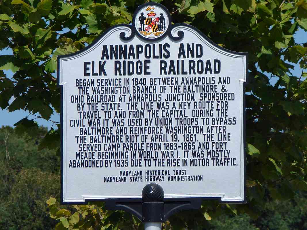
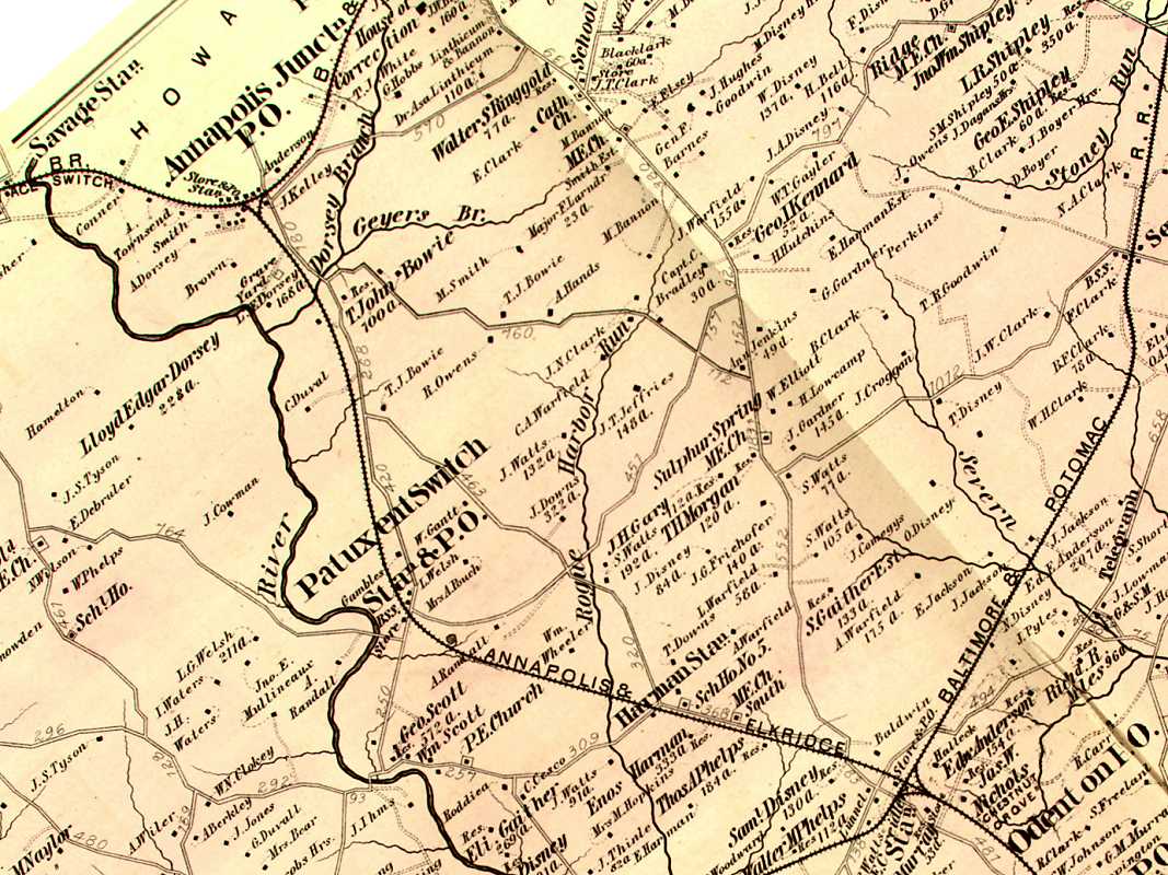
Even though for decades it was the only railroad to serve Annapolis, A&ER was never very profitable. It was reorganized in 1886 as the Annapolis, Washington and Baltimore, and in 1903 or 1908 (sources vary) was acquired by the Washington, Baltimore and Annapolis (WB&A). WB&A had been slightly more successful, in part because it had more direct (faster) routes from Annapolis to Baltimore and Washington. Then in 1917 it convinced the US Army to build Camp Admiral on land around the former A&ER Harman Station. The station was renamed Admiral to match, but Camp Admiral became Camp Meade, and later, Fort Meade. 
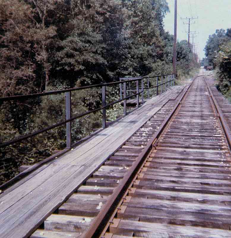
B&O and Pennsylvania RR, not wanting to be left out of the troop movement to and from the new, large camp, secured rights and upgraded old A&ER track. B&O built east from Annapolis Junction, and Pennsy west from Odenton.

Hurt by the depression and a labor strike, WB&A was forced to disband in 1935, 
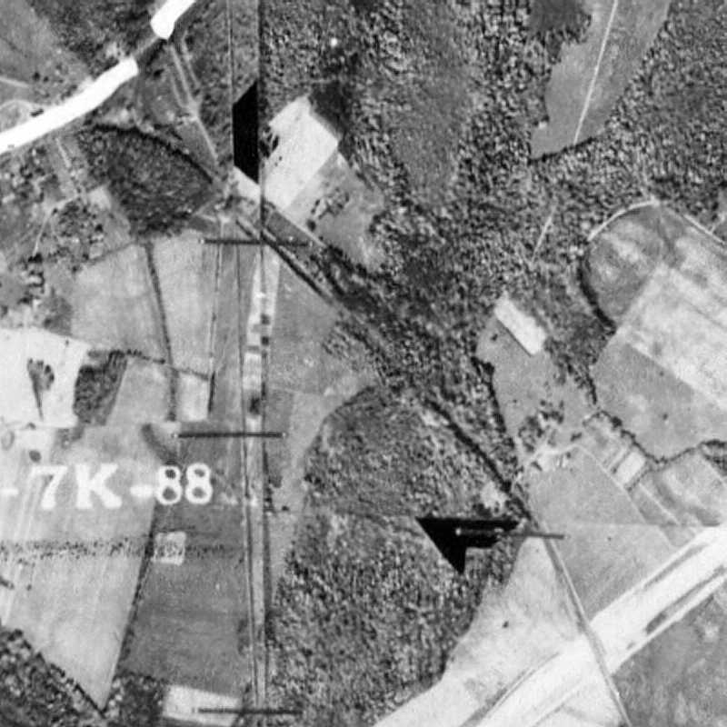
and sold its Fort Meade Branch (the tracks between Annapolis Junction and Odenton) to B&O. B&O continued to operate the route to serve Fort Meade, and also to provide a connection with Pennsy. After WWII, rail traffic levels slowly 
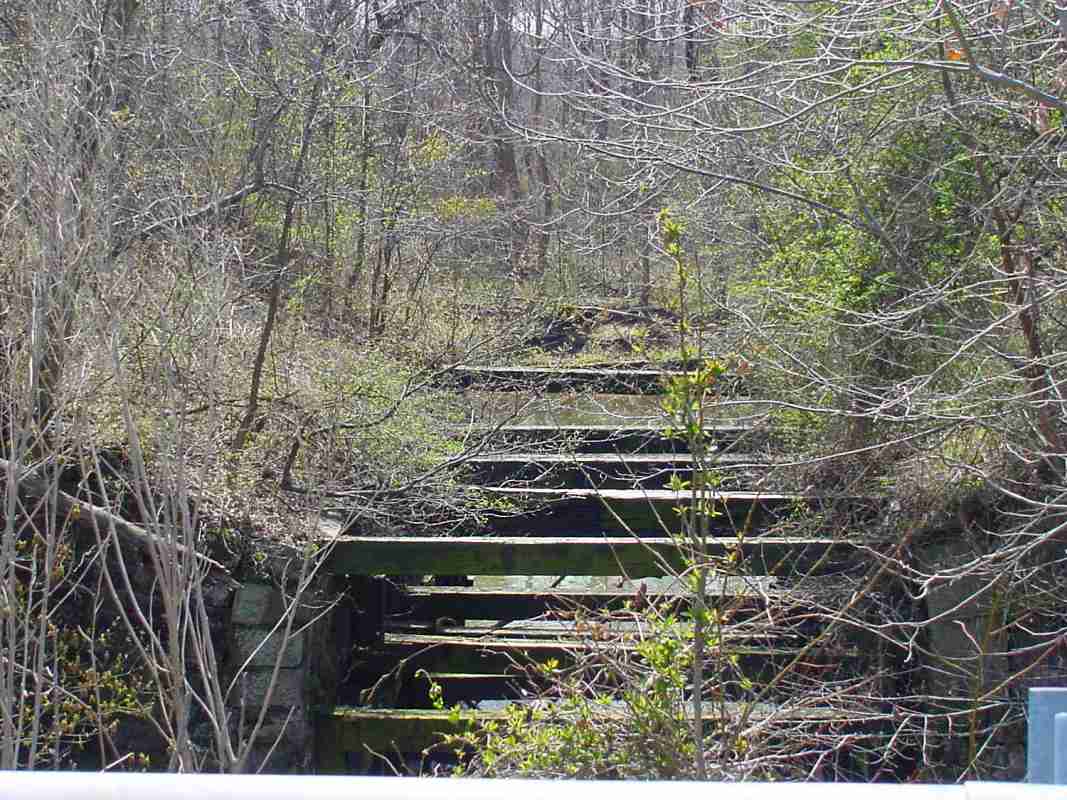
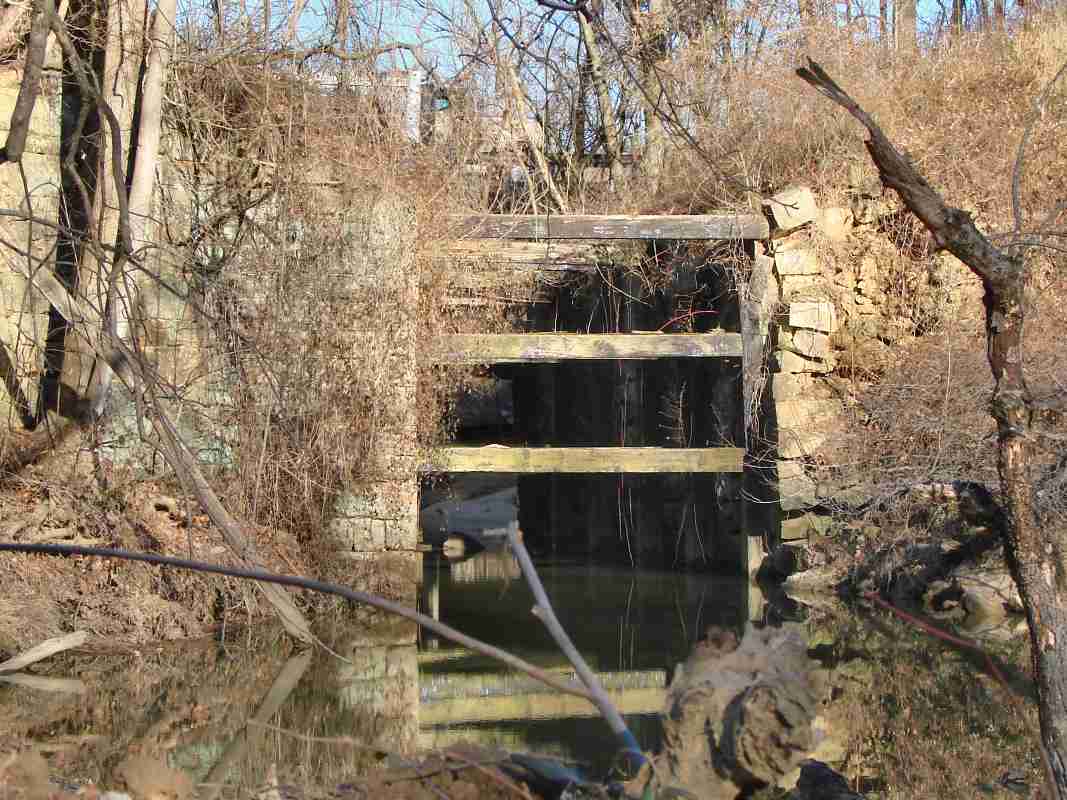
declined, and B&O ceased service along the line sometime in the 1970s. 
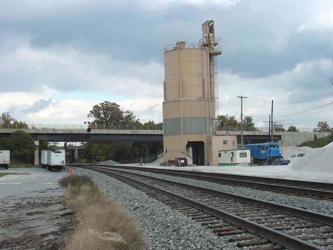
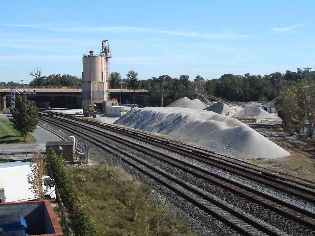
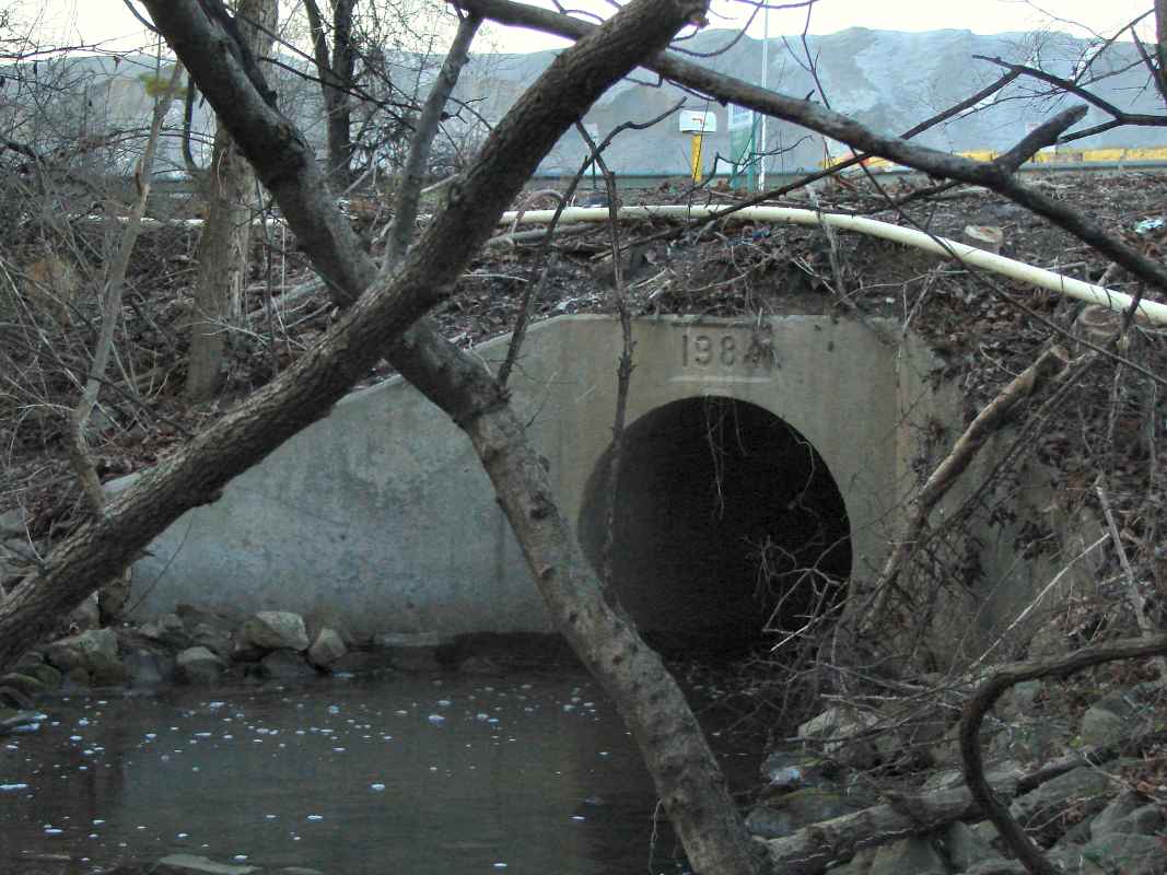
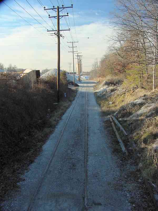
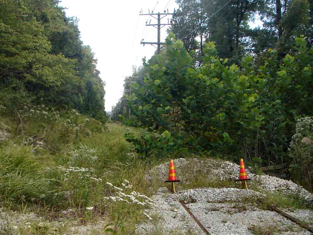
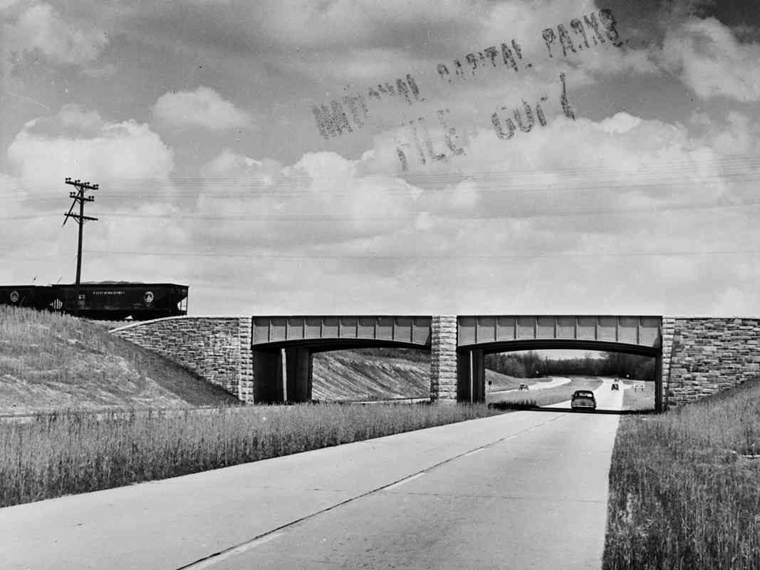
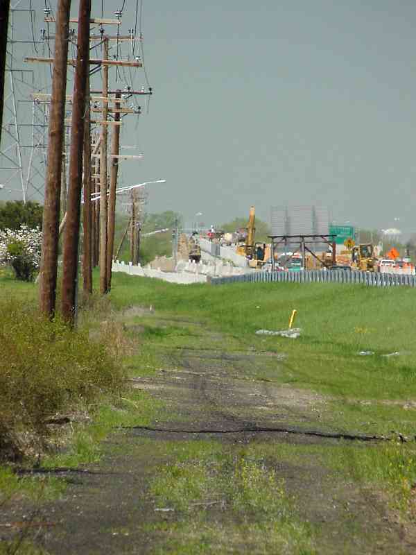
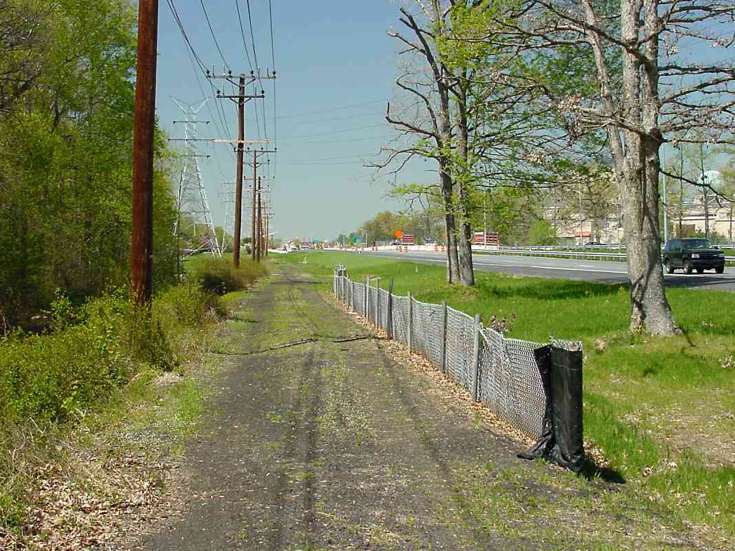
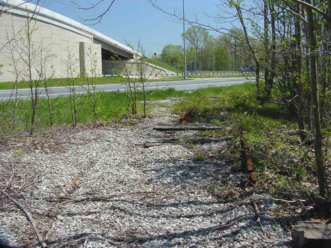
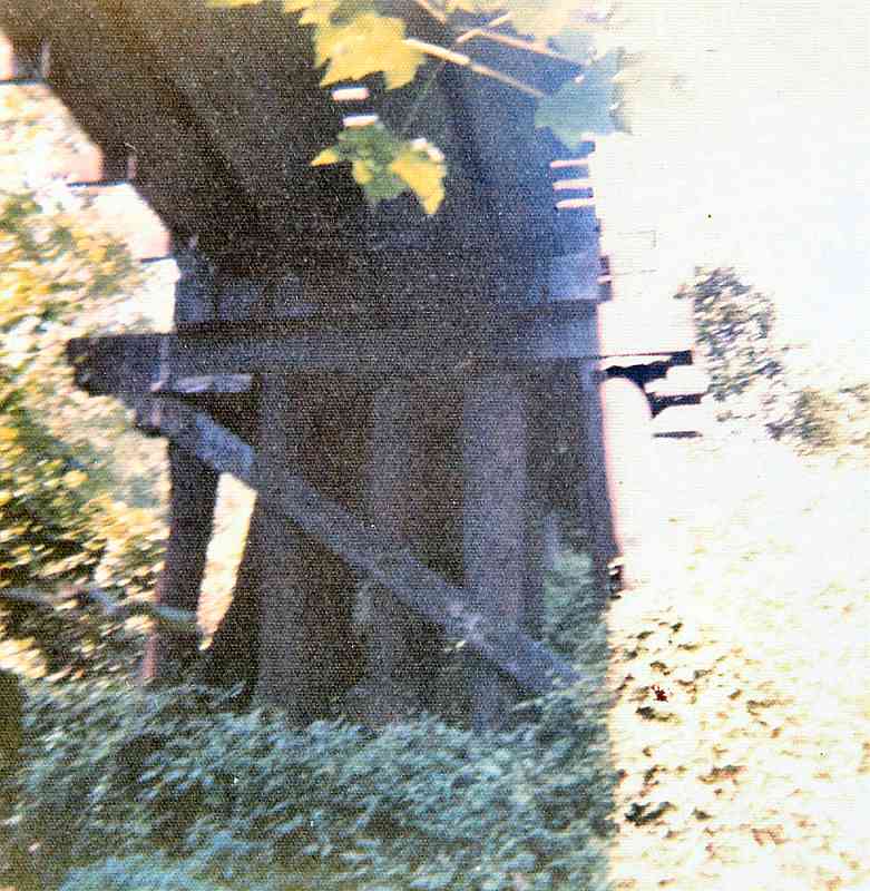
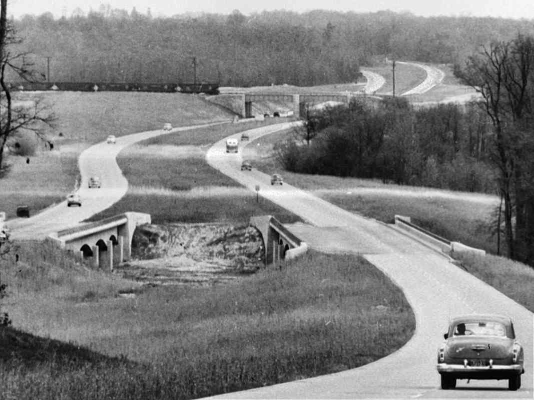
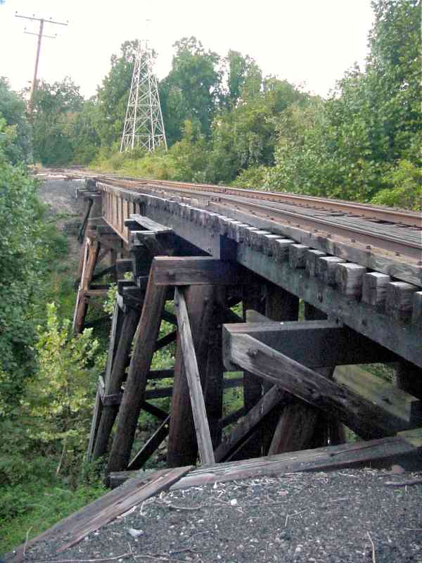
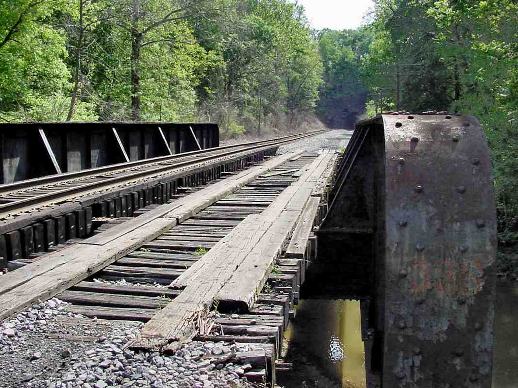
During the 1980s, limited access MD 32 was built adjacent. Even today there are 
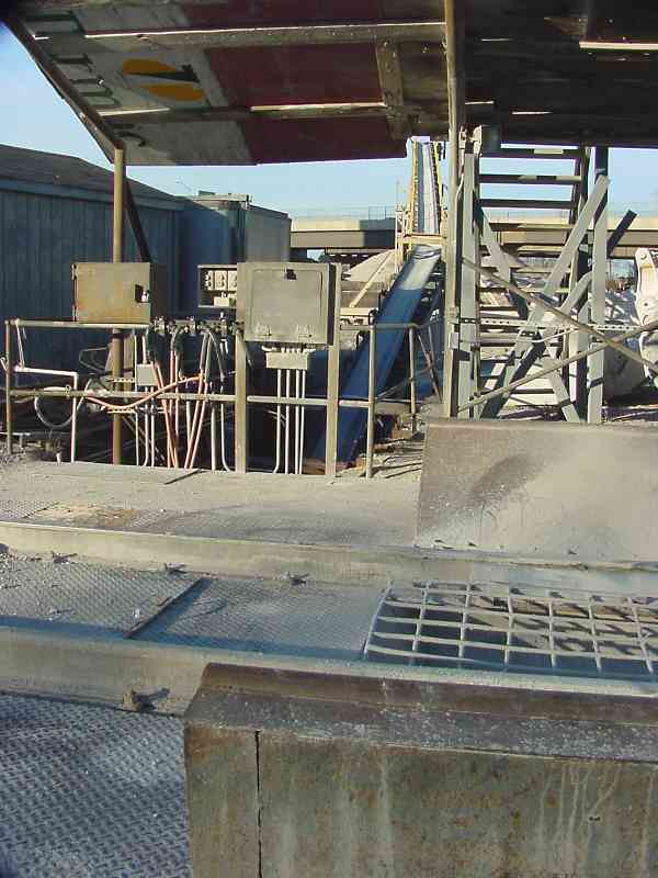
artifacts to be found.


Start

Start
Mile: 0.0 Date: Nov 2002
Ease: A View: E
Area: B IC2: 282, 393
Map: Ho 20 G 9, AA 5 E 9 Topographic Maps

Here at Annapolis Junction, Annapolis and Elk Ridge Railroad at its westernmost reach connected with B&O's Washington Branch. The tracks in the foreground are the ex-B&O, now CSX, mainline. Vulcan Materials' elevator and blue painted switcher are located within what had been the wye that connected A&ER with B&O. The elevator dates to around 1960.

Reader Charlie Wingate wrote:

    "In your picture, the front porch of Henkels would have just barely peeked into the left edge of the picture. The green area was where the corner of the building sat."

Until it closed in 1997, Henkel's Restaurant was located within a 100+ year old Annapolis Junction grocery store. The restaurant was famous for its overstuffed sandwiches, and was a favorite of railroad crews. In 1999, the building was intentionally burned down for a fireman training exercise.

Fellow site vistior Robert Weir wrote:

    "Have you ever heard about the Annapolis Jct. train wreck during the summer of 1964-66 (not to sure of the year) train derailed because of the heat? The locomotive and the first several cars were unaffected. A box car parked itself across Henkel Lane (which ran between old Rt. 32 and Henkels so that vehicles could not pass and I also remember a flat car carrying bulldozers laying on its side. I will have to check with my dad and see if he remembers the year and if there are any photos still around."

The bridge in the foreground is that of MD 32. In the distance is the bridge that carries Guilford Road over the tracks.


From Deck
Updated late-Mar 2023

From Deck
Mile: 0.0 Date: Oct 2018
Ease: A View: E
Area: B IC2:
Map: Ho 20 G 10, AA 5 E 9 Topographic Maps

The scene appears the same sixteen years later, except now there are empties Mar 2019 parking decks that provide an elevated vantage point, as well as multiple large apartment complexes and office buildings off photo left, a product of the military's Base Realignment and Closure (BRAC).

Several short segments of former A&ER wye alignment remain in service. One hosts the distant hoppers, plus one lies empty and hidden beyond the southeastern support poles for MD 32. Between the hoppers and MARC 81 is a team track. Another leg curves empty at the right side of the main photo. The actual steel rails for all of these likely date to well after the A&ER era.


WIMX 2779

WIMX 2779
Mile: 0.1 Date: Jan 2002
Ease: B+ View: E
Area: B IC2:
Map: AA 5 E 9, Ho 20 H 9 Topographic Maps

smokin' Those hoppers were pushed around by this 1974-built, ex-Lehigh Valley, ex-Conrail U23B switcher model known affectionately as a U-Boat. Vulcan Materials inherited it from Tarmac/Wimpey Materials, to become the former's only U23B. The unit was damaged by cold weather at the end of 2022, and its future remains uncertain.

Links: LV 503, CR 2779, WIMX 2779, VULX 2779


Conveyor

Conveyor
Mile: 0.1 Date: Jan 2002
Ease: B+ View: N
Area: B IC2:
Map: AA 5 E 9, Ho 20 H 9 Topographic Maps

At the minerals plant, hopper cars are pushed onto the south leg of the former A&ER wye and in the process pass over this area where their contents are dumped through the screen seen here onto a conveyor system waiting below.

Visible behind the conveyor's lift in the distance is the MD 32 bridge.

Change for: rock delivery at this site
Link: ~2005


Culvert
NEW! late-Mar 2023

Culvert
Mile: 0.1 Date: Dec 2022
Ease: B+ View: NW
Area: B IC2:
Map: AA 5 F 10 Topographic Maps

This creek's culvert was likely the first B&O one lengthened, as became necessary when A&ER arrived here only a couple three years after B&O did. B&O then tapped the creek to fill a water tank for steam engines at Annapolis Junction.

What is probably a stone culvert some 400 feet long is now hidden under the Vulcan Materials plant. Its outlet end received this concrete in 1984 when then-new multilane Maryland 32 caused Brock Bridge Road to be rerouted.


Looking Back

Looking Back
Mile: 0.3 Date: Jan 2002
Ease: B View: NW
Area: B IC2: 393
Map: AA 5 F 9, Ho 20 H 10 Topographic Maps

In this view back toward the Vulcan Materials plant (note the elevator in the distance behind the utility poles), we can see some old track survives. It is now used to stage hopper cars that deliver stone and minerals to the plant.

Parallel MD 32 is obscured by trees on the right. Into the 1990s, Brock Bridge Road had crossed the ex-A&ER at grade to connect MD 32. The utility poles have been shifted in some places to make room for the highway, but otherwise they help mark the original A&ER route. You'll see them in many of the photos below.

Link to older map: 1860 (Pierceland is now named Jessup)


Looking Forward

Looking Forward
Mile: 0.3 Date: Sep 2017
Ease: B+ View: SE
Area: B IC2:
Map: AA 5 F 9, Ho 20 H 10 Topographic Maps

Looking forward means toward Fort Meade, Odenton, and Annapolis. There are rusty rails beyond the cones, where the power company trims the tress. There had been a parallel siding on the left.


Map 1878
Image courtesy Johns Hopkins University

Map 1878
Mile: Date: 1878
Ease: View: N (up)
Area: IC2:
Map: AA 5, Ho 20 Topographic Maps

This snippet from a GE Hopkins map dating to 1878 covers the stretch from Annapolis Junction (upper left) to Odenton (lower right) toured by this page and the next.

At the location named Patuxent Switch, MD 32 and 198 now meet along the edge of Fort Meade. A name of the form ___ Switch generally meant the railroad had, has, or planned a track branch from the location, or a significant siding. Another map places Patuxent Forge at this location, so perhaps the switch reflected an industrial spur to the Patuxent Iron Works.

The name of the stream marked Dorsey Branch on the map has changed to Dorsey Run, as labeled on the aerial photos below.


Aerial 1938
Photo courtesy Johns Hopkins University

Aerial 1938
Mile: Date: May 1938
Ease: View: N (up)
Area: IC2:
Map: AA 5, Ho 20 Topographic Maps

This composite photo, the oldest aerial of this area, shows the railroad from Annapolis Junction (upper left) to Odenton (lower right) in 1938. Compare it to the later one below to observe how Fort Meade expanded during the intervening World War II era.


Aerial 1952
Photo courtesy Johns Hopkins University

Aerial 1952
Mile: Date: Oct 1952
Ease: View: N (up)
Area: IC2:
Map: AA 5, Ho 20 Topographic Maps

1952 zoom The higher-contrast snip at left zooms into the stretch beween Annapolis Junction and the B-W Parkway, then under construction.

Between the two is Dorsey Run, where masonry of a A&ER bridge has survived into the 21st century. To my knowledge, the A&ER built no stone arch bridges, opting instead for wood atop stone abutments. The only intact A&ER "bridge" is instead a small box culvert across Saltworks Creek near Annapolis; it will be seen later in this tour.


Bridge Remains

Bridge Remains
Mile: 0.6 Date: Apr 2004
Ease: A View: SW
Area: B+ IC2:
Map: AA 5 F 10, Ho 20 J 10 Topographic Maps

The only (barely) surviving remains of an A&ER bridge I've found are here at Dorsey Run. The brush is doing an excellent job of hiding the stone supports and the wood beams that someone wedged in as a preservation effort. The guardrail of eastbound MD 32 is seen at the bottom of the picture.

There might be similar stone abutments at Rogue Harbor Branch on the grounds of Fort Meade. I'd welcome a report from anyone who has access to it.


Bridge in 1975
Photos courtesy Robert Weir

Bridge in 1975
Mile: 0.6 Date: 1975
Ease: View: W
Area: IC2:
Map: AA 5 F 10, Ho 20 J 10 Topographic Maps

I expected the A&ER bridge of the prior photo to have gone undocumented, but to my surprise Robert Weir emailed and said he had a few pictures of it. Thanks for sharing, Robert!

He writes:

    "First off let me say what an amazing compilation of information you have at your B&O RR Photo Tours site. I grew up in Annapolis Jct. in the 60's, the house was at the current location of the 7-11 at Guilford Rd.and Dorsey Run Rd.

    "As a kid I often played in and around the ROW of the B&O and WB&A I have that same picture of the Hammond Branch Trestle bridge in my memory.

    underneath "The bridge at mile 0.6 on the WB&A always fascinated me, at that time it was still being used, cars were often staged on the line but I don't know if any locomotives were ever run across it. Up close it is (was) quite an impressive structure. The stone work that still remains was topped by a wooden trestle bridge similar to the Hammond Branch bridge though not as large and without the steel center span. The stone work is braced with a frame work of used ties and the first 2 or 3 courses of stone arch stones are there, whether this was a stone bridge or viaduct that was never finished or if it had been finished and was then somehow damaged, with the wooden bridge built as a quick fix I do not know. I can't believe Dorsey Run ever flooded enough to damage it and there is no stone debris on the down stream side (that I can remember) to hint at a collapse so one would think that the stone work was never completed...but the wooden bridge certainly doesn't date from the 1840's.

    "The wooden bridge was taken down during the Rt. 32 construction...the pilings were cut off at ground level and no doubt are still there. I believe there were 3 trestles on each bank, #'s 1-2-3 on the east side #'s 4-5-6 on the west. The height of new Rt. 32 next to the RR bridge detracts from its actual height, old 32 crossed the run about 8 foot above the water level and the RR bridge loomed high above through the trees.

    "This view was taken from the east end of the bridge looking west; the hopper cars on the siding in the distance were full of scrap steel."


Dorsey Run
Updated late-Mar 2023

Dorsey Run
Mile: 0.6 Date: Dec 2022
Ease: B- View: N
Area: A IC2:
Map: AA 5 F 10 Topographic Maps

Vines obscure much of the bridge even during winter. Behind the vines at top, you might be able to spot a dump truck eastbound on MD 32. To my knowledge, there is no older (i.e. before 1830s) bridge in Anne Arundel County that is more intact. As such, it is a candidate for historical landmarking.


From B-W Parkway
Photos courtesy Library of Congress

From B-W Parkway
Mile: 1.0 Date: ~1955
Ease: A View: NE
Area: IC2:
Map: AA 5 G 11 Topographic Maps

When the B-W Parkway arrived, the ex-A&ER got this new bridge; it endured about only 30 years before MD 32 took its place.

This 1950s photo happens to capture a few B&O hoppers on the line. According to the accompanying Library of Congress information, the adjacent bridge beyond that of the railroad carried Annapolis Junction Road. Now drivers recognize this location as the B-W Parkway's interchange with MD 32.

I asked Robert Weir about the railroad's crossing with the B-W Parkway. He replied:

    distant view "The B-W Parkway was built in 1954....a couple years before myself, I recollect the tracks spanning the parkway on a steel bridge. Checked with my brother and he recalls the steel bridge also. It was of the type that had steel side walls rising 3 or more feet above the tracks (similar to the #33B Bush Creek bridge). In the sixties Fort Meade still had rail traffic so this and the Dorsey Run bridge were in use. The Rt. 32/parkway interchange was not of the typical cloverleaf design, the only ramp on the south side of Rt. 32 (the track side) was the parkway north bound exit ramp which crossed the tracks at grade then came to a stop sign at Rt. 2. The new Rt. 32 eastbound bridge is just about over top of the old rail bridge location as your photo at mile 1.4 shows."
Trains may yet return: as of 2020, both proposed Maglev train route options pass through here.

Links: LoC source photo, LoC bridge in distance


Construction

Construction
Mile: 1.4 Date: Apr 2003
Ease: C View: NW
Area: B IC2:
Map: AA 5 H 12 Topographic Maps

I'm standing on the A&ER right-of-way, zooming the camera northwest toward B-W Parkway. In the distance, eastbound MD 32 bounded by concrete walls has been temporarily displaced south over the old ROW to facilitate the construction of an underpass for Canine Road. Meanhile, our trusty utility poles hover overhead.


NSA

NSA
Mile: 1.4 Date: Apr 2003
Ease: C View: NW
Area: B IC2: 248
Map: AA 5 H 12 Topographic Maps

Here's the same view as the prior photo, except unzoomed.

Directly across MD 32 on the right is Fort Meade and the home of the National Security Agency. This is not an area to tread carelessly during your railroad tour. If you do not wish to be stopped, questioned, and checked out by the Feds, do not visit here in person. Instead, simply enjoy the work of your intrepid historian photographer. I was monitored the entire time I was in this vicinity, and was careful to stay on the disused railroad right-of-way.


A Bit of Track

A Bit of Track
Mile: 1.8 Date: Apr 2003
Ease: C View: SE
Area: B IC2:
Map: AA 5 H 13 Topographic Maps

The disused track remained in place until around the year 2000, but was then removed as part of the road work along MD 32. For unknown reasons, a small segment of track with ties still attached was pushed aside instead of being carted away.


A Siding

A Siding
Mile: 1.9 Date: Apr 2003
Ease: C View: E
Area: B IC2:
Map: AA 5 H 13 Topographic Maps

Nearby, another small rail artifact can be found. This appears to have been part of a siding that crossed MD 32 to serve Fort Meade near the Samford Road interchange.


Ties

Ties
Mile: 2.3 Date: Apr 2003
Ease: B+ View: NW
Area: B IC2:
Map: AA 11 J 2 Topographic Maps

Look closely and you'll see the remains of wooden ties slowly disintegrating in the dirt.


MD 198

MD 198
Mile: 2.5 Date: Apr 2003
Ease: A View: SE
Area: B IC2:
Map: AA 11 J 2 Topographic Maps

This is the view southeast along the old ROW from the now disused segment of MD 198 just west of where it had intersected with MD 32 at a traffic light. MD 198 was extended farther east in 2001/2002 along the old A&ER right-of-way so as to merge with MD 32 via an interchange. A 1904 map places Portland Station here on the right, which may have been a new name for A&ER's Patuxent Switch Station. I have found no artifacts of the switch or station.


ROW

ROW
Mile: 2.7 Date: Apr 2003
Ease: A View: SE
Area: B IC2:
Map: AA 11 K 2 Topographic Maps

The new MD 198 bends off to the right just before the interchange and accompanying traffic circle, leaving the old railroad ROW and its utility poles to fend for themselves. The old ROW had been where MD 198, MD 32, and Mapes Road all now meet.


<< Previous (index) | THIS PAGE: Annapolis Jct to Patuxent Switch | Next (east) >>

Or, return to main page

Copyright Notice