TrainWeb.org Facebook Page
PRR / Amtrak Photo Tour


PRR / Amtrak in Maryland
Modern day photo tour

Accompanying each photo below are:

Click a photo to see a larger view. Please send your comments and corrections to Steve.


Special Note: >>> The places described on this page host quiet, high-speed trains. Stay well clear! <<<

<< Previous (northeast) | THIS PAGE: Violetville to Arbutus | Next (south) >>

AMTK 649

AMTK 649
Mile: 100.6 Date: May 2021
Ease: B+ View: N
Area: B- T6:
Map: Ba 42 C 3 Topographic Maps

Maidens Choice Road had crossed at grade near the middle of this train.

Fences and wires interfere with good train views from Wilkens Avenue.


AMTK 648

AMTK 648
Mile: 100.6 Date: May 2021
Ease: B+ View: SW
Area: B- T6:
Map: Ba 42 C 3 Topographic Maps

The same applies to views the opposite direction of northbound AMTK 648. The easternmost of the four tracks, the one with wooden ties, generally sees freights and some MARC trains. It will likely see more MARC trains after MARC/Amtrak extends the four-track zone south to Odenton.

The bar above the train previously held signals. Those signals are visible from the opposite direction in the next photo.


PC 6110
Photo courtesy Dave Hiteshew

PC 6110
Mile: 100.8 Date: 1973
Ease: B View: N
Area: B- T6:
Map: Ba 42 B 4 Topographic Maps

PC 6110 leads mixed freight south; within four years it would be given Conrail's initial white-on-black paint scheme and, later, white-on-blue.

This is one of few photos that includes standard PRR signals illustrating all three basic operator instructions: stop, go, and slow, or in PRR terminology stop, clear, and approach. Amtrak would later colorize PRR's signals and relocate this set six-catenary-poles south (about a quarter mile).

Links: PC 6110, PRR signals


Safety Stand
Photos courtesy Dave Hiteshew

Safety Stand
Mile: 100.9 Date: Oct 2007
Ease: B View: NE
Area: B- T6:
Map: Ba 42 B 4 Topographic Maps

There remain some freight customers on the west side, like this one. Tall switch stands like this improve visibility of the setting. Another of this design is labeled "Bethlehem Steel Co. Mainline Safety Stand". tanks

This siding is one of few along the NEC between Baltimore and DC that as of 2022 still receives freight service by rail, though the weeds tell you it's not frequent. Each tank car gets its own set of connections.


Amtrak 2013

Amtrak 2013
Mile: 101.1 Date: Jul 2018
Ease: B+ View: NE
Area: B- T6:
Map: Ba 42 B 4 Topographic Maps

At milepost 101 AMTK 2013 lifts its train over the line's highest spot between Baltimore and the Patapsco River. Note the solar-powered track greaser.


Obscured Signals

Obscured Signals
Mile: 101.1 Date: Jul 2018
Ease: B+ View: NE
Area: B- T6:
Map: Ba 42 B 4 Topographic Maps

When Amtrak relocated PRR's signals, it chose to mount them on General Railway Signal Co. a separate gantry even though the nearest catenary poles are connected by a horizontal bar that could have supported signals. As a result, in some views the bar obscures the signals. Judging by milepost 101, the relocated signals are numbered 2 too high.

General Railway Signal Co. equipment from the PRR era remains on duty.

The track on the left leads to the switch stand.


Three Greens

Three Greens
Mile: 101.1 Date: May 2021
Ease: B+ View: N
Area: B- T6:
Map: Ba 42 B 5 Topographic Maps

Three northbound tracks are all signalled green at the same time, something not seen very often.

Link: 1932


Amtrak 635

Amtrak 635
Mile: 101.1 Date: Jul 2018
Ease: B+ View: S
Area: B- T6:
Map: Ba 42 B 4 Topographic Maps

Nine passenger cars chase AMTK 635.

With each engine's pantograph touching and sliding along the overhead power-supply wire in order to draw electricity, one might wonder how quickly that wire wears down and needs to be replaced. Though that wire can endure well over a century, most of the NEC's original 1930s catenary was restrung during the 1960s to support higher-speed trains.


PC 884
Photos courtesy Dave Hiteshew

PC 884
Mile: 101.1 Date: 1973
Ease: B View: NE
Area: B- T6:
Map: Ba 42 B 4 Topographic Maps

By 1973 Amtrak had assumed passenger duties from failed Penn Central, but had not yet repainted all the rolling stock, such as these Metroliner cars.

non-Metroliner 1973 During its early years, Amtrak cobbled together non-Metroliner service from a hodge-podge of equipment, as seen at left.

What's that to the right of the closest track? It appears to be fresh rail waiting installation, except its edges are rusting, which suggests it been sitting there for years. Perhaps the transition from PC to Amtrak delayed such maintenance of way.


PC 4824
Photos courtesy Dave Hiteshew

PC 4824
Mile: 101.1 Date: 1973
Ease: B View: E
Area: B- T6:
Map: Ba 42 B 4 Topographic Maps

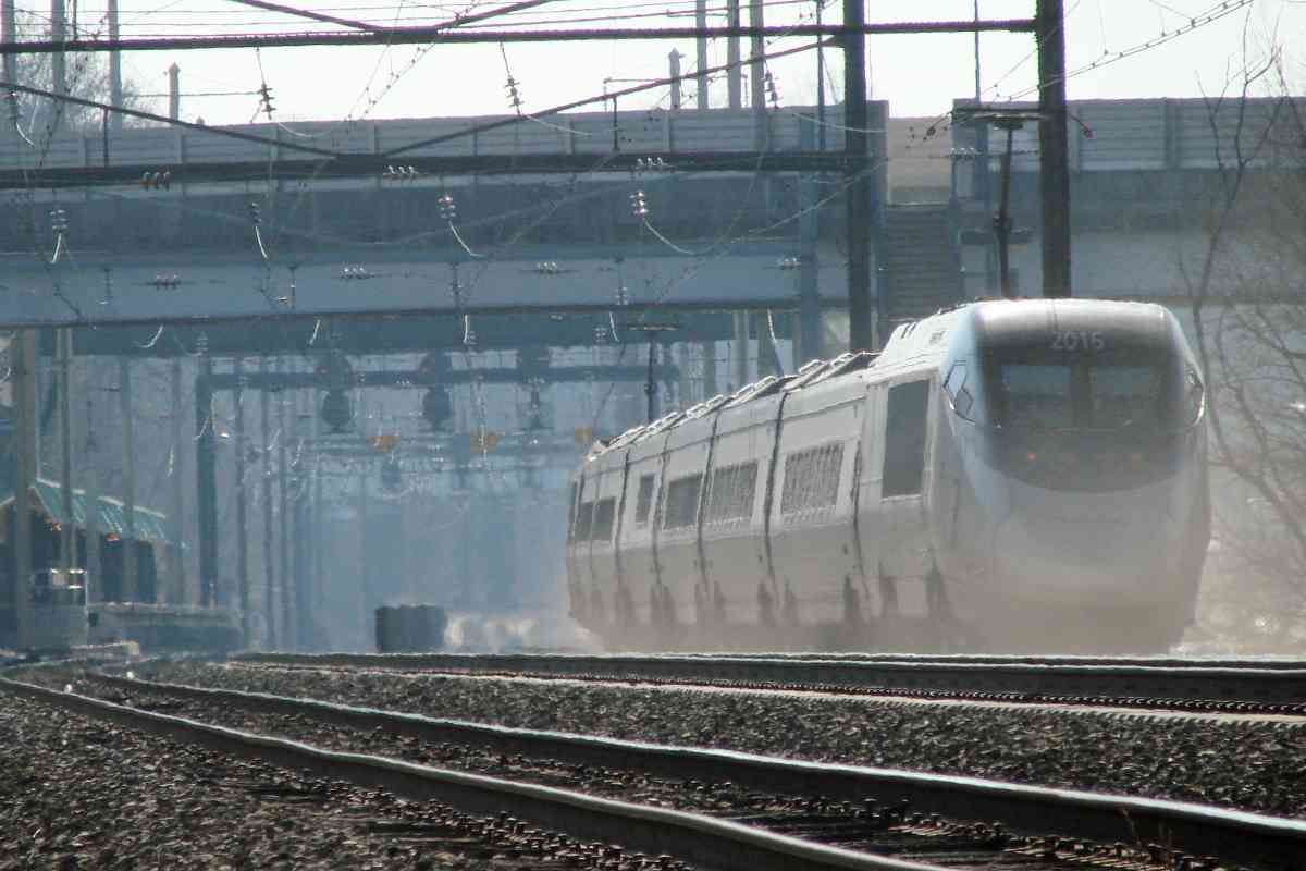
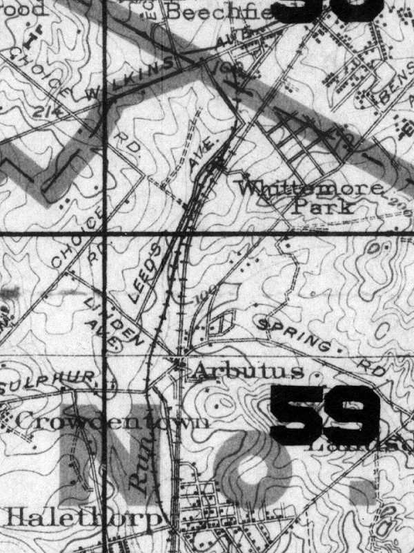
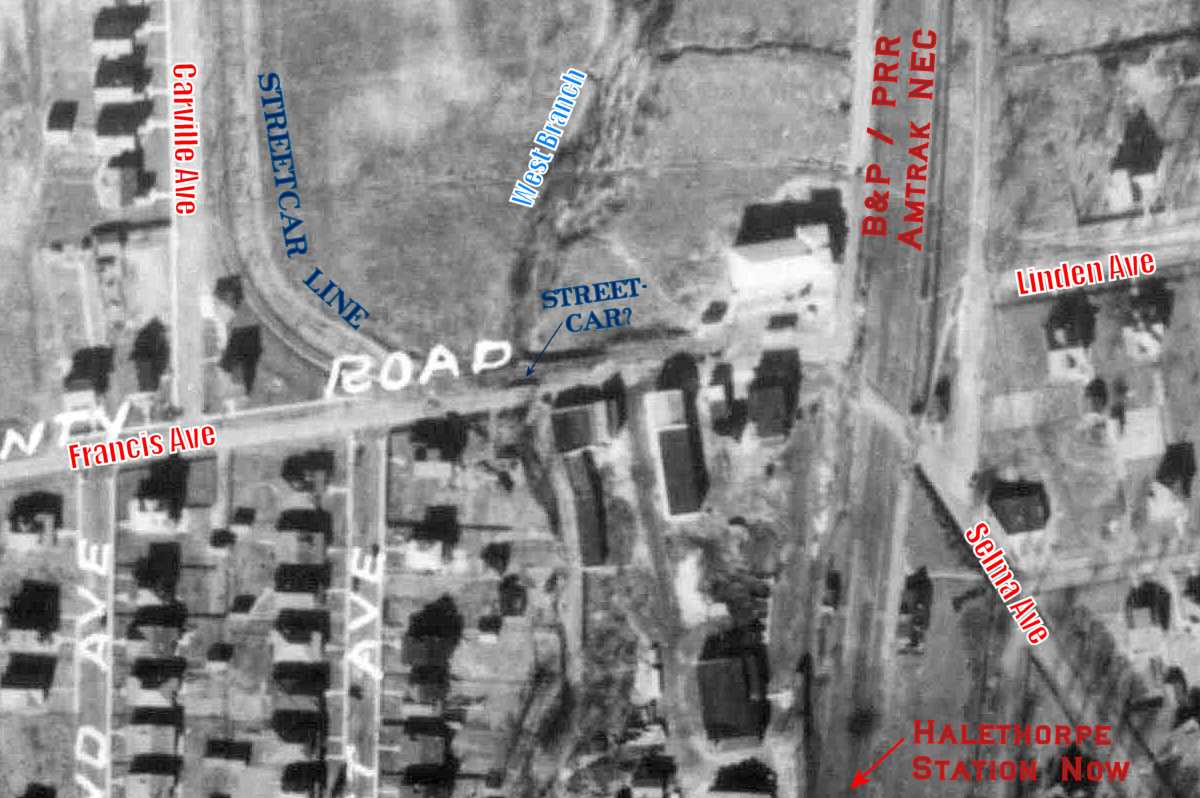
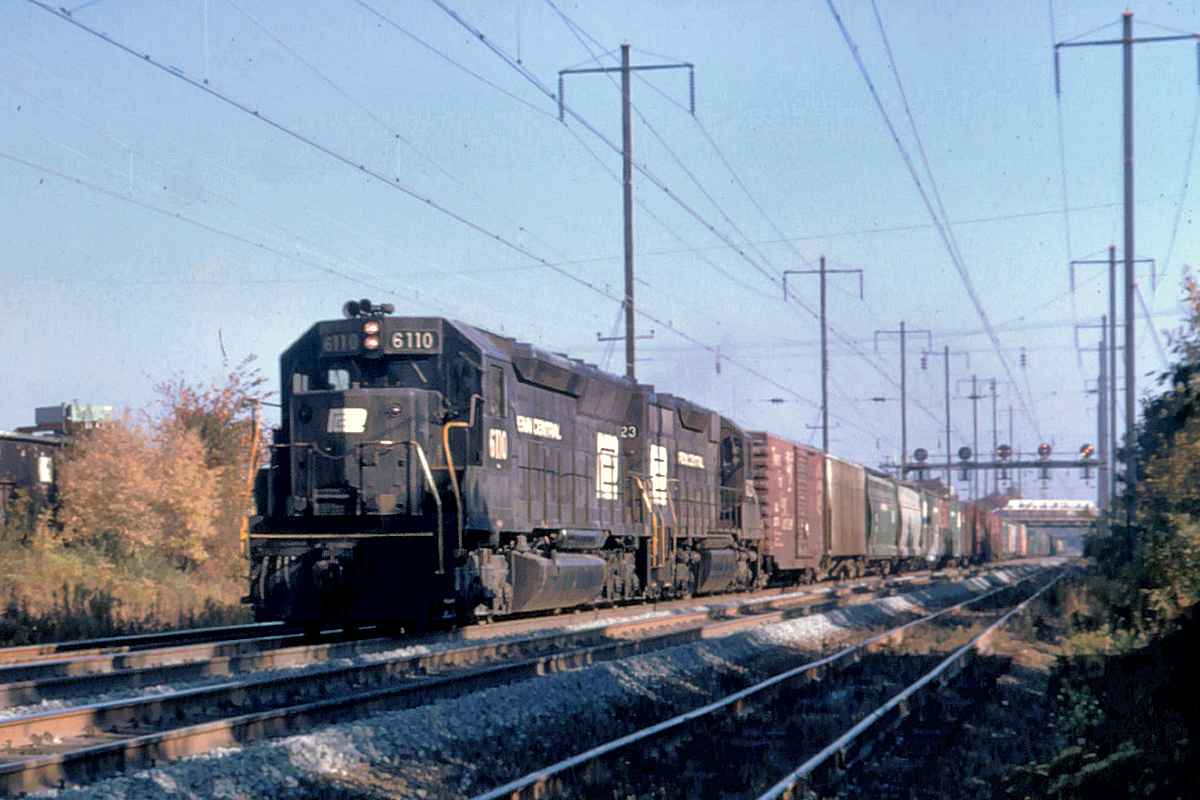
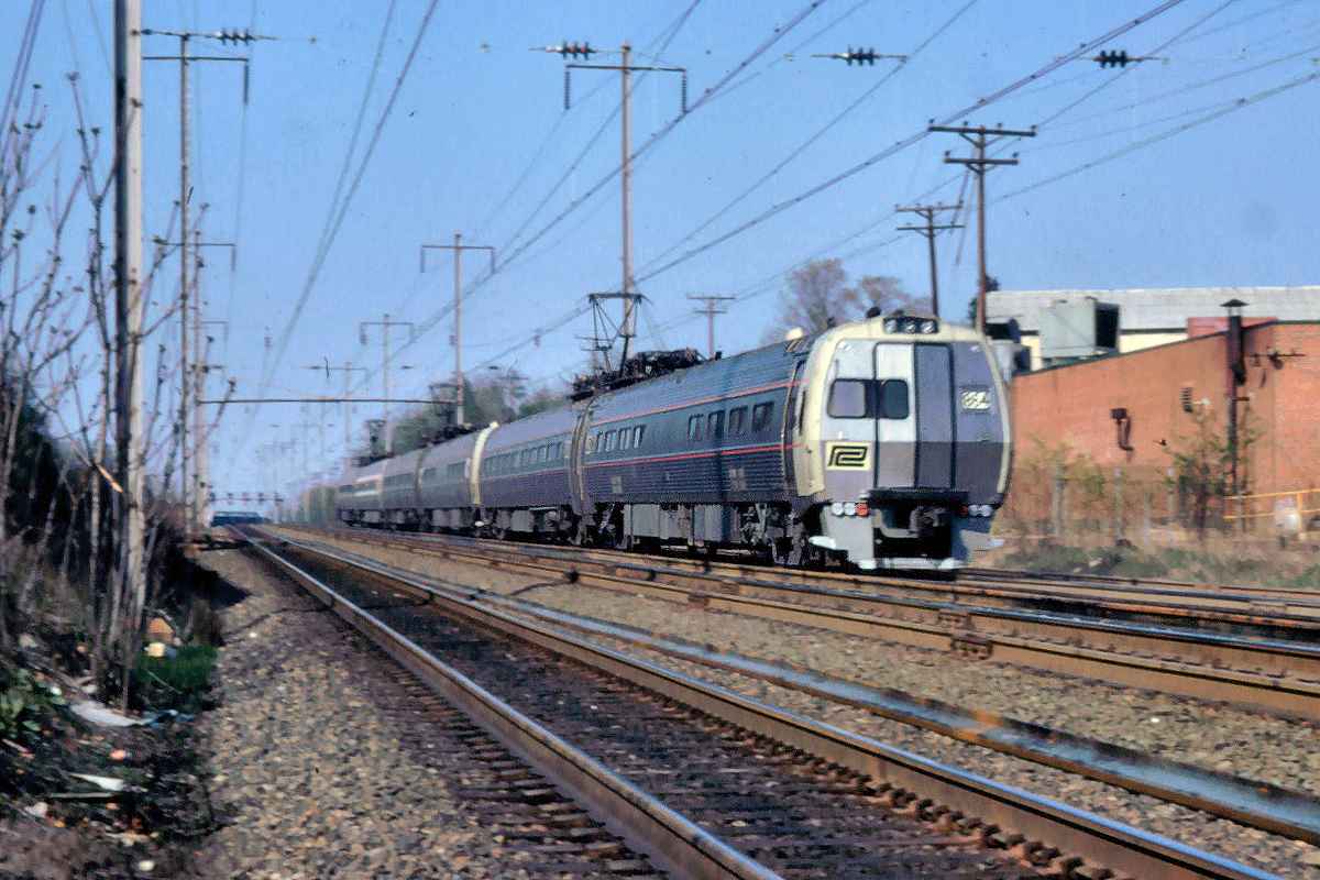
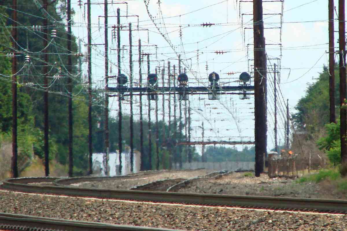
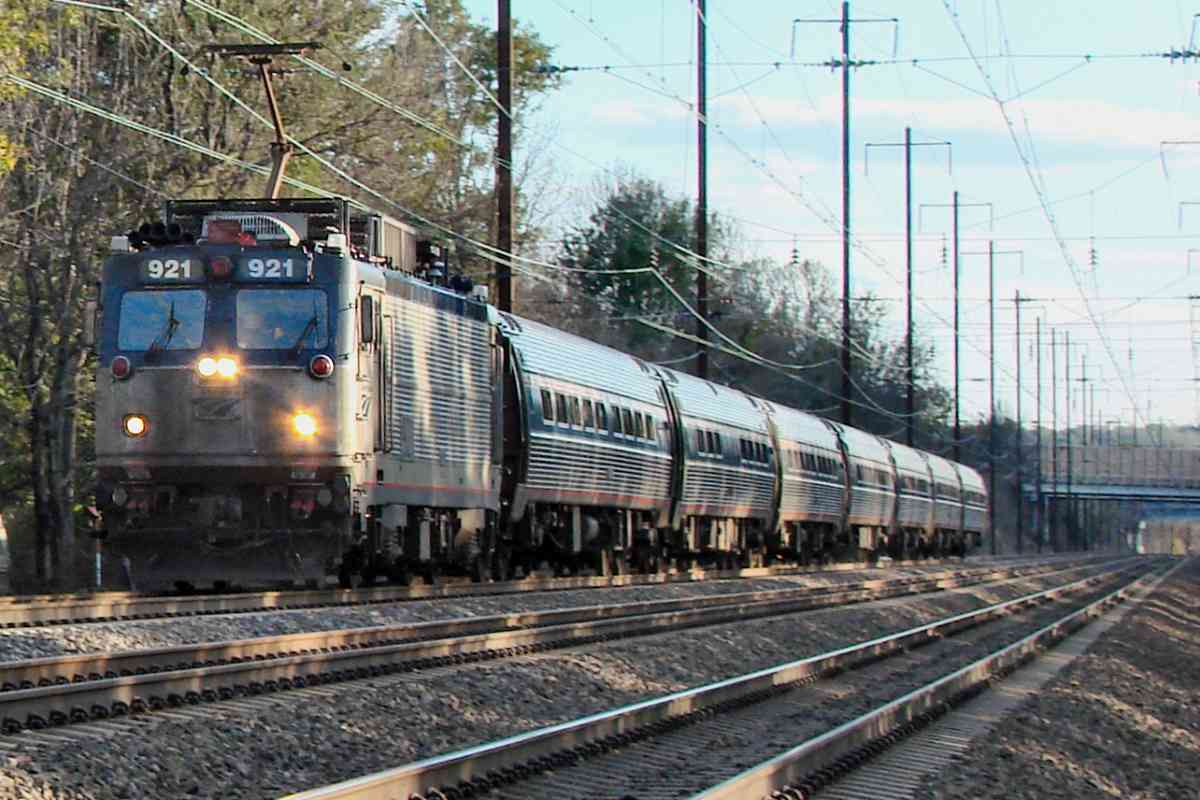
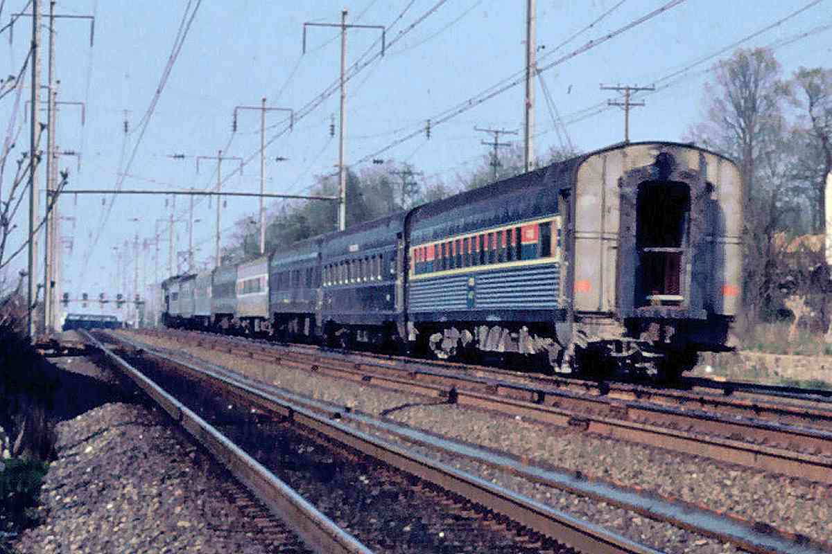
Penn Central's freight operations continued through 1976 when it gave way to Conrail. Here PC 4419 (model E44) shares duty with ex-Pennsylvania RR GG1s 4824 and 4836, the latter two built during 1935. The lead engine's number is not known.

mixed freight 1973 ACFX 23270 in 1973 
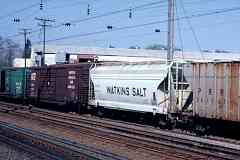
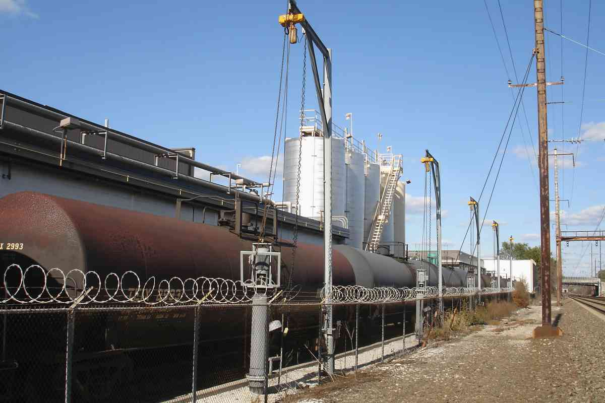
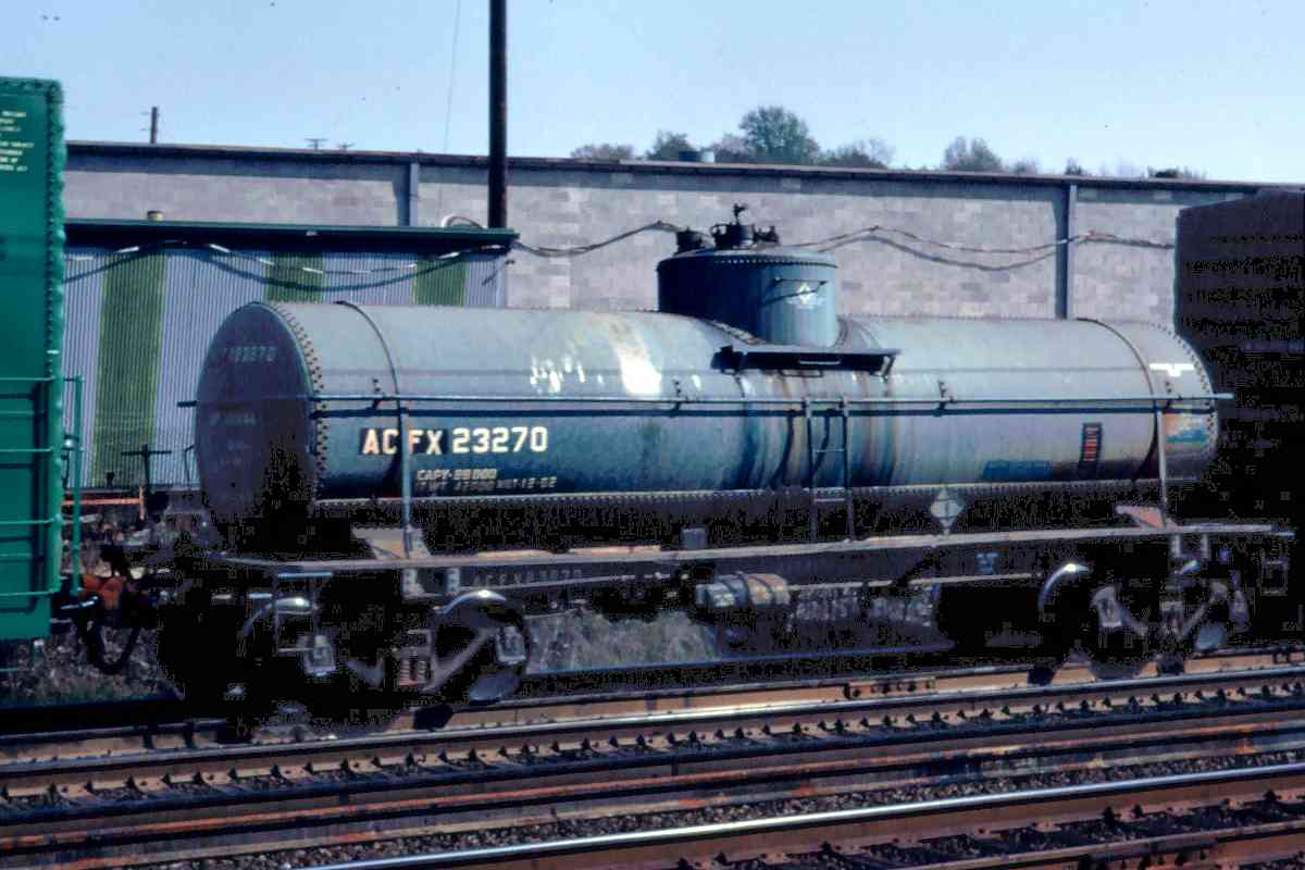
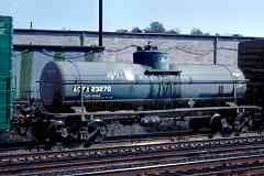
Their mixed freight consist included NYC 86901, Norfolk Franklin and Danville NFD 2151, Watkins Salt SHPX 63533, PRR 261167, and ACFX 23270. At photo time ACFX was a division of General Electric Rail Services; the tank car at right was likely built around 1950 when ACFX was part of American Car and Foundry. You might still be able to spot a car on duty with NYC or PRR reporting marks, but by 2020 most were either repainted or retired.
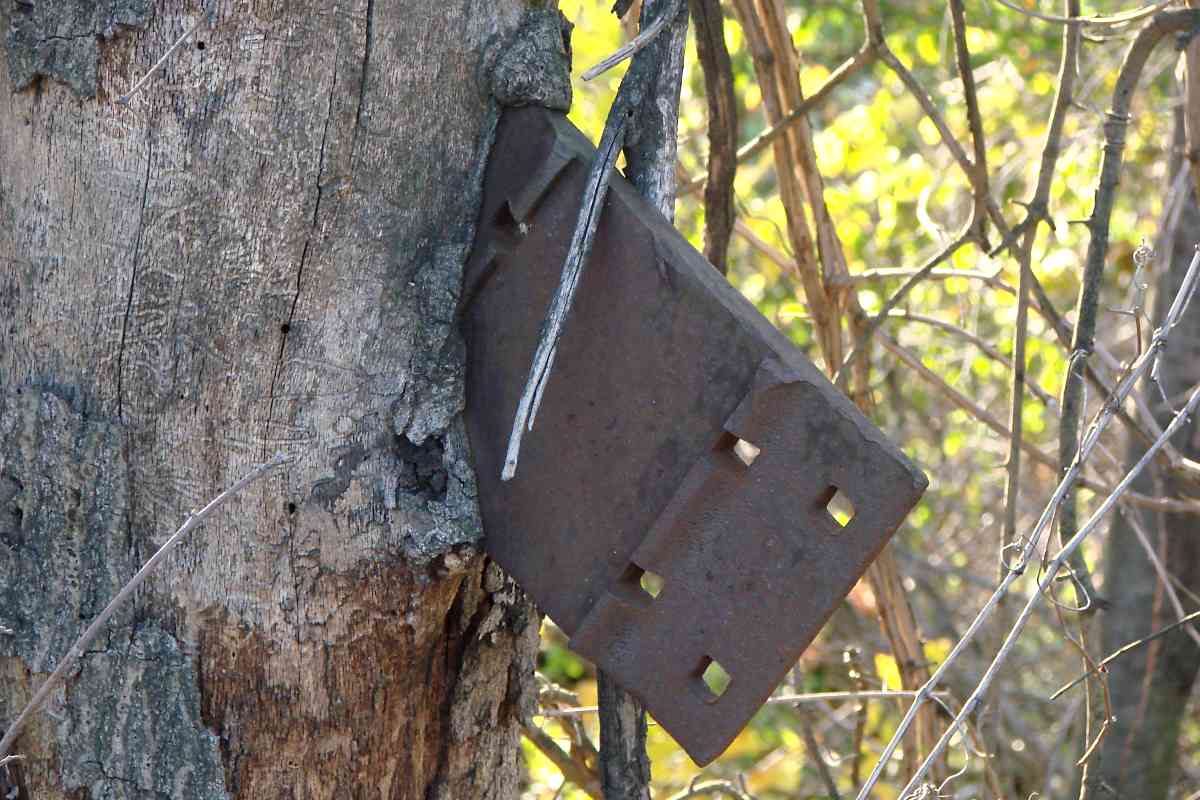
Links: PC 4419, PC 4824, PC 4836


Rusty
Photo courtesy Dave Hiteshew

Rusty
Mile: 101.3 Date: Oct 2007
Ease: B View: N
Area: B- T6:
Map: Ba 42 A 5 Topographic Maps

On the east side of the tracks it's been awhile since a freight rolled past this box. Anyone know the purpose of the box?

Link: 1981


Caboose
Photo courtesy Google

Caboose
Mile: 101.4 Date: 2011
Ease: A View: N
Area: B- T6:
Map: Ba 42 A 5 Topographic Maps

As seen from Knecht Avenue, this caboose sat as storage for years until removed around 2013. Perpendicular to it, with two parked autos, are tracks that run through the building. No one recognizes the caboose's logo / paint scheme.

A highly-detailed 1915 atlas has Knecht Avenue passing under the tracks.

Links: CR 6211 at Knecht Aveunue in 1981, John A. Knecht


Heat Shimmer

Heat Shimmer
Mile: 101.7 Date: Jul 2018
Ease: A View: NE
Area: B T6:
Map: Ba 42 A 6 Topographic Maps

To that catenary horizontal support pole, add wires plus heat shimmer, and those signals numbered 1014 are not easily read from a half mile away.


Beltway

Beltway
Mile: 101.7 Date: Jul 2018
Ease: A View: S
Area: B T6:
Map: Ba 42 A 6 Topographic Maps

Automobile roads built after the railroad sometimes necessitated modifications to the catenary, such as pole relocations or height changes. That's why some poles are less rusted at Baltimore's I-695 Beltway that cut through here during 1957. The bridges for both the inner and outer loops were widened in a series of steps during the 2004 to 2018 period.


Cell Tower
Photo courtesy Dave Hiteshew

Cell Tower
Mile: 101.7 Date: Oct 2007
Ease: A View: N
Area: B T6:
Map: Ba 42 A 6 Topographic Maps

"It's a tall catenary pole." - "It's a cell tower." - Wait, you're both right!

It's someone's job to climb among the live wires to maintain the cell equipment. I'll stick to writing about it.

Link: SNL Shimmer floor wax dessert topping


Limited Speed Sign
Photos courtesy Dave Hiteshew

Limited Speed Sign
Mile: 101.9 Date: Oct 2007
Ease: B View: N
Area: B T6:
Map: Ba 42 A 6 Topographic Maps

resume speed sign S advises limited speed on the track ahead, R designates resume normal speed.

These signs are often found in the vicinity of track repair work.


Access Cover
Photo courtesy Dave Hiteshew

Access Cover
Mile: 101.9 Date: Oct 2007
Ease: B View: E
Area: B T6:
Map: Ba 42 A 6 Topographic Maps

Usually the cable access ports do not protrude from the ground as far as this. Perhaps recent trackwork has disturbed the amount of ballast.

The digits on the cover, 714 in this case, match those of the closest orange-color cable marker.


Water Gantry

Water Gantry
Mile: 102.0 Date: Jan 2018
Ease: B+ View: W
Area: B T6: 343
Map: Ba 42 A 7 Topographic Maps

water Apr 1938 This is one of just two A-frame style gantries that survive along the 60 miles of line covered by this tour; the other survivor is just south of Halethorpe Station. Both survivors stand near streams, which suggests they had supplied water to thirsty steam engines. PRR sometimes mounted signals on these gantries as well.

The standard PRR steam locomotive water station included a wooden water tank standing high on four concrete pads similar to those supporting the A frame. In this fuzzy 1938 aerial, the object at bottom right might be the tank. Since learning this, I have not been to the site to look for its concrete support pads. Such pads survive along the Pope's Creek line.

Link: this gantry ~1950


Masonry Culvert
Photos courtesy Dave Hiteshew

Masonry Culvert
Mile: 102.0 Date: Oct 2007
Ease: B View: NE
Area: B T6:
Map: Ba 42 A 7 Topographic Maps

brick This circular masonry culvert was likely lengthened to support additional tracks above. Its opposite (inlet) side is of cruder construction and thus may be original.

Two culverts very similar to this are found along the disused Trolley Line #9 about five miles west of here.


Railroad Tree
Photo courtesy Dave Hiteshew

Railroad Tree
Mile: 102.0 Date: Oct 2007
Ease: B View: ?
Area: B T6:
Map: Ba 42 A 7 Topographic Maps

And the foreman says track components don't grow on trees.


Amtrak 921
Photo courtesy Dave Hiteshew

Amtrak 921
Mile: 102.0 Date: Oct 2007
Ease: B View: S
Area: B T6:
Map: Ba 42 A 7 Topographic Maps

When the B&P line was being built, the population outside the city areas was less dense, which eased property acquistion for longer stretches of straight track.


Arbutus 1927
Photo courtesy Johns Hopkins University

Arbutus 1927
Mile: 102.4 Date: 1927
Ease: View: N (up)
Area: T6:
Map: Ba 42 A 8 Topographic Maps

B&P runs north/south through Arbutus, Maryland. An 1898 atlas places Arbutus Station in the northeast quadrant of the grade crossing, while a 1915 atlas places it in the southwest quadrant, that is, below the R in "ROAD". The 1898 atlas has been the more accurate on other stations, so I am inclined to believe it. Yet another atlas names it Sulphur Spring Station. The rail-served industry seen southeast of it did not survive the Great Depression. Now Waelchli Avenue traces the path of the short siding.


Amtrak 611

Amtrak 611
Mile: 102.3 Date: Jan 2018
Ease: B+ View: N
Area: B- T6:
Map: Ba 42 A 7 Topographic Maps

AMTK 611 is about to pass defect detectors at Sulphur Spring Road's former grade crossing. The grade crossing was closed around 1950 concurrent with the construction of the adjacent Southwestern Boulevard.


Sulphur Spring Road

Sulphur Spring Road
Mile: 102.3 Date: Jan 2014
Ease: A View: NE
Area: B T6:
Map: Ba 42 A 8 Topographic Maps

Southwestern Boulevard is the closer overpass; the catenary poles beyond reveal where you'll find the Northeast Corridor. Dating to around 1950, Southwestern Boulevard was Baltimore's first attempt to relieve traffic congestion on US 1 via a alternate route that bypassed downtown.

Most area roads bridge over the railroad; Sulphur Spring is one of only two non-dead-end roads between Baltimore City and downtown Washington that run under the railroad.


Amtrak 2038

Amtrak 2038
Mile: 102.8 Date: Jan 2018
Ease: A- View: N
Area: B T6:
Map: Ba 42 A 8 Topographic Maps

AMTK 2038 demonstrates how to avoid I-95 traffic. Before the East Coast's main thoroughfare arrived circa 1970, a small dirt road had crossed at grade here. The concrete-embossed year on the bridge above is 1971.


I-95

I-95
Mile: 102.8 Date: Feb 2004
Ease: A View: NE
Area: B T6:
Map: Ba 42 A 8 Topographic Maps

Here's the view from above. The overhead wires are a giveaway as to what's below. Before sound barriers were added around year 2000, it was possible to glimpse the trains.


Amtrak 2016

Amtrak 2016
Mile: 102.8 Date: Jan 2018
Ease: A- View: S
Area: B T6:
Map: Ba 42 A 8 Topographic Maps

AMTK 2016 kicks up dust during a dry January that preceded the wettest year on record in the region.

For photo tours like this one that proceed in a southerly direction, sun glare can be a problem but sometimes can be worked to a photographic advantage.


1927 Index
Image courtesy Johns Hopkins University

1927 Index
Mile: 102.9 Date: 1927
Ease: View: N (up)
Area: T6:
Map: Ba 42 Topographic Maps

The index to the 1927 aerial photos shows two separate rail lines running south to Halethorp (sic), the straighter Penn Line and a less straight line on its left...


Streetcar
Photo courtesy Johns Hopkins University

Streetcar
Mile: 103.0 Date: winter 1926/1927
Ease: View: N (up)
Area: T6:
Map: Ba 42 Topographic Maps

The more-curved line was a United Railways and Electric Company (UR&E) streetcar line.

Herb Harwood kindly provided details:

    "I can say with certainty that both the topo map in your first link and the aerial photo in your second show the UR&E’s Halethorpe trolley line, which came out Wilkins Ave. and used some private right-of-way paralleling PRR into Halethorpe. It dead-ended short of the PRR station, at or near the point your aerial appears to show a car. This was abandoned some time in the mid-1930s, as I recall, and I believe part of the r.o.w. was later used for Southwestern Blvd."
Though it does not cover this line to Halethorpe, if you enjoy streetcar photos I recommend Harwood's book Baltimore Streetcars The Postwar Years.


<< Previous (northeast) | THIS PAGE: Violetville to Arbutus | Next (south) >>

Or, return to main page

Copyright Notice