TrainWeb.org Facebook Page
PRR / Amtrak Photo Tour


PRR / Amtrak in Maryland
Modern day photo tour

Accompanying each photo below are:

Click a photo to see a larger view. Please send your comments and corrections to Steve.


Special Note: >>> Some places described on this page host quiet, high-speed trains. Stay well clear! <<<

<< Previous (north) | THIS PAGE: Bowie and Popes Creek | Next (main line, south) >>

Huntington City

Huntington City
Mile: (120.5) Date: ~1900 (Nov 2017)
Ease: A- View: S
Area: B T6: 348
Map: PG 9 H 7 Topographic Maps

Starting in 1835, B&O Railroad enjoyed a government-sanctioned monopoly on rail service between Baltimore and Washington. In exchange for that agreement, B&O paid the State of Maryland a large fee for each passenger carried on its Washington Branch. During 1853 a small startup company, the Baltimore and Potomac Railroad (B&P) secured the right to build a line from Baltimore to southern Maryland, an area not yet served by B&O. Bowie history

For over 10 years B&P did little constuction, unable to attract funding until the Pennsylvania RR, noticed B&P was permitted to build from its main line up to 20 miles in any direction. Twenty miles was just enough that the B&P could reach Washington from the town of Huntington City, Maryland, now named Bowie. So in 1869, Pennsy, long wanting to gain access to Washington from Baltimore, gave B&P the needed money...


Museum
Photo courtesy Dave Hiteshew

Museum
Mile: 0.0 Date: May 2010
Ease: A- View: NW
Area: B T6:
Map: PG 9 H 7 Topographic Maps

While B&O was recovering and repairing from the Civil War, B&P expanded from its Baltimore-to-Southern-Maryland line by building a so-called "branch" from Bowie to Washington, the net result being a route between Baltimore and Washington.

During 1880 the town renamed itself Bowie in honor of the men who were instrumental in bringing the railroad: B&P founder William Duckett Bowie, and his son Oden Bowie, by then president of B&P and former Governor of Maryland.


Model Board

Model Board
Mile: 0.0 Date: Nov 2017
Ease: A- View: SE
Area: B T6:
Map: PG 9 H 7 Topographic Maps

board description During the 1990s Bowie Tower was remodeled and made part of the town's railroad museum. If you ask politely, museum staff might let you into the tower - as thanks be sure to donate generously.

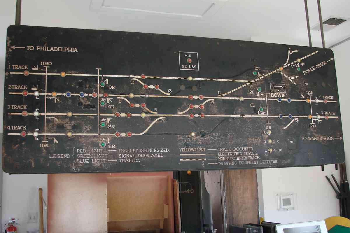
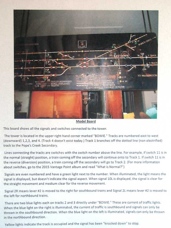
The model board shown in the main photo hangs inside the tower where one also finds its description as shown at right. That description has been copied below and edited for clarity.

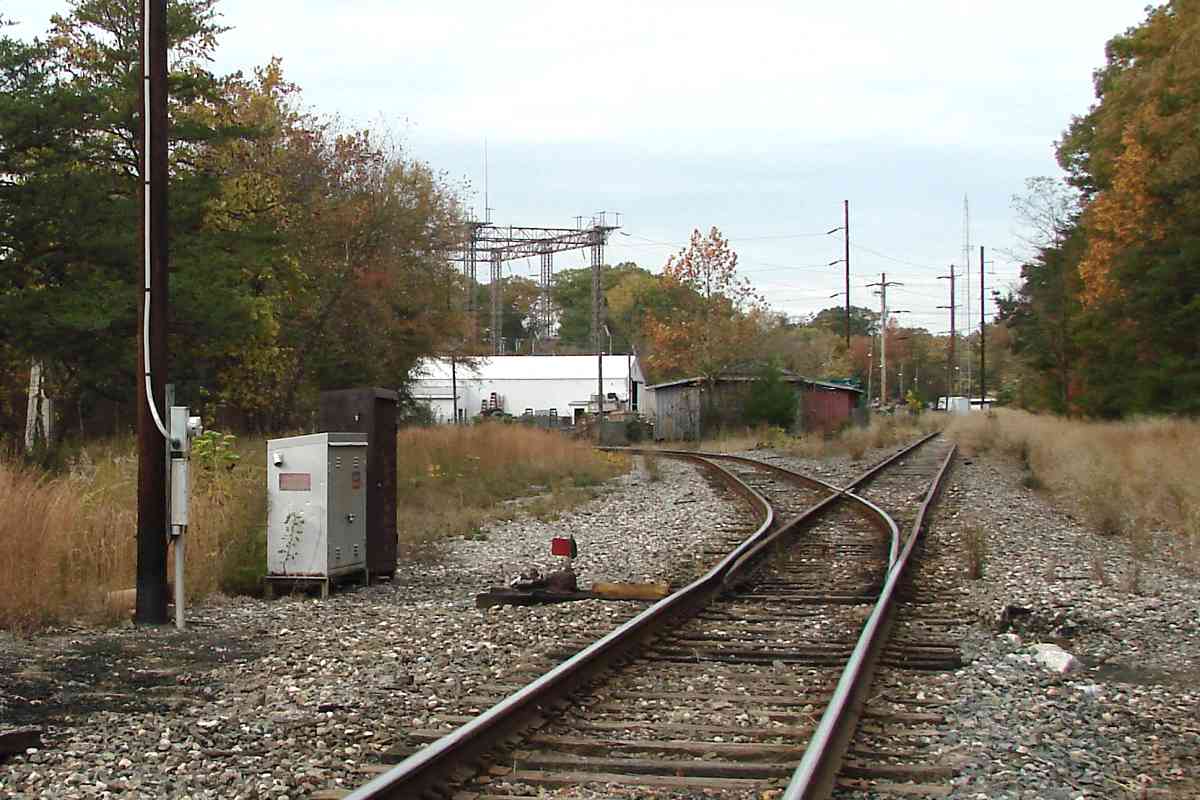
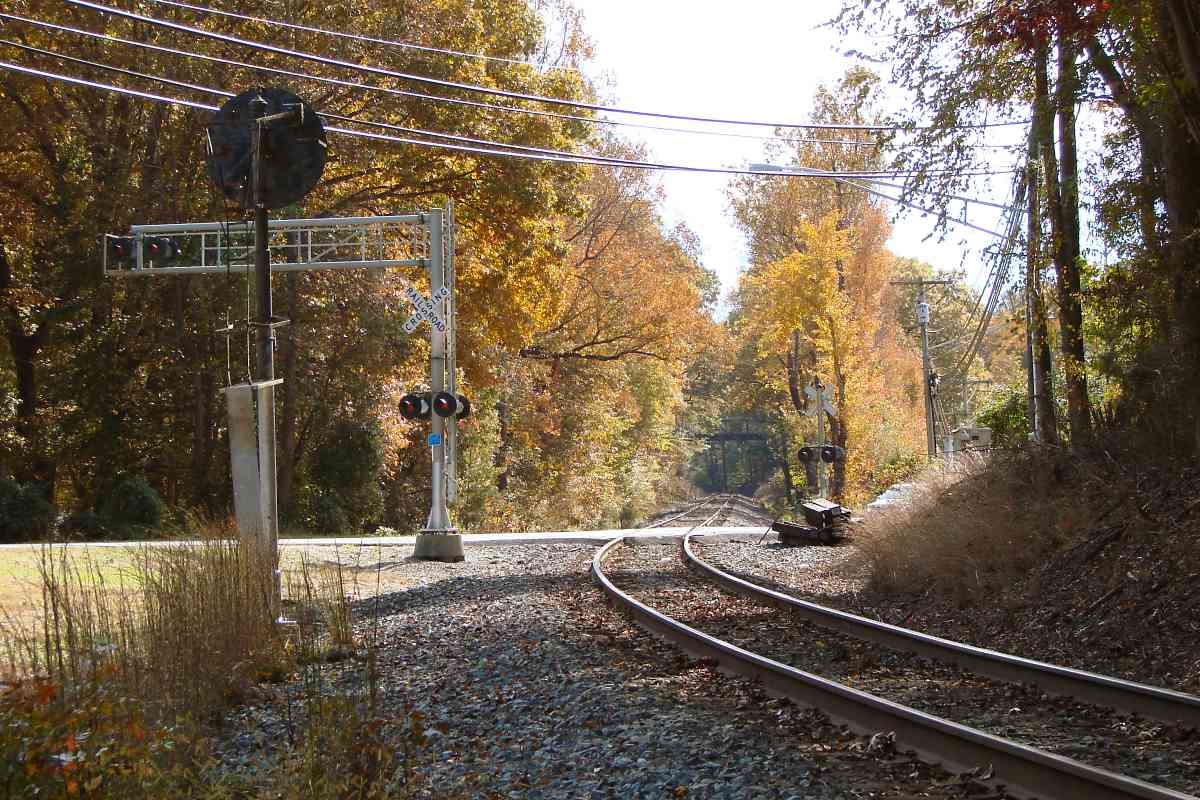
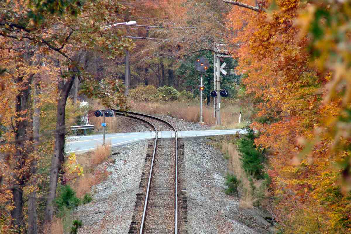
    The model board shows all signals and switches connected to the tower.

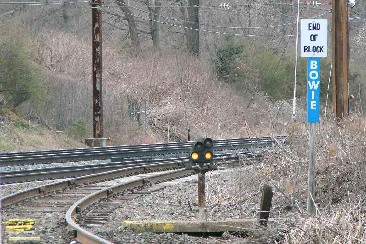
    The tower is depicted in the upper-right hand corner of the board, and marked "BOWIE". upper right 
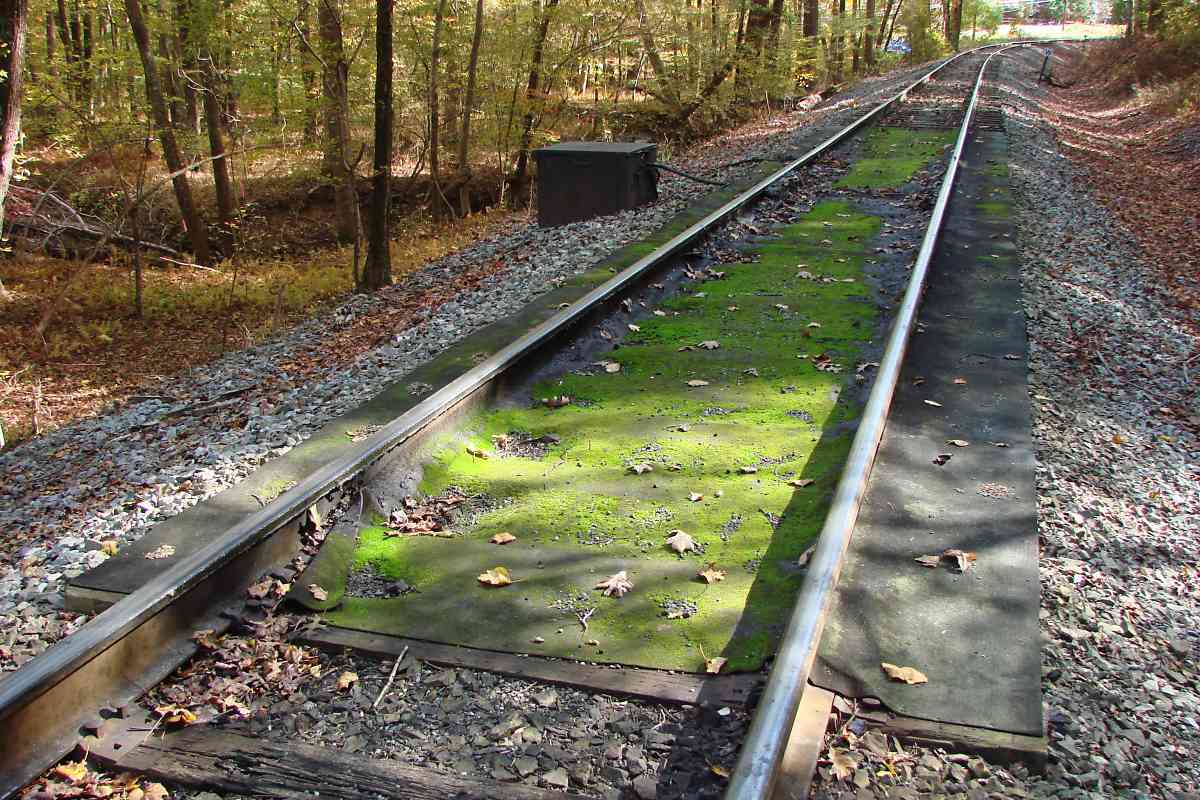
Tracks are numbered east to west (downward) 1, 2, 3, and 4. (Track 4 doesn't exist today.) Track 1 branches off the dotted line (non-electrified) track to the Pope's Creek Secondary.

    S-shaped white lines (best seen in main photo) between the four tracks depict switches with the switch number shown near that line. For example, if switch 11 is in its normal (straight) setting, a train approaching the tower from the Pope's Creek Secondary will continue onto Track 1. However, if switch 11 is in what is known as the reverse (diversion) setting, a train approaching the tower from the Pope's Creek Secondary will go to Track 2. For more information about switches, see Michael Ditkoff's Vantage Point: What Is Normal?

    lower left 
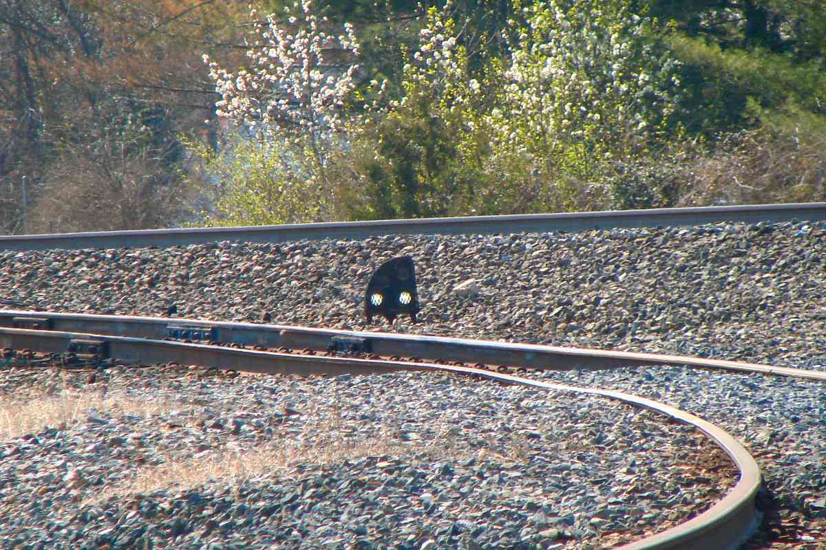
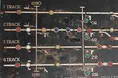
On the board, signals are assigned even numbers and have a green indicator light next to their number. When a signal is lit at the track, on the board its green light is illuminated, but that does not show the signal's aspect or "setting". For example, when signal 10L is lit, the signal is telling the train operator that the track is clear for straight movement forward, and medium clear for reverse movement.

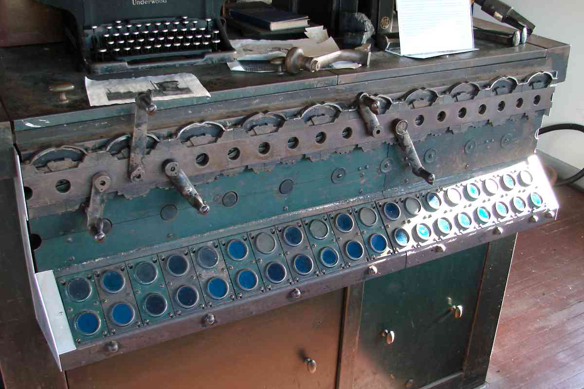
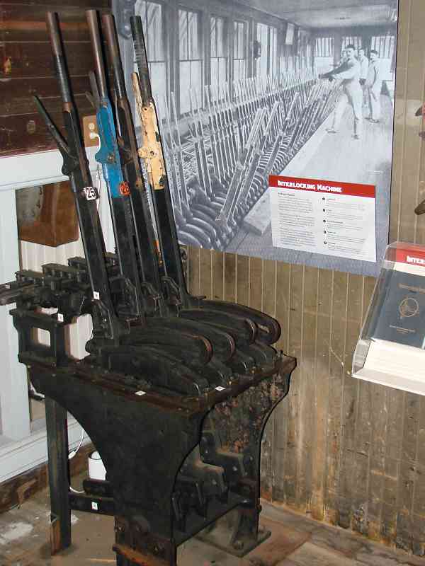
    For southbound trains, when the green indicator light for signal 2R is illuminated, that means lever #2 on the interlocking machine has been rotated to the right. Similarly, for northbound trains signal 2L being illuminated means lever #2 has been rotated to the left.

    Note the pairs of two blue lights on tracks 2 and 3 under "BOWIE". These are "current of traffic" lights. These remind the tower operator that trains on the corresponding mainline track are moving in a particular direction. When the blue light of a given pair on the right is illuminated, the "current of traffic" is moving to the right, in this case southbound, consequently signals can only be set for the southbound direction. When the blue light on the left is illuminated, signals can only be set for the northbound direction

    An illuninated yellow light indicates that track is occupied and the signal has been "knocked down", reduced, to a setting of stop.

Link: track diagram


Machine

Machine
Mile: 0.0 Date: Nov 2017
Ease: A- View: S
Area: B T6:
Map: PG 9 H 7 Topographic Maps

The levers referred to in the description of the model board are the ones on this interlocking machine. This is probably the actual machine that was last used in Bowie Tower. Along the NEC the PRR employed pneumatic switch machinery, which means when the operator changed a lever here, a signal was trasmitted to trackside air pumps that provided air pressure to move the track switch.


Levers

Levers
Mile: 0.0 Date: Nov 2017
Ease: A- View:
Area: B T6:
Map: PG 9 H 7 Topographic Maps

machine description Instead of pneumatics, many railroads installed mechanical interlocking machines where switch settings were changed by an operator pulling on a lever, called an armstrong lever, that was mechanically linked to the switch. The machine in this case is human-powered; the lever turns a crank, which turns a mechanical linkage of pipes from the tower to the actual track switch that can be hundreds of feet away.

The Bowie museum has on display these armstrong levers, used at HO Tower in Hancock, Maryland, the last Baltimore & Ohio RR tower to remain in operation. CSX closed it during 2010. Through 1986 the tower also was part of the country's last Morse code telegraph line.

Links: inside HO tower, levers at Miller Tower


Desk

Desk
Mile: 0.0 Date: Nov 2017
Ease: A- View: NW
Area: B T6:
Map: PG 9 H 7 Topographic Maps

Communication equipment from various eras is spread across the tower operator's desk.


Switch Board

Switch Board
Mile: 0.0 Date: Nov 2017
Ease: A- View: NW
Area: B T6:
Map: PG 9 H 7 Topographic Maps

switchboard Communication has always been as essential to the operation of a railroad as its locomotives. Sadly, this object, what appears to be the oldest of the equipment, is not described. It could be a rudimentary telephone switchboard, or perhaps an old way to set various signals. The larger, more modern box shown at right is a mid-20th Century telephone switchboard.


Telephone

Telephone
Mile: 0.0 Date: Nov 2017
Ease: A- View: NW
Area: B T6:
Map: PG 9 H 7 Topographic Maps

This telephone had been located about a mile southwest of Bowie at Springfield Crossing, site of the PRR's Springfield Station. Landline ringing voltage was -- and still is -- sufficient to deliver an unpleasant shock, hence the warning to not touch the metal portions of the telephone. telephone book

First on the call list was the Power Director, the person in charge of keeping the juice flowing and the trains running, as urged by a "Trains must run!" sign in his office. An article in the January 1937 issue of Popular Mechanics reports the NYC - DC line consumed 563 terawatts of electricity during the year (1936?), roughly the amount used by 500,000 average USA houses that year.


Amtrak 2025

Amtrak 2025
Mile: 0.0 Date: Nov 2017
Ease: A- View: SW
Area: B T6: 353
Map: PG 9 H 7 Topographic Maps

Traffic on the NEC as seen from Bowie Tower...

Previously the tower was closer to the tracks, on the concrete foundation AMTK 2025 is passing.

Links: ~1970, MARC 1978, CSX plus Amtrak 2007


Foundation

Foundation
Mile: 0.0 Date: Nov 2017
Ease: A- View: NE
Area: B T6: 389
Map: PG 9 H 7 Topographic Maps

That's Bowie Tower (as part of the museum) on the right. Lots of wiring to signals and switches ran under the tower as evidenced by these cut cables at the tower's operational location. disused wiring

The track at right represents what had been B&P's initial main line, but what is now a rarely used leg of the wye with the Popes Creek Subdivision.

A sign at the museum displays "Huntington City - Where Bowie Began". Also appropriate, in more a logistical than temporal sense, would be "Huntington City - Where the Northeast Corridor Began". During 1872. B&P's first train operated along the line to Washington rather than the one to Southern Maryland.

Unlike B&O, B&P did not have to pay a portion of its passenger fees to Maryland, and was thus able to offer lower fares. Passenger levels would never be the same for B&O, and even today the ex-B&P, ex-Pennsy route is the one used by Amtrak for passenger service, and the ex-B&O route is the one used by CSX for freight.

Links: hi-rail 1975, ~1980 photos, DH 7616


Pedestal Signal
Photo courtesy Dave Hiteshew

Pedestal Signal
Mile: 0.0 Date: Mar 2019
Ease: B+ View: NE
Area: B T6:
Map: PG 9 H 7 Topographic Maps

A pedestal signal regulates the wye's less-often used leg. The Bowie sign's white-on-blue color scheme is a reminder the Popes Creek line sublimed from Conrail to CSX. Conrail? CSX? See the next photo and description.


Informal

Informal
Mile: 0.0 Date: Nov 2017
Ease: A- View: E
Area: B T6:
Map: PG 9 H 7 Topographic Maps

Changes in transportation after World War II led to the bankruptcy of many eastern US railroads, including the Pennsylvania / Penn Central. To preserve the vital transportation corridors of these railroads, during the 1970s the US government formed Conrail. About 20 years later CSX and Norfolk Southern jointly purchased Conrail then divided its assets between them.

Ironically, upon this division the Popes Creek line that had played a key role in breaking B&O's monopoly on service to Washington, DC wound up in the hands of B&O-successor CSX. The line is not physically connected with the rest of CSX's network, but CSX has rights to operate trains along Amtrak's Northeast Corridor in order to reach this spot.

Where the NEC meets CSX's Popes Creek Subdivision there are no guard houses, no gates, and no razor wire. Instead there's some paint and informal chalk marks. "Conrail" was both figuratively and, as seen in the photo, literally erased.

Link: CSX on NEC


Low Boy
Photo courtesy Marty Hager

Low Boy
Mile: 0.0 Date: May 2010
Ease: A- View: SE
Area: B T6:
Map: PG 9 H 7 Topographic Maps

A low boy car carries a tall transformer for a Southern Maryland power station, either Morgantown or Chalk Point.

Link: at Chalk Point 1984


CSX 811
Photo courtesy Marty Hager

CSX 811
Mile: 0.0 Date: Jun 2007
Ease: A- View: W
Area: B T6:
Map: PG 9 H 8 Topographic Maps

This, the south leg of the wye, is used more often since CSX's coal trains arrive here via Washington, DC while on their way to the power plants.

This SD80MAC unit has had more numbers than a roulette wheel. It had been CR 4125, but the yellow-digits on the side tell us CSX gave it a new number. Later this unit would be renumbered to 4601, then repainted into CSX livery. A few years later, CSX sold it to Norfolk Southern, who renumbered it to 7227, and reportedly sold it to Canadian Pacific during 2020.

Links: as CR 4125, as CSX 811, as NS 7227


Dwarf Signal

Dwarf Signal
Mile: 0.0 Date: Apr 2019
Ease: B+ View: W
Area: B T6:
Map: PG 9 H 7 Topographic Maps

The busier leg of the wye gets this dwarf PRR-style signal. There aren't many of these to be found along the Penn Line, in fact this might be the only example.


Switch

Switch
Mile: 0.2 Date: Nov 2017
Ease: A- View: N
Area: B T6:
Map: PG 9 H 8 Topographic Maps

Pettibone Where the wye's two legs meet, a Pettibone Mechanical Switchman automatically realigns its switch by the weight of the cars passing near it. This is the only installation of it I have found in Maryland.

If commuter service is added along the Popes Creek line, this switch, indeed the whole wye, probably would be reconfigured.

Links: 1977, study of adding commuter service (PDF)


Zug Road

Zug Road
Mile: 0.2 Date: Nov 2017
Ease: A- View: S
Area: B T6:
Map: PG 9 H 8 Topographic Maps

flattened nickel If you've ever wondered what happens to a nickel when a long coal train rolls over it, now you know. Actually this looks like more metal than found in a nickel. Coins on the rails can damage railcar wheels, plus can squirt out at high speed and injure someone trackside.

CSX's blue sign reports this grade crossing is at milepost QP 0.1 but in reality it is QP 0.2. No doubt heads willl roll at the signage department.


Water Tower

Water Tower
Mile: 0.7 Date: Oct 2018
Ease: B View: SE
Area: B T6:
Map: PG 9 H 9 Topographic Maps

This is Maryland's most-complete, surviving PRR water tank installation. The tank itself is gone, but its concrete footings remain, along with piping that carried water up from Newstop Branch creek below.

The forging date on the rails here is 1967. In a way, the Popes Creek line is a living railroad museum, stocked with artifacts that on the NEC proper were torn out or buried decades ago.


Newstop Branch Bridge

Newstop Branch Bridge
Mile: 0.7 Date: Oct 2018
Ease: B View: E
Area: B T6:
Map: PG 9 H 9 Topographic Maps

There's a good chance this is a B&P original, unmodified, circa 1870 bridge. Some maps give this stream's name as Newstep Branch.

Surface water like this was preferred for steam engines because it typically contains less pipe-clogging minerals than does well water.


Leaf

Leaf
Mile: 0.8 Date: Oct 2018
Ease: B View: NE
Area: B T6:
Map: PG 9 H 9 Topographic Maps

Unlike coins, autumn leaves do not get pounded into thinner, longer versions of themselves, instead the most recently passing CSX coal train impressed this leaf, and many others, to the rails.


Mossy Greaser

Mossy Greaser
Mile: 0.9 Date: Oct 2018
Ease: B View: SE
Area: B T6:
Map: PG 9 J 9 Topographic Maps

greaser actuator To do its thing, this grease dispenser relies on the pressure of the flanges of passing wheels.

Milepost 1 is at distant right. The line is over 45 miles in length but for now we're touring only the first few.


Chestnut Avenue

Chestnut Avenue
Mile: 1.0 Date: Oct 2018
Ease: A- View: S
Area: A T6:
Map: PG 9 J 9 Topographic Maps

Autumn colors were out in full force at the Chestnut Avenue grade crossing. In this area autumn color usually peaks a few days either side of November 1st. The distant bridge over the line belongs to the WB&A Trail.


Approach Restricting

Approach Restricting
Mile: 1.1 Date: Nov 2017
Ease: A View: N
Area: A T6:
Map: PG 9 J 10 Topographic Maps

signal head Though CSX now controls this line, traffic is so limited that the company has never seen fit to give it a makeover. Luckily for us that means this Pennsy style signal, the only one on the line, remains extant. It's a one trick pony, displaying "restricting" all the time. It is easily seen from the Chestnut Avenue / Highbridge Road grade crossing.

Link: 2003 with train


Stone Arch

Stone Arch
Mile: 1.2 Date: Nov 2017
Ease: A View: E
Area: A T6:
Map: PG 9 J 10 Topographic Maps

Also easily seen from Highbridge Road a short distance south of the signal above is this fine stone arch bridge over Horsepen Branch built by B&P during the 1870s.


WB&A

WB&A
Mile: 1.3 Date: Nov 2017
Ease: B+ View: N
Area: A T6:
Map: PG 9 J 10 Topographic Maps

When during the early 20th Century the Washington, Baltimore and Annapolis Electric Railway (WB&A) built a "showpiece" interurban rail line connecting Washington and Baltimore, it minimized grade crossings through the use of bridges, such as one over the Popes Creek line.

Though that bridge has since been replaced by one for the WB&A trail, there remains an excellent view back to Highbridge Road. The white-painted tie (photo's lower center) marks the location of the stone bridge over Horsepen Branch.

Change for: WB&A tour at this site


Collington Siding

Collington Siding
Mile: 2.7 Date: Apr 2019
Ease: A- View: S
Area: B T6:
Map: PG 14 A 13 Topographic Maps

Continuing south, the first siding encountered is this 5200-foot one at Collington. It is one of just two passing sidings on the line.

Note the water on the right. When CSX inherited the Popes Creek line it also inherited poor drainage that likely originates with subpar B&P design. Prority was instead being given to the "branch" to Washington.

Link: 1991


CSX 5320

CSX 5320
Mile: 2.8 Date: Apr 2019
Ease: B View: SE
Area: B T6:
Map: PG 15 A 1 Topographic Maps

On the siding CSX 5320 and CSX 5459 were idling, apparently waiting for a train to pass. The line meets FRA Class III standards, limiting train speeds to a maximum of 30 mph. Most of the few trains that operate along the line do so at night so as to avoid clogging the NEC during busier hours.


Milepost 3

Milepost 3
Mile: 3.0 Date: Oct 2018
Ease: B+ View: S
Area: B T6: 349
Map: PG 15 A 1 Topographic Maps

Collington Station had been on the left.


yellow tie

Yellow Tie
Mile: 3.0 Date: Oct 2018
Ease: B+ View: W
Area: B T6:
Map: PG 15 A 1 Topographic Maps

Old Annapolis Road almost shadows a yellow-painted tie that tells RR personel to not leave any equipment between the tie and the nearest switch because the tracks are so close doing so might foul the adjacent track.


2014 Derailment
Photo courtesy Marty Hager

2014 Derailment
Mile: 3.3 Date: May 2014
Ease: B View: S
Area: B T6:
Map: PG 15 B 3 Topographic Maps

This is what you get when you combine a heavy train with poorly-drained trackage and an abnormally rainy spring. Note the coal hopper sunk into the muck on the right.

This derailment happened within a week of 2014's retaining wall collapse at 26th Street along the ex-B&O Belt Line in Baltimore.

Link: more derailment pics
Change for: Baltimore Belt Line tour at this site


Piped Culvert

Piped Culvert
Mile: 4.3 Date: Apr 2019
Ease: B View: S
Area: B T6: 350
Map: PG 15 B 4 Topographic Maps

Subsequent to the derailment, CSX added this piped culvert, but water still ponds trackside in this vicinity.

That's a US 50 overpass ahead. Farther down the line, PRR customers had included Marlboro Implement Company, E. J. O’Brien Company, Maryland Tobacco Packing, and La Plata Mill & Supply. The line connected with the now-defunct Brandywine & Cedar Point Railroad.

At Brandywine, Maryland the line splits, with CSX's Herbert Subdivision leading to the Chalk Point power station, and the main continuing to the Morgantown station. With coal out of favor as a fuel, coal burning at both plants seems likely to end before long, after which there will be little need for rail service along the Popes Creek Subdivision.

On the next page the tour resumes back at the main line.

Link: Brandywine & Cedar Point Railroad


<< Previous (north) | THIS PAGE: Bowie and Popes Creek | Next (main line, south) >>

Or, return to main page

Copyright Notice