TrainWeb.org Facebook Page
PRR / Amtrak Photo Tour


PRR / Amtrak in Maryland
Modern day photo tour

Accompanying each photo below are:

Click a photo to see a larger view. Please send your comments and corrections to Steve.


Special Note: >>> The places described on this page host quiet, high-speed trains. Stay well clear! <<<

<< Previous (northeast) | THIS PAGE: Brentwood to K Tower | Next (south) >>

Stack

Stack
Mile: 134.6 Date: Dec 2018
Ease: A View: NW
Area: C T6:
Map: DC 10 F 11 Topographic Maps

The (disused?) power house and its stack have remained standing. To the left of it is the only train coaling tower still standing in the region.

The bi-level coaches at distant right belong to Virginia Railway Express.


VRE V713

VRE V713
Mile: 134.6 Date: Dec 2018
Ease: A View: SW
Area: C T6:
Map: DC 10 F 11 Topographic Maps

Virginia Railway Express coaches enjoy a quiet siesta before southbound commuters at Union Station pile on for the evening rush home to the Old Dominion State.


Amtrak 562

Amtrak 562
Mile: 134.6 Date: Jul 2005
Ease: A View: SW
Area: C T6:
Map: DC 10 F 11 Topographic Maps

Switcher 562 sits idle between the power house and Amtrak's Coach Yard Building. In the distance the Washington Monument stands tall.


Custom CPL
Photo courtesy Dave Hiteshew

Custom CPL
Mile: 134.8 Date: Sep 2008
Ease: B View: NE
Area: C T6:
Map: DC 10 E 12 Topographic Maps

The signals facing this direction are of ordinary Pennsylvania RR signals by Jersey Mike style, but those opposite are B&O-style Color Position Light (CPL) signals custom crafted from PRR parts (view at left courtesy Todd Sestero). This interesting, perhaps unique, combination arose from the shared route into Union Station. Though the two closest tracks are ex-PRR, now Amtrak, B&O/MARC trains are sometimes switched onto them to facilitate access to all passenger platforms at Union Station.

Note also there are 2 tracks under the signals, but the signals are shifted to one side rather than being back to back. This was a common PRR practice ostensibly to make the signals more visually associated with their corresponding track. That's the 9th Street bridge in the background.

Link: more pics


New York Avenue Bridge
Photo courtesy District Department of Transportation (DDOT) Library

New York Avenue Bridge
Mile: 134.9 Date: Sep 1966
Ease: C View: SW
Area: C+ T6:
Map: DC 10 E 12 Topographic Maps

dwarf CPL on pole C Tower 
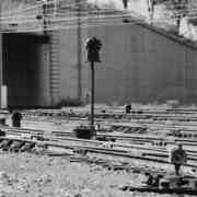
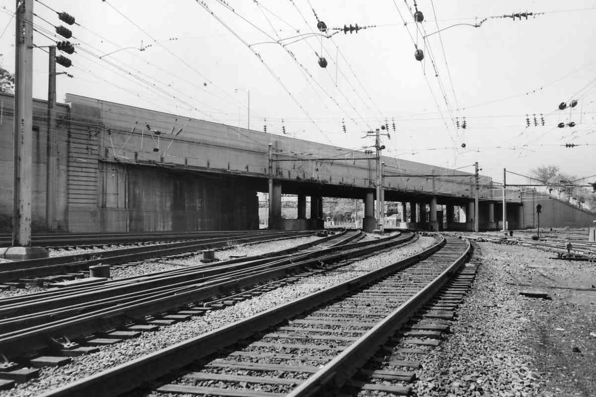
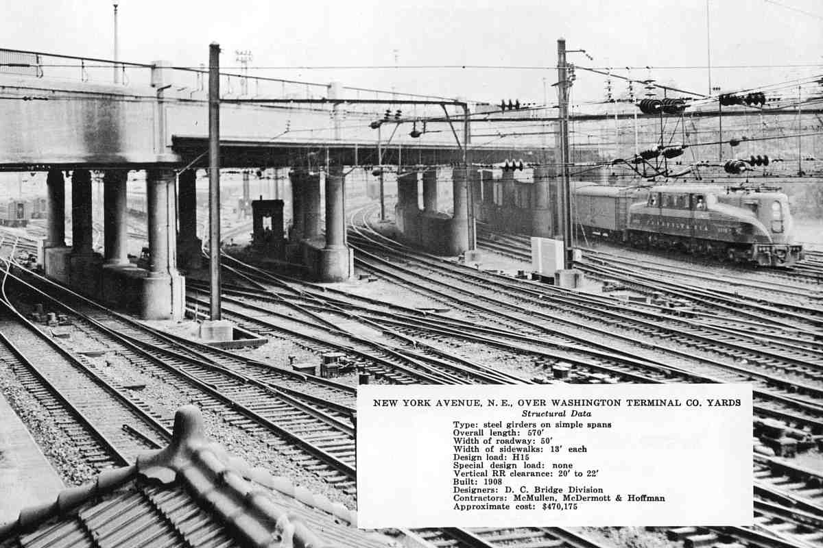
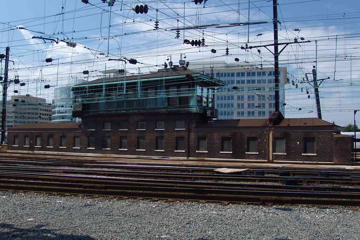
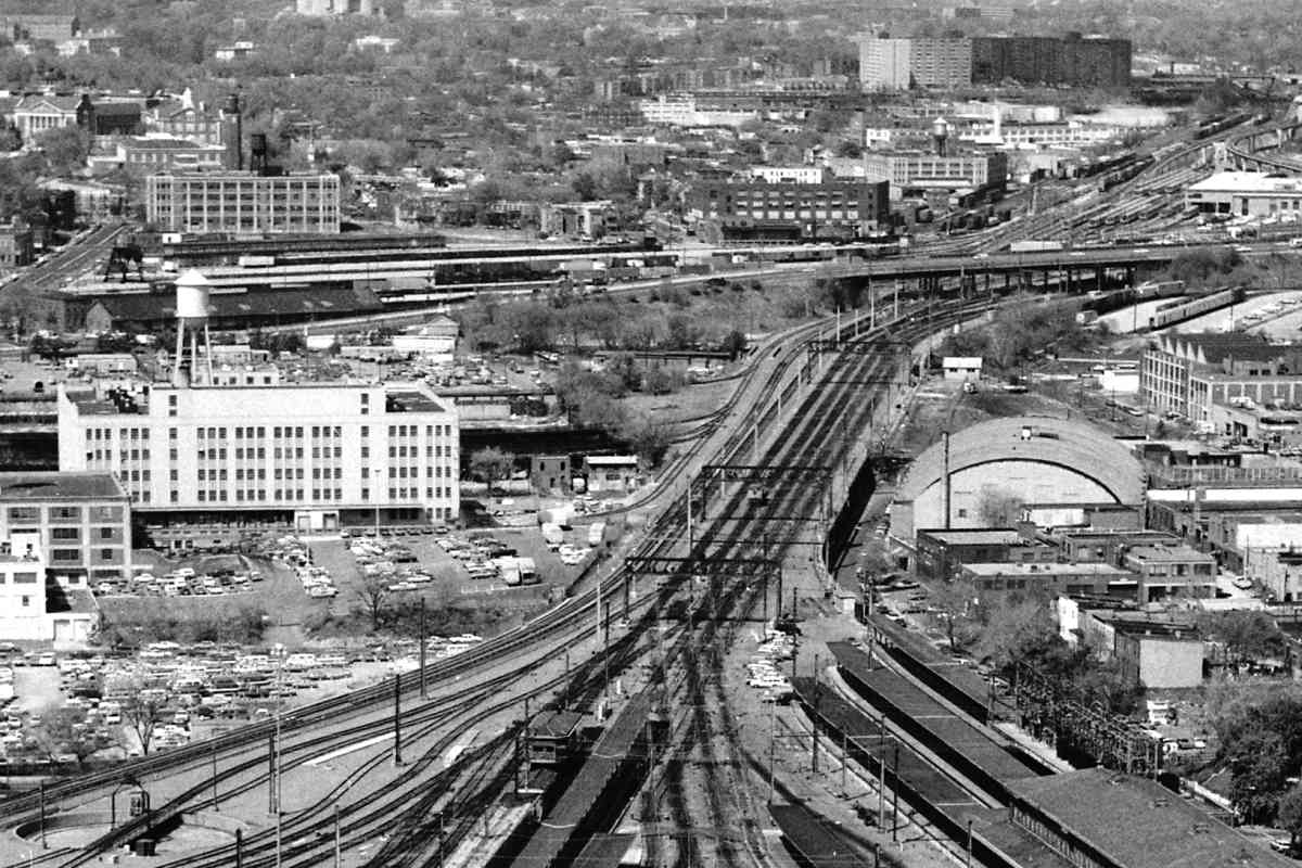
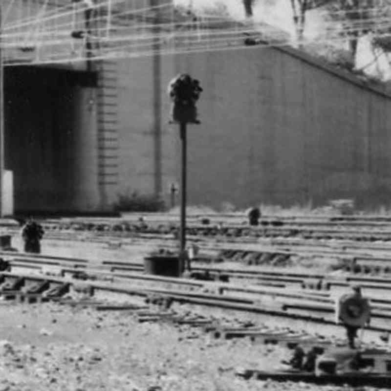
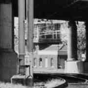
Here the yard tracks neck down to squeeze under New York Avenue. This 1966 track-level photo captured the bridge before it was widened. Beyond the bridge supports, the photo also captured C Tower that was demolished around 1970 to make room for Metro.

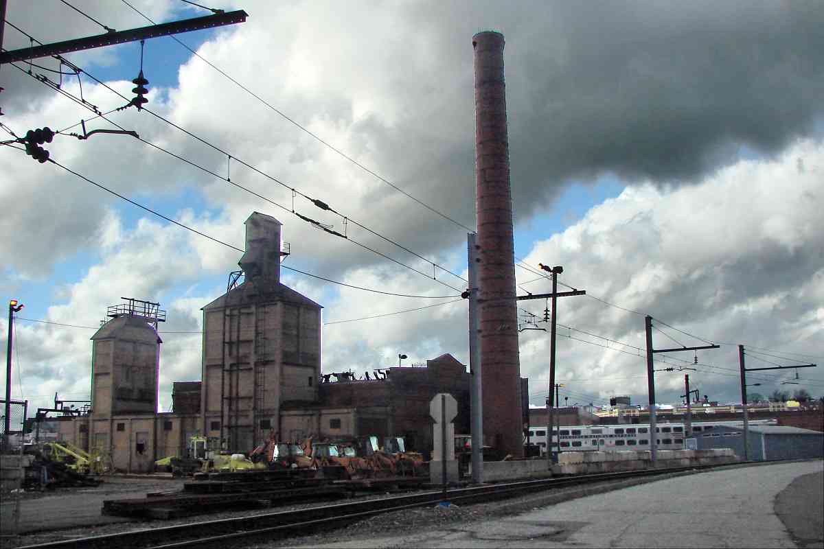
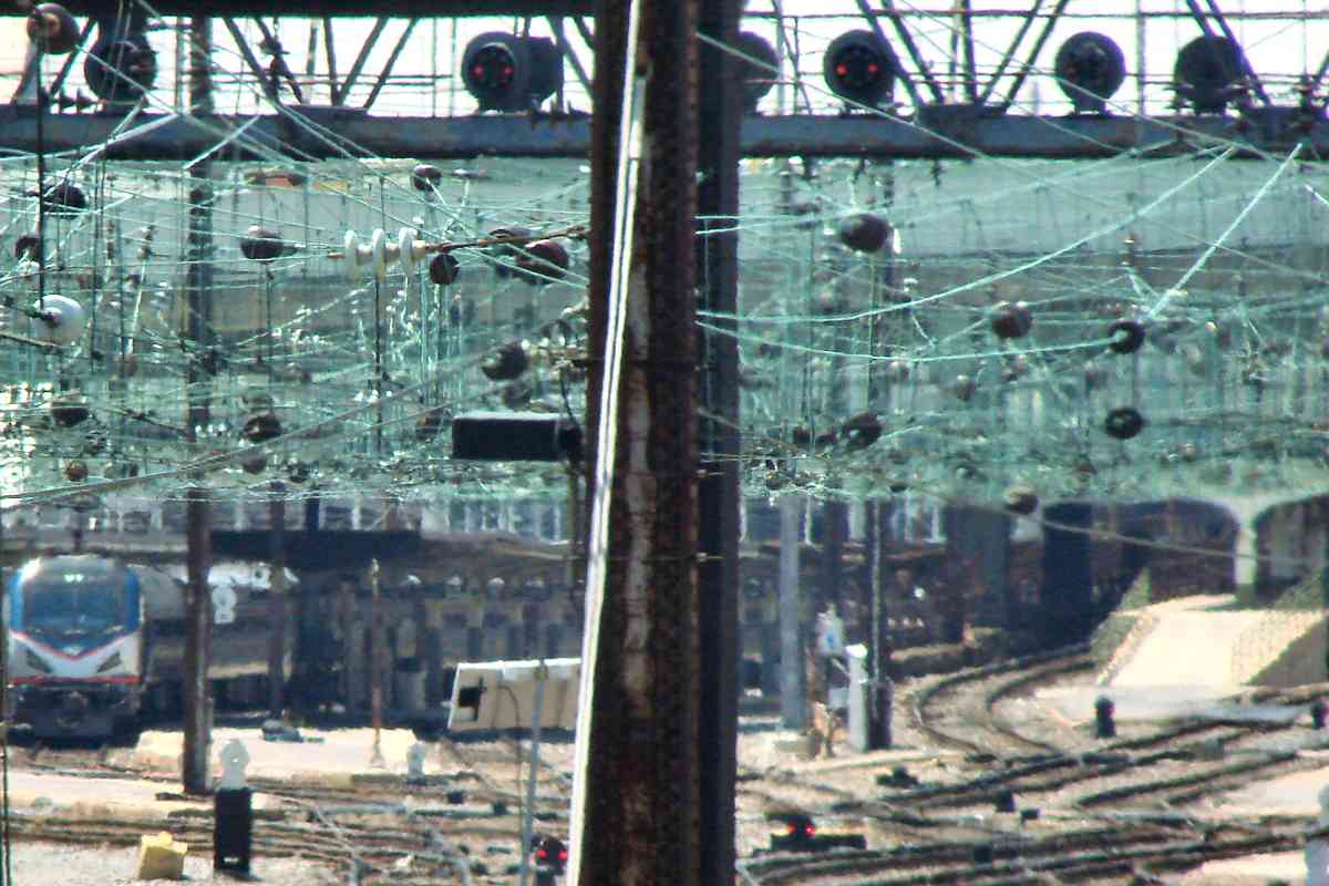
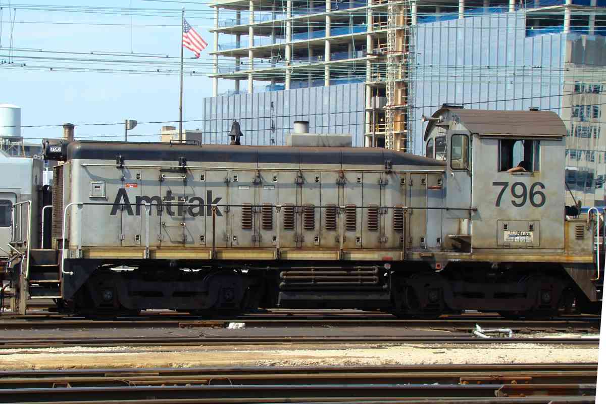
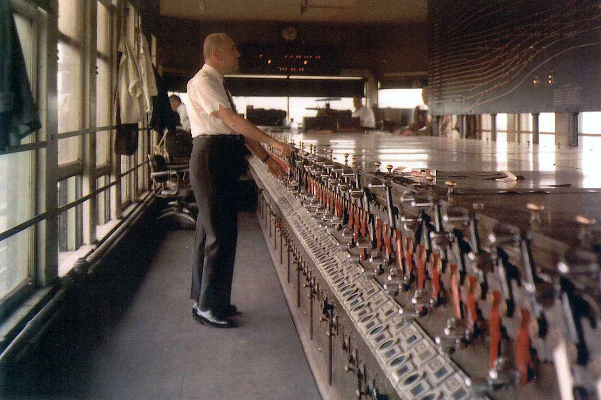
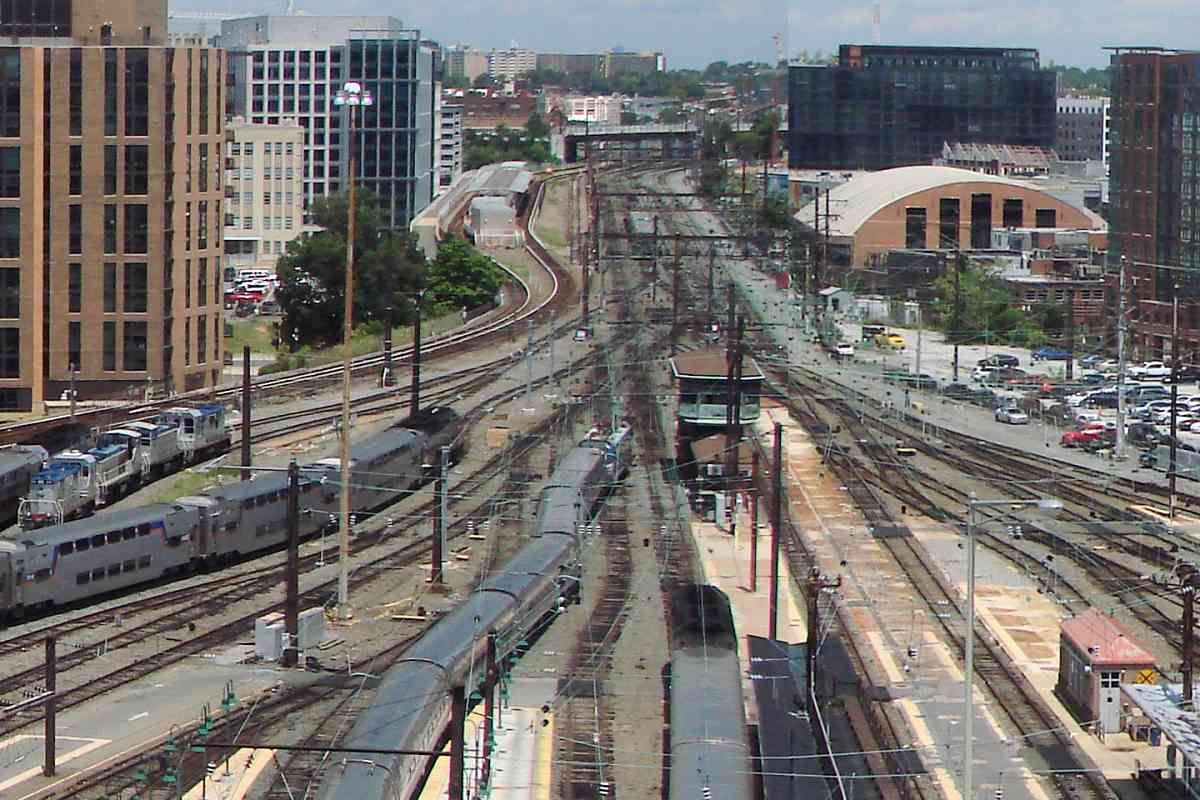
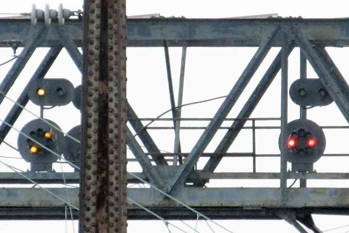
In their joint control of Washington Terminal Company, PRR had priority in track layout, and B&O with signals. This helps explain why PRR/Amtrak has better access, while the signals even during 2019 
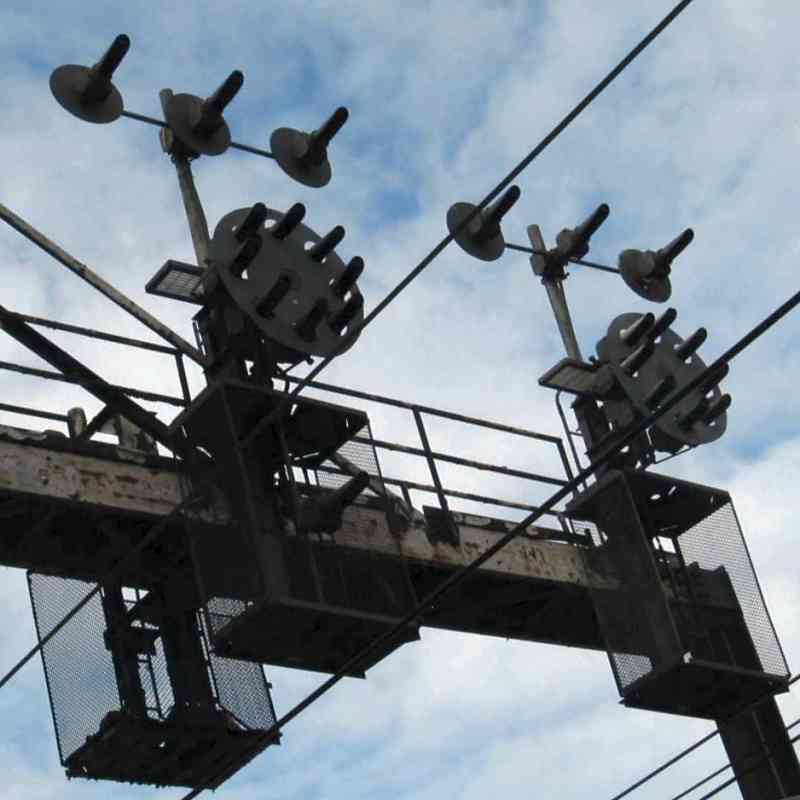
employ a B&O Color-Position Light (CPL) style. There are/were dozens/hundreds of dwarf CPLs around the terminal, including some mounted high on poles, as in the zoom at right. Now, security cameras may outnumber the signals in this area.

Links: DDOT source photo, C Tower 1967, B&O Eckington Yard 1923


Reverse View 1967
Photo courtesy District Department of Transportation (DDOT) Library

Reverse View 1967
Mile: 135.0 Date: May 1967
Ease: B View: NE
Area: C+ T6:
Map: DC 10 E 12 Topographic Maps

The overpass widening effort was in full swing a year later. This is the reverse view over the stretch this page has toured so far. In the distance is the power house stack, left of photo center. B&O's Eckington Yard is off photo left, with a corner of its Freight Station making it into the photo.

Link: DDOT source photo


Reverse View 2008
Photos courtesy Dave Hiteshew

Reverse View 2008
Mile: 135.0 Date: Sep 2008
Ease: B View: NE
Area: C+ T6: 358
Map: DC 10 E 12 Topographic Maps

This was the scene about 40 years later, with Ivy City to the right and Metro's Brentwood shops on the left. Between them pneumatic switch snakes the ex-B&O now CSX Metropolitan Subdivision as marked by the B&O's signature round-faced CPL signals left of photo center, this side of the power house stack.

All the non-Metro area is considered part of Washington Terminal. Distinctive US&S canister purge valves (CP valves) are found at each pneumatic switch, as illustrated at right.

Link: NEC 1979


From New York Avenue
Photo courtesy Dave Hiteshew

From New York Avenue
Mile: 135.0 Date: Sep 2008
Ease: B View: SW
Area: C+ T6:
Map: DC 10 E 12 Topographic Maps

Looking forward again... the Penn Line and Camden (CSX Capital Sub) lead to the three nearest tracks. The others come from Amtrak's Coach Yard at Ivy City, CSX's Metropolitan Sub, and DC Metro's Red Line. Note the verdigrised ground wires attached to the road's fence, perhaps needed due to the proximity of catenary.


Capitol
Photo courtesy Dave Hiteshew

Capitol
Mile: 135.0 Date: Sep 2008
Ease: B View: S
Area: C+ T6: 364
Map: DC 10 E 12 Topographic Maps

One can glimpse the Capitol from farther west on the New York Avenue bridge. On the right is Metro's NoMa-Gallaudet U stop, the system's first infill station; NoMA = North of Massachusetts Avenue. The distant tall structures this side of the Capitol belong to Union Station.


Florida Avenue
Photos courtesy Dave Hiteshew

Florida Avenue
Mile: 135.1 Date: Sep 2008
Ease: A View: N
Area: B- T6:
Map: DC 10 D 13 Topographic Maps

Metro right-of-way disk At the north end of the Metro station, Florida Avenue scoots under. Lighter color stonework shows the abutments were extended west (left) to support the additions of the Metropolitan Branch Trail, and Metro. Metro stakes its claim via right-of-way disks like that at left.

Above at right, all rail traffic to/from Union Station, not counting Metro, bottlenecks through 4 tracks, the fewest since the east end of Ivy City.


Sea Green

Sea Green
Mile: 135.3 Date: Jul 2019
Ease: B View: S
Area: B T6:
Map: DC 10 E 12 Topographic Maps

Ordinarily, one might expect an excellent view from that NoMA Metro station to the back of Union Station, but instead this is the cluttered reality. As the tracks approach the station and bifurcate, so does the catenary as it weaves a sea of greening copper wires. Somehow train operators gaze past the wires to signals above.


Signal Bridge
Photo courtesy Dave Hiteshew

Signal Bridge
Mile: 135.4 Date: Sep 2008
Ease: A- View: NW
Area: B- T6:
Map: DC 10 E 12 Topographic Maps

signals courtesy Todd Sestero What's called the H Street signal bridge is actually closer to L Street. Washington Terminal has its own version of B&O Color Position Signals, smaller ones, in fact the CPLs mounted above might be the dwarf variety. It's difficult to be sure without climbing up there to measure, and upon most recent check, for some reason they weren't letting railfans do that.

Link: 1970s


K Tower
Photo courtesy Dave Hiteshew

K Tower
Mile: 135.5 Date: Sep 2008
Ease: B View: W
Area: B- T6: 365
Map: DC 10 D 13 Topographic Maps

Those signals are/were controlled from K Tower, the primary control point for trains near Union Station. K Tower might not survive the 2020s as real estate developers seek to build here over the tracks.

Link: discussion of track control here


From K Tower
Photo courtesy Library of Congress

From K Tower
Mile: 135.5 Date: ~1910
Ease: View: SW
Area: T6:
Map: DC 10 D 13 Topographic Maps

The view from K Tower is sweet, and these days it's even in color. Before the CPL signals, semaphore arms angled every which way.

Links: 1910 NE view, 1914 NE view, 1921 N view


K Tower 1909
Photo courtesy Library of Congress

K Tower 1909
Mile: 135.6 Date: 1909
Ease: A- View: NE
Area: B T6:
Map: DC 16 D 1 Topographic Maps

This tangle of tracks was barely 2 years old at photo time. Note the turntable at left.

Links: LoC source photo, turntable 1923


K Tower 1977
Photo courtesy Library of Congress

K Tower 1977
Mile: 135.7 Date: 1977
Ease: A- View: N
Area: B T6:
Map: DC 16 D 1 Topographic Maps

That turntable endured into the 1970s, but not much beyond. At distant center and left is the B&O Freight yard that lasted into the 1980s, and Metro to its right.

Link: LoC source photo


K Tower 2019

K Tower 2019
Mile: 135.7 Date: Jul 2019
Ease: A- View: NE
Area: B T6: 362
Map: DC 16 D 1 Topographic Maps

This complex track layout is simpler than it was 100 years prior... one of the old photos linked below was snapped from roughly the same location. That's K Tower near the center.

K Street runs beneath K Tower as one of several grade-separated streets behind Union Station. On the next page, we'll look at those streets as well as their railroad-related items, such as streetcars and a Railway Express Agency office.

Links: 1920, 1920s


<< Previous (northeast) | THIS PAGE: Brentwood to K Tower | Next (south) >>

Or, return to main page

Copyright Notice