TrainWeb.org Facebook Page
Old Main Line Photo Tour


B&O Old Main Line
Modern day photo tour

Accompanying each photo below are:

Click a photo to see a larger view. Please send your comments and corrections to Steve.


<< Previous (east) | THIS PAGE: West Loop | Next (west) >>

Map - West

Map - West
Mile: Date: Jan 2005
Ease: View:
Area: IC2: 352
Map: Topographic Map

B&O's alignment in this area changed so many times that a map is a necessity. The area from Mt. Airy west to near Monrovia is depicted here.

This map represents data from Harwood (1979), USGS maps (1945 and 1980), and aerial photos (1938, 1980, 2018) combined with research from my hiking and photographing the area many times over the course of several years.

The alignments are depicted on the map by colors that indicate the date of opening. The same colors are overlaid on some of the photos below to assist visualizing the route.


Mt. Airy Station, East

Mt. Airy Station East
Mile: 2.0, 12:00 Date: Jul 2000
Ease: A View: E
Area: A IC2: 342
Map: Ca 32 C 1, Ho 2 C 2 Topographic Maps

Resuming where we left off the Mt. Airy Loop tour, here's the station again, this time looking from west to east. Cracks in Main Street's asphalt pavement suggest old rails are hiding underneath.


Caboose Delivery
Photo credit David DeMay
NEW! late-Aug 2019

Caboose Delivery
Mile: Date: Feb 2016
Ease: A View: E
Area: A IC2:
Map: Ho 2 H 7 Topographic Maps

Truck trailers by rail? Boring! Cabooses by truck? Now we're talking.

Fresh from refurbishment at the B&O Museum in Baltimore, Mt. Airy's caboose hitched a ride west along Interstate 70.


Caboose Installed
Photo credit David DeMay
NEW! late-Aug 2019

Caboose Installed
Mile: 2.0, 12:00 Date: Feb 2016
Ease: A View: S
Area: A IC2:
Map: Ca 32 C 1, Ho 2 C 2 Topographic Maps

The crew from Digging & Rigging stands proudly at another completed project.

Mt. Airy's former B&O station now has the company of a relative, B&O caboose C-2095.


Refurbished Caboose

Refurbished Caboose
Mile: 2.0, 12:00 Date: Jun 2016
Ease: A View: E
Area: A IC2: 342
Map: Ca 32 C 1, Ho 2 C 2 Topographic Maps

Bright sun of a fine June day brings out the colors.

Previously adjacent this site on the left was Runkles Mill which was destroyed by one of a series of fires in the town between 1905 and 1925. It was followed by the Mount Airy Milling Company.


End

End
Mile: 2.1, 12:00 Date: Oct 2004
Ease: B View: E
Area: B+ IC2:
Map: Ca 32 C 1, Ho 2 C 2 Topographic Maps

Not quite as constant as the northern star, but still a comforting relic of the past, the only then-surviving stretch of the Loop's double track was to be found here behind Mt. Airy Cold Storage. Before the facility closed both tracks served as sidings to host the occasional boxcar. Since the time of this photo these tracks have been pulled up.

This view looks back toward the brick station, which can be glimpsed through the trees (it's the building beyond the minivan). The forging date of the rails ranges from 1905 to 1915.


Mt. Airy Cold Storage

Mt. Airy Cold Storage
Mile: 2.2, 12:00 Date: Oct 2004
Ease: B View: NW
Area: B+ IC2:
Map: Fr 33 D 13, Ca 32 C 1 Topographic Maps

A Union Pacific reefer (refrigerated boxcar) awaits unloading at Mt. Airy Cold Storage.

The Frederick - Carroll county border crosses right about here. It had followed an old road that connected Hill St. and Buffalo Rd. but at the request of the railroad, that road was removed, and rebuilt as Main Street adjacent to the new depot on Henry Bussard's land. Mr. Bussard knew how to work the system.


Switcher

Switcher
Mile: 2.3, 12:00 Date: Oct 2004
Ease: A View: NW
Area: A IC2:
Map: Fr 33 C 12, Ca 32 C 1 Topographic Maps

The storage facility saw enough train action to warrant their own switcher.

This is the former Upper Merion & Plymouth (Bethlehem, Pennsylvania) unit 9007 still wearing its UM&P paint scheme.

Link to older picture: prior switcher 1995, newer switcher 1995


Clickety Clack

Clickety Clack
Mile: 2.3, 12:00 Date: Oct 2004
Ease: A View: W
Area: A IC2:
Map: Fr 33 C 12, Ca 32 C 1 Topographic Maps

Since customers on the line were few, and as of Summer 2007 Mt. Airy Cold Storage closed, CSX never saw fit to replace the jointed track on the Loop, its segments obvious on this curve just west of Hill Street. In the forground the overly wide ties are evidence a switch once had occupied this spot.

In 1839 the Loop was originally laid with H rail, a considerable upgrade from the thin strap rail which still had been in use on much of the OML.

Reader Jeremy Leftwich contributed this correction in 2007:

    "There's a second customer that is served on the Mt. Airy branch - Willard Chemical, just off of Rising Ridge Road. From what I can gather, they typically receive a few (i.e. 2-4) tank cars every two days. CSX locals B712, D787, and (on occasion, D786) serve Willard and the Cold Storage Facility. I've caught D787 (Brunswick to Mt. Airy) returning from the branch a couple of times. When it has work at the Mt. Airy branch, it will usually be after 11:00pm. The crew had to flag the crossing, and drop flares at Rt. 144 (which is known as Old National Pike)."


Overgrowth

Overgrowth
Mile: 2.8, 11:00 Date: Jul 2014
Ease: B+ View: SW
Area: A IC2:
Map: Fr 33 B 13, Ho 2 B 3 Topographic Maps

After progressing west through a small cut, the tracks hang along the edge of a hill, but without maintenance are subject to falling trees and weed overgrowth. Ahead they finally begin descent toward the current OML.


Willard Agri-Service
Photo credit David DeMay

Willard Agri-Service
Mile: 3.2, 10:00 Date: Sep 2018
Ease: B View: SW
Area: A IC2:
Map: Fr 42 B 1, Ho 2 A 4 Topographic Maps

Finally we reach a loop location with a spur of active rail transport. Here BNSF 8042 and CSX 2007 visit Willard Agri-Service, aka Willard Chemical. Contributor David DeMay reports usually only CSX engines are on this job.


Rising Ridge Road

Rising Ridge Road
Mile: 3.3, 10:00 Date: Oct 2004
Ease: A View: SW
Area: A IC2:
Map: Fr 42 A 1, Ho 2 A 4 Topographic Maps

The growing Mt. Airy Industrial Park straddles the Loop and offers the potential that new customers will want railroad service restored. At this still mostly undeveloped grade crossing, the rails embedded in the pavement are a modern, large size thereby necessitating special reducing plates on each side of the road to connect to the old, smaller Loop track.

Reader Don Damour says:

    "The joint bars joining the crossing rail to the rail at the side of the road are called 'compromise bars' or just 'comp bars' and they allow dissimilar rails to be joined."


Wye

Wye
Mile: 3.4, 9:00 Date: Oct 2004
Ease: B+ View: W
Area: A IC2:
Map: Fr 42 A 2, Ho 1 K 4 Topographic Maps

Here the Loop is left to ask when shall we three meet again?

The Loop had two connections with what became the mail line, forming a wye. Around 1990 the east leg of the wye was torn out during upgrades to the industrial park, but its severed stem remains as seen here.

In the distance is a grade crossing with Park Ridge Drive.


Stringers

Stringers
Mile: 3.6, 9:00 Date: Oct 2004
Ease: B View: S
Area: A IC2:
Map: Fr 42 A 2, Ho 1 K 4 Topographic Maps

Tiny culverts are a dime a dozen on the OML, but are few on the Loop. I braved snakes to check out this one, and was glad I did as some of its stones are recycled stringers from the original track bed of granite.

The stringers here are a puzzle. Records say as B&O built west, when it reached Sykesville it gave up on the idea of using the heavy stones. Sykesville is 10 miles east of here, and on the other side of the ridge. We're left to speculate how the stringers found their way to the Loop: one possibility is that they were used to test how much weight the primitive "tea kettles on wheels" could haul up over the ridge.


Frederick Road

Frederick Road
Mile: 3.9, 9:00 Date: Oct 2004
Ease: A View: W
Area: A IC2:
Map: Fr 41 K 2, Ho 1 K 5 Topographic Maps

The Frederick Road (MD 144) grade crossing was surprisingly unguarded back in 2004.

The green line represents the original 1831 alignment as it descended from Parrs Ridge (left) to the base of Plane 3.


Lights

Lights
Mile: 3.9, 9:00 Date: Jul 2014
Ease: A View: NE
Area: A IC2:
Map: Fr 41 K 2, Ho 1 K 5 Topographic Maps

Soon after the year 2004 photo CSX added these warning lights (this photo is a reverse view of the prior).

I had mistakenly believed the derail mechanism at bottom left meant the Loop no longer saw trains, but I am told as of 2019 Willard Chemicals is still visited by CSX. The derail was probably a temporary to protect workers servicing the Loram unit seen in the next photo.


Loram RG 318

Loram RG 318
Mile: 3.9, 9:00 Date: Jul 2014
Ease: A View: W
Area: A IC2:
Map: Fr 41 K 2, Ho 1 K 5 Topographic Maps

Sometimes Loop track serves as a siding with convenient access to/from I-70 and Old Frederick Road. On this summer day a repair crew from Loram arrived by truck to meet its RG 318 rail grinder unit.

A rail grinder smooths the inevitable uneven wearing of steel rails thus extending their life and improving train performance.


Mill Bottom Road

Mill Bottom Road
Mile: 3.9, 9:00 Date: May 2004
Ease: A View: N
Area: B IC2:
Map: Fr 41 K 2, Ho 1 K 5 Topographic Maps

At Mill Bottom Road, all three B&O alignments make their closest approach in 3-dimensions. The tracks in the foreground are the 1901 Cutoff (tunnel) alignment, and those most distant (marked by magenta) are the Loop. In between, before the Loop existed, 1831's Plane 3 (green) had descended from Parrs Ridge on the right, to its base in this vicinity.

One year after this photo CSX cut down these trees, most of which have since regrown.


Double Track
Photo credit MD State Road Comm.

Double Track
Mile: 4.0, 9:00 Date: 1920
Ease: A View: E
Area: A IC2:
Map: Fr 41 K 2, Ho 1 K 5 Topographic Maps

A Maryland State Roads Commission photog captured the Loop still in double track form in 1920 in this view from Frederick Road east into Mount Airy. Except for those stopping at Mt. Airy Station, main line B&O trains were now bypassing the Loop in favor of the shorter, straighter, and less-steep route through the 1901-dated Mt. Airy Tunnel shrouded by trees at distant right.


Arched Bridge

Arched Bridge
Mile: 4.1, 9:00 Date: Nov 2004
Ease: B View: W
Area: B IC2:
Map: Fr 41 K 2, Ho 1 J 5 Topographic Maps

The only surviving stone arched bridge along the Loop that dates to the 1830s is this one over Bush Creek. Obviously, it has seen more recent modifications.

The Mt. Airy Cutoff, that is, the "new" Old Main Line, is unseen on the left. A short distance ahead the Loop and Cutoff join.

Two things to note here: 1) the style of masonry work of the arch stones matches that of only one other early B&O bridge, the original twin arch bridge over the Patapsco River, and 2) the angle of the bridge does not quite line up parallel to the Loop's track. For these reasons I believe this bridge was actually built in 1831 for use with B&O's original inclined plane route. Maps indicate the base of plane 3 was very close to this location.


1831 Route

1831 Route
Mile: 4.1, 9:00 Date: May 2004
Ease: B View: NE
Area: B IC2:
Map: Fr 41 K 2, Ho 1 J 5 Topographic Maps

Now looking the opposite direction, the green line shows my estimate of how the arched portion of the bridge had lined up with the original 1831 alignment. When the Loop (magenta on the map) was built a few years later, the curve was changed, necessitating a differently-angled addition to the bridge.

The concrete that tops the bridge implies its height was increased from the original. Both the original 1831 alignment and the 1838 alignment had traversed this area at a slightly lower elevation.


Mt. Airy Junction

Mt. Airy Junction
Mile: 4.2, 9:00 Date: May 2004
Ease: B View: W
Area: B IC2: 206
Map: Fr 41 K 2, Ho 1 J 5 Topographic Maps

At its western end, and not far from the bridge of the prior photo, the Mt. Airy Loop (right) and the Cutoff (left) meet on the way to Frederick and points further west. MA tower had been perched on the hillside to the left.

Compared to inclined planes it replaced, the Loop reduced by a half hour the time to traverse the ridge. It was a huge step forward from the inconvenient and dangerous planes.

The green line represents my best estimate of the original (planed) alignment. As it fades into the distance, heading for what had been Plane 4, notice how it does not descend like the existing tracks do: the original alignment was on a level grade between planes.

The Loop took the place of Planes 1, 2, and 3, but not Plane 4 which was a short distance further west. My research indicates B&O opted to regrade Plane 4 out of existence. It did so by spreading the steepness across a longer distance, thereby reducing the grade.

Links: MA Tower 1952


Sidney Road

Sidney Road
Mile: 4.6, 9:00 Date: Nov 2004
Ease: A View: S
Area: A IC2:
Map: Fr 41 H 1, Ho 1 H 4 Topographic Maps

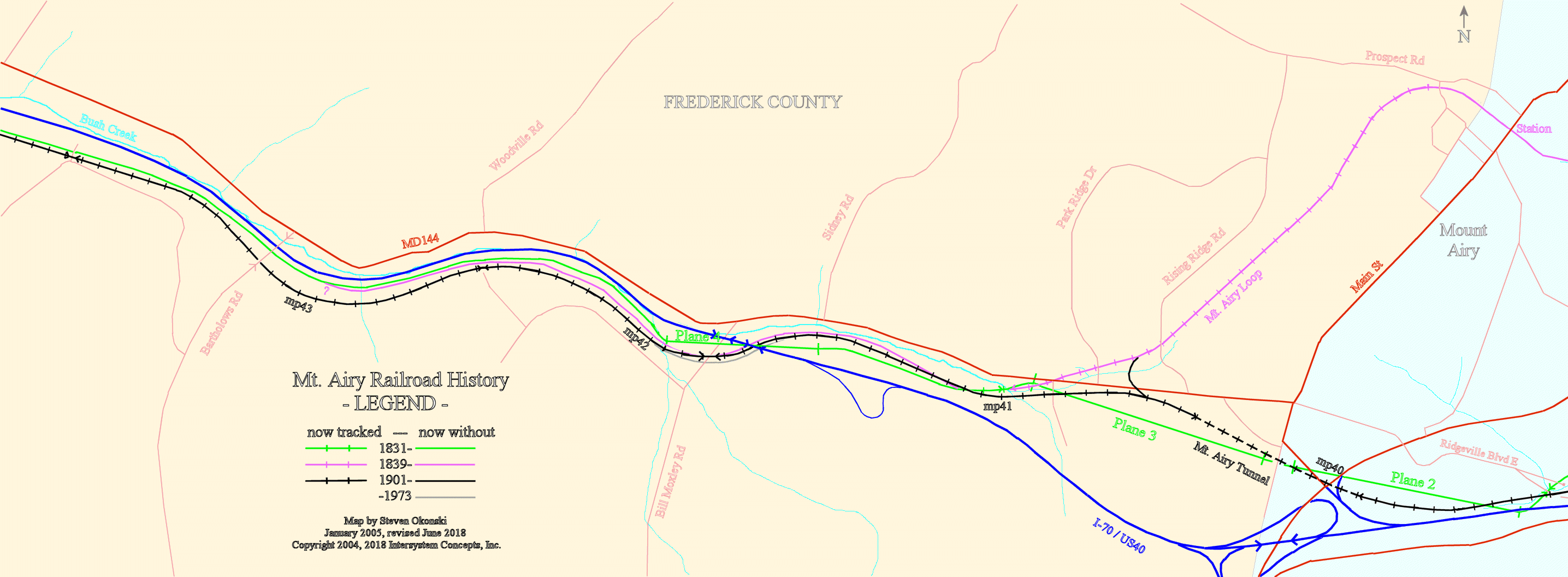
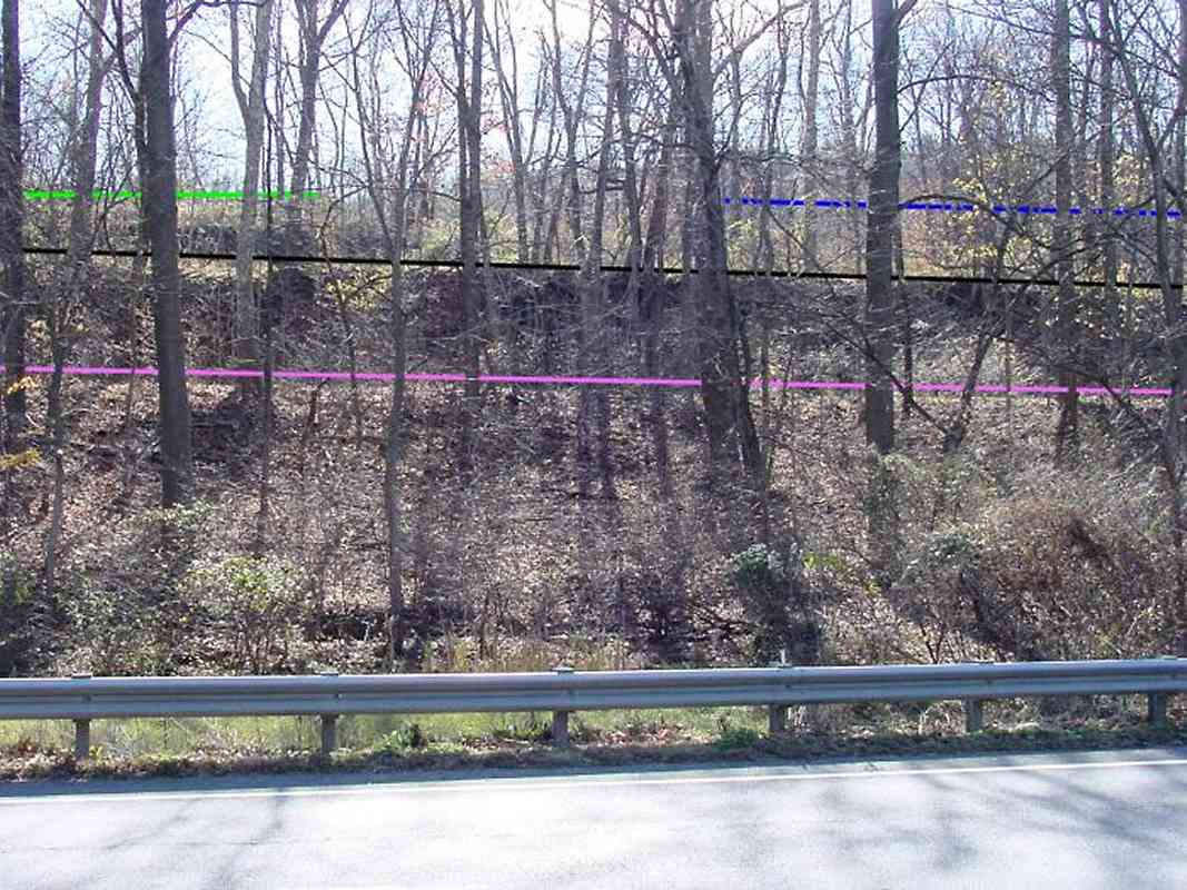
If you visit at the right time of day and season, the sun helps to illuminate the various "shelves" upon which the alignments 
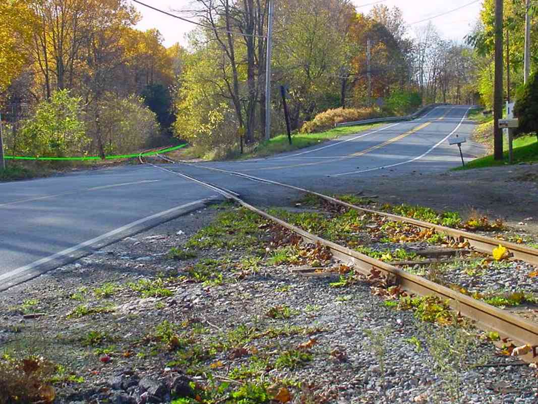
had sat. This is the view looking south from the intersection of MD 144 and Sidney Road.

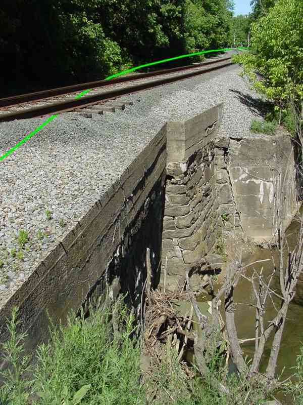
The green line at top left marks B&O's original 1831 alignment; it stayed level between the base of Plane 3 (farther left) and the top of Plane 4 (here). Records indicate a wooden bridge had spanned the dip in the land at the rightmost endpoint of the green line. The construction of I-70 (blue line) scrambled the artifacts of that alignment.

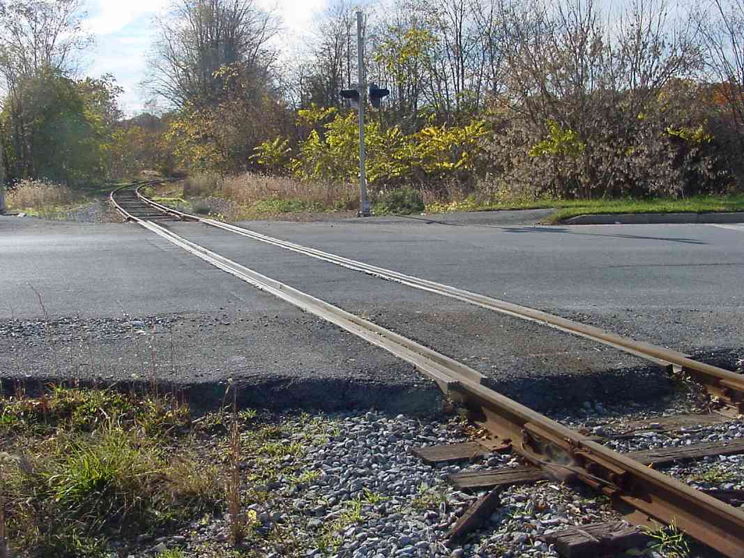
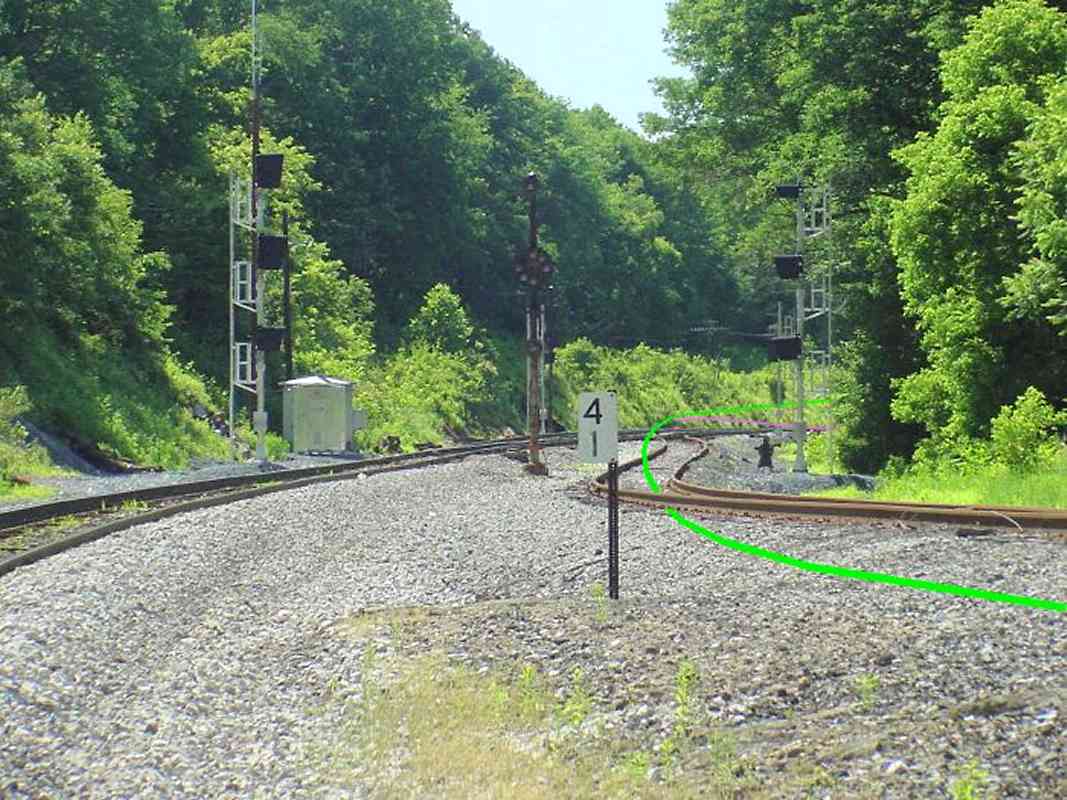
The black line shows the currently active Mt. Airy Cutoff alignment as it descends from the ridge.

The magenta line illustrates the 1838 alignment, constructed at the same time as the Mt. Airy Loop. The roughly 2-mile-long regrade eliminated the need for Plane 4. Note how its slope is roughly the same as that of the Cutoff.

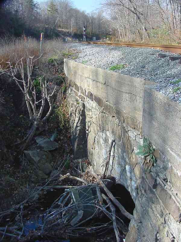
Bush Creek flows at the bottom of the hillside, and the pavement of MD 144 is seen in the foreground.

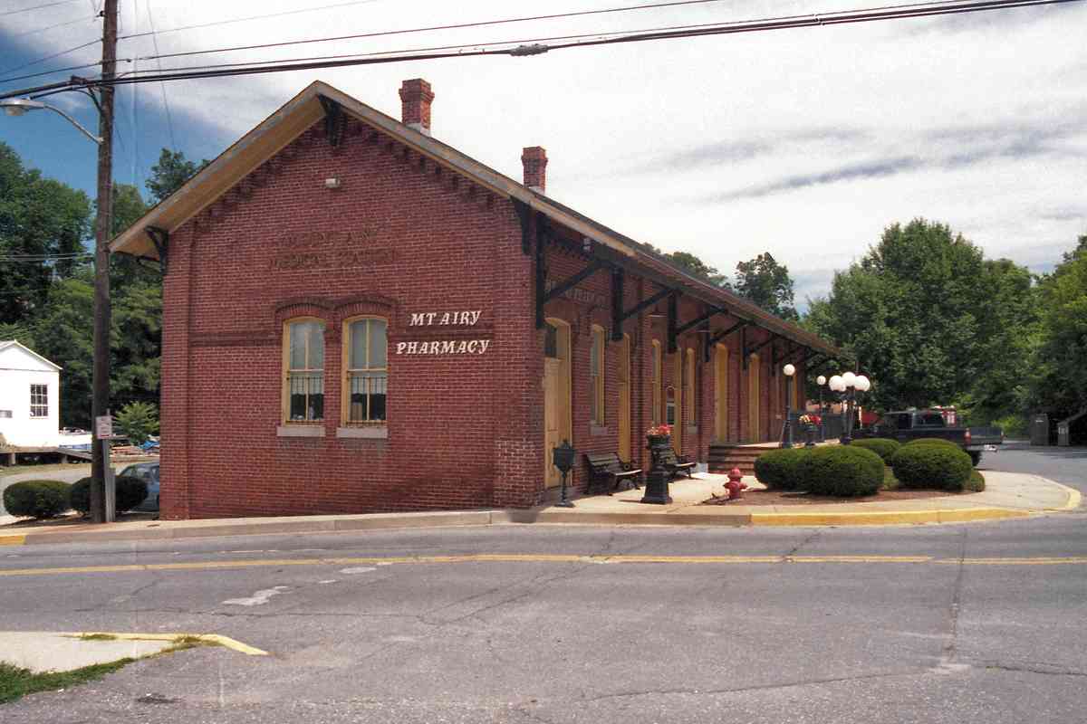
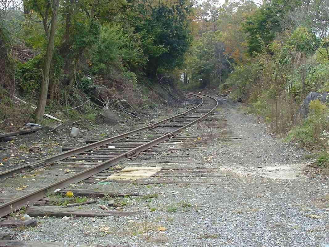
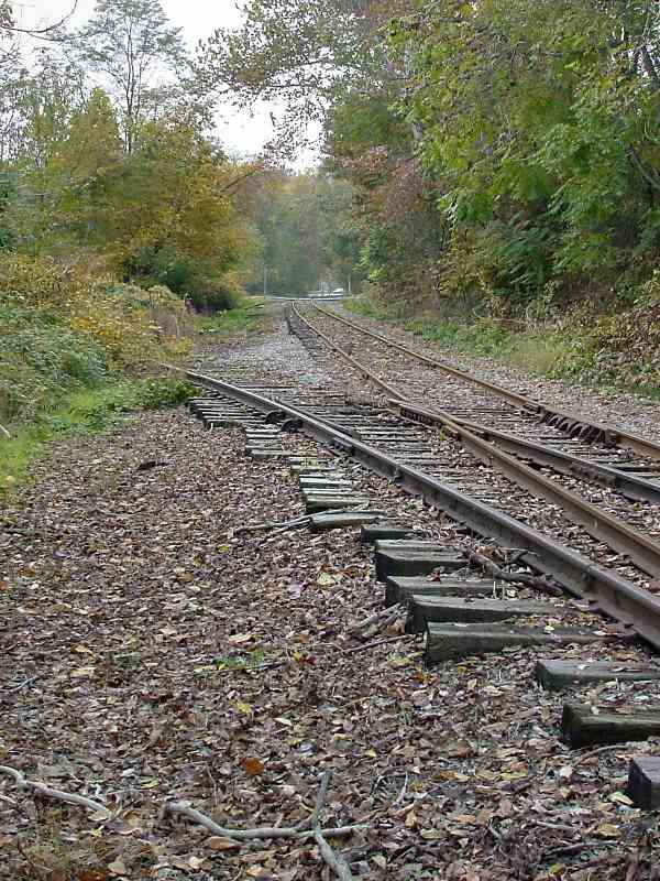
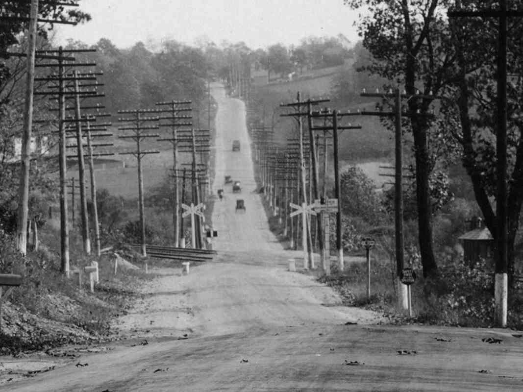
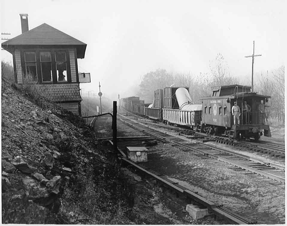
The Loop remained B&O's only way over Parrs Ridge for over 60 years. However, the 1.5% grade was still a challenge that necessitated the stationing of helper engines to assist pushing heavy trains over the ridge.

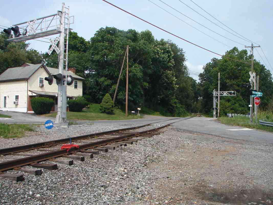
To reduce the grade further, around 1900 construction began on the Mt. Airy Cutoff, which included the half mile long Mt. Airy Tunnel. Even though the Cutoff eventually took over as the primary Old Main Line right of way, the Mt. Airy Loop served well for more than 170 years.


<< Previous (east) | THIS PAGE: West Loop | Next (west) >>

Suggested transfer: the 1831 planes alignment in the Mt. Airy vicinity.

Or, return to main page

Copyright Notice