TrainWeb.org Facebook Page
Old Main Line Photo Tour


B&O Old Main Line
Modern day photo tour

Accompanying each photo below are:

Click a photo to see a larger view. Please send your comments and corrections to Steve.


<< Previous (east) | THIS PAGE: East Loop | Next (west) >>

Mt. Airy Loop - Brief Historical Background:

Map - East

Map - East
Mile: Date: Jan 2005
Ease: View:
Area: IC2: 352
Map: Topographic Map

B&O's alignment in this area changed so many times that a map is a necessity. The area from Mt. Airy east to Watersville is depicted here.

This map represents data from Harwood (1979), USGS maps (1945 and 1980), and aerial photos (1980) combined with research from my hiking and photographing the area many times over the course of several years.

The alignments are depicted on the map by colors that indicate the date of opening. The same colors are overlaid on some of the photos below to assist visualizing the route.


Original Route

Original Route
Mile: 0.0, 3:00 Date: Nov 2004
Ease: B+ View: SW
Area: A IC2:
Map: Ca 32 H 3, Ho 2 H 4 Topographic Maps

This tour begins with the view from the hillside of a new housing development on the east side of Mt. Airy. This vantage point helps us find B&O's original 1831 alignment (green), and the location where the 1839 Mt. Airy Loop (magenta) had diverged, both now survived by little more than mounds of dirt.

This area has lain dormant for over a century, with the right-of-way slowly being reabsorbed by nature, except where dirt bikers have "maintained" it. The 1831 alignment had continued west toward the inclined planes, while on the right the 1839 Loop turned to the northwest and began its gradual ascent of the ridge.

The overgrowth here is so dense don't bother trying to track these old rights of way during the summer unless you bring a machete. Even in non-leaf season, the thorny brush makes going very difficult. It's no wonder this area has received little coverage by railroad historians.

The black fence catches runoff from the "Woodlands at Nottingham" housing development upon the hill.


Culvert

Culvert
Mile: 0.0, 3:00 Date: Nov 2004
Ease: B View: S
Area: A IC2:
Map: Ca 32 H 3, Ho 2 H 4 Topographic Maps

Easily missed in the summer is another survivor. This culvert is found between the two large trees near the left edge of the prior photo.

The design and stone dressing are different than those of culverts found closer to Baltimore. It's likely a different contractor built these. The steel beams are something of an anachronism. They are too modern to date to 1830, and also look too modern (too little rust) to date to ~1900 when this route was abandoned. There are 13 beams in all, providing more than enough room for double track.


Bridge

Bridge
Mile: 0.2, 3:00 Date: Nov 2004
Ease: C View: N
Area: A IC2:
Map: Ca 32 G 3, Ho 2 G 4 Topographic Maps

Shoddy construction (look at the irregular stones) likely contributed to the demise of this bridge which the Loop had employed to span the tributary it follows up to the ridge.

It's difficult to determine now if this had been a stone arch bridge. The structure is substantial, rising about 15 feet above the water.

In the distance the top of the hill has been cleared to make room for new homes.


Extension

Extension
Mile: 0.2, 3:00 Date: Nov 2004
Ease: C View: W
Area: A IC2:
Map: Ca 32 G 3, Ho 2 G 4 Topographic Maps

Looking west from the top of the Loop's crumbling bridge provides a view of the Loop Extension, the short route that in 1901 connected the Loop with the then-new Mt. Airy Cutoff, the track which runs through Mt. Airy tunnel.

The Extension is marked by black, and is not as steep as it would appear.


Emerging

Emerging
Mile: 0.4, 2:00 Date: Nov 2004
Ease: C+ View: NW
Area: A IC2:
Map: Ca 32 G 3, Ho 2 G 4 Topographic Maps

The 1839 Loop emerges from the forest at the Mt. Airy Wastewater Treatment Plant (right). This is also the location at which the original Loop (under photographer's feet) and the 1901-constructed Extension (left) had met.


Loop and Extension

Loop and Extension
Mile: 0.4, 2:00 Date: Nov 2004
Ease: C+ View: SE
Area: A IC2:
Map: Ca 32 G 3, Ho 2 G 4 Topographic Maps

The is close to the prior photo location except looking the opposite direction. Note the same yellow wire caution tube in both pictures.

The 1839 Loop track (magenta "rails") emerged from the trees on the left. The path on the right (black "rails") is the 1901 Extension. While there probably had once been a track connection here, it's unlikely it was used for long: the Cutoff route + Extension quickly superceded the prior.

Next, we'll jump southeast to the start of the Extension, and follow it northwest back to this spot.


Watersville Junction

Watersville Junction
Mile: 0.0, 3:00 Date: Oct 2004
Ease: C View: W
Area: A IC2:
Map: Ho 2 H 5, Ca 32 H 4 Topographic Maps

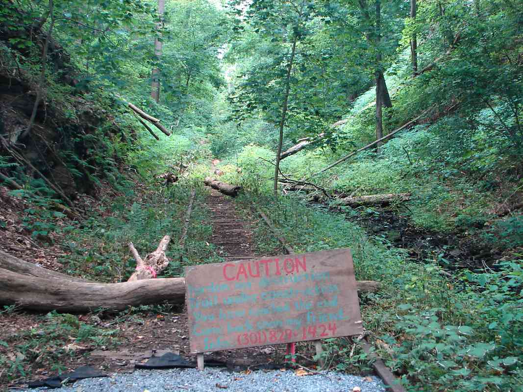
Now we've jumped to the opposite end of the Extension, at a spot the railroad christened Watersville Junction.

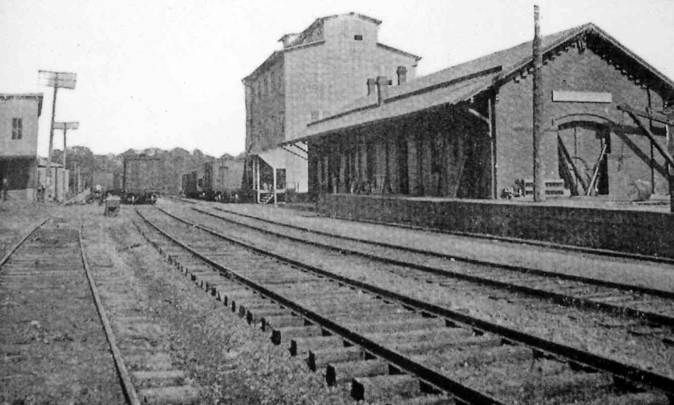
When B&O finally tired of circling Mt. Airy Loop, around 1900 it built what was called the Mt. Airy Cutoff. Rather than loop around the town, the Cutoff roughly paralleled the original 1831 inclined-planes' alignment. Instead of planes, B&O bored Mt. Airy tunnel through the ridge, and regraded the ROW for many miles both east and west to spread out the steepness. That remains the alignment still in use now as evidenced by these shiny rails.

A totally new ROW was constructed gor the Cutoff on the south bank of the Patapsco River beginning east of Watersville, with plans to abandon the north bank's 1831-dated alignment. Because B&O still served customers in Mt. Airy, and the passenger station was on the Loop, it built a roughly half-mile long Extension to connect the Cutoff with the Loop.

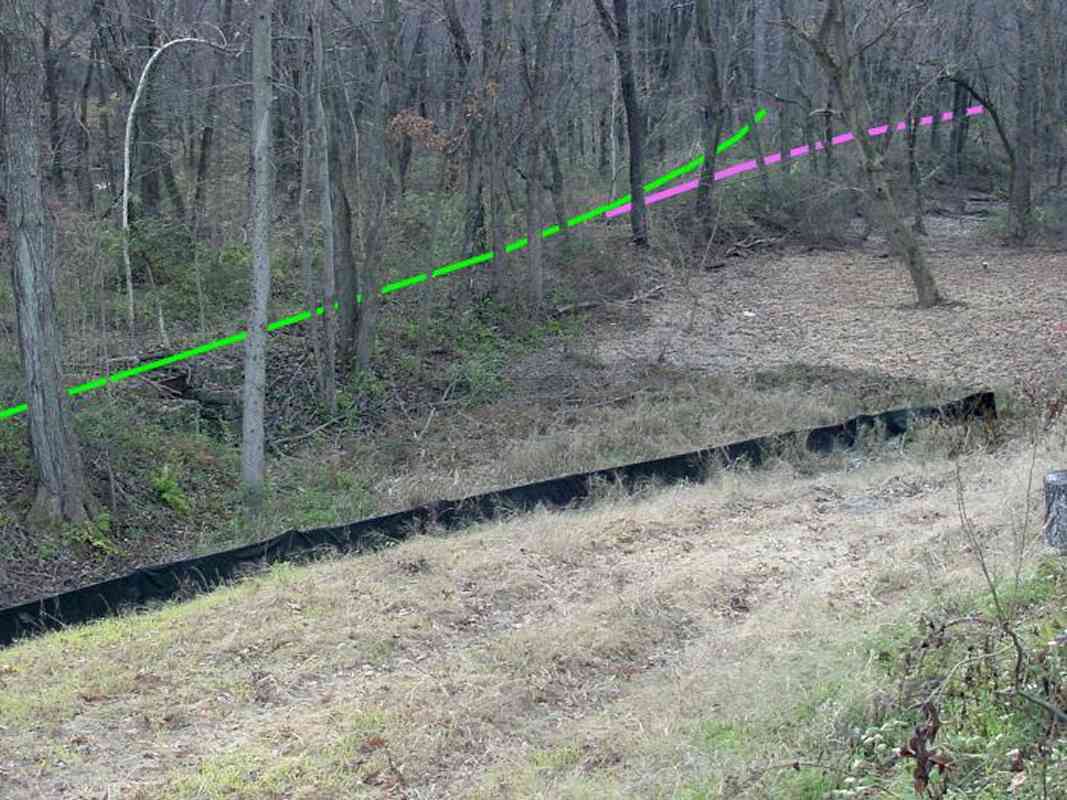
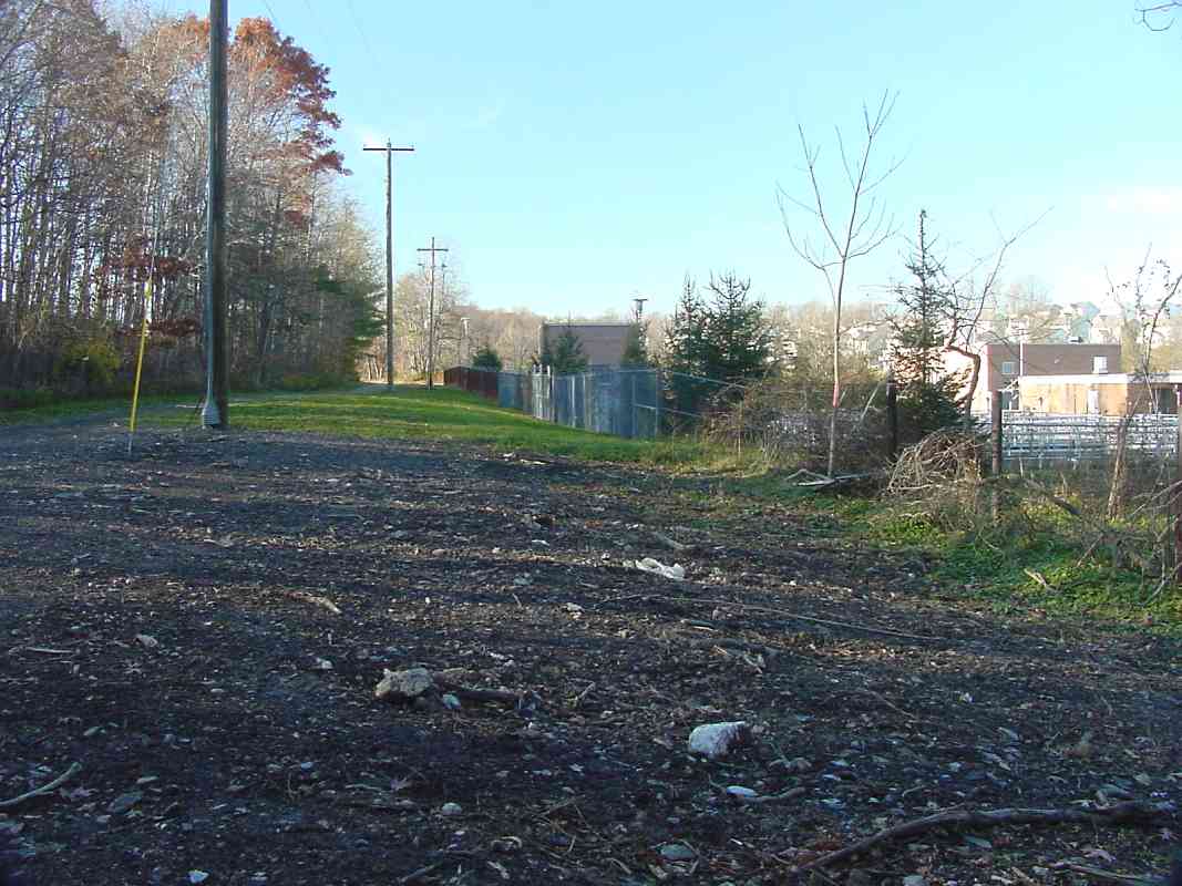
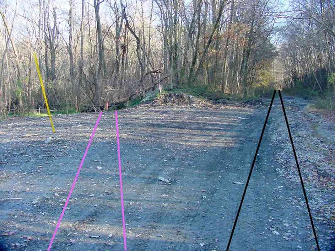
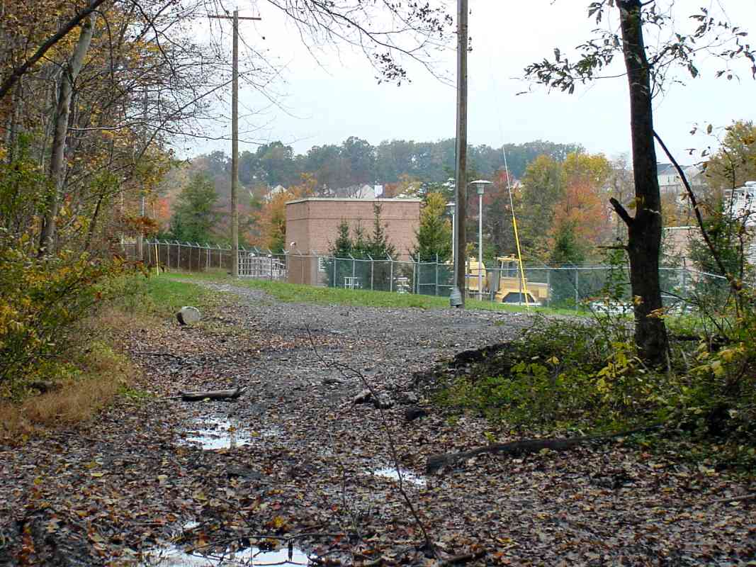
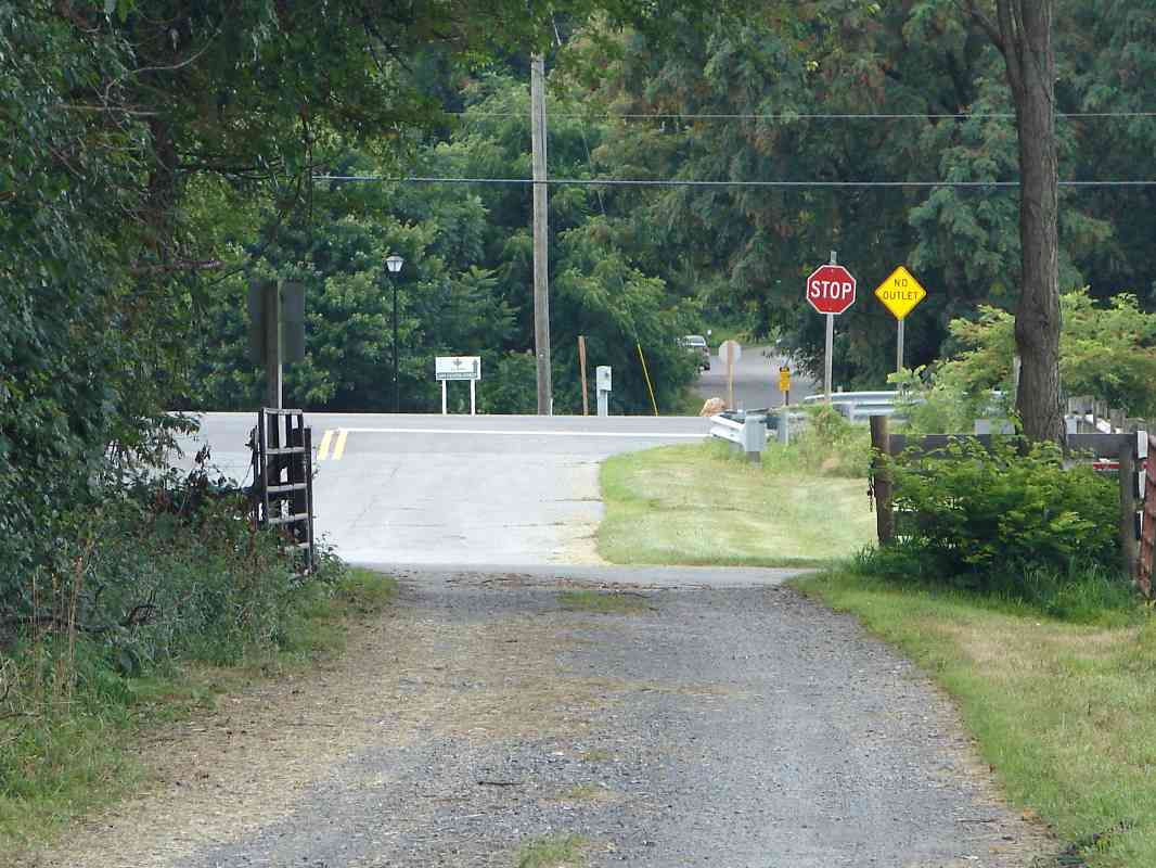
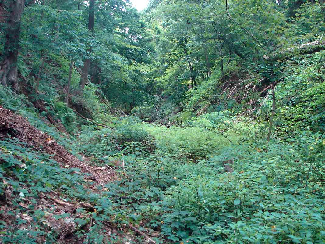
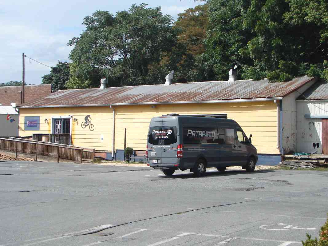
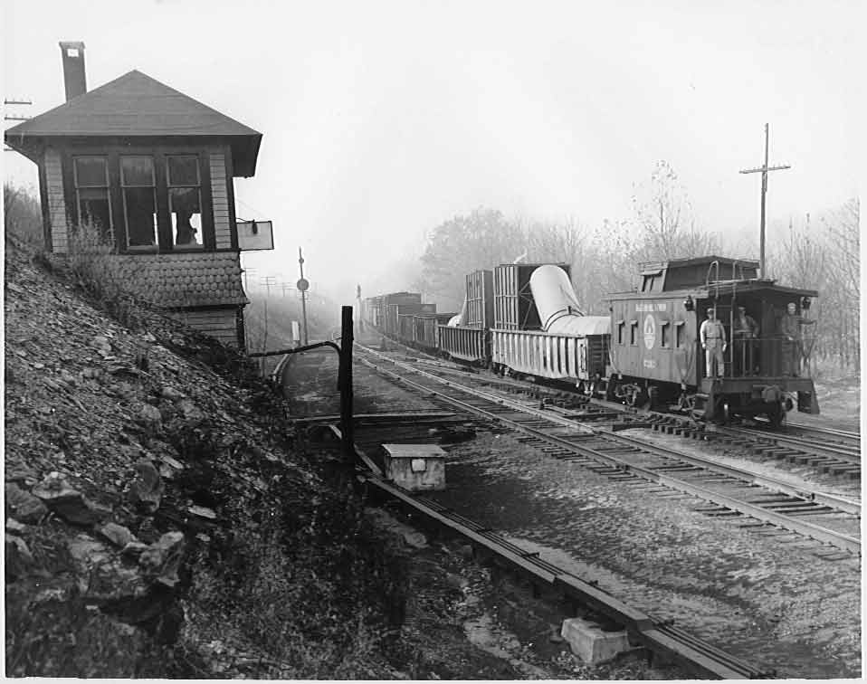
This photo shows where the Extension and Cutoff had diverged. WX tower had once controlled the switch here, and may have resided near the utility pole near the center of this photo. The connection to the Loop proceeded through the gap in the trees at right. The tower lasted until disuse in either 1932 or 1933.

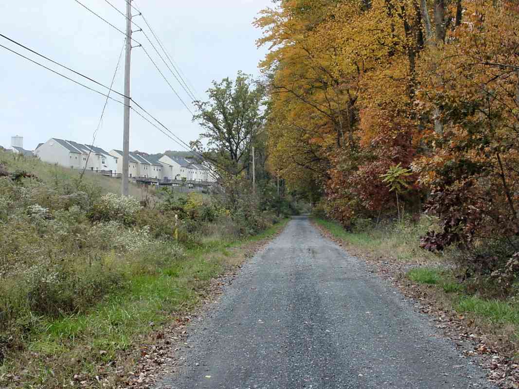
This spot was somewhat remote and lonely in 1901, and requires a long walk even today, though encroaching housing developments nearby have made it more accessible.


extension

Extension
Mile: 0.0, 3:00 Date: Oct 2004
Ease: D+ View: NW
Area: A IC2:
Map: Ho 2 H 5, Ca 32 H 4 Topographic Maps

Stepping into the tree gap yields this scenic autumn view. Thanks to efforts of an occasional dirt biker, the route of the Extension remains visible as a path.

There are no rusty rails to be found here: this part of the Loop last saw trains in August 1957, and the rails were pulled up afterward.


Patapsco River Bridge

Patapsco River Bridge
Mile: 0.2, 3:00 Date: Oct 2004
Ease: C View: W
Area: A IC2:
Map: Ho 2 H 5, Ca 32 H 4 Topographic Maps

Something wicked this way comes no more, but this disused substantial bridge amidst the colorful autumn forest is haunting evidence it once did.

This is one of the largest surviving single arch B&O stone bridges in the area covered by these photo tours. It was also the subject of the first photo ID contest at this site.

The bridge, which is close to 20 feet high at its center, spans the nascent Patapsco River with Howard County on the left and Carroll County on the right. The inside of the arch is brick, and it was constructed around 1900 at the same time as the rest of the Extension.

The pipe at the right discharges "fragrant" effluent from the Mt. Airy sewage treatment plant... perhaps something wicked this way does still come.


1831 Route

1831 Route
Mile: 0.2, 3:00 Date: Nov 2004
Ease: C View: W
Area: A IC2:
Map: Ca 32 H 4, Ho 2 H 5 Topographic Maps

When standing atop the bridge of the prior photo, one can look west to see the route B&O originally traversed between 1831 and 1839. That original route west to the inclined planes at Mt. Airy clung to the north bank of the Patapsco River seen here on the left. The presently active route, the Cutoff, rides the south bank of the river (even further left and out of the picture).

The ROW did not have the sharp turns seen here. Those have been created by dirt bikers as they navigate their way around fallen trees.

Did the 1831 route and the Extension connect here? No. This point is their map intersection, but the Extention was constructed about 60 years after the the 1831 route had been superceded by the Loop.


Left Behind

Left Behind
Mile: 0.2, 3:00 Date: Nov 2004
Ease: C View: NW
Area: A IC2:
Map: Ca 32 H 4, Ho 2 H 5 Topographic Maps

After train service ended in 1957, cleanup crews were very thorough on the Extension, but an old wooden tie managed to escape. It now rests near the northwest corner of the Patapsco River bridge. Note the metal S-shaped pieces that have been tapped into the end, a railroad technique to hold together ties that have begun to split.


Sewage Treatment

Sewage Treatment
Mile: 0.4, 2:00 Date: Oct 2004
Ease: C+ View: NW
Area: A IC2:
Map: Ca 32 G 3, Ho 2 G 4 Topographic Maps

Here the Extension joins with the 1839 Loop where we had left off a few photos above.

Out, damned spot. Bacteria and machines work to cleanse whatever Mr. Airy has produced. I don't know when this facility was built, but obviously the railroad pre-dates it. Now the plant's access road occupies the disused right-of-way which is seen on the left, indicated by the almost-obligatory utility poles.

Link: sewage plant wins award


Housing

Housing
Mile: 0.8, 2:00 Date: Oct 2004
Ease: C View: NW
Area: A IC2:
Map: Ca 32 F 3, Ho 2 F 4 Topographic Maps

Housing developments began around year 2000 to invade the area formerly seen only by farmers and railroaders. They provide the shortest way to reach this spot, if you don't mind climbing down a hill of brush and thorns.

The tall cylindrical structure near the left edge of this photo might be a new water tower under construction.


Got Milk?

Got Milk?
Mile: 1.0, 2:00 Date: Oct 2004
Ease: C View: NW
Area: A IC2:
Map: Ca 32 F 2, Ho 2 F 3 Topographic Maps

There was a reason cow catchers were installed on locomotives. This particular beast was afraid of me, and bolted when I approached, even though I wasn't belching steam and smoke. Well, not much anyway.

Try as they might in 1836, B&O's surveyors were not able to find a route free of sharp curves. However, the very even grading, devoid of sudden ups and downs, is a hallmark of a railroad route. When you find such a route in a forest, it's a big hint that at one time trains had rolled by.

If this road appears to be climbing, it's because it is. This spot is about halfway to the top of the ridge. The Mt. Airy Loop's maximum grade was 1.5% (1.5 feet of climb for 100 feet of distance). A 1.5% grade was more easily handled than the steeper (5.0%) inclined planes the Loop replaced, but still was a limiting factor for B&O, particularly for long eastbound trains heavy with coal.


Farm

Farm
Mile: 1.2, 1:00 Date: Jul 2014
Ease: B View: W
Area: A IC2:
Map: Ca 32 E 2, Ho 2 E 3 Topographic Maps

The road looks a bit narrow now, but yes, the Loop had been double tracked.

Over on the right in the distance in Watkins Park sat a caboose awaiting refurbishment as part of a Mt. Airy Rails to Trails project.


MD 27

MD 27
Mile: 1.3, 1:00 Date: Jul 2014
Ease: A- View: W
Area: A IC2:
Map: Ca 32 E 2, Ho 2 E 3 Topographic Maps

A zoom picture reveals Maryland 27, Ridge Road, has been regraded higher after rail service ended. The Loop tracks continued across toward the utility pole at photo center then paralleled the access road beyond the Stop sign. Watkins Park is on the right and town center is about a half mile straight ahead.


Watkins Park

Watkins Park
Mile: 1.5, 1:00 Date: Jul 2014
Ease: A View: W
Area: A IC2:
Map: Ca 32 E 2, Ho 2 E 3 Topographic Maps
caboose

Pausing for a brief visit to Watkins Park during the summer of 2014 was B&O caboose C-2095. Its next stop was the B&O Museum in Baltimore for a professional restoration followed by a return to Mt. Airy for a home near the station. This was part of a volunteer effort to open portions of the Loop to foot traffic.

The photo linked below shows a B&O model I-5d caboose at Mount Airy (MA) tower (the western limit of the Loop) during 1952.

Link: 1952 (source link)


Trail

Trail
Mile: 1.6, 1:00 Date: Jul 2014
Ease: A View: W
Area: A IC2:
Map: Ca 32 E 2, Ho 2 E 3 Topographic Maps

Near the end of the present-day access road begins a cut. To reduce the Loop's grade, B&O decided to pierce the top of Parrs Ridge with a cut.

In 1838, the man who owned the land at the top was named Henry Bussard (or Buzzard, historical references vary). When he learned B&O had found the best way over the ridge was through his property, he decided to cooperate with the railroad in exchange for them building a depot. He sold this strip of land to B&O for a relatively cheap $250 ($3000/mile was the going rate), but managed to profit nicely in the end. He erected a tavern near the depot, and watched as the town of Mt. Airy grew up around the buildings, in turn increasing the value of his remaining land.

This section last saw a train in 1957. During the ensuing decades, the cut laid dormant as nature reclaimed it and people occasionally dumped items. During the 2010s the Mount Airy Rails to Trails group worked to reopen the cut as a walking trail. At the time of this photo their work was incomplete, and this sign marked the entrance.


Cut Then

Cut Then
Mile: 1.6, 12:00 Date: Nov 2004
Ease: B View: W
Area: A IC2:
Map: Ca 32 D 2, Ho 2 D 3 Topographic Maps

This was the cut's appearance in 2004, overgrown with brush and swamped by spring water. For B&O contractor William Slater, this was the unkindest cut of all.

The cut through Mr. Bussard's land was to be about a half mile long and 50 feet deep. Such a task would be no big deal with today's machinery, but in 1838 with little more than hammers and pickaxes, it was quite an undertaking.

Slater employed more than 750 men for the job and projected he would complete it within five months. However apparently the heat of the summer of 1838 was severe and many of Slater's crew began to get sick, then die. They encountered rock ledges then springs, and after the five months had elapsed, were barely halfway through.

Under time pressure, Slater resorted to blasting, a dangerous proposition in the narrow cut. As author James Dilts described it in The Great Road: "Except for the invention of the safety fuse in 1831, the techniques of blasting had not changed much in the 50 years since James Rumsey's happy-go-lucky crew of brawling ex-convicts 'used the powder Rather too Extravagent' at the Great Falls of the Potomac" during the construction of a canal there.


Cut Now

Cut Now
Mile: 1.6, 12:00 Date: Jul 2014
Ease: B View: W
Area: A IC2:
Map: Ca 32 D 2, Ho 2 D 3 Topographic Maps

After many volunteer hours, the cut is looking much more welcoming.

Slater's crews ended up working through the winter of 1838/39, and the $130,000 5-month task took 12 months to finish. He went $10,000 over budget, apparently, but the railroad, citing the delay did not reimburse him. Incidentally, B&O hauled material excavated from this cut downhill to Elysville (now Daniels) and used it for the construction of the bridges there.


Trail-to-Rails

Trail-to-Rails
Mile: 1.8, 12:00 Date: Jul 2014
Ease: B View: W
Area: A IC2:
Map: Ca 32 D 2, Ho 2 D 3 Topographic Maps

Cleanup work had approached halfway through the cut at the time of this photo, creating basically a trail-to-rails since rusty B&O single-track still rests where the company left it decades ago. While this was B&O's only route west from Baltimore (1839 to 1877), it was busy and double tracked. After the Mt. Airy Cutoff opened in 1901, the Loop was relegated to branch status and its second track here was pulled up to allow for better drainage.


Overgrowth

Overgrowth
Mile: 1.9, 12:00 Date: Jul 2014
Ease: B- View: W
Area: A IC2:
Map: Ca 32 D 2, Ho 2 D 3 Topographic Maps

Our sense of perspective has been changed by huge modern construction projects so this cut seems not particularly impressive. The steep sides of the cut have fallen in places, and discarded tires and old appliances hide under the brush. Near the top, a plumbing contractor had used the cut as a storage area of sorts.


Channel
NEW! Jul 2016

Channel
Mile: 1.9, 12:00 Date: Aug 2015
Ease: B View: W
Area: A IC2:
Map: Ca 32 D 2, Ho 2 D 3 Topographic Maps

The Mount Airy Rails to Trails group persisted and during the summer of 2015 completed cleanup and reopening of the cut. The springs Slater's crew had opened during 1838 still flow, so we'll learn how well metal rails hold up while chanelling water.


Station Ahead

Station Ahead
Mile: 2.0, 12:00 Date: Jul 2014
Ease: A View: W
Area: A IC2: 342
Map: Ca 32 C 1, Ho 2 C 2 Topographic Maps

The trail emerges at a building contractors storage area. Fingers of what had been numerous sidings are now buried under pavement; the main tracks had extended straight ahead and next to the brick Mt. Airy Station. The building at the right edge of this photo dates to about 1985 and is not railroad related.


Freight House

Freight House
Mile: 2.0, 12:00 Date: Jul 2014
Ease: A View: NW
Area: A IC2:
Map: Ca 32 C 1, Ho 2 C 2 Topographic Maps

To the north parallel to the station is a B&O freight house that a bike shop now calls home. The van obscures a large door suitable for boxcar loading and unloading... if only the trains still visited.


Mt. Airy Station Then
NEW! Jul 2016

Mt. Airy Station Then
Mile: 2.0, 12:00 Date: ~1940?
Ease: A View: W
Area: A IC2: 342
Map: Ca 32 C 1, Ho 2 C 2 Topographic Maps

Just past the top of the ridge at the west end of the cut, the railroad did honor its promise to Henry Bussard and constructed a depot at this site. As the town grew around, the depot was in 1875 upgraded to a station made of brick which survives as the center part of the building seen here. Later, at the distant end, a passenger facility was appended, and at the closer end more room was added for freight handling.


Mt. Airy Station

Mt. Airy Station
Mile: 2.0, 12:00 Date: Oct 2004
Ease: A View: W
Area: A IC2: 342
Map: Ca 32 C 1, Ho 2 C 2 Topographic Maps

After B&O's passenger service to here ended around 1950, the building served successively as a feed store and antique store. Since the 1990s it has soldiered on as a pharmacy and doctors' office.


Refurbished Caboose
NEW! Jul 2016

Refurbished Caboose
Mile: 2.0, 12:00 Date: Jun 2016
Ease: A View: W
Area: A IC2: 342
Map: Ca 32 C 1, Ho 2 C 2 Topographic Maps

The refurbished B&O caboose arrived back in Mt. Airy during spring 2016 for installation across Main Street from the former station.

The tracks remained extant here into the 1970s, and ones on the other (west) side of Main Street (in the distant trees) remained active until 2007 to serve Mt. Airy Cold Storage. They and the storage company are now gone. Next, we'll tour the western half of the Loop.


<< Previous (east) | THIS PAGE: East Loop | Next (west) >>

Or, return to main page

Copyright Notice