TrainWeb.org Facebook Page
Old Main Line Photo Tour


B&O Old Main Line
Modern day photo tour

Accompanying each photo below are:

Click a photo to see a larger view. Please send your comments and corrections to Steve.


<< Previous (east) | THIS PAGE: Relay to Avalon | Next (west) >>

Aerial 1927
Photos courtesy Johns Hopkins University
NEW! mid-Jun 2020

Aerial 1927
Mile: 6.6 to 8.0 Date: 1926/1927
Ease: View: N (up)
Area: IC2:
Map: Ba 41 Topographic Maps

St Denis 1927 This is a winter 1926/1927 aerial view of the OML stretch covered by this tour page.

At the left edge of the zoom view at left, the State Roads Commission will soon (1930) grade separate River Road. Not until the 1970s would I-195 make a north/south run through the right half of the photo. In between, left of photo center where East Street meets the railroad, stands B&O's St. Denis station.


Rolling Road

Rolling Road
Mile: 6.8 Date: Oct 2002
Ease: B+ View: SW
Area: B+ IC2: 19
Map: Ba 41 J 12 Topographic Maps

This is the view west from the Rolling Road overpass. CSX 724, CR 4437 and CR 2781 are about to pass under the bridge as they lead a mile-long mixed freight east. CR units with engine numbers on their sides painted in yellow are ones CSX acquired from Conrail but which have not yet been repainted into CSX livery.

Rolling Road got its name from the practice of 18th and 19th century farmers who rolled large bales of tobacco from their Baltimore county fields down to the port of Elkridge, the limit of navigation on the Patapsco River.


Sutton Avenue

Sutton Avenue
Mile: 6.9 Date: Oct 1999
Ease: A View: NW
Area: B+ IC2:
Map: Ba 41 H 12 Topographic Maps

It's a bit awkward to find, but Sutton Avenue between St. Denis and Relay is another great spot for train watching. You can drive to the location from which this photo of CSX 7559 (model C40-8) and CSX 5901 (model B36-7) was taken. Note both engines of this pair are facing the same direction, a less-common arrangement.

Prior to the Rolling Road overpass, a grade crossing existed here for Clark Boulevard, as seen in the next photo.


Grade Crossing
Photo courtesy owner Baltimore County Public Library
NEW! mid-Jun 2020

Grade Crossing
Mile: 7.0 Date: 1930
Ease: A- View: NW
Area: B+ IC2:
Map: Ba 41 H 12 Topographic Maps

Relay 1927 Sutton Avenue and Clark Boulevard had connected via this grade crossing. In the 1927 aerial view at left, it's the bright arc spanning the tracks in the upper right quadrant. The crossing was not perpendicular to the railroad, which hindered visibility, and spurred its closure when the Rolling Road overpass opened during 1930. Clark Boulevard is now named South Rolling Road here.

The OML continues off the left edge of the aerial view. The Washington Branch splits and heads south off the aerial's bottom edge after it crosses the Patapsco River via the Thomas Viaduct. That viaduct will appear in a photo further below.

Link: 1930 source photo


Railroad Avenue
Photo courtesy owner Baltimore County Public Library
NEW! mid-Jun 2020

Railroad Avenue
Mile: 7.0 Date: 1904
Ease: A View: W
Area: B+ IC2:
Map: Ba 41 H 12 Topographic Maps

The building at right, said to be Relay's General Store, is the same one seen in the 1930 grade crossing photo above. This photo looks west from present-day South Rolling Road's intersection with Railroad Avenue. Where a road parallels the tracks it is often named Railroad Avenue.

Near photo center is Relay House which during the 1800s had served as a hotel for rail travelers.

Link: 1904 source photo


Relay House

Relay House
Mile: 7.1 Date: Jul 1999
Ease: A View: NW
Area: B+ IC2: 86, 106, 387
Map: Ba 41 H 12 Topographic Maps

The town of Relay predates the railroad. At Relay, fresh carriage horses would be added for the trip between Baltimore and Washington. Relay House served passengers who rode up from Washington, and paused before heading to points west via the OML. The original Relay House burned down in the late 1800s and was rebuilt in the form shown here. In 1873, B&O constructed its Viaduct Hotel a short distance west of here.

I have received multiple reports that some houses in Relay employ in their framing what had been B&O wood track stringers. That could be true, but there is no easy way to identify old stringers with certainty.

Links: ~1860 looking east, ~1863 looking west, 2002 snow, trains vs weather


Mile Markers

Mile Markers
Mile: 7.2 Date: Mar 2004
Ease: B View: N
Area: B IC2:
Map: Ba 41 H 12 Topographic Maps

An attractive stone mile marker had graced this location, but there's something unusual. Actually, there are many things unusual.

  • This was the only known stone marker along the OML, but in reality it is marking the distance along the Washington Branch.
  • The old stone says 9 miles to Baltimore, but the new sign says 7 (it's too far west by about 1000 feet). When the stone was placed, the Camden Cutoff did not yet exist, so the route had been 2 miles longer.
  • CSX still employs the old mile counting method along its present day main line, the former Washington Branch. The result: there now exists no "mile 8" on the main line. The picture captioned "Relay" above shows main line mile marker 9 which sits less than 100 feet away from this marker.
  • A remote possibility is this stone was moved here from a location nearer DC when Metro Green Line construction threatened its original home.
  • This was the only known stone marker on the northwest side of the tracks. All the others are currently on the southeast side.
  • This was the only known stone marker with a sibling on the other side of the tracks.


Sibling

Sibling
Mile: 7.2 Date: Mar 2004
Ease: B View: S
Area: B IC2:
Map: Ba 41 H 12 Topographic Maps

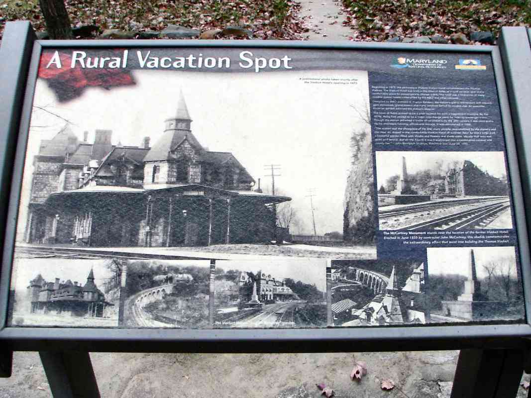
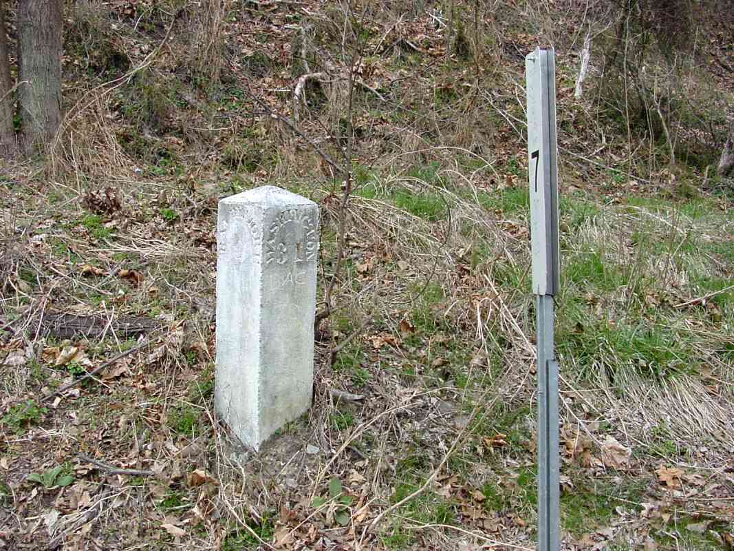
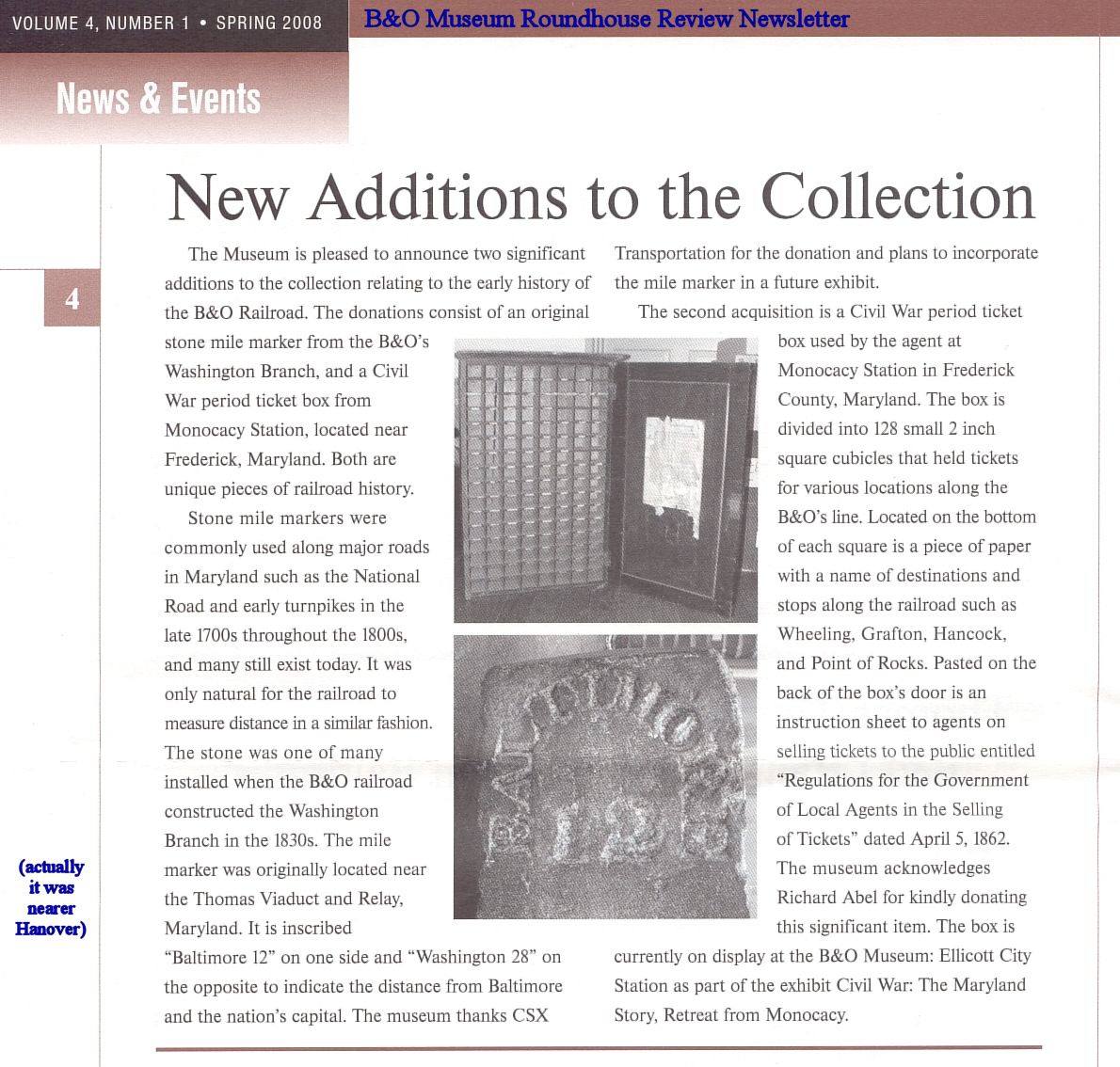
Like a competitive sibling not wanting to be outdone, this marker also has something unusual: it is the only one known with reversed engravings: Washington on the left, Baltimore on the right.

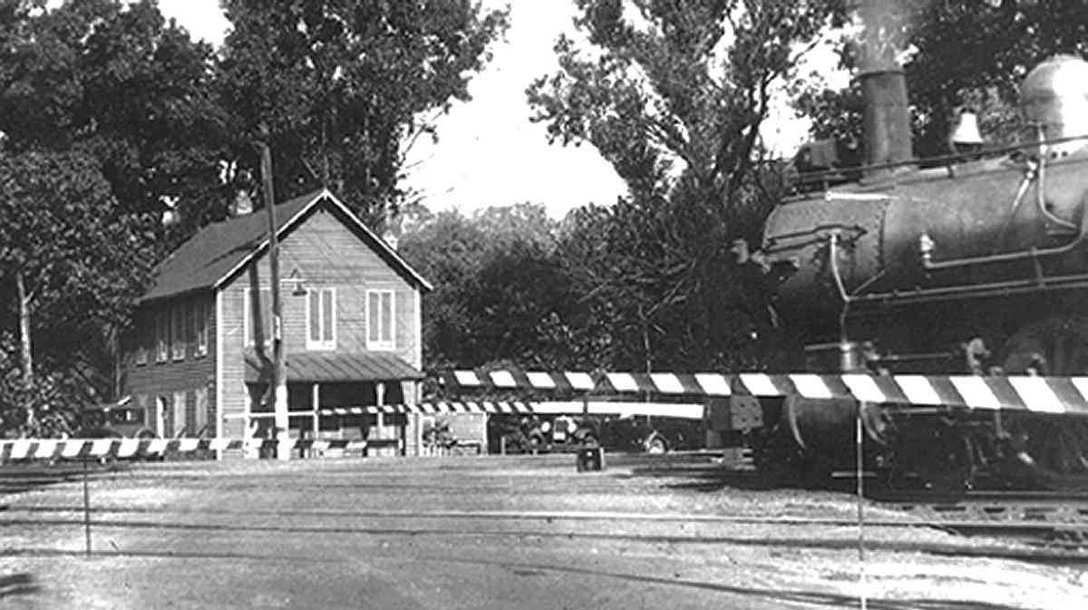
This order of the engravings makes sense to me. While aboard a circa 1835 Grasshopper-powered train steaming along at a then-brisk 10 mph, forward-facing passengers to Washington (left to right in this photo) could read the left side of the marker and know how far their destination remained.

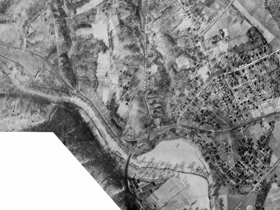
Yet, all the other extant stone markers from here to Washington display the city names in other order: Baltimore on left, Washington on right! The B&O of that era was too detail-oriented for the engravings to have been a mistake. I suspect the surviving mile stones on the way to Washington were at some later date moved from one side of the tracks to the other.

Speaking of moving, in January 2007 CSX excavated and removed these markers... the (unconfirmed) rumor is they became gifts to an executive. I suppose these items are CSX property, and therefore CSX can do with them as they wish, but I'd rather this unique and historic pair had been donated to the B&O Museum. In February 2008 I was pleased to hear from B&O Museum Director Courtney Wilson that indeed CSX did remove and donate another of these markers to the Museum.
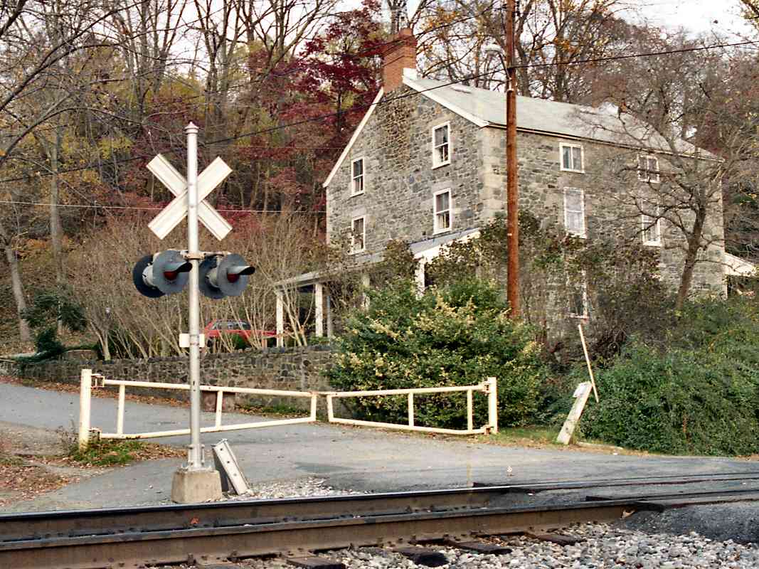
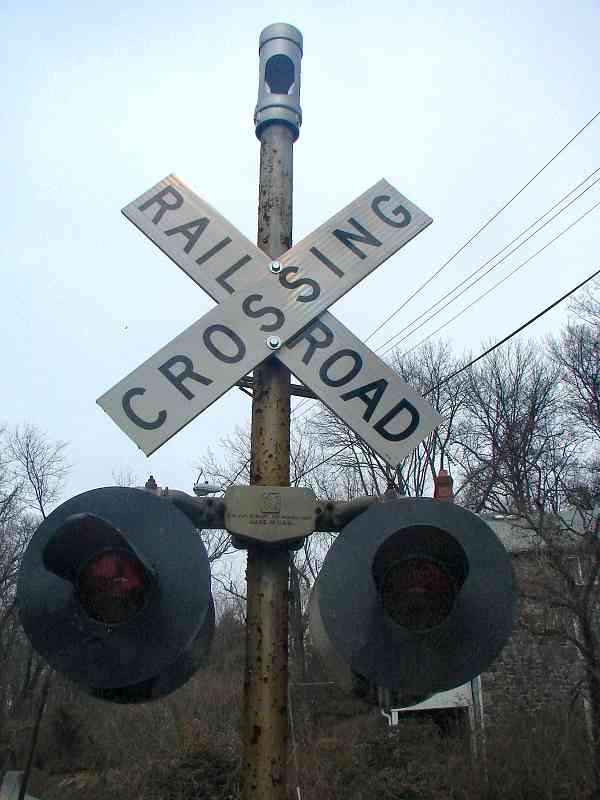

Relay

Relay
Mile: 7.2 Date: Mar 2000
Ease: B View: SW
Area: B IC2: 105, 130
Map: Ba 41 H 12 Topographic Maps

Here at Relay the tracks split. On the left, the Capital Subdivision heads for the Thomas Viaduct (marked by the white monument) and on the right, the OML bends around a rock cliff. B&Os Viaduct Hotel was located between the two routes. Just beyond the white marker, and the bend in the OML track, the ground drops to the Patapsco River. Upon the hill on the right had been the Matley-Hill Sanitarium.

Compare this photo with that taken in the 1860's shown on page 105 in Impossible Challenge II. The view is almost identical, and it's interesting to see how the site has, and has not, changed.

Links: reverse view 1950, ~1976, more about Relay


Viaduct Hotel
NEW! mid-Jun 2020

Viaduct Hotel
Mile: 7.2 Date: (Nov 2015)
Ease: A- View: (NW)
Area: B IC2:
Map: Ba 41 H 12 Topographic Maps

An historical marker near the ranger station downstream of the Thomas Viaduct includes several views of B&O's Viaduct Hotel. The largest of the photos dates to the hotel's opening year of 1873.

Link: ~1930


Thomas Viaduct

Thomas Viaduct
Mile: 7.3 Date: Apr 1999
Ease: B View: SW
Area: B IC2: 310
Map: Ba 41 H 12 Topographic Maps

The OML does not cross the Thomas Viaduct (CSX's Capital Subdivision now does), but this venerable structure is too significant to skip without mention. This photo captures only the northern half of the bridge. At approximately 700 feet in length, the Thomas Viaduct was the longest bridge in the USA, and second longest in the world (London Bridge is slightly longer) when it opened in 1835. Sections of the ornate iron railing installed over the objection of Benjamin Latrobe, the bridge's architect, survive on the SE side (left). Here we see lonely CSX 8507 traversing on a spring day. Easy access via the Patapsco State Park entrance makes this classic structure a must see.

Tangent: This was the first operating locomotive I photoed on what was B&O's Washington Branch. Over twenty years later, it remains the only engine I've ever seen operating solo on the Cap Sub.

Links: 1861, 1886
Change for: Washington Branch (Cap Sub) tour at this site


At I-95

At I-95
Mile: 7.5 Date: Feb 2009
Ease: B View: NW
Area: B IC2:
Map: Ba 41 G 12 Topographic Maps

Back on the OML, heading away from the Viaduct a single track curves under Interstate 95... such curves are common, perhaps too-common, as the OML follows the bends of the Patapsco River.

Unlike the interstate, B&O was funded largely by private money. Since private investors incur high personal risk, they tend to carefully study where the odds of long-term investment returns are best. This route would not have been selected for the first "rail road" had it not held great promise. With such high potential, perhaps it should not surprise us that even some 200 years later a railroad can still be operated profitably here.


Under I-95

Under I-95
Mile: 7.6 Date: Feb 2009
Ease: B View: SE
Area: B IC2:
Map: Ba 41 G 11 Topographic Maps

The 19th century (distance) is framed in contrast by the 20th as the Patapsco Park's access road curves below. If you visit, beware the noise from auto traffic on I-95 can drown out the sound of an approaching train. Use extreme caution!

Unseen on the left, the Old Main Line parallels the river. The millrace of the Avalon Nail and Iron works had rejoined the river on the right. Bull Run flows under the railroad here.

Link: 1972


Avalon

Avalon
Mile: 7.8 Date: Nov 1999
Ease: A View: NE
Area: A IC2:
Map: Ba 41 F 11 Topographic Maps

The community of Avalon shares its name with the Avalon Nail and Iron works that had been a major business at this location. Lured by the power of falling water, many manufacturing industries were attracted to the Patapsco River valley. These industries were B&O customers, and one of the reasons the railroad chose this route.

Unfortunately, a terrible flood in 1868 either destroyed or damaged much of the valley (as well as miles of the railroad). B&O recovered and rebuilt, but most of the businesses did not. Since then, nature has reclaimed the areas previously occupied by factories, and only relics remain. Later floods and the availability of other power sources encouraged businesses to locate elsewhere, and most of the land is now part of Patapsco State Park.

B&O's Avalon Station had been on the right, on the near side of the tracks. The grade crossing shown here (Gun Road) is now permanently closed in order to prevent "back door" access to the state park. Historical accounts attribute creation of Gun Road to George Washington.

Link: Patapsco Valley Park Info


Crossbuck

Crossbuck
Mile: 7.8 Date: Feb 2009
Ease: A View: N
Area: A IC2:
Map: Ba 41 F 11 Topographic Maps

This crossbuck post is topped with an unusual item, one not present in a 2002 photo. Any ideas? Warning sound maker? Air quality tester? Hidden camera?

Reader Al Moran clued me in:

    "The device at the top of the pole is an electric bell. It produces an audible, digital version of a bell ringing. Some newer locomotives have the same thing."


Box Culvert
NEW! mid-Jun 2020

Box Culvert
Mile: 7.8 Date: Sep 1999
Ease: A- View: W
Area: A IC2:
Map: Ba 41 F 11 Topographic Maps

Like all rail lines that follow a valley, the OML must contend with streams that feed the river at the valley floor. From here to the Parapsco River's headwaters 30-some miles west, you'll find stone box culverts dating from the 1830s. Most of those originals remain in service.

This culvert is one of the rare exceptions that needed shoring up by CSX, at least at its output end where you'll now find concrete blocks. Since this is one of the OML"s easternmost box culverts, it was one of the first constructed by B&O as the railroad built its way west.


Avalon Siding

Avalon Siding
Mile: 7.8 Date: Jul 2004
Ease: A View: W
Area: A IC2:
Map: Ba 41 F 11 Topographic Maps

Looking west from Gun Road through summer haze lets us glimpse the eastern endpoint of the 9621-foot-long Avalon Siding.

Cloth bags make new signals look like ghosts, but soon it will be the round CPL (color position light) signals that are the ghosts: CSX removed them the following month.

This Avalon supplied the name for the Avalon Hill Game Company established by Charles S. Roberts who had lived nearby. Roberts was the great-great nephew of Charles Swann Roberts, president of B&O from 1848 to 1853. AH published several railroad-themed board games, including B&O/C&O, and Rail Baron® that inspired this photo tour.

Link: 1987


Covered Phone Shack

Covered Phone Shack
Mile: 7.9 Date: Nov 1999
Ease: A- View: SE
Area: A IC2:
Map: Ba 41 F 11 Topographic Maps

This concrete structure was a B&O telephone shack. Before the days of on-board radio, crews would pause here and call ahead for instructions. This is the last surviving octagonal shack on the OML, one of only three in the Baltimore area, one of which is at the B&O Museum.


<< Previous (east) | THIS PAGE: Relay to Avalon | Next (west) >>

Or, return to main page

Copyright Notice