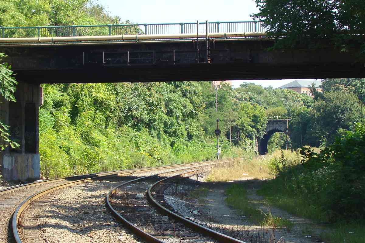
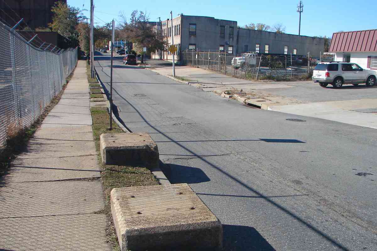
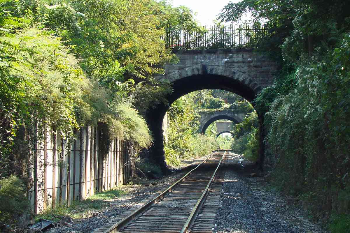
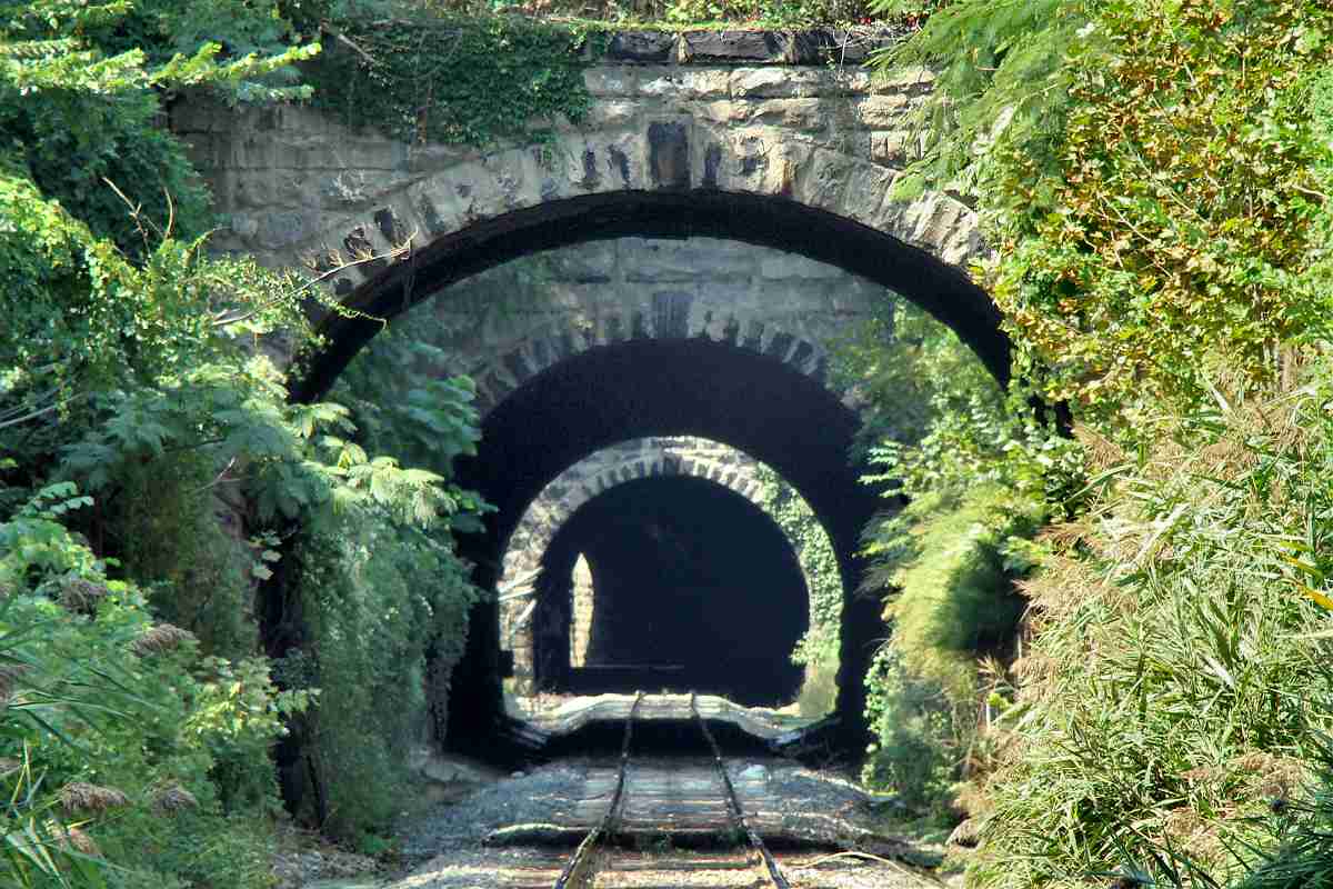
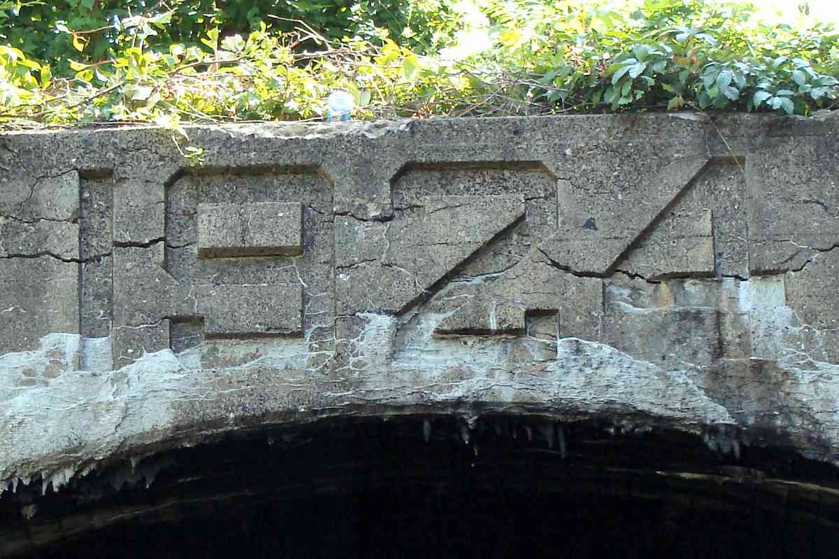
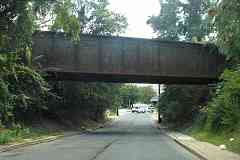
TrainWeb.org Facebook Page
B&O Photo Tour


B&O Baltimore Belt Line
Modern day photo tour

Accompanying each photo below are:

Click a photo to see a larger view. Please send your comments and corrections to Steve.


<< Previous (west) | THIS PAGE: Waverly to Bayview | Next (east) >>

Guilford Avenue 1901
Photo via Smithsonian Institution

Guilford Avenue 1901
Mile: 93.1 Date: 1901
Ease: C View: E
Area: B- RBL: 91
Map: Ba 35 B 8 Topographic Maps

To keep Charles Village denizens smoke-free, the initial General Electric Company design supplied electricity to the helper motors on both tracks via a shared, single "third rail" overhead. The Guilford Avenue name is painted on the pole at right whose purpose otherwise is unknown.

Links: 2018 the wall is fine, 2018 maybe not


Guilford Avenue 2009
Photo courtesy Dave Hiteshew

Guilford Avenue 2009
Mile: 93.1 Date: Sep 2009
Ease: C View: E
Area: B- RBL:
Map: Ba 35 B 8 Topographic Maps

Once diesel engines -- able to generate their own electricity -- became the norm the catenary was removed, and leafy greens allowed to fill in.

This bridge is scheduled to be replaced during the 2020s as part of the Howard Street Tunnel project.

Though snapped at roughly the same spot as the prior photo, three bridges are depicted instead of two because...


Barclay Street
Photo courtesy Dave Hiteshew

Barclay Street
Mile: 93.0 Date: Sep 2009
Ease: C View: E
Area: C+ RBL:
Map: Ba 35 B 8 Topographic Maps

1924 ... as automobiles became more popular, Barclay Street got the bridge treatment too.

That must have happened sometime after the 1901 date of the Smithsonian photo at page top. If only there were a way to know exactly which year... Plans for the Howard Street Tunnel expansion call for this Barclay Street bridge to be removed rather than replaced.

aerial 1927 Barclay got a bridge, in part, because it led to Oriole Park, seen at the top of the 1926/1927 aerial photo at left. Barclay is the street that runs vertically near the middle of the photo, with B&O horizontally at bottom. Careful alignment of this photo with a current one lets us measure the park's dimensions: 275 feet down the left field line, 400 to center, and 320 down the right field line. The Orioles who played here would claim seven consecutive International League championships from 1919 to 1925.

This Oriole Park, number five in a series of six so far, had opened in 1914 as part of the then-new Federal League. The Federal League endured only two seasons, but related subsequent litigation yielded an antitrust exemption in 1922 that is still enjoyed by Major League Baseball.

Link: Oriole Park fire in 1944


Droste Effect
Photo courtesy Dave Hiteshew

Droste Effect
Mile: 92.9 Date: Sep 2009
Ease: C View: W
Area: C RBL:
Map: Ba 35 B 8 Topographic Maps

Looking back presents the visual form of what software coders call recursion, aka the Droste effect.

Link: at Wikipedia


Greenmount Avenue
Photo courtesy Dave Hiteshew

Greenmount Avenue
Mile: 92.9 Date: Sep 2009
Ease: B- View: E
Area: C RBL:
Map: Ba 35 C 8 Topographic Maps

Milepost 93 (left) is 1.1 miles east of mp 94.

The Greenmount Avenue bridge, which shows evidence of widening after original construction, is the last of this group of overpasses.


Wider
Photo courtesy Dave Hiteshew

Wider
Mile: 92.8 Date: Sep 2009
Ease: B- View: E
Area: C RBL: 111
Map: Ba 35 C 8 Topographic Maps

East of Greenmount the railroad has risen enough and the land dropped enough that crossings, if there were any, would be at grade.


Loch Raven
Photo courtesy Dave Hiteshew

Loch Raven
Mile: 92.7 Date: Sep 2009
Ease: B View: E
Area: C RBL: 168
Map: Ba 35 C 8 Topographic Maps

B&O used that geographic opportunity to widen the right of way enough to permit extra tracks where the electric motors that boosted trains since Camden Station could decouple -- on the fly. bridge 6

The photo linked below looks the opposite direction (west) from Waverly (SF) Tower back to an earlier version of the bridge over Loch Raven. The motors have decoupled from the steam locomotive (distance), accelerated ahead, and are switching onto center tracks so the train can pass.

The current version of the bridge is numbered 6.

Link: motors decoupling


Emblems

Emblems
Mile: 92.7 Date: Aug 2016
Ease: A View: S
Area: C RBL:
Map: Ba 35 C 8 Topographic Maps

Where Loch Raven dips under the railroad, CSX has covered the old B&O heralds with its own now-faded signs.


Garrett Avenue
Photo courtesy Dave Hiteshew

Garrett Avenue
Mile: 92.3 Date: Sep 2009
Ease: B View: E
Area: C- RBL:
Map: Ba 35 D 8 Topographic Maps

Garrett bridge 2016 In this vicinity the Belt Line spans several city streets via bridges of similar designs. Rather than show them all, I'll include only a few notable ones, such as this over Garrett Avenue, named for B&O President John W. Garrett.
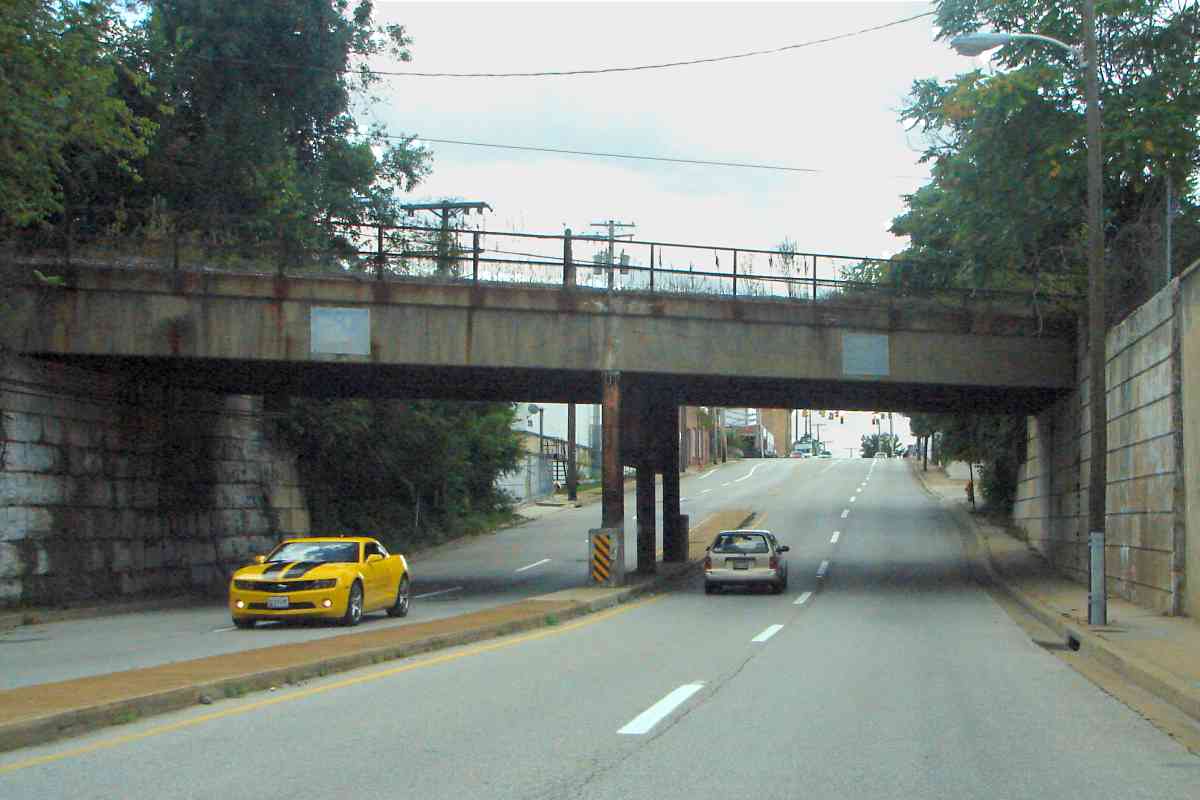
JHU B+O stock 
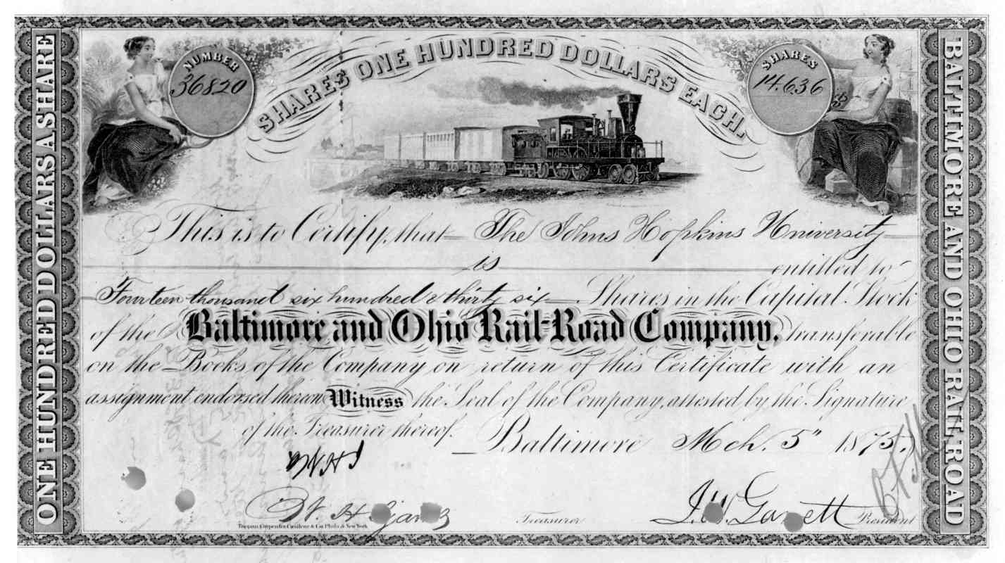
Garrett was also a founding trustee of Johns Hopkins University, just one of many connections between the railroad and the school. 
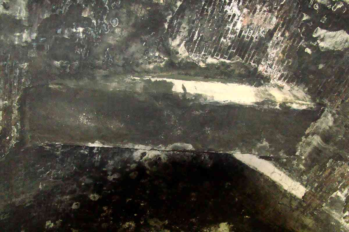
Pictured at right (courtesy the university) is the B&O stock 
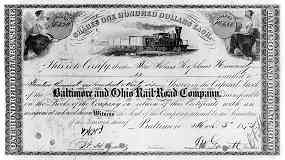
certificate signed by Garrett that represents the bequest of Johns Hopkins that established the school. On the certificate, a sharp-eyed reader may notice the illustrated locomotive's lack of both an American-style pilot and external drive rods.

Though B&O did have inside-drive 4-4-0 engines (designs named "Dutch Wagon" and "Yankee Clock") few examples were built. This suggests this certificate was engraved/printed in Britain where locomotives of that style were more common. Presumably Garrett himself approved the certificate design, and either did not realize these details or chose to ignore them. Perhaps it should not surprise that the Garrett-era of B&O is generally not considered the railroad's best, to put it mildly.

adjacent Hopkins Garrett plots 2018 
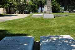
The Garrett name is also known to numismatists after his grandson donated to the university one of the finest private coin collections ever assembled. One can follow Garrett Avenue southwest until reaching Green Mount Cemetery where both Garrett and Hopkins are buried in adjacent family plots.

Link: Garrett biography at Wikipedia


Defect Detectors
Photo courtesy Dave Hiteshew

Defect Detectors
Mile: 92.2 Date: Sep 2009
Ease: B+ View: E
Area: C- RBL:
Map: Ba 35 E 8 Topographic Maps

The land slopes such that Aisquith Street (near) dips under the railroad but Harford Road goes above. In between defect detectors do their job. Low spots often hint where streams have been piped underground, and Aisquith is no exception: Homestead Run flows under the street, and the railroad, here.

Aisquith Street is named for Captain Edward Aisquith who helped defend Fort McHenry and Baltimore from British attack during the War of 1812.

Link: The Men Who Saved Baltimore


Inspector
Photo courtesy Dave Hiteshew

Inspector
Mile: 92.2 Date: Sep 2009
Ease: B View: E
Area: C- RBL:
Map: Ba 35 E 8 Topographic Maps

1914 
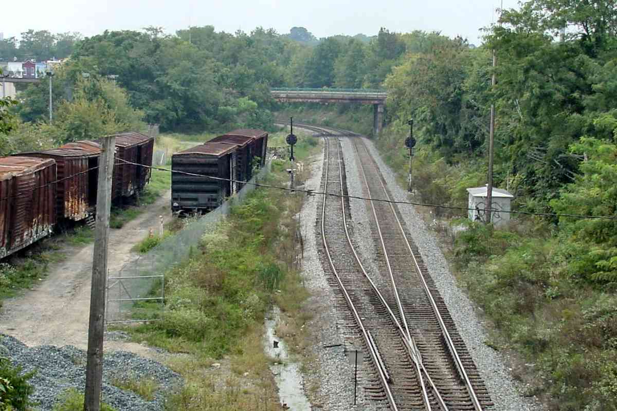
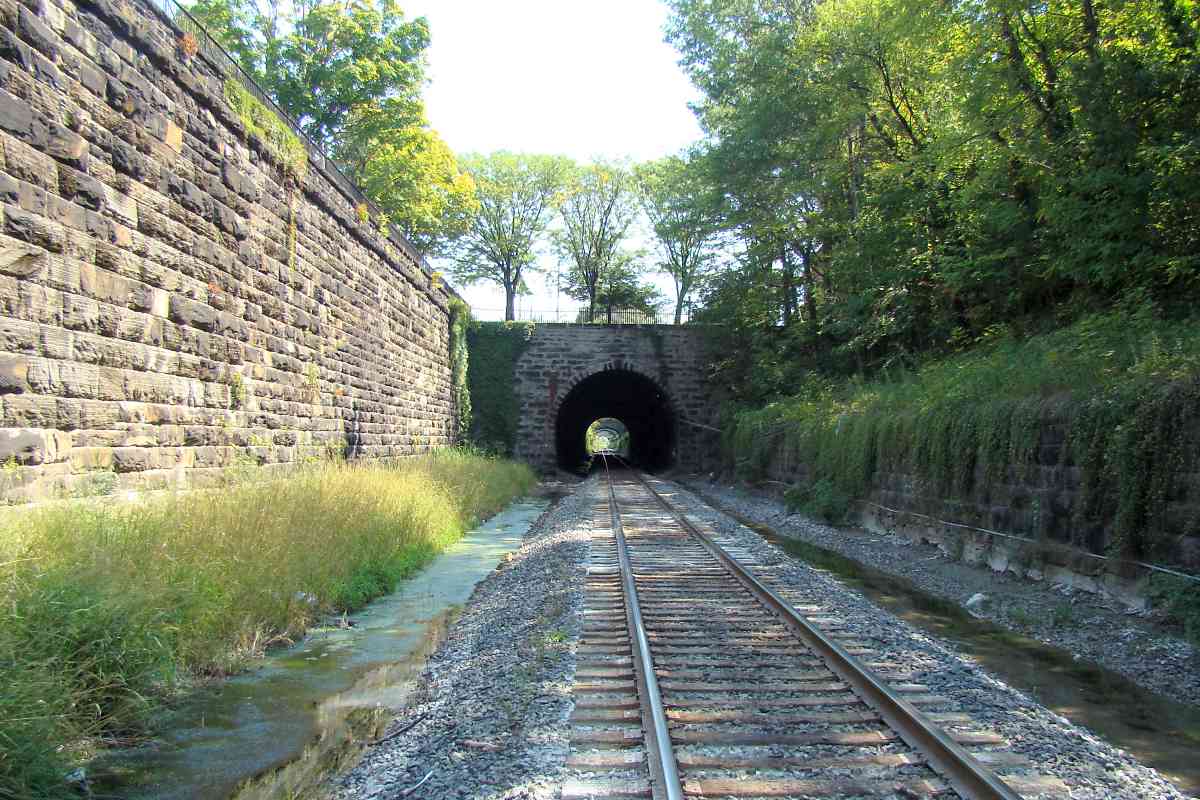
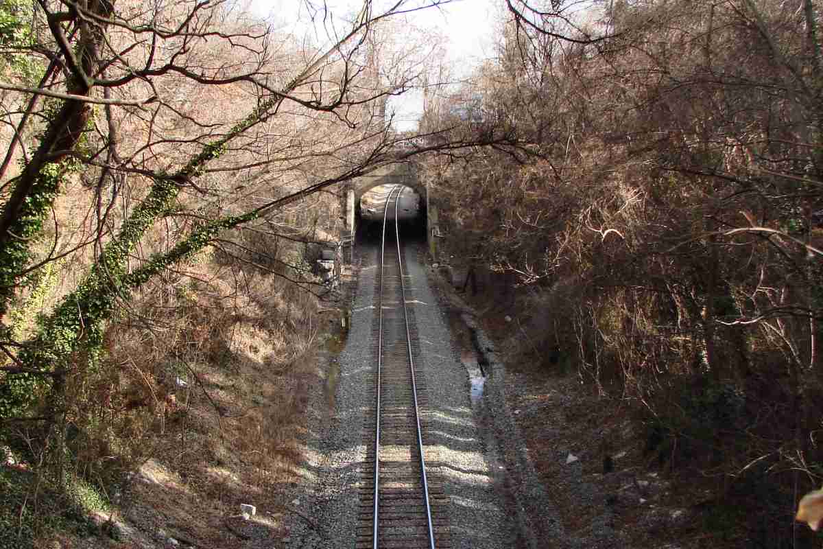
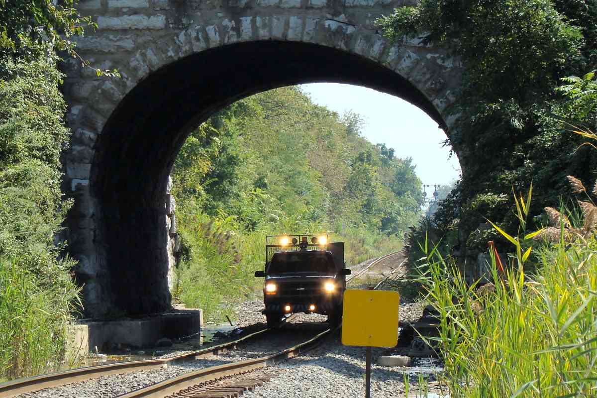
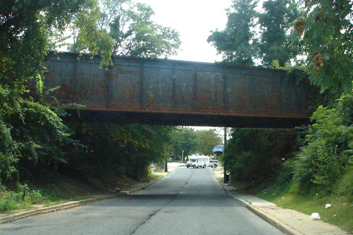
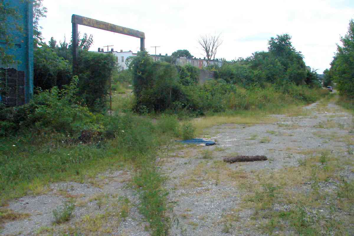
A track inspector's car is dwarfed by the Harford Road bridge.

The stone arch bridge was widened via a concrete addition on its east side during 1914. Expansions of one form or another have reformed many Belt Line bridges. This bridge is scheduled to be replaced during the 2020s as part of the Howard Street Tunnel project.


Milepost 92

Milepost 92
Mile: 92.0 Date: Aug 2016
Ease: B View: W
Area: C- RBL:
Map: Ba 35 E 8 Topographic Maps

Clough Siding Looking back to Harford Road, mix 'n match fonts make milepost 92.

Parallel on the left is Clough Street which has taken the place of sidings. Rusty rails can still be found, as well as weed growth along their path.


1927 Aerial
Photo via Johns Hopkins University

1927 Aerial
Mile: 92 Date: 1927
Ease: View: N (up)
Area: RBL:
Map: Ba 35 Topographic Maps

With Harford Road at upper left, this old aerial photo reveals the pre-Clough Street short siding along the southwest side of the Belt Line. St. Lo Drive is at lower right.

At upper right Clifton Park was to be the home of Johns Hopkins University. Henry Thompson, 18th Century owner of Clifton Park, served as President of the Baltimore and Harford Turnpike Company that built the adjacent Harford Road. After Thompson's death, in 1838 heirs sold the property to Johns Hopkins who in turn bequested it plus his B&O Railroad stock toward the formation of Johns Hopkins University.

Unfortunately, B&O stock was priced too low to fund new construction at Clifton, so the university was temporarily situated downtown. It moved to Homewood, JHU Gilman Hall 2004 its present Homewood location after donation of that land by heirs of Charles Carroll of Carrollton, the last living signer of the United States Declaration of Independence who on July 4, 1828 laid the ceremonial first stone for the construction of the B&O.

Aerial photos indicate the tree in this 2004 campus photo's foreground predates the university's arrival. The campus name dates back to 1690 when this land was surveyed for John Homewood.

Link: Johns Hopkins biography at Wikipedia


Saint Lo Drive

Saint Lo Drive
Mile: 91.8 Date: Sep 2016
Ease: A View: N
Area: C- RBL:
Map: Ba 35 F 8 Topographic Maps

plaque Bridge 11, rebuilt by the American Bridge Company during 1929, carries trains over Clifton Park's Saint Lo Drive.

Though Clifton Lake, once a reservoir of Baltimore City's water system, was drained during the 1960s, its valve house remains, albeit in disrepair, abutting Saint Lo Drive.


CPLs
Photo courtesy Dave Hiteshew

CPLs
Mile: 91.7 Date: Sep 2009
Ease: B View: E
Area: D+ RBL:
Map: Ba 35 F 8 Topographic Maps

cpls East of St. Lo, this stately set of Color Position Light (CPL) signals had guarded the interlocking. Double track extends from here to Bayview Yard. The CPLs have since been replaced by CSX's in-line signals.

Beyond, the sign of Goetze's Meat still stands tall even though the factory has been closed since 1974.


Goetze Siding

Goetze Siding
Mile: 91.5 Date: Aug 2016
Ease: B+ View: E
Area: D RBL:
Map: Ba 35 G 9 Topographic Maps

Goetze was large enough to warrant its own siding adjacent this trackside crumbling building. Only within the past few years has the building been broken into and become a homeless hangout. If you approach be prepared to be growled at.

Some of the support columns look in sad shape, but they did survive the 2011 earthquake, so perhaps they have decades more to go. No stronger earthquake has occurred in the US east of the Rocky Mountains during the more than 110 years since the Belt Line was constructed.

Links: Goetze Meat, 2011 earthquake


Belair Road

Belair Road
Mile: 91.4 Date: Aug 2016
Ease: A View: NE
Area: D+ RBL:
Map: Ba 35 G 9 Topographic Maps

Practically adjacent to the Belt Line's shortest bridge (over Rose Street) FPBW one finds its longest spanning a non-river, that over Belair Road, US 1.

It was built 1914 by the Fort Pitt Bridge Works of Pittsburgh, Pennsylvania, a company that operated from 1896 until a merger with Colonial Steel in 1986. I like the plaque's sans serif, bold font, one apropos of a steel bridge works.

B&O's Gay Street Station, mostly a waiting shelter, had stood in the northeast quadrant.


Ads

Ads
Mile: 91.4 Date: Sep 2009
Ease: B View: N
Area: D+ RBL:
Map: Ba 35 G 9 Topographic Maps

Delicious! Refreshing! Drink Coca-Cola At All Fountains. The brand's flowing font would not befit a steel bridge works.

This early 20th century wall ad has outlasted the house that had previously covered it. Other ads, visible by both B&O passengers and drivers on US 1 (Belair Road), have merged into a palimpsest.

Link: fading ads site


North Avenue

North Avenue
Mile: 90.7 Date: Aug 2016
Ease: A- View: SE
Area: D+ RBL:
Map: Ba 35 J 9 Topographic Maps

After curving under Edison Highway, the Belt Line meets North Avenue again, this time at the latter's most eastern reach (off photo right). The railroad has a lengthy straight run here. Bugle Field (baseball) had been on the right.


Federal Street

Federal Street
Mile: 90.3 Date: Aug 2016
Ease: A View: E
Area: C- RBL:
Map: Ba 35 J 10 Topographic Maps

This underpass for Federal Street was added during the 1930s, and is now busy enough to warrant widening.

At the northeast corner, during the 1950s The Hecht Company department store constructed a warehouse that received an adjacent siding for deliveries via B&O. The siding is now gone -- and so is Hecht's -- while the store's painted name fades on the warehouse.

Link: more about this Hecht


RR Crossing

RR Crossing
Mile: (90.2) Date: Aug 2016
Ease: A View: NW
Area: C- RBL:
Map: Ba 35 J 10 Topographic Maps

East of Federal Street, B&O's Columbia Siding curled into the Pennsylvania Railroad's former yard near Orangeville. The siding has not seen a train in decades, but the tracks and a unique crossing sign remain.


Forgotten Bridge

Forgotten Bridge
Mile: 90.1 Date: Mar 2020
Ease: B- View: N
Area: D RBL:
Map: Ba 35 K 10 Topographic Maps

This forgotten B&O stone bridge from the late 1800s is numbered 19 but is not marked on any map I have seen. It is aligned to permit Preston Street to pass under the railroad, but Preston Street never made it this far east. The creek in this vicinity gets its own culvert, so this bridge serves no purpose. Note: this location shows signs of being a homeless hangout.


Milepost 90
Photo courtesy Dave Hiteshew

Milepost 90
Mile: 90.0 Date: Jun 2009
Ease: B View: SE
Area: C RBL:
Map: Ba 35 K 10 Topographic Maps

Milepost 90 gets the stencil treatment.


Columbia Siding
NEW! late-Jan 2023

Columbia Siding
Mile: 89.9 Date: Aug 2016
Ease: B+ View: NW
Area: C RBL:
Map: Ba 35 K 10 Topographic Maps

B&O's Columbia Siding ends at the red "Stop End of Track" sign. In reality, at photo time track continued beyond the sign, but was in poor condition. During the 1980s, the siding had served Continental Can Company and Westvaco. Milepost 90 peeks out at the right edge.


Macon Street
Photo courtesy Dave Hiteshew

Macon Street
Mile: 89.9 Date: Dec 2009
Ease: A View: NE
Area: C RBL:
Map: Ba 35 K 10 Topographic Maps

At Macon Street you'll find bridge 20B, the Belt Line's only stone arch bridge under which you can drive. Note the concrete addition reveals widening to support a third track. CSX 5316 is on top.


MoW

MoW
Mile: 89.9 Date: Aug 2016
Ease: A- View: SE
Area: C RBL:
Map: Ba 35 K 10 Topographic Maps

mow Maintenance of way is an ongoing job of all railroads. On this particular summer's day CSX MoW units BR 9825 and MT 9524 had teamed up to ensure the rails are properly spiked to the wooden ties and ballast (crushed stone) distributed evenly.

Link: assorted MoW pics


New Signals

New Signals
Mile: 89.5 Date: Jul 2016
Ease: A- View: NW
Area: C RBL:
Map: Ba 36 A 11 Topographic Maps

dwarf Where BA tower previously stood CPLs have given way to CSX's new signals. Even the dwarf signal was not spared.

Rusty rails are disused rails. Sidings like these at left had sprouted off the Belt Line at various places during the early 20th century; all but a few stragglers have since been pulled up.

This location, at the northwest corner of Pulaski Highway, is considered one of the Belt Line's better railfanning spots, in part because one can peer the other direction into a bit of Bayview Yard.

Links: 1970s, 1980, 1990s


Over Pulaski Highway

Over Pulaski Highway
Mile: 89.5 Date: Jul 2016
Ease: A- View: SE
Area: C RBL:
Map: Ba 36 A 11 Topographic Maps

For example, deep zoom toward Bayview Yard finds a lonely locomotive. Beyond that I-895 passes overhead.


CSX 6032
NEW! late-Jan 2023

CSX 6032
Mile: 89.4 Date: Aug 2018
Ease: A View: W
Area: C RBL:
Map: Ba 36 A 12 Topographic Maps

Arrival in Baltimore from the east via US 40, Pulaski Highway, will take you under this color-coordinated CSX bridge. The plaque left of B is a faded CSX sign that likely hides a B&O herald.


CSX 5325

CSX 5325
Mile: 89.3 Date: Jul 2016
Ease: A- View: NW
Area: C RBL:
Map: Ba 36 A 12 Topographic Maps

The lonely guy working on his rust, umm, tan is a GE model ES44DC built during 2006.

Link: more 5325 pics


1953 Aerial
Photo via Johns Hopkins University

1953 Aerial
Mile: 89 Date: 1953
Ease: View: N (up)
Area: RBL:
Map: Ba 36 Topographic Maps

This aerial shows the Belt Line entering from upper left, and feeding into a busy Bayview Yard on the right. The yard south of it belonged to the Pennsylvania Railroad, and is now occupied by Norfolk Southern. More recent aerial photos will include I-895. Within a few years after this photo, B&O's bridge over Pulaski Highway would be lengthened so more lanes of cars could pass underneath.

The wye at the west (left) end of the B&O yard marks the start of the Sparrows Point Branch to Dundalk. The branch still exists but has been quiet recently due to the closure of the huge Bethlehem Steel factory at Sparrows Point.

Change for: this site's PRR/Amtrak tour from here southwest


CSX 8387

CSX 8387
Mile: 89.3 Date: Jul 2016
Ease: A- View: S
Area: C RBL:
Map: Ba 36 A 12 Topographic Maps

CSX 8387 is resting on the west leg of the wye. Note the catenary of the Northeast Corridor in the distance, as well as CSX 2201.

This photo demonstrates why it's not a good idea to snap pics into the sun and through windshield glass, unless you don't have time to get a better angle.


Yard Office

Yard Office
Mile: 89.2 Date: Nov 2016
Ease: A View: W
Area: B RBL:
Map: Ba 36 B 11 Topographic Maps

The wye has CSX's Bayview Yard office surrounded. The view from I-895 is obstructed.

Link: Todd's Bayview page


Bayview Yard

Bayview Yard
Mile: 89.3 Date: Jul 2016
Ease: A- View: SE
Area: C RBL:
Map: Ba 36 A 12 Topographic Maps

Here's the view east into the yard from the ground...


From I-895

From I-895
Mile: 89.2 Date: Nov 2016
Ease: A View: E
Area: B RBL:
Map: Ba 36 B 11 Topographic Maps

... and from above.

Bayview was to be the eastern terminus of Baltimore's Red Line light rail project. The high cost of the project, some $3 billion, would require projected ridership fares of nearly $10 per trip just to cover the interest on bonds of that amount. And that plan called for the Red Line to cross but not connect with Baltimore's existing light rail and subway. As of this writing the Red Line project sits stopped at a red signal.

Link: Todd's Red Line page


The Belt Line meets / becomes the Philadelphia Branch here.

It also meets the Sparrows Point Branch which has its own tour.

<< Previous (west) | THIS PAGE: Waverly to Bayview | Next (east) >>

For more tours here now, select from the map: clickable map

Or, return to main page

Copyright Notice