TrainWeb.org Facebook Page
ASL Photo Tour


Annapolis Short Line
Modern day photo tour

Accompanying each photo below are:

Click a photo to see a larger view. Please send your comments and corrections to Steve.


<< Previous (south) | THIS PAGE: Arnold to Elvaton | Next (north) >>

B&A Trail

B&A Trail
Mile: 2.7 Date: Apr 2018
Ease: A View: NW
Area: A EH:
Map: AA 20 J 3 Topographic Maps

From here some 12 miles northwest to Glen Burnie, Maryland, ASL's right-of-way has been remade into the Baltimore & Annapolis Trail. Rails-to-trails efforts rarely manage to completely eradicate railroad artifacts, and often they intentionally retain a few, so let's see what we can find...

Link: B&A Trail info


Marker B

Marker B
Mile: 3.7 Date: Apr 2018
Ease: A View: W
Area: A EH:
Map: AA 20 H 1 Topographic Maps

At the Severn Way grade crossing this cement base of a signal or equipment box survives. The B&A's stop here was named Asberry.

Various points of interest along the trail are indicated by historical markers labelled A through Z installed during 1992 by Eagle Scout Brian Sanders and Troop 1785. During October 2005 Eagle Scout Eric Schroeder and Troop 450 refreshed them. A descriptive marker list can be obtained at the Earleigh Heights ranger station that will be seen later on this page.

At the adjacent Pines on the Severn grade crossing a train-automobile collision killed 4 during December 1924. During that time the crossing was private, and trains did not sound a whistle or horn for such crossings.

Link: Arnold area history


Electrification
Photo courtesy HH Harwood collection

Electrification
Mile: Date: ~1908
Ease: View:
Area: EH:
Map: Topographic Maps

This photo of ASL car 32 dates to shortly after the 1908 electrification of the line. Unfortunately the photo location has been lost to time. Even after 1908, ASL operated some steam while it waited for delivery of more "motors" as the electrically-powered cars were known.


Joyce Lane

Joyce Lane
Mile: 4.2 Date: Apr 2018
Ease: A View: NE
Area: A EH:
Map: AA 15 G 12 Topographic Maps

Sadly none of the railroad bridges between here and Glen Burnie remain in their original state. For trail purposes most have been replaced by light-duty bridges like this. This was the location of the stop named Joyce.

Link: 1987


Asquith Creek

Asquith Creek
Mile: 5.1 Date: Apr 2018
Ease: B+ View: NW
Area: A EH:
Map: AA 15 E 11 Topographic Maps

There's another light-duty, post-railroad bridge to span a small but deep creek between Asquithview Lane and Old County Road; at the latter, Revell was the stop name. The Icy Conditions sign is fake news since by photo time spring greening was well underway. Fast-growning, non-native bamboo stands tall in many spots along this stretch of the trail, perhaps an unintentional import during the regrading for the trail.


Substation

Substation
Mile: 6.1 Date: Apr 2018
Ease: A- View: NW
Area: A- EH:
Map: AA 15 D 9 Topographic Maps

rails This building at Jones housed an ASL electrical substation. The rails under the structure (right) facilitated swapping the heavy equipment within for service or newer models.

During 2015 the Ann Arrundell County Historical Society opened a store within the building, and as of 2018 is remodeling it into a craft shop.

Links: shop, AACHS site


Jones Station Road

Jones Station Road
Mile: 6.1 Date: Apr 2018
Ease: A- View: SE
Area: A- EH:
Map: AA 15 D 9 Topographic Maps

After the Severn River bridge closed during 1968, the B&A's southern terminus shifted north from Annpolis to here, where into the early 1970s the railroad hauled freight for the Annapolis Lumber and Supply Company.

Jones's passenger station that stood trailside at left is remembered by a historical sign.


Jones Station

Jones Station
Mile: 6.1 Date: (Apr 2018)
Ease: A- View: (E)
Area: A- EH:
Map: AA 15 D 9 Topographic Maps

Per the sign (the linked photo is extra-large so as to make the full text legible):

    "Jones Station was the eighth stop from Annapolis on the rails Baltimore & Annapolis Railroad and served both as a passenger and freight station. The railroad fueled growth in the Baltimore-Annapolis corridor by providing fast and frequent passenger service via an expertly-constructed railroad infrastructure. This location was also the site of vital railroad support facilities, most importantly an electrical substation that facilitated reliable propulsion for all rail vehicles."
A short stretch of track at Jones Station was left extant. At the white truck beyond, a second Jones electrical substation was added when the original proved insufficient.


Round Bay

Round Bay
Mile: 6.8 Date: Apr 2018
Ease: A- View: NW
Area: A EH:
Map: AA 15 C 8 Topographic Maps

During the early 20th Century people escaping the summer heat of Baltimore and Washington rode trains to Anne Arundel County in sufficient quantity to temporarily quadruple its population. At that time, Round Bay, along the Severn River, was the only interracial beach area. Summer camps for children, such as Camp Linstead and Camp Wawanaissa, were also found along the river.

J. Wilson Brown was part owner of both Round Bay as well as ASL, hence ASL built a station a short distance off the main line, plus a track wye here. Randell Road on the left is a remnant of that wye.

Link: AA Beach Resorts (PDF)


Round Bay Station

Round Bay Station
Mile: 6.8, spur 0.3 Date: Apr 2018
Ease: A View: N
Area: A EH:
Map: AA 15 B 7 Topographic Maps

Old Station Road Round Bay Station has been preserved by incorporation into a private home. A plaque on the structure reads "Hall Train Station Est. 1878" though ASL did not arrive here until 1887. Hall might be the name of the current resident.

The appropriately-named Old Station Road (left photo), with the grading and narrow width characteristic of a railroad route, leads to the former station.


Severna Park Station

Severna Park Station
Mile: 7.6 Date: Apr 2018
Ease: A View: S
Area: A- EH:
Map: AA 15 B 6 Topographic Maps

Riggs Avenue Less than a mile north one finds another station building, that of Severna Park, currently home to The Severna Park Model Railroad Club.

Privately owned even during its heyday, with heat during the winter this station may have been the comfiest one between ASL's terminal cities.

Railroad crossing signs in reverse-color of today's standard may date to the post-ASL, WB&A era yet still stand guard at adjacent Riggs Road.

Link: station history


Robinson
Photo credit R.H. Young

Robinson
Mile: 8.2 Date: Apr 1939
Ease: A- View: NW?
Area: A- EH:
Map: AA 15 A 5 Topographic Maps

The even-numbered signal means this view looks eastbound, which per WB&A and B&A reckoning is from Annapolis to Baltimore, hence the camera is looking northwest as B&A car 205 pauses at Robinson. The siding on the right appears to not extend very far, and is omitted by topographical maps from the period.


Robinson Now

Robinson Now
Mile: 8.2 Date: Apr 2018
Ease: A- View: NW
Area: A- EH:
Map: AA 15 A 5 Topographic Maps

A modern view at Robinson Road shows little more than the right-of-way still matches.


Robinson Station

Robinson Station
Mile: 8.2 Date: Apr 2018
Ease: A- View: SE
Area: A- EH:
Map: AA 15 A 4 Topographic Maps

This reverse view puts Robinson Station on the left. History Marker L stands nearby.

When we think of train stations today often we envision grand structures such as DC's Union Station. It is important to remember that along interurban lines, stations in less-populated areas were sometimes little more than passenger waiting shacks open to the elements. Robinson is unique along the trail in that both sides exhibit curbs that marked the edge of platforms.


Pack Town

Pack Town
Mile: 8.9 Date: Apr 2018
Ease: A- View: N
Area: A EH:
Map: AA 14 K 3 Topographic Maps

Pack Town (History Marker M) was named for a local family. The Jennings Road grade crossing closed during 2017.


Earleigh Heights

Earleigh Heights
Mile: 9.7 Date: Mar 2018
Ease: B+ View: NW
Area: B+ EH:
Map: AA 14 H 1 Topographic Maps

Earleigh Heights Station 
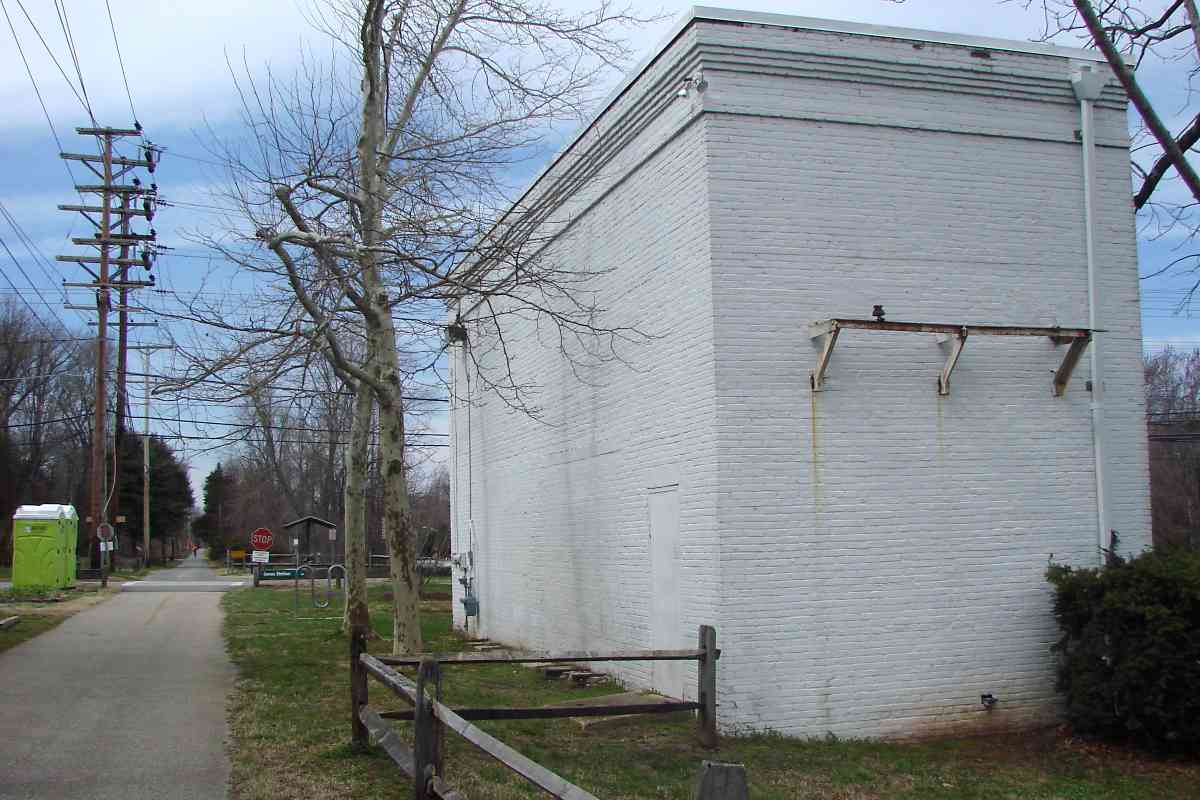
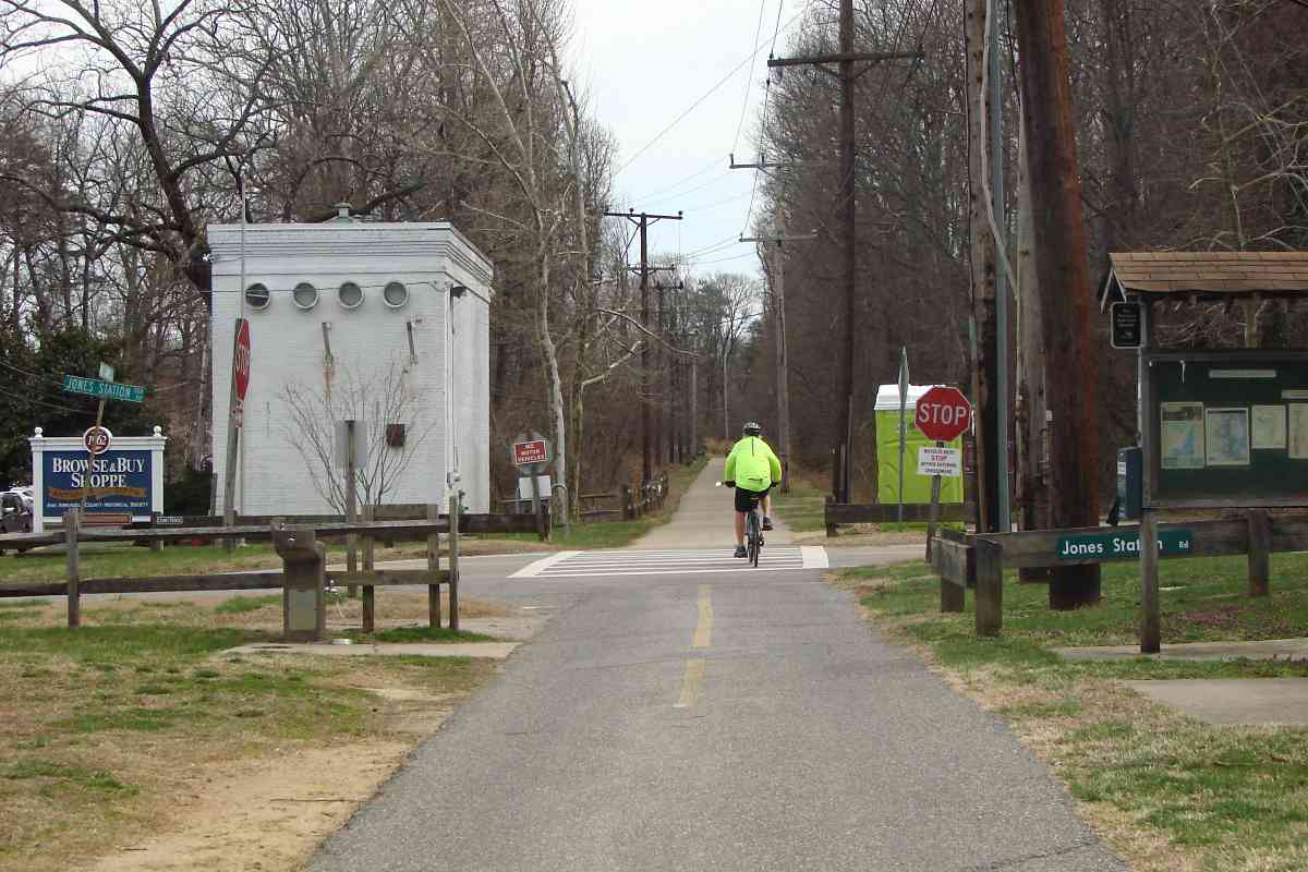
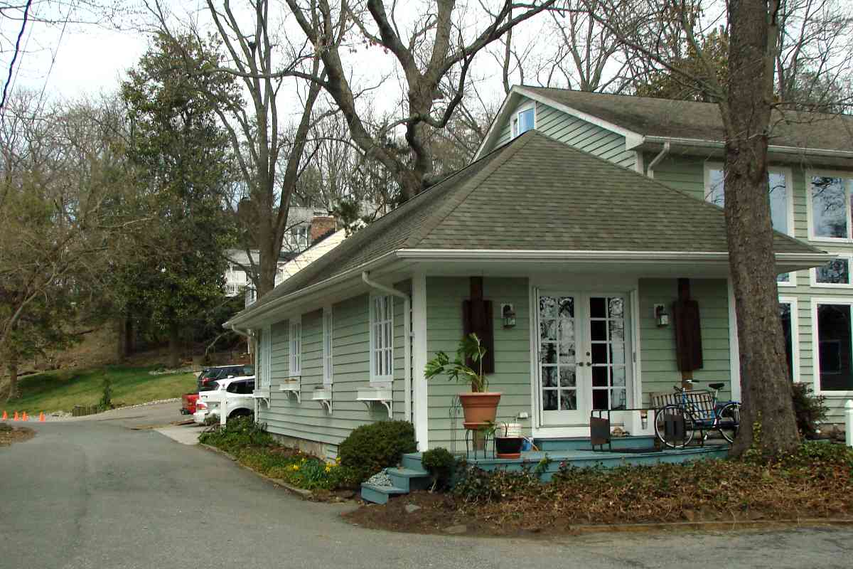
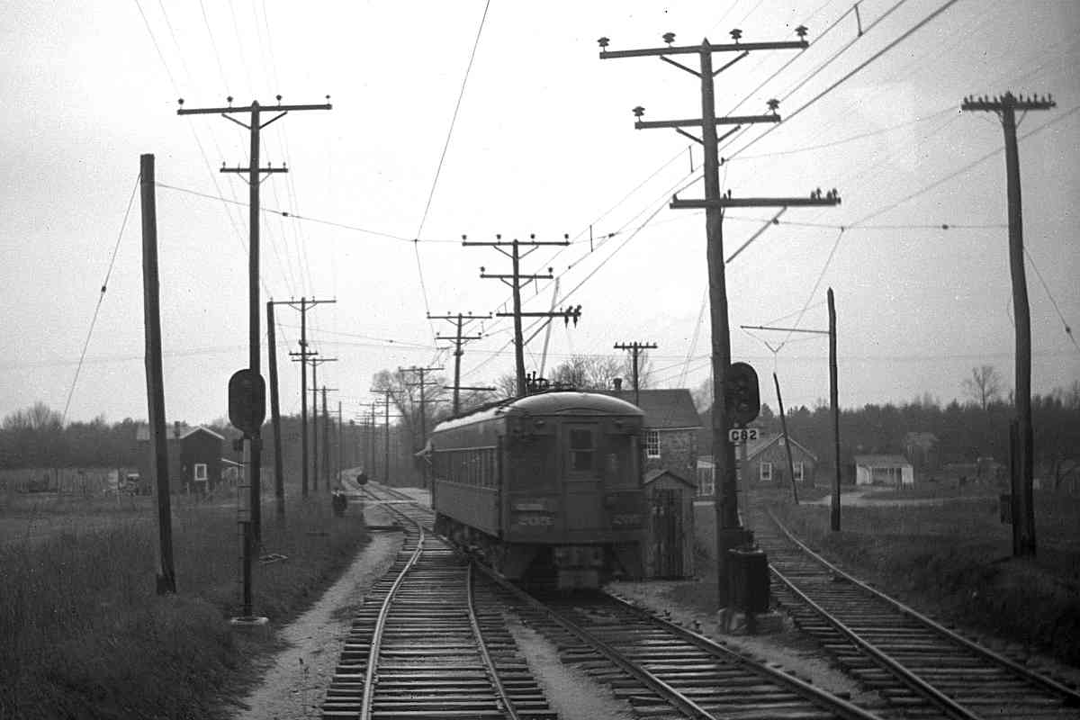
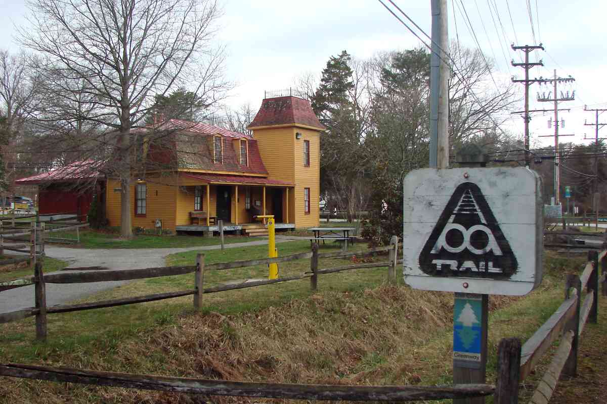
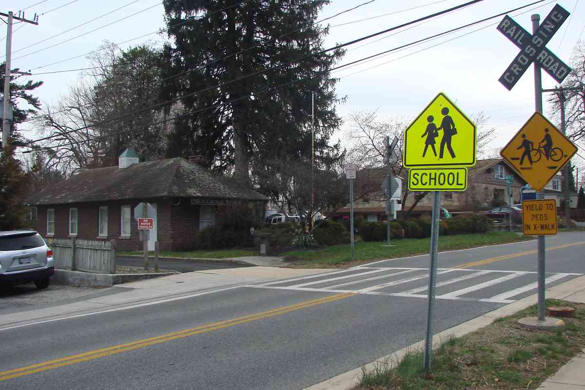
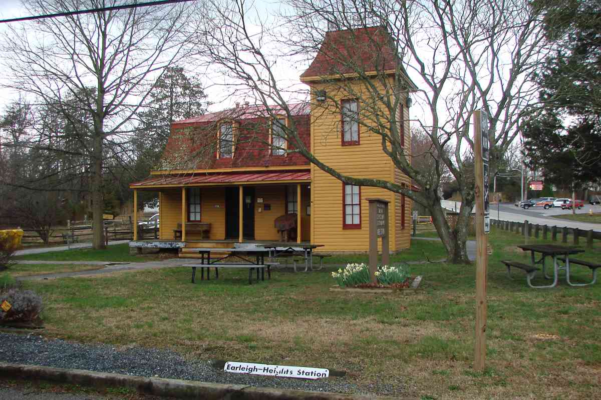
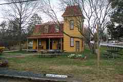
The oldest surviving railroad station in the county is now a ranger station for the B&A Trail park. Frost's Store, as it was known, was built in the second-Empire style popular during the late 1800s. Over time it has served as a home, post office, ticket office, and store.
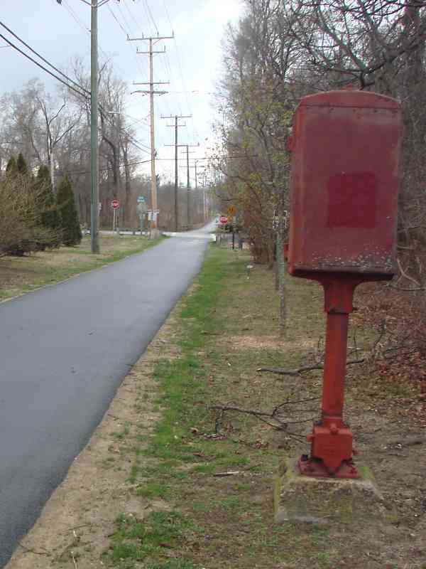
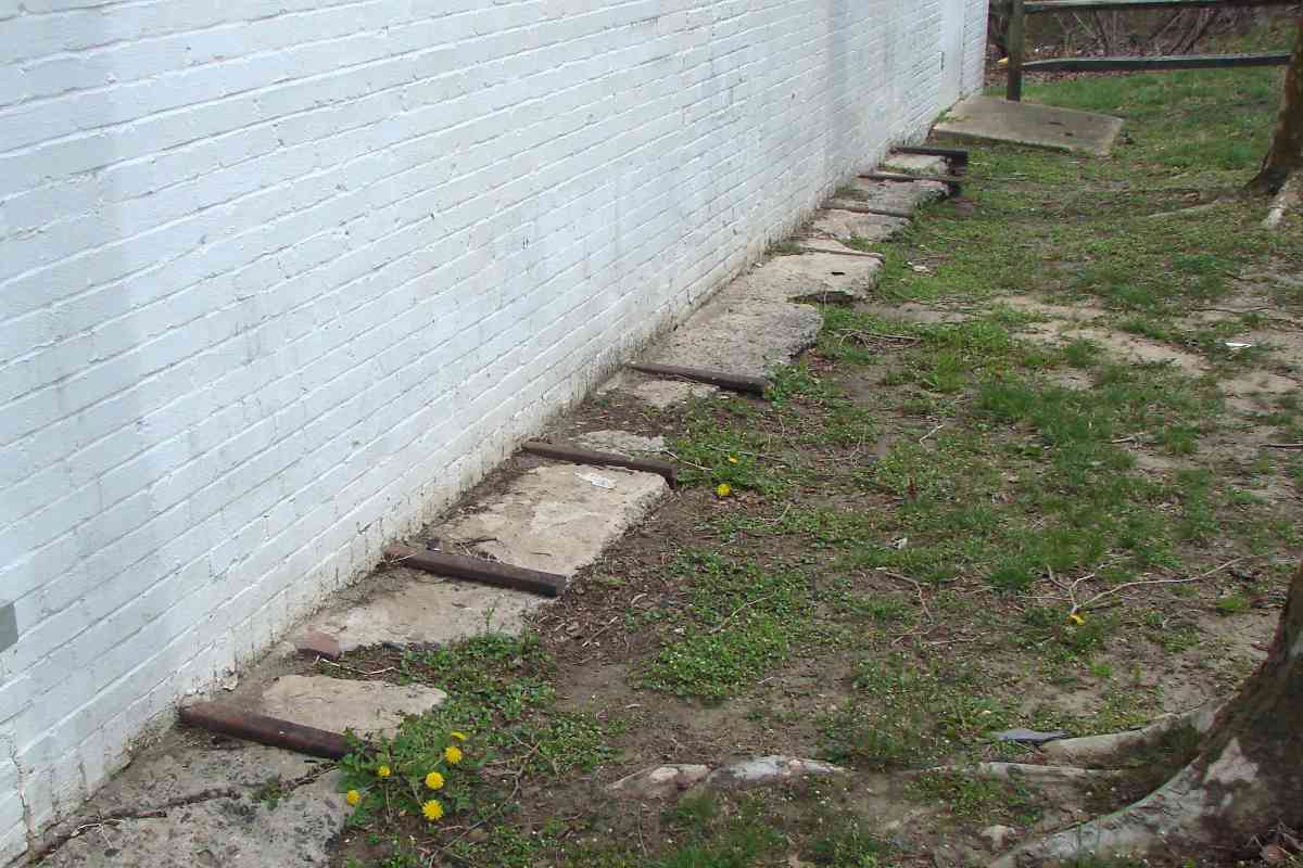
To my knowledge this building served as a passenger station only until ASL built its own station closer to the tracks; if you know otherwise 
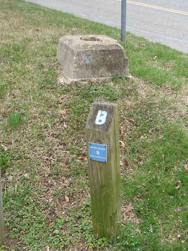
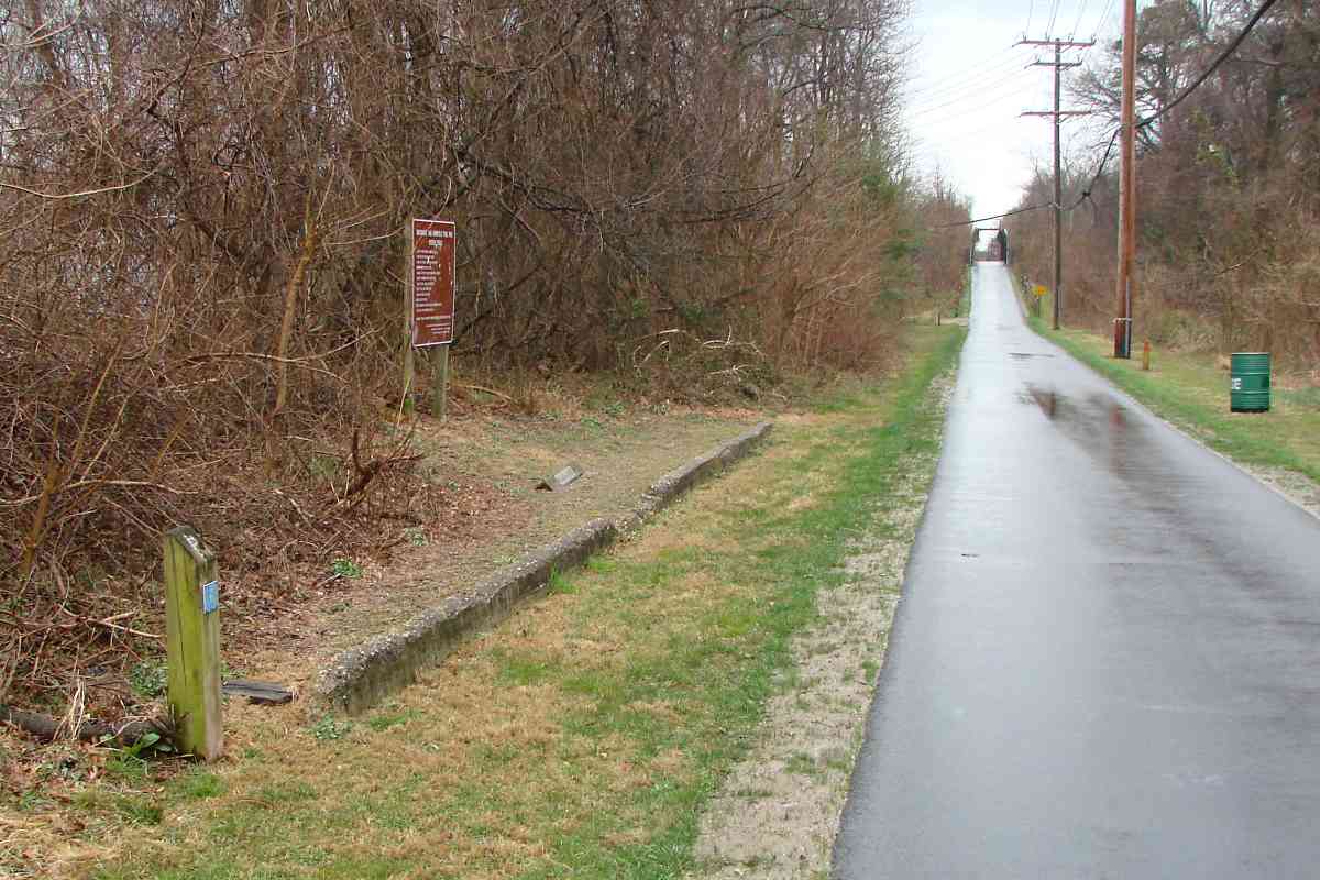
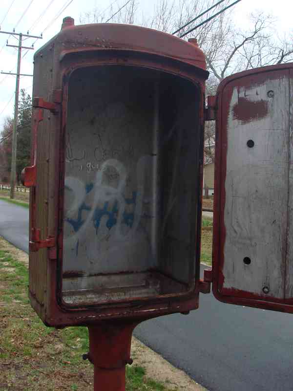
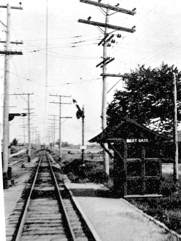
please email me. Note the curb at the bottom of the photo at left is the same type as found at many station sites, such as at Best Gate.


Millennium Legacy Trail

Millennium Legacy Trail
Mile: 9.7 Date: Mar 2018
Ease: B+ View: W
Area: B+ EH: 77
Map: AA 14 H 1 Topographic Maps

Marker N Earleigh Heights is not lacking for historical markers. The White House web site describes Millennium Legacy Trails as:

    "Sixteen 'National Millennium Trails' are trails of national significance -- large, visionary projects that allow people to walk or bike to national wonders, trace historic canals and commercial routes, or commemorate trails of discovery and migration. Fifty-two 'Millennium Legacy Trails,' selected from nominations by Governors of the states and jurisdictions, reflect the unique spirit of the areas they represent."


Planet Panorama

Planet Panorama
Mile: 9.8 Date: Mar 2018
Ease: A- View: W
Area: B+ EH:
Map: AA 14 H 1 Topographic Maps

Pluto If you've ever wanted to take big steps in your life, while you walk the B&A trail you can tour the solar system. Each of your steps covers about 400,000 miles.

Link: Planet Walks


Pasadena

Pasadena
Mile: 10.8 Date: Mar 2018
Ease: A- View: SE
Area: A- EH:
Map: AA 8 G 12 Topographic Maps

Visitor Ethics The foundation of yet another station sits north of West Boulevard. History Marker P is for Pasadena.

A sign that reminds trail visitors of ethics makes one wonder if similar signs were needed when ASL operated here. Public transit used to feature "No Smoking, No Spitting" signs.

Link: No Smoking/Spitting in NYC subway


Box

Box
Mile: 11.5 Date: Mar 2018
Ease: A- View: NW
Area: A- EH:
Map: AA 8 F 10 Topographic Maps

inside box Near Waterford Road this surviving, now-empty equipment box likely dates to the WB&A era.

This area consisted largely of family farms when ASL built through. Farmers welcomed a new and faster way to send food to the cities. Over time small towns grew around the various rail grade crossings.


Elvaton
Photo credit James P. Shuman

Elvaton
Mile: 11.9 Date: May 1936
Ease: A View: SE
Area: A- EH:
Map: AA 8 E 10 Topographic Maps

At Elvaton this view looks southeast to B&A car 203 from the adjacent Jumpers Hole Road grade crossing.


Elvaton Now

Elvaton Now
Mile: 11.9 Date: Mar 2018
Ease: A View: SE
Area: A- EH:
Map: AA 8 E 10 Topographic Maps

turtles Eighty years later some of the utility pole lines remain.

During 2010 a storm washed out the B&A trail at the swampy, low spot in the distance. The terrapins didn't mind.

Link: Is it a turtle, a terrapin, or a tortoise?


Wires

Wires
Mile: 11.9 Date: Mar 2018
Ease: A View: NE
Area: A- EH:
Map: AA 8 E 10 Topographic Maps

As evidenced by the quantity of wires, an electrical substation had been located at Elvaton, behind what locals may remember as Luckies Store.


<< Previous (south) | THIS PAGE: Arnold to Elvaton | Next (north) >>

Or, return to main page

Copyright Notice