TrainWeb.org Facebook Page
B&O Washington Branch Photo Tour


B&O Washington Branch
Modern day photo tour

Accompanying each photo below are:

Click a photo to see a larger view. Please send your comments and corrections to Steve.


<< Previous (east) | THIS PAGE: Savage | Next (branch) >>

Looking Southwest

Looking Southwest
Mile: 19.0 Date: Oct 2003
Ease: C View: SW
Area: B IC2:
Map: Ho 20 E 10, AA 5 B 9 Topographic Maps

Back on the main line, this is the view southwest at mile marker 19. There was no mile stone here that I could find, but there was a old "mile marker on a rail" hidden in the brush on the opposite side of the tracks.

Link: 1986


Little Patuxent Bridge

Little Patuxent Bridge
Mile: 19.4 Date: Sep 2000
Ease: B View: N
Area: A IC2:
Map: AA 5 A 10, Ho 20 D 10 Topographic Maps

Continuing south, the next significant structure along the Washington Branch is this bridge over the Little Patuxent River in Savage. At one time, a Bollman Bridge spanned the river here, but now this rather plain one does the job. This is the location of the very first Bollman Bridge installed by B&O. Before the Bollman, a 50-foot single (!) arched stone bridge was used, but it washed out in a flood on October 7, 1847.

To obtain this view, look carefully through the trees while driving past on Brock Bridge Road.


Little Patuxent Bridge 2

Little Patuxent Bridge 2
Mile: 19.4 Date: Sep 2001
Ease: C View: SW
Area: A IC2:
Map: Ho 20 D 10, AA 5 A 10 Topographic Maps

Here's the view from trackside looking railroad west.

A plaque on this corner of the steel structure says it was built by the "American Bridge Company, U.S.A. 1920".

Between the bridge and the tall signal tower in the distance, the Patuxent Branch veers off to the right (northwest). The Patuxent Branch is the subject of the next page of this tour.

Link: Real-time USGS stream flow data near this location


Little Patuxent Bridge 3

Little Patuxent Bridge 3
Mile: 19.4 Date: Aug 2013
Ease: B- View: S
Area: A IC2:
Map: Ho 20 D 10, AA 5 A 10 Topographic Maps

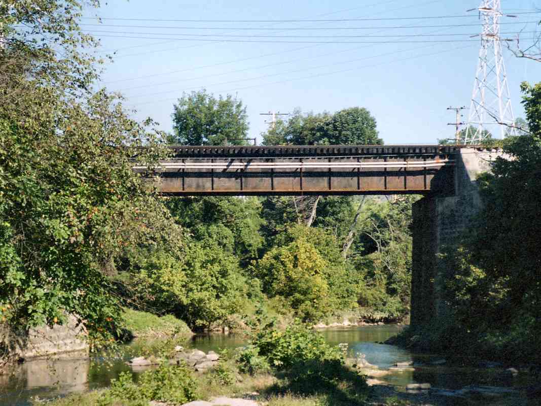
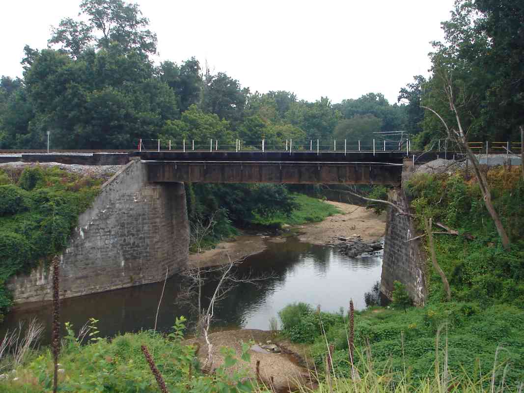
At one time, B&O considered starting its Metropolitan Branch (the shortcut that connects Washington and the Old Main Line) near here. The route would have followed the Patuxent River, then branched to Gaithersburg, then up to the OML. This was known as the Laurel-Gaithersburg line.

During the 1880s the route was also considered by the Baltimore, Cincinnati and Western, a competing railroad that never materialized.

Had such a route been built, land development in central Maryland would have progressed quite differently (for example, less undeveloped room for the town of Columbia?).


Juice Train

Juice Train
Mile: 19.4 Date: Sep 2001
Ease: B View: S
Area: A- IC2:
Map: Ho 20 D 10 Topographic Maps

The Tropicana Juice Train is a blur as it rushes its cargo north past the Patuxent Branch at Savage. When you see an ex-Conrail unit with a yellow number on its side like this one has, you know it was hastily renumbered by CSX before being repainted into CSX livery.


Orange Cars

Orange Cars
Mile: 19.4 Date: Sep 2001
Ease: B View: NE
Area: A- IC2:
Map: Ho 20 D 10 Topographic Maps

In a non-stop run, the vibrant orange cars of the "Juice Train" transport chilled fruit juices from Florida to distribution facilities in New Jersey. A few years later Tropicana's juice cars were repainted in white.

This might have been the last juice train before an unscheduled pause: this photo was snapped about one train length from where several 9/11 hijackers were staying at a Laurel motel, and just 3 days before their infamous deed.


CSX 5468

CSX 5468
Mile: 19.5 Date: Dec 2018
Ease: A- View: NE
Area: A- IC2:
Map: Ho 20 C 10 Topographic Maps

Deep zoom finds CSX 5468 jockeying a string of autoracks that reaches all the way back to Jessup Yard.


Disused Bridge

Disused Bridge
Mile: 19.5 Date: Dec 2018
Ease: A- View: SE
Area: A- IC2:
Map: Ho 20 C 10 Topographic Maps

Non-leaf season reveals stonework of a bridge that had once spanned the tracks here, as confirmed by old maps. Those maps place B&O's Savage Station in this vicinity on the Howard County side.


Signal Tower

Signal Tower
Mile: 19.5 Date: Oct 2003
Ease: A- View: NE
Area: A- IC2:
Map: Ho 20 C 10 Topographic Maps

A tall color-position light (CPL) signal tower protects the crossovers near the Patuxent Branch.


Last Days

Last Days
Mile: 19.6 Date: Aug 2013
Ease: A- View: NE
Area: A- IC2:
Map: Ho 20 C 10 Topographic Maps

CSX removed these CPLs November 16, 2013.


<< Previous (east) | THIS PAGE: Savage | Next (branch) >>

Or, return to main page

Copyright Notice