TrainWeb.org Facebook Page
Dundalk Trolley


Dundalk Trolley
Modern day photo tour

Accompanying each photo below are:

Click a photo to see a larger view. Please send your comments and corrections to Steve.


Background: Dundalk Trolley

Probably North
Photo courtesy Baltimore Streetcar Museum
and Digital Maryland

Probably North
Mile: Date: 1915
Ease: View: N
Area: BSTPY:
Map: Ba 44 D 4 Topographic Maps

Overhead wires confirm this is a trolley line rather than a B&O, PRR or Canton Railroad line.

The tracks appear to run straight into the distance for at least a mile.

Link: photo source


Probably East
Photo courtesy Baltimore Streetcar Museum
and Digital Maryland

Probably East
Mile: Date: 1915
Ease: View: E
Area: BSTPY:
Map: Ba 44 D 4 Topographic Maps

This is the same grade crossing. Summer shadows suggest we're looking somewhere between north and east.

The sign at the building reads "We Sell American Oil Co's Gasoline".

Link: photo source


Probably South
Photo courtesy Baltimore Streetcar Museum
and Digital Maryland

Probably South
Mile: Date: 1915
Ease: View: S
Area: BSTPY:
Map: Ba 44 D 4 Topographic Maps

A different road crosses at an angle closer to the camera. If the previous photo indeed looks east, this one looks south. The track is straight for at least a mile, which when combined with the opposite view direction means straight track totals about two miles.

Present-day Dundalk Avenue makes a straight run for a bit more than two miles. That had been the route of trolley line 26.

It's a puzzle. Do you know where this grade crossing had been?

I believe the puzzle has been solved. The solution follows below.

Link: photo source


Atlas 1915
Image courtesy Johns Hopkins University

Atlas 1915
Mile: Date: 1915
Ease: View: N (up)
Area: BSTPY:
Map: Ba 44 D 4 Topographic Maps

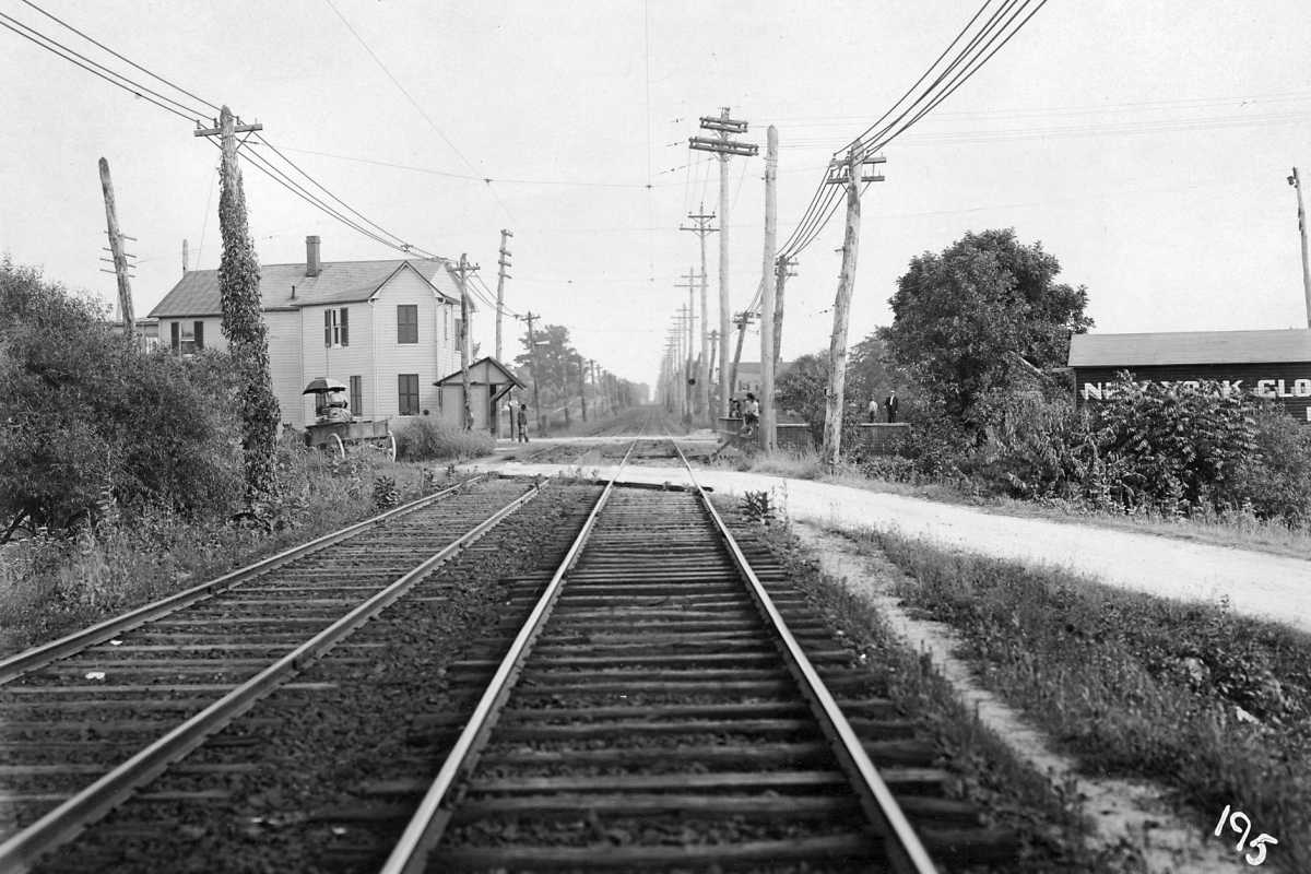
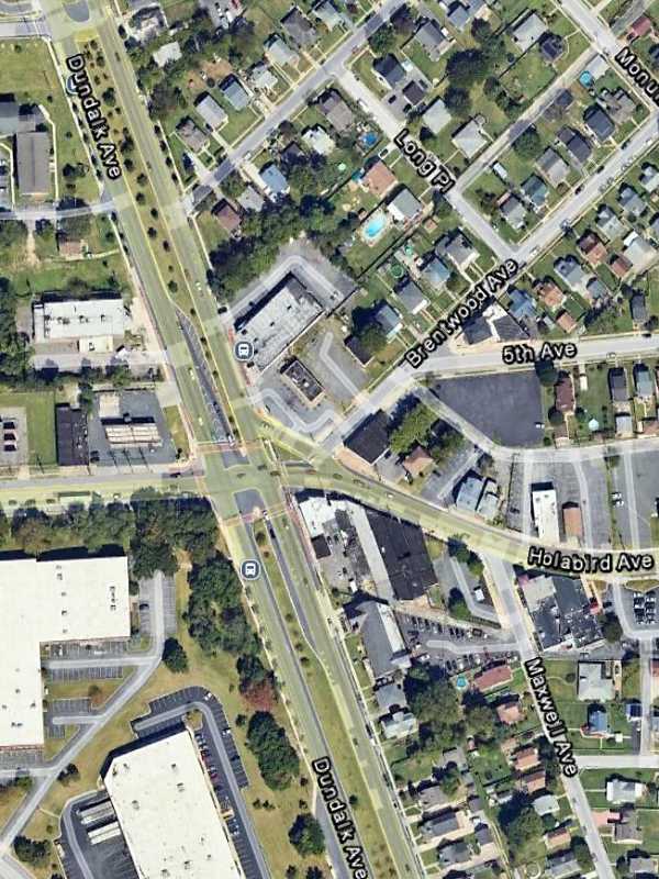
After more study, I believe the present-day intersection of Holabird and Dundalk Avenues is the spot.

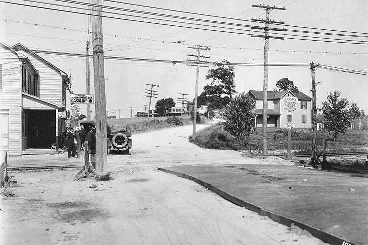
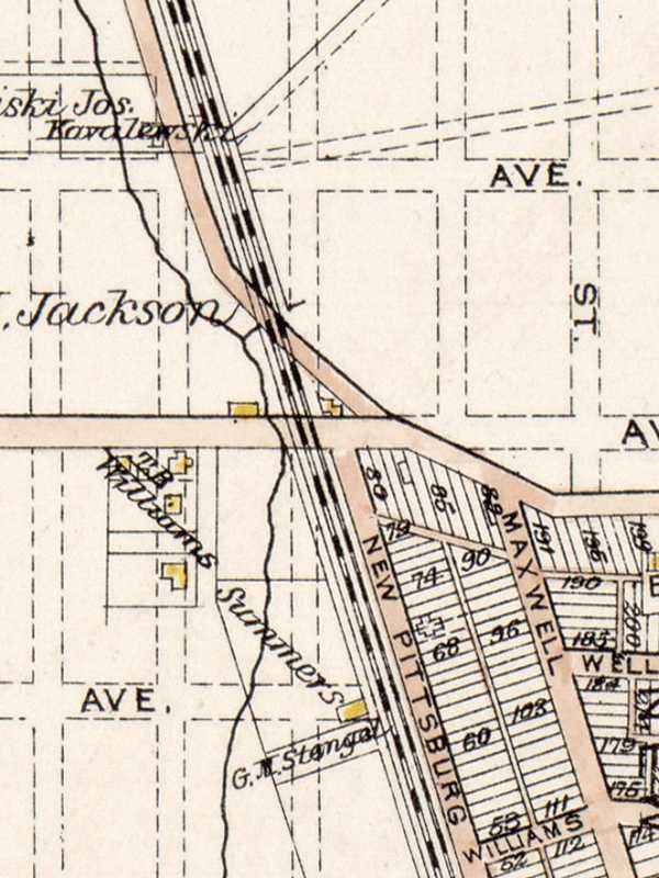
This map is contemporaneous to the photos. The gas station is the small building in the center of the triangle bounded by what had been Fifth Avenue (from left), Trapp Road (from north) and the trolley. The trolley stop's passenger shelter is not depicted.

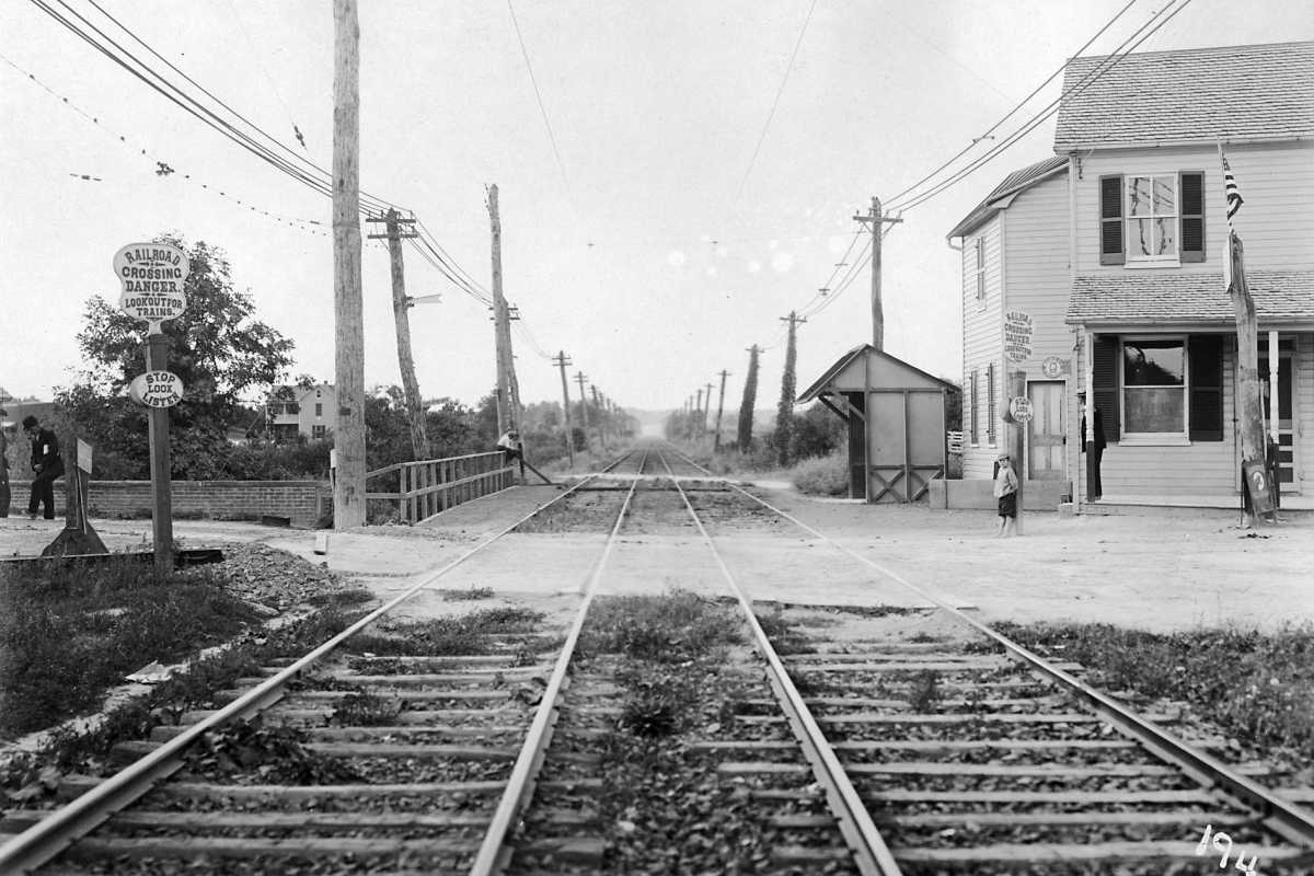
Notice the creek that wanders to the left of the trolley: in the Probably North view above, people at left are standing on what looks to be a bridge.

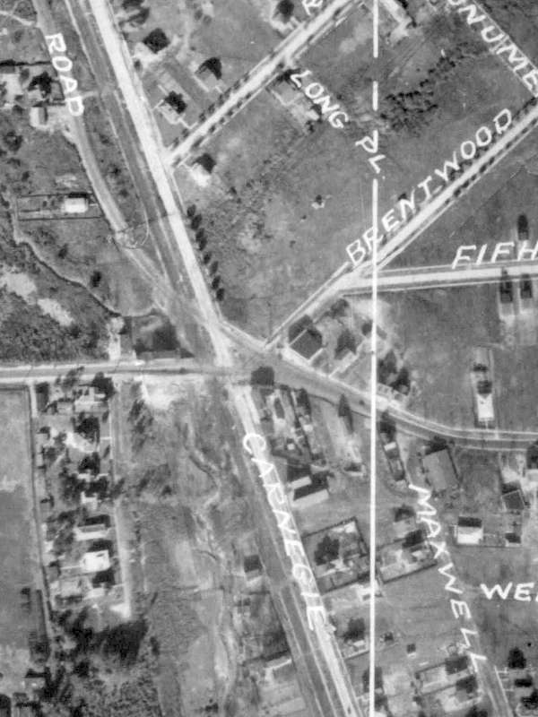
Part of Trapp Road was later incorporated into Dundalk Avenue while Fifth Avenue was renamed Holabird Avenue. What shows as New Pittsburgh would be renamed Carnegie by the time of the 1927 aerial below. It is now named Dundalk Avenue.


Aerial 1927
Photo courtesy Johns Hopkins University

Aerial 1927
Mile: Date: 1927
Ease: View: N (up)
Area: BSTPY:
Map: Ba 44 D 4 Topographic Maps

The roads and houses had changed a bit by 1927. Carnegie is now named Dundalk Avenue.


Aerial 2023
Photo courtesy Google

Aerial 2023
Mile: Date: Sep 2023
Ease: View: N (up)
Area: BSTPY:
Map: Ba 44 D 4 Topographic Maps

The southbound lanes of Dundalk Avenue have taken the place of the trolley and Trapp Road.


For more trolleys, see (offsite link) Baltimore Streetcar Museum.

For other tours here, select from the map: clickable map

Or, return to main page

Copyright Notice