TrainWeb.org Facebook Page
B&O Photo Tour


B&O Seawall Branch
Modern day photo tour

Accompanying each photo below are:

Click a photo to see a larger view. Please send your comments and corrections to Steve.


<< Previous (west) | THIS PAGE: Chesapeake Avenue to Wagners Point | End of tour || main index

Chesapeake Avenue

Chesapeake Avenue
Mile: 0.8 Date: Jan 2015
Ease: A View: S
Area: B- IC2:
Map: Ba 43 H 9 Topographic Maps

Only bits and pieces remain of the petrochemical industry that had bustled here. The dearly departed left hazardous waste behind that has required years of cleanup effort. The area's bleak appearance, particularly during winter, might be helped by a few evergreen trees.

Former employees of these companies and their families continued to reside in the area despite its industrial nature, and reportedly unusually high cancer incidence rates. Groups raised money during the 1990s to relocate the straggling residents out of Fairfield and Wagner's Point, a process that took over 10 years to complete.


CSX 2746

CSX 2746
Mile: 0.8 Date: Jan 2021
Ease: A View: S
Area: B- IC2:
Map: Ba 43 H 9 Topographic Maps

water The branch grows quieter beyond the Fairfield Auto Terminal, but with some luck you can still find a train operating.

While waiting for the dispatcher to give the go ahead, the interior of a locomotive can get pretty warm, but at least during January, a GP38-2 model offers a convenient place to cool your bottled water. This unit began life in 1973 as Penn Central 8121. The second engine, CSX 6412, is a GP40-2 built in 1978 for C&O.


Above Ground

Above Ground
Mile: 0.9 Date: Jan 2015
Ease: B View: S
Area: B- IC2:
Map: Ba 43 J 9 Topographic Maps

Above ground pipes are easier to install, even if they must leave clearance for trains, plus easier to monitor for leaks and to repair.


Omni Rail

Omni Rail
Mile: 0.9 Date: Jan 2015
Ease: B View: W
Area: B- IC2:
Map: Ba 43 J 10 Topographic Maps

Specially-designed materials are employed at industrial grade crossings like this. With the residents gone, acres are now desolate, fallow until the next industrial boom. During the subsequent decade, Fairfield would become home to more new car storage and warehouses.

Link: Omni Rail's web site


C&CB RR

C&CB RR
Mile: 1.1 Date: Apr 2015
Ease: A View: NW
Area: B- IC2:
Map: Ba 43 J 10 Topographic Maps

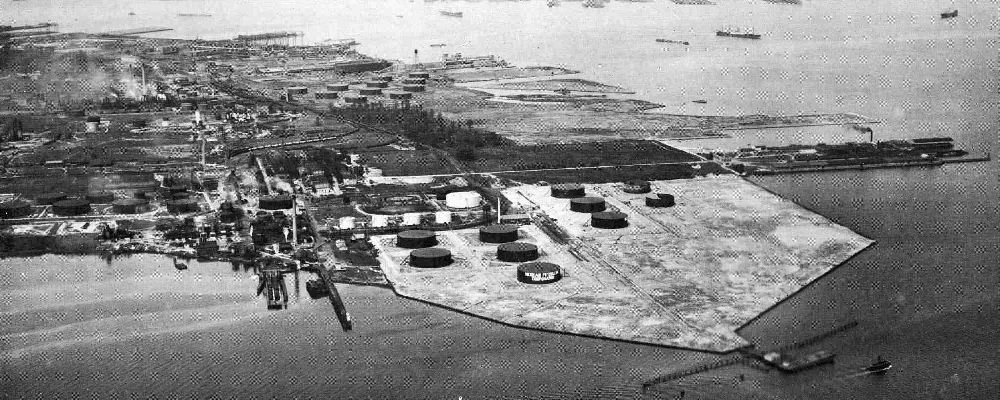
Industry first arrived at Wagner's Point during 1883 when Martin Wagner moved his canning factory from East Baltimore. Expansion of the company town continued until in 1912 the cannery burned down, and to survive, Wagner sold off much of the property to the then-burgeoning petrochemical industry. 
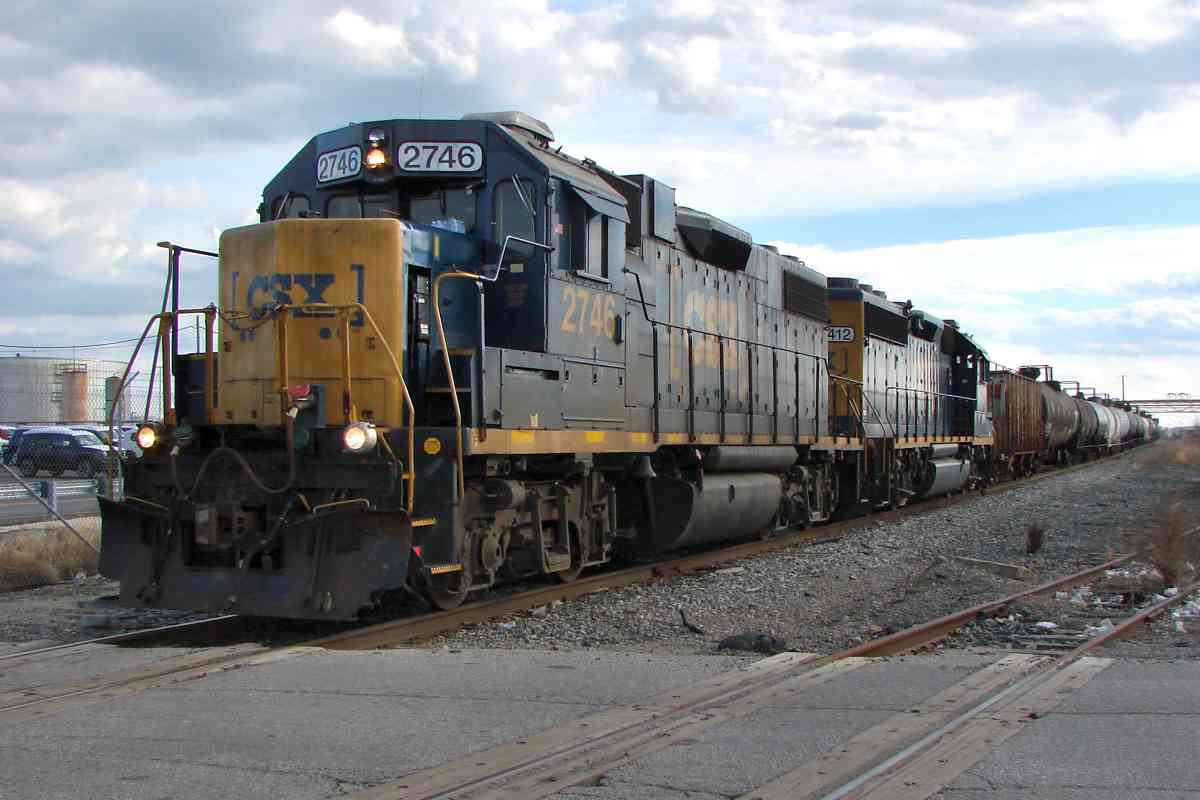
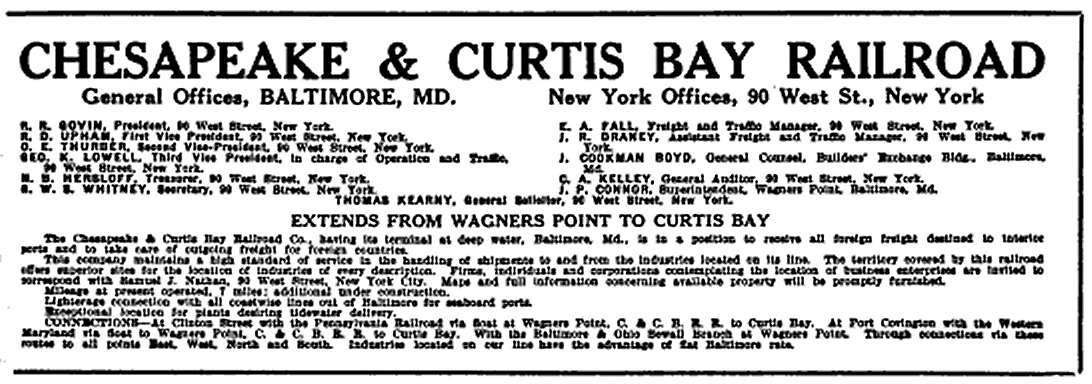
The Chesapeake and Curtis Bay Railroad Company (C&CB) arrived in 1915, later becoming part of Western Maryland.

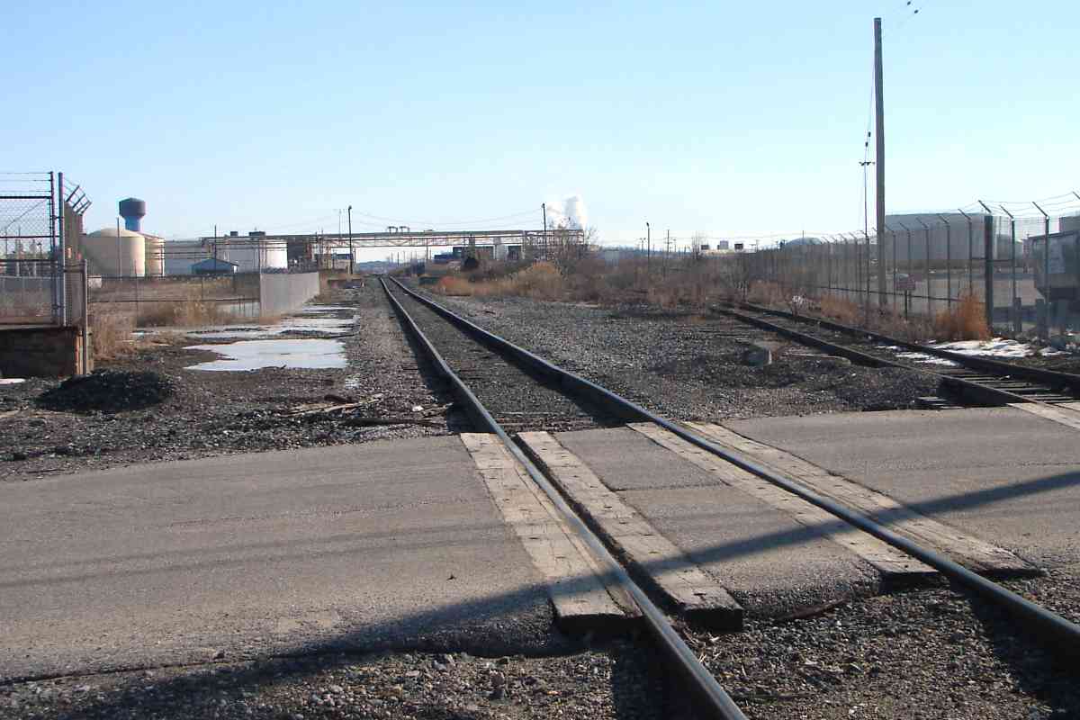
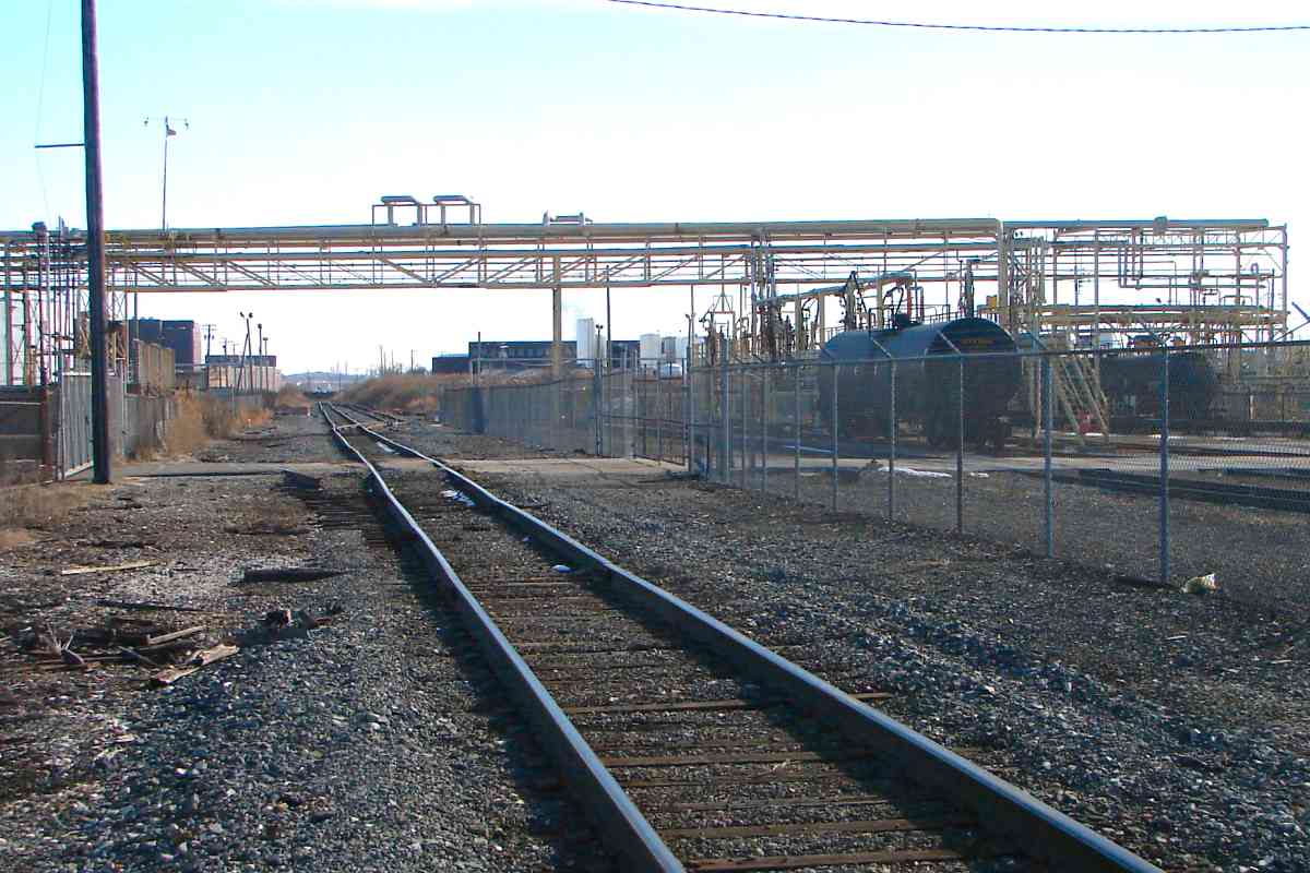
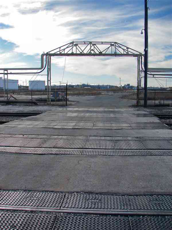
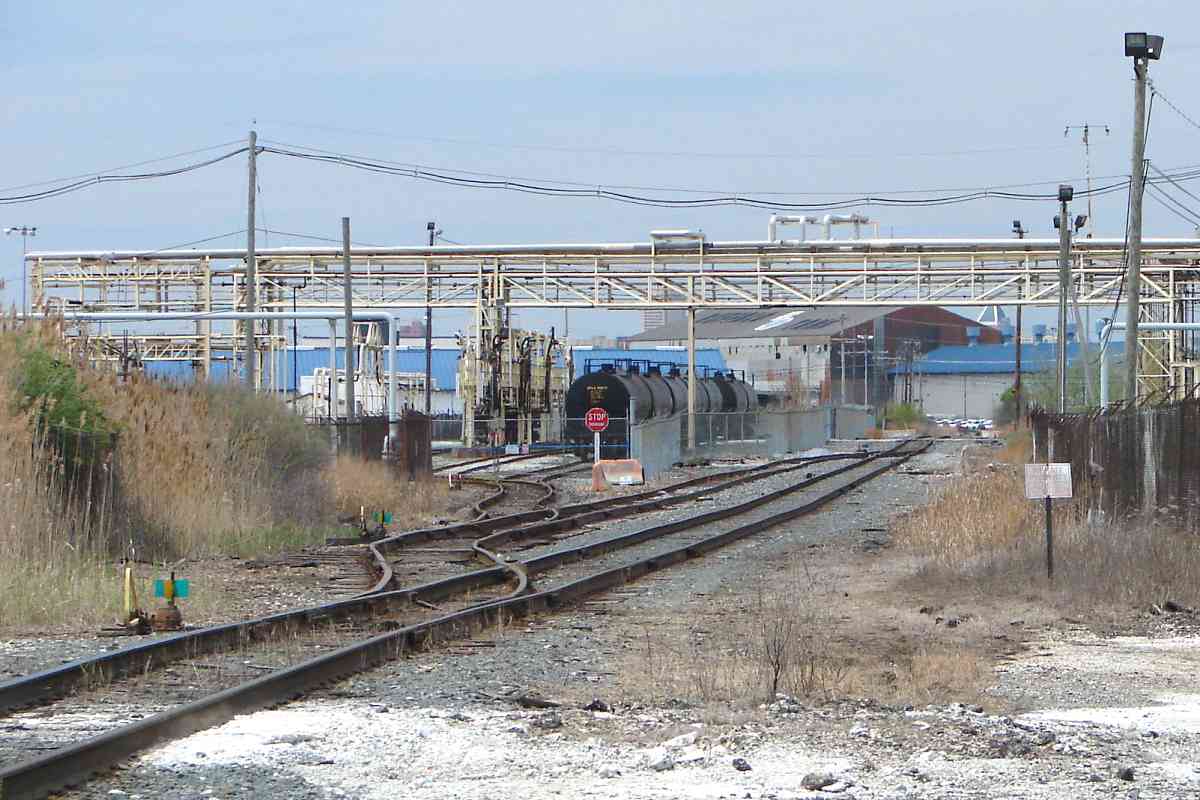
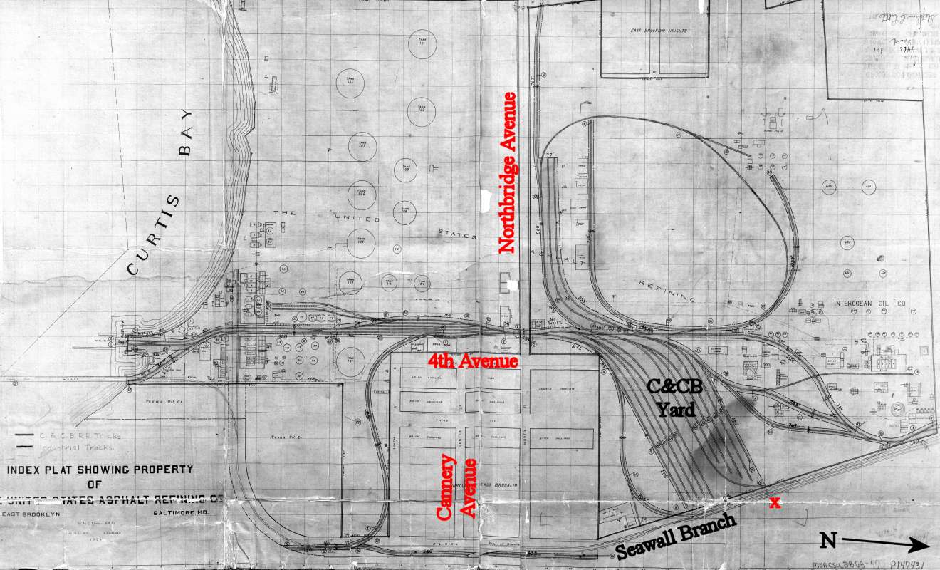
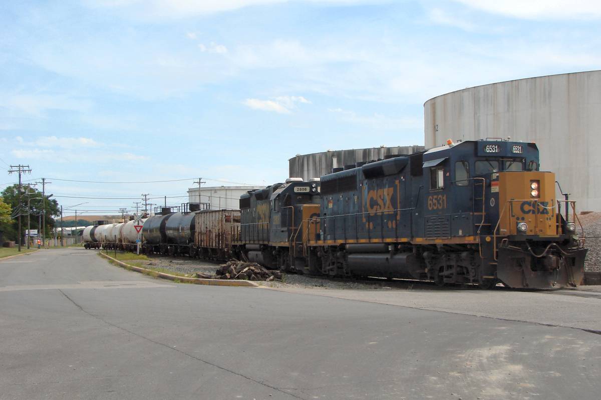
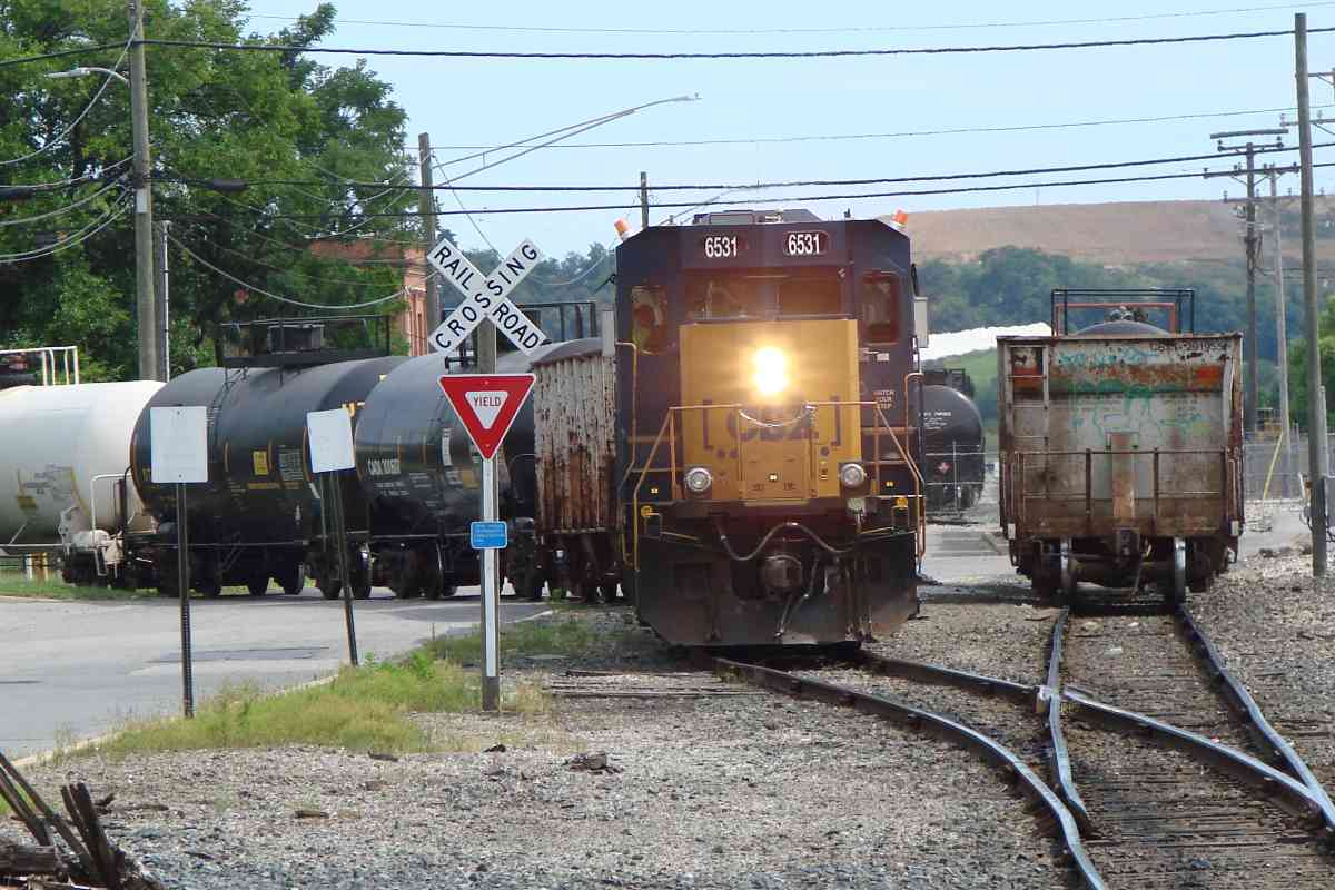
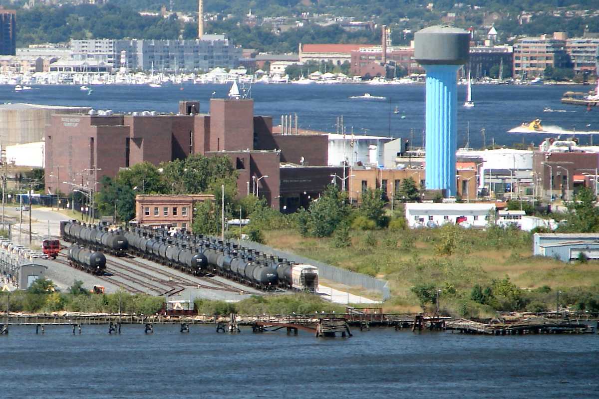
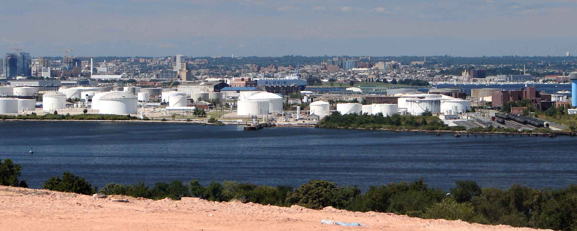
As part of its northernmost reach to serve this industrial yard, the tiny C&CB had connected with B&O's Seawall Branch on the left near the green switch indicator. The photographer's location is designated by a red x on the map below.

"Chesapeake and Curtis Bay" is a surprisingly modest name for a railroad. So many others of that era attracted investors via grand, aspirational names like "Chesapeake, Curtis Bay and Pacific".


C&CB Map

C&CB Map
Mile: Date: 1925
Ease: View: N (right)
Area: IC2:
Map: Ba 43 J 11 Topographic Maps

ad Chesapeake and Curtis Bay Railroad was mainly a car float operation, back when that phrase meant rail cars rather that the automobile import/export seen back at Childs Street. C&CB's track looped within Wagner's Point (and possibly on the south side of Curtis Bay too) to access various companies, then exchange the rail cars with B&O here, or float them from a slip and wharf at the left edge of this map to the Pennsylvania RR at Clinton Street or the Western Maryland RR at Port Covington. The track parallelling Northridge Avenue off the top of the map may have connected with B&O track that emerged from its Curtis Bay Yard.

By the time this map was drawn, C&CB was already under Western Maryland control. Its wharf remains today, though its rails have been swapped out for pipes that can offload/onload ships. What remained of C&CB merged into CSX in 1989.


Ex-Yard

Ex Yard
Mile: 1.2 Date: Apr 2015
Ease: A View: S
Area: B- IC2:
Map: Ba 43 J 10 Topographic Maps

C&CB's yard has been overtaken by brush on the right. The tracks within have been removed and I observed no artifacts, but such can easily be hidden by weeds. The photographer's location is designated by a red x on the map above.


C&CB Crossing

C&CB Crossing
Mile: 1.4 Date: Jan 2015
Ease: A View: E
Area: B- IC2:
Map: Ba 43 J 11 Topographic Maps

1964 aerial You may have noticed on the map above how C&CB's tracks necked down to a grade crossing near what had been the intersection of 4th and North Streets, now 4th and Northbridge Avenues. The lighter pavement stripe across the bottom of this photo is a remant of that crossing, repaved when the rails were pulled up. Straight ahead had existed the homes of the workers of the company town, along with St. Adalbert's Church that survived until 1969.

You can see the yard in the 1964 aerial photo at right (photo courtesy Johns Hopkins University), and below it the grade crossing and steepled church.

Link: St. Adalbert's Church pic


Asiatic Avenue

Asiatic Avenue
Mile: 1.4 Date: Jul 2023
Ease: A View: S
Area: B- IC2:
Map: Ba 43 J 10 Topographic Maps

Railroads were here before Asiatic Avenue was. Street running, that is, freight trains operating along rails in paved streets, was found all around Baltimore's waterfront during the 20th century. Very little of that track remains, and even trains running side by side with automobiles, as happens here, is no longer common.

Link: Monumental City street trackage archive


CSX 6531

CSX 6531
Mile: 1.4 Date: Jul 2023
Ease: A View: S
Area: B- IC2:
Map: Ba 43 J 10 Topographic Maps

A delivery is pushed into USALCO. The distant hill is Baltimore's Hawkins Point Landfill.


Two Trains

Two Trains
Mile: 1.5 Date: Jul 2023
Ease: A View: E
Area: B- IC2:
Map: Ba 43 J 11 Topographic Maps

Not to be outdone by CSX, geese make their own train.


CSX 2808

CSX 2808
Mile: 1.5 Date: Jul 2023
Ease: A View: E
Area: B- IC2:
Map: Ba 43 J 11 Topographic Maps

CSX 2808 is credited with the assist.


USALCO

USALCO
Mile: 1.5 Date: Jul 2023
Ease: A View: SE
Area: B- IC2:
Map: Ba 43 J 11 Topographic Maps

Another day of car spotting is almost done.


Key Bridge

Key Bridge
Mile: 1.5 Date: Jun 2001
Ease: A View: SE
Area: B- IC2:
Map: Ba 43 J 11 Topographic Maps

Back in 2001, tanks at USALCO had a nice view of the Baltimore Beltway's Key Bridge about 2 miles away.


Shuttlewagon

Shuttlewagon
Mile: 1.5 Date: Sep 2023
Ease: A View: S
Area: B- IC2:
Map: Ba 43 J 11 Topographic Maps

Shuttlewagon Feb 2012 Those tanks don't move by themselves, well, at least not when ya want 'em to, hence Kinder Morgan calls one of these cool railcar movers to duty. This electric Commander SWX 735 model is made by Nordco. Feb 2012 photo at left courtesy Dave Hiteshew.

Links: Shuttlewagon in action (youtube video), Nordco's railcar movers


End

End
Mile: 1.5 Date: Jan 2015
Ease: A- View: S
Area: B- IC2:
Map: Ba 43 J 11 Topographic Maps

The tracks, re-extended to the water during 2006, dip to a car slip at what is called Fishing Point. The equipment silhouetted on the distant hill across Curtis Bay is toiling at Hawkins Point Landfill. The rightmost curving track, the one surrounded by fencing, had connected to C&CB's wharf but now serves only as a siding.


GMTX 139
NEW! early-Apr 2024

GMTX 139
Mile: 1.6 Date: Mar 2024
Ease: C View: W
Area: B- IC2:
Map: Ba 43 K 11 Topographic Maps

A sharp-looking GATX locomotive rests in the car slip yard, perhaps a replacement for the Shuttlewagon seen above. GMTX 139 is a model SW 1500 that began life in 1972 with Southern Pacific.


Wagners Point

Wagners Point
Mile: Date: Aug 2015
Ease: C View: N
Area: B IC2:
Map: Ba 44 B 10 Topographic Maps

One can look north from Hawkins Point Landfill across Curtis Bay to Wagner's panorama 1920s Point. In the photo above, on the right are black tank cars in the yard at the end of Seawall Branch, while on the left, ex-C&CB's wharf pipes extend into the water. One tank is painted "Mexican Petroleum Corportation." The distant (horizon) tall structure on the right is probably Ridgely Condos over 10 miles away in Towson. I believe the one on the left is along the Jones Falls corridor, but I've yet to determine it exactly.

panorama 2015 The landfill (now landhill?) does not reach quite as high as a plane, but these two panorama shots capture similar views, one fron 1924 and the other 2015.

Link: "Mount Baltimore"


Disrepair

Disrepair
Mile: Date: Aug 2015
Ease: C View: N
Area: B IC2:
Map: Ba 44 B 10 Topographic Maps

magnified The wooden structures poking out of the water at right are B&O's disused docks in the process of being reclaimed by the tides. It appears cars are no longer exchanged here between land and sea.

A magnified view shows the end-of-track bumper, the upside-down yellow V, as well as the red Shuttlewagon.


Bumper

Bumper
Mile: Date: Jun 2015
Ease: B View: N
Area: B IC2:
Map: Ba 44 B 10 Topographic Maps

boater A view from water level also shows the end-of-track bumper, the upside-down yellow V. The large red brick building at distant left is the Patapsco Water Treatment facility, and the tower on the right had belonged to 1st Mariner Bank, now CareFirst, in Canton some 4 miles away.

For a closer and better look at the carfloat remains, you'll need to bring your boat.


Dali
NEW! early-Apr 2024

Dali
Mile: Date: Mar 2024
Ease: C View: SE
Area: B- IC2:
Map: Ba 43 H 11 Topographic Maps

A flight of cormorants on the old car slip jetty watches cleanup efforts after the drifting cargo ship Dali collapsed I-695's Francis Scott Key Bridge.

Link: more exclusive Key Bridge photos at this site


Bookend

Bookend
Mile: Date: Aug 2015
Ease: C View: NW
Area: B IC2:
Map: Ba 44 B 10 Topographic Maps

For closure, we'll zoom back to the start of the Seawall Branch where on the right a line of autoracks is headed for the port...


<< Previous (west) | THIS PAGE: Chesapeake Avenue to Wagners Point | End of tour || main index

Hope you enjoyed touring the Seawall Branch. You may also enjoy the adjacent Marley Neck Branch.

Or, return to main page for other tours

Copyright Notice