TrainWeb.org Facebook Page
Old Main Line Photo Tour


B&O Old Main Line
Modern day photo tour

Accompanying each photo below are:

Click a photo to see a larger view. Please send your comments and corrections to Steve.


<< Previous (east) | THIS PAGE: Frederick Branch | Next (west) >>

Frederick Branch - Brief Historical Background:

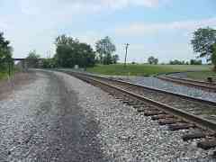
Frederick Junction

Frederick Junction
Mile: OML 54.1 Date: May 2001
Ease: A View: NW
Area: A IC2: 88, 134, 208
Map: Fr 38 J 1 Topographic Maps

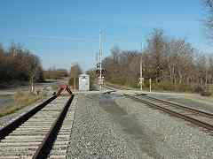
B&O's main line, now CSX Old Main Line, crosses in the foreground, with wye trackage peeling off to the right (north) for the Frederick Branch. Because this was a significant switching location, B&O put a station here, and called it Frederick Junction.

However, for a few years there was other substantial action in this area. The American Civil War's Battle of Monocacy raged here in 1864, and B&O's bridge over the nearby Monocacy River was destroyed and rebuilt several times during that war. This location was also known as Monocacy Junction.

This photo looks across the wye made between the OML and branch. The Frederick Junction Station sat within the wye near the lonely utility pole at photo center. This is believed to be the world's oldest wye still in railroad use.

Links to older pictures: Pic 1, Pic 2, Pic 3


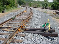
Derail

Derail
Mile: branch 0.0 Date: May 2001
Ease: A View: E
Area: A IC2:
Map: Fr 38 J 1 Topographic Maps

In 2001 CSX upgraded and updated their freight trackage on the Branch to support MARC passenger standards. One change was the addition of a new derail at the wye. A derail is safety measure to cause a runaway train or car to run off the tracks and stop rather than roll onto the main line where a collision could then occur.


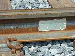
Derail Closeup

Derail Closeup
Mile: branch 0.0 Date: May 2001
Ease: A View: NE
Area: A IC2:
Map: Fr 38 J 1 Topographic Maps

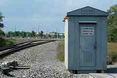
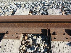
This new derail switch where the branch meets the OML was installed just days before the photo. The steel rail dates to March 2001, and the sticker says "Progress Rail Services Miscellaneous Rail" and gives a manufacture date of May 2001.


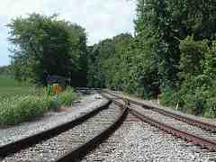
Top of Wye
Photo courtesy Dave Hiteshew

Top of Wye
Mile: branch 0.1 Date: Jun 2007
Ease: B View: N
Area: A IC2:
Map: Fr 38 J 1 Topographic Maps

The speed limit sign at the north end of the wye reads 30/25.


Culvert
Photo courtesy Dave Hiteshew

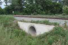
Culvert
Mile: branch 0.1 Date: Jun 2007
Ease: B View: NE
Area: A IC2:
Map: Fr 38 J 1 Topographic Maps

No cut stone blocks here... 21st century culverts are iron/concrete pipes.


Crossing
Photo courtesy Dave Hiteshew

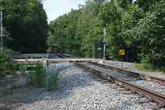
Crossing
Mile: branch 0.2 Date: Jun 2007
Ease: B View: N
Area: A IC2:
Map: Fr 29 J 13 Topographic Maps

A farm's small grade crossing gets its own small bridge over the drainage channel adjacent to the tracks.


Signal
Photo courtesy Dave Hiteshew

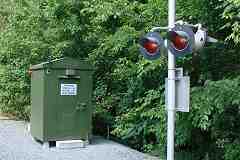
Signal
Mile: branch 0.2 Date: Jun 2007
Ease: B View: NE
Area: A IC2:
Map: Fr 29 J 13 Topographic Maps

Modern grade crossing signals are equipped with larger lenses. The big red eyes give them a demonic expression, like that of a haunted Furby toy.


Trough
Photo courtesy Dave Hiteshew

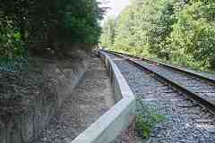
Trough
Mile: branch 0.4 Date: Jun 2007
Ease: B View: N
Area: A IC2:
Map: Fr 29 H 13 Topographic Maps

Engineers apparently determined this is an erosion-prone area, so they called for a concrete trough for runoff. I've not seen this elsewhere along CSX alignments.


Passing Track
Photo courtesy Dave Hiteshew

Passing Track
Mile: branch 0.6 Date: Jun 2007
Ease: B View: N
Area: A IC2:
Map: Fr 29 H 12 Topographic Maps

The track splits here because a passenger station is a short distance ahead. The autos are in the station's parking lot, and beyond them in the distance are buildings of Francis Scott Key Mall. Per the signage, the Branch's milepost prefix is BAX; CSX typically employs three-letter identifiers for its minor branches.


Dismount
Photo courtesy Dave Hiteshew

Dismount
Mile: branch 0.8 Date: Dec 2007
Ease: A View: N
Area: A IC2:
Map: Fr 29 H 12 Topographic Maps

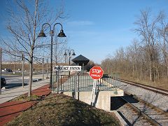
Monocacy Station is a creation of MARC; B&O did not have a station here. The STOP DISMOUNT sign puzzles me. For whom is it intended? Train crews? Passengers? People on bikes? Equestrians? Inquiring minds want to know.

Reader Fran Giacoma kindly wrote to explain:

    "The sign is for CSX train crews to warn them of a 'Close Clearance' situation. They must stop and get off the equipment before proceeding because the side clearance is less than standard (9 feet from centerline of track to the face of any obstruction; here it's a passenger platform)."

Link: MARC 62 approaches the station


Monocacy Station
Photo courtesy Dave Hiteshew

Monocacy Station
Mile: branch 0.9 Date: Dec 2007
Ease: A View: E
Area: A IC2:
Map: Fr 29 H 11 Topographic Maps

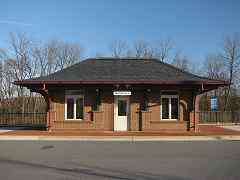
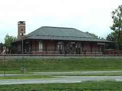
Kudos to the architects of Cochran, Stephenson & Donkervoet, Inc. for echoing the design of a small B&O station. This structure is an attractive combination of function and railroad history.


Junction_Box
Photo courtesy Dave Hiteshew

Junction Box
Mile: branch 1.1 Date: Dec 2007
Ease: B View: N
Area: A IC2:
Map: Fr 29 J 11 Topographic Maps

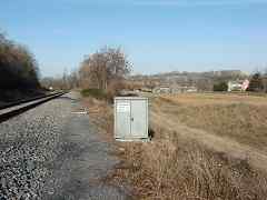
North of Monocacy Station, the Branch encounters terrain of old farms and some industry. As illustrated by this junction box, 21st century standards include detailed labeling of trackside equipment.


Genstar Crossing
Photo courtesy Dave Hiteshew

Genstar Crossing
Mile: branch 1.5 Date: Dec 2007
Ease: B View: N
Area: B IC2:
Map: Fr 29 J 10 Topographic Maps

This is the first of four Genstar grade crossings. Genstar, a division of LaFarge, quarries stone at several locations around Maryland, one of which is adjacent to much of the Frederick Branch. The rusty siding hosts trains infrequently.


WW II Rail
Photo courtesy Dave Hiteshew

WW II Rail
Mile: branch 1.5 Date: Dec 2007
Ease: B View: E
Area: B IC2:
Map: Fr 29 J 10 Topographic Maps

The siding's track reveals a manufacture date of February 1944. During World War II metals were in short supply, so using some for rails demonstrates the importance of railroads. D-Day was still four months away when this rail was forged. Whether this track was laid in 1944 is less clear, but it may have been since basic building material like Genstar's stone was also important to the war effort.


B&O
Photo courtesy Google

B&O
Mile: branch 1.8 Date: May 2007
Ease: View:
Area: B IC2:
Map: Fr 29 J 9 Topographic Maps

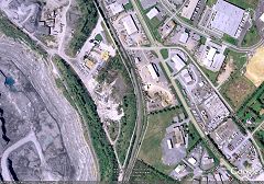
This satellite photo shows Genstar's quarry left (west) of the Branch tracks. Also note that Google still labels a removed siding as belonging to the Baltimore and Ohio Railroad.


Yard Derail
Photo courtesy Dave Hiteshew
NEW! mid-May 2019

Yard Derail
Mile: branch 2.1 Date: Jun 2018
Ease: A View: S
Area: A IC2:
Map: Fr 29 J 9 Topographic Maps

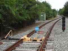
The main is protected from yard traffic by this derail with blue sign and blue flasher on an arm that raises and lowers, a design not often seen in this region.


Storage Yard
Photo courtesy Dave Hiteshew

Storage Yard
Mile: branch 2.1 Date: Dec 2007
Ease: A View: NE
Area: A IC2:
Map: Fr 29 J 9 Topographic Maps

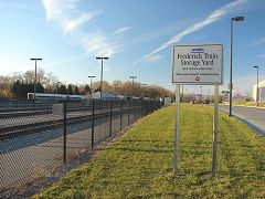
The Branch's obsessive signage person did not fail to label MARC's yard, officially known as the Frederick Train Storage Yard.


Bi-Level

Bi-Level
Mile: branch 2.2 Date: Mar 2005
Ease: A View: N
Area: A IC2:
Map: Fr 29 J 9 Topographic Maps

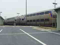
When MARC service began in 2001, they operated three morning and three evening trains to/from Washington, DC. That the middle train schedule-wise was (is?) the only one to employ bi-level coaches suggests it is the busiest.

Link: bi-level model


MARC
Photo courtesy Dave Hiteshew

MARC
Mile: branch 2.3 Date: Dec 2007
Ease: A View: SE
Area: A IC2:
Map: Fr 29 J 8 Topographic Maps

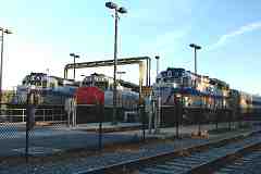
A stable of MARC iron horses relaxes on a late-fall weekend.


MARC 57
Photo courtesy Dave Hiteshew

MARC 57
Mile: branch 2.3 Date: Dec 2007
Ease: A View: S
Area: A IC2:
Map: Fr 29 J 8 Topographic Maps

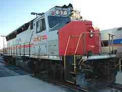
Old friend MARC 57 appeared on this site's initial pages over 10 years prior. It's looking a bit more rusty now, but aren't we all?

Link: MARC 57 at Union Station in 1999


I-70
Photo courtesy Dave Hiteshew

I-70
Mile: branch 2.4 Date: Dec 2007
Ease: A View: N
Area: A IC2:
Map: Fr 29 H 8 Topographic Maps

A complex intersection here at Genstar crossing #3 yields a bevy of signage and structures. Eastbound I-70, seen ahead left, dumps a ramp of auto traffic into this spot too.


Looking Back

Looking Back
Mile: branch 2.5 Date: Mar 2005
Ease: A View: S
Area: A IC2:
Map: Fr 29 H 8 Topographic Maps

Looking back from Genstar crossing #4, this is the westermost location at which the OML (plus branches) and I-70 tango.

Before Genstar took over in the 1980s, the mining location unseen on the right was operated by the M.J. Grove Lime Company.


Hamilton Avenue
NEW! mid-May 2019

Hamilton Avenue
Mile: branch 2.7 Date: Jun 2018
Ease: A View: W
Area: A IC2:
Map: Fr 29 H 7 Topographic Maps

The complex grade crossing of South Street at Hamilton Avenue and Hope Alley leads to special signal applications, such as the high-mounted warning lights turned to face westbound traffic on South Street.


Milepost 3
Photo courtesy Dave Hiteshew

Milepost 3
Mile: branch 3.0 Date: Dec 2007
Ease: B View: NW
Area: A IC2:
Map: Fr 29 G 7 Topographic Maps

Mileposts? Yep, got 'em. Curbs? Yep, got them too, but I have no idea why.

Reader Fran Giacoma, who is involved in railroad design, commented:

    "The concrete curb is most likely used to keep the water, debris and dirt from the adjacent ditch out of the ballast. They must have an erosion problem here; reason why they used the curb. I have seen similar examples used on Metro-North RR's Hudson Line between Poughkeepsie and NYC."


industry
Photo courtesy Dave Hiteshew
Updated mid-May 2019

Industry
Mile: branch 3.2 Date: Dec 2007
Ease: B View: NW
Area: A IC2: 391
Map: Fr 28 G 7 Topographic Maps

hoppers June 2018 One of the many rusty disused industrial sidings along the Branch sprang back to life during the 2010s (photo at left June 2018). Sidings had served Southern States, Willard Chemical, and Potomac Edison among others. The last active freight customer for awhile had been Wickes Lumber, back near Monocacy Station.

Link: MARC 65 at this spot


Odd Signal
Photo courtesy Dave Hiteshew

Odd Signal
Mile: branch 3.3 Date: Dec 2007
Ease: A View: NW
Area: A IC2:
Map: Fr 29 G 6 Topographic Maps

Next stop Frederick Station. Since freight traffic does not venture this far into the line, MARC is free to use its personal favorite style of signal.


post
Photo courtesy Dave Hiteshew

Post
Mile: branch 3.3 Date: Dec 2007
Ease: A View: NW
Area: A IC2:
Map: Fr 29 G 6 Topographic Maps

This post reminds waiting passengers that B&O turf ended here. The passenger terminal of the Hagerstown & Frederick Railway, an interurban line, sat on the north side of Carroll Creek, unseen just beyond the Frederick Rail Station ahead.

Links: H&F Wikipedia, Don's Photos, Historical Society


Kiss-And-Ride
Photo courtesy Dave Hiteshew

Kiss-And-Ride
Mile: branch 3.3 Date: Dec 2007
Ease: A View: N
Area: A IC2:
Map: Fr 29 G 6 Topographic Maps

Frederick Rail Station as seen from its bus / kiss-and-ride exit onto South East Street. Hmmm, "buss and ride"?


Frederick Rail Station
NEW! mid-May 2019

Frederick Rail Station
Mile: branch 3.4 Date: Jun 2018
Ease: A View: W
Area: A IC2:
Map: Fr 29 G 6 Topographic Maps

The station's architecture recalls that used by B&O. The building opened to passengers during December 2001.


End of the Branch
Photo courtesy Dave Hiteshew

End of the Branch
Mile: branch 3.4 Date: Dec 2007
Ease: A View: S
Area: A IC2:
Map: Fr 29 G 6 Topographic Maps

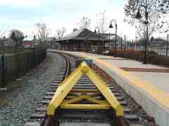
A bumper post from Rawie of Osnabruck, Germany says the Frederick Branch now ends here.

Link: a MARC passenger reports on the trip between DC and Frederick


YH&F
Photo courtesy Dave Hiteshew

YH&F
Mile: branch 3.3 Date: Dec 2007
Ease: A View: SW
Area: A IC2:
Map: Fr 29 G 6 Topographic Maps

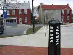
However, in prior centuries the Frederick Branch ended elsewhere. B&O's trackage had curved, passing just right of the house at the right of this photo and continued west along East All Saints Street.

Another side of the post lists the YH&F Railway. Intially I mistook this to represent the Hagerstown & Frederick Railway, but Herb Harwood, author of a book on the H&F, helped untangle the rails and my confusion. As he explained, YH&F stands for York, Hanover and Frederick, a branch of the Pennsylvania Railroad into Frederick that met B&O here. Surviving relics of YH&F track can be found parallel to East Street north of 8th Street, then generally north to and through Taneytown, MD. Part of the route is now in railfan hands in the form of the Walkersville Southern tourist railroad.


First Station
Photo courtesy Dave Hiteshew

First Station
Mile: branch 3.4 Date: Dec 2007
Ease: A View: E
Area: A IC2: 41, 72
Map: Fr 29 F 6 Topographic Maps

The empty area on the right marks where B&O's first Frederick Station had opened in 1832. It survived until about 1911, hanging on as a freight facility after the railroad built a separate passenger station one block west on East All Saints Street. The brick structure at the distant center is the MARC Frederick Rail Station seen above in this tour.

Links to older pics: First Station as seen ~1900, ~1906


Freight Depot
Photo courtesy Dave Hiteshew

Freight Depot
Mile: branch 3.4 Date: Dec 2007
Ease: A View: NE
Area: A IC2: 208
Map: Fr 29 F 6 Topographic Maps

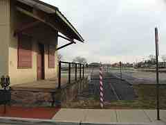
Soon after the first station came down in 1911, B&O erected this small depot to handle freight. Note that rails are still visible here (bottom right); they saw use into at least the 1990s. As of 2009 there is new construction in this vicinity.

Herb Harwood added some info:

    "The B&O Frederick freight station that you show is only the truncated remains of a much larger structure. Until it was partially demolished, the station had the cupola from the original station atop its roof."


Frederick B&O
Photo courtesy Dave Hiteshew

Frederick B&O
Mile: branch 3.6 Date: Dec 2007
Ease: A View: SW
Area: A IC2:
Map: Fr 29 F 6 Topographic Maps

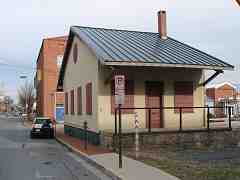
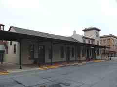
Following East All Saints Street a long block west from the freight depot brings us to the railroad's second station in Frederick; opened in 1854, it is the third-oldest surviving B&O station in Maryland. The station was extended east in 1892 and a canopy added for waiting passengers. The May 11, 1911 Baltimore Sun newspaper reported the city wanted a new station, writing "The Town Has Long Been Patient" but that never came to fruition.

After cessation of passenger service in 1948, the station lived on as a food market and furniture store. It was restored in 1979 to its original appearance, and became home to the Frederick Community Action Agency.

Link: 1911 Sun


Market St
Photo courtesy Dave Hiteshew

Market St
Mile: branch 3.6 Date: Dec 2007
Ease: A View: SE
Area: A IC2: 72, 343
Map: Fr 29 F 6 Topographic Maps

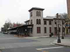
The station's Italianate architecture courtesy designers Niernsee and Neilson is best seen from this angle at Market Street. B&O used a similarly-styled station in Washington, DC before Union Station opened there in 1907.

Prior to the renovation, a Civil War Centennial plaque on the building read "Baltimore and Ohio Railroad Depot - President Abraham Lincoln spoke from his special caboose at this depot before departing for Washington October 4, 1862 following his visit to the battlefields Antietam and South Mountain."

Frederick's militia assembled here as the first group to respond to John Brown's October 1859 raid on Harper's Ferry, (West) Virginia. Frederick recently noted the 150th anniversary of that event.

Links: 1862 drawing, 2009 markers


Stations
Photo courtesy Google

Stations
Mile: branch 3.4 Date: May 2007
Ease: View:
Area: A IC2:
Map: Fr 29 F 6 Topographic Maps

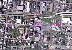
The years written on this satellite picture mark Frederick's three generations of B&O/MARC passenger stations.

Links: Todd's site, MarcRailfan's site


<< Previous (east) | THIS PAGE: Frederick Branch | Next (west) >>

Or, return to main page

Copyright Notice