TrainWeb.org Facebook Page
Old Main Line Photo Tour


B&O Old Main Line
Modern day photo tour

Accompanying each photo below are:

Click a photo to see a larger view. Please send your comments and corrections to Steve.


<< Previous (east) | THIS PAGE: spur at Granite | Next (west) >>

Granite Spur - Brief Historical Background:

Putney's Bridge

Putney's Bridge
Mile: 0.1 Date: Jan 2003
Ease: C View: S
Area: A IC2:
Map: Ba 31 F 6, Ho 6 G 12 Topographic Maps

In this view from the Baltimore County side, the OML can be seen over on the Howard County side of the Patapsco River. The crumbling remains of what was called Putney's Bridge mark where the Granite Spur split from the OML and immediately spanned the river. Downstream is to the left in this photo.

The bridge was named for either Putney & Swope or Putney & Riddle, one of which was the company to operate the mine from about 1835 to about 1850. The company would change hands several times over the years, eventually ending operations in about 1925 while named the Guilford & Waltersville Granite Company.


Putney's Bridge East

Putney's Bridge East
Mile: 0.1 Date: Jan 2003
Ease: C View: NW
Area: A IC2:
Map: Ba 31 F 6, Ho 6 G 12 Topographic Maps

1937 aerial courtesy JHU In this view upstream, the bridge abutment on the Baltimore County side is similarly being eroded away by the river. The mound on the right is obviously of man made origin, and designed to match the height of the OML. The concrete portion likely dates to a 1920 reconstruction of the bridge after a flood. The reconstructed version did not last long: the river crossing portion was gone by the time of the December 1937 aerial photo at right.

Because this spur was not built by the railroad, it was considered private. According to a B&O Station List from 1917, the Granite Spur had the largest car capacity of any private spur in the Maryland District. The table claims room for 762 cars, each 42 feet long. In fact, the 762 capacity is greater than that of ANY type of siding (private or B&O owned) in Maryland except for those at yards.

Link: 1920 newspaper mention


Mound

Mound
Mile: 0.1 Date: Jan 2003
Ease: C View: SE
Area: A IC2:
Map: Ba 31 F 6, Ho 6 G 12 Topographic Maps

Here's the same mound as viewed looking downstream. This is what you'll encounter if you hike in about a mile from Woodstock via the horse trail that follows the north bank of the Patapsco.


ROW

ROW
Mile: 0.3 Date: Jan 2003
Ease: C View: N
Area: A IC2:
Map: Ba 31 F 6, Ho 6 G 11 Topographic Maps

Here's what you'll see if you hike up a bit from the bridge remains. It's a bit steep here for a railroad, but going uphill the trains were empty. They returned downhill with a heavy load of granite.

The disused right-of-way has the classic look: a shelf paralleling a small stream, and still limited tree growth. I don't know when the rails here were pulled up. My guess would be in the 1930s.


Horsehide Locomotive?

Horsehide Locomotive?
Mile: 0.6 Date: Jan 2003
Ease: C View: N
Area: A IC2:
Map: Ba 31 F 5, Ho 6 H 11 Topographic Maps

The steps of horses help keep the ROW cleared from plant overgrowth.

There's a certain irony to seeing these beasts follow an abandoned route of the "iron horse".


Shadows

Shadows
Mile: 0.8 Date: Jan 2003
Ease: C+ View: NE
Area: A IC2:
Map: Ba 31 G 5, Ho 6 H 11 Topographic Maps

As we continue to hike further up the ROW, the shadows of a pair of trees echo the path of the steel rails that had once been here.


Davis Ave

Davis Ave
Mile: 0.9 Date: Jan 2003
Ease: B View: N
Area: A IC2:
Map: Ba 31 G 5, Ho 6 H 10 Topographic Maps

The spur is about to cross Davis Avenue (note the road fencing at upper left), but first spans a branch of the tiny stream which it has been following up from the Patapsco. This assortment of pipes was a crude, but quick way of building a bridge for the spur.

The spur crossed at the location of the fence at upper right, then curved left as it crossed Davis Avenue. This is almost half way to the quarry.


Private

Private
Mile: 1.0 Date: Jan 2003
Ease: B View: N
Area: A IC2:
Map: Ba 31 G 5, Ho 6 H 10 Topographic Maps

On the north side of Davis Avenue, the spur emerges from Patapsco State Park, and crosses into what now appears to be private property. Though it was not marked "No Trespassing" I decided to not hike further in, and encourage you to do similarly. Think about it: you probably would not be happy about a stream of strangers hiking through your back yard.


Letter
Scan contributed anonymously

Letter
Mile: Date: (May 26, 1833)
Ease: View:
Area: IC2:
Map: Topographic Maps

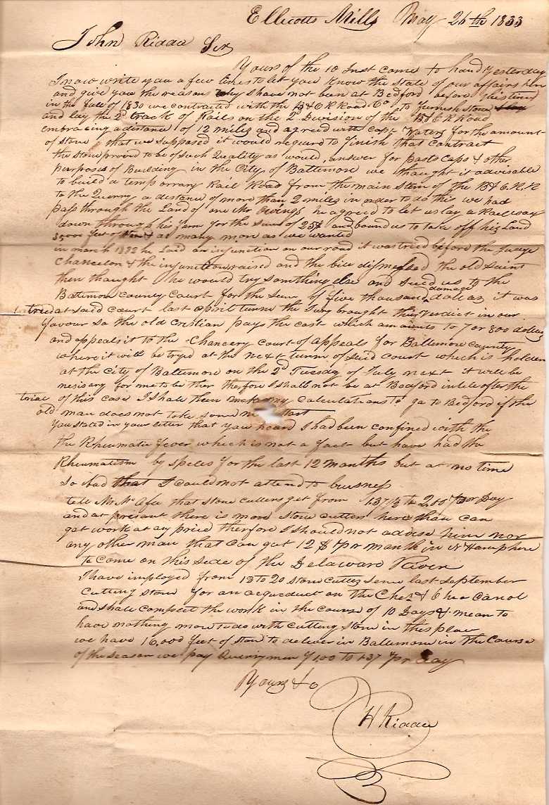
We are fortunate that some of Riddle's correspondence survives to provide background historical details. This letter from Hugh Riddle to his brother John in Bedford, New Hampshire recounts his activities from 1830: "...in the fall of 1830 we contracted with the B&O to furnish stone and lay the second track of rails on the 2nd division of the B&O R Road embracing a distance of 12 miles."

Hugh also writes about the laying of track between the quarry and the B&O. In exchange for $25, a landowner named Owings permitted the construction of the spur through his farm. A disagreement arose that led to Owings seeking injuction against the quarry company, and later filing a $5000 lawsuit. These suits date to March 30, 1832 and Feb 28, 1833 as Nicholas Owings vs. Enoch Sweat, Enoch Lake, True Putney and Hugh Riddle.

By 1836 Enoch Lake had relocated to Quincy, Massachusetts. From various sources it seems that different combinations of the same group of stone cutters had contracts with B&O, and others such as the C&O Canal, under various company names. For example, the second pair of stones stringers for the second division was Sweat & Co., while some of the bridges were handled by Putney, Riddle and others. In 1832 Riddle was at New Castle, Delaware, probably working with Sweat on the New Castle - Frenchtown RR.

In 1835 Riddle was in Baltimore building a warehouse for the Federal Government (not the customs house). He received permission from the city of Baltimore to lay "railroad track" from the B&O to the Federal land where he was building, contingent on the agreement of a majority of the landowners affected. At the same time Riddle was recommending the stock for the Savage Railroad to his relatives in New Hampshire. He and Putney were going to invest $1000. The Savage Mill is not mentioned in the correspondence, only the quarry. Peter G. Gorman may have been involved in this project. Sources say Gorman had the contract for the section of rail from Ellicott Mills to Woodstock.

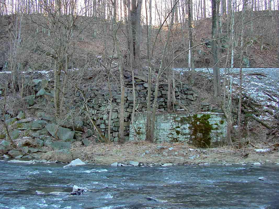
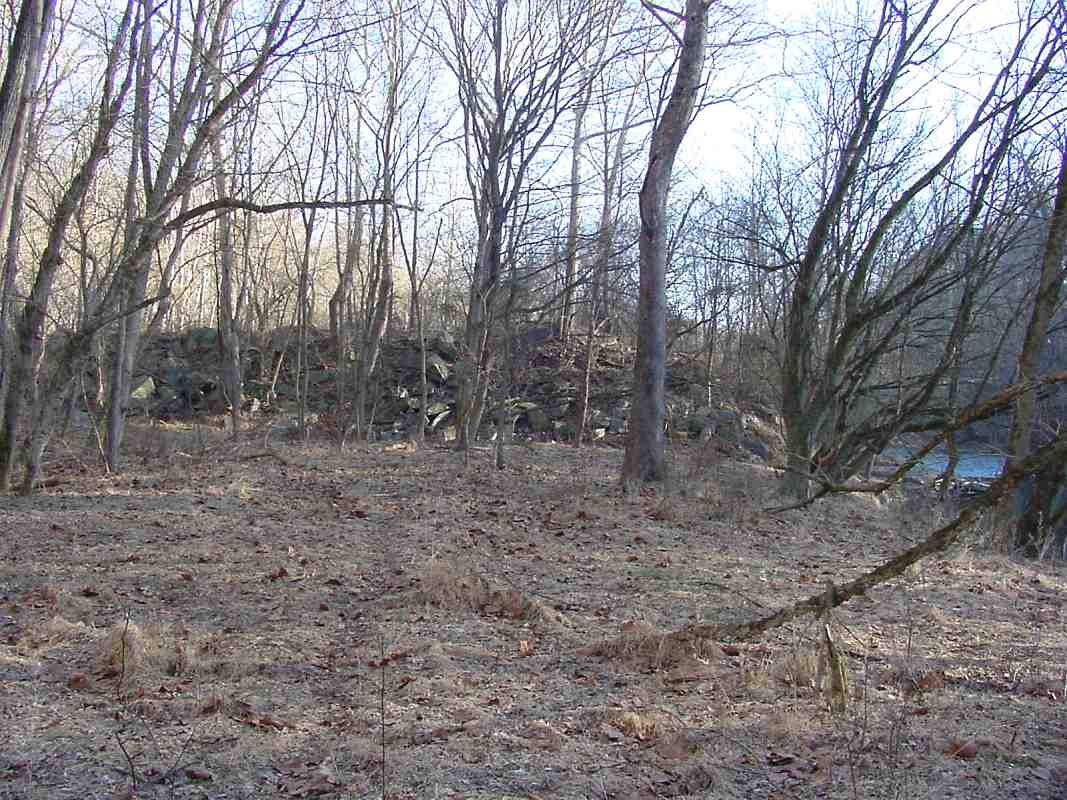
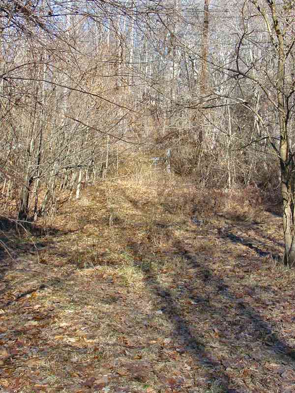
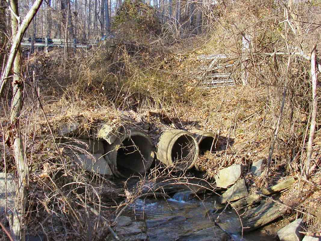
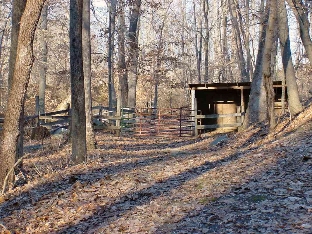
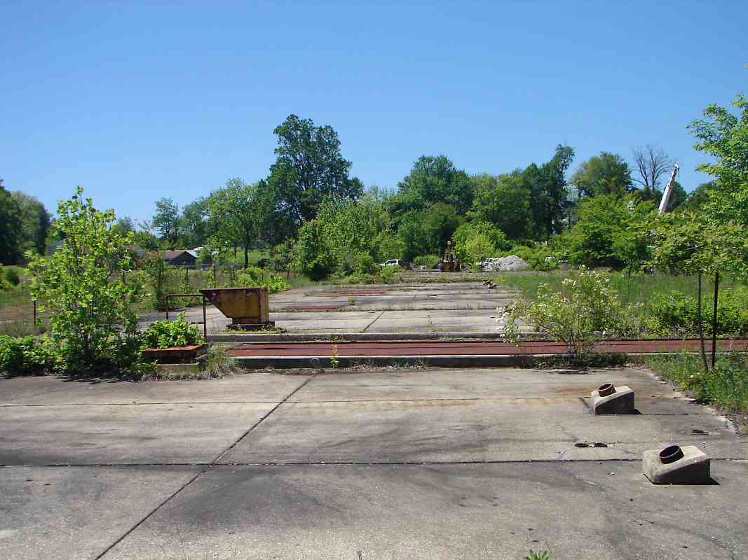
Riddle was in the Woodstock area until at least 1844. In 1838 he wrote his brother from Woodstock that he was finishing two bridges for B&O, perhaps the disused piers now found at Daniels. By 1848 he had moved to Laurel, and in 1849 seeking to dig more than granite, Riddle became a 49er. His last known letter was mailed from St Joseph, Missouri, as he was heading to California along the Overland Trail. He died enroute.


Kemp Road

Kemp Road
Mile: 1.7 Date: Jan 2003
Ease: A View: W
Area: B+ IC2:
Map: Ba 31 H 4, Ho 6 J 9 Topographic Maps

According to an old USGS map, about 3/4 mile from the prior photo, the spur snaked around and continued here at what has become Kemp Road, now a semi-private driveway.

Unlike the photos immediately above, this view looks backward down the spur.


Melrose Ave

Melrose Ave
Mile: 1.7 Date: Jan 2003
Ease: A View: E
Area: B+ IC2:
Map: Ba 31 H 4, Ho 6 J 9 Topographic Maps

Spin 180 degrees from the prior photo, and this is what you'll see.

As best as I can determine from the USGS maps, the spur followed what is now Melrose Avenue, then curved left ahead, probably shortly before the road rises in the distance. However, there was no obvious former ROW to the left along this stretch.


Marker

Marker
Mile: 2.0 Date: Jan 2003
Ease: A View: NE
Area: A IC2:
Map: Ba 31 H 3, Ho 6 J 9 Topographic Maps

This marker sits at the northeast corner of Old Court Road and Sylvandell Avenue. According to the USGS maps, this location appears to be close to but slightly west of where the spur crossed Old Court Road.

The text reads as follows: "Granite National Historic District - Some of the finest granite on the North American continent was quarried in this area for over a century. The village of Granite was first named Waltersville after the Walters/Blunt family who founded the local quarrying industry circa 1820. The two largest quarries were Waltersville and Fox Rock. These and smaller quarries counted hundreds of stonecutters among their employees. One of the most important uses was for America's first railroad, the Baltimore and Ohio. This construction included the famous Thomas Viaduct, a vital link between Baltimore and Washington. The quality of this stone led to its use in such buildings as the Library of Congress, the inner walls of the Washington Monument, old Patent Office and the Baltimore Custom House. Local granite was the choice for foundations, gateposts, garden walls, cemetary monuments, churches and schools. Many homes, still seen nearby, housed the hardy workmen and their families forming a community proudly named for its most famous natural resource, granite. Granite was placed on the National Register of Historic Places in 1994. Erected by the Granite Historical Society - 1996."

Link to Granite Historical Society


Old Court Road

Old Court Road
Mile: 2.0 Date: Jan 2003
Ease: A View: N
Area: A IC2:
Map: Ba 31 H 3, Ho 6 J 9 Topographic Maps

Here, at what is now a private driveway, the Granite Spur crosses Old Court Road, which originally was an Indian trail. This location is a short distance east of the marker seen in the prior photo.


Quarry Area

Quarry Area
Mile: 2.1 Date: Jan 2003
Ease: A View: N
Area: A IC2:
Map: Ba 31 H 3, Ho 6 J 8 Topographic Maps

A little over 2 miles from where it began back at the Patapsco River, the spur reaches the quarry area. This is the view along the ROW looking from between the chain link fence gate seen in the prior photo. Quarrying activity ceased in the 1920s so the trees have had plenty of time to regrow.


Nike Missiles
Updated late-Jun 2019

Nike Missiles
Mile: Date: May 2017
Ease: View: NW
Area: A IC2:
Map: Ba 31 G 1 Topographic Maps

view west May 2017 About a half mile from the granite quarry were other excavations into the rock, these to hold cold-war-era Nike missiles. This hatch opens to a ladder down into (decommissioned) underground launch mechanisms. The site had six underground magazines each with four missile launchers.

missile lifter Due to adjacent police and military, this may be the best-preserved of the region's Nike sites. A reputable source has confirmed that some of the missiles here were nuclear-tipped, even though their range was too limited to reach the Atlantic Ocean. The blasts would have knocked enemy planes within a large radius and thus protected cities.

During 2019, a project began to restore the site not for military purposes but rather to facilitate public access to what is a cold-war museum of sorts. Donations of both time and money are needed; see the first link below.

Links: restoration project, aerial photos, site photos, visit reports


<< Previous (east) | THIS PAGE: spur at Granite | Next (west) >>

Or, return to main page

Copyright Notice