TrainWeb.org Facebook Page
B&O Georgetown Branch Photo Tour


B&O Georgetown Branch
Modern day photo tour

Accompanying each photo below are:

Click a photo to see a larger view. Please send your comments and corrections to Steve.


<< Previous (east) | THIS PAGE: Mile 1 to 2 | Next (west) >>

Steel
Photo courtesy Dave Hiteshew

Steel
Mile: 1.2 Date: Nov 2008
Ease: B View: NW
Area: A IC2: 241
Map: Mo 36 F 9 Topographic Maps

The view from the path below shows not only wood but also steel serves as support for the Rock Creek trestle.

Link to older pic: 1977


Platform
Photo courtesy Dave Hiteshew

Platform
Mile: 1.2 Date: Nov 2008
Ease: B View: NW
Area: A IC2:
Map: Mo 36 F 9 Topographic Maps

Platforms echo those of B&O's bridge. These allow sightseers to step out of the way of hurried bikers rather than passing trains.

Link to older pic: 1942


Wood
Photo courtesy Dave Hiteshew

Wood
Mile: 1.2 Date: Nov 2008
Ease: B View: NW
Area: A IC2:
Map: Mo 36 F 9 Topographic Maps

There's a method to this madness, I think.


Treat
Photo courtesy Dave Hiteshew

Treat
Mile: 1.3 Date: Nov 2008
Ease: B View: E
Area: A IC2:
Map: Mo 36 F 9 Topographic Maps

No tricks from the Rock Creek bridge, instead lots of railfan treats.

The bridge was removed during 2019 to make way for the Purple Line.

Links: Purple Line Construction, removal starting Apr 2019


Jones Mill
Photo courtesy Dave Hiteshew

Jones Mill
Mile: 1.4 Date: Nov 2008
Ease: A View: W
Area: A IC2:
Map: Mo 36 E 9 Topographic Maps

Next up is the Jones Mill Road crossing. I'm guessing in a past century someone named Jones had a mill along Rock Creek, but I've not found any historical references, other than street names of course.


Post
Photo courtesy Dave Hiteshew

Post
Mile: 1.4 Date: Nov 2008
Ease: A View: W
Area: A IC2:
Map: Mo 36 F 9 Topographic Maps

This survivor appears to have been the post of a RR crossbuck.


Autumn View
Photo courtesy Dave Hiteshew

Autumn View
Mile: 1.5 Date: Nov 2008
Ease: A View: SW
Area: A IC2:
Map: Mo 36 E 9 Topographic Maps

A straight, level path through a forest... you know what used to be here.


Culvert
Photo courtesy Dave Hiteshew

Culvert
Mile: 1.6 Date: Nov 2008
Ease: B View: NW
Area: A IC2:
Map: Mo 36 F 9 Topographic Maps

A B&O standard-issue stone culvert now carries the trail.


Box
Photo courtesy Dave Hiteshew

Box
Mile: 1.8 Date: Nov 2008
Ease: B View: SW
Area: A IC2:
Map: Mo 36 D 9 Topographic Maps

Concrete boxes with a vent are found in many places along B&O routes; often they house electrical equipment. For some reason, this relic has not been removed.


Sign
Photo courtesy Dave Hiteshew

Sign
Mile: 1.9 Date: Nov 2008
Ease: A View: SW
Area: A IC2:
Map: Mo 36 D 9 Topographic Maps

Considering the type of traffic that once passed this way, a five ton weight limit seems ultra-conservative...


Bridge 3
Photo courtesy Dave Hiteshew

Bridge 3
Mile: 1.9 Date: Nov 2008
Ease: B View: NW
Area: A IC2:
Map: Mo 36 D 9 Topographic Maps

...especially when B&O's Georgetown Branch Bridge #3 remains on duty.

Bridge #1 would likely have been a no-longer-extant structure at Brookville Road, and #2 the Rock Creek trestle.


Wide
Photo courtesy Dave Hiteshew

Wide
Mile: 1.9 Date: Nov 2008
Ease: B View: E
Area: A IC2:
Map: Mo 36 D 9 Topographic Maps

Though the branch was never wider than single-track in this area, the stone work shows provisions were made for more.


Connecticut Ave
Photo courtesy Dave Hiteshew

Connecticut Ave
Mile: 2.0 Date: Nov 2008
Ease: A View: SW
Area: A IC2:
Map: Mo 36 D 10 Topographic Maps

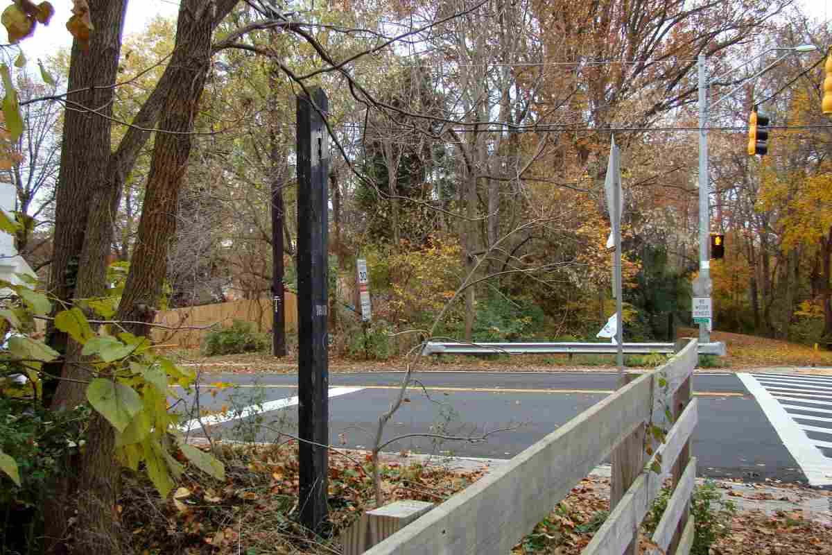
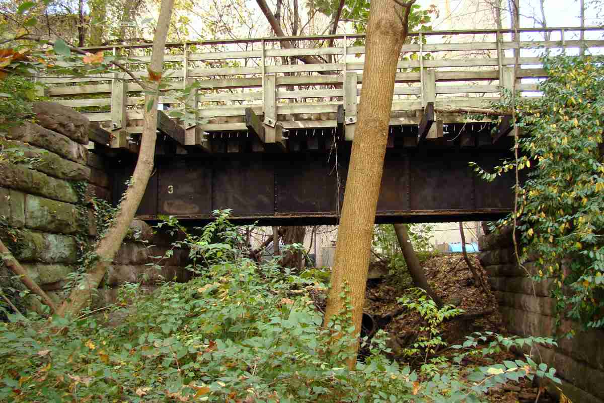
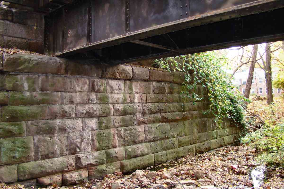
Pedal-to-the-metal Connecticut Avenue drivers no longer need worry about a B&O train blocking their way, but the B&O tracks survive. Before 1935, another set of tracks extended perpendicular to these.

The Sunoco gas station occupies the site of offices of the Chevy Chase Lake & Kensington Railway, a trolley line that opened in 1895 and ran north (to the right in this view) along Connecticut Avenue for about 3 miles to Kensington. Later, the line was leased to Capital Traction company, an amalgamation of several DC-area streetcar lines, but abandoned in 1935.

Links: ~1900 looks north along Connecticut Avenue, carbarn at center-right, ~1921 north along Connecticut Avenue, 1948 south, 1969 northeast, 1983, Purple Line construction 2018


<< Previous (east) | THIS PAGE: Mile 1 to 2 | Next (west) >>

Or, return to main page

Copyright Notice