TrainWeb.org Facebook Page
Northern Central Railway Photo Tour


Northern Central Railway
Modern day photo tour

Accompanying each photo below are:

Click a photo to see a larger view. Please send your comments and corrections to Steve.


<< Previous (main line) | THIS PAGE: Hollins to Rockland | Next (west) >>

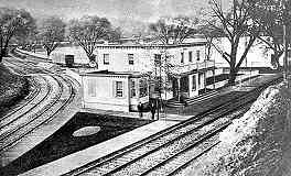
Hollins Station
Photo courtesy Baltimore Sun

Hollins Station
Mile: 0.0 branch Date: ~1880
Ease: View: NW
Area: T6: 245
Map: Ba 26 H 10 Topographic Maps

This is the second version of Hollins Station.

While debate in Pennsylvania hampered the B&S's northward advance across the Jones Falls, during 1832 the railroad built west from Hollins toward Owings Mills. In this photo, the start of that 8-mile segment is on the left. A few years later, when the B&S got the green light for a main line north into Pennsylvania, its track west became the Green Spring Branch, the subject of this tour page.

At right, note the boxy object paired with a round one. If the round object is a lens, that pairing may be a signal. Another appears at the left side of the station. Online searches of B&S, NC, and PRR signals of the era yield nothing that matches. Anyone have more information on these items?


Aerial 1938
Photo courtesy Johns Hopkins University

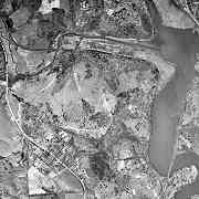
Aerial 1938
Mile: Date: Apr 1938
Ease: View: N (up)
Area: T6:
Map: Ba 26 H 8 Topographic Maps

This aerial shows roughly the first two miles of Green Spring Branch trackage. This tour's starting point, Hollins, is at bottom right where the south end of the Lake Roland bridge reaches land. The main line continues north across the lake, while the branch follows the left bank before turning west. Falls Road is the light line that weaves mostly north-south at left.

Due to Maryland's location south of the reach of the most-recent glaciation, the state has no natural lakes. Lake Roland was created during the 1850s by damming Jones Fall downstream of where Roland Run and Towson Run flow into it. A lakeside hill was the northern terminus of the Lake Roland Elevated Railway, a streetcar line that largely paralleled the NC within Baltimore City.


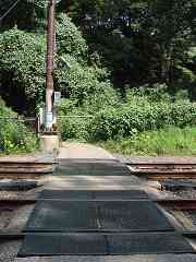
Trail Walkway

Trail Walkway
Mile: 0.0 Date: Aug 2019
Ease: B+ View: E
Area: B+ T6:
Map: Ba 26 H 10 Topographic Maps

The trails around Lake Roland are one of few places people are sanctioned trains are arriving to cross the ex-B&S, ex-NC, light rail tracks other than at a street or station. In this view, Hollins Station had been behind on the left.

The top sign is found at many light rail crossings. I suppose the "Danger! High-Voltage, Moving Trains!" wording is supposed to sound scary. After all, getting run over by a "low-voltage slow train" does not sound as alarming, even if it can ruin everyone's day just as effectively.

"Trains are arriving from both directions." Not during my visit. How about the simpler and more accurate, "Trains arrive from both directions."?


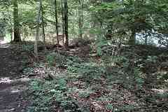
Rails

Rails
Mile: 0.1 Date: Aug 2019
Ease: B View: NW
Area: B+ T6:
Map: Ba 26 G 9 Topographic Maps

joint These leftover rails can be found a shortage distance into the branch.

The last train rolled through the entire branch during the mid-1950s before the PRR removed some track west of Rockland.

Link: 1920


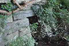
Stone Culvert

Stone Culvert
Mile: 0.1 Date: Aug 2019
Ease: B- View: W
Area: B+ T6:
Map: Ba 26 G 9 Topographic Maps

Several stone culverts like this permit streams to empty into Lake Roland. The non-mortared portions of the culverts are likely of original B&S 1832 construction.


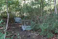
Telephone Box

Telephone Box
Mile: 0.1 Date: Aug 2019
Ease: B View: SE
Area: B+ T6:
Map: Ba 26 G 9 Topographic Maps

Detailed records put both a tool house and a telephone box in this vicinity, so these concrete blocks likely had supported one of those.


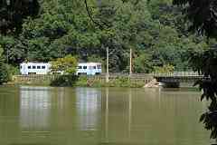
Lake Roland
Photo credit HH Harwood

Lake Roland
Mile: 0.1 Date: ~2000
Ease: B View: NE
Area: B+ T6:
Map: Ba 26 G 9 Topographic Maps

This view looks from the Green Spring Branch, across Lake Roland waters, to what became the B&S's main line, and much later Baltimore's central light rail.

The country's first wooden railroad bridge was constructed either here or along the Green Spring Branch in 1832 under the direction of Col. Stephen H. Long. An advocate of wooden bridges, Long teamed with the B&S after disagreements with the stone-bridge-favoring B&O. Long's one B&O wooden bridge was Jackson Bridge which carried a turnpike over the railroad at Morrell Park.

In 1854 the B&S merged with other lines to form Northern Central RR. Before that decade ended, the NC upgraded the B&S bridge here to permit the then-new Lake Roload to flow under. The bridge and surrounding trackage were damaged by Confederate sympathizers during the Civil War of the 1860s to slow progress of Union troops from the north. The bridge was likely further modified for heavier steam locomotives, then again around 1990 for light rail. Along the way, there may have been other modifications as well.

Links: Long's bridges here, Jackson Covered Bridge


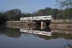
Light Rail

Light Rail
Mile: 0.2 Date: Aug 2019
Ease: B View: E
Area: B+ T6: 246
Map: Ba 26 G 9 Topographic Maps

Until the lake was created, the Bellona Gunpowder Company had operated in the photographer's vicinity. During the early 1800s it produced 20% of the country's gunpowder, likely including some of those "bombs bursting in air" during the perilous fight at Fort McHenry during the War of 1812.

A short distance north of the photographer, the branch turns sharply to the west at what was called Powder Mill Curve. Unfortunately, the mill earned a reputation for all-too-frequent explosions, prompting the B&S to construct what appear to be protective bulwarks between the mill and railroad. Most of the mill's remnants are now under Lake Roland, where explosions are much less likely.

Links: 1886, 1920, historical marker


Milepost 1
Photos credit HH Harwood

Milepost 1
Mile: 1.0 Date: Feb 2020
Ease: B View: E
Area: A T6: 247
Map: Ba 26 G 8 Topographic Maps

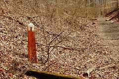
milepost 1 and 7 Sorrento Station's screened-in 200-foot platform was built in 1892 just east of milepost 1.

The post indicates 1 mile from Hollins, and 7 miles from Green Spring Junction near Owings Mills. Its design is the same as that the PRR used in Maryland along its Philadelphia, Baltimore & Washington division that is now part of Amtrak's Northeast Corridor.

When the B&S route to Pennsylvania became the railroad's main line, the Green Spring Branch was relegated to secondary status. During the 1850s, the Western Maryland Railway arranged to "borrow" the branch and use it to access Baltimore. The WM upgraded the line, then began service along it in 1859.

Link: Penn Line mileposts at this site


Stone Arch
Photo credit HH Harwood

Stone Arch
Mile: 1.1 Date: Feb 2020
Ease: B- View: N
Area: A T6:
Map: Ba 26 G 8 Topographic Maps

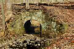
Due to dissimilarities between the masonry of the abutments and that of the arch, Herb Harwood speculates the B&S originally employed a wooden bridge to span this creek, and that the stone arch came later, perhaps as part of the WM's upgrade of the line.


BSM Collection
Photo credit Todd Sestero

BSM Collection
Mile: 1.1 Date: Aug 1968
Ease: B View: E?
Area: A T6:
Map: Ba 26 G 8 Topographic Maps

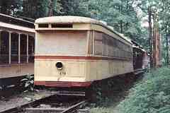
In 1962 the PRR sold a portion of the Green Spring Branch to the National Capital Historical Museum of Transportation. Rail preservationists from Baltimore and Washington joined efforts to create an operating trolley museum between Hollins and Sorrento. Dual trackage was prepared to support Baltimore's quirky 5 foot, 4 1/2 inch (1,638 mm) gauge cars, and equipment from both cities was rolled in.

However, local interests did not want a rail museum operating in their backyard, so the two rail groups were forced elsewhere. The groups split the collection, with the Washington equipment going to what is now the National Capital Trolley Museum (NCTM), and the Baltimore cars to the Baltimore Streetcar Museum (BSM). Todd Sestero photoed some of the cars before they were moved to the BSM's Fall Road location during 1968.

Links: more info from Todd, 1964, NCTM, BSM


Jones Falls

Jones Falls
Mile: 1.2 Date: Dec 2019
Ease: B- View: S
Area: A T6:
Map: Ba 26 F 8 Topographic Maps

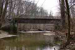
This 65-foot steel bridge across the Jones Falls was built by the American Bridge Company in 1906.


Generations

Generations
Mile: 1.2 Date: Dec 2019
Ease: B- View: SE
Area: A T6:
Map: Ba 26 F 8 Topographic Maps

penn central As at the smaller stone arch, this bridge shows evidence of multiple generations. Note the less-refined stonework at left, possibly original B&S masonry dating to 1832 when one of Long's wooden bridges was built here.

Despite the steel bridge's PC logo, Penn Central trains never operated here. The logo was added by local railfans during the 1970s.


Ties

Ties
Mile: 1.4 Date: Dec 2019
Ease: B View: N
Area: A T6:
Map: Ba 26 E 8 Topographic Maps

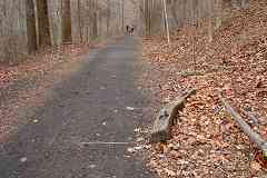
Roughly the first two miles of the GSB has been made into Lake Roland's Red Trail. In several places, hikers have worn the path down to its wooden crossties. Some ties have been pushed to the side of the trail.


Drilled Rock

Drilled Rock
Mile: 1.8 Date: Dec 2019
Ease: B+ View: N
Area: A T6:
Map: Ba 26 E 7 Topographic Maps

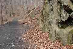
Near Falls Road, several rock faces show evidence of drilling to cut a ledge into the stone.


Falls Road

Falls Road
Mile: 1.9 Date: Dec 2019
Ease: A- View: W
Area: A T6:
Map: Ba 26 E 7 Topographic Maps

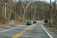
The Red Trail ends/begins at Falls Road. The railroad never crossed Falls Road here, but rather paralleled it on the east side for the next quarter mile.

Falls Road began during the 1800s as a turnpike (toll road). Its milepost 8 northern limit was near here (Rockland). Maintenance of a turnpike along a flooding river proved too expensive, and the pike fell into such disrepair that in 1905, the last year it collected tolls, Baltimore City revoked the company's charter. Falls Road is now Maryland state road number 25.

Link: turnpike history (PDF)


No Xing

No Xing
Mile: 2.0 Date: Feb 2020
Ease: A View: SE
Area: A T6:
Map: Ba 26 E 7 Topographic Maps

That's the disused right of way on the left, as seen in a reverse view from Falls Road. No grade crossing existed here.

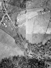
Apr 1938 Rockland Bleach and Dye was formerly on the right, sandwiched between Falls Road and the Jones Falls as seen in the 1938 aerial at right (north is toward photo top).

The company was the last regular carload customer along the line. The final few trains circa 1960 carried small loads, and hauled materials for a sewer line project. Shortly after, bulldozers began clearing the nearby area for JFX construction purposes. As of 2020, the Rockland company still exists, renamed Rockland Industries. Those blackout drapes in your last hotel room were likely made by Rockland.

Link: Rockland Industries


Rockland 1927
Photo courtesy Johns Hopkins University

Rockland 1927
Mile: Date: 1926/1927
Ease: View: N (up)
Area: T6:
Map: Ba 26 E 6 Topographic Maps

Rockland Station, an 8 foot by 12 foot frame structure built in 1896, is the building on the north side of Ruxton Road, west of the tracks, below "Penn". Rockland Flour mills were northwest of there. The Ruxton Road grade crossing was protected by wigwag signals.

When the JFX pushed through during the early 1960s, Ruxton Road was one of the local streets that was realigned. The original Ruxton Road, as shown in this photo, is now a firehouse entrance.

Links: RR in bgnd 1912, Rockland mill, wigwag


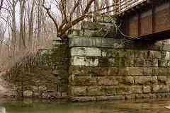
Stone Abutment

Stone Abutment
Mile: 2.3 Date: Dec 2019
Ease: B View: S
Area: A T6:
Map: Ba 26 D 6 Topographic Maps

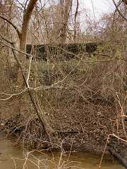
Not only was Ruxton Road realigned, so was the Jones Falls, reducing its original route to this "disused" swampy creek. One vine-covered, dark stone abutment remains of what had been a 56-foot steel bridge dating to 1907. The other abutment and bridge were removed as part of JFX/I-83 construction.

In 1832 this was the location of one of Long's three wooden bridges across the Jones Falls. About 1000 feet north, a millrace was spanned by a smaller bridge, perhaps wood initially, but steel during the 20th century.

Link: JFX history


Brightfield Road

Brightfield Road
Mile: 2.8 Date: Dec 2019
Ease: A- View: N
Area: A- T6:
Map: Ba 26 E 5 Topographic Maps

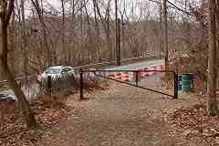
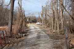
We're looking north from Brightfield Road along the former right of way. What is now Brightfield Road had been Joppa Road prior to the JFX's scrambling of local roads. The Green Spring Branch crossed it at grade at the photographer's feet. Hidden by brush between here and the small white truck exists a small B&S stone culvert. This gravel access road follows the disused rail alignment.

The most distant bright square is the side of a truck on the ramp from the Baltimore Beltway's inner loop to southbound I-83. It happens to be rolling where NC trains had rolled perpendicularly in the past.


<< Previous (main line) | THIS PAGE: Hollins to Rockland | Next (west) >>

Or, return to main page

Copyright Notice