TrainWeb.org Facebook Page
B&O Washington Branch Photo Tour


B&O Washington Branch
Modern day photo tour

Accompanying each photo below are:

Click a photo to see a larger view. Please send your comments and corrections to Steve.


<< Previous (east) | THIS PAGE: Riverdale to Hyattsville | Next (Alexandria branch) >>

Wreck
Photo courtesy Marty Hager

Wreck
Mile: 32.3 Date: 1973
Ease: A View: NE
Area: B IC2:
Map: PG 12 E 2 Topographic Maps

Marty Hager kindly contributed these two photos of a wreck and cleanup near Riverdale. Of this photo, Marty writes:

    I'm pretty certain it was winter of '72-73. It is looking north from the Rt 410 overpass. This was a string of covered hoppers carrying corn heading for Baltimore. I remember that as the corn began to rot the entire area smelled like the inside of a port-a-potty for a while. It was around that time that a succession of accidents happened around the Riverdale-Hyattsville area.

Links: 1964, 1973, 1973, 1973, 1973


More Trees
NEW! early-Sep 2023

More Trees
Mile: 32.3 Date: Nov 2021
Ease: A View: NE
Area: B IC2:
Map: PG 12 E 2 Topographic Maps

A visit to the wreck site almost 50 years later finds more railcars on the tracks and more trees.


B&O 3762
Photo courtesy Marty Hager

B&O 3762
Mile: 32.3 Date: 1973
Ease: A View: NE
Area: B IC2:
Map: PG 12 E 2 Topographic Maps

Of this scene with B&O 3762 Marty Hager writes:

    This shot is not very interesting but it shows the scene of the wreck after repairs were completed. One artifact in the shot is the siding on the east side of the tracks. As much time as I spent hanging around Riverdale I don't remember that siding being there. It's gone now.

A B&O 1910 station list indicates Riverdale had pens for live animals, and a company siding with room for seven railcars.

Links: more of B&O 3762, still in use during 2018 as UP 1500


CSX 3433
NEW! early-Sep 2023

CSX 3433
Mile: 32.3 Date: Nov 2021
Ease: A View: NE
Area: B IC2:
Map: PG 12 E 2 Topographic Maps

Much the same view about 50 years later finds a westbound riding Track 2 so it can access the Alexandria Branch. The switch from Track 1 to 2 usually happens immediately west of Jessup Station.

Link: trimming brush 2010


RDC
Photo courtesy B&O History Collection

RDC
Mile: 32.3 Date: Jul 1968
Ease: A View: S
Area: B IC2:
Map: PG 12 E 2 Topographic Maps

At photo time, a siding extended down to Queensbury Road where boxcars are being passed by a B&O Budd Rail Diesel Car (RDC). The RDCs were self propelled and ideal for carrying small groups of commuters. The RDCs gave way to MARC which, during non-covid times, hauls multiple-cars-worth of commuters.

The owner of the B&O History Collection had kindly contributed this digital version and several others below.

Link: RDC interior


Waiting

Waiting
Mile: 32.2 Date: Oct 2013
Ease: B View: S
Area: B IC2:
Map: PG 12 E 2 Topographic Maps

Deep zoom shows a passenger at Riverdale awaiting the next MARC train. Farther away, some of the Cap Subdivision's last CPL signals still in operation await the retirement that will come upon activation of their successors standing adjacent.

Link: 1966


Riverdale

Riverdale
Mile: 32.4 Date: Nov 2003
Ease: A- View: S
Area: B+ IC2:
Map: PG 12 E 2 Topographic Maps

Riverdale makes for a surprisingly pleasant and scenic stop on any tour of area railroads. This view looks south toward Queensbury Road, the last grade crossing encountered on the way to Washington. That may partially explain why a higher-than-normal number of drivers at this crossing make the mistake of turning onto the tracks and getting their car damaged or stuck.


Riverdale Station

Riverdale Station
Mile: 32.4 Date: Nov 2003
Ease: A View: NW
Area: B+ IC2: 157
Map: PG 12 E 2 Topographic Maps

Riverdale's MARC station has recently been rebuilt on the site of B&O's original station. Inside are volunteer-maintained small displays of railroad history. The short row of shops seen behind give the area a quaint, small town feel. On the right, the overpass is that of East-West Highway, Route 410.

Reader David Hiles shared some history:

    According to town legend, the Calvert family allowed the railroad to run through their plantation in Riverdale under the condition that the railroad will always offer passenger service somewhere on the original grounds. If passenger service was discontinued to Riverdale, then the railroad would forfeit the right of way back to the Calverts. Maybe that is why we still have the closest MARC station to DC.

Links: 1964, Riverdale Railfans Yahoo Group


Trolley

Trolley
Mile: 32.4 Date: Nov 2003
Ease: A View: S
Area: B+ IC2:
Map: PG 12 E 2 Topographic Maps

At Riverdale, B&O and the Rhode Island Avenue trolley were separated by the width of the building seen here, at which trolley tickets were sold. The railroad is on the left, while the trolley line survives only in the form of the series of utility poles stretching into the distance on the right. The trolley operated into the 1950s after which for a time the building was home to Griff's famous subs and house of pizza.

Link: 1964


JD Tower
Photo credit Don Smith

JD Tower
Mile: 32.5 Date: 1988
Ease: A View: S
Area: B+ IC2: 322
Map: PG 12 E 2 Topographic Maps

Before torn down in 1994, B&O's JD Tower had stood in Hyattsville at the northern limit of the Alexandria Branch wye with the main line. This view looks south (railroad west) from Queensbury Road. Note the extra arm left of the left CPL signal; that was called a doll post, and it reminded train operators of a non-standard signal application there. There's more about JD Tower below.


MARC 7100

MARC 7100
Mile: 32.8 Date: Apr 2004
Ease: B+ View: NE
Area: B- IC2:
Map: PG 12 E 3 Topographic Maps

The area's oldest surviving motive unit in revenue service at the time of this photo leads a commuter train toward Washington on a spring afternoon. MARC 7100 is a twice-refurbished, ex-B&O 239A EMD model F7-A originally built in 1951, and assigned B&O number 293A (later 4553). It's not really a locomotive... instead here it is a control cab that leads when another unit is pushing the train from behind.

MARC 7100 spent most of its time on other lines: this is the first posted photo of it running on the Camden Line, what the B&O Washington Branch (CSX Capital Subdivision) is called by commuters. The unit was retired during 2010 then took up residence at the B&O Railroad Museum.

Link: history of this unit, with pics from B&O days


Marker

Marker
Mile: 33.0 Date: Nov 2003
Ease: B+ View: SE
Area: B- IC2:
Map: PG 12 D 4 Topographic Maps

The character of the neighborhood declines as you proceed south of Riverdale.

My maps indicated a mile marker might be near the deserted end of Kennedy Street, and I was determined to check for one, despite the street being littered with abandoned, stripped cars. As I drove in from US 1 to trackside, I passed a group of people who were in the process of disassembling vehicles. Since then, an apartment tower complex has sprung up.

The marker was exactly where I had expected, though buried in brush, so I quickly snapped a few photos before making a hasty exit.

Reader Marty Hager sent some feedback:

    Your virtual tour of the Washington Branch of the B&O is a wonderful resource and I have enjoyed it tremendously since I first discovered the site... I take exception with one of your observations however. The site at the end of Kennedy Street in Hyattsville you described as not safe. This could not be further from the truth, at least in the day time. I have visited this site many times by myself and with my kids and we have never felt the least bit threatened. I teach at a school in the area and my oldest son is a student there. He sometimes goes to the tracks on the way home (he is also a big railfan) and I have no problem with letting him go by himself or with friends.
Marty, after another visit it looks like some of those cars are discarded hulks from nearby repair shops. Not pretty, but not as bad a sign as stripped vehicles. I've bumped up my grade for the area. Since the time of the photo the area has been redeveloped and Kennedy Street no longer reaches the tracks. -Steve


JD Tower
Photo credit Don Smith,
B&O History Collection

JD Tower
Mile: 33.0 Date: May 1988
Ease: A- View: S
Area: B- IC2: 322
Map: PG 12 D 4 Topographic Maps

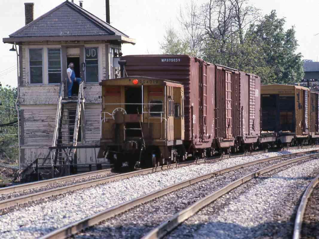
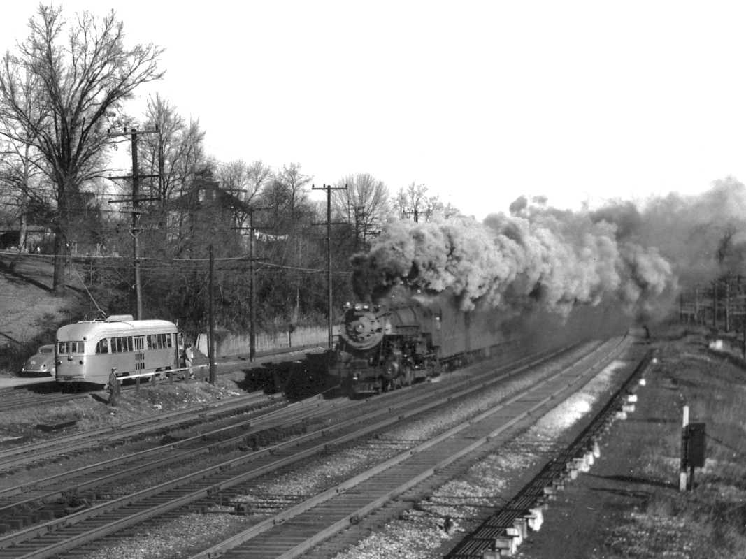
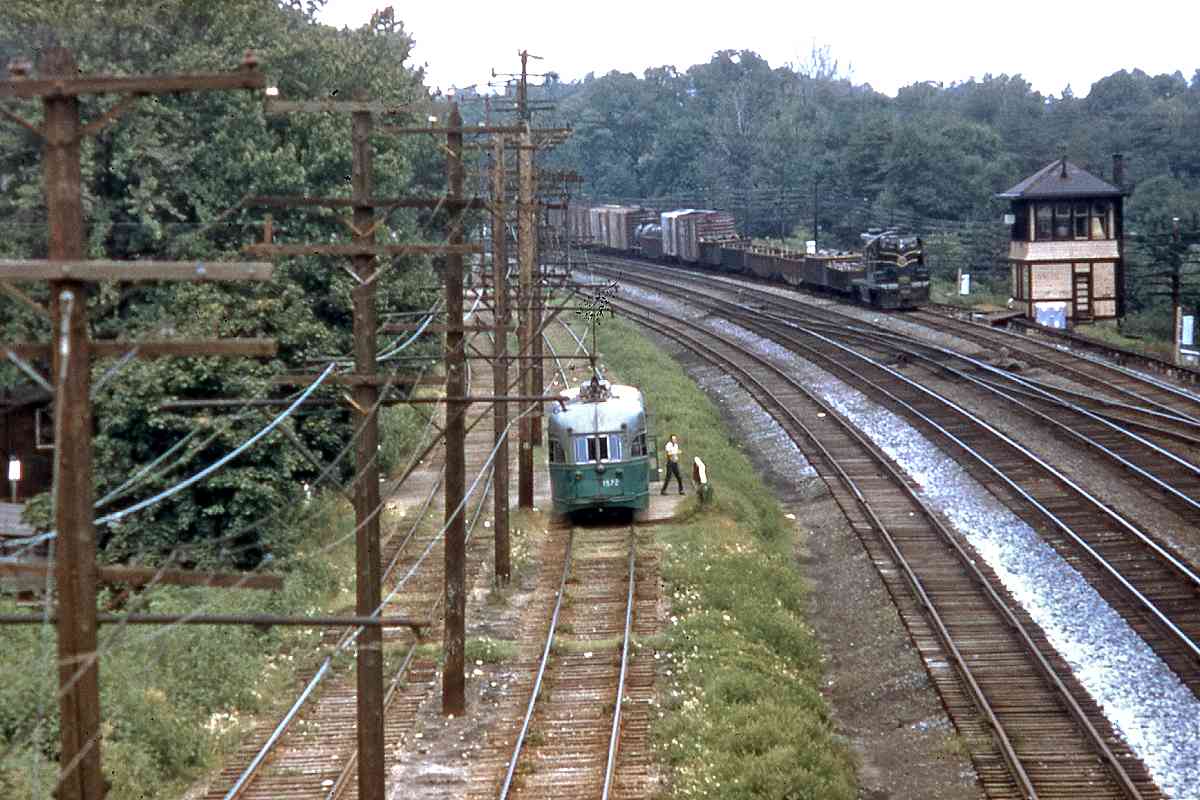
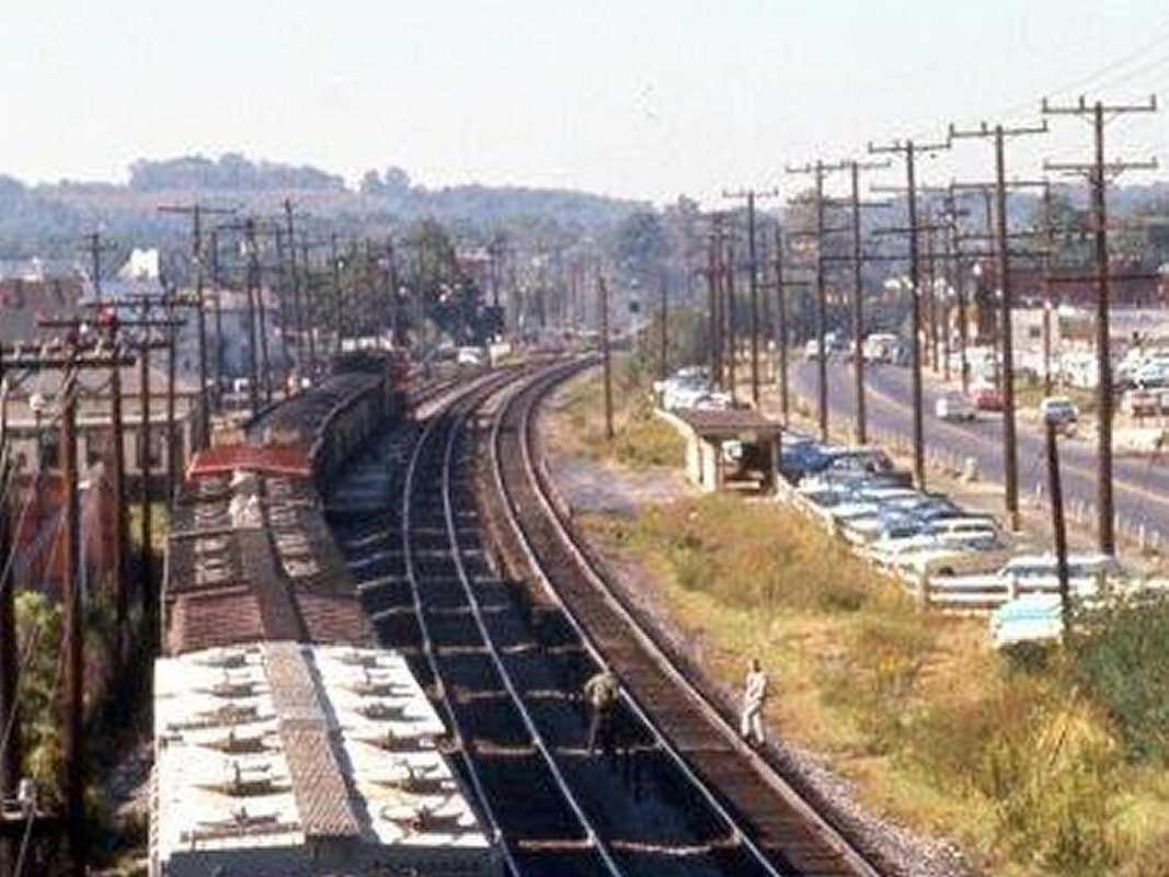
JD Tower oversaw traffic to/from the busy Alexandria Branch that scoots around downtown Washington. A B&O 1910 station list encodes it as JU Tower, possibly representing Alexandria JUnction, the name by which the tower was known when it opened during 1894. The basis for its renaming to JD has been lost to time.

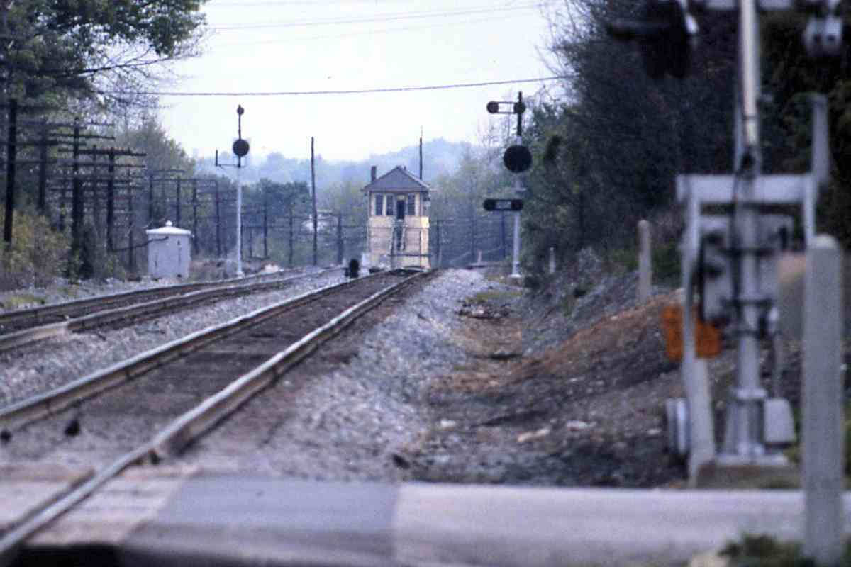
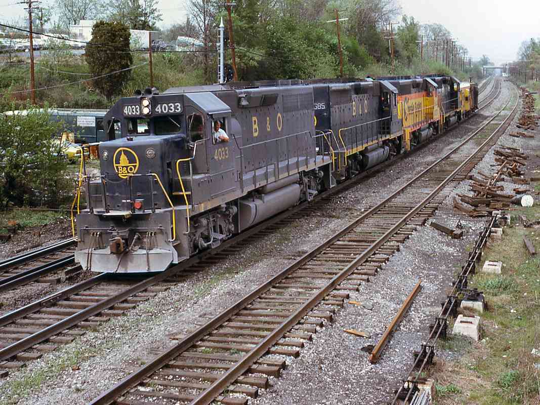
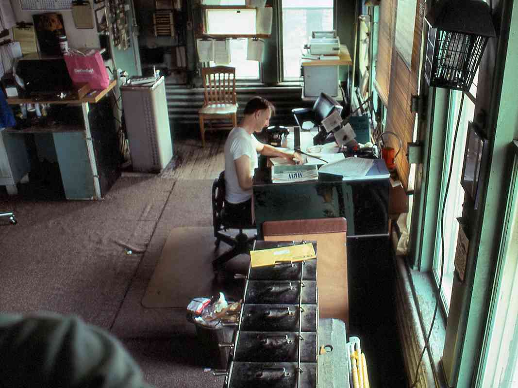
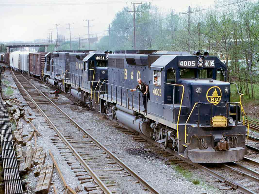
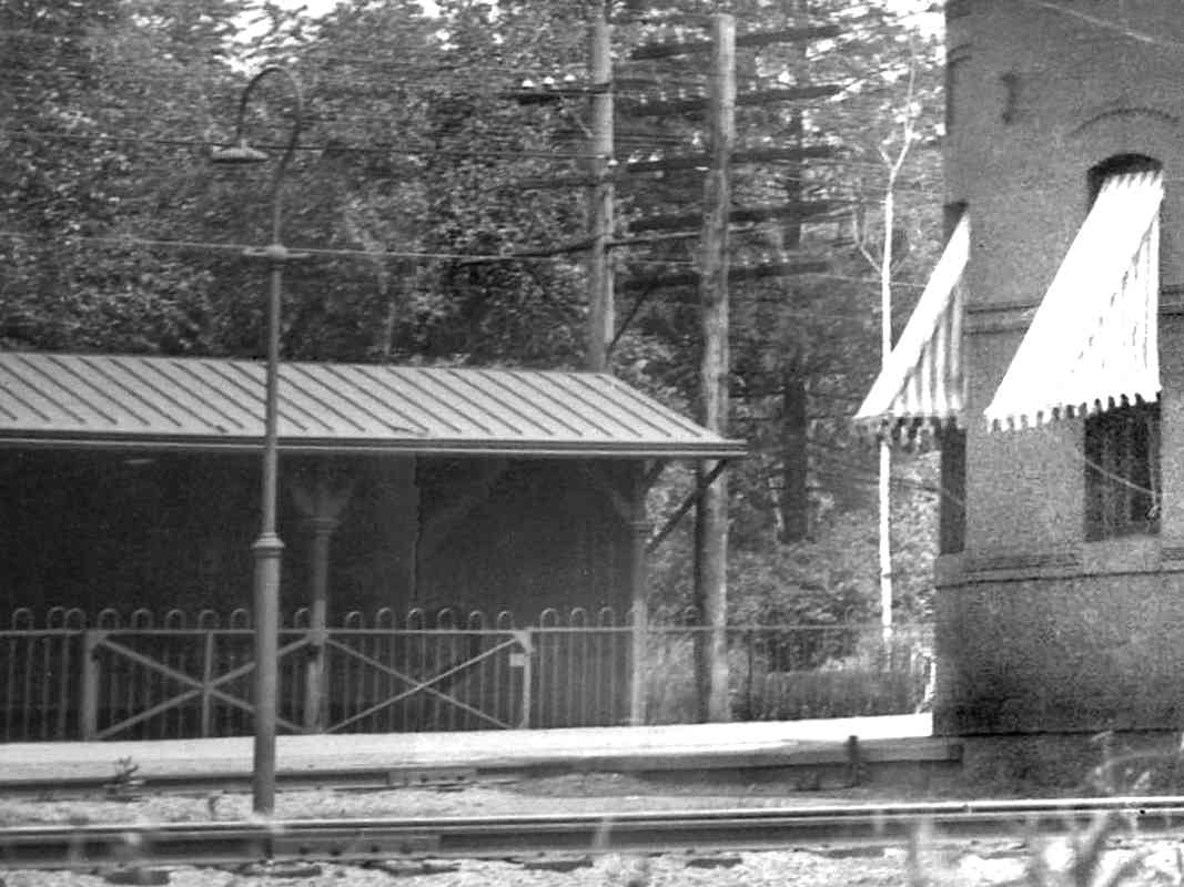
Tower operator George Laycock stands at the door. The building seen here, located across the tracks from Jefferson Street, was the third tower at this site. The first tower soon proved too small, and the second was damaged beyond repair by a 1917 derailment.

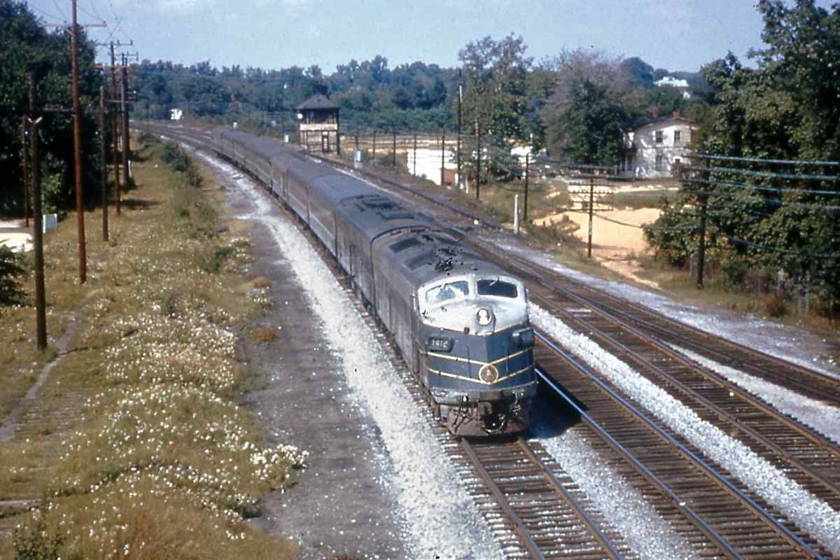
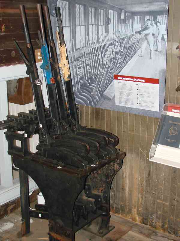
Railroads placed a tower at junctions of multiple, significant rail lines. Before onboard radios and trackside telephones, towers relayed dispatcher instructions to train engineers. Tower operators would configure nearby track switches (also called turnouts and points) to match the dispatcher's train routing instructions.

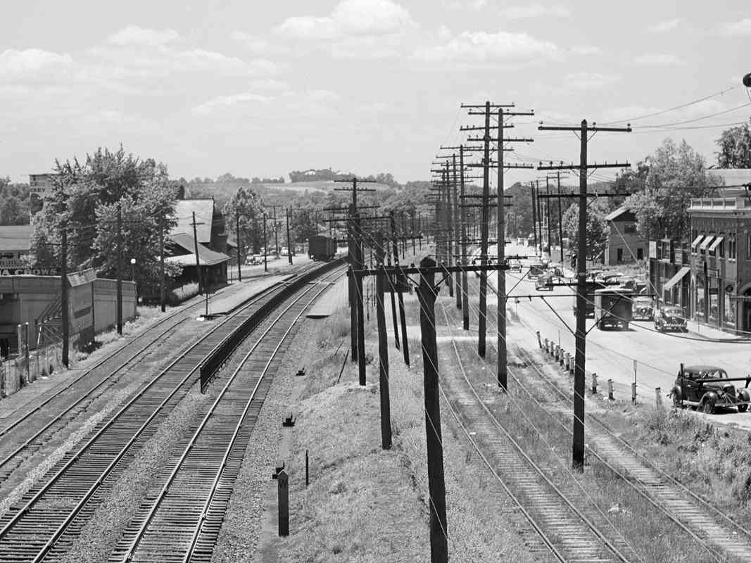
Reader Russ Forte shared some memories:

    When I was a kid, my dad took me to get my hair cut at a barber school located in a building near the tracks. We used to walk down to the tracks to look for trains. One day, the guys in the tower invited us up to see the insides. I was a very impressed 12 year-old. They had a board on the wall and about 50 levers that controlled the turnouts and signals. We didn't see any trains, but they showed us how they changed the turnout settings by moving the lever.


From JD Tower
Photo credit Warren Olt
Updated early-Sep 2023

From JD Tower
Mile: 33.1 Date: 1940
Ease: A- View: N
Area: B- IC2:
Map: PG 12 D 4 Topographic Maps

JD Tower of 1940 gave views of not only B&O trains but also Capital Transit streetcars.


B&O 4033
Photo credit Walt Schopp,
B&O History Collection

B&O 4033
Mile: 33.1 Date: May 1973
Ease: A- View: N
Area: B- IC2: 394
Map: PG 12 D 4 Topographic Maps

By 1973, locomotives wearing the yellow-red-black livery of the Chessie System were joining B&O units, here combining for four engines and one caboose. Number 4033 is a model GP40 built during 1971 that as of 2016 was working for the Wisconsin & Southern Railroad.


JD Tower Interior
Photo credit Allen Brougham,
B&O History Collection

JD Tower Interior
Mile: 33.1 Date: May 1990
Ease: View: SW
Area: IC2:
Map: PG 12 D 4 Topographic Maps

Allen Brougham completes a bit of paperwork. The tabletop box at bottom center housed electrical controls for nearby track switches.

Few women staffed railroad towers, so it's no surprise towers became man-caves-with-windows, making the pink bag of Wockenfuss candies feel very out of place. Maybe it was a pending Mother's Day gift, or one of the crew simply had a sweet tooth. Since drinking on the job was not condoned, alternate caloric vices surely substituted.

Links: 1985, 1985 1986, 1991


Recordkeeping
Photo credit Don Smith,
B&O History Collection

Recordkeeping
Mile: 33.1 Date: 1972 (2021)
Ease: View:
Area: IC2:
Map: PG 12 D 4 Topographic Maps

A tower job involved more than just eating bon bons, of course, much more. For example, details of every train on the Alexandria Branch had to be recorded. Into the 1970s, those records were kept by hand in journals like these.

Allen Brougham, the operator who officially closed the tower, wrote in 1992:

    The life and times at the tower were not always so easy as they were in more recent years. The glory days extending back to before the 1950s found the place: (1) without air-conditioning; (2) with coal in the basement to be shoveled each shift; (3) with no indoor toilet; (4) with armstrong levers to throw; (5) with the messy aftermath of soot and smoke from passing trains; and (6) with a longer work week. Add to all of this the legacy of oil lamps, Morse communication between offices, written orders and messages instead of radios, and a sundry of other glory-day railroading features, one can understand what I mean by implying that any honors that are due are really to those of an era long before my own.

Link: Allen Brougham tower info


B&O 4005
Photo credit Walt Schopp,
B&O History Collection

B&O 4005
Mile: 33.1 Date: May 1973
Ease: A- View: SW
Area: B- IC2:
Map: PG 12 D 4 Topographic Maps

B&O 4005 slows at JD Tower as its consist follows from the Alexandria Branch. The fireman has walked out to hoop train orders for the engineer as the train struggles upgrade past the tower.

armstrong levers As of 2021, B&O 4005 remained busy hauling Connecticut commuters as CDOT 6694.

Originally, all track switches controlled from JD Tower were operated by the use of armstrong levers (example at right) that were mechanically linked to the switches via a pipeline. Those pipes, one per switch, are seen parallel to the tracks at left. When B&O installed additional track switches during 1943, it made them electrically controlled. The two types then co-existed until the removal of the armstrong levers during 1978.

Link: as CDOT 6694 in 2021


Alt 1

Alt 1
Mile: 33.0 Date: Nov 2003
Ease: B+ View: S
Area: B- IC2:
Map: PG 12 D 4 Topographic Maps

As part of CSX moving to centralized traffic control, it closed JD Tower March 5, 1992. The structure endured on the left until 1994.

The view south shows the bridge that carries Alternate US 1 (Baltimore Avenue) over the tracks at Hyattsville. Around 1990, it replaced the original bridge at that location.


B&O 3555
Photo credit Walt Schopp,
B&O History Collection

B&O 3555
Mile: 33.2 Date: Jun 1972
Ease: A- View: S
Area: B- IC2:
Map: PG 12 D 4 Topographic Maps

That's the original bridge, built during the 1930s. B&O 3555 leads an eastbound off the Alexandria Branch at the correspondingly-named Alexandria Junction.


B&O 1961
Photo credit JP Stroup,
B&O History Collection

B&O 1961
Mile: 33.2 Date: Aug 1967
Ease: A- View: SW
Area: B- IC2:
Map: PG 12 D 4 Topographic Maps

When commuter demand warranted, B&O would employ RDCs in pairs. The Alexandria Branch, at the photo's left edge, will be followed via the next tour page.


DC Transit
Photo credit Al Holtz,
B&O History Collection

DC Transit
Mile: 33.2 Date: Sep 1956
Ease: A View: NE
Area: B- IC2:
Map: PG 12 D 4 Topographic Maps

Looking back from the Baltimore Avenue bridge, at photo time, DC Transit's Rhode Island Avenue trolley was in its final operating years. Car 1572 is stopped near the end of Hamilton Street.

Link: ~1930


B&O 1312
Photo credit Al Holtz,
B&O History Collection

B&O 1312
Mile: 33.2 Date: Jul 1963
Ease: A View: NE
Area: B- IC2: 179
Map: PG 12 D 4 Topographic Maps

By 1963, the trolley was gone, but its utility pole route has lingered into the 2020s, parts of which are now a paved walking trail.

Link: 1978


B&O 6585
Photo credit JP Stroup,
B&O History Collection

B&O 6585
Mile: 33.2 Date: Aug 1967
Ease: A View: SW
Area: B- IC2:
Map: PG 12 D 4 Topographic Maps

Looking the other direction from the Baltimore Avenue bridge finds the site of B&O's Hyattsville Station. If the station were still standing at photo time, visually it would be behind the CPL signal's disk. CPL poles with pointy finials like this are found where the first generation of CPLs replaced semaphore signals beginning around 1930.


Crossing Eliminated
Photos courtesy Library of Congress

Crossing Eliminated
Mile: 33.2 Date: Jun 1940
Ease: A View: SW
Area: C+ IC2:
Map: PG 12 D 5 Topographic Maps

W post This was the scene some 30 years earlier when the Baltimore Avenue grade separation bridge was newish. B&O is on the left, the trolley in the middle, and US 1 on the right. After the trolley ceased operation, its right of way would be used to widen US 1, a 30-year process that began during the 1950s.

At photo bottom is a whistle post of a design I've not seen elsewhere. Beyond it small piles of crossties are neatly arranged for no apparent reason.

Link: LoC source photo


Hyattsville Crossing
Photo courtesy B&O Museum

Hyattsville Crossing
Mile: 33.3 Date: ~1900
Ease: A- View: SW
Area: C+ IC2: 157
Map: PG 12 D 4 Topographic Maps

Prior to the bridge, there was a complex grade crossing for both Baltimore Avenue and Decatur Street. On the far right are the trolley tracks, and on the left is B&O's Hyattsville Station.


Zoom
Photo courtesy B&O Museum

Zoom
Mile: 33.3 Date: ~1900
Ease: A- View: SW
Area: C+ IC2: 157
Map: PG 12 D 4 Topographic Maps

Magnification and contrast enhancement of the prior photo bring out details such as the mail crane at the distant end of the westbound passenger platform. Via a mail crane, a train could pick up mail "on-the-fly" without stopping.

The lighting at the waiting shack consists of hanging lanterns rather than electric lamps.

On the right note the trolley car and what may be either passengers or workers. The trolley arrived here during 1899, followed decades later by Rhode Island Avenue.

Links: in action in WV 1966, 82 Trolley line (1950s, youtube video)


Hyattsville Station
Photo courtesy B&O Museum

Hyattsville Station
Mile: 33.4 Date: ~1920
Ease: A View: N
Area: C+ IC2: 157
Map: PG 12 D 5 Topographic Maps

This 1884 version was B&O's largest station between Baltimore and Washington. The area is named for Christopher Hyatt who in 1865 established a store in this vicinity.

Links: 1940s, station ~1948, B&O 4156 1948, Maryland Historical Trust (PDF)


Hyattsville Details
Photo courtesy B&O Museum

Hyattsville Details
Mile: 33.4 Date: ~1920
Ease: A View: N
Area: C+ IC2: 157
Map: PG 12 D 5 Topographic Maps

A magnified view shows the station's southwest side equipped with awnings, that era's environmentally-friendly air conditioning. On the left is an electric lamp in the then-popular bishop's crook style, its horizontal bar a holdover from when gas lamps were lit each evening by someone who leaned a ladder against that bar.

Sep 2017 Across the tracks, DC-bound passengers could wait at a long, covered platform shack. The curved-top fence discouraged passengers from crossing the tracks at any but the approved locations.

Segments of that type of fence survive at Hyattsville, perhaps because a tree has grown up around them, but this location is not between the B&O tracks. The fence abuts a concrete pad that supported the waiting shelter seen in the next photo. The structure survived until about 1990. The yellow pipes might have been added later to block vehicles from parking.

Links: 1940s, Maryland Historical Trust (PDF)


Shelter
Photo credit JP Stroup,
B&O History Collection
NEW! early-Sep 2023

Shelter
Mile: 33.2 Date: Aug 1967
Ease: A View: SW
Area: B- IC2:
Map: PG 12 D 4 Topographic Maps

After the original station was removed, the passenger waiting shelter in the distance served B&O commuters who parked their cars adjacent it. Rhode Island Avenue had not yet been twinned.


B&O 6459
Photo credit JP Stroup,
B&O History Collection

B&O 6459
Mile: 33.4 Date: Aug 1967
Ease: A- View: N
Area: B+ IC2:
Map: PG 12 D 5 Topographic Maps

B&O 6459 rolls past the site of Hyattsville Station. The aforementioned shelter is off photo left.


<< Previous (east) | THIS PAGE: Riverdale to Hyattsville | Next (Alexandria branch) >>

Or, return to main page for other tours.

Copyright Notice