TrainWeb.org Facebook Page
B&O Washington Branch Photo Tour


B&O Washington Branch
Modern day photo tour

Accompanying each photo below are:

Click a photo to see a larger view. Please send your comments and corrections to Steve.


<< Previous (east) | THIS PAGE: Patuxent | Next (branch) >>

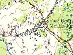
Topo 1949
Image courtesy USGS
NEW! Nov 2024

Topo 1949
Mile: 17.5 to 18.3 Date: 1949
Ease: View: N (up)
Area: IC2:
Map: AA 5 E 9, Ho 20 G 9 Topographic Maps

Heading west from Annapolis Junction, the next railroad control point is one named Patuxent, where B&O's PA Tower had stood.

B&O is the crescent of double track while Guilford Road is depicted in red and white. The two had met at grade until about 1930, after which nearby roads were forced into convoluted paths. Upgrade of Guilford Road to limited-access MD 32 would not begin here until 1980.

Influenced by World War II, USGS maps from the 1940s label the track wye Fort George G Meade Junction. To my knowledge, the postal address has been Annapolis Junction ever since the first office opened here in 1844. USGS says the dotted triangle at center is a "horizontal control with checked spot elevation." Indications are that had been the location of a small grade crossing.

Link: Fort Meade info


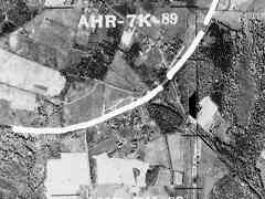
Aerial 1952
Photo courtesy Johns Hopkins University
NEW! Nov 2024

Aerial 1952
Mile: 17.5 to 18.3 Date: 1952
Ease: View: N (up)
Area: IC2:
Map: AA 5 E 9, Ho 20 G 9 Topographic Maps

Unfortunately, that small grade crossing is hidden by the white divider overlaid along county borders. The area was largely farmland in 1952, but that was about to change with help from the B-W Parkway that was under construction off photo right. The triangular wye that began with the Annapolis and Elk Ridge Rail Road in 1838 is visible right of center even on 21st century versions of this aerial.

PA Tower, which will be seen below, is obscured by the white divider. To find its location, extend an imaginary line down from the letter R in AHR to where it meets the railroad.


B&O C2927
Photo courtesy B&O History Collection
NEW! Nov 2024

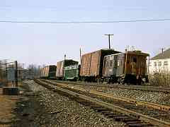
B&O C2927
Mile: 17.9 Date: Feb 1966
Ease: A- View: W
Area: B IC2:
Map: AA 5 E 9, Ho 20 G 9 Topographic Maps

As is true at many former grade crossings, wires span the tracks overhead. The utility pole visually behind B&O caboose 2927 was still there 50 years later for the similar photo in the next panel.


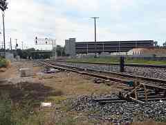
Parking Deck

Parking Deck
Mile: 17.9 Date: Sep 2014
Ease: A- View: W
Area: B IC2:
Map: AA 5 E 9, Ho 20 G 9 Topographic Maps

CSX upgraded the stretch west from Annapolis Junction with new signals, switches and track during the 2010s.

Multi-deck parking for commuters is under construction adjacent to the MARC station in the distance. Another parking deck would be built on the right two years later. The edge of expanding Fort Meade, that someday might be renamed for Charlie Wilson, is two miles to the east.


Budd RDC
Photo courtesy B&O History Collection
NEW! Nov 2024

Budd RDC
Mile: 17.9 Date: Feb 1966
Ease: A- View: W
Area: B IC2:
Map: AA 5 E 9, Ho 20 G 9 Topographic Maps

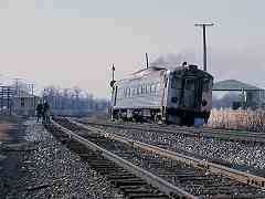
PA Tower A rail diesel car transports commuters toward Washington on a mild winter morning. The open air building on the right facilitated rail car unloading at what was Furman Lumber (or its predecessor).

One finds B&O's small PA Tower at distant left. It was the only tower between HX in Halethorpe and JD in Hyattsville. There exist only a small number of photos of it.


PA Tower

PA Tower
Mile: 18.0 Date: Sep 2014
Ease: A- View: NE
Area: B IC2:
Map: AA 5 E 9, Ho 20 G 10 Topographic Maps

CSX has retained B&O's name for this spot: PA Tower. The code names, often two letters, were also the telegraph call signs of the tower, and usually incorporated letters of a town or nearby geographic feature, in this case the Patuxent River. PA tower had been located immediately behind the photographer where Brock Bridge Road meets Washington Street.

Links: PA Tower ~1980 (closed), 1953 from PA Tower? (former Howard's Hotel at left)


Old Ties

Old Ties
Mile: 18.1 Date: Oct 2003
Ease: A- View: E
Area: B IC2:
Map: AA 5 E 9, Ho 20 G 10 Topographic Maps

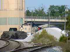
Deep zoom back to the track wye spies old crossties being loaded onto, ironically, trucks for disposal.

A D sign on a post all on its own (right) is not common, usually they share their placement with signals.


Mile Stone 18

Mile Stone 18
Mile: 18.0 Date: Oct 2003
Ease: A View: NW
Area: B IC2:
Map: AA 5 E 9, Ho 20 G 10 Topographic Maps

Nov 2003 Neglected, forgotten and hiding in weeds 18 rail miles from Baltimore was original mile stone 18. The opposite side of the marker (right) had the mileage engravings, but was partially obscured by a discarded slab of concrete that was pushing the marker and causing it to lean. This was not a very respectful way to treat a loyal worker who had been on the job since around 1835. Reduced foliage permitted a partial view the following month (right).

This stone milepost was still on site during 2007, but I was unable to refind it seven years later. It is no longer extant.

Detour: Washington Branch Milestones


MARC 31
NEW! Nov 2024

MARC 31
Mile: 17.9 Date: Oct 2018
Ease: A- View: W
Area: B IC2:
Map: Ho 20 G 9, AA 5 E 9 Topographic Maps

Illuminated red tail lights reveal MARC 31 is pushing a commuter train that will flip the green overhead signal to a similar red color in a moment.


CSX 902946
Photo courtesy Dave Hiteshew

CSX 902946
Mile: 18.0 Date: Nov 2007
Ease: A View: S
Area: B IC2:
Map: AA 5 E 9, Ho 20 G 10 Topographic Maps

During 2007, this caboose was rescued from Caboose Row along Hammonds Ferry Road then given the makeover seen in the panel below. The other side had no lettering, which suggests this circa 1987 CSX paint with B&O sublettering may be a railfan's creation. I have been unable to find a photo of another caboose wearing this paint scheme.


B&O C2946

B&O C2946
Mile: 18.0 Date: Sep 2017
Ease: A View: SE
Area: B IC2:
Map: AA 5 E 9, Ho 20 G 10 Topographic Maps

B&O cabooses were usually painted red or blue. This one is blue for the Royal Blue train, B&O's celebrated service between New York and Washington. During the early 21st century, this refurbished unit had operated as a B&B, and may still do so.

Links: more pics at trainorders.com, Airbnb


CSX 3450
NEW! Nov 2024

CSX 3450
Mile: 18.0 Date: Aug 2024
Ease: A- View: E
Area: B IC2:
Map: AA 5 E 9, Ho 20 G 9 Topographic Maps

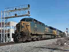
CSX 3450 and Tropicana reefers round one of many curves on their way back to Florida. The engine's paint colors are not very different from those of the B&O caboose.


CSX 11
NEW! Nov 2024

CSX 11
Mile: 18.0 Date: Feb 2024
Ease: A View: NE
Area: B IC2:
Map: AA 5 E 9, Ho 20 G 9 Topographic Maps

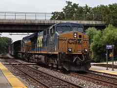
Winter-dirtied CSX 11, followed by 3410, 3078 and 4577 are about to pass the control point CSX calls Patuxent.


Autoracks

Autoracks
Mile: 18.1 Date: Sep 2017
Ease: A View: E
Area: B IC2:
Map: Ho 20 G 10, AA 5 E 9 Topographic Maps

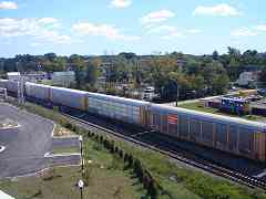
Autoracks often jockey back and forth here as they split apart or are trained together at Jessup terminal in lengths of one to two miles. At right, the restored caboose supervises from the former grounds of Camp Kelsey.

Link: Camp Kelsey 1861


Logos

Logos
Mile: 18.0 Date: Sep 2017
Ease: A View: SE
Area: B IC2:
Map: Ho 20 G 10, AA 5 E 9 Topographic Maps

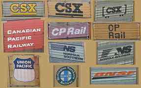
Rail company logos of differing eras roll by on passing autoracks.


Panama Canal Railway
NEW! Nov 2024

Panama Canal Railway
Mile: 18.0 Date: Feb 2024
Ease: A View: E
Area: B IC2:
Map: AA 5 E 9, Ho 20 G 9 Topographic Maps

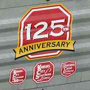
Logos are also a place to spot names of foreign railroad companies. Panama is about 4000 rail miles from here.


Stencil

Stencil
Mile: 18.0 Date: Sep 2017
Ease: A View: SE
Area: B IC2:
Map: Ho 20 G 10, AA 5 E 9 Topographic Maps

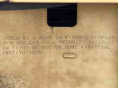
This "Owned by a bank or finance company..." stencil on some autoracks is a requirement of an agreement between railcar lessor and lessee that is spelled out in a dense legal document quoted below:

    "(j) As soon as reasonably practicable, place decals, plates and/or such other marks, legends, or decals on the Containers to indicate that such Containers are owned by Owner and that they may be subject to a security interest in favor of one or more financial institutions. Manager may also label the Containers with all of its customary labels, marks and decals and/or to indicate that they are managed by Manager. The cost of placing all such marks, legends or decals on the Containers shall be included in the Per Container Price and Total Invoice Price paid by Owner."


From Deck
Photo courtesy Kirk Nabors

From Deck
Mile: 18.1 Date: Jul 2015
Ease: B+ View: E
Area: B IC2:
Map: Ho 20 G 10, AA 5 E 9 Topographic Maps

Before the newer parking deck got in the way, the older one facilitated a long, clear view. PA Tower stood near the eastbound signal on the other side of the tracks that is visually below the multi-signal mast.

Link: 1996


CSX 788

CSX 788
Mile: 18.1 Date: Jun 2018
Ease: A- View: E
Area: B IC2:
Map: Ho 20 G 9, AA 5 E 9 Topographic Maps

For a brief period during June, the interior curve of trains gets a bit of midday sunlight. CSX 3370 trails.


MARC 86

MARC 86
Mile: 18.0 Date: Oct 2018
Ease: A- View: SW
Area: B IC2:
Map: Ho 20 G 9, AA 5 E 9 Topographic Maps

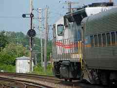
While barely a few months old, one of MARC's Charger units leads four bi-level commuter cars east out of Savage Station.


Savage Station

Savage Station
Mile: 18.1 Date: Sep 2000
Ease: A- View: E
Area: B IC2:
Map: AA 5 D 9, Ho 20 G 10 Topographic Maps

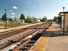
Savage Station opened during 1989. A few boxcars rest along what had been Furman Lumber's siding at distant center.

The Annapolis Junction name had almost been squeezed out of existence as Jessup intruded from the northeast and Savage from the southwest before in 2013 the developer of the land on the left changed the project name from Savage to Annapolis Junction. Eventually, this MARC commuter rail stop will probably be renamed too. This spot is much closer to what had been B&O's Annapolis Junction Station than Savage Station.

This train station and Jessup's are the only two in the Baltimore/Washington region with passenger platforms active in two different counties: Howard County on the left, Anne Arundel on the right.

Link: AnnapolisJunction.com


Departing Station

Departing Station
Mile: 18.1 Date: Jun 2004
Ease: A- View: E
Area: B IC2:
Map: Ho 20 G 10, AA 5 E 9 Topographic Maps

MARC 57 has just discharged evening commuters, and now has a green light to continue toward Baltimore. This 8-lamp CPL is no longer extant.


CSX 4583
NEW! Nov 2024

CSX 4583
Mile: 18.1 Date: Feb 2024
Ease: A- View: SW
Area: B IC2:
Map: Ho 20 G 9, AA 5 E 9 Topographic Maps

csx.com CSX 4583 is an EMD SD70MAC that had been CR 4138. It was one of the last locomotives built for Conrail.

The CSX.com web site has existed for decades, so the addition of "www.csx.com" to locomotives during 2023 feels a bit unnecessary.


CSX 5211
NEW! Nov 2024

CSX 5211
Mile: 18.1 Date: Aug 2024
Ease: A- View: W
Area: B IC2:
Map: AA 5 E 9, Ho 20 G 9 Topographic Maps

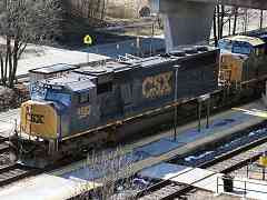
All the 52xx ES40DC units have lemon-yellow side lettering that does not match the standard orange-yellow color. CSX 589 follows.


CSX 825

CSX 825
Mile: 18.2 Date: Mar 2021
Ease: A- View: W
Area: B IC2:
Map: Ho 20 G 10, AA 5 D 10 Topographic Maps

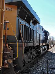
As seen from Savage Station, CSX 825 takes a break from jockeying Jessup autoracks.


Looking West

Looking West
Mile: 18.2 Date: Jan 2003
Ease: A View: W
Area: B IC2:
Map: AA 5 D 10, Ho 20 F 10 Topographic Maps

On a dreary winter day, this is the general view of westbounds shortly after they depart Savage Station. Brock Bridge Road parallels the tracks. Since photo time, CSX has removed the trackside utility poles.

A map from around 1900 shows a road split off here to the left, headed south, crossed the Patuxent River and connected into what is now the Russett Community accessed via MD 198. Long before Russett, a different community was planned on the right side of this photo.

Annapolis Junction, with rail service by B&O and A&ER, offered commuting possibilities, and with Civil War hostilities ended, the planning map at right United Cities 1866 for United Cities was drawn by surveyor Simon Martenet in 1866. I surmise United Cities sought to replicate the success of Lutherville, Maryland, which was likely the first planned commuter community in the country. During the 1850s, it was developed along the Northern Central Railway.
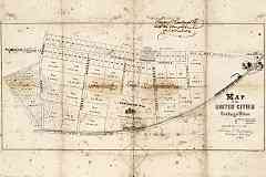
The map depicts the west side of Annapolis Junction where cottage sites are measured in acres, roods, and perches. One rood is equal to one quarter of an acre (~1012 square meters). A rectangle that is one furlong (or 10 chains, or 40 rods) in length and one rod in width is one rood in area, as is any space comprising 40 perches (a perch being one square rod).

Something went awry because United never came to fruition; instead Junction Business Park took up residence some 100 years later with the same footprint as depicted by the 1866 map. The awkward name and, railfan preferences aside, siting of larger lots on lower-elevation land closest the railroad may have been factors in the failure. That marked Front Street is roughly where Dorsey Run Road is found now.

Links: LoC source map, 1985


2010s Culvert

2010s Culvert
Mile: 18.3 Date: Jul 2022
Ease: B+ View: S
Area: B IC2:
Map: Ho 20 F 10, AA 5 D 10 Topographic Maps

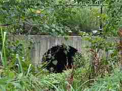
South of "Mansion Lot No. 50" on the map above, CSX reshaped a B&O culvert into this form during the 2010s. I do not know if a stone culvert was here previously.


Spur

Spur
Mile: 18.7 Date: Oct 2003
Ease: C View: W
Area: B IC2:
Map: Ho 20 E 10, AA 5 C 9 Topographic Maps

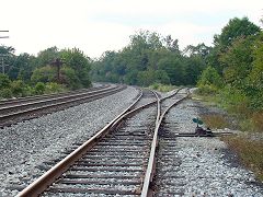
About a half mile west of Savage Station, the Washington Corridor Industrial Park spur/branch serves the area around the Little Patuxent Water Treatment Plant. It is the subject of the next tour page.


<< Previous (east) | THIS PAGE: Patuxent | Next (branch) >>

Or, return to main page

Copyright Notice