TrainWeb.org Facebook Page
B&O Photo Tour


Unknown Photos
Modern day photo tour

Accompanying each photo below are:

Click a photo to see a larger view. Please send your comments and corrections to Steve.


Introduction:

ASL 5
Photo courtesy HH Harwood collection

ASL 5
Mile: 1.2? Date: ~1900
Ease: B View: SW
Area: B- IC2:
Map: Ba 42 J 3 Topographic Maps

ASL 5 zoom This photo came labeled as the Annapolis Short Line (ASL) engine 5 at Cliffords. Both Herb Harwood and I believe that location is incorrect. For a period around 1900, the ASL followed the B&O's South Baltimore Branch plus Camden Cutoff to reach into Baltimore city.

One candidate location is near Bush Street, looking southwest. In the distance there appears to be a structure on the left, about where Carroll Tower had been. That could be a bridge over the tracks at distant center, which might correspond to Curtis Bay Junction where the Curtis Bay Branch crosses over the Camden Cutoff. If you believe a different location is a better fit, please let me know.


Chicago IL

Chicago IL
Mile: Date: ~1960
Ease: View: ?
Area: IC2:
Map: Topographic Maps

Written on this photo is "Chicago", but what road is this? What year? The white car near center would appear to be the newest, but which model is it? In what compass direction are we looking? Railroad content: Santa Fe billboard at left.


Charlemont MA

Charlemont MA
Mile: Date: 1950s
Ease: View: ?
Area: IC2:
Map: Topographic Maps

It's the Indian Wishing Well in Charlemont, MA near the Mohawk Park Motel and Shell gasoline station. Looks 1950s to me. Is there a way to narrow the year? For example, perhaps that style of Shell sign did not debut until, say, 1952.


Bridges

Bridges
Mile: Date: 1950s
Ease: View: ?
Area: IC2:
Map: Topographic Maps

The most distant appears to be a railroad bridge. It also looks to have one collapsed span. Where is this? That a sharply-rising hill is near the water suggests a Pacific Rim location.


Way Down

Way Down
Mile: Date: 1973
Ease: View: ?
Area: IC2:
Map: Topographic Maps

OK, this is just for the fun (I do know where this is). Hint: This pic was not shot from an aircraft. What is the name of the railroad down there?


Box Culvert

Box Culvert
Mile: OML ~16? ~30? Date: 2000
Ease: View: ?
Area: IC2:
Map: Topographic Maps

There are many box culverts along the Old Main Line, and I can't recall where this particular one is located. This photo was with a batch taken near mileposts 16 (Hollifield) and 30 (Sykesville/Gaither).


The Wire
Updated late-Nov 2022

The Wire, SOLVED
Mile: Date: 2000s
Ease: A View: W
Area: B- IC2:
Map: Ba 44 E 1 Topographic Maps

Fait Av at 48 St 
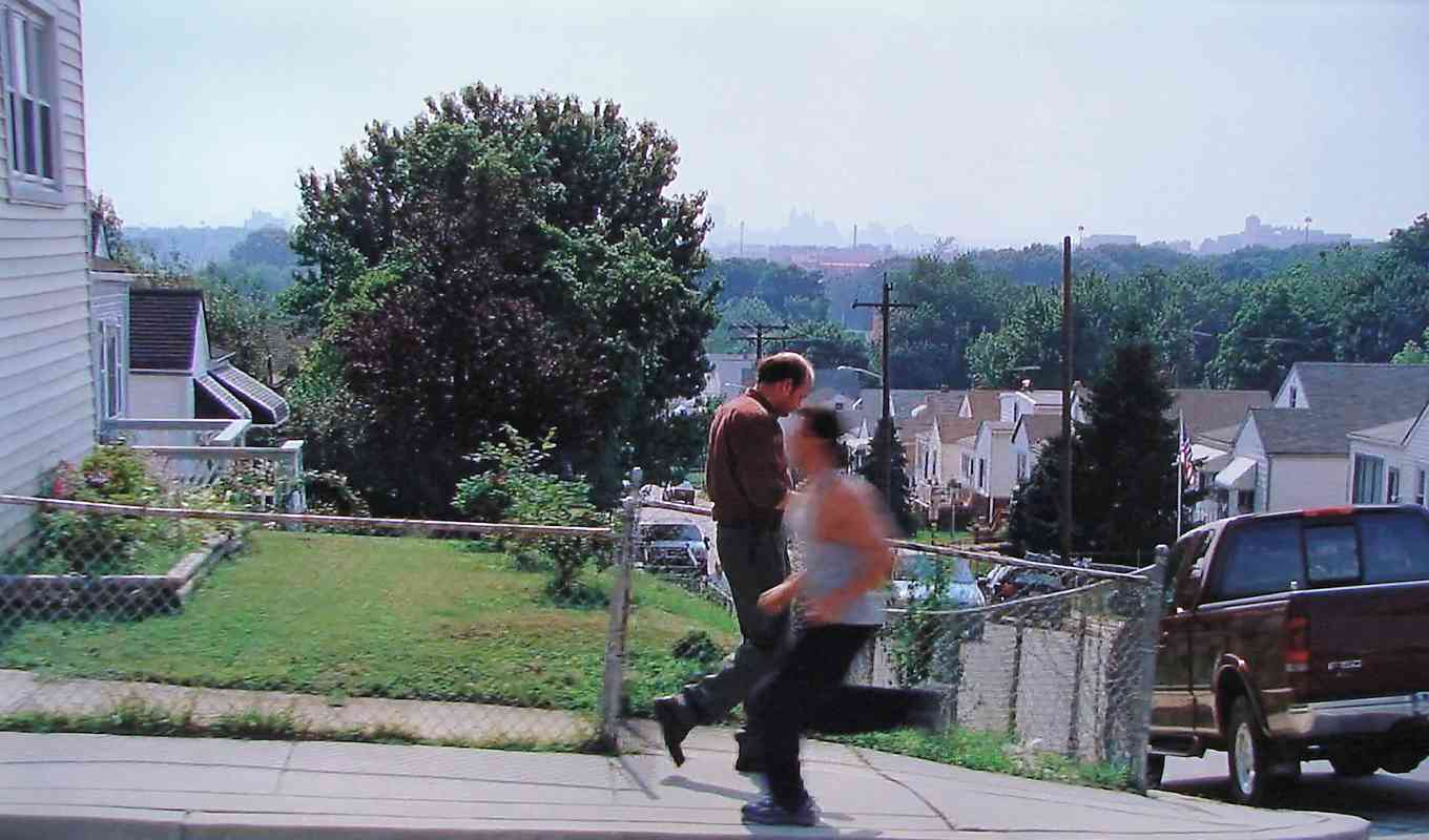
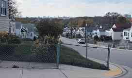
This screen cap from The Wire had stumped me for years, and was missing from filming location lists assembled by fans. As depicted, this is where fictional character Frank Sobotka lives. My suspicion the filming location was on a hill in Dundalk (Baltimore) looking west to downtown was correct.

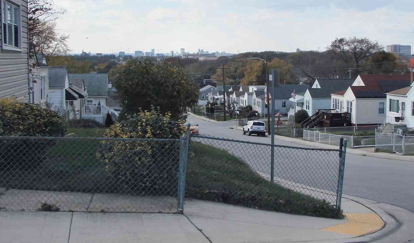
The intersection (off right) is of Fait Avenue and 48th Street. Though several things, such as trees and shrubs, have changed during the ~15 years since the scene was filmed, the November 2022 view at left is clearly a location match.

Link: other then-now pairs for The Wire


Thanks for looking!

Return to main page

Copyright Notice