TrainWeb.org Facebook Page
Old Main Line Photo Tour


B&O Old Main Line
Modern day photo tour

Accompanying each photo below are:

Click a photo to see a larger view. Please send your comments and corrections to Steve.


<< Previous (east) | THIS PAGE: disused at Woodbine | Next (west) >>

Woodbine Tunnel - Brief Historical Background:

Tie Plates

Tie Plates
Mile: 33.3 Date: Mar 2005
Ease: B View: W
Area: A IC2:
Map: Ca 33 J 4, Ho 3 J 5 Topographic Maps

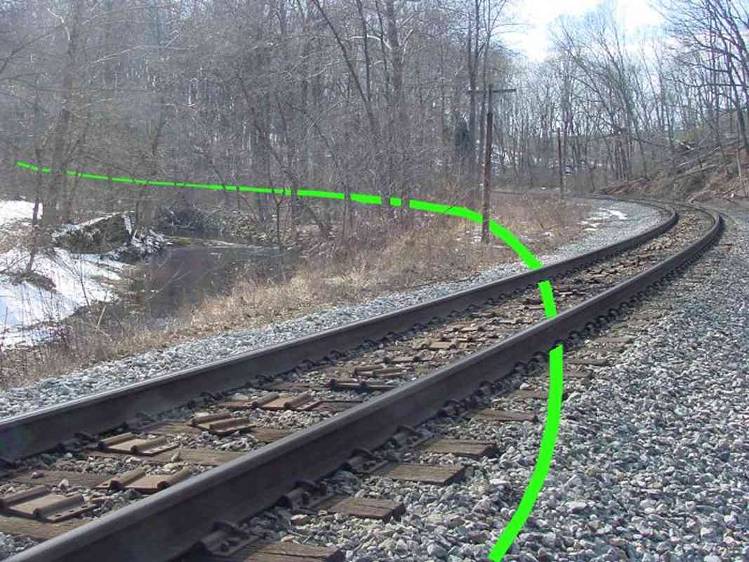
The original route (green line) presented even more of a curve than what remains in use today.

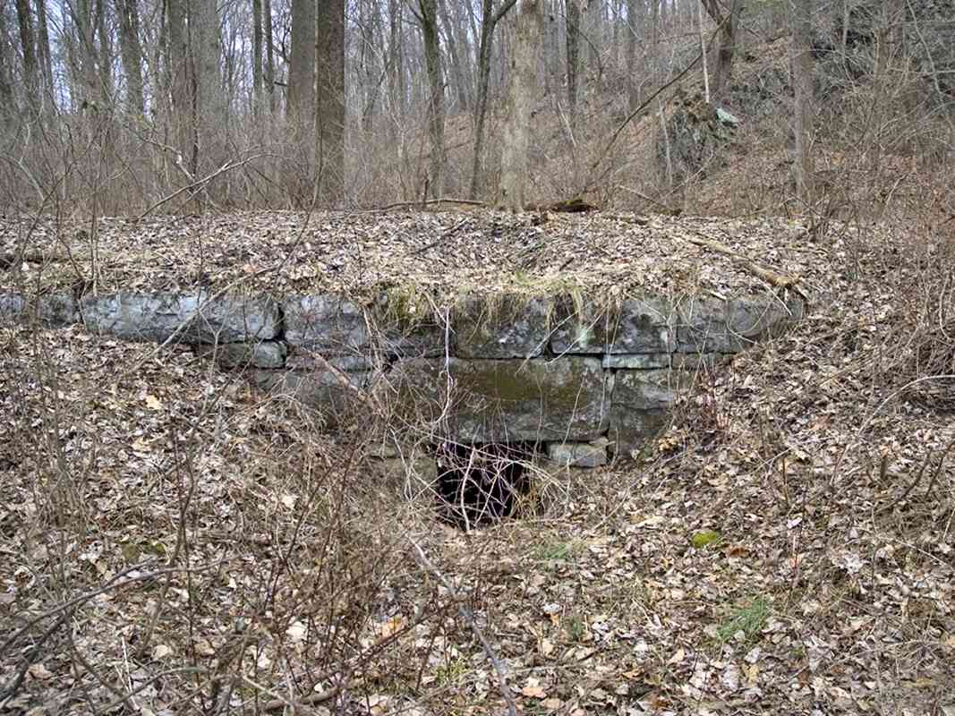
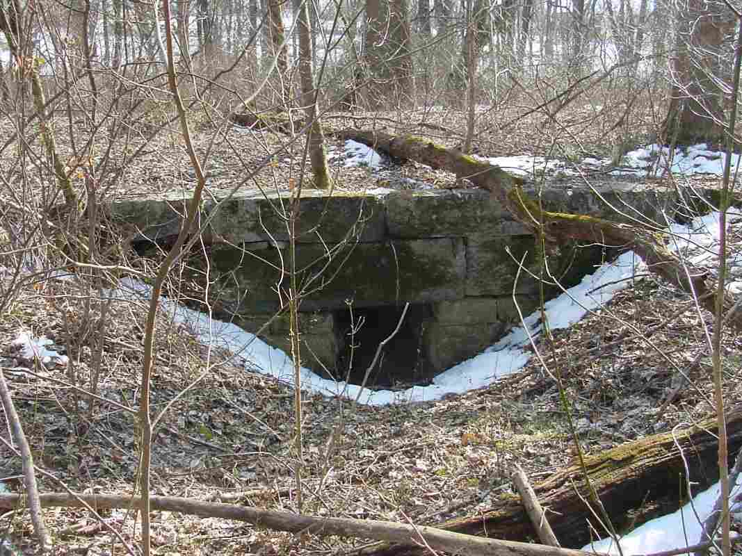
Woodbine Tunnel is just beyond the bend, but for years I was unable to locate remains of a disused original alignment. Reader Steve Hanlon visited during non-leaf season, found the original route and clued me in. I also credit him with inspiring me to break out the disused alignments onto web pages of their own.

A trail of tie plates is evidence CSX was performing track work.


Ballast

Woodbine Tunnel, East
Mile: 33.4 Date: Mar 2005
Ease: B View: SW
Area: A IC2:
Map: Ca 33 J 4, Ho 3 J 5 Topographic Maps

When following the old alignment around the hill, we find these fallen trees that never established a good root system because they grew atop the old right-of-way: embedded in the exposed dirt are rocks of ballast.


Culvert
Photo courtesy Steve Hanlon

Culvert
Mile: 33.6 Date: Feb 2005
Ease: B View: NW
Area: A IC2:
Map: Ca 33 H 4, Ho 3 H 6 Topographic Maps

Steve discovered this disused culvert, definitive proof of the old alignment. Other than this and some ballast, there's not much surviving evidence of the route. Perhaps the Patapsco's periodic convulsive floods have cleansed the area.

Woodbine Tunnel was bored through the hill seen on the right.


Culvert

Culvert
Mile: 33.6 Date: Mar 2005
Ease: B View: SE
Area: A IC2:
Map: Ca 33 H 4, Ho 3 H 6 Topographic Maps

This view looks the other way, toward the river.


Break

Break
Mile: 33.9 Date: Mar 2005
Ease: B View: E
Area: A IC2:
Map: Ca 33 H 4, Ho 3 H 6 Topographic Maps

The break in the vegetation on the right shows where the original right-of-way had passed. That's Woodbine Tunnel at distant left.


Rejoin

Rejoin
Mile: 34.0 Date: Mar 2005
Ease: B View: W
Area: A IC2:
Map: Ca 33 H 4, Ho 3 H 6 Topographic Maps

The current alignment rejoins with the original at milepost 34 in order to squeeze past the Patapsco River. The town of Woodbine is just beyond the bend.


<< Previous (east) | THIS PAGE: disused at Woodbine | Next (west) >>

Or, return to main page

Copyright Notice