TrainWeb.org Facebook Page
B&O Metropolitan Branch Photo Tour


B&O Metropolitan Branch
Modern day photo tour

Accompanying each photo below are:

Click a photo to see a larger view. Please send your comments and corrections to Steve.


<< Previous (east) | THIS PAGE: Forest Glen | Next (west) >>

Number 09
Photo courtesy Dave Hiteshew

Number 09
Mile: 9.0 Date: Aug 2008
Ease: B View: NW
Area: B IC2:
Map: Mo 36 H 8 Topographic Maps

When the sign department is fresh out of 9s, everyone knows to use an upside-down 6. But what if they are all out of 6s too? Here's an inventive solution near Brookville Road (bridge number 10A, or perhaps that should be 010A). The older milepost-on-a-rail nods in approval at right.

As we'll learn later in the tour, this is only the first of several jury-rigged Met mileposts.


Insulators
Photo courtesy Dave Hiteshew
NEW! mid-Sep 2022

Insulators
Mile: 9.2 Date: Aug 2008
Ease: B+ View: E?
Area: B IC2:
Map: Mo 36 G 7 Topographic Maps

Emerald color glass insulators like these had decorated the trackside utility poles. CSX has since removed them.

B&O's Linden Station stood near here, more specifically, where Montgomery Street meets the tracks.


CSX 693
Photo courtesy Dave Hiteshew

CSX 693
Mile: 9.3 Date: Aug 2008
Ease: A- View: N
Area: B IC2:
Map: Mo 36 G 7 Topographic Maps

Max zoom spies CSX 693 eastbound under Linden Lane. The industry on the right is one of many that no longer receives shipments by train. The W whistle signpost is not an artifact: ahead is the Met's closest-to-DC grade crossing that survives.


No Whistling

No Whistling
Mile: 9.3 Date: Feb 2016
Ease: B+ View: N
Area: B IC2:
Map: Mo 36 G 7 Topographic Maps

No Wicked Witch of the West permitted here. Seeking better sleep, since the time of the prior photo locals successfully petitioned to have the loud train whistling stopped, hence this new sign. Given that sounding the horn at grade crossings is a Federal regulatory requirement, you will not find "don't whistle" signs many places. The sign applies to the Linden Lane / St. Johns Road grade crossing about a half mile ahead. There's another one like it along the Washington Branch (Cap Sub) north of Riverdale.


Beltway Preparation
Photo credit W Grosselfinger
B&O History Collection
NEW! mid-Sep 2022

Beltway Preparation
Mile: 9.6 Date: Apr 1960
Ease: B View: NW
Area: B IC2:
Map: Mo 36 G 6 Topographic Maps

The Capital Beltway's blueprints said the Met needed a bridge where one had never been. As seen here, that bridge was built during 1960 herald on the west side of the Met's original alignment, probably with help from Interstate highway funds. Upon the bridge's completion, the original alignment could be dug out to make room for six, and later eight, lanes of I-495 Capital Beltway pavement below.

The bridge was equipped with at least one blue-and-white B&O herald, as seen in the zoom view at left. CSX later covered it with one of their rectangular plaques.


I-495
Photo courtesy Dave Hiteshew

I-495
Mile: 9.7 Date: Jul 2008
Ease: B View: NW
Area: B IC2:
Map: Mo 36 G 6 Topographic Maps

Many DC-area drivers have seen the bridge thousands of times, but not from this angle. Given that the Beltway dates to the 1960s, this B&O bridge remains one of the Met's newer.


Temple
Photos courtesy Dave Hiteshew
Updated mid-Sep 2022

Temple
Mile: 9.7 Date: Jul 2008
Ease: B View: W
Area: B IC2:
Map: Mo 36 G 6 Topographic Maps

Temple In Washington, a railroad bridge can span the separation of church and state.

Art, politics and statements of the human condition contrast with views of a Mormon Temple, or more precisely the Washington D.C. Temple of The Church of Jesus Christ of Latter-day Saints. The central spire, topped by angel Moroni, stands 288 feet tall, roughly half the height of the Washington Monument.


Bridge 10D

Bridge 10D
Mile: 9.7 Date: Oct 2012
Ease: A View: W
Area: B IC2:
Map: Mo 36 G 6 Topographic Maps

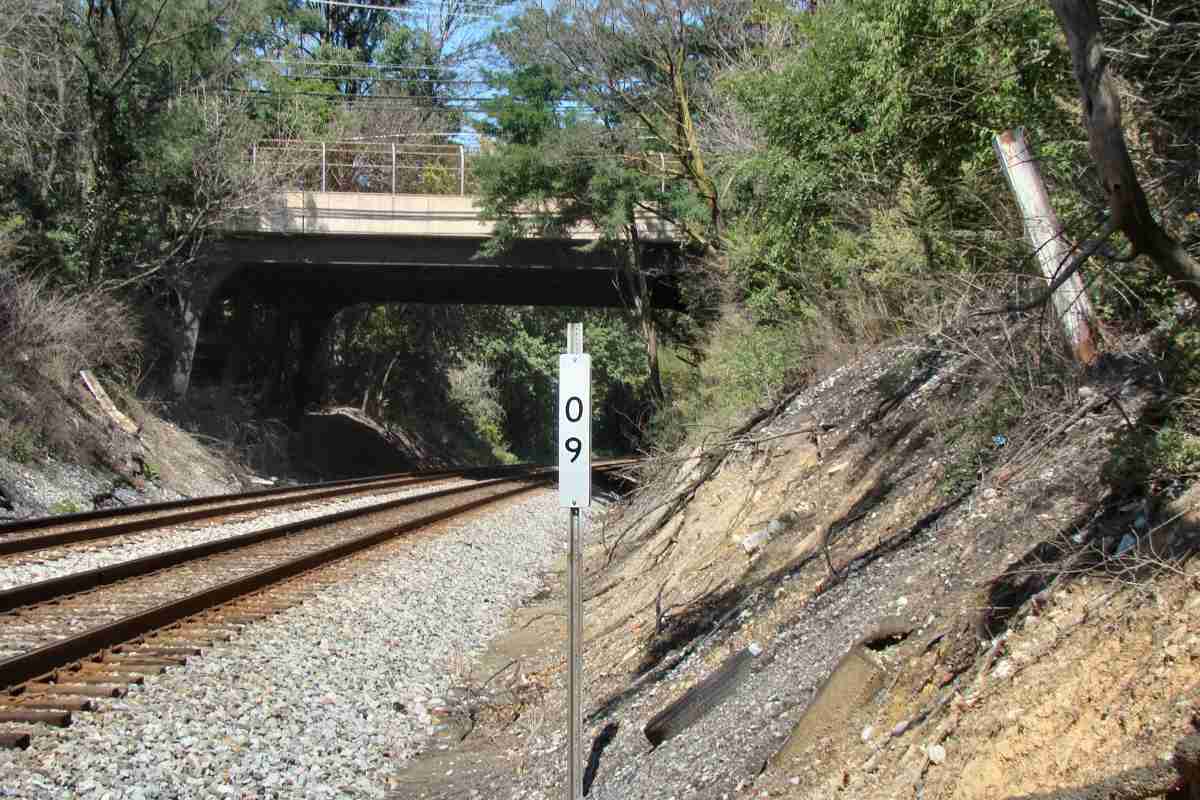
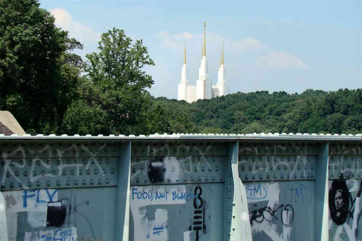
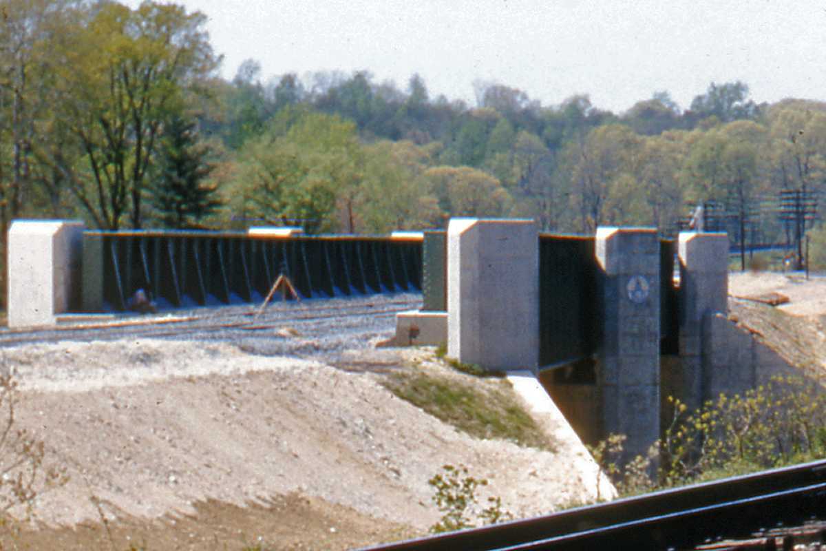
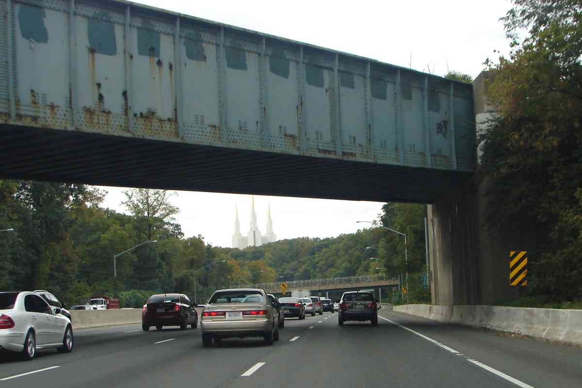
The rail bridge is known for a "Surrender Dorothy" graffito inspired by a prank in 1974 by schoolgirls of nearby Holy Child School whose play that year was The Wizard of Oz. The graffito has appeared in several forms, but the one I recall spread one letter per riveted segment, as seen here overpainted by darker blue rectangles.

Emergence 
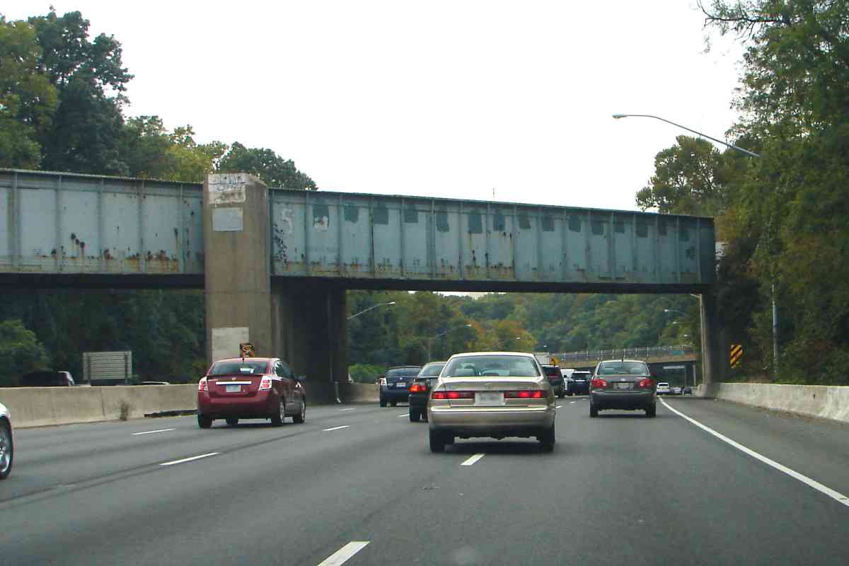
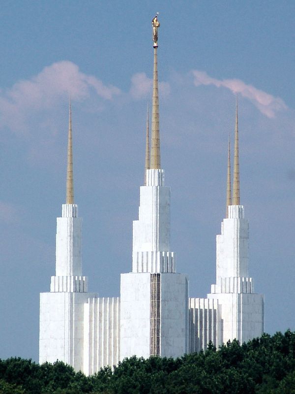
For outer Beltway drivers, the bridge obscures the temple until it emerges into view as illustrated at right. Not just temples stand tall around the Beltway, but also headquarters of many huge government contractors. Maybe there exists a yellow brick road after all. The original Baum Oz novel was about US monetary policy, especially the backers of gold versus silver (oz. is an abbreviation for ounce).

Links: Surrender Dorothy, schoolgirls, Wikipedia's entry


Forest Glen
Photo credit B&O Museum

Forest Glen
Mile: 9.8 Date: ~1920
Ease: A View: NW
Area: B+ IC2:
Map: Mo 36 G 6 Topographic Maps

Between the time of this photo and the next, B&O replaced the railcar siding on the right with a passenger shack, accessible via a tunnel under the tracks. After passenger demand diminished, during the 1950s the railroad removed all these items, plus the station, leaving behind little more than the rails. For reference in the photos below, note the turreted "castle" at right.


Castle Then
Photo credit EL Thompson

Castle Then
Mile: 9.8 Date: 1928
Ease: A View: N
Area: B+ IC2:
Map: Mo 36 G 6 Topographic Maps

EL Thompson caught this DC-bound B&O Pacific engine chuffing through Forest Glen and past the "castle" in 1928. At the time the building was part of the Mail Crane National Park Seminary. The ground floor was occupied by the Sanitary Grocery Company, which later evolved into Safeway supermarkets.

Magnification brings out details such as the mail crane at the distant end of the passenger platform. Via a mail crane, a train could pick up mail "on-the-fly" without stopping.

Links: in action in WV 1966, Sanitary Grocery in DC in 1926


Castle 2008
Photo courtesy Dave Hiteshew

Castle 2008
Mile: 9.8 Date: Jul 2008
Ease: A View: N
Area: B+ IC2:
Map: Mo 36 G 6 Topographic Maps

In much the same view some 80 years later, nothing much remains except the rails, the "castle" and the Linden Lane grade crossing (CSX calls it St. Johns Road). Not only is the Forest Glen Station dead, but it is buried: the building of the railroad bridge over I-495 necessitated realigning the tracks to the west (left) such that they now cover its foundation. The "castle" became a Hungarian restaurant during the 1960s and is now home to various professional offices. Easy access makes this a decent railfan location, though noise from Beltway traffic is continuous.

Link: wikipedia's entry


Forest Glen Station
Photo credit B&O Museum

Forest Glen Station
Mile: 9.8 Date: ~1920
Ease: A View: W
Area: B+ IC2: 223
Map: Mo 36 G 6 Topographic Maps

B&O's Forest Glen station was an EF Baldwin design erected in 1887 prior Cart to the opening of the National Park Seminary adjacent, a private school for girls.

In front of the station awaiting the next train appears to be a baggage cart stenciled with "Baltimore and Ohio".


C&O 8259
Photo courtesy B&O History Collection
NEW! mid-Sep 2022

C&O 8259
Mile: 9.9 Date: Mar 1990
Ease: B+ View: SE
Area: B IC2:
Map: Mo 36 F 6 Topographic Maps

C&O 8259 in Chessie System paint is a model B30-7. SBD 8314 is former L&N 1238. Also wearing Chessie paint is (B&O?) 2035. All are westbound across bridge 10D over the Beltway.

All the Met's grade crossings within Washington have been eliminated, so the one in the foreground for Linden Lane tells us we're not in DC anymore.


B&O 5143
Photo credit EL Thompson

B&O 5143
Mile: 9.9 Date: 1945
Ease: B+ View: SE
Area: B IC2: 223
Map: Mo 36 F 6 Topographic Maps

After WWII, EL Thompson caught another B&O Pacific at Forest Glen; number 5143 formerly belonged to the Buffalo, Rochester and Pittsburgh.


Westbound
Photo courtesy B&O History Collection
NEW! mid-Sep 2022

Westbound
Mile: 9.9 Date: Sep 1964
Ease: B+ View: SE
Area: B IC2:
Map: Mo 36 F 6 Topographic Maps

A B&O westbound has just passed over the Linden Lane grade crossing...


B&O 4050
Photo credit HL Buckley
B&O History Collection
NEW! mid-Sep 2022

B&O 4050
Mile: 9.9 Date: Sep 1973
Ease: B+ View: NW
Area: B IC2:
Map: Mo 36 F 6 Topographic Maps

... while this eastbound will soon reach that grade crossing.


Bridge 10E
Photos courtesy Dave Hiteshew
Updated mid-Sep 2022

Bridge 10E
Mile: 9.9 Date: Jul 2008
Ease: B View: NE
Area: B IC2:
Map: Mo 36 F 6 Topographic Maps

Just beyond the grade crossing one can find this substantial 1870s original bright 10e stone arch bridge.

Its opposite end (right) was widened in two stages, first by a brick arch, then later with concrete into which 1979 is embossed. Notice the brick arch transitions to stone not far from this end. The widening was likely made necessary by track realignment for the Capital Beltway bridge.


MARC 72
Photo courtesy Dave Hiteshew

MARC 72
Mile: 10.0 Date: Jul 2008
Ease: B View: SE
Area: B+ IC2:
Map: Mo 36 F 5 Topographic Maps

CSX shares the Met with a horse of a different color pulling westbound MARC commuters. Though the line began life in single-track form, traffic warranted completion by 1893 of double-tracking between DC and Gaithersburg.


<< Previous (east) | THIS PAGE: Forest Glen | Next (west) >>

Or, return to main page for other tours.

Copyright Notice