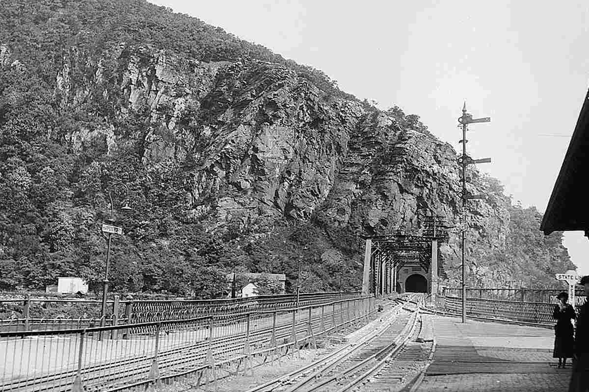
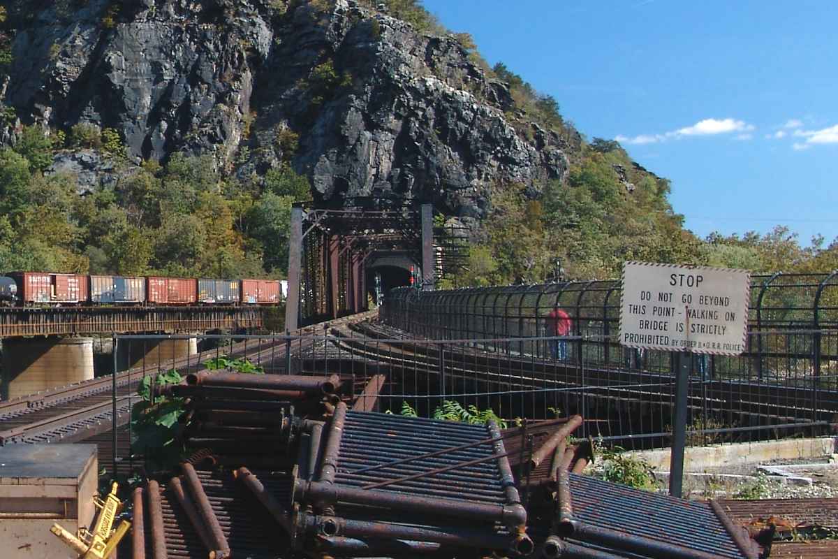
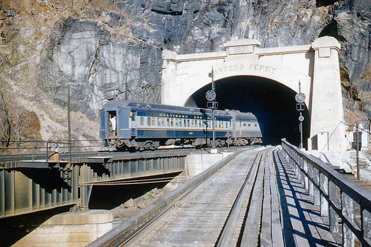
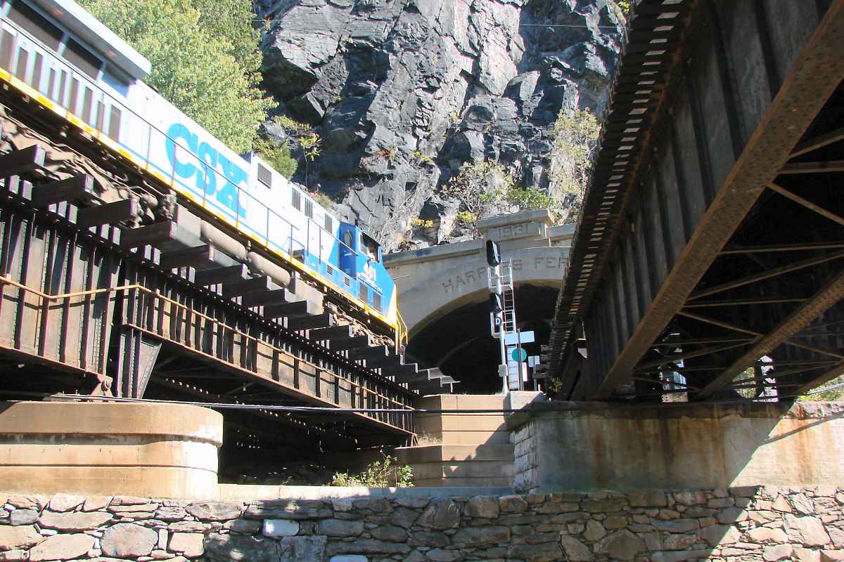
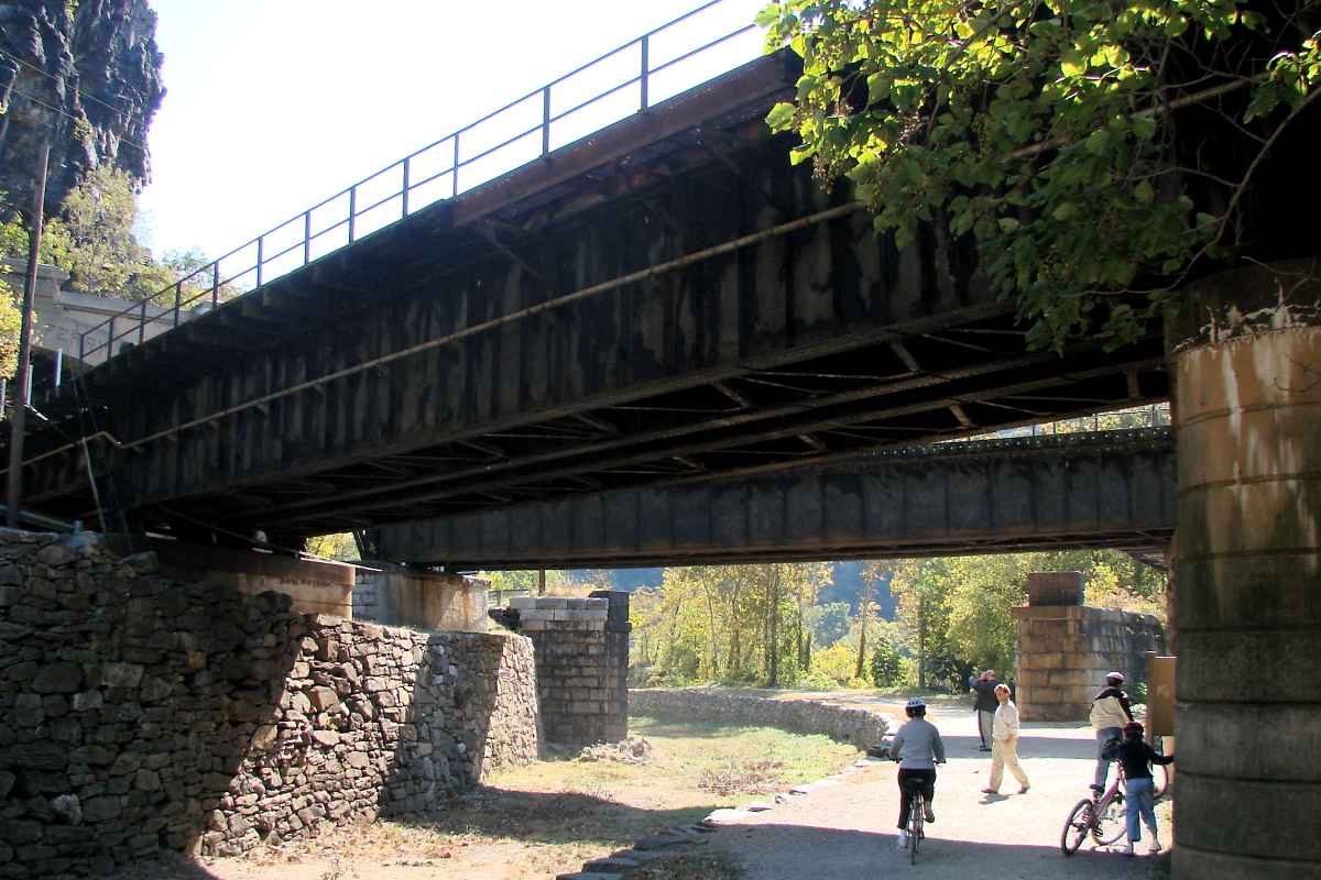
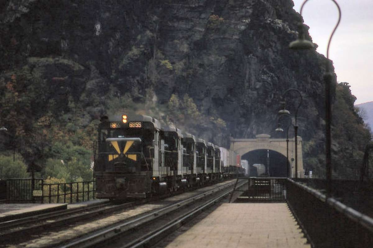
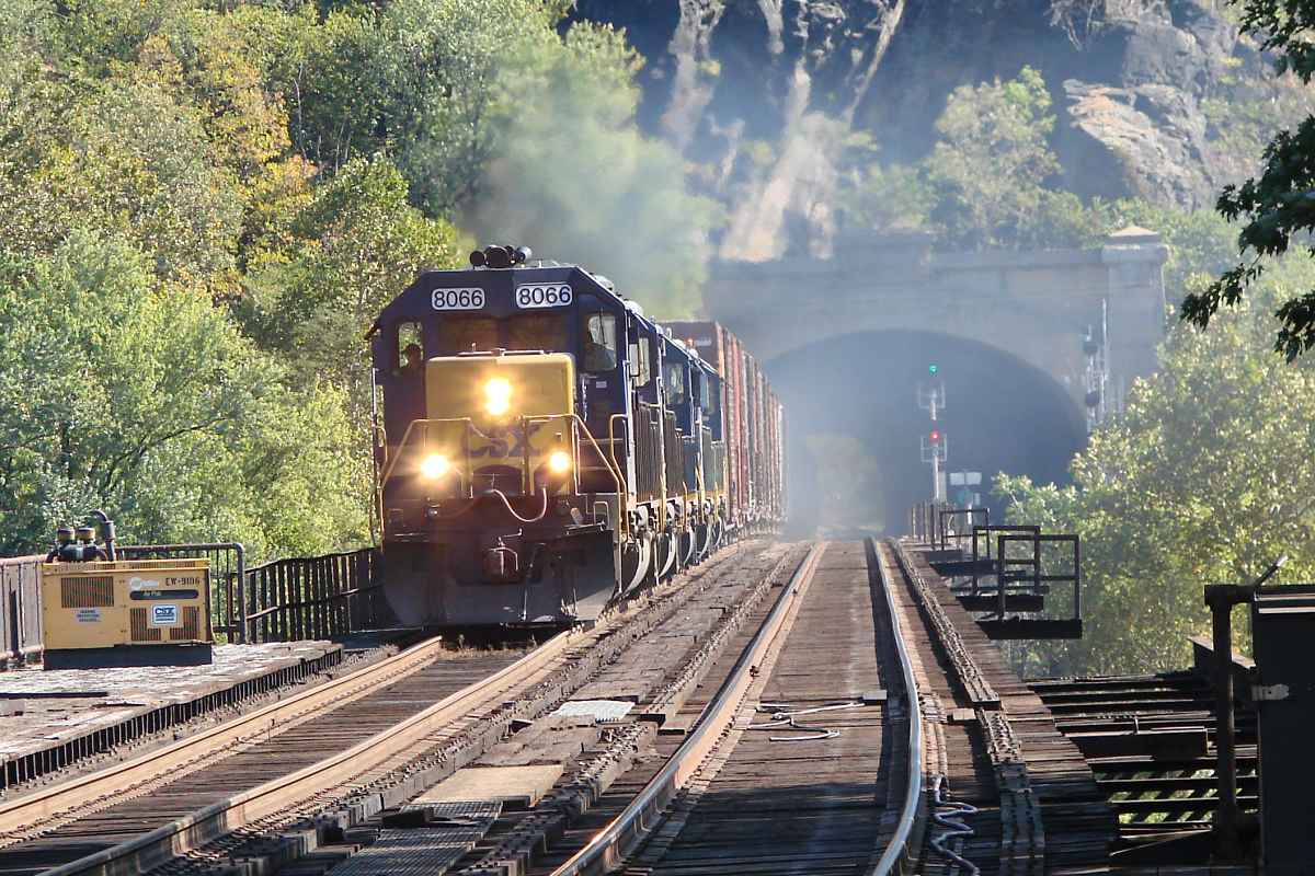
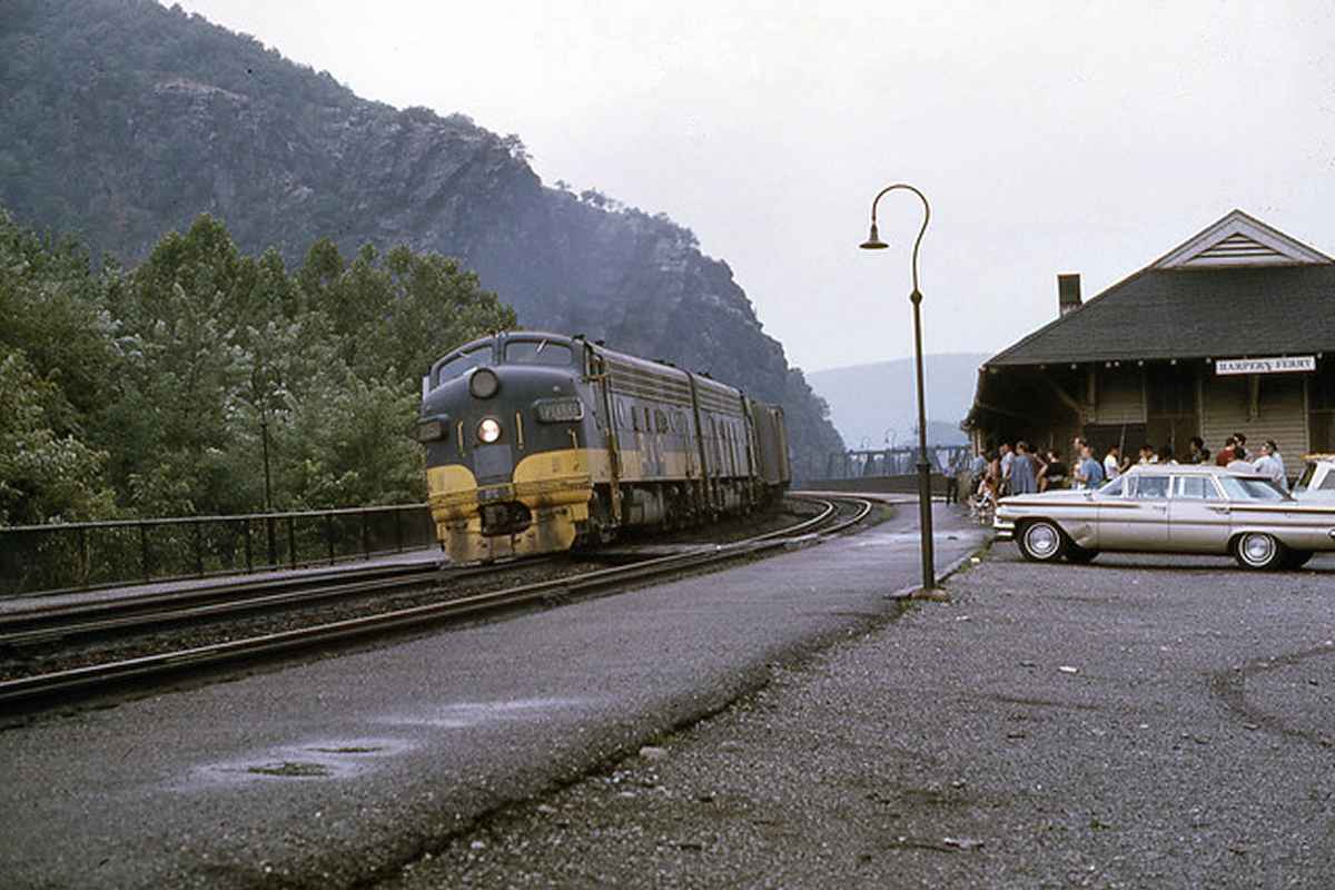
TrainWeb.org Facebook Page
B&O Cumberland Branch Photo Tour


B&O Cumberland Branch
Modern day photo tour

Accompanying each photo below are:

Click a photo to see a larger view. Please send your comments and corrections to Steve.


<< Previous (east) | THIS PAGE: Sandy Hook to Harpers Ferry | End of tour || main index

Squeeze
Photo courtesy Dave Hiteshew

Squeeze
Mile: 79.6 Date: Oct 2007
Ease: C+ View: W
Area: A IC2:
Map: Wa 37 B 11 Topographic Maps

The hills and river squeeze the two competitors into tight quarters. From left to right: the Potomac River, the C&O Canal tow path, the algae covered Canal, the railroad, the hills.

The Appalachian Trail follows the canal towpath for about a mile here.


Generations
Photo courtesy Dave Hiteshew

Generations
Mile: 79.6 Date: Oct 2007
Ease: B View: NE
Area: A IC2: 245
Map: Wa 37 B 11 Topographic Maps

Looking back... as if exposed by an archeological dig, layers of various stone and concrete reveal the railroad has been busy here for a long time. Yhe first route was forged through amidst an 1833 cholera outbreak.


Stand
Photo courtesy Dave Hiteshew

Stand
Mile: 80.0 Date: Oct 2007
Ease: C+ View: W
Area: A IC2:
Map: Wa 37 A 10 Topographic Maps

The signals are gone, but their concrete bases live on. Dozens of these disused stands now act as CPL graveyard markers along the routes toured by this site. Railroad personnel often assign names, some official, some not, to the signals to make them easier to identify; Zach Kaiser reports this one had been named Millers Bend.

Just beyond the bend ahead is Sandy Hook.


CSX 5221
Photo courtesy Dave Hiteshew

CSX 5221
Mile: 80.1 Date: Oct 2007
Ease: A View: E
Area: A IC2:
Map: Wa 36 K 10 Topographic Maps

Views from the Potomac-spanning US 340 bridge built in 1947 can be spectacular, even when looking down.

US 340 offers two river crossings for automobiles in this vicinity. They connect Maryland, Virginia and West Virginia.


Sandy Hook
Photo courtesy Dave Hiteshew

Sandy Hook
Mile: 80.2 Date: Oct 2007
Ease: A View: E
Area: A IC2:
Map: Wa 36 K 10 Topographic Maps

US 340, coal, and kayakers... Sandy Hook has them all. This is a popular spot for kayakers to enter the Potomac River because it is downstream of dangerous river rocks near Harpers Ferry.

Link: 2010 snow


Stilts
Photo courtesy Dave Hiteshew

Stilts
Mile: 80.5 Date: Oct 2007
Ease: A- View: W
Area: A IC2:
Map: Wa 36 J 10 Topographic Maps

This control box is ready for the next Potomac flood... probably.


Tango
Photo courtesy Dave Hiteshew

Tango
Mile: 80.8 Date: Oct 2007
Ease: A- View: W
Area: A IC2:
Map: Wa 36 J 11 Topographic Maps

Sandy Hook Road and the railroad curve, swing and dance their way to Harpers Ferry.


See Through
Photo courtesy Dave Hiteshew

See Through
Mile: 81.0 Date: Oct 2007
Ease: B+ View: W
Area: A IC2:
Map: Wa 36 H 11 Topographic Maps

You don't need to be Superman to be able to see through 925 feet of rock. Instead, just build a tunnel.

Link: 1988


Ex-ROW
Photo courtesy Dave Hiteshew

Ex-ROW
Mile: 81.1 Date: Oct 2007
Ease: A View: W
Area: A IC2:
Map: Wa 36 H 11 Topographic Maps

Sandy Hook Road now occupies the B&O right of way that became available upon opening of the tunnel.

Link: 2018 after notching


Incognito
Photo courtesy Dave Hiteshew

Incognito
Mile: 81.1 Date: Oct 2007
Ease: A View: W
Area: A IC2: 194
Map: Wa 36 H 11 Topographic Maps

The Harpers Ferry Tunnel goes incognito. This portal is the oldest between Baltimore and Harpers Ferry, the only one dating to the 19th century, before tunnel naming in brick had become the rage. All the other portals are either newer, or were redesigned more recently. This tunnel's opposite portal employed the same nameless design until replaced during a 1931 bellmouthing project.

This is the only double-tracked railroad tunnel between Baltimore and Harpers Ferry, but clearances are tight, so as part of the National Gateway project this tunnel is scheduled to be enlarged.

Link: National Gateway (PDF)


Split
Photo courtesy Dave Hiteshew

Split
Mile: 81.2 Date: Oct 2007
Ease: B View: W
Area: B IC2:
Map: Wa 36 G 11 Topographic Maps

Near the tunnel's bellmouth dual trackage morphs into triple, and upon reaching daylight one track curves to the left... in the shadow below the 10 mph speed sign is the marker for milepost 0 of CSX's Shenandoah Subdivision. Meanwhile, the Cumberland Subdivision continues on the right.

The church steeple in the distance gives notice that we'll soon be leaving Maryland to visit the scenic town of Harpers Ferry, West Virginia where the Shenandoah and Potomac Rivers join forces.


West Portal
Photo courtesy Dave Hiteshew

West Portal
Mile: 81.3 Date: Oct 2007
Ease: B+ View: E
Area: A IC2: 194, 400
Map: Wa 36 G 11 Topographic Maps

A serpent's tongue of trackage emanates from the bellmouth west portal of the Harpers Ferry Tunnel; CSX 461 is about to feed the hungry maw. The photographer's vantage point is surprisingly easy to reach: it's the C&O Canal towpath.

At Harpers Ferry, B&O would finally rid itself of its canal nemesis, but the task proved anything but easy.

Links: 1997


Canal
Photo courtesy Dave Hiteshew

Canal
Mile: 81.3 Date: Oct 2007
Ease: B+ View: SE
Area: A IC2:
Map: Wa 36 G 11 Topographic Maps

The C&O Canal towpath is now a popular hiking and biking route. B&O would escape the canal by here spanning both it and the Potomac River.

The distant unused stone bridge support is a relic of B&O's first attempt to solve the Potomac River crossing. The century-long saga includes three different sets of piers and no fewer than 10 bridges of various styles and designs.


Three Crossings
Photo courtesy Dave Hiteshew

Three Crossings
Mile: 81.3 Date: Oct 2007
Ease: B View: W
Area: A IC2: 44, 73, 193, 253
Map: Wa 36 G 11 Topographic Maps

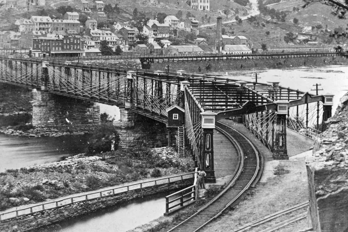
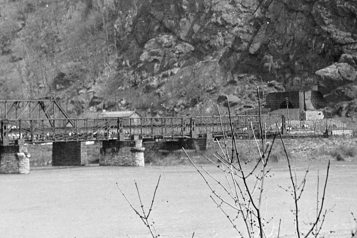
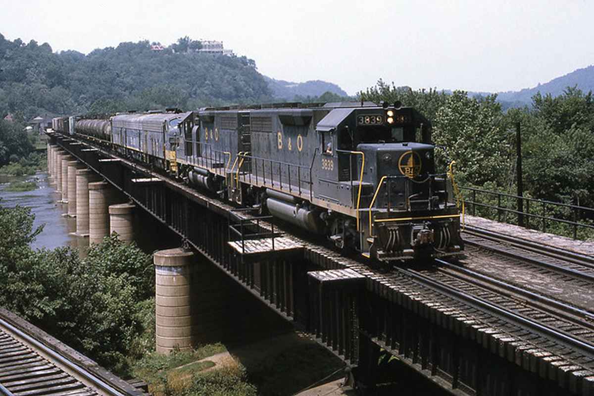
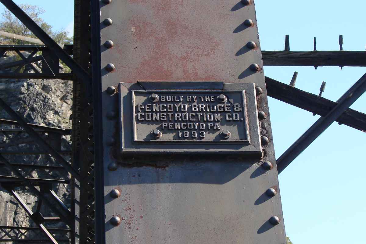
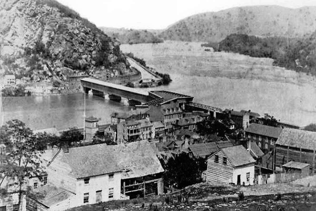
In 1836, the B&O constructed the now-disused piers on the left parallel to and just downstream of Wager Bridge, a then-new road bridge that replaced a ferry (yes, Harper's Ferry). The intial design quickly proved too weak for locomotives that were growing heavier, so in 1839 the piers were upgraded to not only carry the railroad but also wagons/passengers, obviating Wager's Bridge that was then removed.

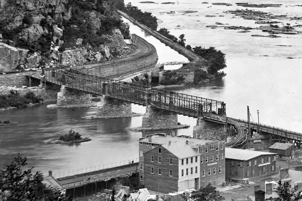
B&O aligned its initial bridge, portions of which were covered, to provide easy connection with the Winchester & Potomac Railroad (W&P) that had arrived in town in 1836. W&P did not wish to share Harpers Ferry, nor did Virginia want to share its agricultural shipments with the port of Baltimore, and thus B&O's overtures of a business relationship were shunned. Consequently, instead of a straight track connection from the bridge to W&P's route parallel to the Shenandoah River (seen in the distant left), the B&O had to settle for track that curved sharply north (right) to follow the Potomac.

Link: Covered Bridges


Bollman Spans
Photo courtesy Library of Congress

Bollman Spans
Mile: 81.3 Date: ~1870
Ease: B View: W
Area: A IC2: 109, 116
Map: Wa 36 G 11 Topographic Maps

Not only were the curves at each shore an operational headache, but the railroad and wagon road crossed each other, and did so at a point over the river! Despite these problems, the bridge was rebuilt in such configuration no fewer than 9 times during the 1860s after repeated destruction by Civil War action and floods. That period at least afforded the opportunity to switch from wood to iron. Eventually all of the segments employed the B&O's signature spiderwebby Bollman design seen here.

Links: 1862 ruins, 1862 ruins, 1865 repaired, 1865, 1860s, 1865, specs


Pencoyd
Photo courtesy Dave Hiteshew

Pencoyd
Mile: 81.3 Date: Oct 2007
Ease: A- View: E
Area: A IC2:
Map: Wa 36 G 11 Topographic Maps

It took until 1893 for B&O to escape the unhappy railroad / wagon road marriage. B&O bored Harpers Ferry tunnel through South Mountain and realigned its track upon a new set of bridge piers, the middle group in the Three Crossings photo above. As this plaque explains, these spans were erected by the Pencoyd Bridge and Construction Company. The 1893 date makes these segments the oldest steel bridges still in railroad use in the Baltimore/Washington/Harpers Ferry triangle.

When the new bridge was opened, the prior crossing was converted to wagon then automobile use.

Links: 1997, a few Pencoyd bridges, Baltimore Sun photos


CSX 8066
Photo courtesy Dave Hiteshew

CSX 8066
Mile: 81.4 Date: Oct 2007
Ease: A- View: E
Area: A IC2: 254, 285
Map: (Wa 36 G 11) Topographic Maps

But the curves of even the 1893 alignment proved too limiting, and in what would be one of the B&O's last major track realignment projects it spanned the Potomac yet again. As seen from the West Virginia side, CSX 8066 confirms the bridge from that 1931 project still works.

Links: 1865, 1979, 1982, 1983


Vintage Sign
Photo courtesy Dave Hiteshew

Vintage Sign
Mile: 81.4 Date: Oct 2007
Ease: A- View: E
Area: A IC2: 194
Map: (Wa 36 G 11) Topographic Maps

B&O kept the 1893 crossing as a connection to the Shenendoah Valley Branch it had leased and eventually purchased from W&P. That line continues in use today as CSX's Shenendoah Subdivision, seen here as the tracks curving off the right edge of the photo. Prior to the 1931 bridge, the tracks curving to the left provided the connection northwest to Cumberland, MD.

When a 1936 flood destroyed the road bridge over the century-old alignment, this bridge was pressed into shared service as a temporary, single-lane automobile bridge. World War II delayed construction of a dedicated automobile replacement until in 1947 US 340 spanned the Potomac over Sandy Hook, as seen earlier.

More recently, a crossing for passengers was added to the bridge, even though strictly prohibited by this vintage B&O sign. It seems unlikely any B&O RR police will be around to enforce the rule.

Links: ~1900?, 1914, 1984


Harpers Ferry Station
Photo courtesy Dave Hiteshew

Harpers Ferry Station
Mile: 81.5 Date: Oct 2007
Ease: A- View: SE
Area: A IC2: 194, 399
Map: (Wa 36 F 11) Topographic Maps

Renovations in 2005 to the Harpers Ferry Station restored the interlocking tower at its east end. The station dates to 1889, built as part of the 1893 bridge project, and was moved slightly west to better accommodate the 1931 bridge. It soldiers on as a MARC passenger station.

Links: 2002 pic page, 2004


Interior
Photo courtesy Dave Hiteshew

Interior
Mile: 81.5 Date: Oct 2007
Ease: A View:
Area: A IC2:
Map: (Wa 36 F 11) Topographic Maps

The station's interior has been attractively restored to include an original-period-style passenger waiting room.


Amtrak Shack
Photo courtesy Dave Hiteshew

Amtrak Shack
Mile: 81.5 Date: Oct 2007
Ease: A View: N
Area: A IC2:
Map: (Wa 36 F 11) Topographic Maps

This passenger shack sits in disrepair across from the station, atop a passenger tunnel that extends under the tracks. Almost as if to hide from the relationship, Amtrak is letting its 1970s-era sign fade into oblivion.

Link: 1997


Tour Limit
Photo courtesy Dave Hiteshew

Tour Limit
Mile: 81.5 Date: Oct 2007
Ease: A- View: NW
Area: A IC2:
Map: (Wa 36 F 11) Topographic Maps

This marks the western limit of these B&O RR Photo Tours. It took me over 10 years to collect and comment on the Maryland routes the B&O constructed in about half that time, largely by hand in the 1830s. I remain indebted to the father-son Hiteshew team who supplied hundreds of photos, including most of those seen here west of Frederick Junction. I would not have been able to complete this project without their gracious contributions. Thanks also to all who sent comments and corrections to keep me on track. I hope you enjoyed these tours.

Get out there so the Train of Life can come around the bend to take you on more fun and interesting journeys.

Links: 1950s, 1969


<< Previous (east) | THIS PAGE: Sandy Hook to Harpers Ferry | End of tour || main index

Thanks for riding along!

Return to main page for other tours.


Copyright Notice