TrainWeb.org Facebook Page
Bowie Race Track Branch


PRR / Amtrak in Maryland
Modern day photo tour

Accompanying each photo below are:

Click a photo to see a larger view. Please send your comments and corrections to Steve.


<< Previous (west) | THIS PAGE: Bowie Race Track Branch Part 2 | Next (main line, south) >>

About the spur, before the trail was built, reader Jim Younger had written:

Track Drawing
Image courtesy The Baltimore Sun
NEW! mid-Jan 2026

Track Drawing
Mile: Date: ~1940
Ease: View: N (up)
Area: T6:
Map: PG 10 Topographic Maps

This tour won't let the branch slip into obscurity. It resumes at the triangular wye near "Projected", a spot the railroads called Boyle. We're proceeding generally to the right.

The wye was built by WB&A. When PRR assumed race track service after WB&A shuttered in 1935, it kept and reused all WB&A wye track here so it could station helper engines, turn other engines and hold trainsets that did not fit within the race track's yard.

"Projected" refers to the unrealized repurposing of WB&A's disused original route into the Baltimore-Washington Parkway.


WB&A Wye
Photos credit James P. Shuman

WB&A Wye
Mile: 1.7 Date: 1935
Ease: B- View: NE
Area: A T6:
Map: PG 10 C 7 Topographic Maps

In an attempt to stay solvent during the Great Depression, WB&A provided freight service in the form of hauling gravel and sand. zoom This train is coming off the part of the branch toured by the prior page and veering onto the WB&A main line. Today, a trail parking lot accessed from Race Track Road is adjacent to the right edge of this photo, but the old right-of-way is a tangle of thorny brush.

Into the distance (zoom view, right), WB&A's main line dips towards its Patuxent River crossing then rises on the Anne Arundel County side of that river. The dark line leading to the right is WB&A's track to Bowie Race Track. The photo does not reveal if that section was electrified.

Change for: WB&A tour at this site


Boyle

Boyle
Mile: 1.7 Date: Nov 2017
Ease: A View: NE
Area: A T6:
Map: PG 10 C 7 Topographic Maps

A similar modern view finds none of WB&A's wye survives in the grassy area at center, but overhead wires criss-cross above the site.

Bowie Race Track opened in 1914 at first under the name Prince George's Park then later Bowie Race Course. WB&A soon extended a spur to it from this location known to the railroad as Boyle. The race track is to the right in this photo.

After the B&O/B&A partnership for two weeks of service to Bowie ended, PRR temporarily operated steam specials to the race track by connecting to the WB&A at Naval Academy Junction (Odenton). In time for the 1937-38 racing season, PRR built the shortcut seen earlier in this tour.

Link: Pennsy sends special train to rescue those snowbound at Bowie Race Track 1958


Naval Academy Junction
Photo credit James P. Shuman

Naval Academy Junction
Mile: Date: May 1935
Ease: A View: N
Area: A- T6:
Map: AA 12 J 3 Topographic Maps

This one-photo detour from 1936 shows where PRR trains bound for Bowie Race Track would have approached the camera while turning south onto ex-WB&A track near Rieve's Store in Odenton. As of this writing, the site of Rieve's Store is occupied by a Walgreens along MD 170 south of its intersection with 175.

Bowie Race Train sign courtesy collection of Frank A. Wrabel Potential passengers could identify PRR's special race trains by placards like the one at right (image courtesy collection of Frank A. Wrabel).

Link: 1936 abandonment


Trail Sign
NEW! mid-Jan 2026

Trail Sign
Mile: 1.7 Date: Oct 2025
Ease: A View: SW
Area: A T6:
Map: PG 10 C 7 Topographic Maps

Back at Boyle, signs like this on pavement point the way to the WB&A Trail and its bridge across the Patuxent River that opened during 2025.


Ex-RoW
NEW! mid-Jan 2026

Ex-RoW
Mile: 1.7 Date: Nov 2017
Ease: A- View: SE
Area: A T6:
Map: PG 10 C 7 Topographic Maps

Heading opposite to the modern WB&A Trail is this disused route trains followed toward the race track. Horsepen Branch flows at the low spot ahead.


Horsepen Branch

Horsepen Branch
Mile: 1.8 Date: Nov 2017
Ease: B- View: S
Area: A T6:
Map: PG 10 C 7 Topographic Maps

Crumbling concrete suggests a former structure of some sort at the creek. Perhaps it was part of a system to collect water for the horses, of both the animal and iron varieties. USGS topo maps from the period place a "Water" label here, as they do at other locations where water was available for steam engines.


Trestle

Trestle
Mile: 1.8 Date: Nov 2017
Ease: B View: SE
Area: A T6:
Map: PG 10 C 7 Topographic Maps

This 1945 PRR-built trestle over Horsepen Branch replaced an earlier one of WB&A origin. It survives with rusty rails still on top.


Trestle Height
NEW! mid-Jan 2026

Trestle Height
Mile: 1.8 Date: Nov 2017
Ease: B- View: E
Area: A T6:
Map: PG 10 C 7 Topographic Maps

The top of the trestle is about 12 feet above the stream. This was the only bridge PRR needed between the main and the race track.


Rails

Rails
Mile: 1.8 Date: Nov 2017
Ease: B View: SE
Area: A T6:
Map: PG 10 C 7 Topographic Maps

Trains mag Aug 1946 Rails still extended across the top of the trestle at photo time. They may be the very same segments as seen in this August 1946 Trains magazine photo (left) that looks in much the same direction toward the race track. PRR kept a helper/pusher waiting back at the Boyle wye in case trains could not climb this final hill up to the race track.


Track 1967
Photo credit P Morrisset

Track 1967
Mile: 1.9 Date: Mar 1967
Ease: B View: W
Area: A- T6:
Map: PG 10 D 7 Topographic Maps

Motive power during the 1960s was often E unit diesels, such as PRR 4273, an EMD E8A. At photo time, it had been recently renumbered from 5703 in preparation for the merger with New York Central that formed Penn Central.

Arriving 4273 has just passed the branch's "Track" control point that was located at the race track's northwest boundary. It is about to pull into in the yard behind the race track.


Track 2019

Track 2019
Mile: 1.9 Date: Mar 2019
Ease: B View: W
Area: A- T6:
Map: PG 10 D 7 Topographic Maps

If not for the rails still embedded in pavement, one would not know this is the site of the previous photo. No remnants of the Track shack remain, not even a foundation, perhaps erased by a sewer line that was built here after the trains stopped running. Rusty rails litter the treed area ahead.


1950s Aerial
Photo courtesy City of Bowie

1950s Aerial
Mile: 1.7 Date: ~1955?
Ease: View: SE
Area: T6:
Map: PG 10 C 7 Topographic Maps

That hill leading up the to the train yard is at bottom left in this aerial view during an active racing day.

At the left edge of the photo, old maps place Bealmears Bridge across the (Big) Patuxent River. I hope to look for its remains some day.

Link: source photo


Flagged
Photo credit P Morrisset

Flagged
Mile: 1.9 Date: Mar 1967
Ease: B View: E
Area: A- T6:
Map: PG 10 D 7 Topographic Maps

The track's western entry road lacked crossing signals, hence a flagman oversees the process of the train rolling into the yard behind (north of) the race track. Anxious racegoers will soon disembark from this train and head to the track which is off photo right.

Link: 1962


Place Your Bets
Photo courtesy Frank A. Wrabel collection

Place Your Bets
Mile: 2.2 Date: 1946
Ease: B+ View: NW
Area: A- T6:
Map: PG 10 D 7 Topographic Maps

Racing that had been suspended during World War II resumed in 1946 with help from some PRR K-4 Pacific 4-6-2 steamers.

During the 1930s, PRR used GG1 engines as far as the wye at the main. Since the branch was not electrified, at least not after WB&A shuttered, a steam engine like the one in this photo would bring the cars from there to the race track. The GG1s would then wait on the main, thus blocking it. When racing resumed after WWII, PRR shifted to using steam engines all the way from Baltimore to the race track. Doing so avoided idle GG1s blocking the main.


Schedule 1957
Image courtesy Frank A. Wrabel collection
NEW! mid-Jan 2026

Schedule 1957
Mile: Date: 1957
Ease: View:
Area: T6:
Map: Topographic Maps

In 1957, the trip via PRR from Philadelphia to Bowie took 2.5 hours. Rides from New York City needed about 4 hours, with just 4 minutes allotted for a transfer at Baltimore. The horses began running around 30 minutes after the trains arrived.

Trains did not depart Bowie at a preset time but rather waited for certain races to conclude.


Departure Sign
Photo courtesy Trains magazine
NEW! mid-Jan 2026

Departure Sign
Mile: 1.9 Date: 1946
Ease: B View: W
Area: A T6:
Map: PG 10 C 7 Topographic Maps

This sign at the Track control point tells the operator of the train waiting on track 8 that he has the go ahead to depart next.

Link: Trains magazine


Track Yard

Track Yard
Mile: 2.1 Date: Nov 2017
Ease: B+ View: W
Area: A- T6:
Map: PG 10 D 7 Topographic Maps

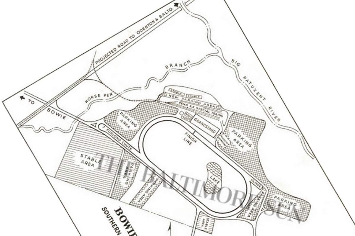
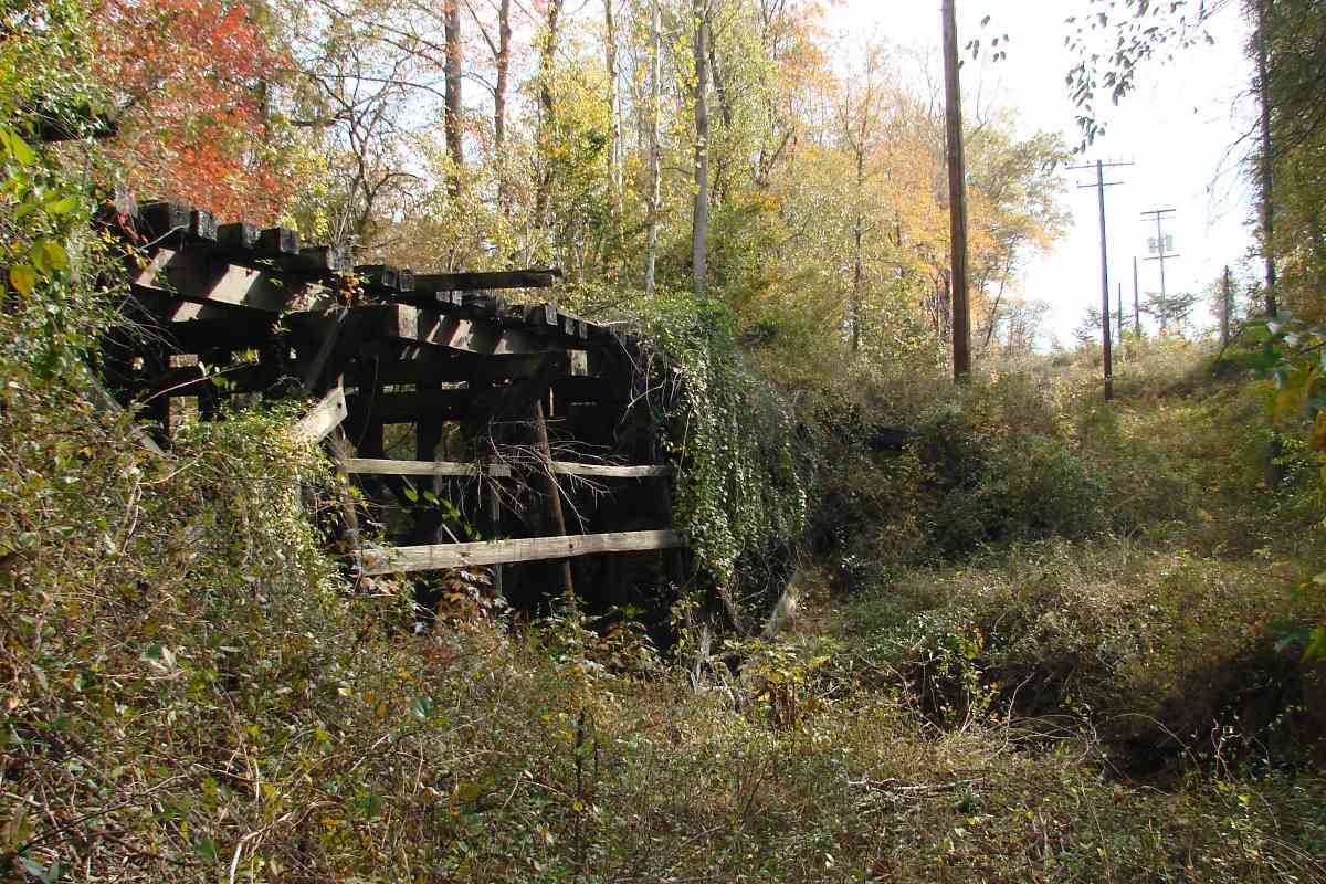
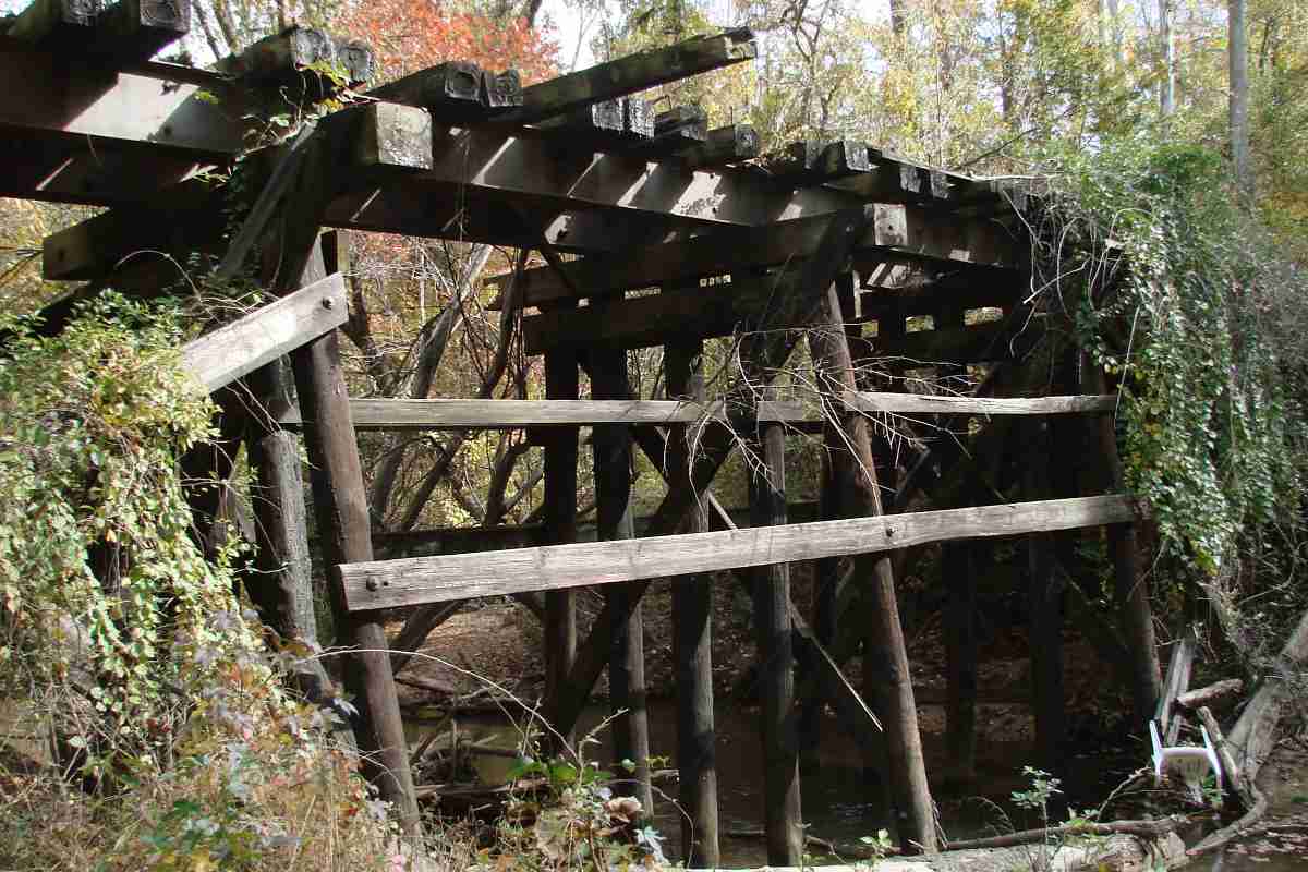
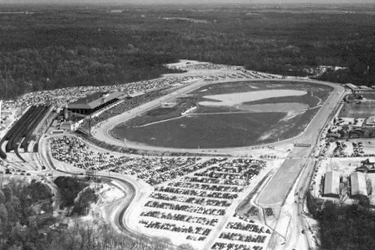
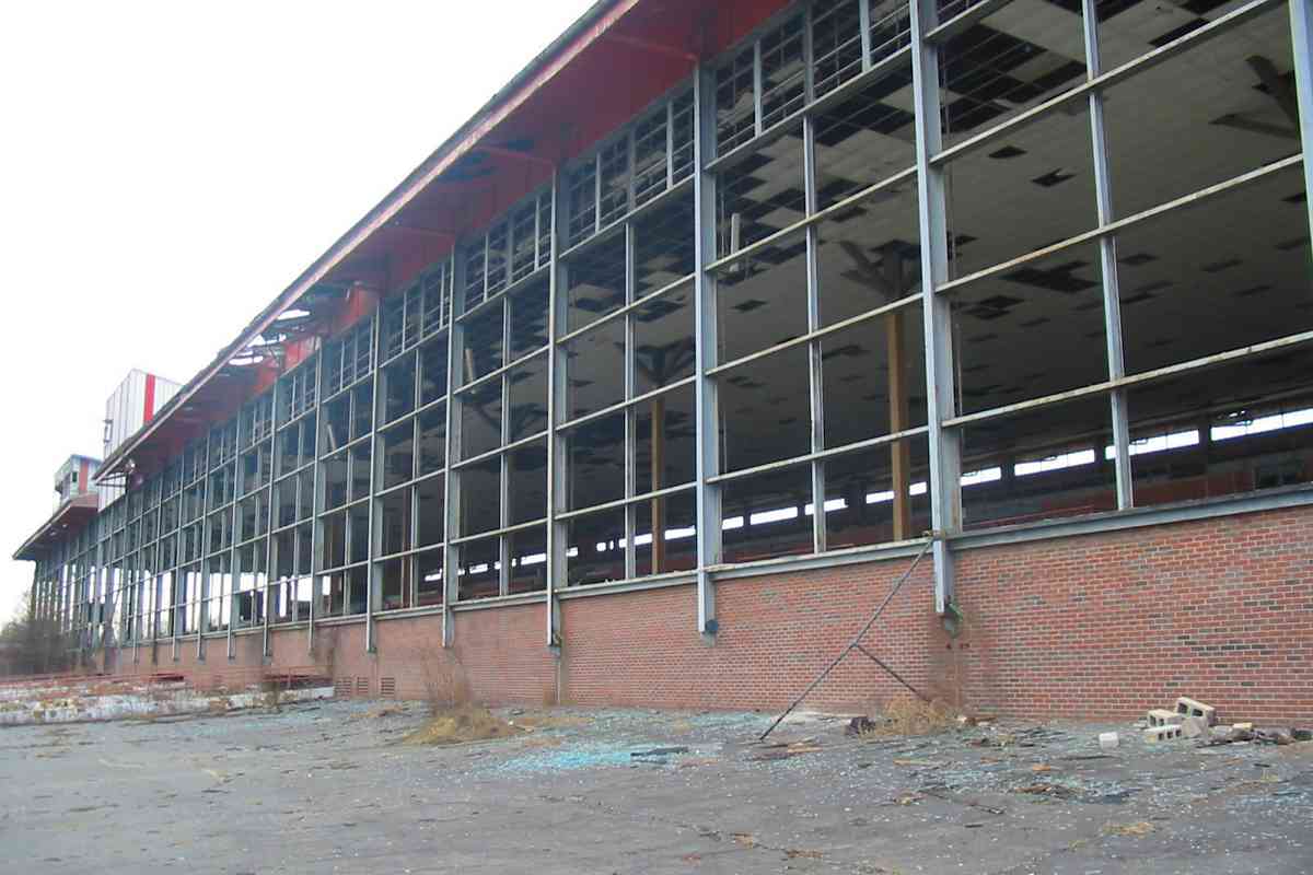
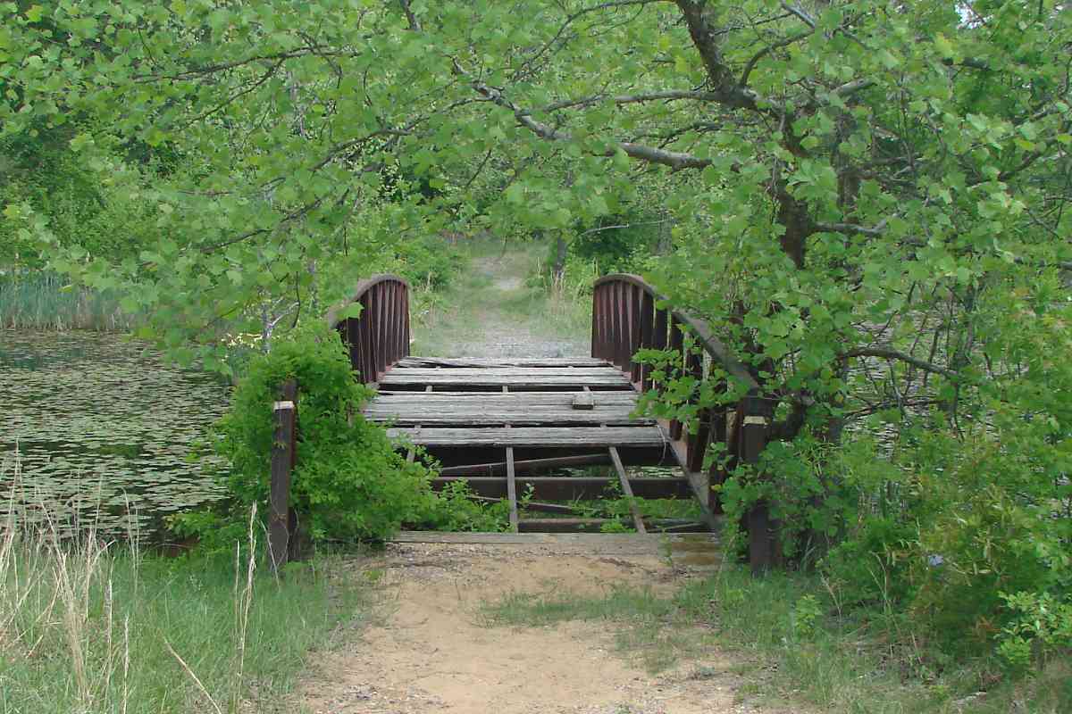
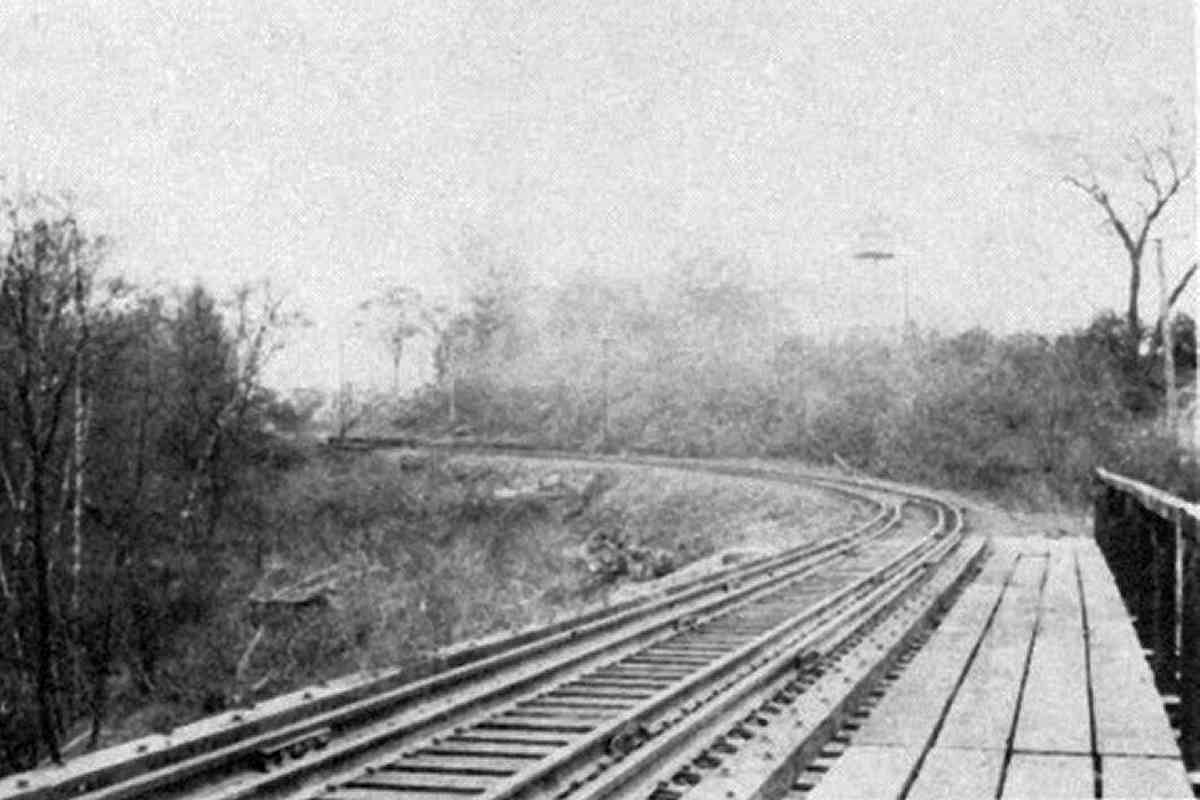
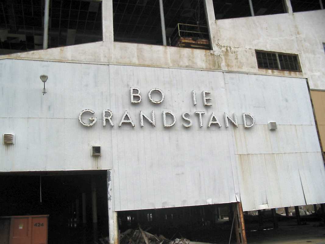
The tracks behind the track survive, but perhaps for not much longer since both redevelopment and revival are being studied for the site. Bowie Race Track has been closed since 1985; its horse training center ceased operation during 2015.

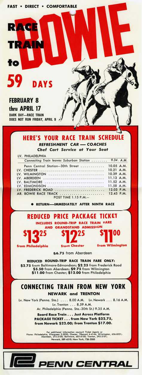
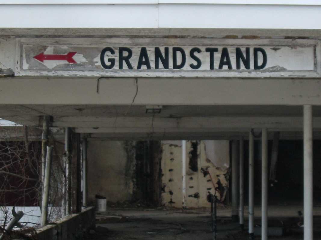
The Stronach Group, the dominant player in Maryland horseracing, announced plans in 2018 to shift activity away from Pimilco in Baltimore, to both Laurel and Bowie. That plan was scrapped after Pimlico received upgrades.

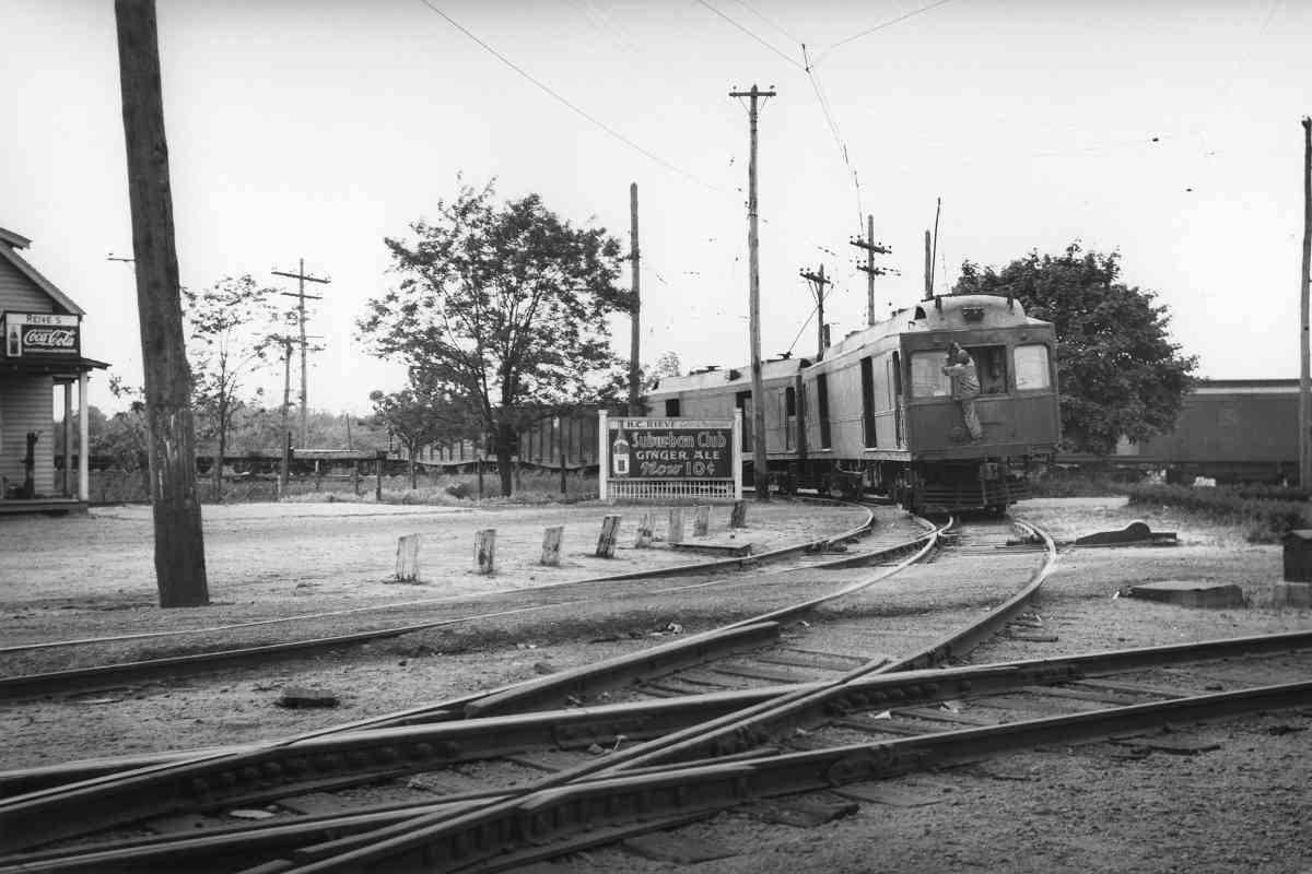
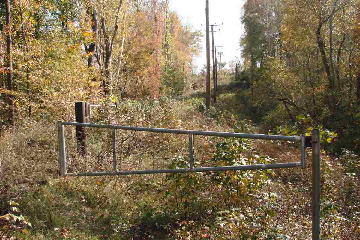
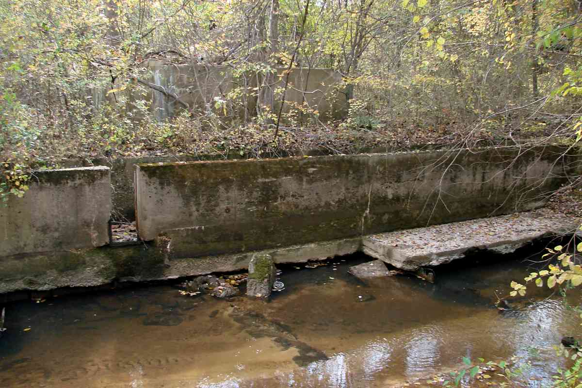
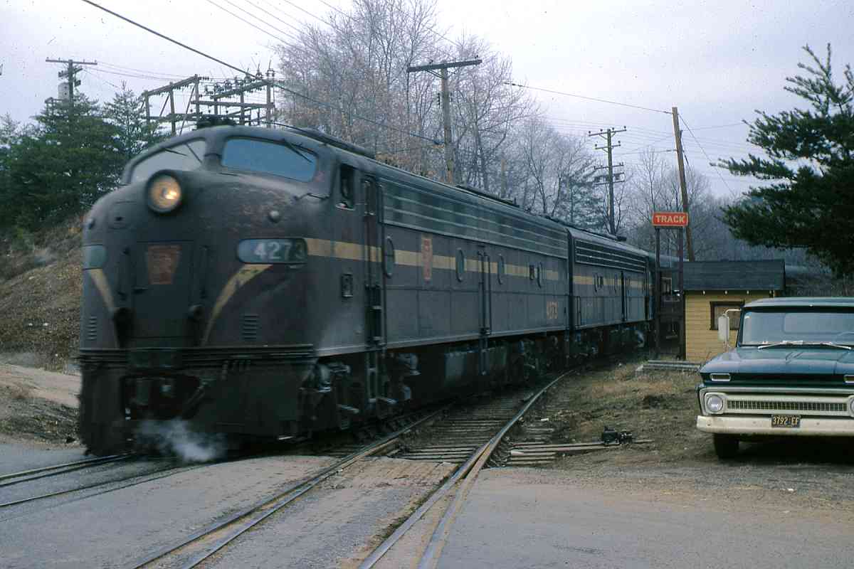
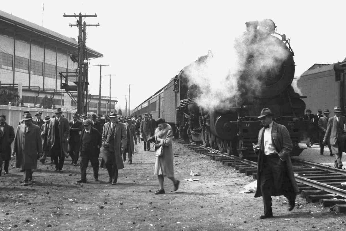
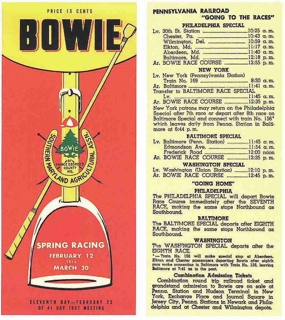
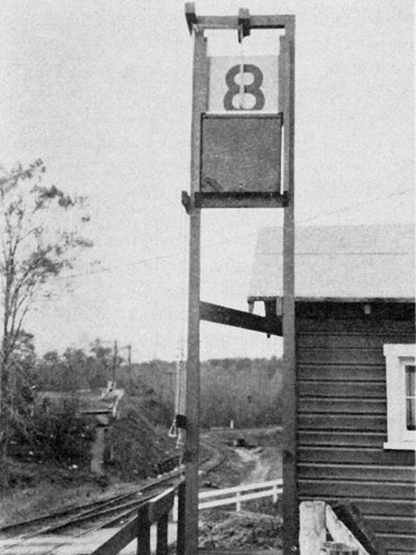
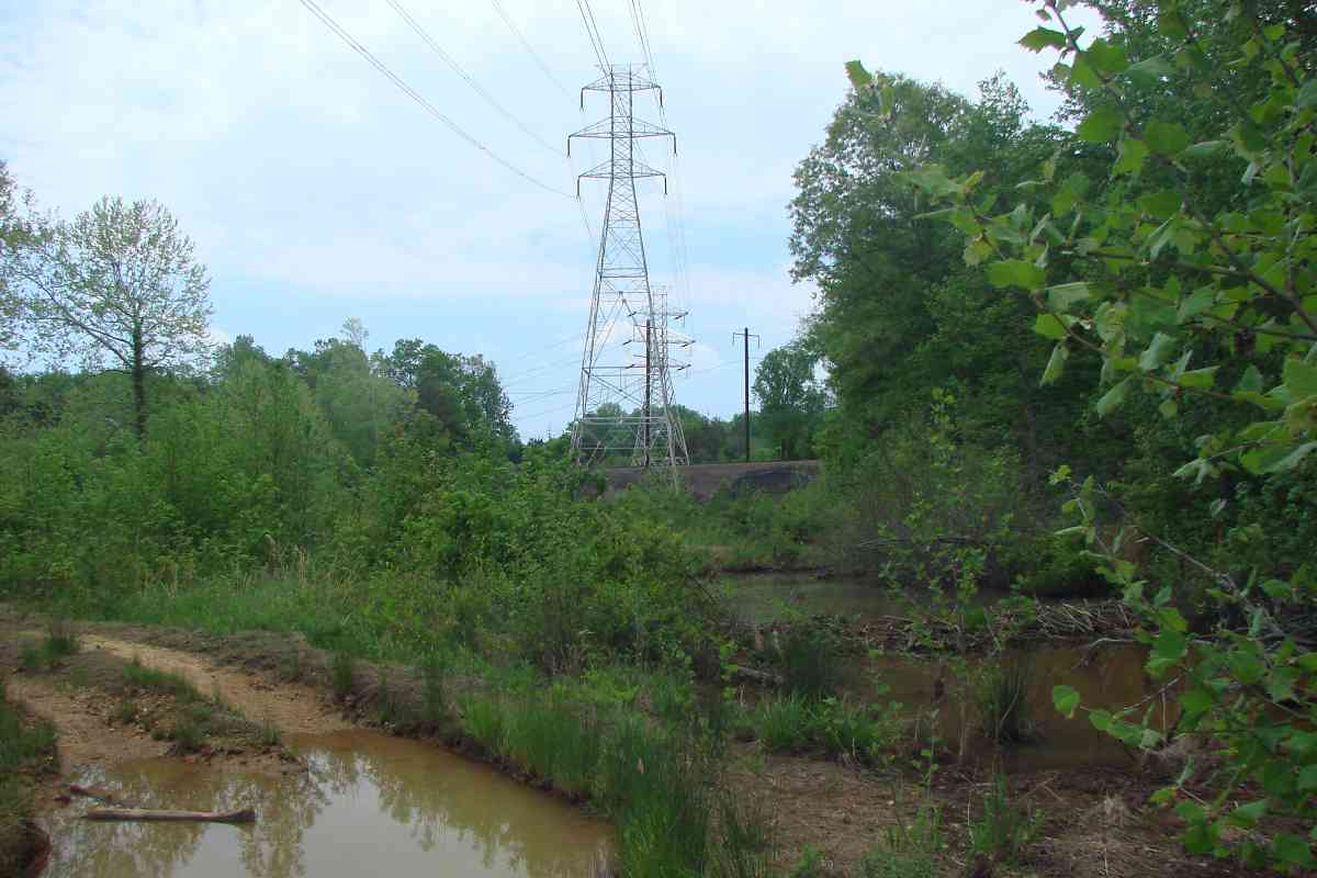
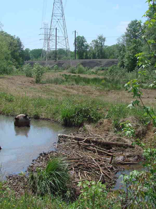
The train yard was/is to the north of the race oval. There were/are eight storage tracks, each 600 to 1010 feet in length, where past racegoers disembarked then later, richer or poorer, climbed back aboard. Ten trains would arrive per race day during peak popularity. The trains departed after certain races of that day, such as the seventh or eighth, had been completed.

Link: similar view 1992, source page


Grandstand
Photos courtesy Marty Hager
Updated mid-Jan 2026

Grandstand
Mile: 2.2 Date: Nov 2003
Ease: B+ View: N
Area: A- T6:
Map: PG 10 D 7 Topographic Maps

by Marty Hager by Marty Hager by Marty Hager
Marty captured these scenes a few months before the grandstand was demolished and carted away.

Those inclined to gamble have many more options now than when the Race Track Specials operated.


Race Track

Race Track
Mile: 2.2 Date: Nov 2017
Ease: B+ View: SW
Area: A- T6:
Map: PG 10 D 7 Topographic Maps

This was the view to the southwest from the grandstand. The location was intentional: by keeping racegoers in the warm sun, Bowie could host races during the winter, the only track in/near the northeast US to do so.


Schedule 1971
Image courtesy Frank A. Wrabel collection
NEW! mid-Jan 2026

Schedule 1971
Mile: Date: 1971
Ease: View:
Area: T6:
Map: Topographic Maps

Under the Penn Central banner, the final scheduled train departed from Bowie on April 17, 1971. After Amtrak began control of much passenger rail service on May 1, 1971, it did not continue Race Trains. Amtrak local trains such as The Chesapeake continued to stop at the town of Bowie, about 2 miles south, into the 1980s.


THE MAKING OF THIS TOUR

In addition to the photos graciously contributed, I gathered some of my own, including these:


Bridge Out

Bridge Out
Mile: Date: May 2018
Ease: B View: E
Area: A T6:
Map: PG 10 B 4 Topographic Maps

Reaching the wye at the main line looked simple: there are paved paths behind Bowie State University. However, those sinfage-free paths turn to dirt and split.

After taking several wrong turns that led to swamps, we found a bridge. Its decking has seen better days, but the metal structure looked like it could support us, so onward we went.


Swampy

Swampy
Mile: Date: May 2018
Ease: B View: SW
Area: A T6:
Map: PG 10 B 3 Topographic Maps

That also led to puddles and streams. Even the service "road" was underwater during 2018's damp-but-very-green spring. We wanted to reach somewhere on the right.


Beaver Dam

Beaver Dam
Mile: Date: May 2018
Ease: B View: W
Area: A T6:
Map: PG 10 B 3 Topographic Maps

The beavers are making this area so swampy the forest service has resorted to mining their ponds.

No, that object on the left appears to be the case of a discarded electrical transformer.

Will a beaver dam support the weight of a person who wishes to cross? We learned the answer is yes - provided one does not slip off it.

Link: mine that washed up on Gilligan's Island


Ballast Mountain

Ballast Mountain
Mile: Date: May 2018
Ease: B- View: N
Area: A T6:
Map: PG 10 B 3 Topographic Maps

The railroad dealt with the swamp by mounding the earth, then adding layer upon layer of stone ballast, creating what looks to be a large hill made entirely of ballast. The hill is over 20 feet high, and the stone is loose.

Ultimately, reaching the wye required an entirely different route.


<< Previous (west) | THIS PAGE: Bowie Race Track Branch Part 2 | Next (main line, south) >>

Or, return to main page

Copyright Notice