TrainWeb.org Facebook Page
B&P Tunnel Photo Tour


PRR / Amtrak in Maryland
Modern day photo tour

Accompanying each photo below are:

Click a photo to see a larger view. Please send your comments and corrections to Steve.


<< Previous (northeast) | THIS PAGE: B&P Tunnel | Next (southwest) >>

Brief Historical Background:

Map
Map credit Federal Railroad Administration

Map
Mile: Date: May 2014
Ease: View: N (up)
Area: T6:
Map: Topographic Maps

Studies of the B&P Tunnel replacement options have produced many maps, such as this, that highlight the course of the existing tunnel's three segments through Baltimore City, north of downtown. Much more is online about B&P Tunnel than Union Tunnel (east of Penn Station).

This tour page begins immediately west of Pennsylvania Station (right center of map) and proceeds generally westward (left) to and through three B&P Tunnel segments.

Link: B&P Tunnel map in compressed PDF


Portal

Portal
Mile: 96.0 Date: Sep 2016
Ease: A- View: NW
Area: C T6:
Map: Ba 35 A 9 Topographic Maps

At North Avenue, southbound trains duck into the B&P Tunnel segment known as the John Street Tunnel (left). The tunnel opened for operation less than a month before Union Tunnel did. That tunnel combination gave PRR a continuous route between the Northeast US and Washington, DC, thus breaking B&O's monopoly on such service.


Compare
NEW! mid-Jan 2024

Compare
Mile: 96.0 Date: Jun 2018
Ease: A- View: N
Area: C+ T6: 230
Map: Ba 35 A 9 Topographic Maps

Views from ground level let you compare and contrast the portal with North Avenue's larger arch over the ex-Northern Central right of way (right). By virtue of its greater height and width, the latter is planned as the route to the Frederick Douglass Tunnel, the name assigned the B&P Tunnel's replacement.

Change for: Nothern Central Railway tour at this site


Under CSX
NEW! mid-Jan 2024

Under CSX
Mile: 96.0 Date: Sep 2016
Ease: C View: N
Area: C+ T6:
Map: Ba 35 A 9 Topographic Maps

After passing under the ex-B&O Baltimore Belt Line, future Amtrak trains will enter the new tunnel ahead via portals between the tunnel ventilation fan on the left and building on the right.

Change for: B&O Baltimore Belt Line tour at this site


Artist Concept
Image courtesy Amtrak
NEW! mid-Jan 2024

Artist Concept
Mile: 96.0 Date: ~2020
Ease: View: N
Area: T6:
Map: Ba 35 A 9 Topographic Maps

Two new single-track tunnel portals (center) are planned east of Baltimore light rail's North Avenue stop. The original plan called for four tubes, but the inexplicable decision that mandated century-old Penn Station be on the new route doomed the project before construction even began.

The Penn Station requirement meant the only practical tunnel options were under neighborhoods. Communities along the proposed route were understandably concerned about train noise and smoke. That forced a compromise that 1) reduced the tube count from four to two, 2) decreased tunnel height so that double-stack freight trains won't fit, and 3) blocked diesel locomotives from regularly operating in the tunnel.

Consequently, the new tunnel offers even less functionality than the old B&P Tunnel. MARC will need to buy electric locomotives and add service facilities for them. So, billions of dollars get us a tunnel with fewer leaks. Trains might be able to run slightly faster through the new tunnel, but since they all stop at Penn Station, they'll not be at full speed anyhow. If I were the leader, I'd have sent the plan back to the drawing board. Below, I outline an alternative route that not only yields benefits but also probably costs less.

The loop at bottom right is Baltimore Streetcar Museum trackage.

Change for: Baltimore light rail tour at this site


North Portal

North Portal
Mile: 96.0 Date: Sep 2016
Ease: A- View: W
Area: C- T6:
Map: Ba 35 A 9 Topographic Maps

Back at the B&P Tunnel... many drive on North Avenue's bridge across the Jones Falls and never know its sidewalk offers the easiest clear view of the portal.

Despite its B&P name, the tunnel's construction was funded by PRR and Northern Central.


John Street Segment

John Street Segment
Mile: 96.0 Date: Sep 2016
Ease: B- View: NW
Area: C T6: 327, 387
Map: Ba 35 A 9 Topographic Maps

sign I was surprised to see nearby signage describing this as the "John St. Tunnel North Portal". Not east portal? That's a carryover from when Pennsylvania RR considered its east coast route to run north-south.

The adjacent sign reports this is Amtrak B&P Tunnel Zone E. The zones are labeled A to E from south to north (west to east on a map). Zone F includes Penn Station, and Zone G covers the Union Tunnels east of that station.

Some sources report that to facilitate ventilation the B&P Tunnel was originally built in two segments, with the John Street Tunnel later becoming a third segment.

Links: 1947, 1978, Fan car 1979, 1981, 2006


Building

Building
Mile: 96.0 Date: Sep 2016
Ease: A- View: E
Area: C- T6:
Map: Ba 35 A 9 Topographic Maps

One person reports this had been a station for Maryland & Pennsylvania Railroad passengers and that a stairway led down to it from North Avenue. Ma&Pa's Oak Street Station had stood not far from this spot, but was demolished during the 1930s to make room for the Howard Street bridge. After Ma&P ceased operation in Maryland during the 1950s, this building was likely used by NC/PRR as a tool shed. That's the same shed at the right edge of the 1952 photo linked below.

Link: 1952


Deterioration
Photo courtesy Washington Post
NEW! mid-Jan 2024

Deterioration
Mile: 96.1? Date: 2021
Ease: F View: E?
Area: F T6:
Map: Ba 35 A 9? Topographic Maps

Inside the tunnel, water has pushed the concrete lining away, exposing the brick arch.


Stone Walls
Photo courtesy Washington Post
NEW! mid-Jan 2024

Stone Walls
Mile: 96.1? Date: 2021
Ease: F View: E?
Area: F T6:
Map: Ba 35 A 9? Topographic Maps

Even the stone walls are cracking.


South Portals

South Portals
Mile: 96.2 Date: Nov 2016
Ease: A- View: SE
Area: C+ T6:
Map: Ba 35 A 9 Topographic Maps

The John Street Tunnel curves under North Avenue and soon reopens to daylight at Mount Royal, making it the shortest of the three B&P Tunnel segments. The opening may originate with a tunnel collapse in this vicinity during the 1800s.

A surprise is there are two portals, the closer one unused and the other in use but cloistered by brick walls. The unused tunnel was to be part of a Washington,-DC-to-west route that bypassed Penn Station. It could yet see use as a future expansion of commuter rail.

You will find online no mention of the unused tunnel other than at this B&O photo tours site. It does not show on a detailed 1896 topographic map, meaning it may have been added later, though in his The Pennsylvania Railroad tome, author Albert Churella writes that the unused tunnel was built concurrently.


1927 Aerial
Photo via Johns Hopkins University

1927 Aerial
Mile: 96.1 Date: 1927
Ease: View: N (up)
Area: T6:
Map: Ba 35 A 9 Topographic Maps

The unused tunnel never quite connected to what in 1927 was Mt. Vernon Yard, even though this photo shows grading and track in the vicinity. Now Baltimore's Light RailLink and Norfolk Southern share that yard, The yard was inherited from PRR, which in turn had acquired it from Northern Central.

Note the John Street Tunnel segment was later enclosed within a sort of masonry box that prevented engine smoke from wafting at ground level into what had been a tony neighborhood. Since the box does not appear on detailed maps from the late 1800s it was probably added during the early 1900s.

Link: 1935 catenary plan here


Seventies Scene
Photo credit HH Harwood

Seventies Scene
Mile: 96.3 Date: Dec 1978
Ease: C+ View: NE
Area: C T6:
Map: Ba 34 K 9 Topographic Maps

The box enclosure endured into the 1930s but when diesel and electric engines relegated their smoke-belching steam predecessors to history, the roof was removed, leaving the walls plus support beams across the top. The stairway at the left had led from the street down to the tracks.

The new tunnel is designed primarily for electric trains. Most MARC engines are diesel as of 2024, so new engines will be needed unless the old B&P Tunnel is retained for MARC use.


Masonry

Masonry
Mile: 96.3 Date: Nov 2016
Ease: C+ View: NE
Area: C T6:
Map: Ba 34 K 9 Topographic Maps

Some 40 years later the scene remained much the same, but with fewer accessible stairways and more fences.


Open Roof

Open Roof
Mile: 96.3 Date: Nov 2016
Ease: A- View: NW
Area: C T6:
Map: Ba 35 A 9 Topographic Maps

From this angle one can glimpse into the tunnel, but not deeply enough to see the trains. One can hear them though.

Link: 2013 artist walking tour


Opposite Portal

Opposite Portal
Mile: 96.3 Date: Nov 2016
Ease: A- View: SW
Area: C T6:
Map: Ba 35 A 9 Topographic Maps

The opposite end of the cut at John Street shows just one portal, that of the next segment, known as the Wilson Street Tunnel.


Wilson Street Segment
Photo credit Federal Railroad Administration

Wilson Street Segment
Mile: 96.3 Date: ~2010
Ease: View: SW
Area: T6:
Map: Ba 35 A 9 Topographic Maps

From here the Wilson Street Tunnel segment rises at a 1.3% grade to its western portal at the Pennsylvania Avenue Opening.

Link: 2013 derailment


Interior
Photo courtesy Amtrak
NEW! mid-Jan 2024

Interior
Mile: 96.5? Date: ~2020
Ease: F View: E?
Area: F T6:
Map: Ba 34 K 10? Topographic Maps

This view is from somewhere in the tunnel, the exact location uncertain.


Ventilation Tower
Photo credit HH Harwood

Ventilation Tower
Mile: 96.7 Date: Oct 1965
Ease: A View: E
Area: C T6: 321
Map: Ba 34 K 10 Topographic Maps

What had been an upscale Bolton neighborhood would never have seen fit to have locomotive smoke blown its way, so along the tunnel route Pennsy built two tall ventilation towers like this one that stood where Tiffany Alley meets Wilson Street. The tower was dismantled shortly after this photo. A school's playground now occupies the site.

Within the nearby Marlboro Apartments, the local residents known as the Cone Sisters had amassed a collection of 500 Matisse paintings and numerous other circa 1900 art pieces, a collection now worth over $1 billion, much of which they donated to the Baltimore Museum of Art.

Link: BMA Cone Wing


Opening

Opening
Mile: 97.0 Date: Nov 2016
Ease: A- View: E
Area: F RBL: 87
Map: Ba 34 J 11 Topographic Maps

After B&P Tunnel runs southwestward under Wilson Street, it emerges here at the Pennsylvania Avenue Opening. Baltimore's Metro Subway passes underneath the Wilson Street Tunnel less than 200 feet east of this portal.

Certain passenger trains stopped here, hence the stairways. Certain freights did too, but not intentionally: on rainy days the exposed rails at this opening would become slippery, causing locomotives to become unable to pull heavy trains up through the incline and curves. Even when dry, the sharp curve west of here has long been a speed-limiting factor for trains.


Stone Portal
Photo courtesy Washington Post
NEW! mid-Jan 2024

Stone Portal
Mile: 97.0 Date: 2021
Ease: D View: NE
Area: F T6:
Map: Ba 34 J 11 Topographic Maps

The Wilson Street Tunnel's original stone portal exists beyond the brick one.


Amtrak 968
Photo credit HH Harwood

Amtrak 968
Mile: 97.0 Date: Mar 1977
Ease: D (now) View: NE
Area: F T6: 322
Map: Ba 34 J 11 Topographic Maps

GE model E60s like this were common Amtrak power during the 1970s. With the old station here closed long ago, your easiest view of this stretch will come from the end of an Amtrak or MARC train. The Wilson Street Tunnel segment makes a straight run: the distant bright spot within is its opposite (east) portal. The Pennsylvania Railroad had operated large ventilation fans in the brick building above the portal.

Links: stills from ride through, Amtrak 968 pics


Tunnel Alternative PRR
Photo courtesy Johns Hopkins Univeristy
NEW! mid-Jan 2024

Tunnel Alternative PRR
Mile: Date: Apr 1938
Ease: View: N (up)
Area: T6: 324
Map: Ba 34 H 10 (center) Topographic Maps

PRR realized long ago the B&P Tunnel was an operational headache, so during the 1920s planned a new tunnel. The old tunnel would be retained for use by rail traffic of the Northern Central's line along the Jones Falls while the new tunnel would be bored under Presstman Street east to Penn Station.

Implementation began around 1930 when PRR acquired and demolished homes along the planned route from Fulton Junction (wye at left edge) to Presstman Street, represented by the bright arc across the center of this 1938 aerial. When the Great Depression grew worse, PRR abandoned the plan. A few new buildings can be seen along the arc, tbough even in 2024 much of the route remauns unimproved and owned by Amtrak.

B&P's Pennsylvania Avenue Opening is visible at the photo's right edge slightly below center.


Gilmor Street Segment

Gilmor Street Segment
Mile: 97.0 Date: Jul 2018
Ease: A- View: SW
Area: F T6:
Map: Ba 34 J 11 Topographic Maps

After the Pennsylvania Avenue Opening, southbound trains soon go back underground via the Gilmor Street Tunnel segment; extensive fencing makes an unobstructed photo difficult. Gunshots, such as those heard while obtaining this photo, might discourage one from seeking better views.

Gilmor Street Tunnel Views are a problem for train operators too, hence these dwarf or pedestal signals stand in for their more common, larger counterparts. Small signals can be mounted lower to make them visible from a greater distance within the tunnel.

Few recent photos of this portal are online because 1) the opening is very much fenced in, and 2) it is located adjacent to what by at least one metric (2015, linked below) was the most likely place in the United States to experience a violent crime.

Links: 2015's most violent neighborhoods, less obscured pic


Westernmost Portal
Photo credit HAER

Westernmost Portal
Mile: 97.6 Date: 1974
Ease: View: SE
Area: F T6:
Map: Ba 34 G 11 Topographic Maps

The Gilmor Street Tunnel segment opens to light below the southbound bus riding Gilmor Street at top left. Mount Street is at bottom right, and Vincent Street in between.

from Vincent Street 2018 Since 1974, trees and vines have grown to block easy clear views of the portal, such as the one at left from Vincent Street, and more fencing has been added. Every decade or two Amtrak trims back the overgrowth. Vincent Street is one of Baltimore's many alleys, interrupted pieces of which extend from downtown north to University Parkway. Vincent Street's claim to fame is that it dates to 1873, and by remaining unmodified, apparently it is Baltimore City's oldest extant road bridge.

Links: LoC source photo, as seen from train when emerging from tunnel


Amtrak 2028

Amtrak 2028
Mile: 97.6 Date: Jul 2018
Ease: C View: E
Area: D T6:
Map: Ba 34 G 11 Topographic Maps

Northbound AMTK 2007 leads the way into the stone arch west portal at Gilmor Street. Nearer are the concrete-lined arch of Vincent Street, and unseen steel beams of Mount Street. The nose of AMTK 2028, trailing at the end, is about to pass into the shadow of Fulton Avenue.

Links: 1980, 2006 reverse view, 2006 reverse view


Fulton Junction
Photo credit HH Harwood

Fulton Junction
Mile: 97.6 Date: Sep 1978
Ease: C View: E
Area: D T6: 387
Map: Ba 34 G 11 Topographic Maps

This Washington-bound train will follow the wires and turn to the southwest. The tracks on the left, the northeast leg of the Fulton Junction wye, were pulled up during the 1980s, but at photo time they still connected to the Western Maryland Railway.

During the 2000s, plans for bringing MARC service to the ex-WM line called for restoration of the connection here. Such a connection is not possible with the Frederick Douglass Tunnel due to placement of its portal farther south. The B&P Tunnel could be kept in service for MARC trains.

This marks the south (west) end of the B&P Tunnel plus adjacent stone arch grade separation bridges that date from the 1870s.

Change for: this site's Western Maryland tour from here


Zone A

Zone A
Mile: 97.6 Date: Sep 2015
Ease: C View: W
Area: D T6:
Map: Ba 34 G 11 Topographic Maps

Shrouded by Zone A's fence is the Monroe Street bridge. Amtrak divides the B&P Tunnel into five zones:

    Pennsylvania Ave Opening 2018
  • Zone A: western B&P Tunnel approach
  • Zone B: Gilmor Street Tunnel
  • Zone C: Pennsylvania Avenue Opening (right)
  • Zone D: Wilson Street Tunnel
  • Zone E: John Street Opening, Tunnel and approach
The Frederick Douglass Tunnel is set to bypass all five zones.


Tunnel Alternatives
Maps credit Federal Railroad Administration

Tunnel Alternatives
Mile: Date: 2014
Ease: View: N (up)
Area: T6: 324
Map: Ba 34 Topographic Maps

Studies considered many possible routes for the Frederick Douglass Tunnel. The 2014 report linked below eliminated for further consideration all alt 3b but routes 2, 3, and 11. Routes 2 and 4 were the only options that could preserve a connection with the ex-WM at Fulton Junction. Route 4 mimics PRR's 1928 never-completed plan for a new tunnel.

The Federal Railroad Administration during December 2016 announced 3B, a tweaked version of alternate 3, as its recommended route (right).

Links: 2014 B&P Report (huge 100m PDF), FRA 2016 decision


Not Considered
Map credit Federal Railroad Administration
NEW! mid-Jan 2024

Not Considered
Mile: Date: 2014
Ease: View: N (up)
Area: T6: 324
Map: Ba 34 Topographic Maps

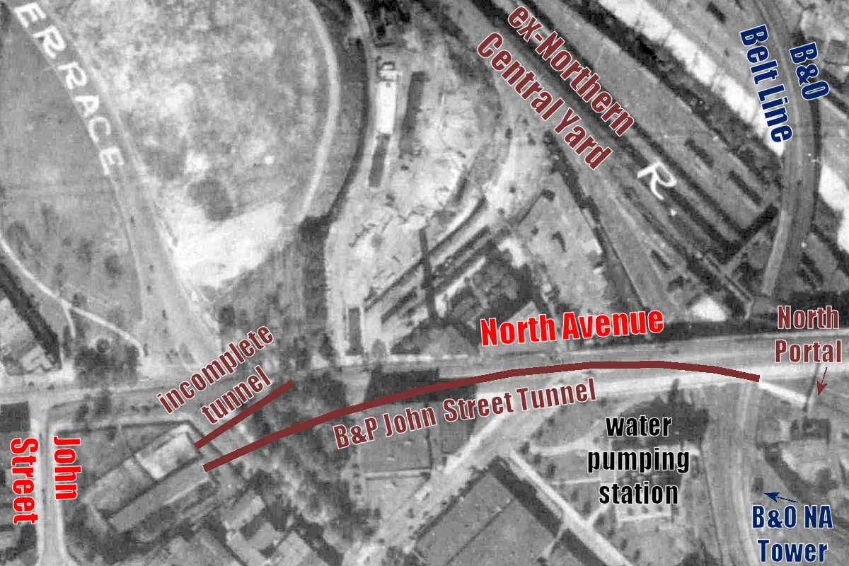
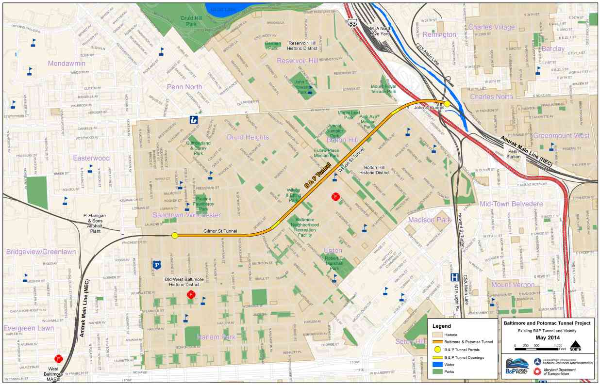
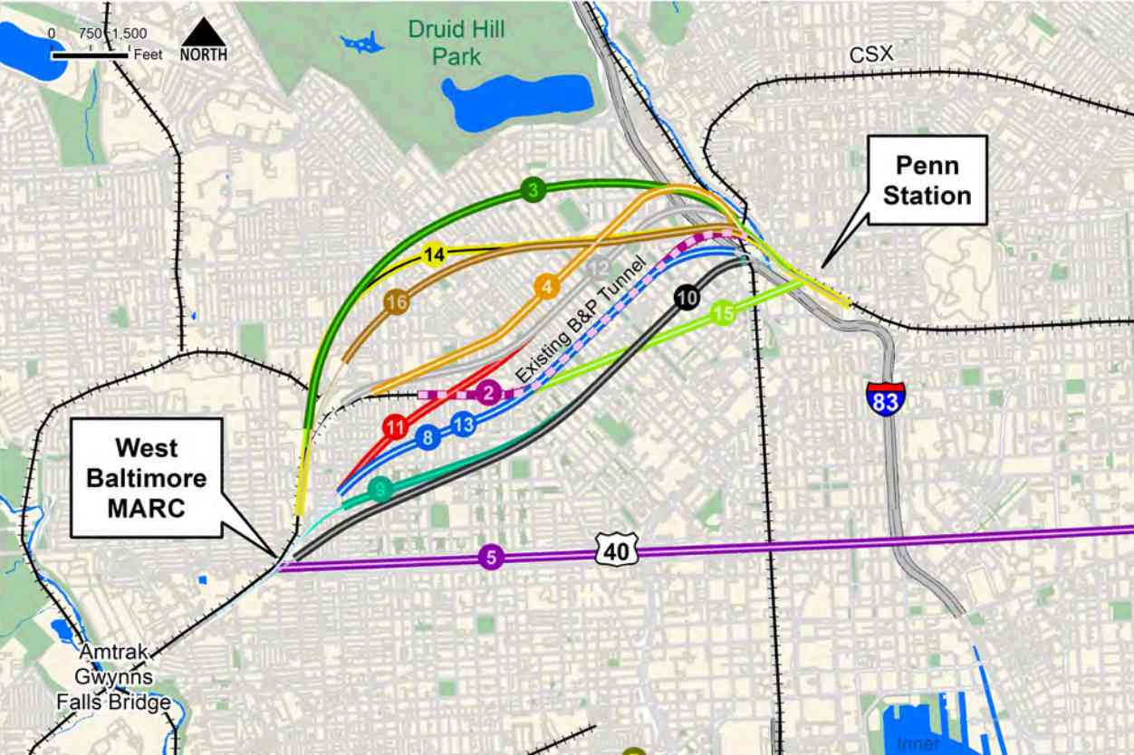
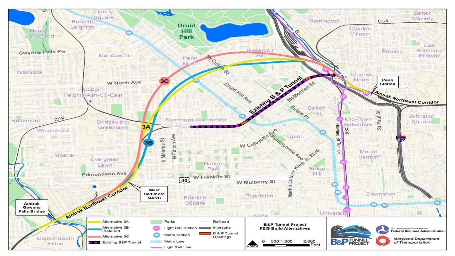
My recommended route is shown in purple. It is much straighter, a mile shorter, and would displace fewer/no homeowners. A new Amtrak station built at Franklin and MLK Boulevard is closer to downtown and the sports stadiums. Also, that location would halve the walking distance to Baltimore's subway, and easily have been put on light rail's main line.

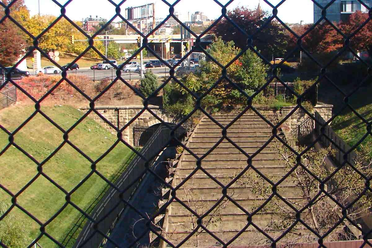
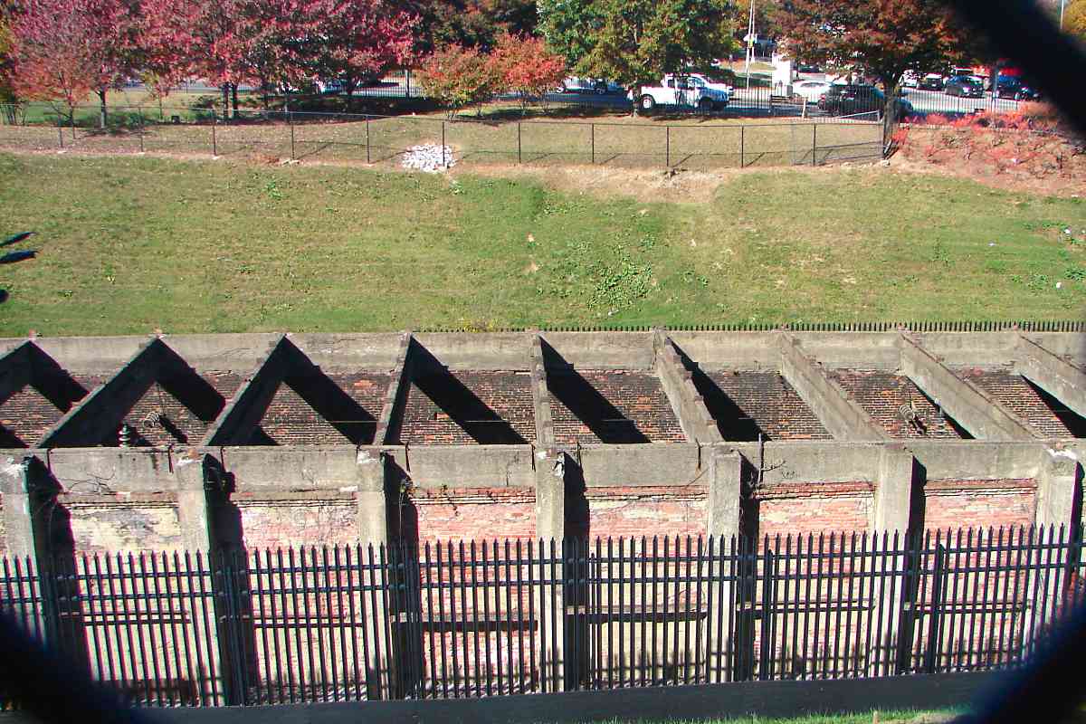
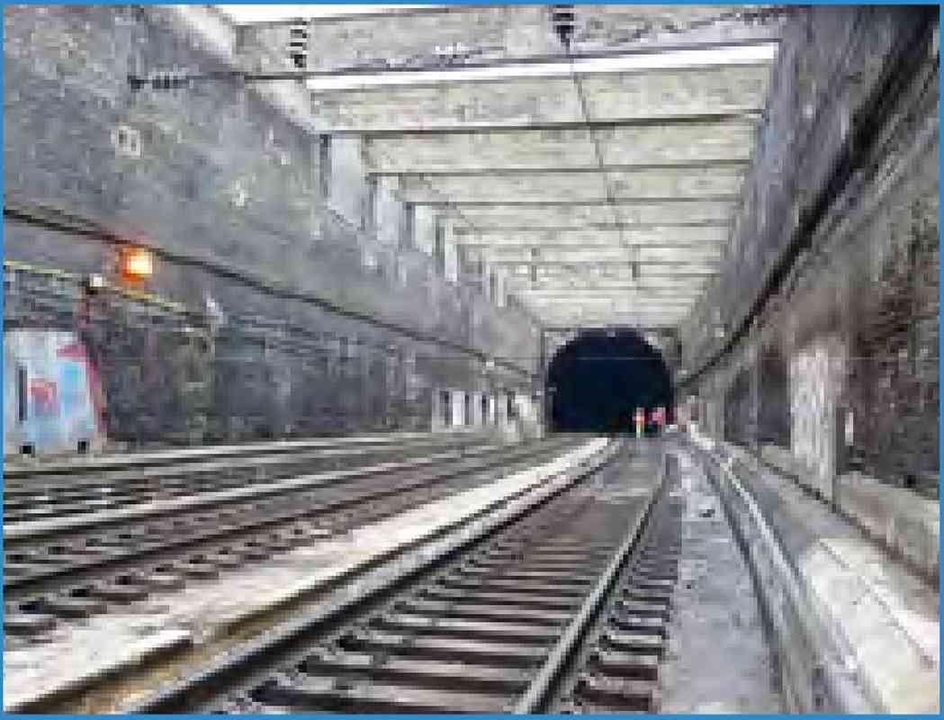
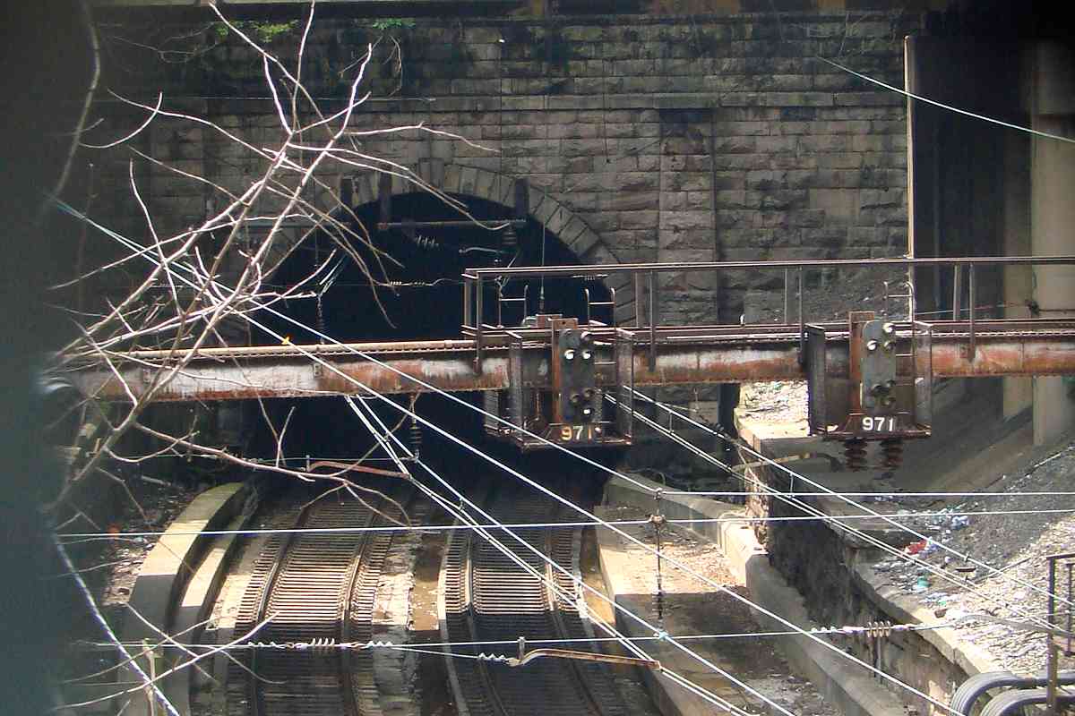
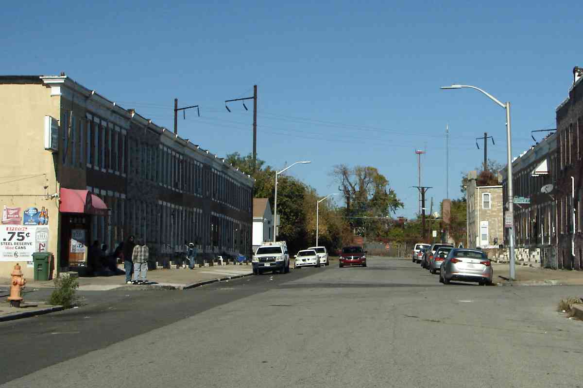
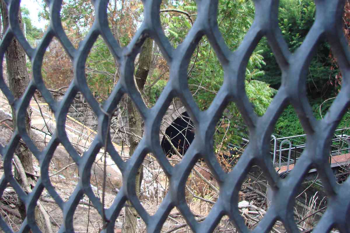
The purple alignment would finally put to real use the "highway to nowhere" I-170 cut west to the West Baltimore MARC stop. At 150 feet wide, that cut has room for more tracks than exist at Penn Station. To reach it from the east side of town, trains could follow the existing right of way 
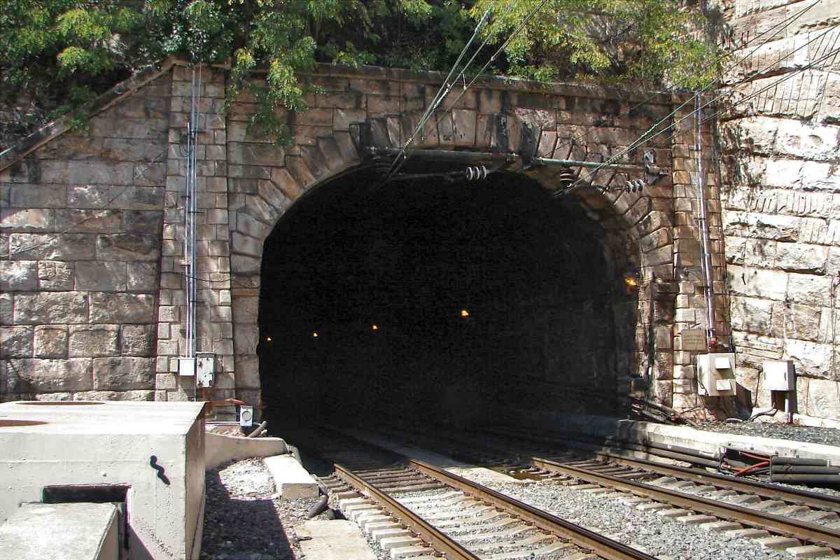
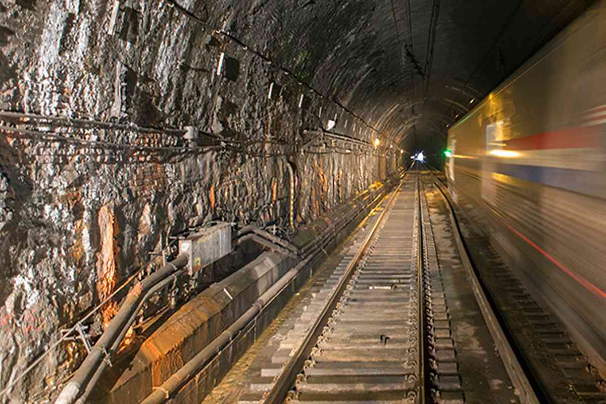
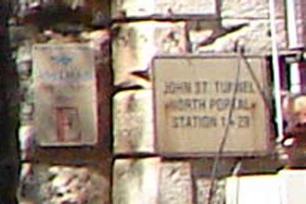
west from Bay View, through Union Tunnel, then turn south along the former Northern Central line 
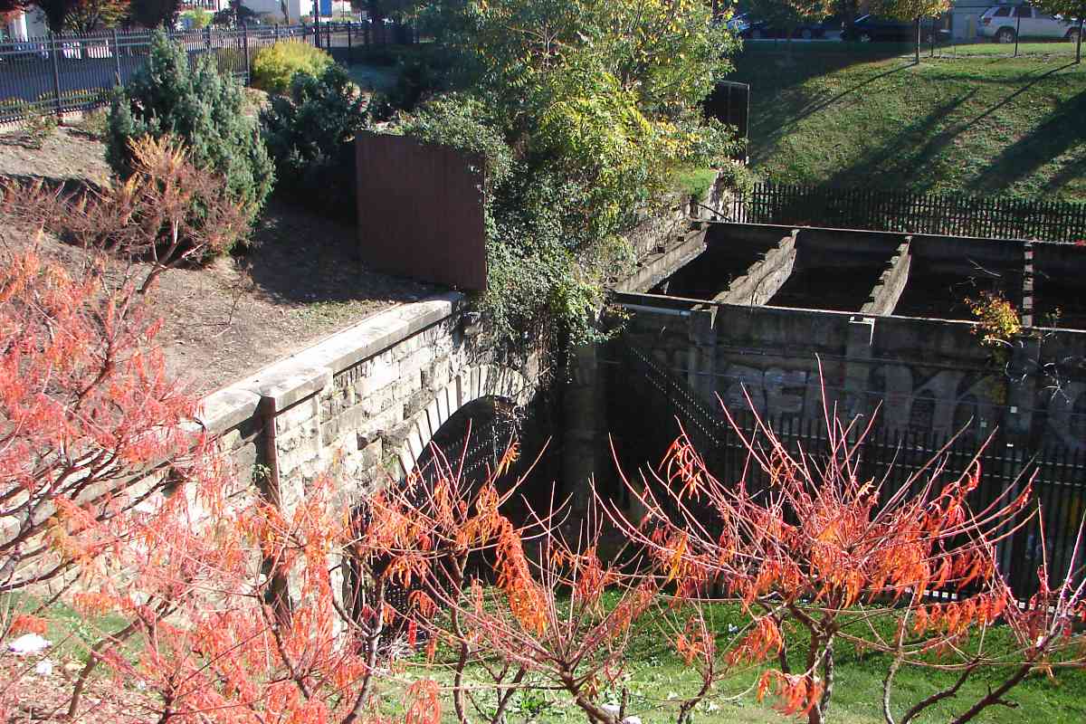
before turning west into a new tunnel under I-83 and commercial central Baltimore. 
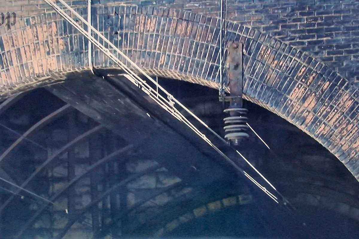
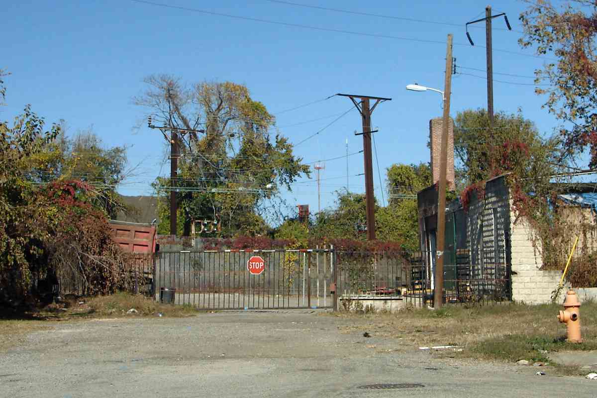
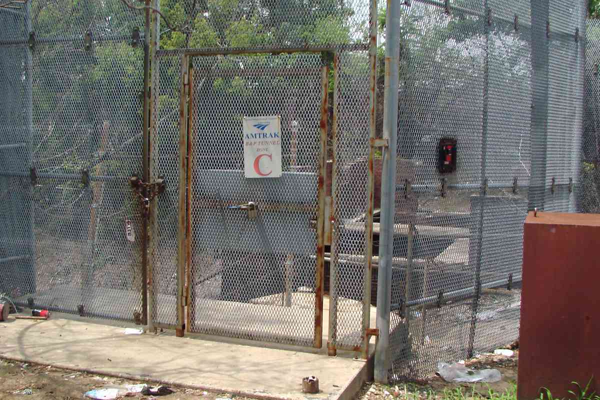
Near Center Street, there is roughly 30 feet of room for the tunnel above CSX's Howard Street Tunnel, and probably about the same amount above Baltimore's subway, so a new tunnel can be threaded through.

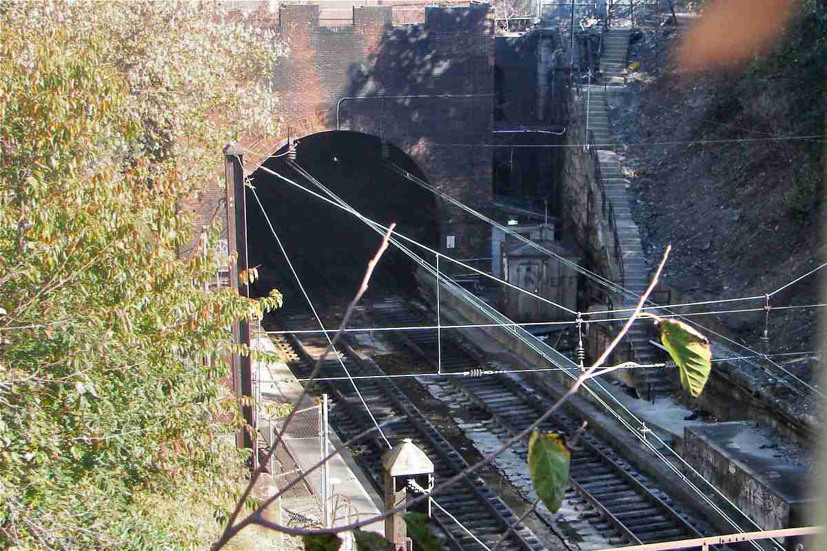
This new tunnel would emerge at a new station proposed at Franklin and MLK. The tunnel would be half the length of the planned new tunnel, and thus reduce total costs because tunnels are notoriously expensive. It would have a grade of no more than 1%, which is more level than the planned new route. Furthermore, the proposed new Amtrak station would be so close to the West Baltimore Station that there would 
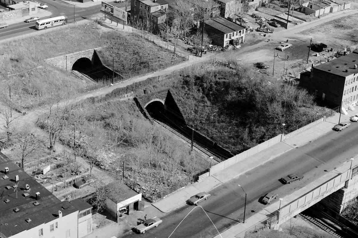
be no need to spend to redo the latter. That would leave money to repair the deteriorating Gwynns Falls Viaduct (unlabeled near N at lower left corner).

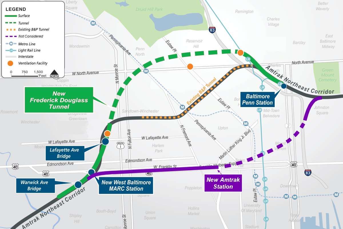
Plus, this tunnel would have more functionality. Unlike the chosen plan, this tunnel would have more tubes and thus avoid train bottlenecks. Double stacks of containers would fit, which would support the port of Baltimore. It could regularly handle diesel locomotives, so MARC would not need to buy and service electric locomotives. Lower costs and more benefits mean the purple route should have been selected.

Link: "Next time we'll get it right"


New Portal (Site)

New Portal (Site)
Mile: 98.0 Date: Nov 2016
Ease: A View: N
Area: D T6:
Map: Ba 34 G 11 Topographic Maps

#bmorepositive A site near this intersection of Payson and Mosher Streets has been chosen for the new tunnel's south/west portal. Roughly half the houses here were abandoned at photo time -- owned by Baltimore City -- and many others vacant, hence the paucity of parked vehicles. Photo at right courtesy Google, Lafayette at McKean, November 2017.

The catenary beyond marks the existing Northeast Corridor route originally laid down by B&P circa 1870. The distant, tall broadcasting tower stands about 2.5 miles away atop TV Hill.


Proceed or Stop

Proceed or Stop
Mile: 97.9 Date: Nov 2016
Ease: A View: N
Area: D T6: 327
Map: Ba 34 G 11 Topographic Maps

The need for an expensive repair or replacement of the B&P Tunnel comes at a time when Amtrak lacks excess funds. Can we afford to lose the use of the tunnel? Can we afford to spend so much on a project that, without huge fare increases, will not return it? President Joe "Amtrak" Biden has voiced his support for the new tunnel. If all goes to plan, the new tunnel will open in 2035.

Link: B&P Tunnel Project site


<< Previous (northeast) | THIS PAGE: B&P Tunnel | Next (southwest) >>

Related info you may enjoy: Todd's B&P page

Or, return to main page

Copyright Notice