AM Leach Lumber Co aka Challenge Mill RR
AM Leach Lumber Company was established in 1874 when Andrew Martin Leach aquired the Challenge mill, along with several others,
from the Union Lumber Company. As logging moved further into the woods, it was decided a railroad would be needed to bring the logs
to the mill. An 0-6-0 locomotive built by Baldwin named "Chas Kohler", with serial number 7362, was aquired in 1884. The railroad eventually grew to about six miles in length.
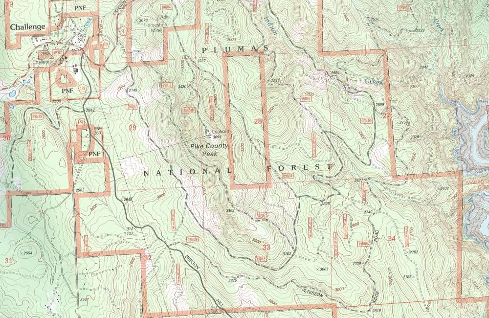
The line first went south and eastward to go around Pike County Peak then turned northward to Indian creek. After a few years,
the new Beanville mill was established at the Indian Creek end of the line to send rough cut lumber to Challenge instead of logs.
According to David Myrick's book, Railroads of Nevada & Eastern California Vol 3, part of the possible alignment is along Peterson Ridge Rd.
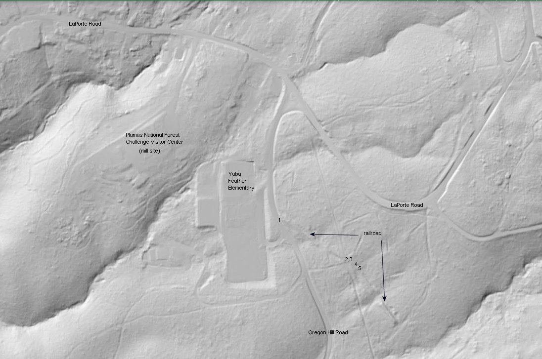
Recent access to USGS LIDAR has revealed that the road and railroad are not one and the same but parralled each other. The USDA Forestry .pdf file linked below
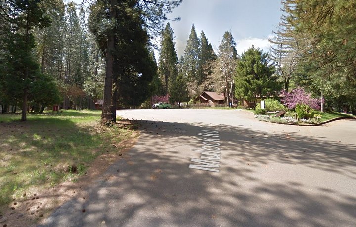
also reveals that the Challenge mill sat on the flat ground just to the west of the present day Yuba Feather Elementary. This site is currently occupied by the Plumas
National Forest Challenge Visitors Center.
Note: The locomotive eventually ended up in a scrap yard in San Rafael. The remains have now been recovered and reside at SPCRR,Ardenwood,CA
Upon my visit at the end of August 2023, logging has disrupted the land just east across Oregon Hill Road from the school making it difficult to pick up
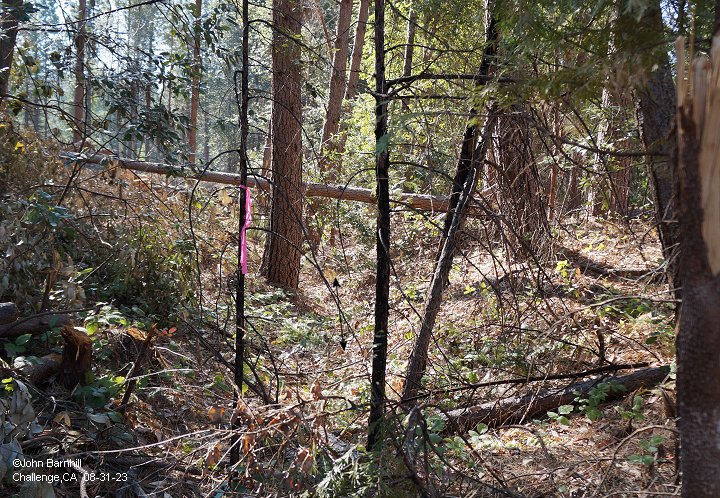
the beginning of the railroad line. Fortunately enough, surveyors had flagged the old right of way with red and black tags. These would be found all
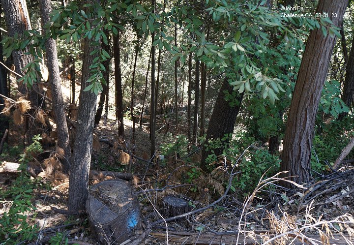
along the right of way I managed to explore. I must point out that the forest is so thick in most places that exploring any of the line south from Challenge
to Peterson Ridge Road is quite the challenge (pun intended) and photos are nearly impossible to get to translate. Viewing with the naked eye is recommended.
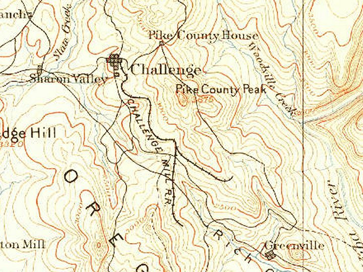
The first topo map shows the entire area covered by the railroad. The second topo map shows the line before the extension to Indian Creek.
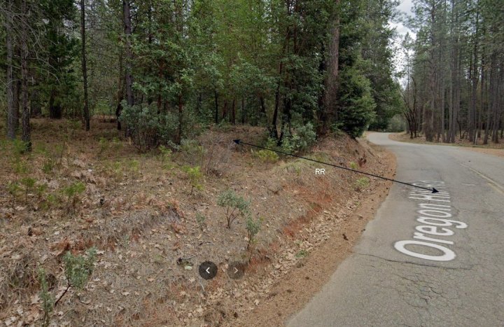
The third image is a Google Street view of the Challenge mill site, now the PNF Challenge Visitor Center.
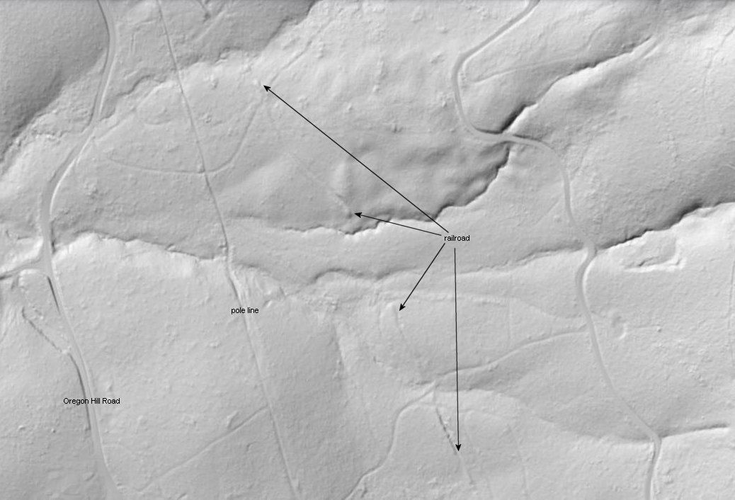
The fourth image is a USGS LIDAR image of Challenge. It has been marked to indicate some features and photo locations for the following images.
1. Google street view looking south along Oregon Hill Road where the line crosses from the elementary school into the woods.
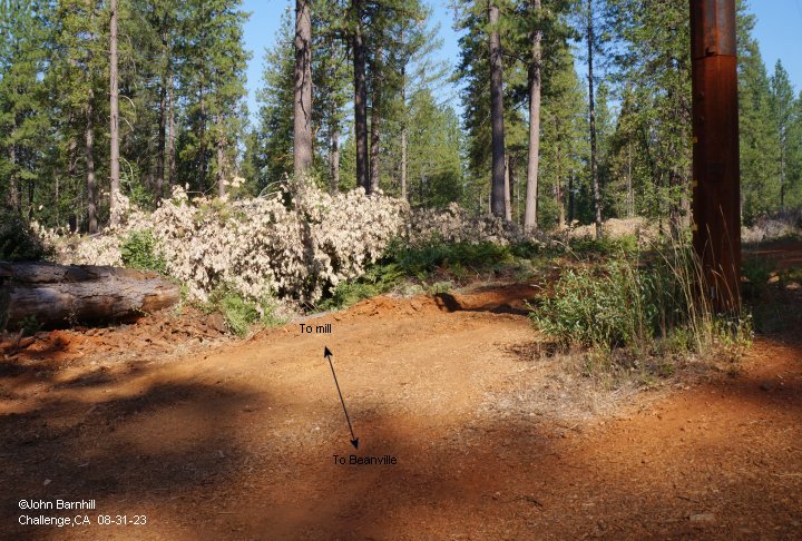
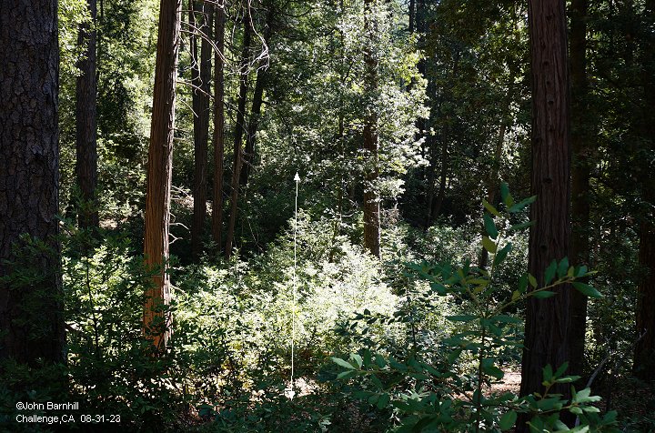
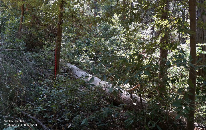
2.-3. Opposite views taken from the pole line. Image 2 looks towards the school and mill site. Image 3 looks south along the line.
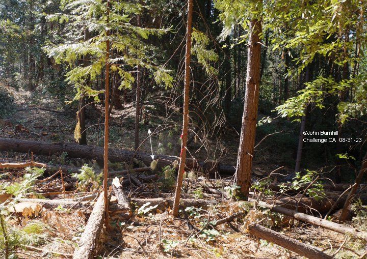
4.-5. A series of short cuts and fills mark this portion of the line. Anything further here is impossible to explore at this time.
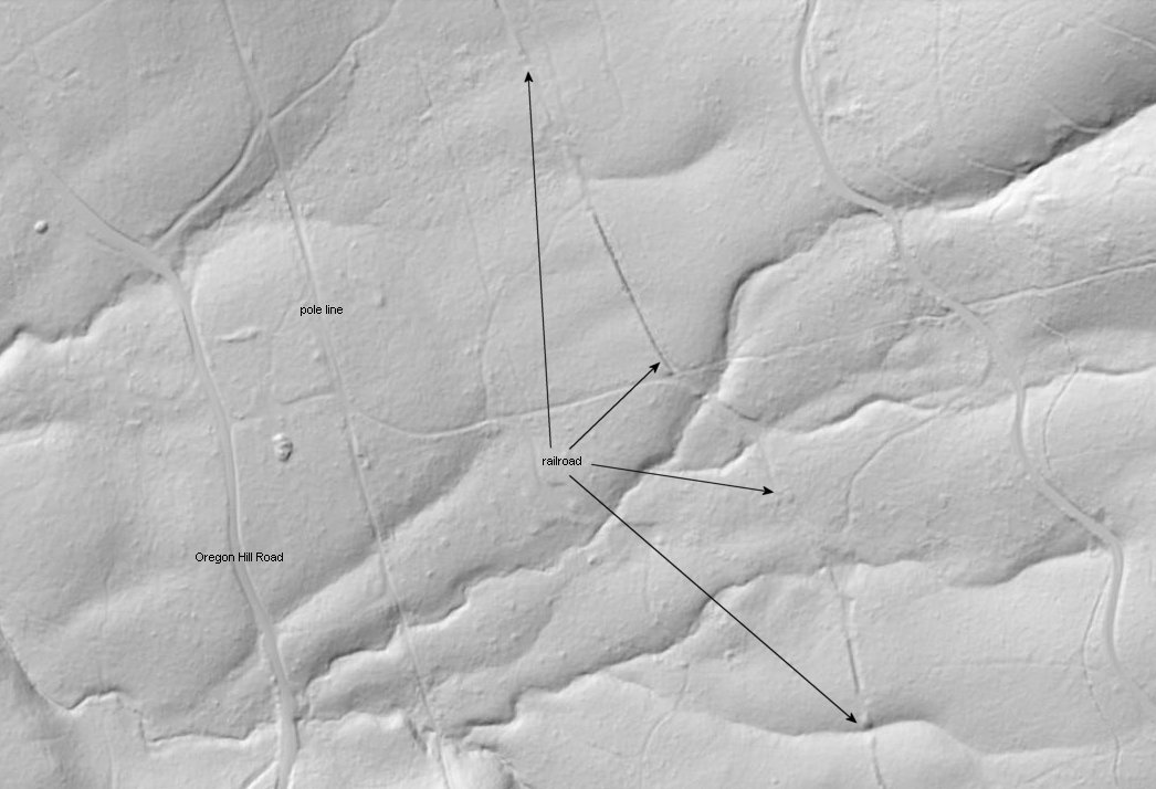
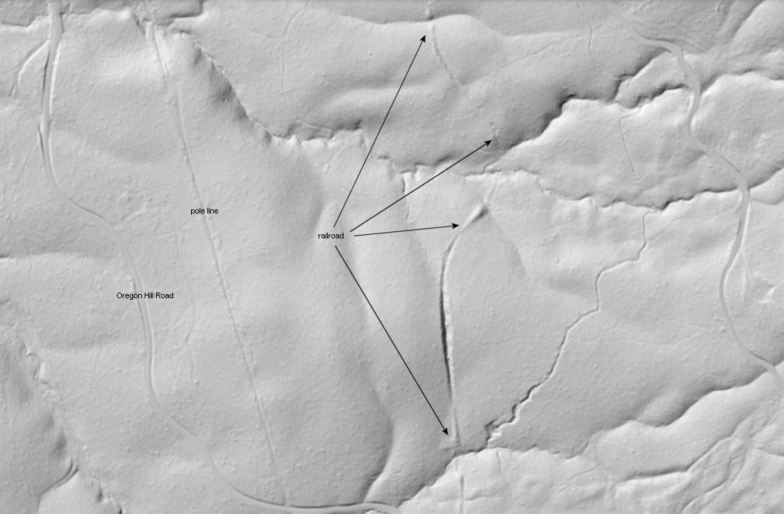
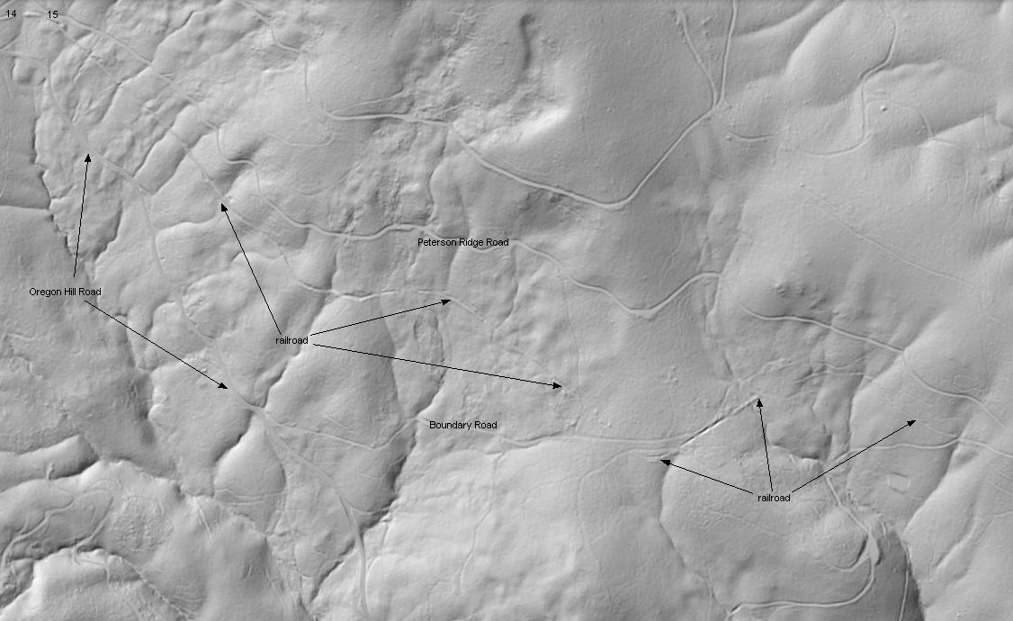
6.-8. USGS LIDAR images continuing south towards Peterson Ridge Road.
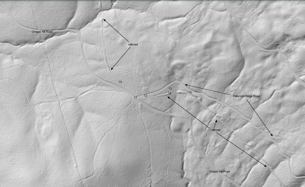
9. The junction of Oregon Hill Road and Peterson Ridge Road appears in this USGS LIDAR image. It has also been marked
to indicate the following photo locations.
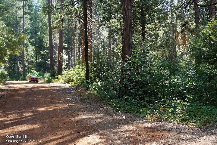
10. Barely visible indication of the line just north of and looking towards Peterson Ridge Road.
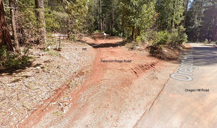
11. Google Street view of the intersection of Oregon Hill Road and Peterson Ridge Road. Line indicates the railroad.
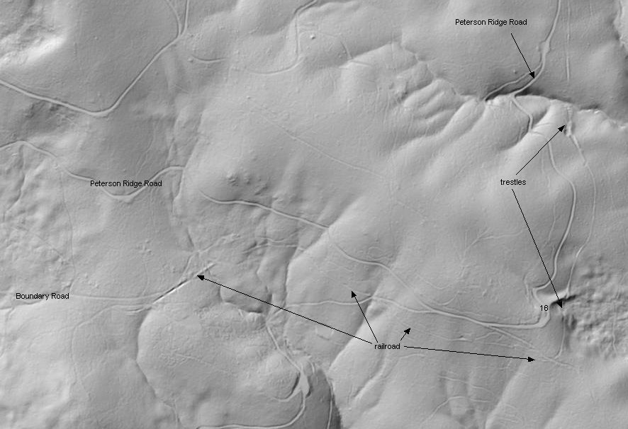
12. The line starts to parrallel just to the south of Peterson Ridge Road.
13.-14. Image 13 is the abutment of the first trestle in this section. Image 14 looks east from the abutment across the trestle site.
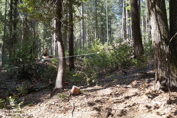
15. Eastward view from Peterson Ridge Road into a cut that just follows the trestle site in the previous two images.
16.-17. These two USGS LIDAR images follow the line east to the turn northward.
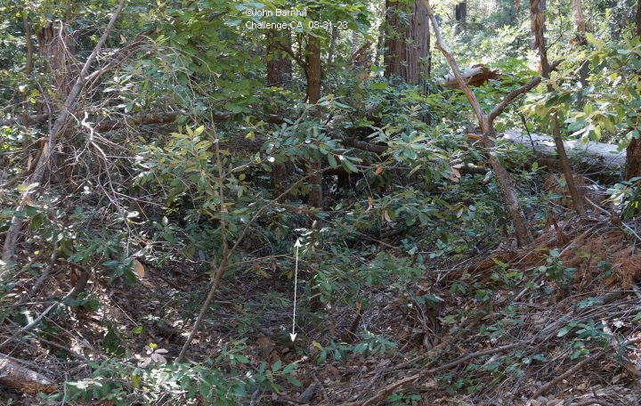
18. This image looks straight down the ancient land slide as indicated in the previous LIDAR image. Somewhere
below is a large trestle site to bridge this land feature.
Exploration of the northward leg of the line will have to wait for future trips.
References
Railroads Of Nevada & Eastern California vol. 3, David Myrick
Check out this link for more info: USDA Forestry: Life In Challange Mills by Philip M McDonald and Lona F Lahore.


==================================================
This page, these images and underlying code ©2023-2026 Barnhill Web Design unless otherwise noted.