Adventurers in Utah for Spike
150
Promontory Summit -
150 years later
A Sesquicentennial
Chapter Two
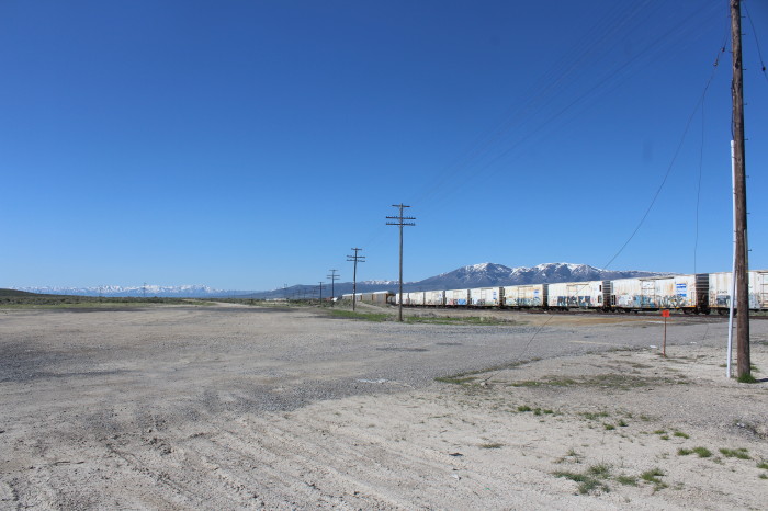
Tooele Valley, Rio Tinto Kennecott Mine
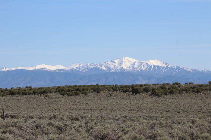
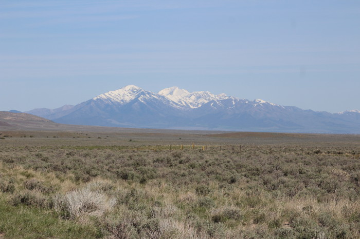
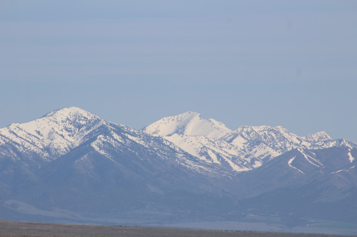
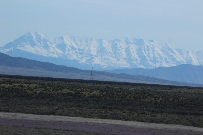
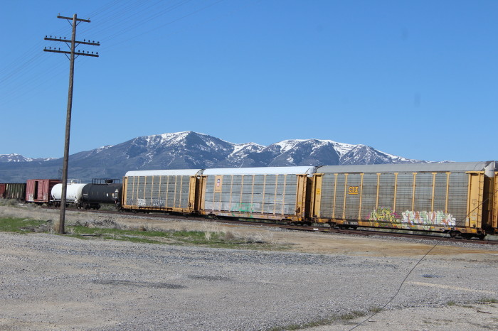
Snow Covered Utah Mountain Ranges
May 3, 2019
Friday
by
Robin Bowers
Text and Photos by Author
The
author retains all rights. No reproductions are allowed
without the author's consent
Comments are appreciated at...yr.mmxx@gmail.com
After a restful night here in
Cedar City, UT and after loading the car, we drove to McDonald's
on W 200 N which was going through a remodel with only the drive
through open for business. After picking up our orders we then
drove a few blocks to the Union Pacific station where we ate
breakfast. I had my usual order of Egg McMuffin, hash browns
with a small coffee. Then it was time to hit the road. Leaving
town we connected with SR 130 northbound. At Minersville it was
then SR 21 north to Milford and then SR 257 going to Delta where
it was US 6 north to Lynndyl where north of here we had a Union
Pacific stack train backing with two crew members on the rear
platform. It was a cold ride for the crew.
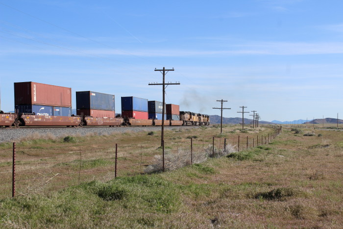
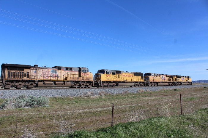
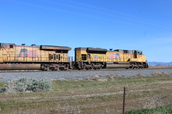
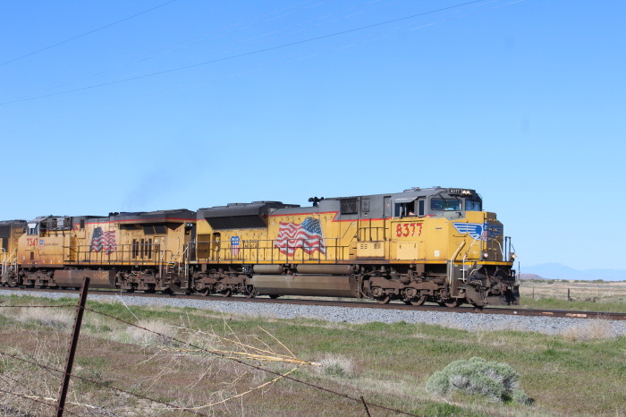
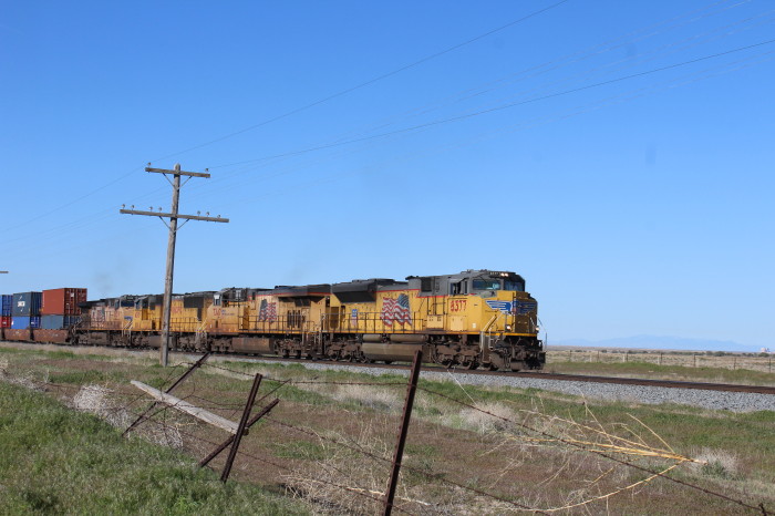
Union Pacific 8377 north of Lynndyl. He would have to back all the
way to Lynndyl before he could set off the bad order car.
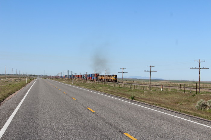
Looking south on US 6.
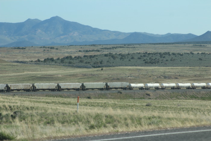
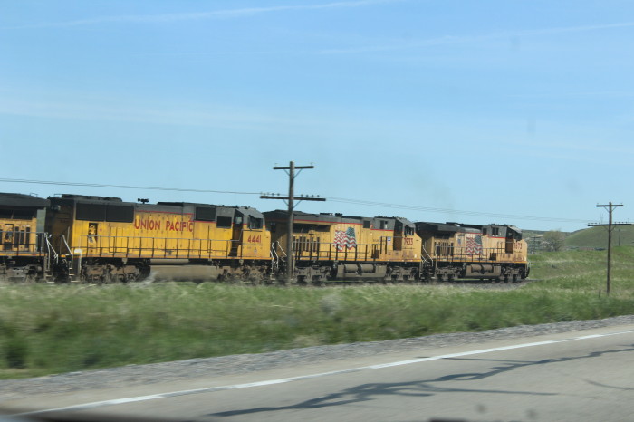
Union Pacific 5569 West near Jericho. We headed north to Mammoth
where we turned north onto SR 36.

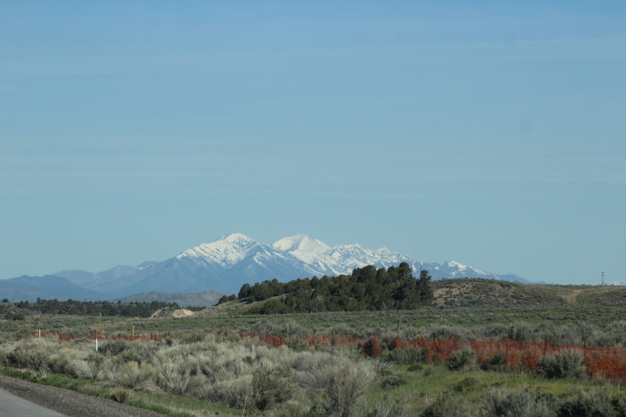
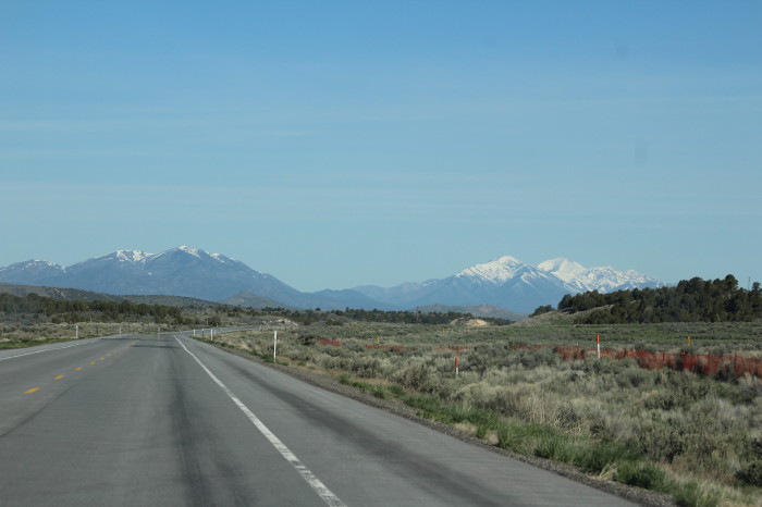
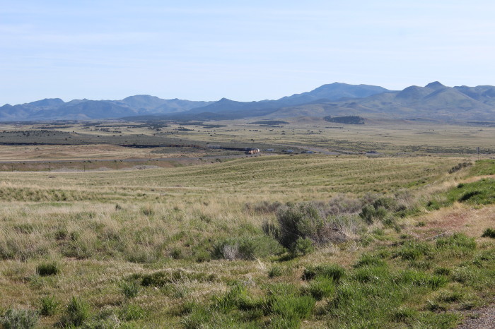
On US 36 with Onaqui Mountains.
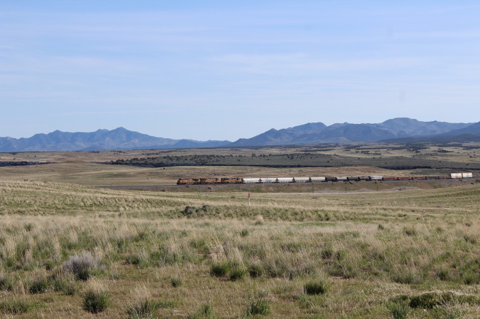
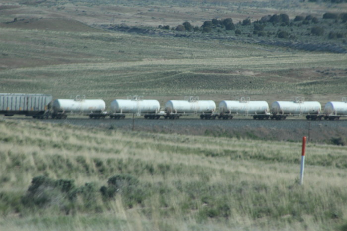
We just missed this northbound train near Vernon but caught up
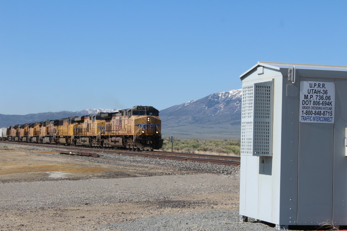
with him at this grade crossing near Clover Valley.
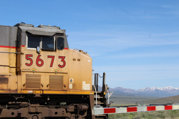
Union Pacific 5673 East near Clover Valley.
From here we then drove into Tooele to our first destination of
the morning.
Tooele, UT
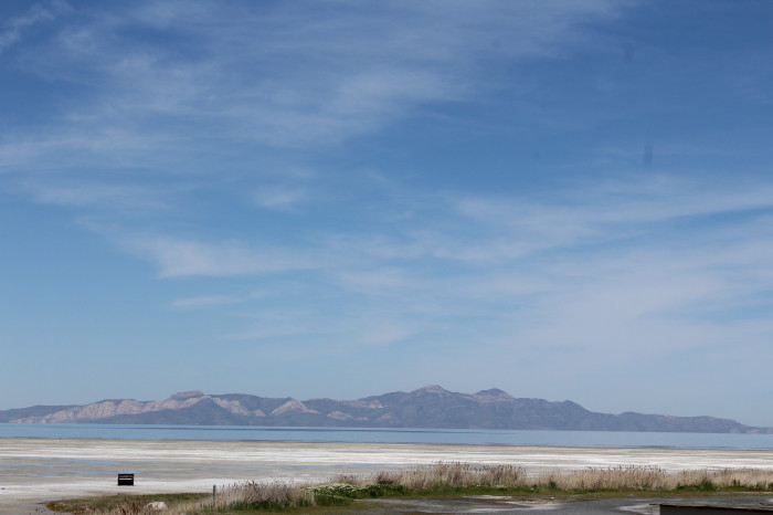
The scenic views from Tooele (pronounced too-ILL-uh) take in Great
Salt Lake to the north and across the Tooele Valley to the west -
the Stansbury Mountains.
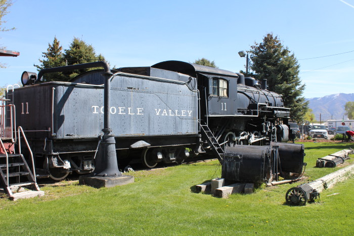
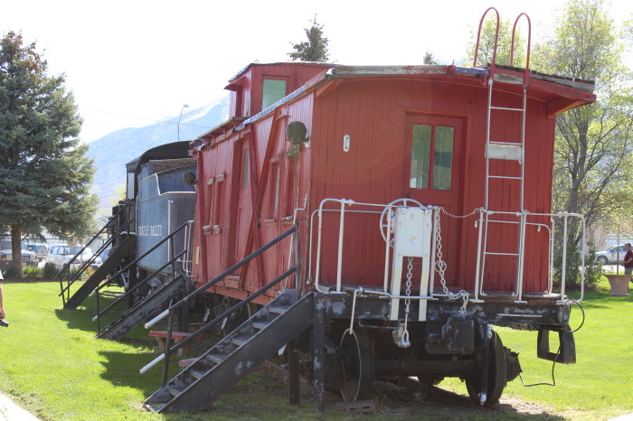
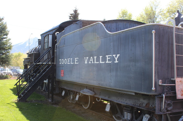
Tooele Valley Railroad Museum
Locomotive 11 and 12 were
built as part of an order of 2-8-0's for the Buffalo and
Susquehanna Railroad by the American Locomotive Company at their
Brooks Locomotive Works in 1910. Bankruptcy caused the Buffalo
and Susquehanna to cancel the order, and ALCO kept the
locomotives until selling them. 11 and 12 where sent to the
Tooele Valley Railway in 1912. Locomotive 11 would be preserved
after retirement in 1963. 12 was scrapped in 1956, with the
tender being used to mount a snowplow. 11 would be the last
steam locomotive in Utah to be used in revenue freight service.
First displayed near the intersection of Vine Street and 200
West, 11 was moved to the Tooele Valley Railroad Museum in 1982
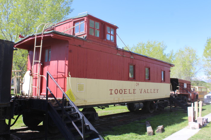
via rail. The museum also preserved the snowplow mounted to
locomotive 12's tender, several pieces of maintenance-of-way
equipment, and a pair of cabeese from the railway. Locomotive
100 and 104 were sold to new owners. A steam crane preserved at
the Nevada Southern Railroad Museum known as "The Crab" likely
originated at the Tooele Valley Railway or the smelter before
being acquired by the Wasatch Mountain Railroad (modern day
Heber Valley Railroad) before moving to its current location in
Nevada.
They were having a work cleanup party so we went through the
open gate into the museum's grounds.
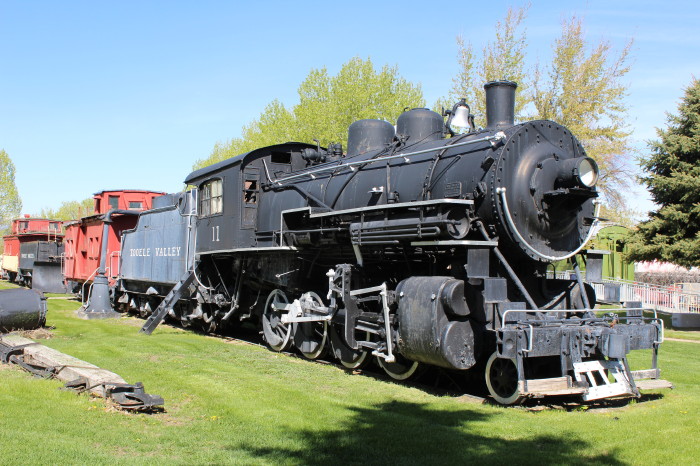
Tooele Valley Railroad 2-8-0 11 is the star of the museum.
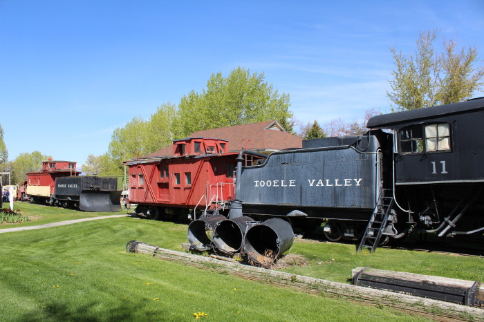
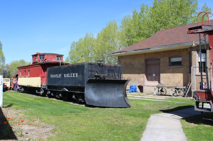
Snow plow.
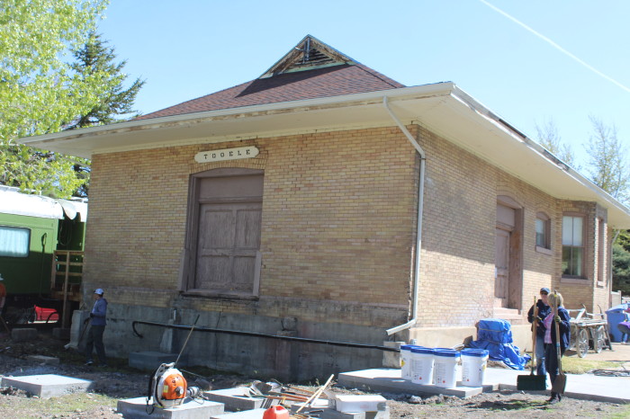
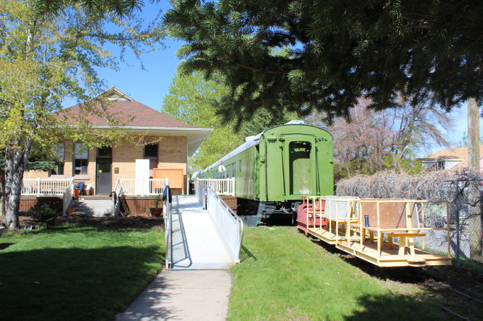
Tooele Valley Railroad station with clean-up workers.
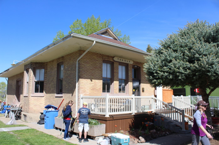
More volunteer workers, others were cutting and trimming the grass
and plants.
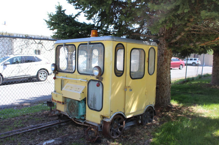
Track Speeder.
After our nice visit in Tooele we drove north on SR 36 to I-80
East to Exit 104 where we saw an interesting building across the
highway.
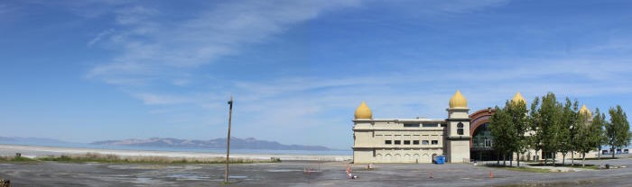
Saltair Pavilion, a Moorish palace theme.
Originally owned by the
Mormon Church, the original Saltair was intended to be a Utah
version of Coney Island, out on a boardwalk into the Great Salt
Lake. It was a nice escape for the people of Salt Lake City--
and a good way for younger Mormon couples to get out without
being chaperoned by their parents. It was partially owned by
groups associated with the Mormons, and they came under fire for
selling coffee, tea and booze (prohibited in the Mormon faith)
and for being open on Sundays (another no-no). The church sold
the resort in 1906, and when it burned down in 1925, a new
version was funded by new investors.
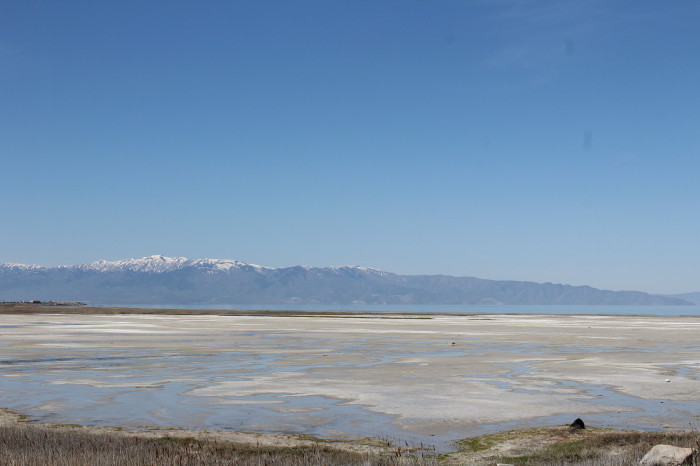
Scenes along the Great Salt Lake.
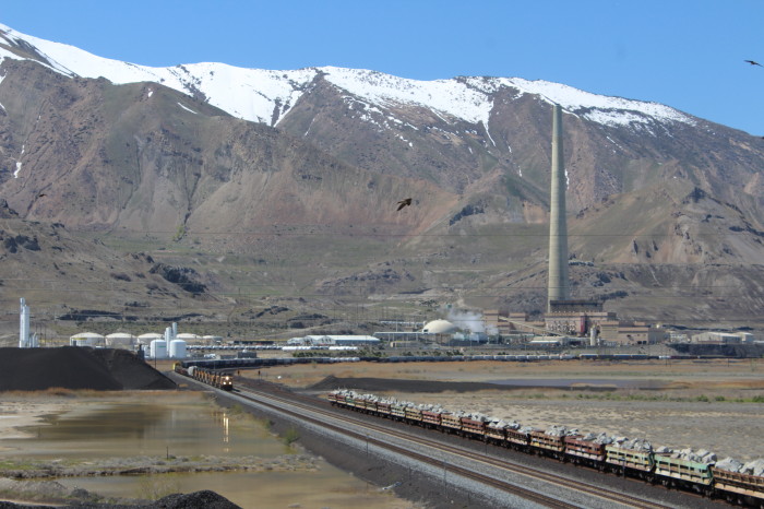
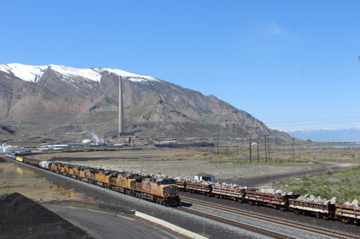
Union Pacific 5673 East at Smelter, UT. We drove down SR 111 south
to the Rio Tinto Visitor Center.
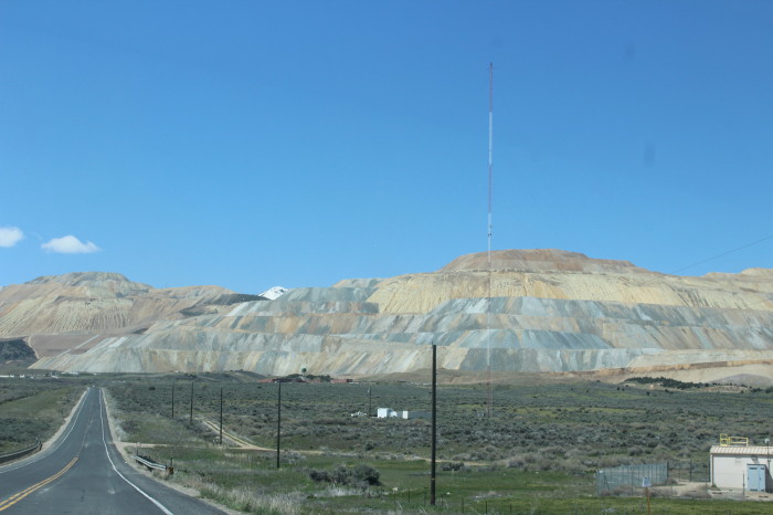
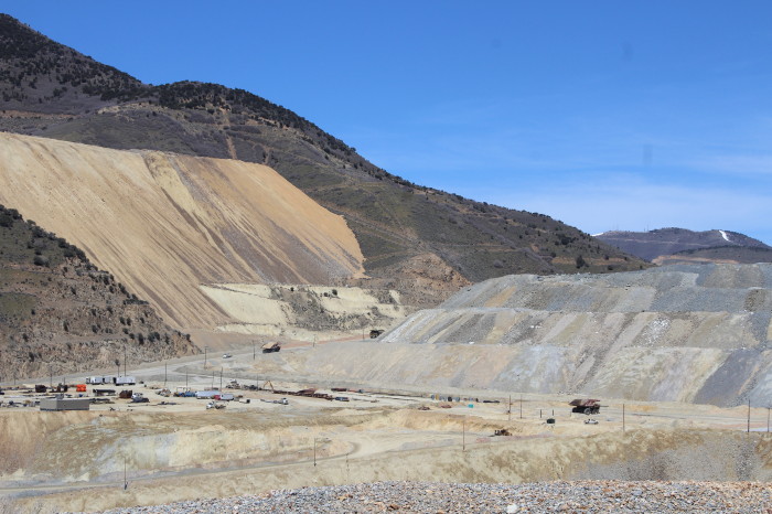
Mine tailings taken from the open pit.
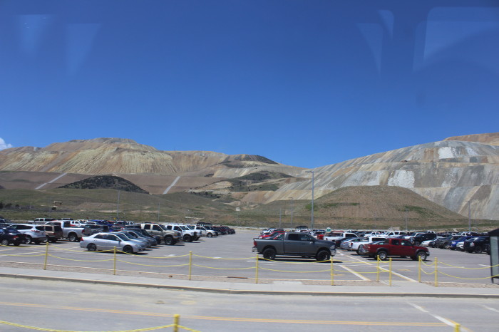
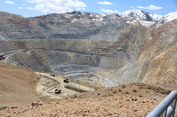
We parked and walked to the Visitor Center where we purchased our
12:30pm bus tour ticket. The bus would shuttle us between the
parking area and the visitor's overlook in the world's largest
open pit copper mine. This has been on my bucket list for a long,
long time.
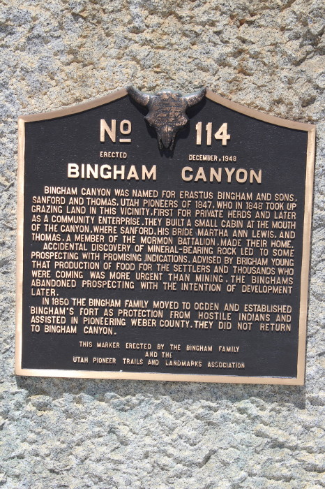
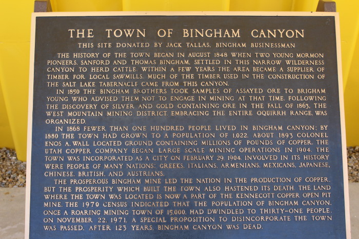
Bingham Canyon Copper Mine
Bingham Canyon was a city
formerly located in southwestern Salt Lake County, Utah, United
States, in a narrow canyon on the eastern face of the Oquirrh
Mountains. The Bingham Canyon area boomed during the first years
of the twentieth century, as rich copper deposits in the canyon
began to be developed, and at its peak the city had
approximately 15,000 residents. The success of the local mines
eventually proved to be the town's undoing, however: by the
mid-twentieth century the huge open-pit Bingham Canyon Mine
began encroaching on the community, and by the late twentieth
century the Bingham town site had been devoured by the mine. No
trace of the former town remains today.
The geographic feature known as
Bingham Canyon received its name from the location's two first
settlers, the brothers Thomas and Sanford Bingham, who arrived
in the canyon in 1848. Initially, the area was utilized for
livestock grazing and logging, but the region's economic focus
changed with the 1863 discovery of rich gold and silver ore
bodies in the canyon. Mining activity in Bingham Canyon boomed
after the Bingham Canyon and Camp Floyd Rail Road completed a
line to the canyon in 1873, and as the region grew the focus
shifted to the high-quality copper ores in the district. As the
mines grew, the town of Bingham also expanded, spreading along
the narrow and steep canyon floor below the mines.
The Bingham Canyon mines
experienced their greatest boom during the first years of the
twentieth century, as the district's smaller mines were
consolidated under large corporate ownership. The most
significant development occurred in 1903, when Daniel C.
Jackling organized the Utah Copper Company to begin surface
mining at Bingham Canyon. The Utah Copper Company's mine
prospered, and this brought a tremendous influx of new residents
into the canyon. The town of Bingham Canyon was officially
incorporated on February 29, 1904. By the 1920s, the city of
Bingham Canyon was at its peak, with perhaps 15,000 inhabitants.
Urban development spread for some seven miles along the single,
narrow road winding up the steep canyon floor.
As with many western mining
towns, the Bingham Canyon area evolved into a collection of
diverse neighborhoods, many with pronounced ethnic affiliations.
Many Scandinavians lived in the Carr Fork area, while southern
and eastern Europeans congregated in Highland Boy, which was in
another branch canyon toward the top of the main city. As the
mainstreet in the bottom of the canyon grew, Copperfield became
the name of the upper section of the main town. Bingham itself
attracted British, French, Irish, Puerto Rican, Mexican, and
other immigrants and ethnicities. Numerous other small
neighborhoods and communities also existed. Most took the name
of the mine where they were located. Commercial, Boston Con, and
"the Niagara" were the first three communities to be mined away
or covered, as the last one was by Galena Gulch waste dumps.
Others were the Galena, Old Jordan, and Silver Shield (these
three found in Galena Gulch), along with Niagara. Telegraph was
in the upper part of the canyon, along with Copperfield, which
was threatened when the mining excavating was expanded and a
long one-way tunnel was built before 1940 to allow traffic to
reach the upper communities. Many names were colorful: Terrace
Heights, Dinkeyville, Jap Camp, and Greek camp were sections of
Copperfield. The Frisco, Yampa, Phoenix, and Apex were in Carr
Fork along with Highland Boy. Further down the canyon were
Markham, Freeman, and Frog Town (lower Bingham).
The size and importance of the
Bingham community began to fade as early as the 1920s. The
canyon's difficult geography made urban development difficult,
while exposing the town to the hazards of fire and avalanche.
The first effort to reduce settlement in the canyon came in
1926, when Utah Copper established the town of Copperton on the
flats east of the canyon mouth. This was a lovely community with
many copper products used in the building of the houses, and the
low rent encouraged company employees to live there. In 1956,
Kennecott sold the homes to employees for $4,800 to $6,000.
Increasing mechanization at the mine also reduced local
employment-and hence, Bingham Canyon's population.
By the 1930s it was becoming
apparent that the most significant threat to the town of Bingham
was the mine itself, whose ever-expanding open pit began
encroaching on lands formerly occupied by miners' neighborhoods.
The mine continued to eat away at Bingham throughout the middle
years of the twentieth century, and by 1971 little of the town
remained. That November, Bingham Canyon's 31 remaining residents
voted 11-2 to disincorporate the town, and the last buildings at
Bingham were razed in 1972. Today, most of the land once
occupied by Bingham has been consumed by the Bingham Canyon
Mine.
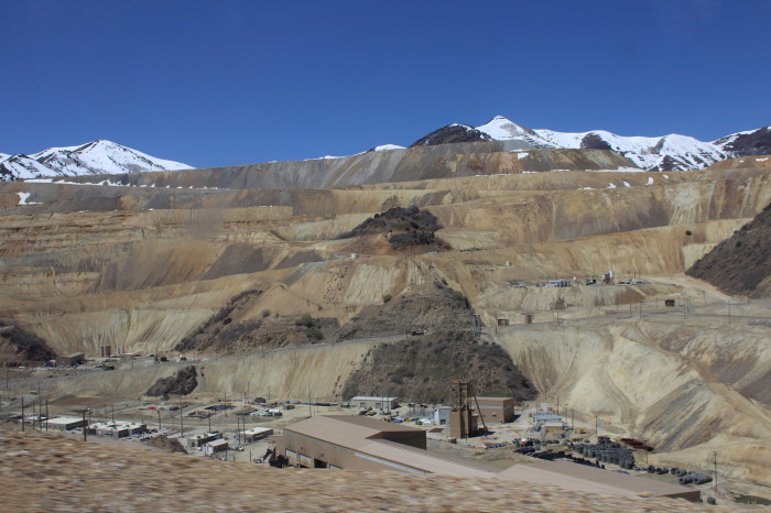
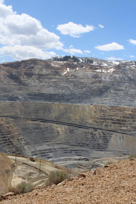
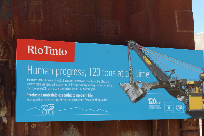
The Bingham Canyon Mine, more
commonly known as Kennecott Copper Mine among locals, is an
open-pit mining operation extracting a large porphyry copper
deposit southwest of Salt Lake City, Utah, in the Oquirrh
Mountains. The mine is the largest man-made excavation in the
world and is considered to have produced more copper than any
other mine in history - more than 19 million tons. The mine is
owned by Rio Tinto Group, a British-Australian multinational
corporation. The copper operations at Bingham Canyon Mine are
managed through Kennecott Utah Copper Corporation which operates
the mine, a concentrator plant, a smelter, and a refinery. The
mine has been in production since 1906, and has resulted in the
creation of a pit over 0.6 miles deep, 2.5 miles wide, and
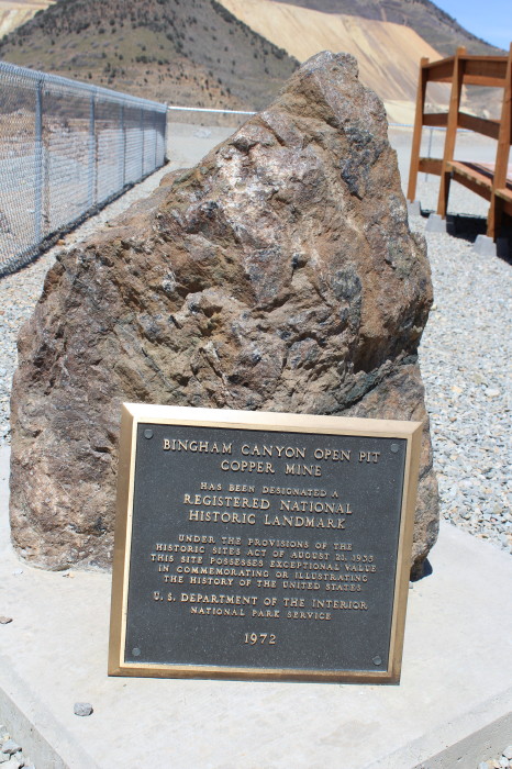
covering 1,900 acres (3.0 sq mi). It was designated a National
Historic Landmark in 1966 under the name Bingham Canyon Open Pit
Copper Mine. The mine experienced a massive landslide in April
2013 and a smaller slide in September 2013.
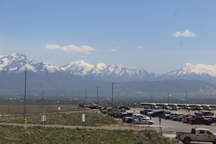
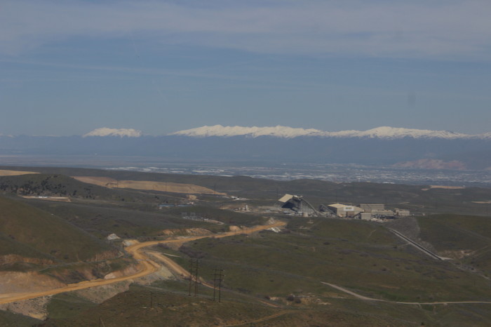
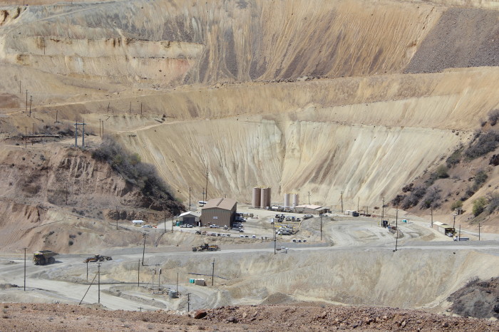
The Wasatch Mountains and Salt Lake Valley. The building is the
smelter for the mine. The ore is moved on conveyor now days,
eliminating the rail ore cars.
At 12:20pm we boarded our bus and left on time. Our bus took us to
the upper viewpoint but some better views were from the lower
viewpoint to which you need to walk down to.
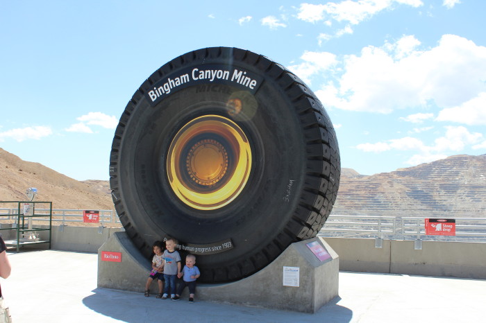
Haul truck tire display.
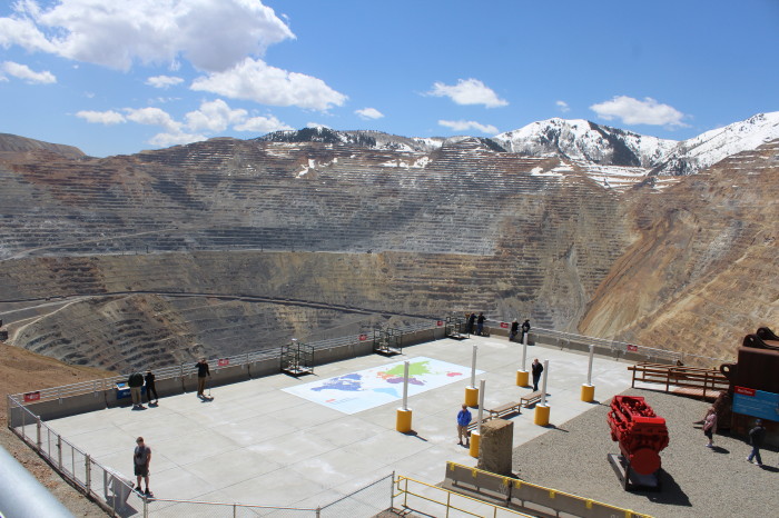
The lower view point.
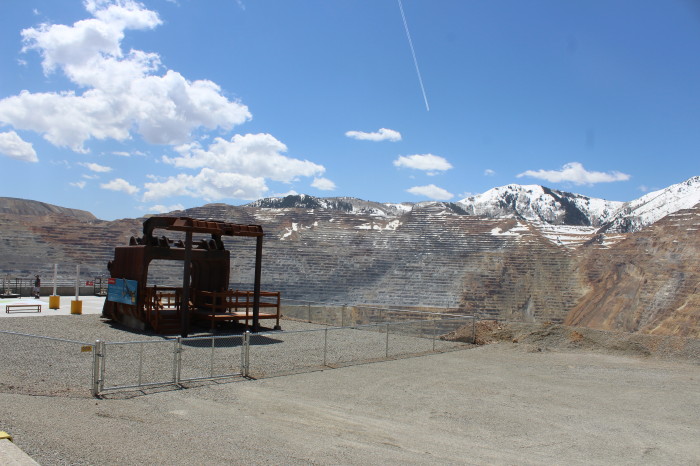
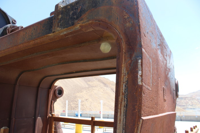
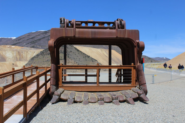
Shovel dipper.
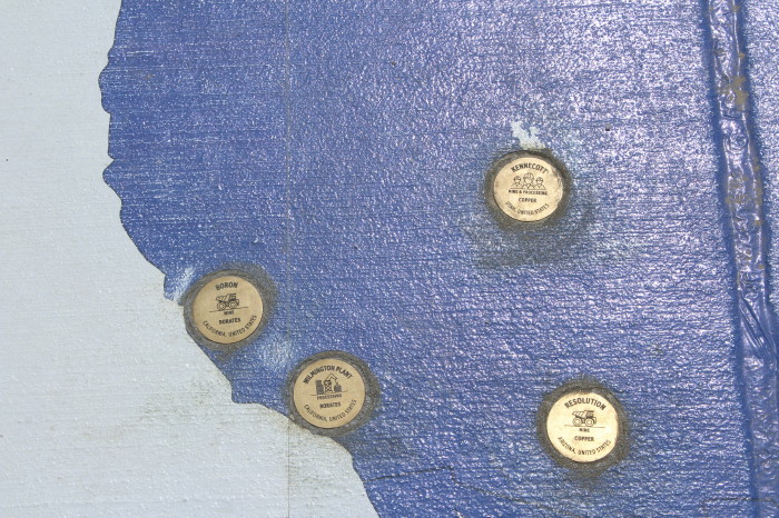
Locations of Rio Tinto west coast operations in United States.
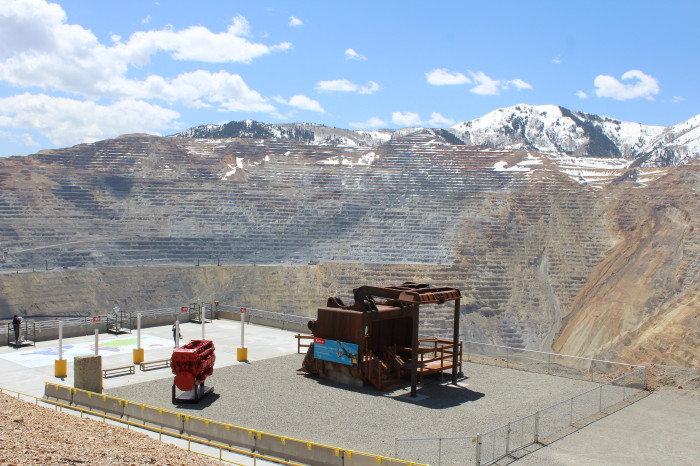
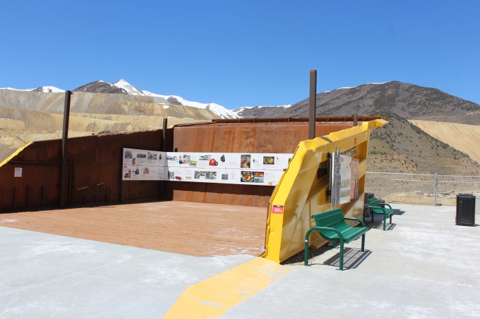
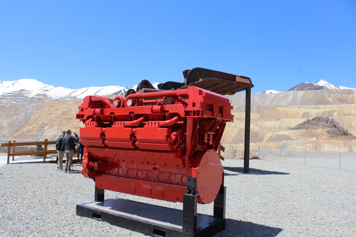
Haul truck bed and Kennecott history display.
While we were visiting, two small earthquakes occurred but I
didn't feel any movement.
I took the shuttle back to
parking area and met up with Chris and we headed to Park City.
We took SR 111 to the Old Bingham Highway east to I-15 to I-215
to I-80 east to US 189 south to SR 248 into Park City and to
find our stop for the night.
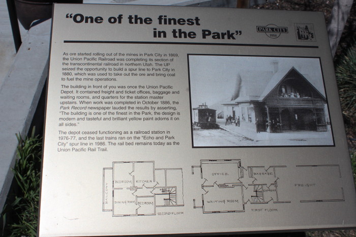
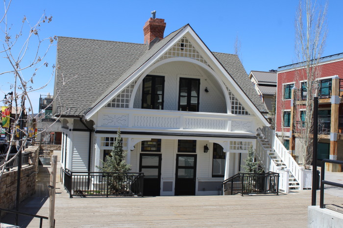
Park City Union Pacific Depot.
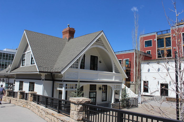
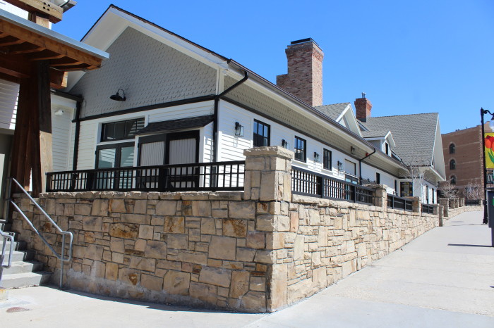
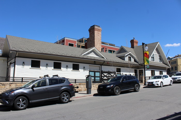
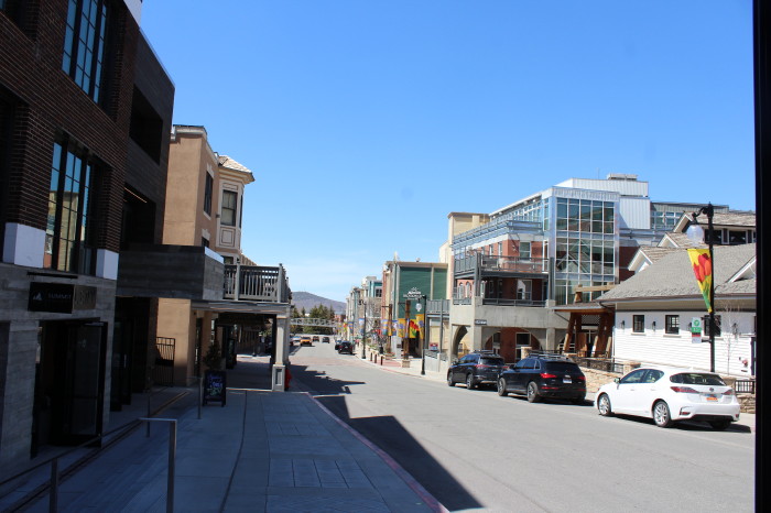
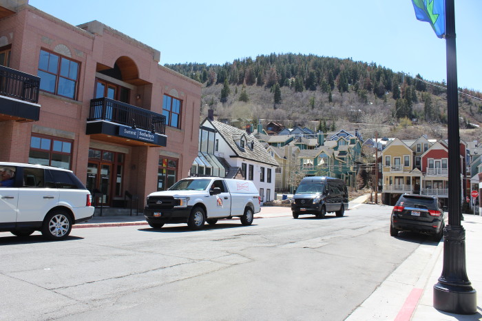
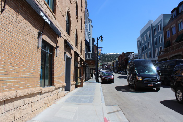
Street views of Park City.
Our first full day in "The
Beehive State" was going along swimming until we tried to find
our lodgings for the next two nights. Then it was one cluster
debacle after another. We arrived at the address Chris had from
the booking agent, but what we found was a nondescript
residential condominium building. We went inside and found no
front desk nor office and asked several people if this was a
hotel or motel. The answers ranged from "don't know" or "no." It
wasn't long before we realized something was amiss. After
several phone calls, we were told to go to another hotel on the
other side of town. As we had only been in town a few minutes
and with no local map for directions, we went into a local
business across the parking lot for help. Since they didn't know
the street we were looking for ether, a nice lady got on her
phone and was able to give us directions. We tried to follow her
instructions but got lost. The streets in Park City are laid out
in a labyrinth with short streets, dead ends and just for good
measure, a few obliques. After cruising up and down a few
streets, we finally found our destination.
After registering, picking up the keys, a
local map and parking permit, we drove to the proper place. It
turned out that our place was two blocks away from the first
place we stopped just on the other side of street. The parking
lot to our building was raised several steps or about a foot and
half from the ground floor of the building. As Chris was
unloading the car, he missed a step and took a tumble producing
a bloody scrape. Then as we were getting settled, we heard
pounding, sawing and drilling coming from the floor above. How
long was that racket going to last? Next we found out the
internet was not working. With that it was decided to go to
supper.
We had a name and address of a place but
couldn't find that either, with no help from several passersby.
We spotted a nice sandwich shop, Clockwork Cafe, and had our
diner there. The lone worker, a capable young man, was taking
orders, making the sandwiches, and bring them to the table.
After eating, Chris rushed back to the room but I decided stay
and soak in the ambiance of our stay in Park City. Going back to
the room I decided to walk the old railroad bed which is now a
hiking/bike trail. The trail ran behind our building but a small
stream ran parallel between the trail and the building so there
were only select places to cross over without getting wet. I
continued for several more blocks past our building and exited
on a paved street that I thought would return me back to the
motel. I was then turned around and missed my street by a couple
of streets. The city is not easy to navigate for strangers. But
I enjoyed exploring the streets and window-looking. After all, I
was out for a walk and sightseeing. Back in the room the
internet was working so I was able to check email before it was
time to turn in. Tomorrow we'll ride a train through a canyon.
Thanks
for reading.
Next Chapter - Riding the Heber
Valley Railroad
Text and Photos by Author
The
author retains all rights. No reproductions are allowed
without the author's consent.


