Today is the day to get out of
town. Due to a late booking, I am faced with an 8 to 9 hour
layover in Seattle Washington. I was excited to have a whole
afternoon to explore, since my last layover in Seattle did not allow
for being a tourist. My ride to Long Beach Airport got me there
by 5:45 AM. After settling an issue of one too many checked
items, I waited patiently for the boarding call. Eventually, the
MD-80 aircraft was loaded and instead of being pushed back at 6:45 AM,
we sat for an extra 75 minutes while a fueling issue was resolved and
we took off approximately 8 AM. I already had a dislike for
MD-80's since I work near them often and find them extremely noisy
compared to other commercial airliners. At least they are very
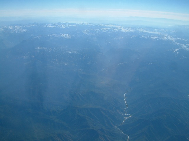
fast! The flight took us up the middle of California with nice
views of the Sierra Nevada mountains to the east. I typically select my
northbound seat to take advantage of checking out the mountains.
Since I am a native Californian, I spent plenty of time in the Sierra
Nevada mountains, checking out Sequoia, Kings Canyon and Yosemite
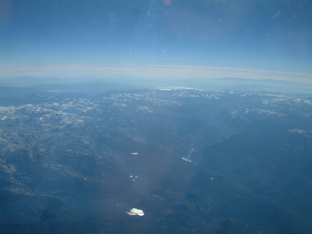
National Parks. Since this was a morning flight, the sun made
photography diffiicult. However, Yosemite and Lake Tahoe were
visible.
Lower left, the rock El Capitan in Yosemite is barely visible on the
left side of the valley. Lower right, El Capitan is center of
frame.


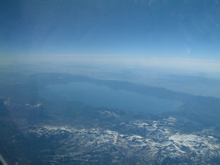
Between Yosemite and Lake Tahoe, more
valleys are visible. In the distance, more mountain ranges are
visible past the Sierra Nevada range.
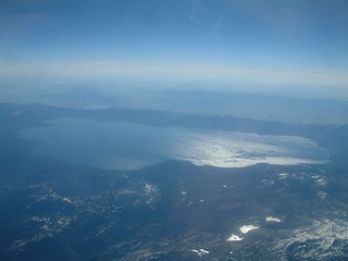
Below left, Mono Lake on the eastern
side of the Sierra Nevada range is visible in the right center.
Below right, is another view of Mono Lake which has been a center of
controversy in the past regarding the City of Los Angeles Department of
Water and Power diverting water and lowering the lake surface.
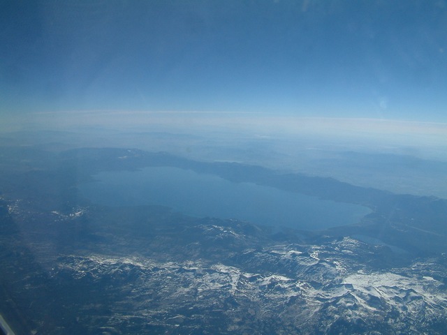
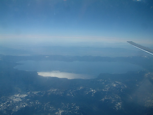
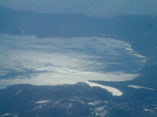
Lake Tahoe is easier to identify with
Fallen Leaf Lake on the right. After the winter 2004 with
almost 38 inches of rain in Southern California, the mountains retained
their snow until July.

After Lake Tahoe, my camera batteries were depleted and I figured I
would buy batteries in Seattle.
We landed at Seattle-Tacoma Airport
only half hour late and I left as soon as possible to check out
downtown Seattle. I took a bus from the airport terminal to the
International Tunnel stop and immediately tried to find batteries with
little luck. My location was near the trolley line, but I walked
up the main street on the bluff overlooking Alaskan way and had lunch
at Pike Place Marketplace. Seattle is know for the renaissance of
brewpubs and that was my first stop for lunch and beer. I
continued my walk down a set of stairs to Alaskan Way along the
waterfront then towards the Space Needle which is where I found an
overpriced set of AA batteries. I had visited Seattle on a family
automobile trip in the early 1970's and remember the Space Needle very
vividly. In 2004, while on the
Amtrak
Empire Builder 75th Anniversary train, we crawled past the Space
Needle on the last leg to King Street Station.
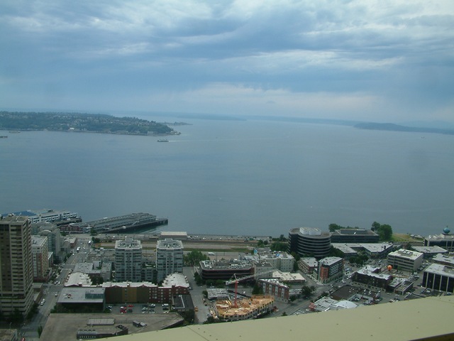
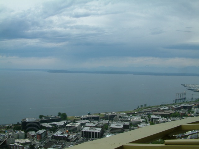
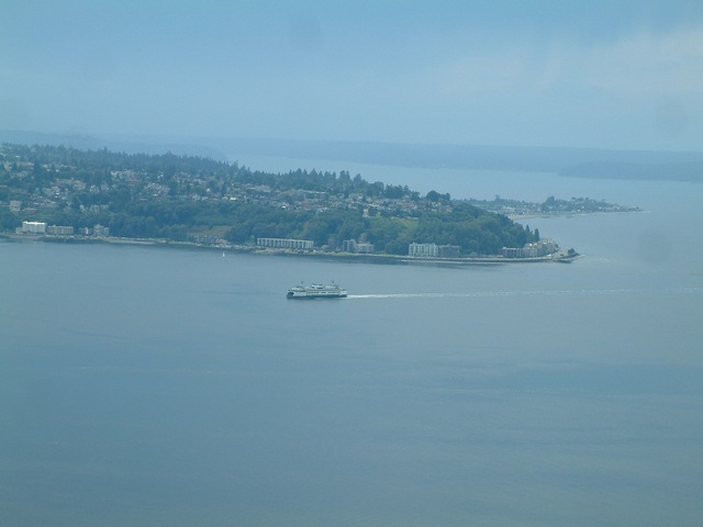
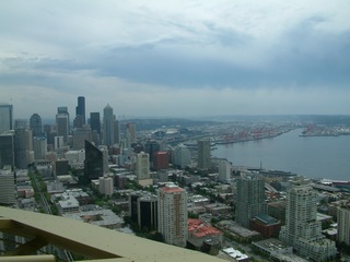
The Seattle Space Needle offers
beautiful views of the area. I had a cloudy somewhat rainy day
with limited view as far as Mount Baker. Mount Ranier, a 14,400
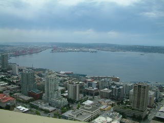
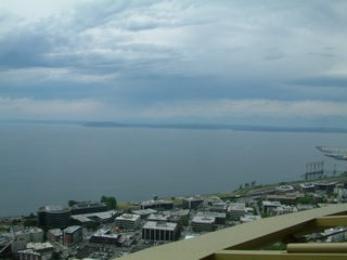
foot volcano to the southeast was not visible. The following 4
photographs show part of the harbor panning across a portion of Puget
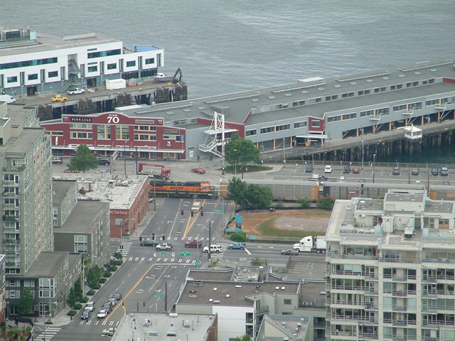
Sound with a ferry visible. Immediately below left, the football
and baseball stadiums are visible in the center west of King Street
Station. A double deck freeway structure skirts the westerly edge
of the stadiums.
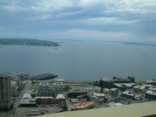

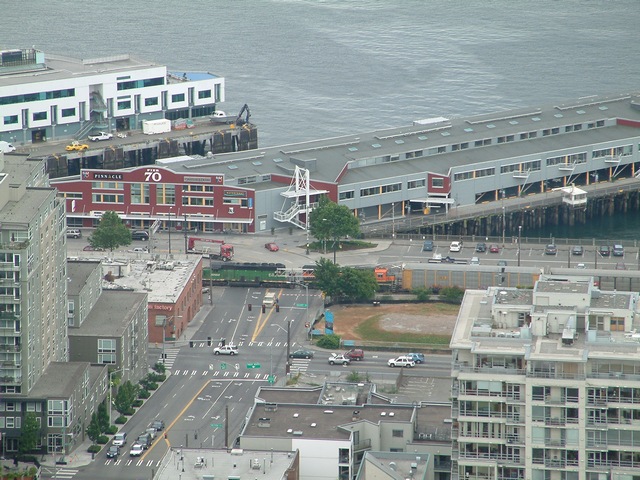
Above right shows the waterfront
trolley line named for former Seattle City Councilman B.B. King.
A trolley car barn is out of view to the right of the parked
trolley. The line parallels the BNSF Railway which sends freight
to points south. The city struck a deal with James J. Hilll to
build a tunnel and remove the tracks from the waterfront. The
north portal is down the line to the left. A new museum is to be
situated on a vacant lot upslope of the railroad. The lot is
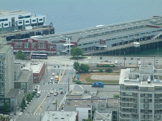
blocked by the buildings in the center of the below views. Pier
70, which marks the northerly tourist business district limit, is
visible in the left center. There are restaurants, commercial
businesses and museums along the Alaskan Way waterfront south to the
King Street area.
Seattle Layover Page 2