

| Traffic Screensaver |
 
|
| Metro Riyadh |
| Echelle MM double / Doppelter
MM-Massstab / Double MM scale |
 |
| Sommaire / Inhalt / Summary |  |
 |
|
| Infos
/ Info |
|
 |
|
| Photos / Fotos / Pictures | |
 |
|
| Véhicules / Fahrzeuge / Vehicles |
|
 |
|
| Backgrounds |
|
 |
|
| Viaducts
/ Brücken / Bridges |
|
 |
|
| Downloads | |
   |
| General
Info |

|
   |
 Le
métro de Riyadh fait partie du projet de transports publics de la ville
de Riyadh ("King Abdulaziz Project for Riyadh Public Transport"). Il
comporte 6 lignes de métro à voie normale, électrifiée en 750V par 3eme
rail: Le
métro de Riyadh fait partie du projet de transports publics de la ville
de Riyadh ("King Abdulaziz Project for Riyadh Public Transport"). Il
comporte 6 lignes de métro à voie normale, électrifiée en 750V par 3eme
rail:• Ligne 1 (Ligne Bleue): Ligne Nord-Sur suivant le corridor Olaya-King Faisal-Batha (38 km, 22 stations) • Ligne 2 (Ligne Jaune): Ligne Est-Ouest suivant la King Abdullah Road (25.3 km, 13 stations) • Ligne 3 (Ligne Rouge): Ligne Est-Ouest suivant Al Madinah Al Munnawwarah Road et Prince Saad Bin Abdulrahman Al Awal Road (40.7 km, 20 stations) • Ligne 4 (Ligne Orange): De King Abdullah Financial District à King Khaled International Airport (Aéroport) (29.5 km, 8 stations, dont 3 stations en commun avec la ligne 6) • Ligne 5 (Ligne Verte): Ligne Nord-Sur suivant King Abdulaziz Street (12.9 km, 10 stations) • Ligne 6 (Ligne Pourpre) : Ligne semi-circulaire de King Abdullah Financial District par Abdulrahman Bin Ouf et Sheik Hassan Bin Hussein Bin Ali Streets (29.9 km, 8 stations, dont 3 stations en commun avec la ligne 4) Les travaux ont débuté en 2014, et doivent être achevés fin 2021 (suivant l'état actuel du projet) Les illustrations graphiques et cartes de cette page proviennent des pages de l'autorité pour le développement de Riyadh (ArRiyadh Development Authority, http://www.ada.gov.sa/ada_e), du métro de Riyadh (http://www.riyadh-metro.com/ , uniquement en arabe) ou du consortium FAST (http://www.fastmetroriyadh.com/) |
 Der
U-Bahn Riyadh ist Teil des Projekts für öffentlichen Verkehr der Stadt
Riyadh ("King Abdulaziz Project for Riyadh Public Transport"). Es
besteht aus 6 normalspurigen U-Bahn Strecken, elektrifiziert mit 750V
über Stromschiene: Der
U-Bahn Riyadh ist Teil des Projekts für öffentlichen Verkehr der Stadt
Riyadh ("King Abdulaziz Project for Riyadh Public Transport"). Es
besteht aus 6 normalspurigen U-Bahn Strecken, elektrifiziert mit 750V
über Stromschiene:• Linie 1 / Blaue Linie: Nord-Süd entlang der Korridor Olaya-King Faisal-Batha (38 km, 22 Stationen) • Linie 2 / Gelbe Linie: Ost-West entlang der King Abdullah Road (25.3 km, 13 Stationen) • Linie 3 / Rote Linie: Ost-West entlang der Al Madinah Al Munnawwarah und Prince Saad Bin Abdulrahman Al Awal Roads (40.7 km, 20 Stationen) • Linie 4 / Orange Linie: Flughafenlinie von King Abdullah Financial District nach King Khaled International Airport (29.5 km, 8 Stationen / 3 Stationen gemeinsam mit Linie 6) • Linie 5 / Grüne Line: Nord-Süd entlang der King Abdulaziz Street (12.9 km, 10 Stationen) • Linie 6 / Purpurene Line: Halbkreisförmige Linie von King Abdullah Financial District entlang der Abdulrahman Bin Ouf und Sheik Hassan Bin Hussein Bin Ali Streets (29.9 km, 8 Stationen / 3 Stationen gemeinsam mit Linie 4) Die Arbeiten sind in 2014 gestartet, Bauabschluss ist für 2021 vorgesehen (Nach aktueller Projektstatus) Die Abbildungen und Karten auf diese Seite sind aus der Seiten der ADA ArRiyadh Development Authority, http://www.ada.gov.sa/ada_e), der U-Bahn Riyadh (http://www.riyadh-metro.com/ , nur auf Arabisch) und der FAST Konsortium (http://www.fastmetroriyadh.com/) |
|
 The
Riyadh Metro is part of the King Abdulaziz Project for Riyadh Public
Transport. It is constitued of 6 standard-gauge metro lines,
electrified with 750V by 3rd
rail: The
Riyadh Metro is part of the King Abdulaziz Project for Riyadh Public
Transport. It is constitued of 6 standard-gauge metro lines,
electrified with 750V by 3rd
rail:• Line 1 / Blue Line: North-south line along Olaya-King Faisal-Batha Corridor (38 km, 22 stations) • Line 2 / Yellow Line: East-west line along King Abdullah Road (25.3 km, 13 stations) • Line 3 / Red Line: East-west line along Al Madinah Al Munnawwarah and Prince Saad Bin Abdulrahman Al Awal Roads (40.7 km, 20 stations) • Line 4 / Orange Line: Airport line between King Abdullah Financial District and King Khaled International Airport (29.5 km, 8 stations / 3 stations in common with Line 6) • Line 5 / Green Line: North-south line along King Abdulaziz Street (12.9 km, 10 stations) • Line 6 / Purple Line: Half-circular line from King Abdullah Financial District along Abdulrahman Bin Ouf and Sheik Hassan Bin Hussein Bin Ali Streets (29.9 km, 8 stations / 3 stations in common with Line 4) The works started in 2014, and are intended to be completed in 2021 (present state of the project) The illustrations and maps on this page are from the pages of the ADA ArRiyadh Development Authority, http://www.ada.gov.sa/ada_e), the Riyadh metro (http://www.riyadh-metro.com/ , in arabic only) and the FAST consortium (http://www.fastmetroriyadh.com/) |
|
   |
| Photos / Fotos / Pictures | |||
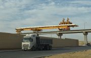
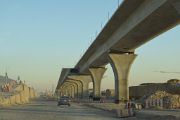
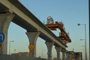
| University road (Line 4) | |||
 |
 |
 |
 |
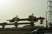
| Northern ring road (Lines 4 / 6) | |||
 |
|||
   |
|||
| Downloads |
| Traffic screensaver (116 Pix) |
 Traffic
Screensaver, TVL file Traffic
Screensaver, TVL file |
 Traffic
Screensaver, GIF files Traffic
Screensaver, GIF files |
   |
 |
Retour
au menu MM en francais |
 |
Zurück
zum deutsche MM-Seite |
 |
Back
to the english MM-Page |
 |
Retour
à la page principale Zurück zum Hauptseite Back to the main page |

