Foothill Rails--No Hands Bridge: Closeup
"No Hands Bridge": A Closeup Look

History & Construction
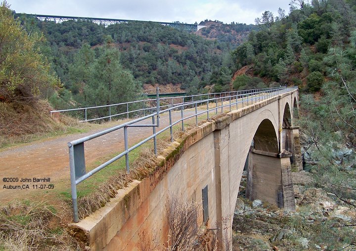
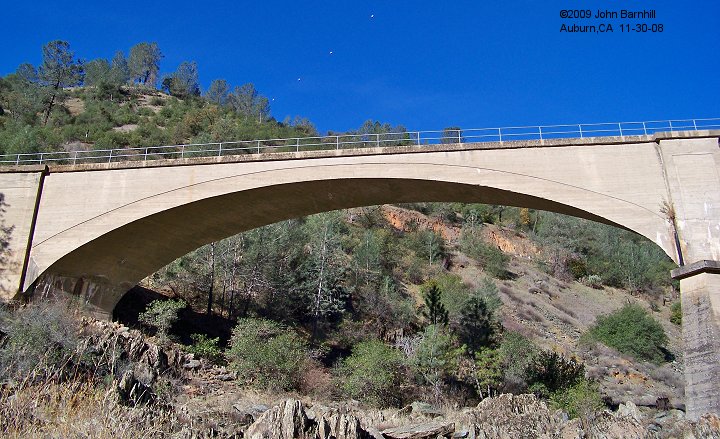
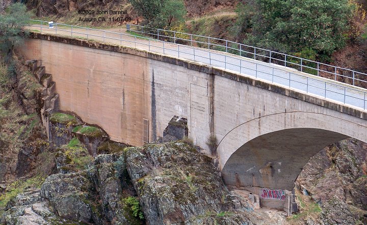
Just donwstream from the confluence of the North and Middle Forks of the American River stands this iconic triple arch concrete
bridge, the "No Hands Bridge". Originally constructed in 1911 for the Mountain Quarries Railroad under ownership of the Pacific Portland
Cement Company, it now serves as a hiking and equestrian crossing of the river. The Bridge was designed by John Buck Leonard and built by Donaldson & Harrelson Co, costs ran
about $300,000.
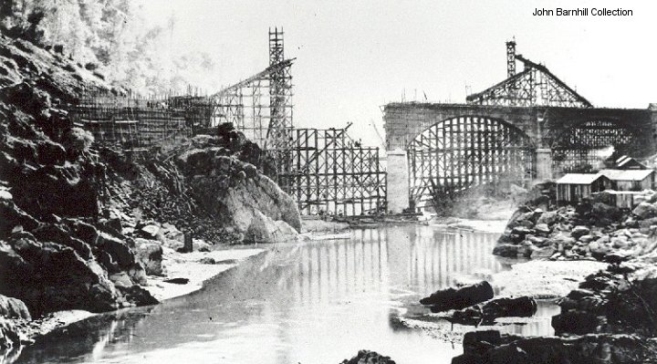
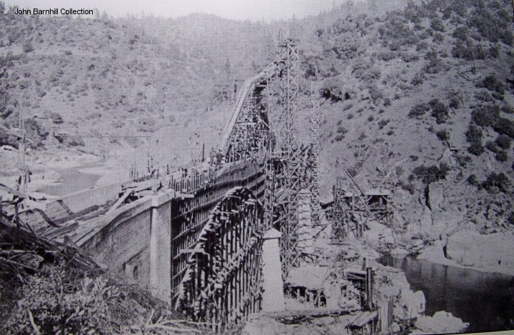
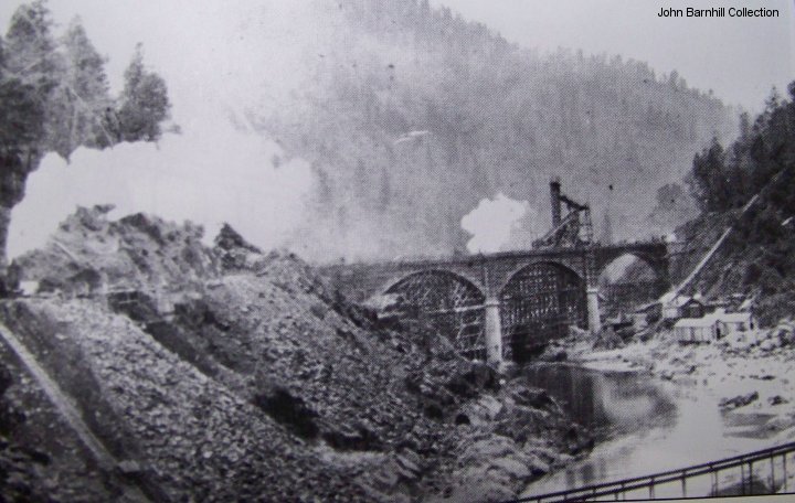
No Hands has had a few incidences in its life. First off was the Nov. 04, 1911 collapse of the El Dorado side third arch during
construction. This killed three men but was found to be a no fault accident. In Dec. 1964, far upriver on the Middle Fork, the first Hell
Hole dam broke while the lake was filling, sending a massive flood down the Rubicon and Middle Fork. This deluge washed away at least two
bridges upstream from No Hands including the Hwy 49 bridge. No Hands survived and was used for auto traffic until a new Hwy 49 bridge
could be completed. 1986 saw massive flooding across the state and the American River was not spared. Water backed up from the diversion
tunnel at the Auburn Dam site and flooded the bridges of the confluence area. When the coffer dam broke, the outrush of water damaged the deck
of the bridge but not irreparably. During ensuing years, erosion was undermining the column that stands in the river causing the bridge to
be temporarily closed from 1997 to 1999.
The bridge was originally only known as the Mountain Quarries Railroad bridge. It was not until long after disuse that it got the name
"No Hands". As the story goes, one of the Tevis Cup riders was asked once, was it scary to ride across the bridge with no hand rails. Her
response was to drop her reins as she did so and say "look, no hands". From there the name stuck. By the way, it wasn't until Sept of 1986
that handrails were added.
Dimensions
- length: 482 feet
- width at top: 15 feet
- arches are 140 feet long, 70 feet high
- height from river to top of deck is approx 150 feet
- 1996 Repair Plan Drawing with lots of dimensions. (.pdf file)
Detail Photos
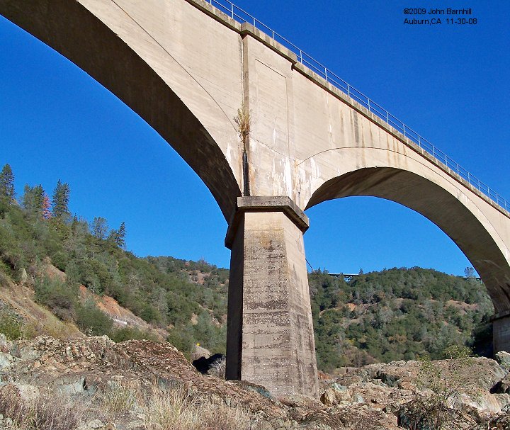
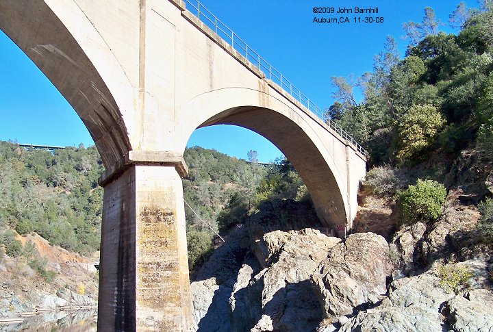
Starting on the Placer Co side of the river, photos 1 through 4 cover the first arch and column.
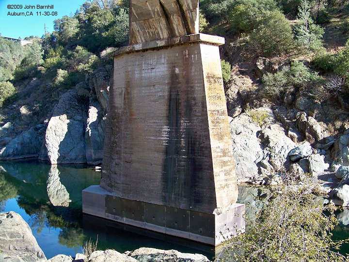
Photo 5 is an upstream closeup view of the first column.
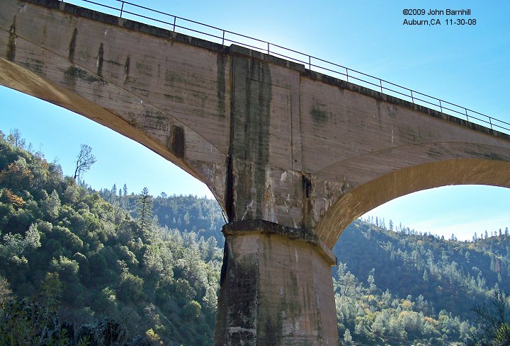
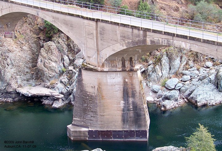
6 is a view of the bottom of the second or center arch. 7 is the second column. Note the reinforcement repairs done.
Photo 8 shows the downstream side of arch #3. This is the arch that collapsed during construction and got rebuilt.
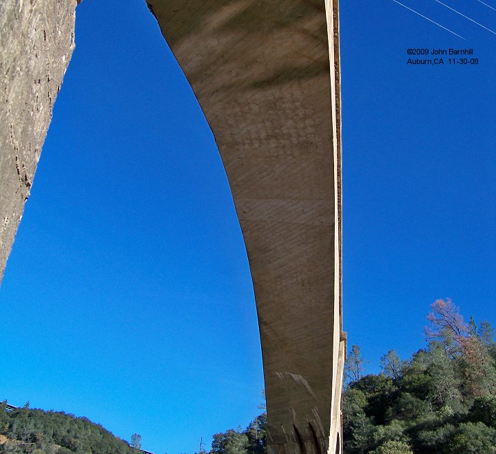
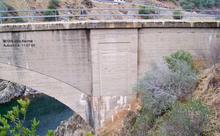
Photos 9 and 10 show the second column and the El Dorado end of the bridge from downstream. 11 and 12 are these same features
taken from upstream.
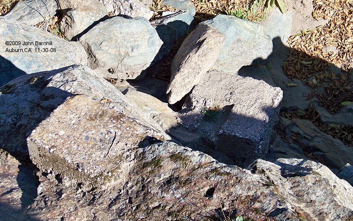
As seen in photo 13 and 14, construction evidence still abounds. A large number of footings for the timbers and a few eyebolt anchors
can be easily found underneath the bridge amongst the rocks of the riverbed.


==================================================
This page and underlying code ©2009-2026 Barnhill Web Design.