


|
I didn't make any improvements to the pictures as I copied them. After all the work and computer troubles this spring, I am just glad to get this page posted in any condition.
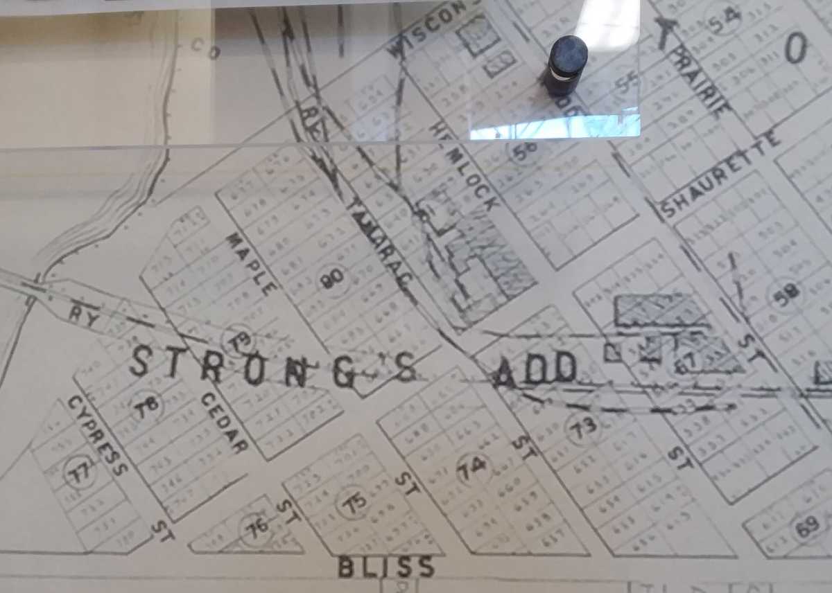
The first set of pictures is from a wall mural in my Aspirus Clinic, it looks like an old city plat map
I didn't give you an overall view of this map. |
.
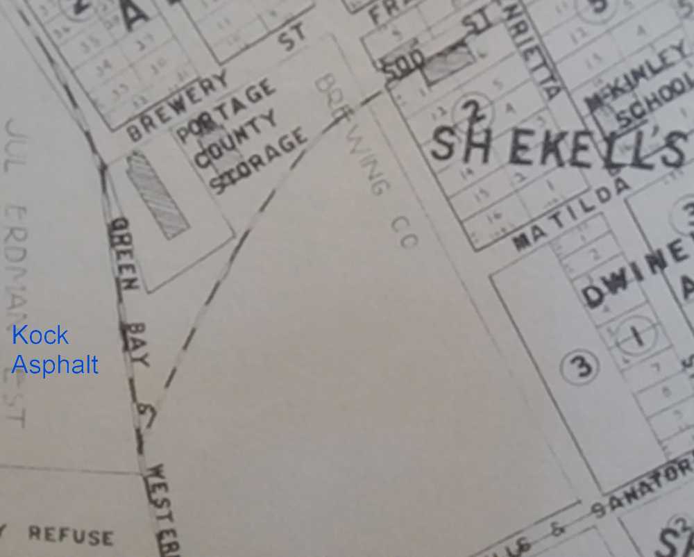
| Stevens Point brewery spur. And I labelled where Koch Asphalt later had a spur for road tar |
.
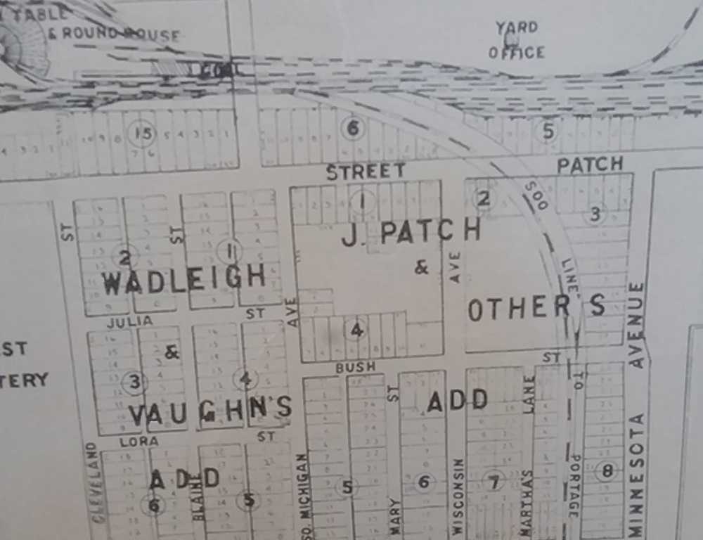
| The roundhouse, and the P-Line labelled Soo Line To Portage |
.
|
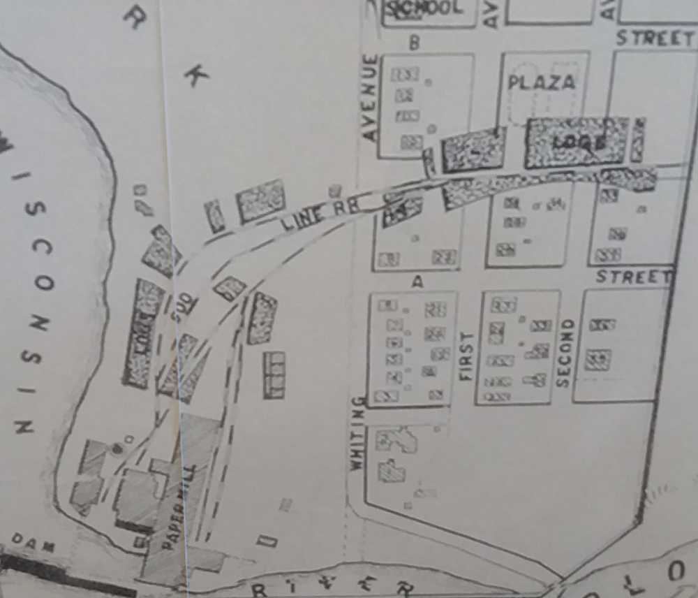
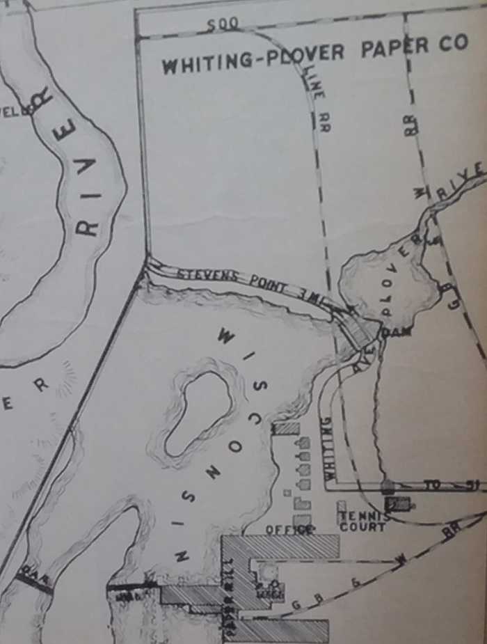
The paper mill in Whiting, and it is small at this time. It would grow to have a wye and spurs to the north into the 'R and K' area in the northwest. |
.
|
Place this picture to the right of the above picture. The Soo Line branched down to the Rag Mill on Tommy's Turnpike. The GBW RR is now part of the Green Circle Trail The Soo Line spur and the track curve by the Tennis Court is long gone. I had a webpage 20 years ago showing the old ROW, I should find it and re-post it. |
.
|
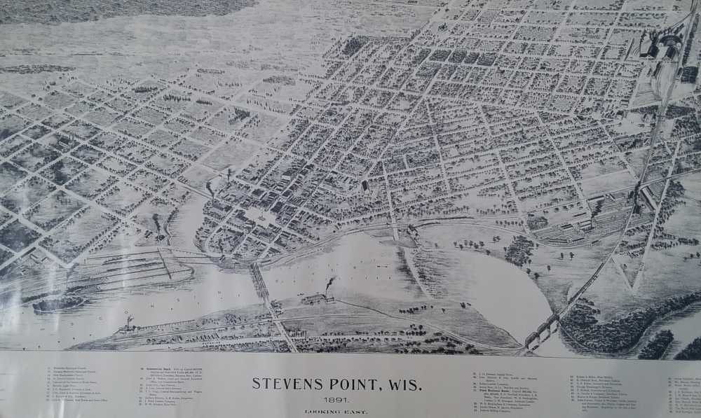
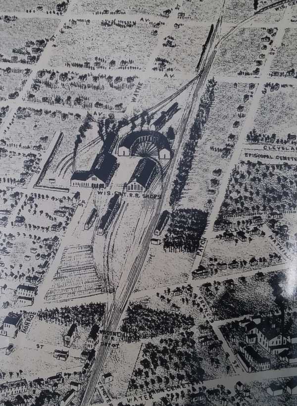
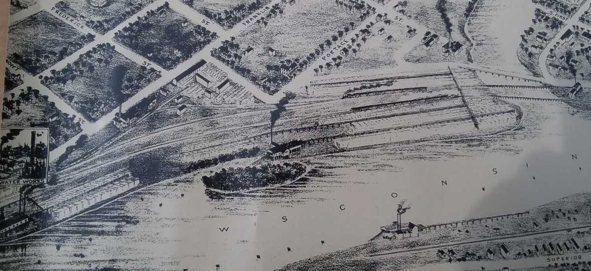
I found this 1891 paper 'birds eye' map while looking for something else in my piles of old pictures and books. I could guess this was a hand-out at some railroad convention, long ago. I would imagine the Portage County Historica society would have some record of this, better than I have. The view is looking east, and North would be on the left of the picture |
|
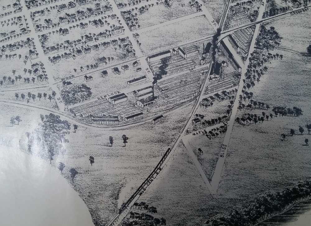
The original is almost 30 inches wide. Here's some close-up views from that 1891 map.
Below, shows track from 2 city blocks west of the depot and west to the Wisconsin River Black Bridge that is just out of sight at the bottom of the picutre |
.
|
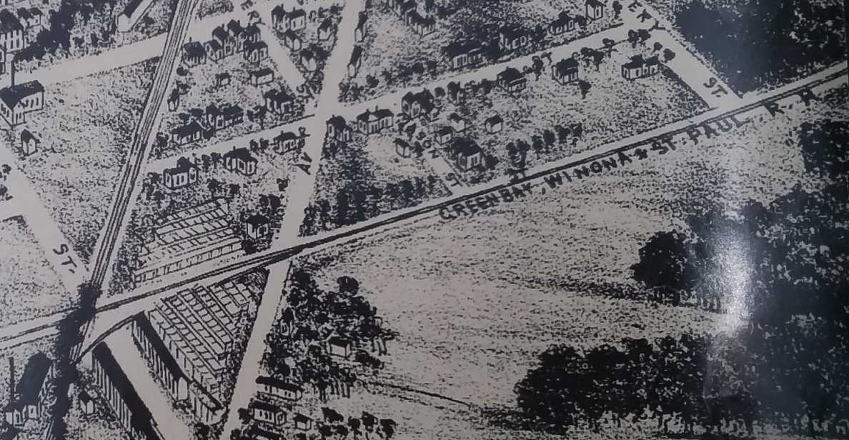
Actually, Green Bay, Winona and St. Paul RR And, surprisingly, there is a curving junction track connecting the Soo and the GBW. A century later, that curve no longer existed, and a city street is there. In the 21st century, that connection would have been really handy, because the WC and CN could have used the former GBW from here to Whiting and Plover instead of what was left of the P-line near Minnesota Avenue. And that would have saved the city from having to fix up the costly highway crossing flashers, and the many complaints of the P-line trains blocking street crossings. |
|
the WC shops and roundhouse. There was very little shown of the yard east of here. |
|
And way over on the left side of the big picture are some sawmills, on both sides of the River. These areas are city park lands now. |
to My Main Index Page on the TrainWeb site.
This page was wrote in July, 2024


