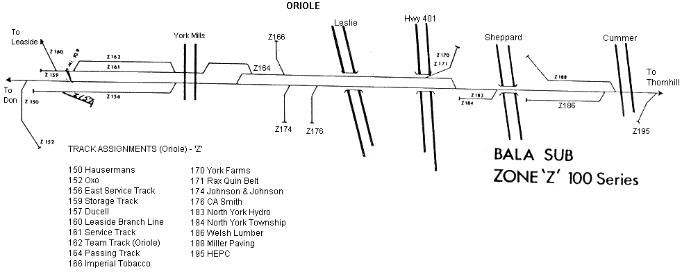
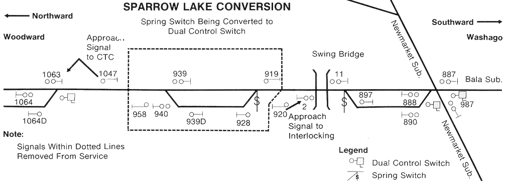
Below are SUBDIVISION NOTES and LINKS for the CNR Zone Maps. All maps are authentic Canandian National Railways track schematic maps dating between 1962 and 1982 for the Great Lakes Region / Ontario Division. The Oakville Subdivision I converted to a Train Dispatcher Computer simulation in 1999 and from CNR maps designed between 1964 and 1968 for the GO Transit expansion on the Lakeshore Corridor.
The Zone Maps are more historical now than ever as most of these track plans have been heavily changed or do not even exist today. Several maps have purposely left out details.
(click on link below or scroll down / use BACK button)


