


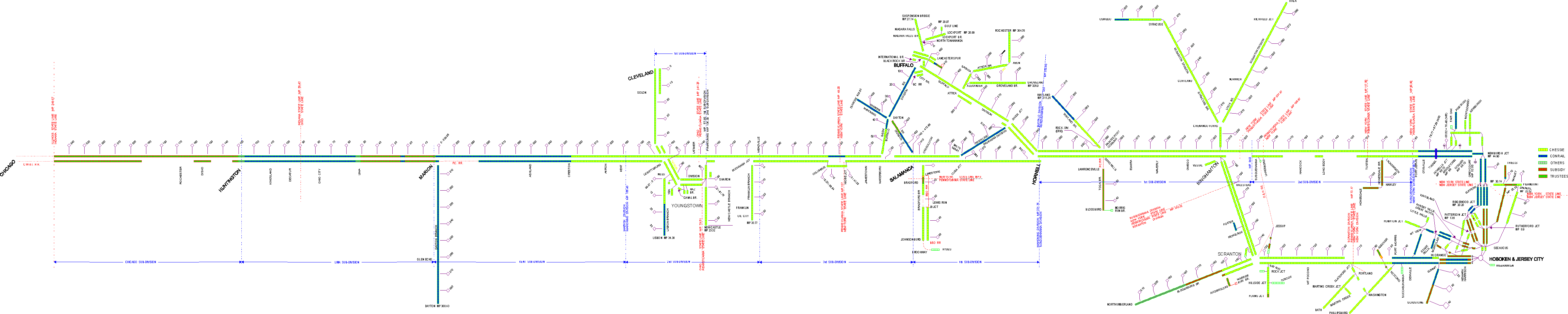
Larry Berger sent me copies of maps he purchased at railroad shows. The maps I thought were interesting were system line maps showing how the EL was to be divided. The first map dated in 1974 shows the way the EL would be broken up when purchased by the Chessie. The second map shows the break up for Conrail and is dated 1976.
From this information, it appears that the EL was talking to the Chessie about purchasing the railroad prior to Conrail. As I remember the Unions killed this proposal. Note that some of the lines were to go to Conrail under this plan. The CSX didn't want the line west of Sterling Ohio.
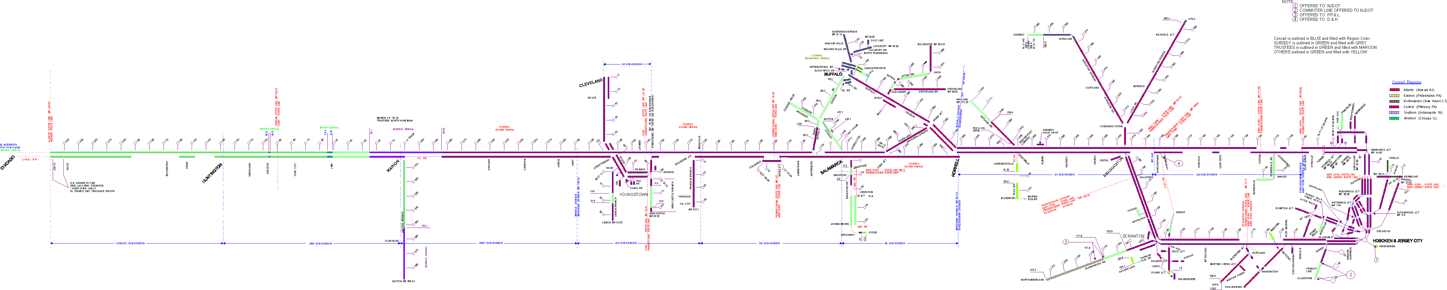
This map is the Conrail take over map with proposed disposition of the line. All lines are shown as Conrail with the following exception. The commuter line out of Hoboken are offered to NJDOT. The following lines were to the trustees.
From the two maps, it appears that the west end of the EL was to be removed.


