We passed more groups of
people descending the trail and asked most of them either how far to go
or how much time to the top. Most hikers replied not quite half
way or several hours. I still had a hard time believing
this. Eventually, the trail and hikers was visible above the tree
line going diagonally upslope and on snow. When we got there,
Maria had a bit harder time moving than I did. At times I had to
help her by holding her hand. Three-quarters of the way there, a
tall young man passed us like we were standing still. I saw that
he had a yarmulke on his head, so I fugured that he was Orthodox
Jewish. Half an hour later, we caught up to this man and I asked
"where are you from" thinking he would reply "New York." Instead,
he replied "Israel." We kept going and soon this guy passed us
again. This journey seemed endless, however we arrived after
3-1/2 hours.


We finally got to a
location where descending hikers pointed to a small hut which was close
to the end. The hut, as it turned out, had a register in it,
which we signed, and many people inscribed on the interior walls
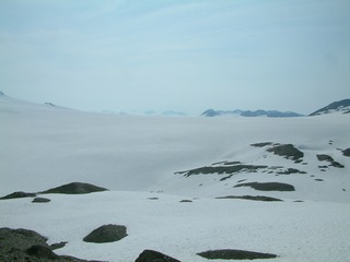
too. The best view point of the Harding Ice Field was actually
about one-quarter mile further up the myriad of trails. After
3-1/2 hours climb, we landed at a spot, dropped our packs and took many
pictures. Other people had descended towards the Exit
Glacier. The young Israeli man we chatted with briefly earlier,
now joined us and we chatted for 20 minutes. He told us that he
was travelling in Alaska for 3 weeks with a 90 litre (volume)
backpack. He was on this trail with minimal belongings. We
determined that we had passed him on the Exit Glacier Road as he was
hitchhiking. Channan told me that he had finished undergraduate
college with emphasis in law, but he was going to do something
else. I offered him a ride from the parking lot to the Seward
Highway if we saw him hitchhiking again. He also plans to visit
southern California and I offered him to sail on my boat. We took
pictures of one another and exchanged email addresses. He then
took off back towards the bottom and we never saw him again. I
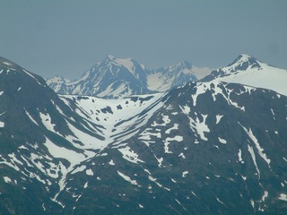
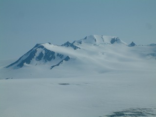
knew we could not catch him. Notice the peaks way in the back of
the below photographs, near in the above photographs, nunatak in native
american language, which means "lonely peaks."


Below left, looking down at Exit Glacier leaving the Harding
Icefield. Below right, a cirque, or bowl shaped area carved by
glacial action. Of course, as my camera batteries were in need of
change, we heard people excitedly yelling that there was a bear down on
the Exit Glacier. Sure enough, the bear was running across the
glacier then down it. He looks like a dot in the pictures.
He was easily 1500 feet away when I spotted him. Flying over
Harding Icefield years ago, another bear was running somewhere between
Exit Glacier and Aialak Glacier.
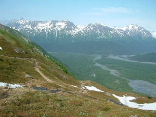
Below, the mountains to the east, towards the Prince William Sound.
Note the hanging "u" shaped valley, the same one in the above left and
below left photographs.


Finally after an hour on top, we set
out to descend to our iron horse with rubber tires. For those of
you who have never climbed something like Mt. Whitney, the descent can
be even more brutal on your legs than the climb. The first mile
and a half of descent was easy with some flats and the snow traverse, I
found out could be easy and fun by sliding on your boot heels or
glisading. Glisading calls for some amount of balance so you stay
upright without falling on your face or butt. Maria had a harder
time which I could not understand as she is lean and thin. I
could go ahead and wait and watch her catch up to me. The late
afternoon descent allowed for some great photographs since the sun
angle was more favorable. We kept up a nice pace once off the
snow, rested occasionally and lamented the length of time it was
taking. Since sunset was around 11:30 PM, other hikers were
starting in the very late afternoon and we encountered maybe 10 of
them. The spot where an animal concerned us was passed and
occasionally we got a glimpse of the parking lot, which had fewer
cars in it. Still it seemed like a major amount of time still on
the trail before we rejoined the asphalt trail. From the trail
junction to the car must have been almost half a mile, so I calculate
our round trip hike was closer to 9 miles and took 6 hours and 40
minutes.


I felt so much relief opening the car and sitting on a
cushion removing my now broken in Red Wing boots. These boots
never got wet and my feet only felt anything resembling wear and tear
on the descent and only towards the end. Our plan now was to find
the restaurant known as Salmon Bake. I had not questioned Marliee
enough or listened closely enough to determine exactly where the
restaurant was. As it turned out, we passed it several times
taking almost an extra half hour of driving back and forth to find
it. The Exit Glacier Salmon Bake is just a few hunderd yards west
on
the Exit Glacier Road from the intersection with the Seward
Highway. The log cabin type building has a sign that says "Good
Food, Cheap Beer." As it turned out, the place is, to me,
expensive, although the food was good. I ordered the Salmon plate
which had a generous portion of fish. The vegetables were sorry
looking, overcooked and few in number. In my last food intake
reorganization about 5 years ago, I became a rabbit food
connesuer. What could be better than Alaskan halibut or salmon
added to a giant salad? I have gotten good at cooking fish on my
barbeque. At least Alaskan Brewing Summer Ale was on tap and
cold. These were my first two of countless Summer Ales while on
this trip! We did have reasonably good service here at Salmon
Bake. We paid the tab and drove back to the Ballaine House.
Maria was going to take a late morning bus to Denali Park and hook up
with friends and I had a reservation to go halibut fishing with Semaka
Charters.
Page 7 Alaska Railroad Coastal
Classic