


Tracing the ROW
of the DL&W railroad in South Waverly PA.
By Scot Lawrence

There are a LOT of images on this
page! I apologize to dial-up users!
but this was the best way to do
it...
The Delaware, Lackawanna
& Western Railroad ran from New York City to Buffalo.
She came through "The
Valley" (Waverly, NY, Sayre & Athens PA) in the 1880's and had a Passenger
station
on Fulton st. until
the end of passenger service in the 1950's..
The DL&W and the
Erie railroad were rivals who paralleled each other through much of the
Southern Tier of New York.
In 1960 the 2 railroads
merged to form the Erie Lackawanna railroad.
The Erie route was
retained in this area, and the DL&W line was abandoned.
The line we are going
to trace has only been gone since 1960! but much of it is totally obliterated
because Route 17
was built on a good
deal of the ROW of the DL&W in the early 1970's.
There is however a
small stretch of DL&W ROW still visible in the valley, this is the
line we are going to look at.
(oh..just in case you arent sure,
"ROW" stands for "Right of Way"..it means the actual location, or roadbed,
of the former tracks)
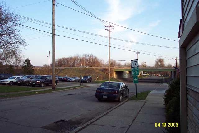
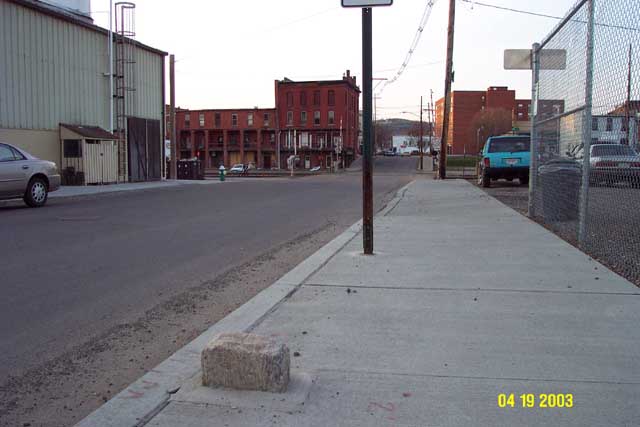
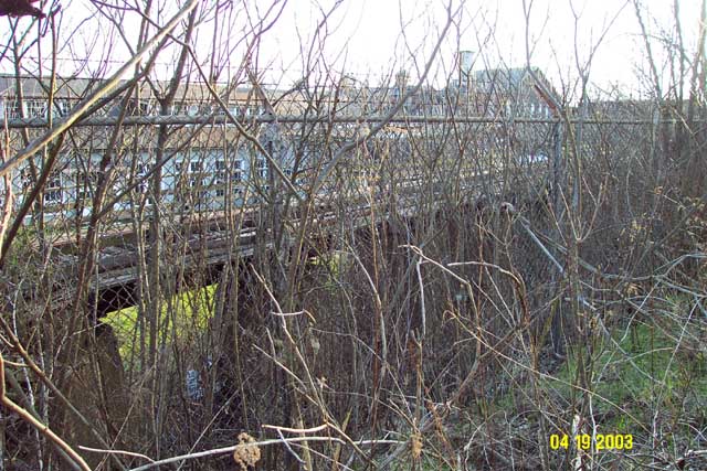
Lets start at the
site of the DL&W station on Fulton St.
Im looking South,
the building on the Right edge of the photo is Yanuzzi's resturant.
Thats route 17 passing
over Fulton St.
The DL&W ran East
- West exactly where the route 17 bridge is today.
except the tracks
were at "street level" with Fulton st..not elevated as route 17 is today.
The station was in
the North East corner..basically in that parking lot across the street.
At this point, we
are in South Waverly, PA.
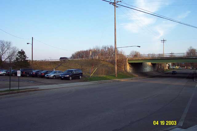
Here is a closer view
of the same area. still looking South.
The station was essentially
where that black mini-van sits..
or it might have been
a bit behind the mini-van,
perhaps buried inside
the route 17 fill. but it was at that NE corner of the tracks & Fulton
St.
There is no actual
ROW visible through here, because route 17 totally wiped it out.
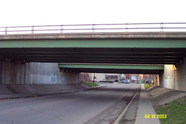
Walking south on Fulton
St, under the route 17 bridges, and now looking North towards
Waverly, NY.
The station site is
where that telephone pole is just past the second bridge, to the right
(East)
of Fulton St. The
DL&W ROW crossed Fulton st, at grade, basically right under these bridges.
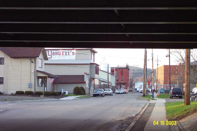
A few steps further
North. Still under route 17. (still looking North)
Yanuzzi's is in PA.
Those brick buildings in the background are in NY!
Im probably standing
right on DL&W tracks at this point.
Further north still,
and leaving the DL&W behind for a few minutes..
See that stone sticking
up out of the sidewalk? that is the ACTUAL NY/PA border!
there is a thin line
etched in the block. I am standing PA as I take this photo, and right on
the
other side of the
block it is New York State..
We are coming up on
the Erie railroad..today still in use as the Norfolk Southern Railroad's
Souther Tier main.
D&H/CP trains also still use this line.
(it is owned by NS,
it was Conrail from 1976-1999)
To the left is the
Leprino Foods plant.
the state border passes
THROUGH the Leprino buildings!

Now we are fully in
Waverly, NY. This is the Erie crossing at Fulton St. looking North.
That White ford escort
is sitting on the Passenger platform of the
Erie's Waverly station.
the station filled the space between the tracks and the ancient
brick hotel. (originally
the Wagner Hotel) up the little hill is the corner of Fulton and
Broad st, in beautifull,
thriving, downtown Waverly NY.
(Waverly is my home
town, so I can say that! ;)
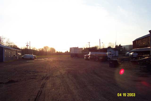
The Southern Tier main
was VERY busy today! (Saturday April 19th, the day before Easter)
I heard probably 12
trains roll through town today! as I was driving on Broad St. extenstion
I paced a D&H/CP
train with EIGHT engines!
Seven CP SD-40-2's
and one Cotton Belt GP40..but I couldnt get into positition to get any
pictures..
naturally, while I
was right here at the tracks, no trains came through!
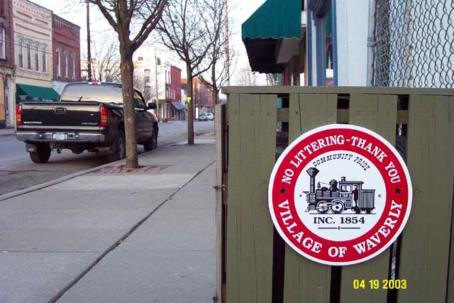
Taking a quick walk
up to Broad st. check out Waverly's town logo!
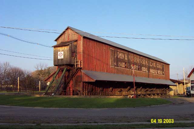
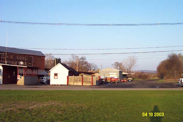
Ok, getting back to
the DL&W. Now we are maybe 1/2 mile further East from Fulton St.
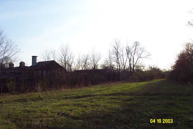
This is the "John
H. Murray & Sons DL&W Coal" facility.
This is an ancient
Coal trestle. one of the Valley's major remaining railroad artifacts.
coal was brought in
by hopper cars *inside* the building, then transferred to trucks
from the chutes still
visible along the bottom. This view is looking East.
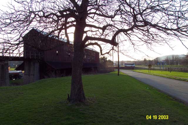
Here is the north
side of the structure, looking West.
The bus is heading
east on Route 17.
The ROW is on the
other side of the structure, the South side.
There is still a track
leading up into the building! view is looking west.
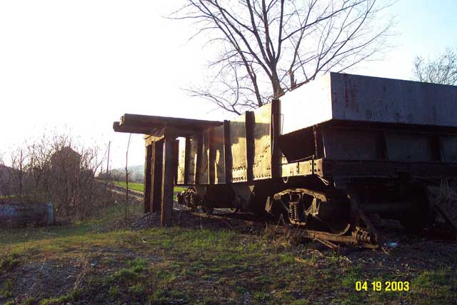
And at the end of
the track sits an ancient hopper car.
There are no identefying
markings on the car.
That car has been
there since the DL&W tracks were torn up!
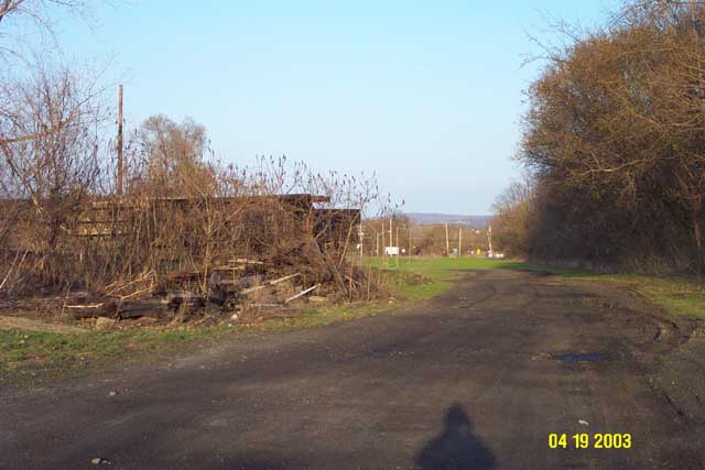
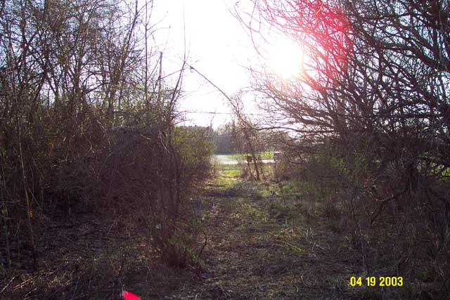
Here is the ROW of
the DL&W again. Looking east.
The ROW passed behind
the coal trestle, to the South of it.
That black road heading
off into the distance is the actual DL&W ROW.
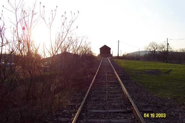
This is the Western
end of the tracable DL&W ROW through South Waverly.

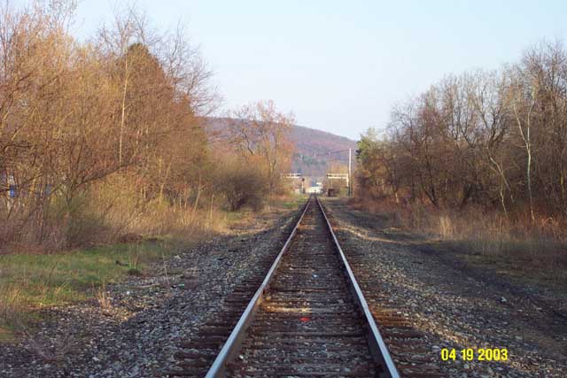
Here is a telephoto
view from the same position. still looking East.
We are looking straight
down the ROW towards "Bananna curve" in the distance.
Walking a few feet
East, and turning around 180 degrees looking down the ROW towards the west.
The coal trestle is
to the right (north). I am standing directly on the ROW.
there is a large grass
field next to the South Waverly Bourough hall. between the hall
and route 17. (in
the last 2 photos above, I am standing in this field)
This field has been
the home of the annual S. Waverly carnival for many years.
The ROW passed directly
through this field. The ROW leaves route 17 at the NorthWestern
edge of that field.
The boxy building
in the background is the Leprino plant. We are looking straight west
towards the Station,
which was just south of the Leprino plant.
A few more feet East..looking
East, at the East end of the coal trestle.
That hopper car is
hidden behind the brush to the left (north) of the ROW.
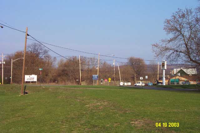
Now we are almost
to "Bananna Curve" (Keystone ave.)
looking East.
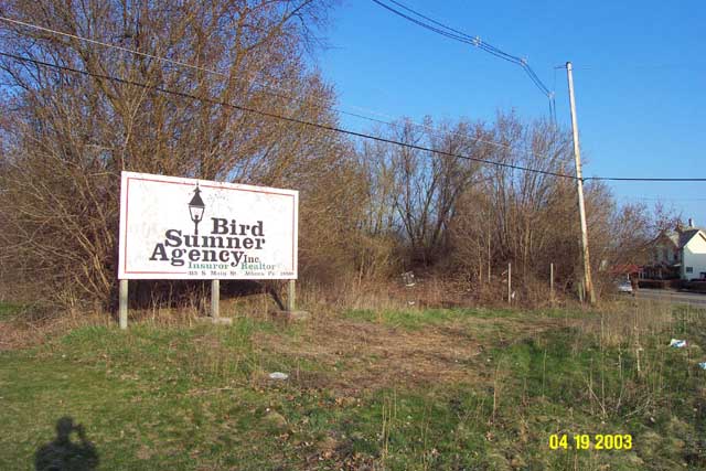
The ROW passes between
the white "Bird Sumner agancy" sign on the left,
and the Blue "birthright
of Sayre" sign in the center.
Pizza Hut is behind
the green house on the right edge of the photo.
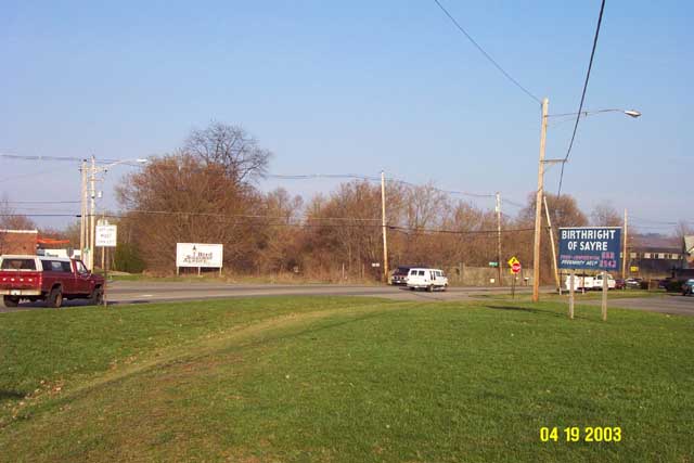
closer...now you can
see where the ROW passes into the trees, just to the right of the white
sign.
The ROW was elevated
at this point, the tracks passed OVER Keystone ave on a bridge.
Here is a view off
to the north side of the ROW, looking south.
The Bridge passed
right in front of this scene, the tracks heading off into the trees.
You can just see a
bit of the red roof of Pizza Hut.

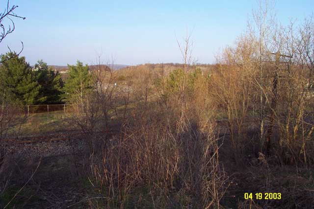
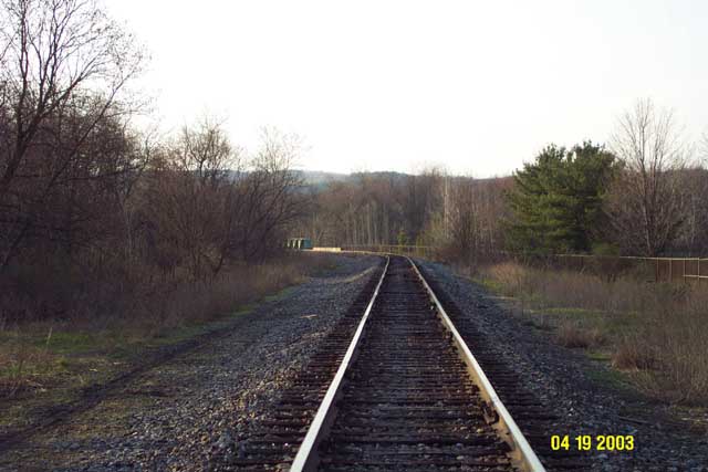
Now we head into the
trees, and the actual ROW becomes visible again.
This is looking East.
Pizza Hut and the Ajax Foundry are to the Right. (south)
Paxar Inc. is to the
Left.(north)
Notice the DL&W
telephone pole! there are 2 of them still standing on this stretch.
they were along the
South edge of the ROW.
Turning around and
looking West. Keystone ave is visible at the end of the trees.
Walking further East.
looking West down the ROW.
(you can see that
telephone pole again in the background)
Ajax foundry is the
building in the background.
At this point a short
connecting track diverged south from the DL&W and connected to the
LV-Erie line.
Look what is behind
Ajax Foundry! A wood trestle with track! This track would have come off
of the connecting
track to the LV.

Walking further East,
looking East. At this point the ROW is elevated up above the surrounding
land. it drops down
sharply on both sides.
End of the Line! This
is where the DL&W ROW reaches the LV-Erie track.
(The LV-Erie track
is the short connecting track between the Sayre yard and the Erie in Waverly.
It was originally
the LV's connection with the Erie. Today it is still used by Norfolk Southern
to run trains between
the Southern Tier main in Waverly, into the Sayre yard.)
This view is looking
East, the DL&W would have passed over the LV at this point on a bridge.
the DL&W is obviously
high above the LV at this point.
The Guthrie Inn is
just out of sight on the right edge of this photo.
Across the LV tracks
the DL&W ROW is lost in the Route 17 exit ramps.
The DL&W would
have continued East from this point, probably crossing Spring St. on a
bridge,
then crossing
Shepards creek (also known as Cayuta Creek) then finally passing over the
North end of the
LV Sayre yard. Based
on recent Aerial photos (linked at the bottom of this page) it is now obvious
to me
that the DL&W
and the current route 17 did NOT cross the Sayre yard at the same point!
The DL&W bridge
would have been a bit South of the current Route 17 crossing.
Notice the second
DL&W telephone pole on the right side of this picture.
Scrambling down the
hill, down to the LV tracks.
Here is the view looking
straight down! ;)

From the same position,
looking West. This hill is the elevated DL&W ROW..
the DL&W would
have crossed over the LV on a bridge at this point.
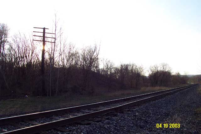
This is the Eastern
end of the tracable DL&W ROW through South Waverly.
Same position, looking
East. The DL&W ROW is lost in the exit ramps of route 17.
Same position, looking
South. Toward the Sayre yard.
Same position, looking
North, towards Waverly.
The green bridge carrying
the tracks over route 17 is just visible.
Last photo of the
tour!
A view of the elevated
DL&W row, a few feet to the south from the previous images.
looking North-West.
there is the second
DL&W telephone pole again. still on the south side of the ROW.
That pole is visible
as you drive by the front of the Guthrie Inn, and past the route 17 exit
ramps.
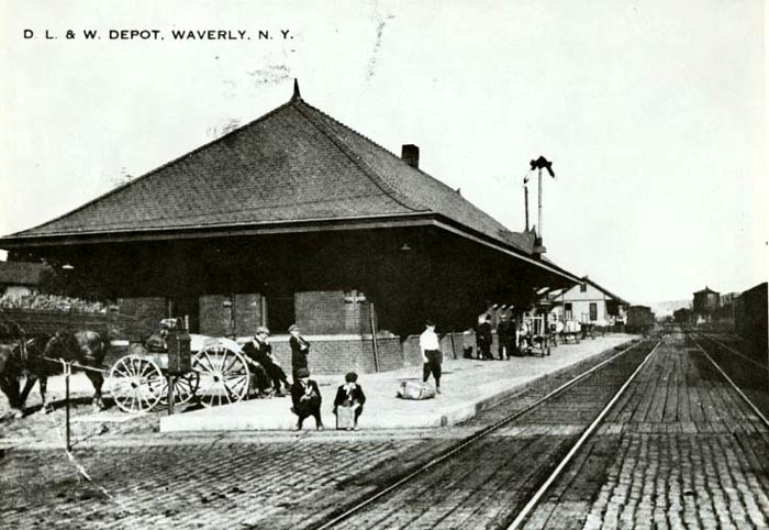
Here is the DL&W
station. Even though the photo says "Waverly NY" it was actually located
in S. Waverly PA.
This shot is looking East down the DL&W main..
Fulton st. is crossing
the tracks right in the foreground of this photo.
Today the Route 17
bridge crosses over Fulton st at this spot.
Here is the North
end of the Sayre yard. (looking North up the LV main)
the LV train is heading
South into the yard, going over the bridge over the creek.
There is a train going
over the DL&W bridge in the background.
and in the far distinance
is the Erie bridge.

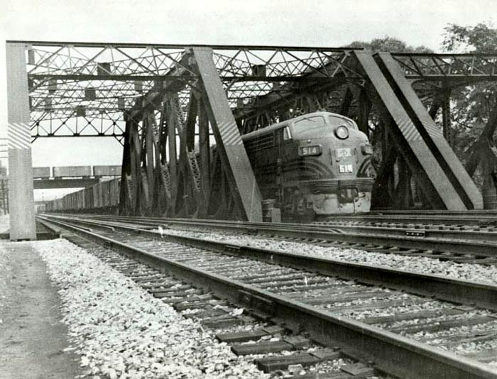
and here is the same
scene, but up next to the DL&W bridge. Still looking North.
those are Lackawanna
FT's!
again the Erie bridge
is in the background.
(check out the razor-sharp
ballast edge on the LV!)
Well thats it for now..hope
you enjoyed this look at the last sad remnants of the DL&W in the valley.
Sometime later this
year im going to wander over by the yard and see if I can find any traces
of the DL&W bridge
over the Sayre yard. If I find anything I will add then to the end of this
page.
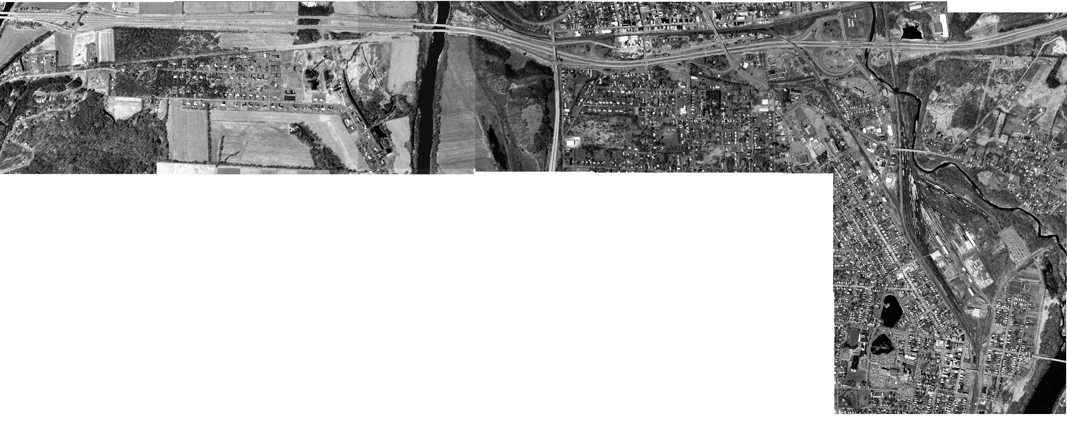
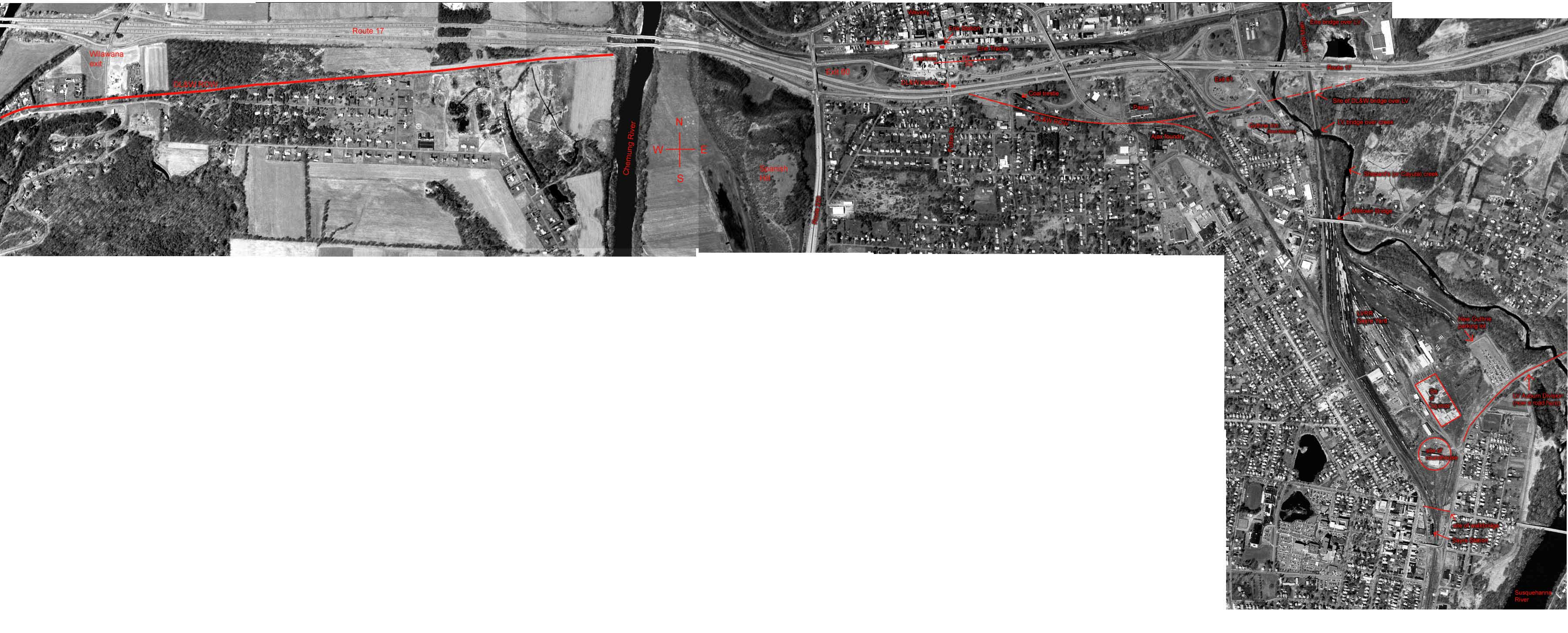
Check out this aerial
photograph!!
(again I apologize
to the dial-up users..these images are HUGE! but I want then that way to
really
display the information.)
This is a modern aerial
photograph. (actually several that I pasted together!)
taken March 27, 1995.
The DL&W ROW is
quite visible.
Here
is the un-marked photo.
Here
is the same photo, but I drew in the ROW and other landmarks.
(I spent lots of time
carefully drawing all the ROW's and labels with nice neat red letters..
it all looked nice
and perfect, then I saved it and JPEG compression totally distorted and
blurred my labels! :(
oh well..its still
mostly readable..I might re-do it...someday.
check out the other
tours.
1. Van
Etten junction on the LVRR
2. Sayre
PA yards on the LVRR
3. DL&W in S.
Waverly (this page)
Back
to Lehigh Valley Railroad Survivors
Scot Lawrence
Rochester, NY (grew
up in Waverly! ;)
April 2003
sscotsman@yahoo.com


