Phase 2 Other Options Studied
Environmental planning is nearing completion for phase 2 of the Expo Line, the rest of the way from Culver City to Santa Monica. If all goes well in planning and funding, final design and construction could begin in 2010 as phase 1 is completed, with opening 2014-15. Following are all of the Expo Construction Authority's options that were studied, and their timeline. Our position on the route for phase 2 has been that we expect environmental study of all appropriate route options with comprehensive engagement of neighboring communities in planning route details and mitigations. Full study of the alternatives' station locations, cost, travel time, ridership, and environmental impacts and mitigations enable an informed decision. We then endorsed the existing railroad right-of-way route based on documentation by the Draft Environmental Impact Report (DEIR) that it is faster, much less expensive, has greater ridership, and has fewer environmental impacts. Original Route Options
Added Options
*From 10/22/07 Phase 2 Community Meeting Presentation. An alternative going further down Venice Blvd. would not fulfill the purpose of the Expo Line going to Santa Monica, especially to serve the huge number of westbound commuters jamming the Santa Monica Freeway to jobs in West Los Angeles and Santa Monica. Preliminary Analysis (from 3/26/08 Presentation, slides 22 and 17) |
|
Alternative |
2030 Phase 2 New Boardings |
Transit Time: 7th Metro to Santa Monica |
Escalated Capital Cost (M) |
Full Parcel Takes |
|
Exposition ROW |
41,400 |
44 mins |
$1,509-$1,695 |
1-5 |
|
Venice/Sepulveda (aerial) |
34,700 |
49 mins |
$1,912-$2,095 |
21 |
|
Expo Phase 2 Projected Schedule (updated 10/22/07, 4/7/08, 12/4/08, 2/5/09 (Source and PDF) |
|
Public Scoping Meetings |
February/March, 2007 |
|
Definition of AA/DEIS/DEIR Alternatives |
|
|
Public Hearings on Draft |
|
|
Board Adoption of Preferred Alternative |
|
|
Final |
|
|
Construction begins |
2010 |
|
Revenue Service |
2014-15 |
Venice-Sepulveda Option
|
|
 |
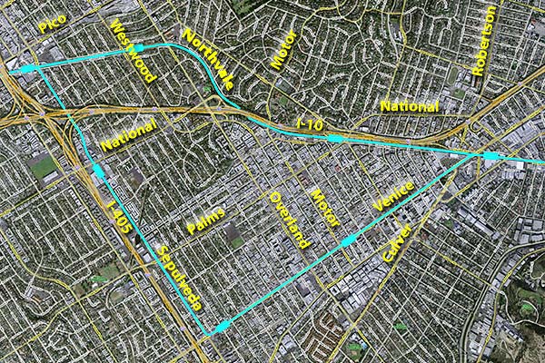
Venice-Sepulveda would leave the Exposition right-of-way to run along Venice and Sepulveda Boulevards (lower line on map, stations as wider rectangles). Venice Blvd. in the 2001 Draft EIS/EIR (Figure 2D-7, left) would have been at-grade and lost one traffic lane in each direction. (click images to enlarge) |
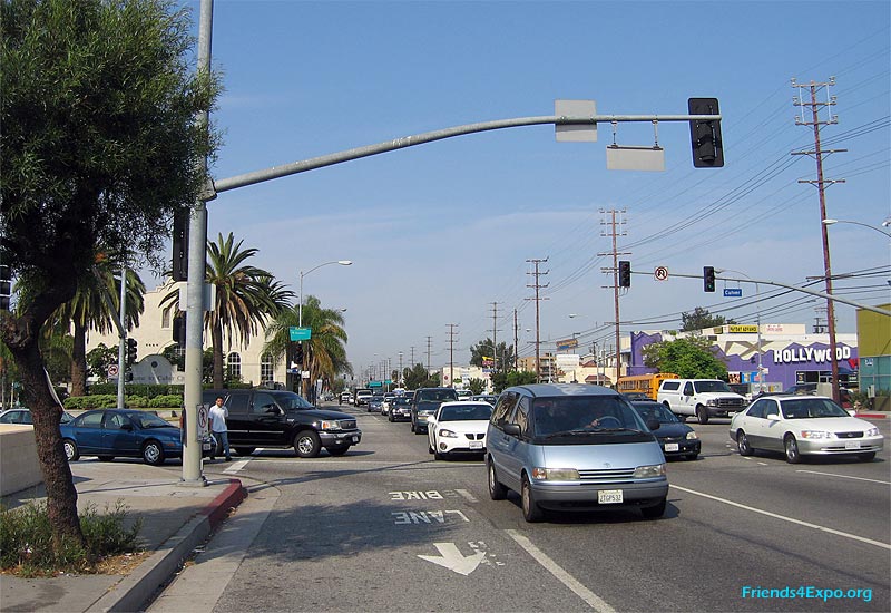 |
Here is Venice Blvd., looking west at Culver Blvd. Constricted right-of-way and double left turn lanes between Culver and Robertson Blvds. make this very congested. The current option would not remove lanes, thus requiring bridges here on Venice over Robertson-Culver, and at Overland, Kelton-Sepulveda, and on Sepulveda from Palms to National. |
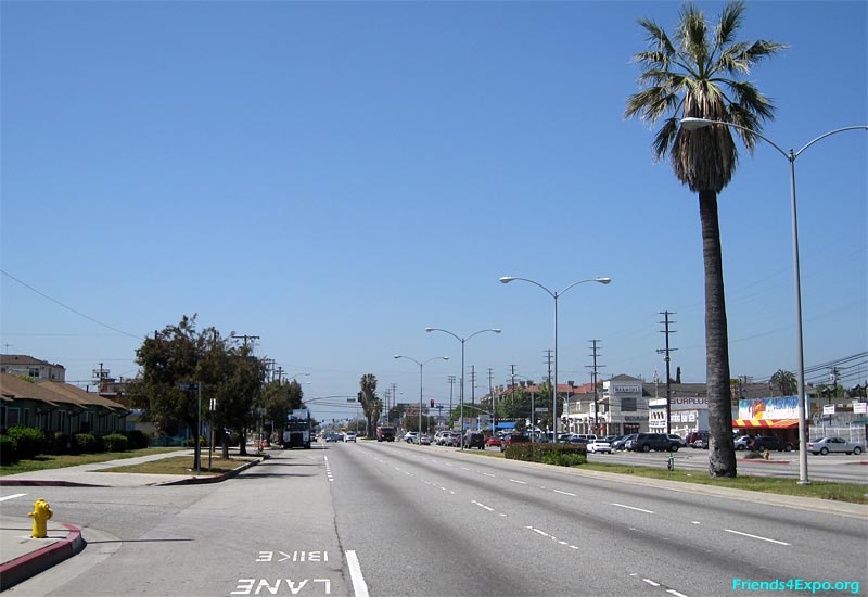 |
A station was proposed here east of Motor, where front parking (right) and wide parkways (left) — and property takes — would be used to widen the median for at-grade tracks. |
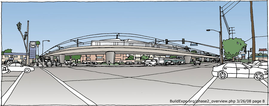 |
This is the proposed bridge over the congested intersection of Venice and Sepulveda Blvds., with aerial station to the right. These bridges, its mile-longer route, and property takes make this route around $465 million more expensive (2008 $) and 4 minutes slower. (Draft EIR Table 6.2-2 and Page 2-36) |
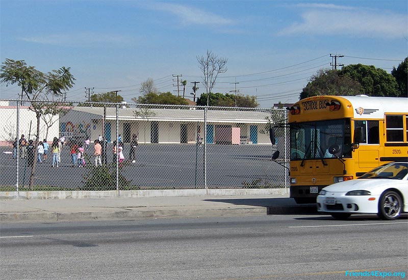 |
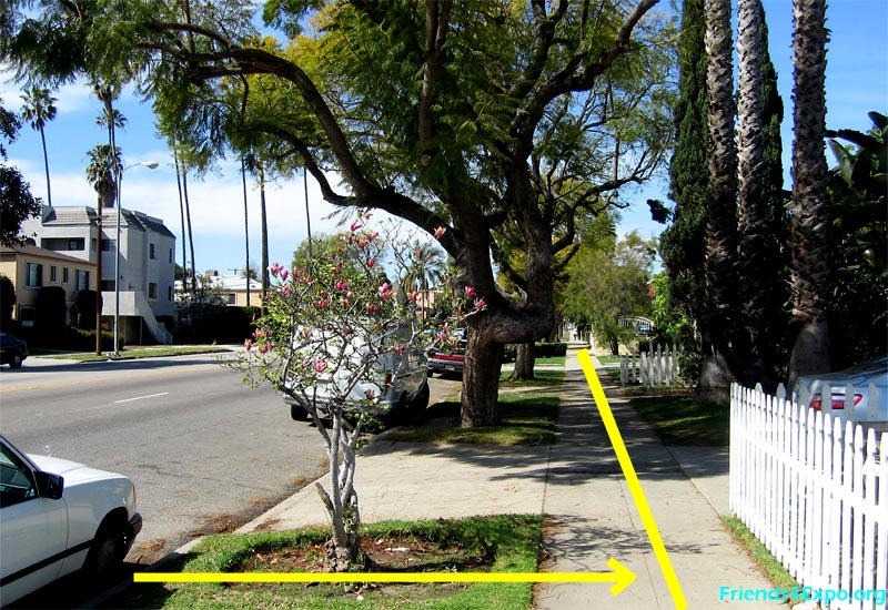
Charnock Road Elementary School borders Sepulveda Blvd. as Overland Ave. Elementary School borders Overland and Northvale Avenues. Tracks would pass here at-grade in the median of Sepulveda Blvd. |
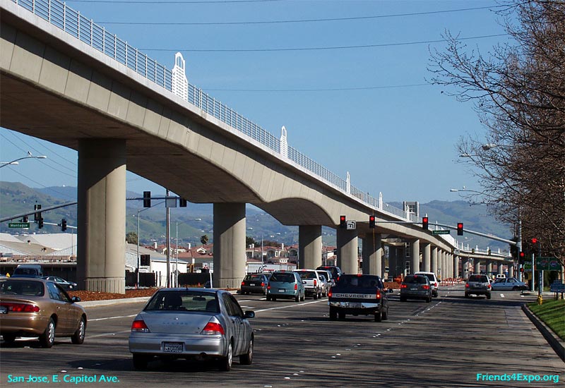 |
This aerial structure with center-platform station on East Capitol Avenue in San Jose gives an idea how the proposed grade separations could look on Sepulveda from Palms to National, with aerial station south of National. |
 |
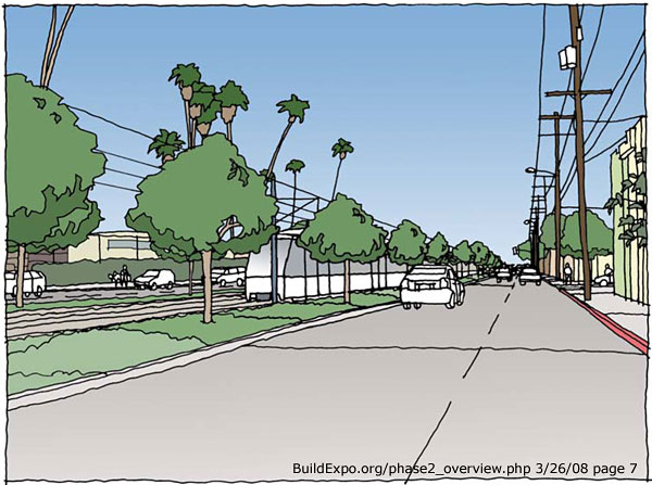
At-grade tracks in the median of Sepulveda Blvd. north of the freeway, plus an additional southbound lane, would require loss of all properties along the east side of Sepulveda, north of I-10. (Draft EIR Appendix G, sheet RW-009) |
Olympic Option
|
|
 |
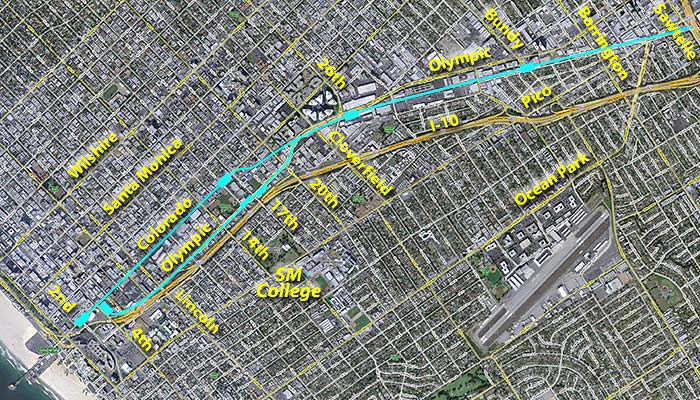
Olympic would follow the median of Olympic Blvd. west of Cloverfield, then go aerial along the north side of the I-10 freeway from 11th to its terminus at 4th and Colorado. But it would conflict with the landmark coral trees. Both options propose a third station at 17th Street to serve the mid-city area, Santa Monica College to the south, Santa Monica-UCLA Medical Center to the north, and a new Transit Village around Memorial Park. |
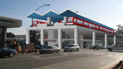 |
The Santa Monica terminus station for the Olympic option would replace the Sears Automotive Center on the southeast corner of 4th and Colorado with a 35-foot-tall aerial station (City of Santa Monica image, left). On Colorado, west of 4th, was too tight between Sears and Santa Monica Place. See Images from Draft EIR (Ch3-Sec3) and Maps of proposed Santa Monica stations. |
|
Summary of proposed street crossings and stations Venice-Sepulveda option Olympic option (updated 4/8/09) |
|