| Location |
Document |
File Information |
| Brallier, PA |
Brallier Station Road stone arch overpass - 5/4/2002 |
800X608 .JPG image, 97KB
Looking east, Brallier station was just north of here |
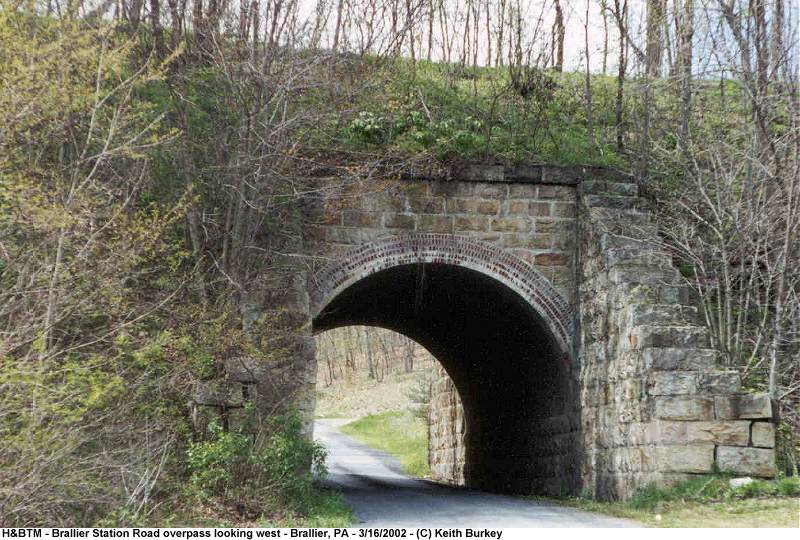
| Brallier, PA |
Brallier Station Road stone arch overpass - 5/4/2002 |
800X540 .JPG image, 99KB
Looking west, Brallier station was just north of here |
| Brumbaugh, PA |
Right of Way, looking North - 4/5/2002 |
800X548 .JPG image, 56KB |
| Brumbaugh, PA |
Right of Way and culvert, looking North - 4/5/2002 |
800X548 .JPG image, 57KB |
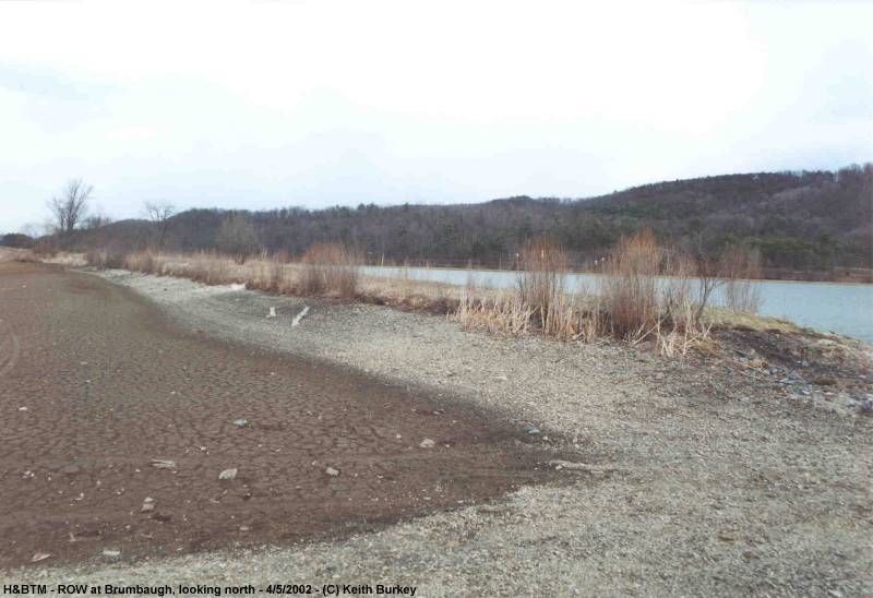
| Brumbaugh, PA |
Right of Way, looking South - 4/5/2002 |
800X554 .JPG image, 54KB |
| Brumbaugh, PA |
Right of Way overview and stone arch - 4/5/2002 |
640X452 .JPG image, 46KB |
| Cypher, PA |
Cypher Bridge - 5/4/2002 |
800X560 .JPG image, 83KB
Scenic photo, taken from Polecat Hollow Rd |
| Cypher, PA |
Cypher Bridge - 3/16/2002 |
800X550 .JPG image, 92KB
Looking north |
| Cypher, PA |
Cypher Bridge - 3/16/2002 |
640X422 .JPG image, 79KB
South span and abutment |
| Cypher, PA |
Cypher Bridge - 3/16/2002 |
400X630 .JPG image, 66KB
Looking north across bridge deck |
| Cypher, PA |
Cypher Bridge - 5/4/2002 |
800X566 .JPG image, 111KB
Looking south across bridge deck |
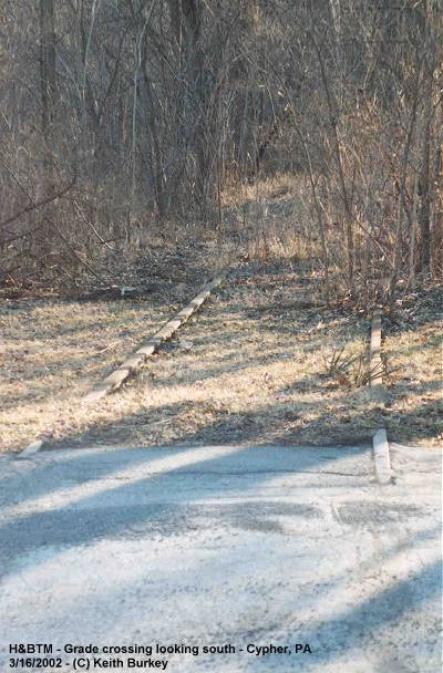
| Cypher, PA |
Trackage and grade crossing - 3/16/2002 |
400X608 .JPG image, 54KB
Looking south, next to Cypher General Store |
| Cypher, PA |
Overview of grade crossing - 5/4/2002 |
640X415 .JPG image, 57KB
Looking southeast, next to Cypher General Store |
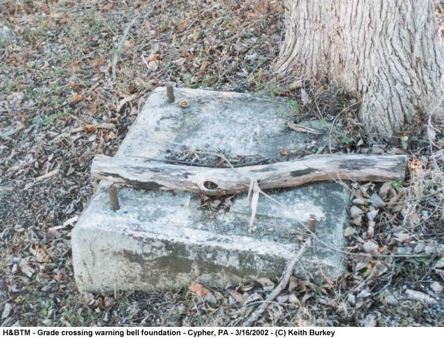
| Cypher, PA |
Cement foundation for grade crossing warning bell - 3/16/2002 |
640X487 .JPG image, 80KB |
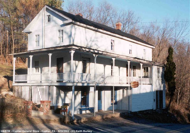
| Cypher, PA |
Cypher General Store - 3/16/2002 |
800X558 .JPG image, 88KB |
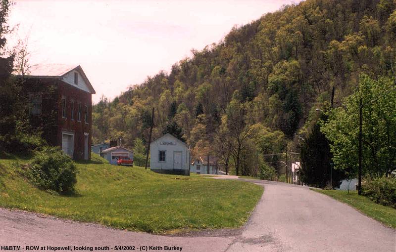
| Hopewell, PA |
Right of Way and Station, looking south - 5/4/2002 |
800X510 .JPG image, 71KB
Duplicating postcard view from Pg 57, Coal to Glory Vol. 1 (Baughman/Morgan) |
| Huntingdon, PA |
PRR Hunt Tower - 4/5/2002 |
800X733 .JPG image, 83KB
H&BTM main line (Old H&BTM branches off to the left of the photo) |
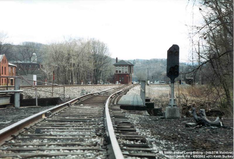
| Huntingdon, PA |
North end of former H&BTM mainline - 4/5/2002 |
800X543 .JPG image, 72KB
NS Long Siding (H&BTM Mainline), looking north towards NS |
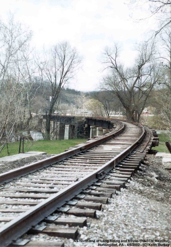
| Huntingdon, PA |
North end of former H&BTM Trackage - 4/5/2002 |
800X547 .JPG image, 85KB
NS Long Siding (H&BTM Mainline), looking south |
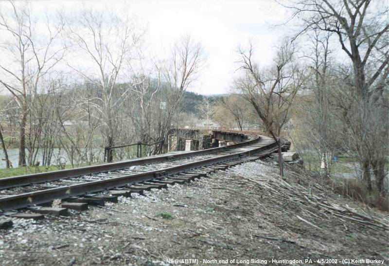
| Huntingdon, PA |
H&BTM Trackage across bridge - 4/5/2002 |
553X800 .JPG image, 79KB
NS Long Siding (H&BTM Mainline), looking south |
| Huntingdon, PA |
H&BTM Yard Master's Office - 4/5/2002 |
800X521 .JPG image, 68KB
Preserved at Huntingdon County Fairgrounds |
| Huntingdon, PA |
H&BTM Yard Master's Office - 4/5/2002 |
800X512 .JPG image, 63KB
Preserved at Huntingdon County Fairgrounds |
| Huntingdon, PA |
H&BTM Yard Master's Office - 4/5/2002 |
800X511 .JPG image, 67KB
Preserved at Huntingdon County Fairgrounds |
| Saxton, PA |
Right of Way, looking North - 5/4/2002 |
800X528 .JPG image, 97KB
North of Saxton Furnace and Stonerstown Viaduct |
| Saxton, PA |
Right of Way, looking South - 5/4/2002 |
401X630 .JPG image, 96KB
North of Saxton Furnace and Stonerstown Viaduct |
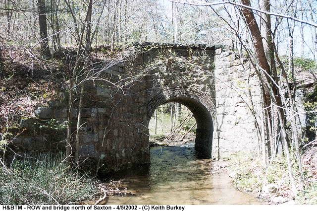
| Saxton, PA |
Right of Way and Bridge - 5/4/2002 |
640X425 .JPG image, 96KB
North of Saxton Furnace and Stonerstown Viaduct |
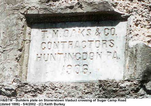
| Saxton, PA |
Builders plate on northernmost section of Stonerstown Viaduct - 5/4/2002 |
493X346 .JPG image, 47KB
Segment of viaduct crossing Sugar Camp Road and road into Saxton Furnace |
| Saxton, PA |
Stonerstown Viaduct Bridge Abutment - 5/4/2002 |
640X461 .JPG image, 90KB
Southern abutment of Sugar Camp Road crossing |
| Saxton, PA |
Stonerstown Viaduct Northernmost Abutment - 5/4/2002 |
640X457 .JPG image, 84KB
Near Saxton Furnace off Sugar Camp Road |
| Saxton, PA |
Stonerstown Viaduct Pier - 5/4/2002 |
640X465 .JPG image, 103KB
Near Saxton Furnace off Sugar Camp Road |


