


The second day of the three-day Dak Dillon charter featured a rare eastbound journey through Los Pinõs Valley at dawn, where participants would experience the valley and the iconic Cascade Trestle in rare morning light as on this spectacular section of the line. Beginning at sunrise from Cumbres Pass, witness the K-36 silhouetted against the dawn sky before descending through landscapes typically seen only in afternoon light during regular operations. Our journey east will take us to Antonito with multiple runby locations along the way.
A very early start was the order of the day and fellow charter participant Josh picked me up at the Branding Iron Motel in Chama. After we started the drive to Cumbres Pass via New Mexico Highway 17 into Colorado, where it turned into Colorado Highway 17, I ate my doughnuts and orange juice then upon arrival at the pass, we met the rest of our group. Dak gave us a safety briefing during the wait for our train from Chama.
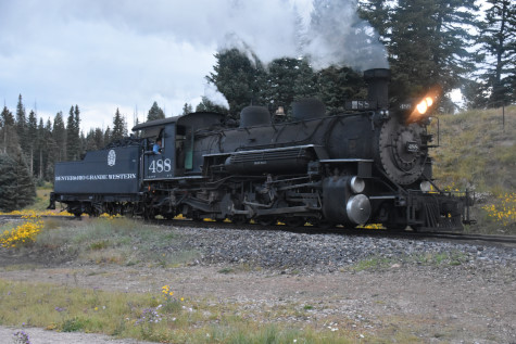
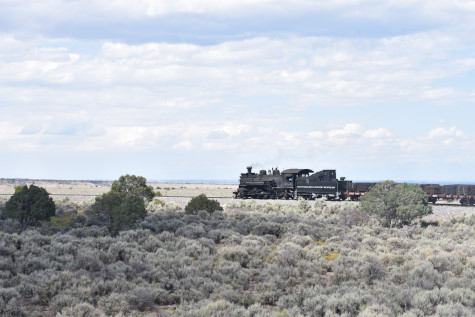
Cumbres and Toltec 2-8-2 488, Denver and Rio Grande Western 488, built by Baldwin in 1925, came up from Chama.
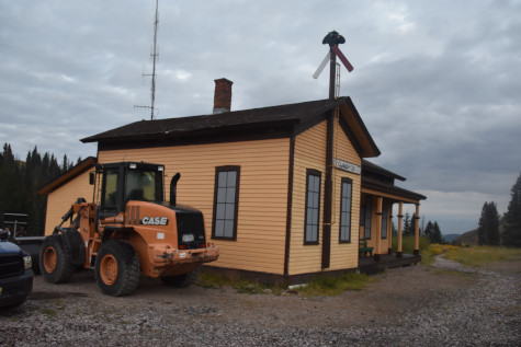
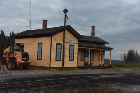
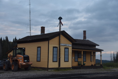
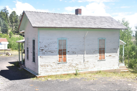
Cumbres Pass depot, built in 1882 as a section house.
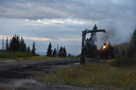
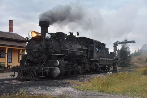
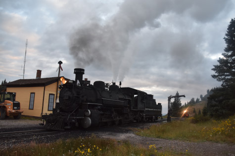
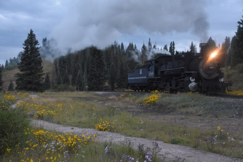
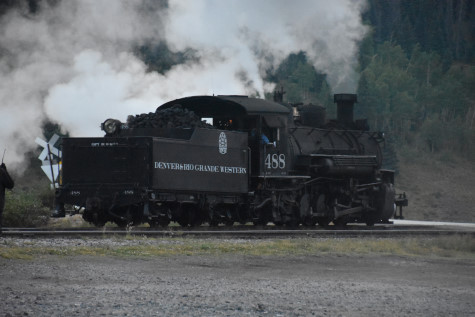
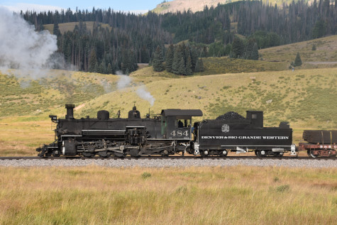
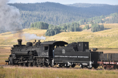
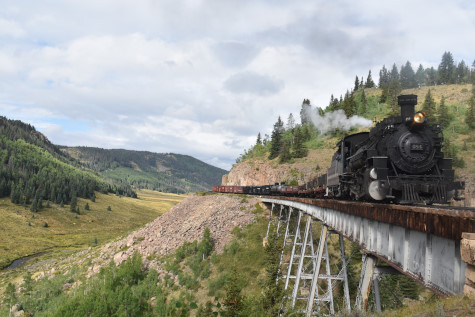
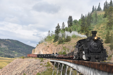
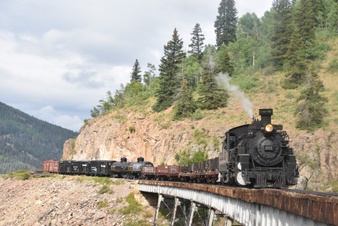
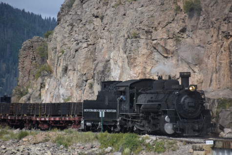
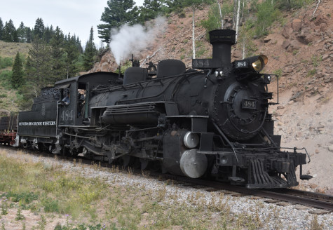
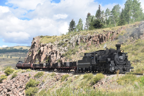
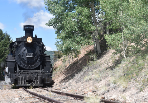
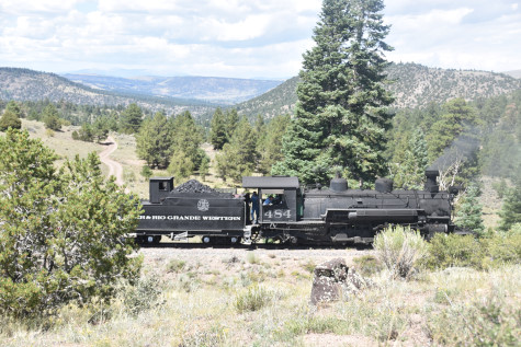
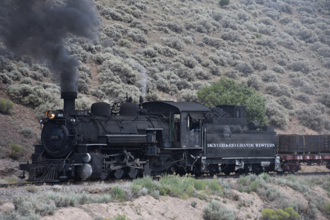
Cumbres and Toltec 2-8-2 484, Denver and Rio Grande Western 484, built by Baldwin in 1925, was the steam engine which would power our train.
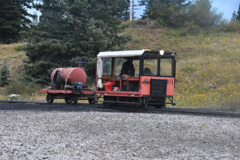
Fire speeder 101 was assigned to us.
All participants boarded and the crew inspected the train before we left.
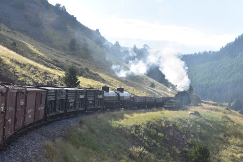
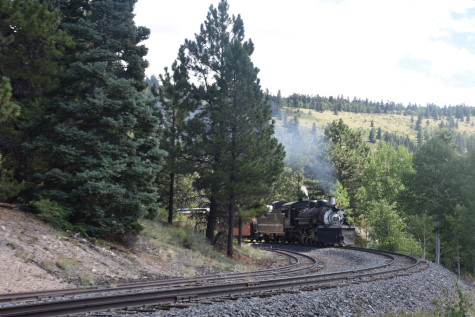
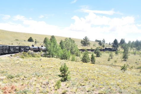
We then departed Cumbres Pass and started our journey to Antonio.
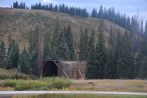
The remains of the snowshed across Colorado Highway 17.
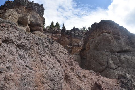
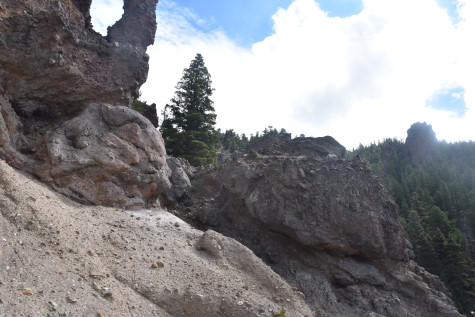
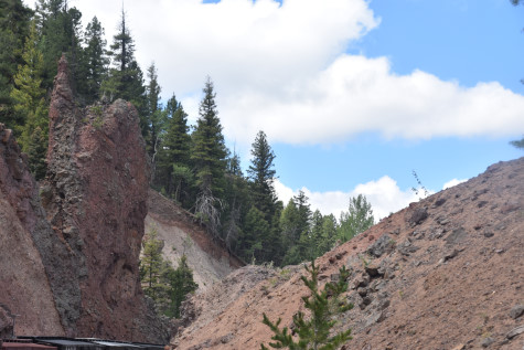
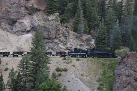
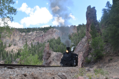
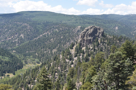
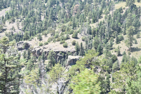
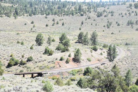
Starting to round Tanglefoot Curve, which was also called the "balloon loop" by railroad crews until the 1970's. In the early years, there were three snowsheds and two wooden tretles around the tight curve.
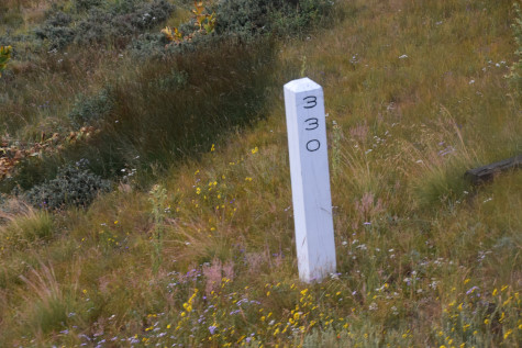
Milepost 330 concrete sign.
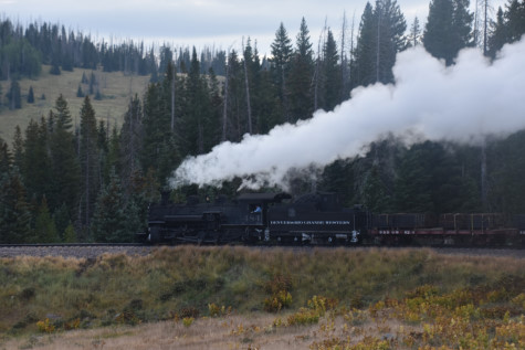
Tanglefoot Curve.
Running off Tanglefoot Curve.
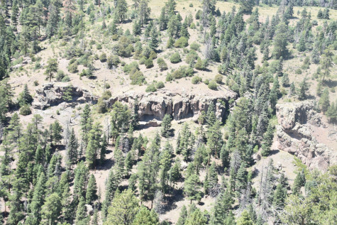
The curve above the railroad.
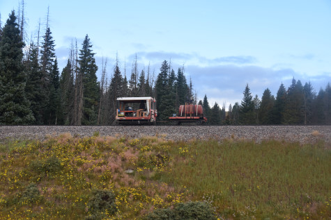
Fire speeder 101.

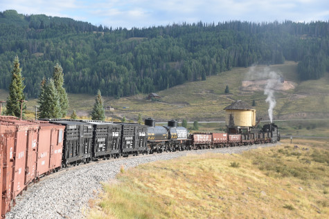
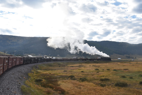
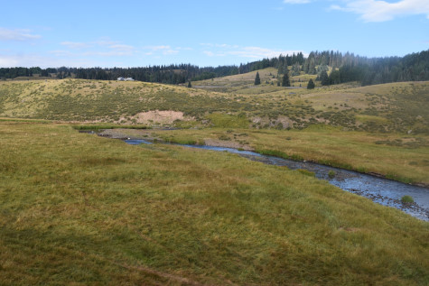
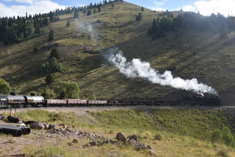
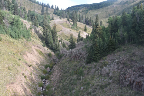
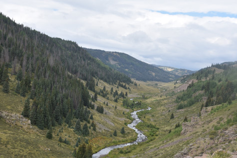
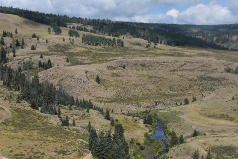
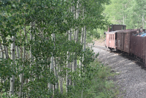
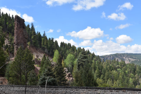
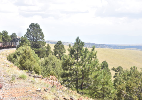
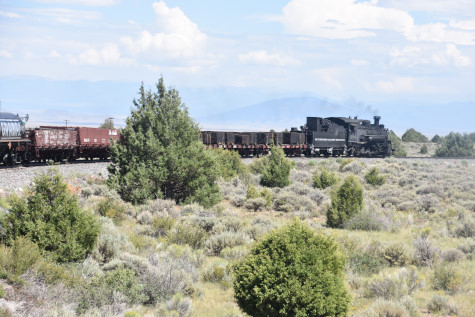
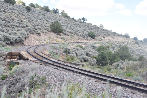
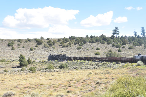
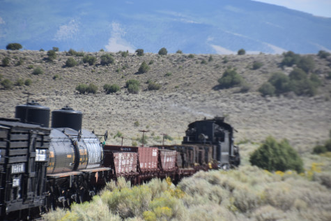
Curving above the Los Pinõs Valley.
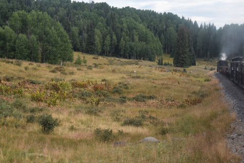
Curving towards the Los Pinõs water tank.
Curving into the valley.
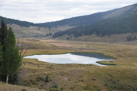
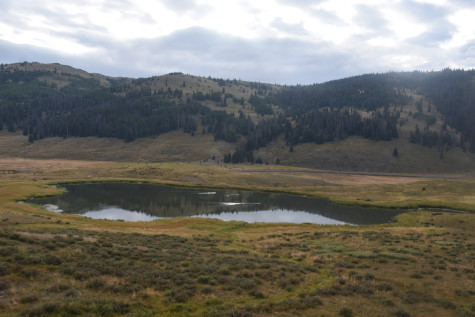
A small lake.
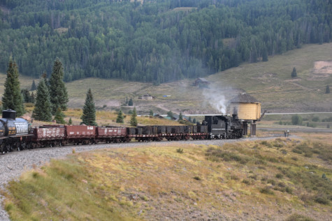

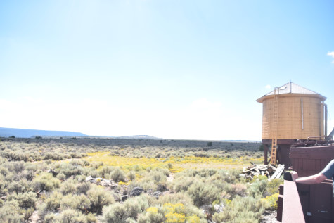
We stopped for water at the Los Pinõs water tank.
We departed and continued on our way.

The curve east of the water tank.
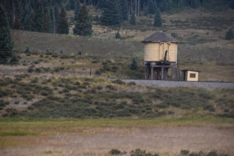
The Los Pinõs water tank as seen from across the valley.
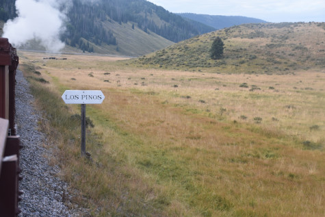
The Los Pinõs sign post.
Grouse Creek.
Our shadows.
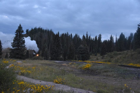
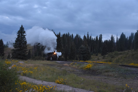
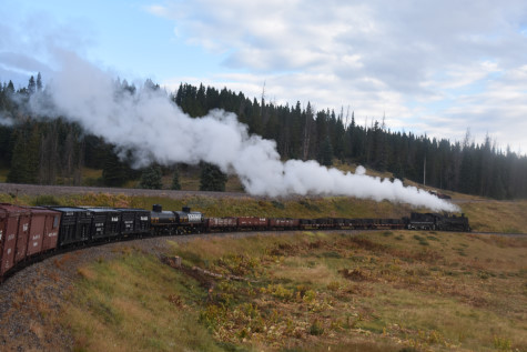
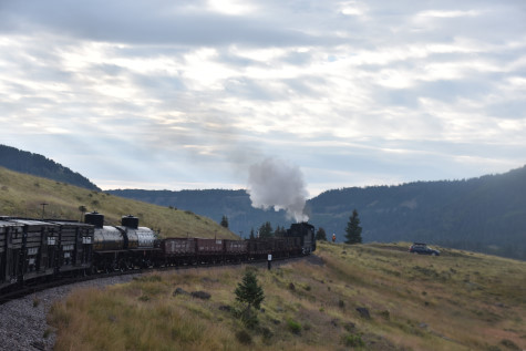
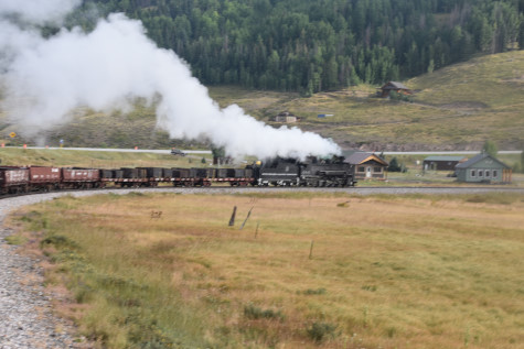
We stopped for the first runby of the day.
The reverse move across Grouse Creek.
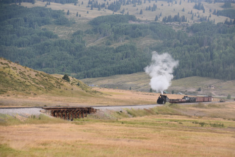
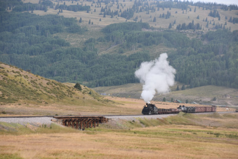
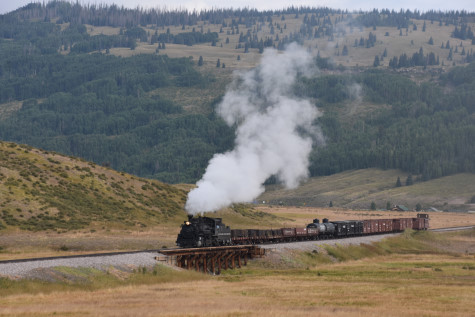
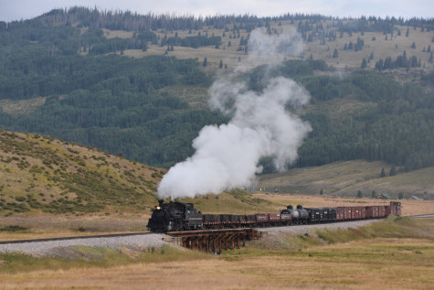
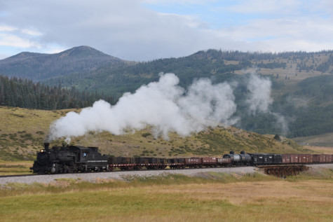
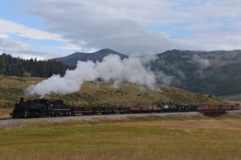
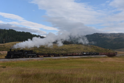
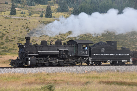

Photo runby one across Grouse Creek.


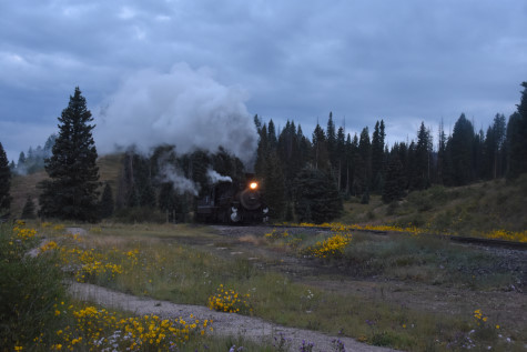
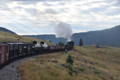
The reverse move.
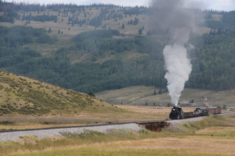
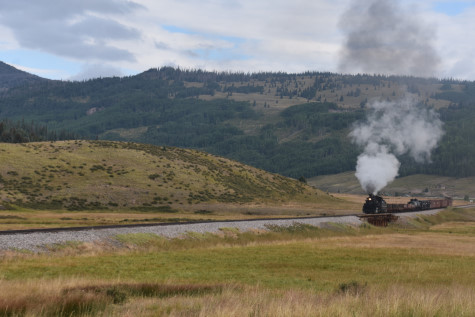
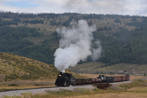

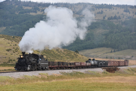
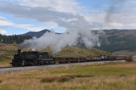

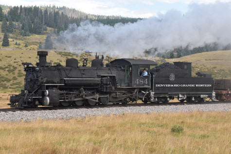
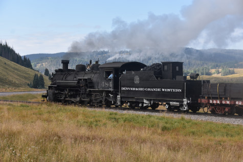
Photo runby two across the creek.
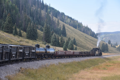
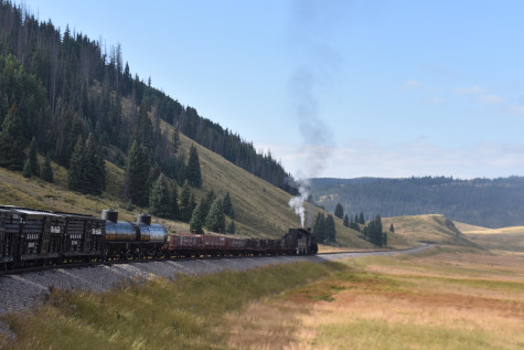
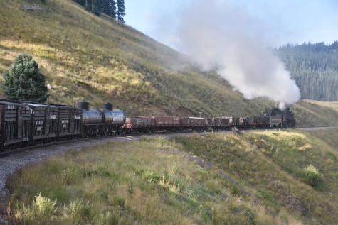
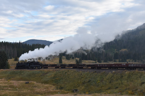
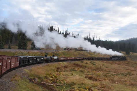
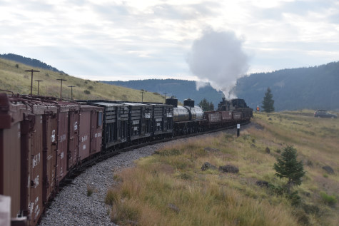
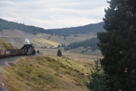
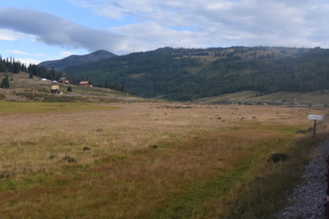
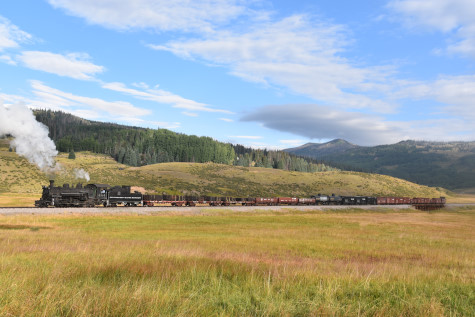
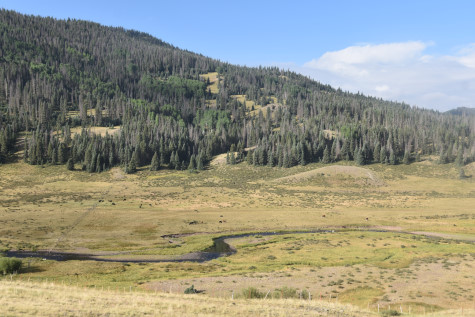
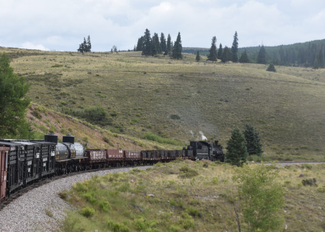
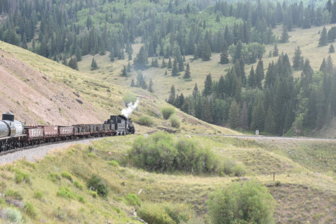
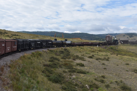
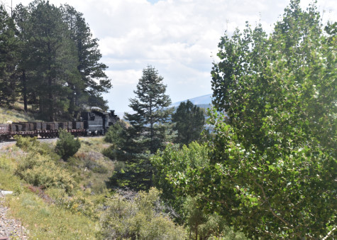
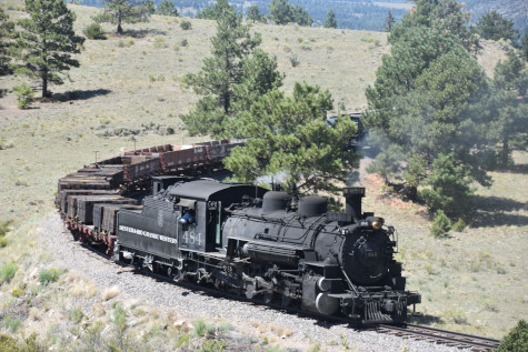
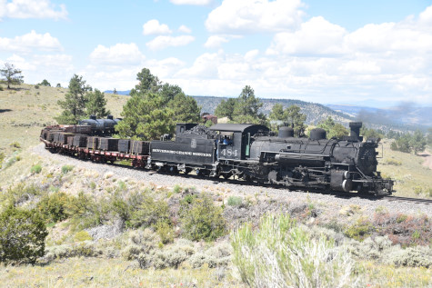
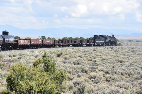
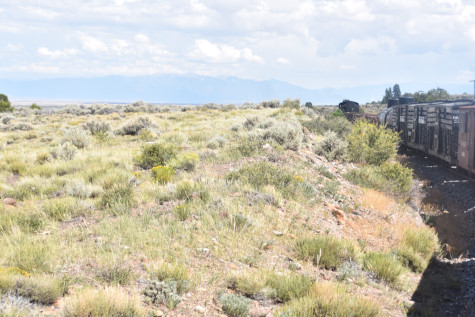
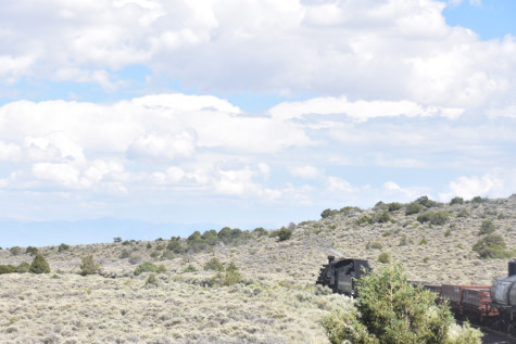
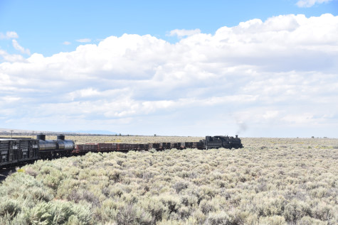
We continued down the Los Pinõs Valley.
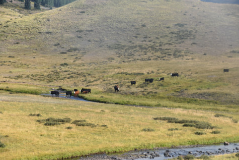
Cattle along the property.
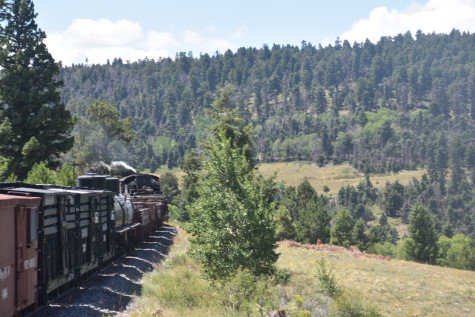
Following the Rio de Los Pinõs, a small mountain stream.

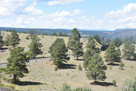
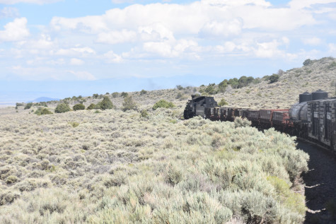
The view ahead.
Following the Rio de Los Pinõs.
Curving and about to cross Long Creek around the bend.
 >
>
Arriving at Long Creek.
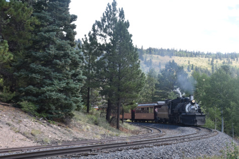
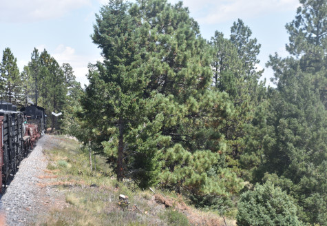
The caboose always behind us.

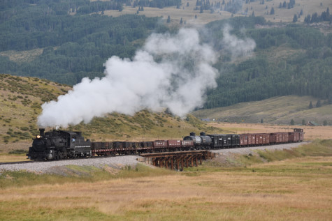
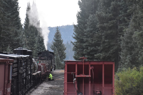
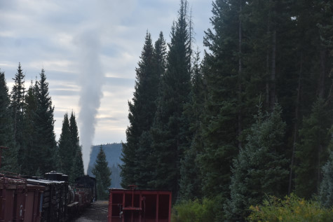
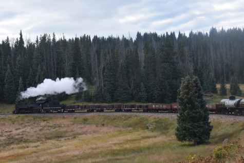
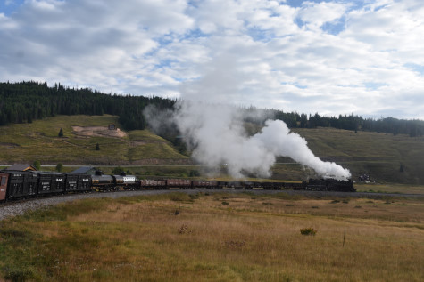
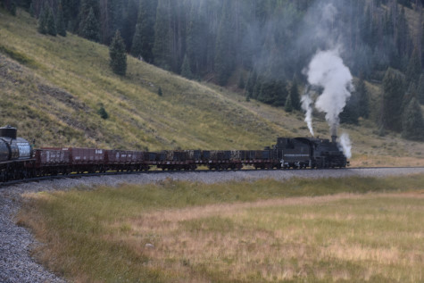
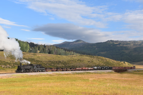
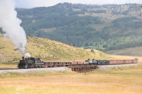
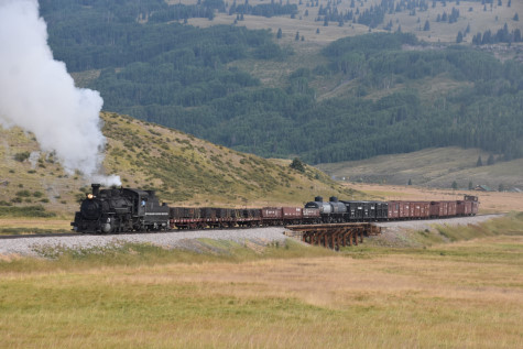
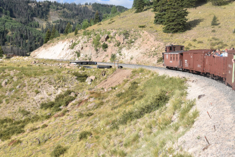
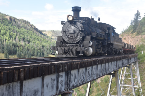
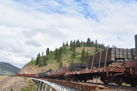
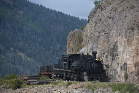
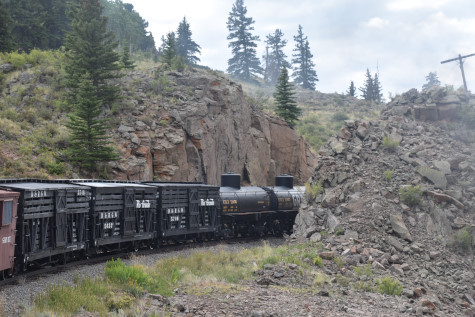
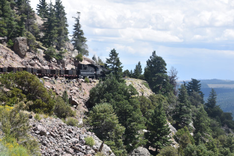
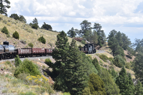
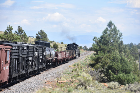
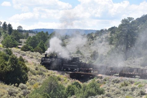
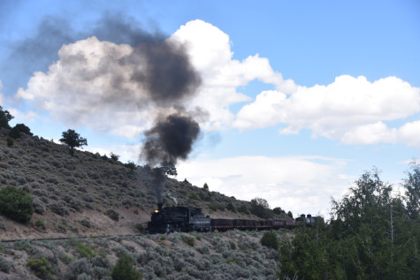
We crossed Cascade Trestle and stopped for the next set of photo runbys. Beforehand, Dak had divided us into two groups and all went to their assigned spots.
Cascade Creek.

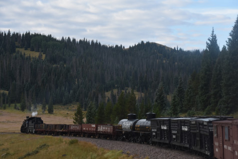
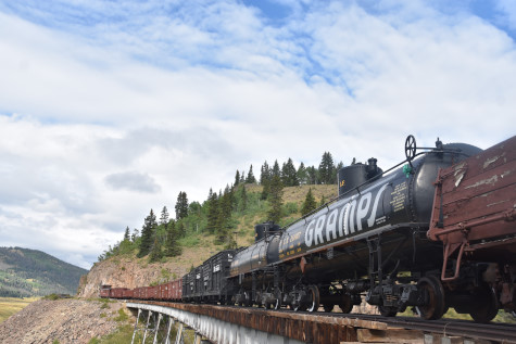
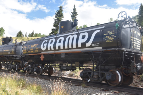
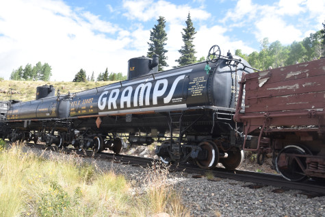
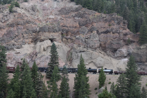
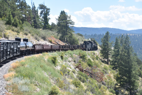
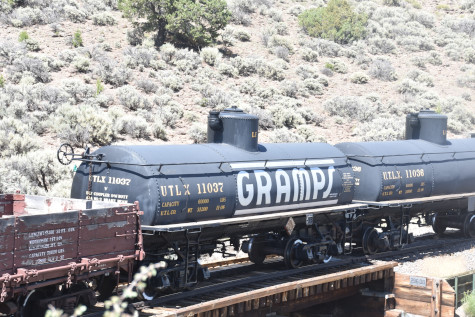
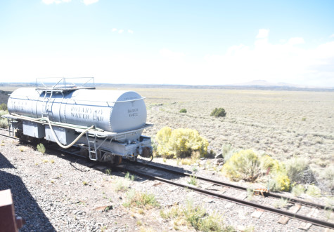
Union Tank Car tank car 11037, nee Union Tank Car 58432, built by the company in 1936. Around 1935, oil was discovered approximately 13 miles north-northwest of Chama, due east of Chromo, at what would become known as the "Gramps Oil Field". The field was owned by Lafayette "Gramps" Hughes. His company moved oil from these wells by pipeline across the Continental Divide to holding tanks and a narrow gauge loading dock at Chama. The system was largely a siphon, with no en-route pumping stations. There are reports that the pipe actually travelled in a wooden box for large sections, insulated with sawdust, to keep the oil warm and fluid enough to make the trip.
At Chama, the oil was loaded into narrow gauge UTLX tank cars for the trip to the Oriental Refinery (sometimes called the Gramps Refinery) in Alamosa. The cars were then sent back light to Chama. When the field was at peak production (1100-1300 bbl/day), this would amount to a fully-loaded 11-car oil train to Cumbres Pass daily. The operation continued until late 1964 and some point that year, the refinery apparently suffered a fire and repairs/ replacement on such a small facility was considered uneconomical. The refinery closed down during September 1964 and the oil traffic over Cumbres Pass ceased. The loss of traffic was a significant blow to all-season operations on the narrow gauge, as the winter of 1964 was the first time the line was shut down. Oil from the field from 1964 until production ended in the 1980s to 1990s was sent by truck to Farmington, New Mexico instead.

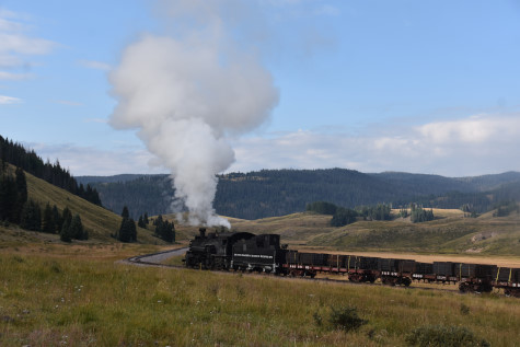
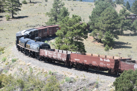
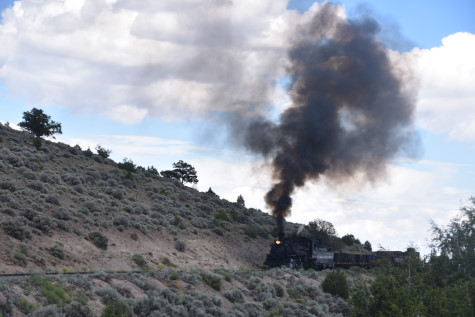
Cumbres and Toltec Scenic 2-8-2 484, nee Denver and Rio Grande Western 484, built by Baldwin in 1925 at Milepost 319.95, Cascade Trestle, which is 136 feet high and 409 feet long. The original bridge was wood, but it was replaced in 1889 with an iron bridge of a unique German design with bents that were tapered at each end. It also did not have any cross-bracing between the bents. In the 1920's, a new eight-span steel deck-girder bridge with steel bents placed on masonry pedastels and abutments was built to standard gauge specificitions, in the event the line was standard-gauged.
.


The reverse move at Cascade Trestle.
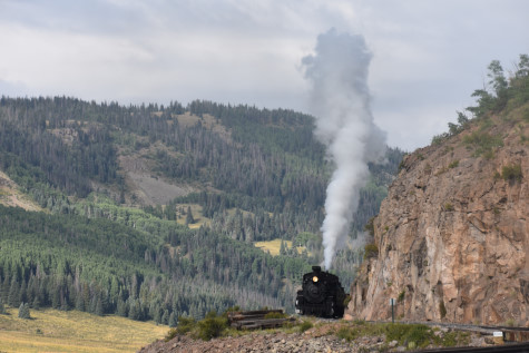
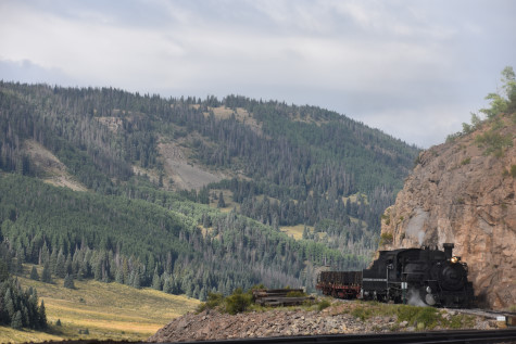
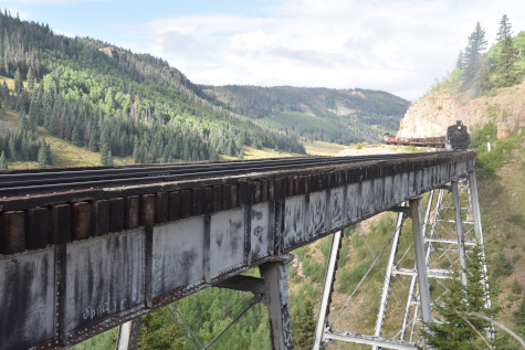
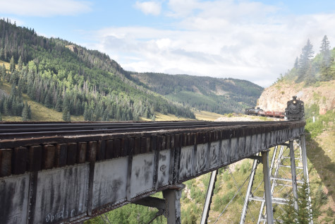
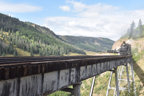
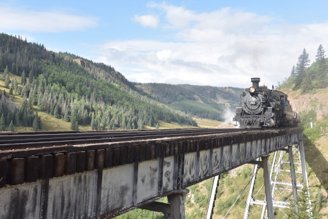
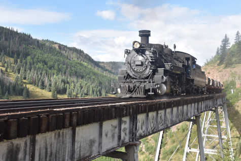
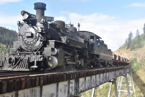
Photo runby three at Cascade Trestle. At this point, everyone switched sides.
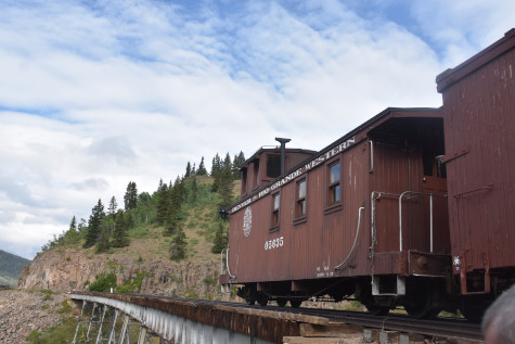
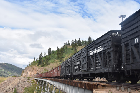
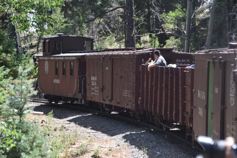
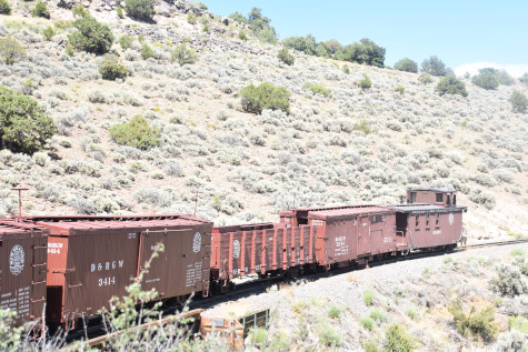
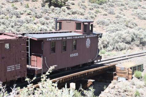
Denver and Rio Grande Western caboose 05635, built by the railroad, year unknown, but constructed from stock car 5635.
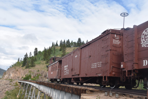
Denver and Rio Grande Western box car 3244, built by American Car and Foundry in 1904.
Denver and Rio Grande Western gondola 1357, built by American Car and Foundry in 1902.
Denver and Rio Grande Western box car 3414, built by American Car and Foundry in 1904.
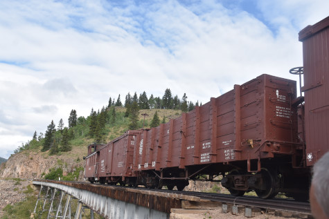
Denver and Rio Grande Western box car 3537, built by American Car and Foundry in 1904.
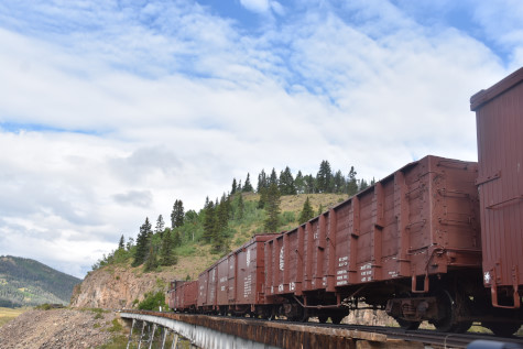
Denver and Rio Grande Western gondola 1268, built by American Car and Foundry in 1902.

Denver and Rio Grande Western box car 3566, built by American Car and Foundry in 1904.
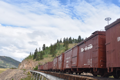
Denver and Rio Grande Western box car 3605, built by American Car and Foundry in 1904.
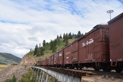
Denver and Rio Grande Western box car 3669, built by American Car and Foundry in 1904.
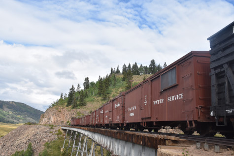
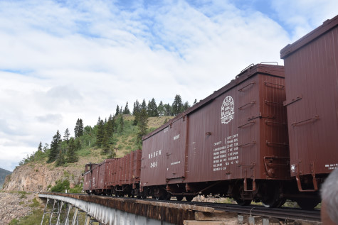
Denver and Rio Grande Western water car 04904 built by the railroad and Ohio Falls in 1895 from boxcar 4904.
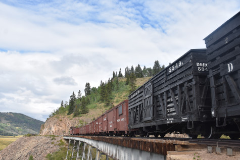
Denver and Rio Grande Western stock car 5549, built by American Car and Foundry in 1904.
Denver and Rio Grande Western stock car 5633, built by American Car and Foundry in 1904.
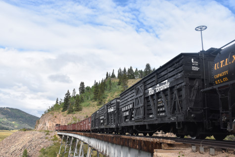
Denver and Rio Grande Western stock car 5706, built by American Car and Foundry in 1904.
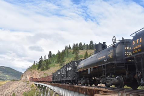
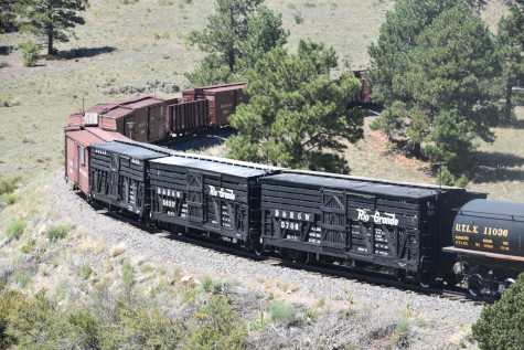
Union Tank Car tank car 11036, nee Union Tank Car 58424, built by the company in 1936.
Union Tank Car tank car 11037, nee Union Tank Car 58432, built by the company in 1936.
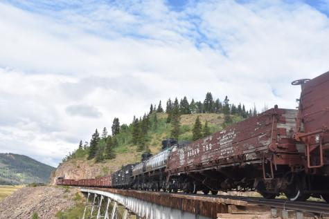
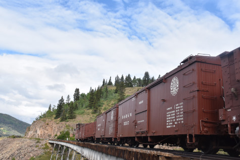
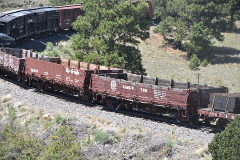
Denver and Rio Grande Western drop-bottom gondola 783, built by American Car and Foundry in 1904.
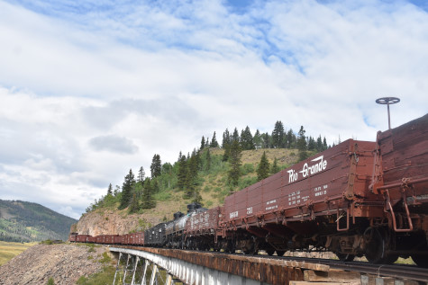
Denver and Rio Grande Western drop-bottom gondola 731, built by America Car and Foundry in 1904.
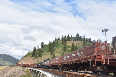
Denver and Rio Grande Western gondola 769, built by American Car and Foundry in 1904.
Denver and Rio Grande Western flat car 6601, built by the railroad in 1955 from a box car.

Denver and Rio Grande Western flat car 6200, built by the railroad in 1918.


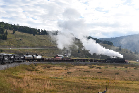
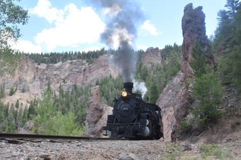
The reverse move.
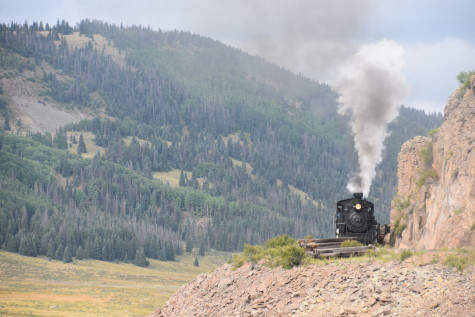
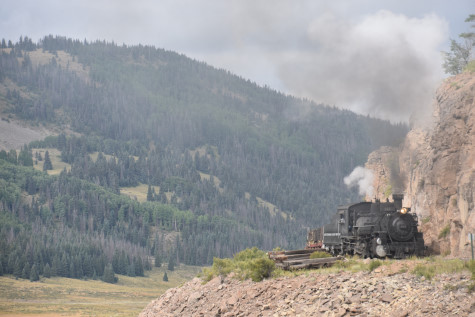
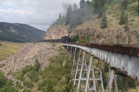

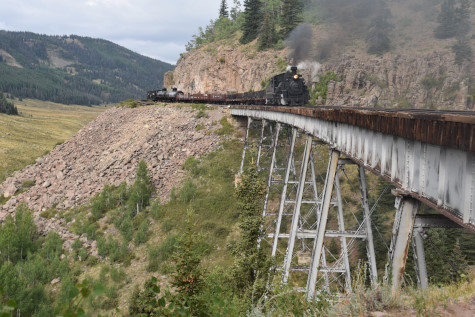
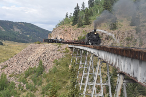
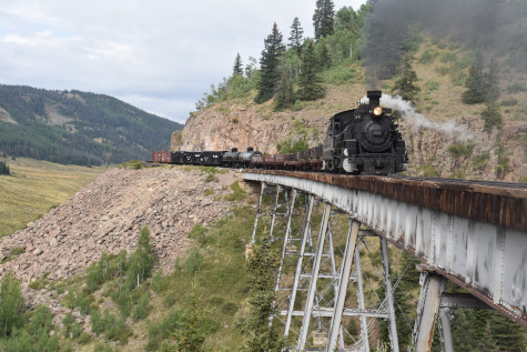

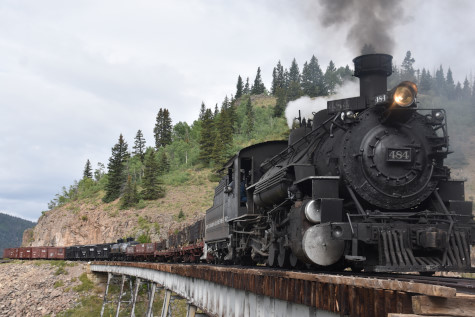
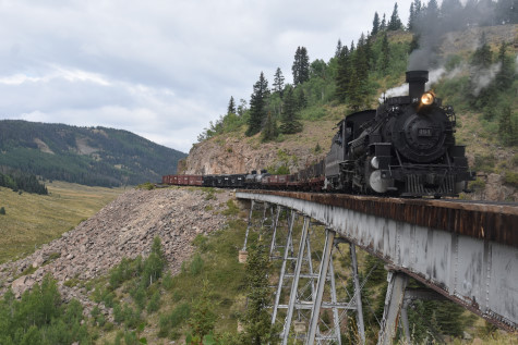
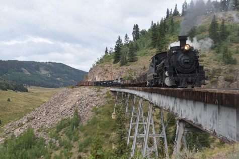
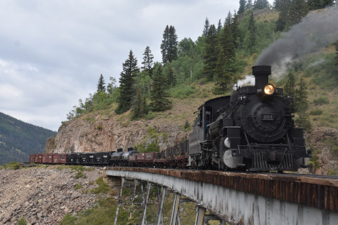
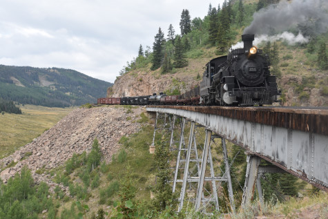
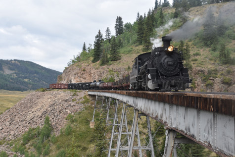
Photo runby four.
Cumbres and Toltec Scenic 2-8-2 484, lettered for Denver and Rio Grande Western for this charter.
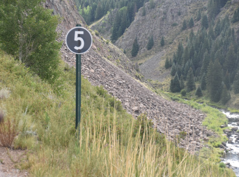
Five miles an hour sign.
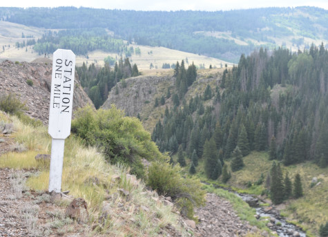
Station one mile.
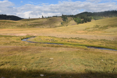
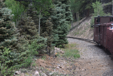
Following the Rio de Los Pinõs.

Travelling along the ledge before Osier.

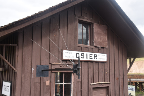
The building at Osier where lunch is served for the regular trains. Dak told everyone not to go into the lunch room as he had arranged for boxed lunches to be delivered to the train.
We continued to Osier.
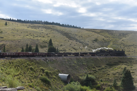
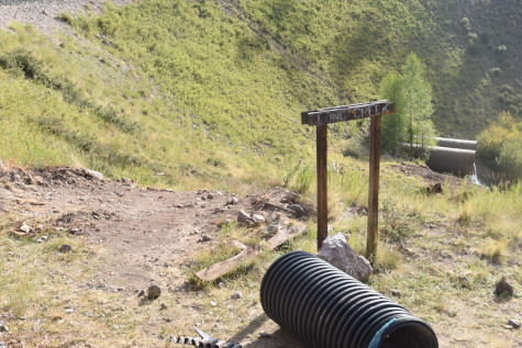
A large drainage pipe cut into the right-of-way to take the water under the tracks.
Approaching Osier.

Throughout the years of riding the Cumbres and Toltec Scenic Railroad, I had not seen deer before.
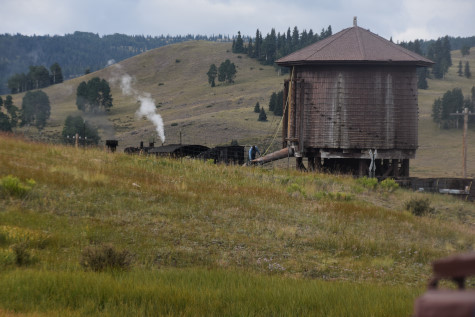
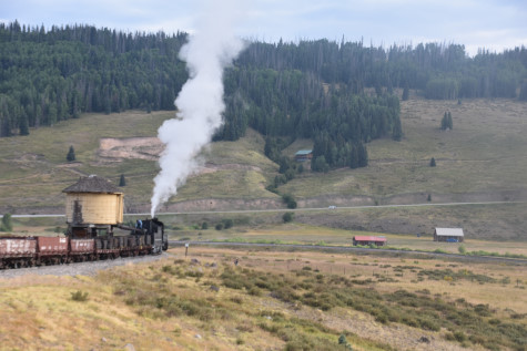
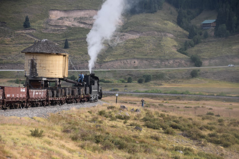
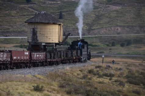
During the layover, the steam engine was watered.
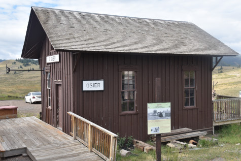
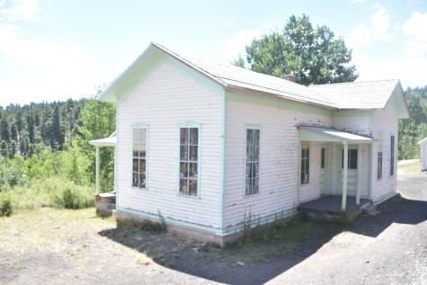
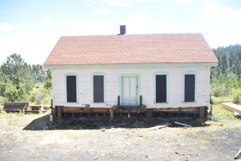
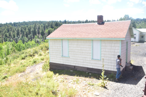
Osier station built in 1880.
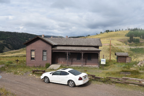
The section house built in 1881.
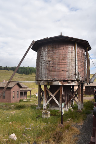
The water tower.
Cumbres and Toltec Scenic Railroad 2-8-2 484.

Back aboard, we passed the balloon track.
Going through a cut.

Denver and Rio Grande Western caboose 05635. Before we arrived at the next photo runby location, Dak gave each participant a number which corresponded to a specific location, as there were three distinct photographic locations in this area.
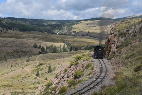
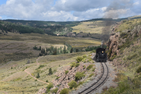
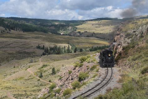

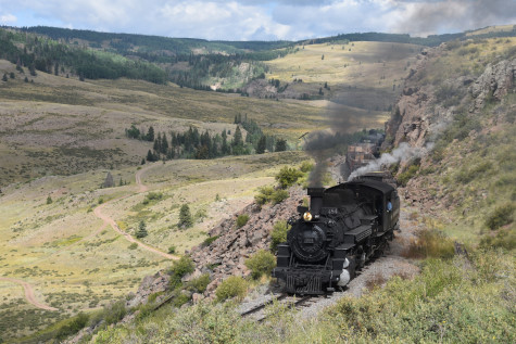

Photo runby five east of Osier.
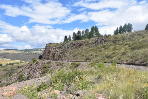
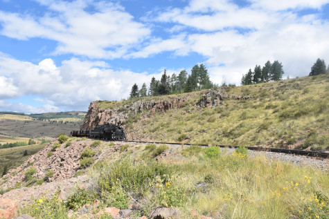
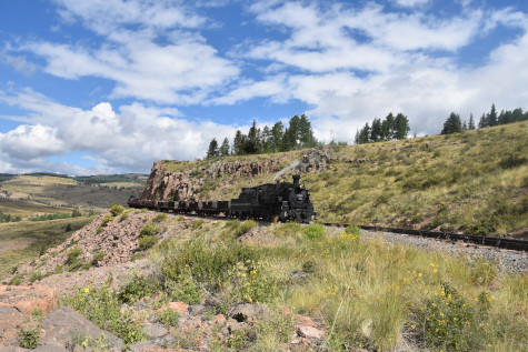
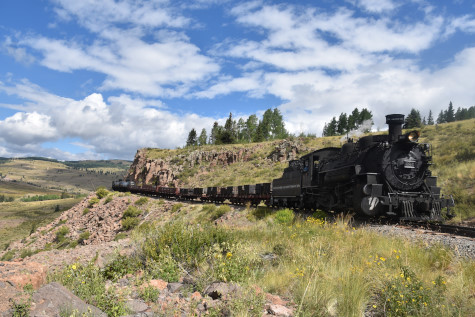
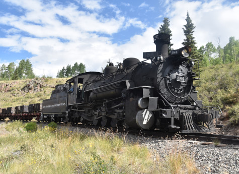
Photo runby six.

Reverse move.
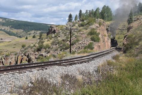
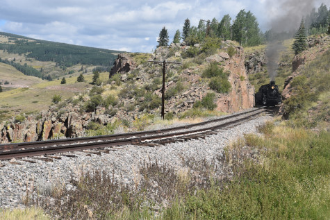
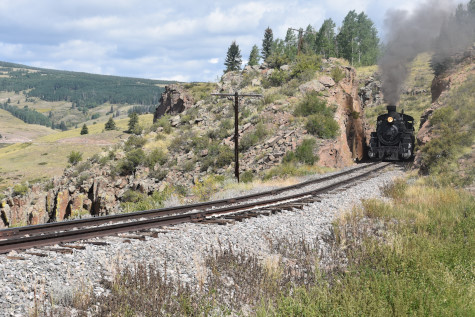
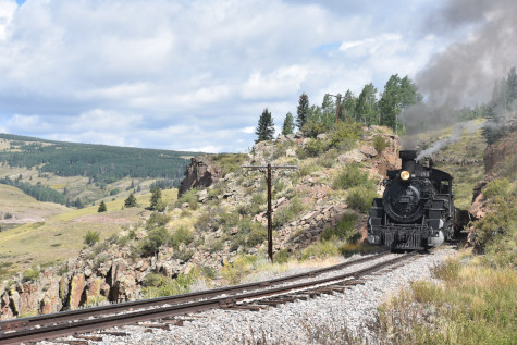


Photo runby seven.
Rio de Los Pinõs which would take us to Toltec Gorge.

The Garfield Monument, a memorial to President James Garfield, was erected by the American Association of General Passenger and Ticket Agents on September 26, 1881, the day concluding funeral services were held in Cleveland, Ohio for President Garfield who was shot by Charles J. Guiteau. This monument is located at milepost 315.32.

We entered Rock Tunnel at an elevation of 9,631 feet. This 366 foot curving tunnel was blasted out ofthe Pre-cambrian cystalline rock, was enlarged in 1937 and is 600 feet above the river.
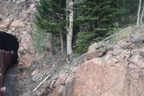
Exiting the tunnel.
Toltec phone booth at Milepost 314.75.
The caboose brought up the rear.
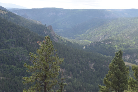
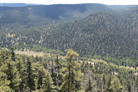
Looking down into the Rio de Los Pinõs Valley.

The train on a curve.

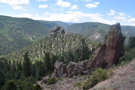
We entered Phantom Curve, the next photo runby location.
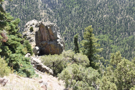
A phantom in a curve. The tracks wind back and forth around tall pinnacles, spires and pedestral rocks formed from breccias of the Conejos Formation. The weird shapes are the result of the alteration by hot water, by weathering and by erosion of the volcanic rock. The alteration also causes the wide variety of colours seen in the rocks along the section of track.
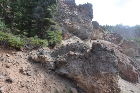
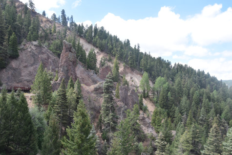
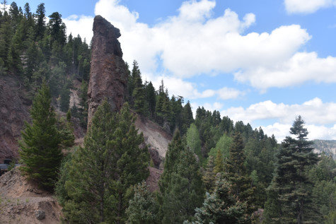

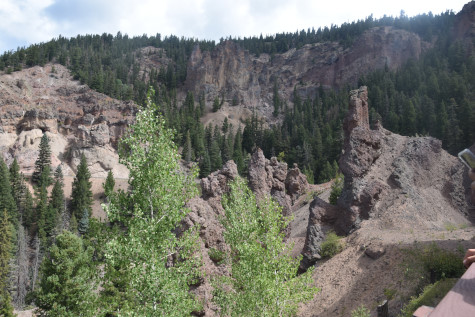

Phantoms are very prolific here.
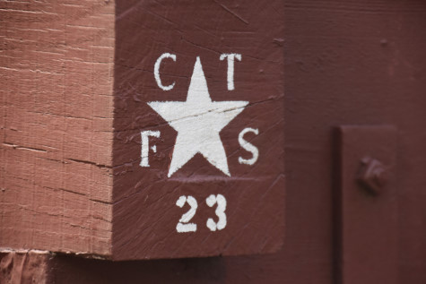
The Friends of Cumbres and Toltec Scenic Railroad started in 1980 and is an organization of thousands of members, many of whom serve as volunteers, from all 50 states and several countries. Volunteer opportunities are wide-ranging and work sessions are held throughout the summer and autumn months. The "23" denotes the year that this piece of rolling stock was restored.
We all detrained for the photo runby.
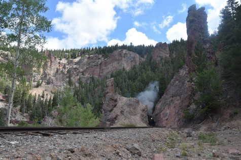
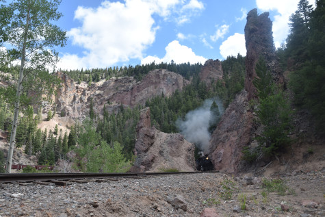
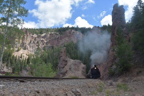

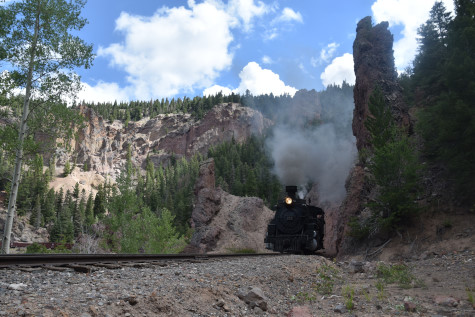
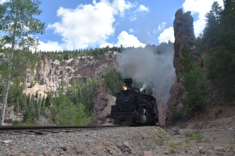
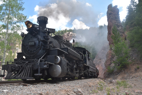
Photo runby eight in Phantom Curve.
The reverse move, after which I relocated.

This was my location.
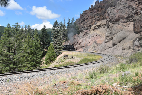
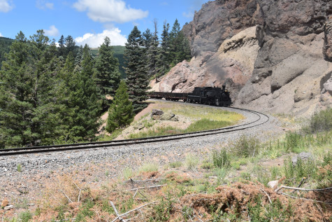

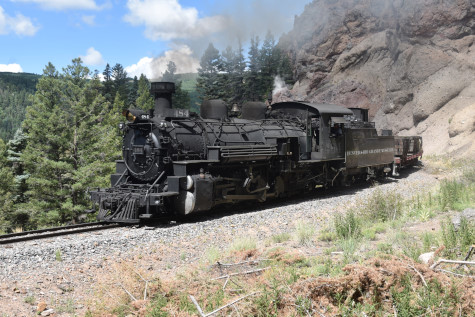
Photo runby nine. I walked back to the train and had to wait for several people who climbed up onto the rocks above.
We travelled towards Mud Tunnel.
The caboose still behind our train.
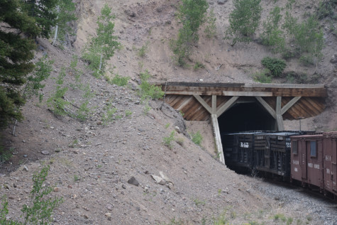
Entering the 349 foot Mud Tunnel, or Toltec Tunnel, at Milepost 311.0. The Rio Grande had many problems with this tunnel as both portals were built in soft, volcanic ash that had a tendency to slide when wet.
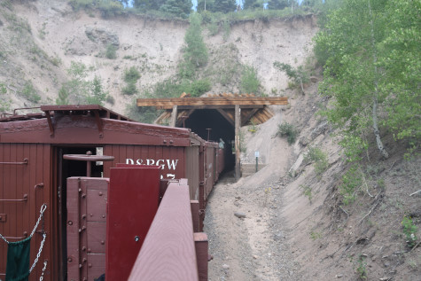
Exiting the tunnel.
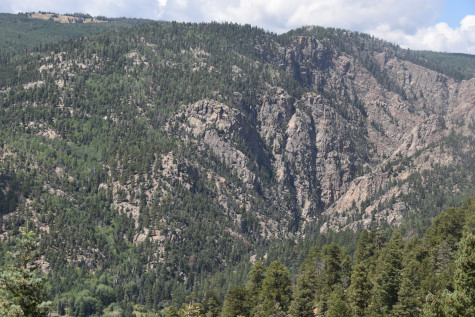
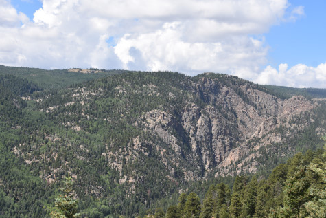
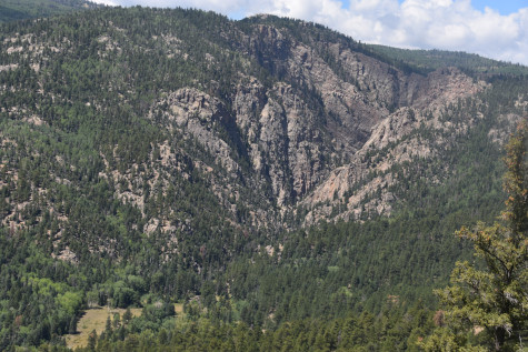
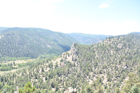
The Toltec Gorge.
We entered Toltec siding, Milepost 311.0 and detrained to photograph our train and the regular train.
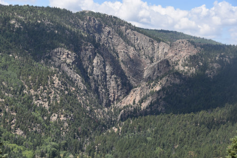
Toltec Gorge.
Our train sitting in the siding.

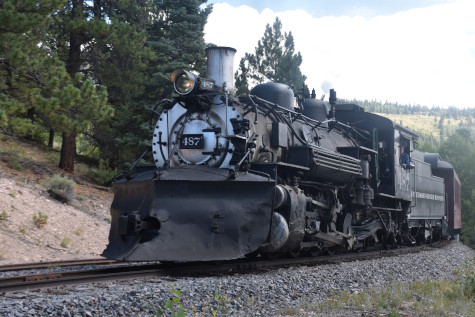
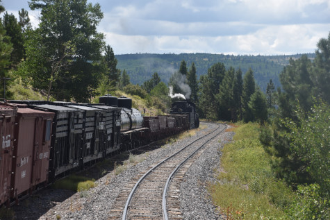
The regular train from Antonito, led by Cumbres and Toltec Scenic 2-8-2 487, nee Denver and Rio Grande Western 487, built by Baldwin in 1925.
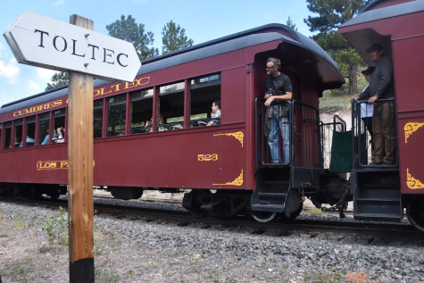
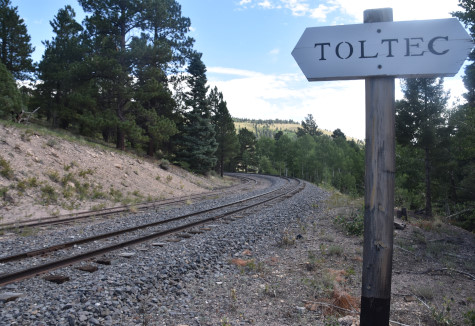
The Toltec sign post.
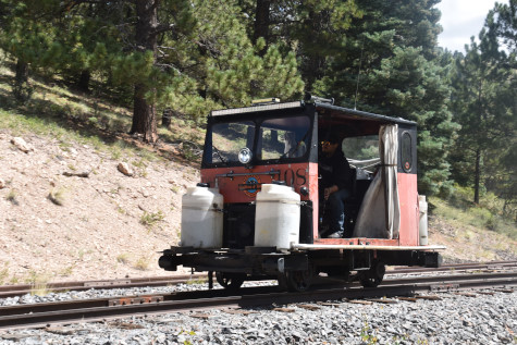
Fire speeder 108.
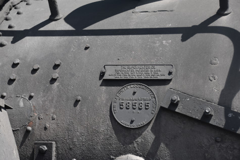
Builder's plate of Cumbres and Toltec Scenic 484.
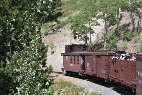
The crew was riding in the caboose.
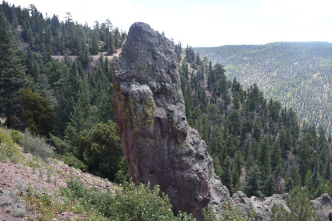
One last phantom.

A rock outcropping.
Our motive power far ahead of us.
One of several Conejos breccias in the Toltec Gorge.
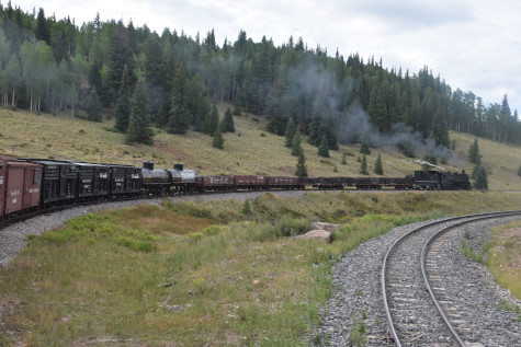
Cumbres and Toltec Scenic 2-8-2 484 leading our train toward our destination of Antonito.
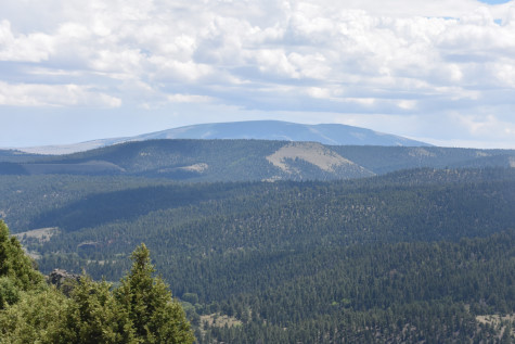
Mount San Antonio, a shield volcano.
The Toltec Gorge.
Rounding another curve.
Sublette was a mile away with a yard limit sign.
Curving into Sublette, Milepost 306.06, elevation 9,276 feet, where we stopped for water. The station was called Boydsville until December 1880, although the reason for the change is unknown.
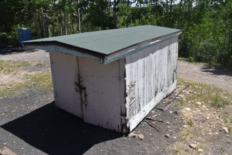
A hand car shed.

Phone booth 3 was located here.
The section workers' house.
The bunk house.

The Sublette sign post.
The old coal house that moved from Allison in 1945.
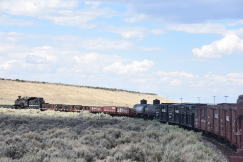
On the move again, we rounded the curve out of Sublette.
Rounding a reversing curve.
The canyon with Sublette at its head.

Towards the Rio de Los Pinõs.

High above Cañada Jarosita stream, part of Rio Arriba.
On the ledge above the stream.
Looking across Cañada Jarosita.
Descending the grade to our next photo location.


Reverse move at Milepost 301.9.
The scene of our next two photo runbys.

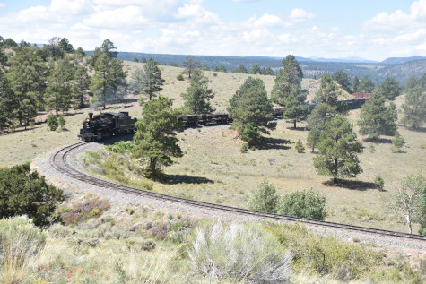
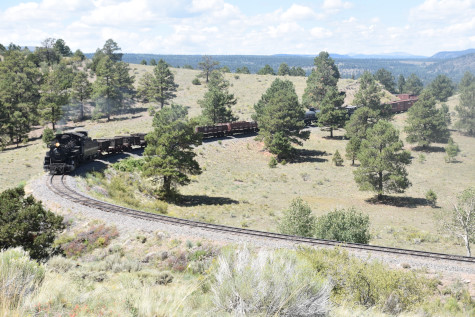
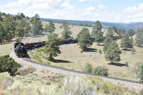
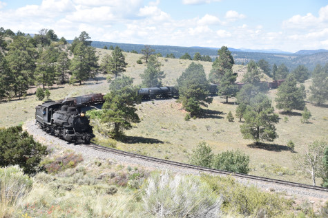
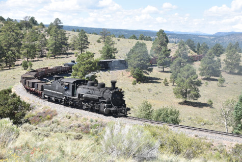
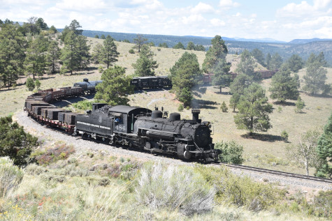

Photo runby 10 at Milepost 301.2.

The reverse move.

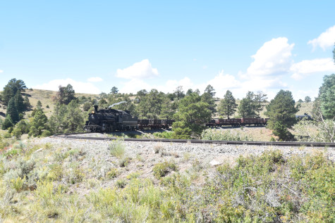
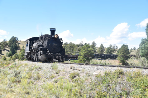
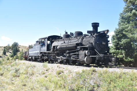
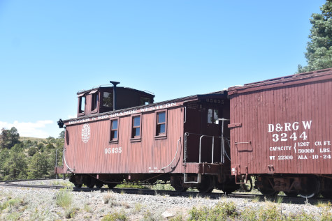
Photo runby eleven.

Big Horn at at Milepost 299.41.
On the way to Whiplash Curve.
Approaching the curve.
About to cross the curve at Milepost 297.
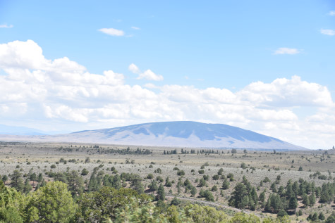
Mount San Antonio.

Whiplash Curve Milepost 296.0.
The photo runby location.
The reverse move.
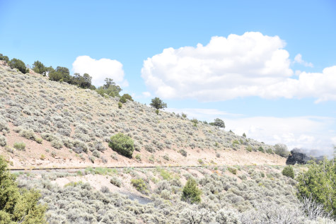
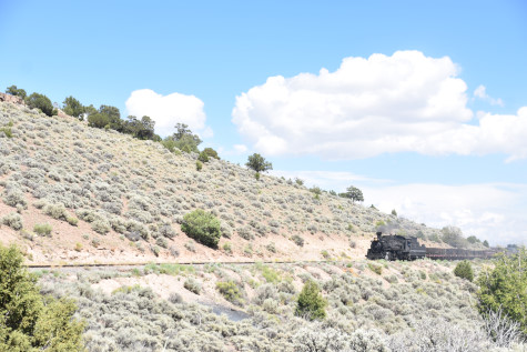


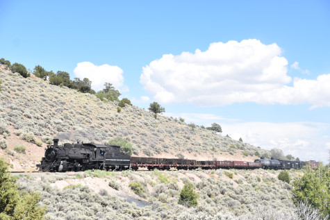
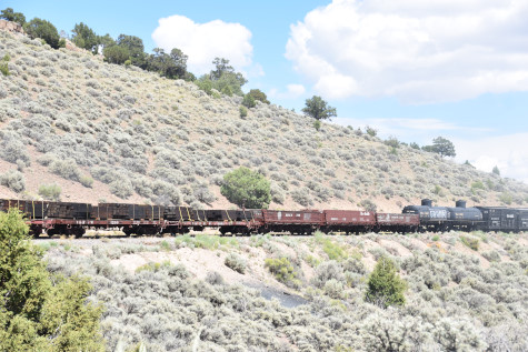

Photo runby twelve at Milepost 295.98.
Reverse move.
The scene.
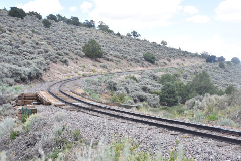
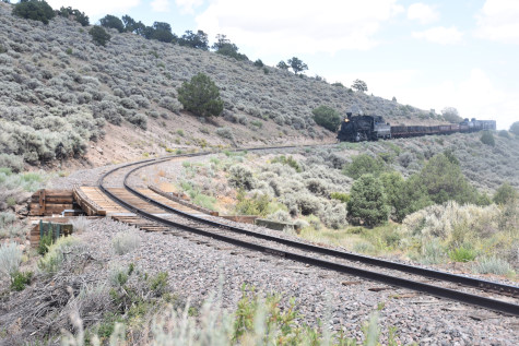
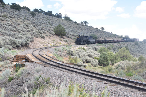
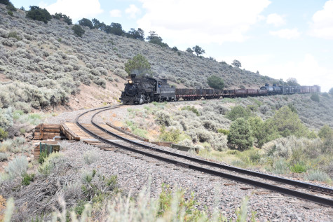
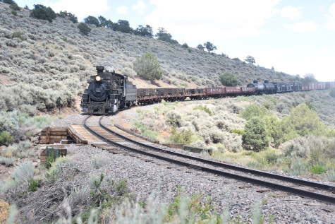
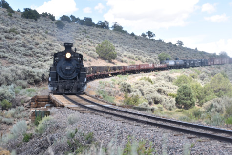
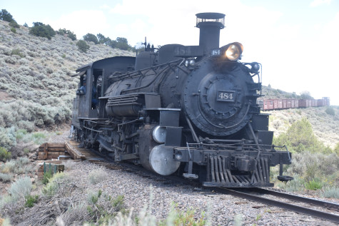
Photo runby thirteen.

Mount San Antonio.
The train and Mount San Antonio Peak.
The front of the train on a curve.
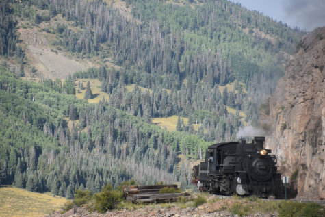
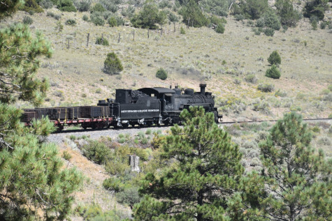
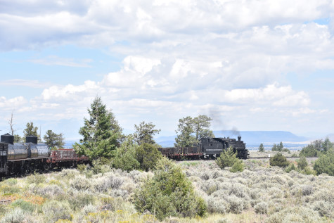
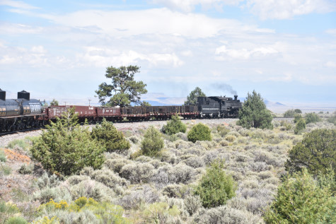
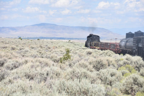
Cumbres and Toltec Scenic 484 pulled our train down the grade.
The steam engine leading the charter train on a curve before Lava Tank.
Denver and Rio Grande Western rotary OY water car 0472, nee Union Tank Car 12958, built by the company in 1908.
Lava Tank at Milepost 291.55 At 8,000 feet and slightly less than 11 miles from Antonito, the railroad has gained 600 feet in altitude. Lava is still "simply a water station". The original tank burned in the fall of 1971, probably by a careless photographer who had climbed to the top. The present tank was originally in Antonito, but was dismantled and moved here after the fire. Water is brought up from the Rio De los Pinõs by a pumping station located beside the river.
Denver and Rio Grande Western 484 rounds the Lava Loop at Milepost 291.00.
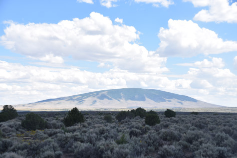
Mount San Antonio.
The snow plough track at Lava.
Cumbres and Toltec Scenic 488 rounded a descending curve.
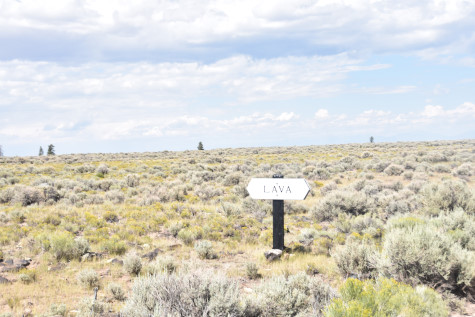
The Lava sign post.
Cumbres and Toltec Scenic 488 nearing Antonito.

The final curve into Antonito at Milepost 280.7. After a most enjoyable and succesful day, we detrained and walked to the waiting motor coach to be taken back to Chama. Once at my car, I drove over La Manga Pass on Highway 17 then turned onto Highway 287 to La Jara, where I had dinner at Subway, then returned to Antonito and checked into the Narrow Gauge Motel for two nights.
| RETURN TO THE MAIN PAGE |