


Elizabeth and I arose in Gallipolis and after our usual morning preparations, enjoyed another good breakfast at Bob Evans. Once on the road, we crossed the Ohio River to Point Pleasant for the first depot of the day.
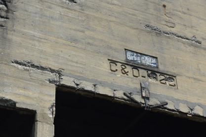
Baltimore and Ohio Point Pleasant station now used by CSX. Point Pleasant is located approximately 55 miles downstream from Charleston where the Kanawha River empties into the Ohio River, as well as approximately 40 miles up the Ohio River from Huntington. Railroads that served Point Pleasant were the Baltimore & Ohio and the New York Central. Across the Ohio in neighboring Kanauga, Ohio was a branch of the Chesapeake & Ohio that ran from Columbus to Gallipolis. B&O's line through Point Pleasant started out as the Ohio River Railroad around 1882 running from Wheeling to Huntington and on to Kenova with a connection to the Norfolk & Western Railway. The B&O acquired the line around 1912. In 1963 the C&O took control of the B&O. Shortly after, the C&O consolidated operations with the B&O in the Huntington area, which led to removal of most of B&O's track through the city and on to Kenova.
We then made our way to Ripley.
Baltimore and Ohio Ripley station where trains ceased in the 1960's. This town was served by the B&O Ripley & Mill Creek Valley Branches.
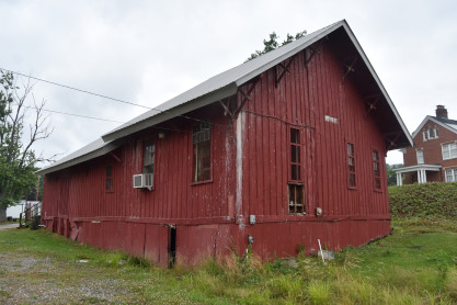
I then drove us to Staats Mill Covered Bridge.
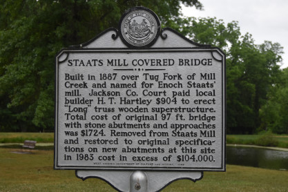
State of West Virginia Historical Sign Staats Mill Covered Bridge.
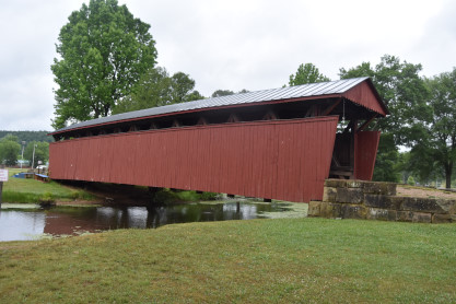
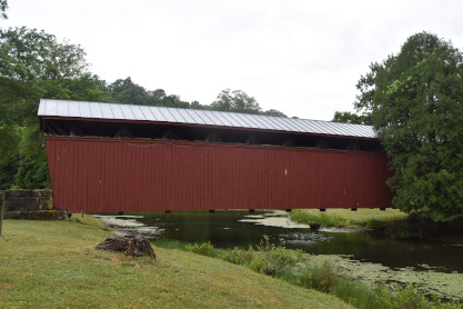
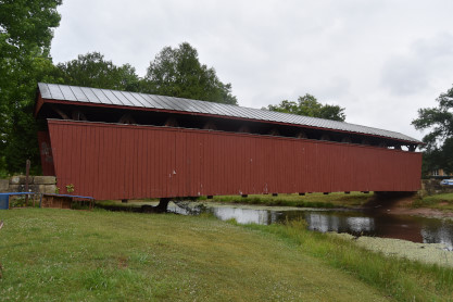
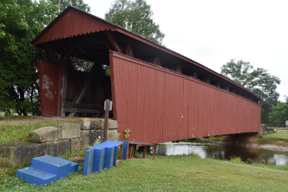
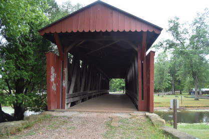

Staats Mill Covered Bridge. This 100-foot wooden covered bridge cost the Jackson County Court $1,788.35 to built in 1887 and it was built across the Tug Fork of Big Mill Creek near Ripley, next to prominent citizen Enoch Staats' water-powered mill and general store, a community hub. This historic covered bridge served the area well for years, but it was relocated to its current location, Cedar Lakes Center, in 1983. Now it serves pedestrian traffic on the camp grounds and it sits adjacent to a playground and historic pioneer village.
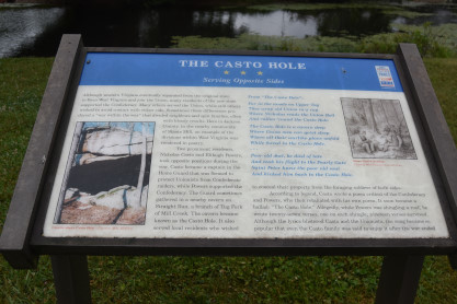
The Castro Hole Serving Opposite Sides historical board. Elizabeth navigated us to Charleston.
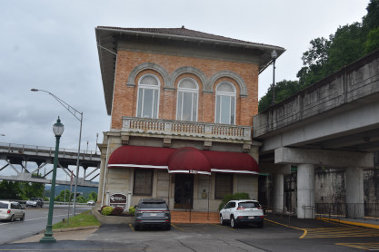
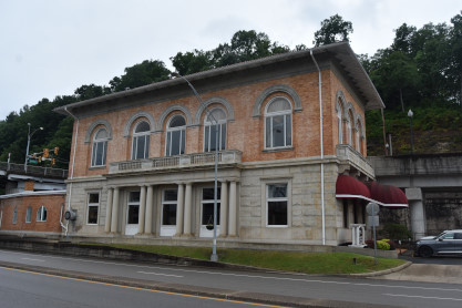
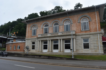
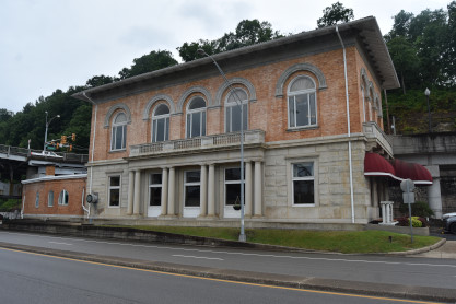
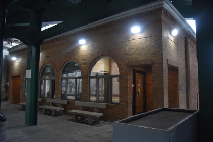
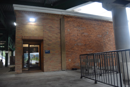
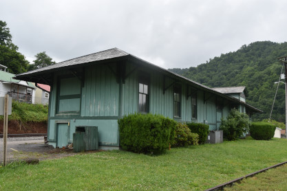
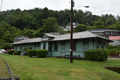
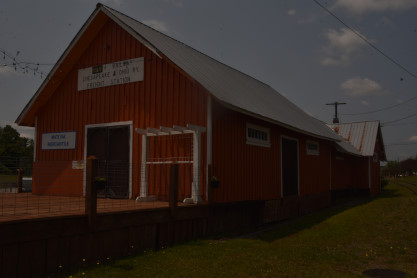
Cheasapeake and Ohio Charleston station built in 1906, part of it used by Amtrak's Cardinal. The principal architects were J.C. and A.L. Pennock and is located at the foot of the South Side Bridge. The track itself sits at the bottom of a shored-up cut into the hillside along the river. The two-story neoclassical style structure is of blonde brick and stone construction. The façade features a shallow single-story portico of paired Roman Doric columns facing the river and the low hipped, terra-cotta tile-covered roof's deep eaves are supported with brackets. This building is the only railroad passenger station structure remaining in Charleston, was placed on the National Register of Historic Places in 1984 and substantially renovated in 1987. Today, it houses offices and commercial space.
Our next stop of the day was Gauley Bridge.
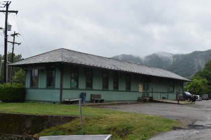
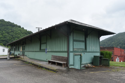
Cheasapeake and Ohio Gauley Bridge station built in 1904 is an example of a small-town passenger station constructed in the late 19th century that has survived down to the present time. It is one of the few remaining passenger stations built by the Chesapeake & Ohio Railroad for the many small towns and villages of Appalachia.
Gauley Bridge, as a community, dates from around 1812, the period of its earliest settlement when it was first known as Kincaid's Ferry until 1822, when bridges were constructed across the Gauley and Kanawha Rivers to accommodate traffic on the James River - Kanawha Turnpike. As a stopping point on the Turnpike, Gauley Bridge grew and thrived with th first church established in 1835. The Civil War played havoc with the community, including a covered bridge being burned by Confederate forces in 1861 and a short-lived suspension bridge built by Federal forces met the same fate in 1862. The town was also the scene of much fighting and suffered from several artillery shellings. Partially as a result of the War, Gauley Bridge grew, but slowly, in the 19th century.
Another economic factor of this period was that the early railroads had bypassed Gauley Bridge. This situation was remedied, however, when the Kanawha and Michigan Railroad Company (founded as the Kanawha and Ohio in 1882, reformed as Kanawha and Michigan in 1890 and bought out by the C&O in 1914) extended its line from Charleston up the north bank of the Kanawha River to Gauley Bridge in 1893, making Gauley Bridge the railroad's terminus. This was done primarily to exploit the booming coal fields in the area. The C&O, in the same year, constructed the Gauley Bridge station, primarily by local black labor, using one of the company's pre-designed architectural plans. Shortly thereafter, the C&O constructed a branch line up the east bank of the River to handle the coal output of the area's mines.
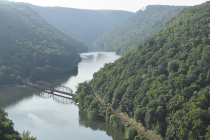
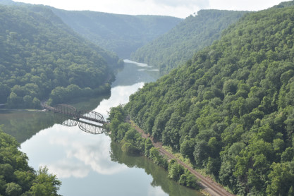
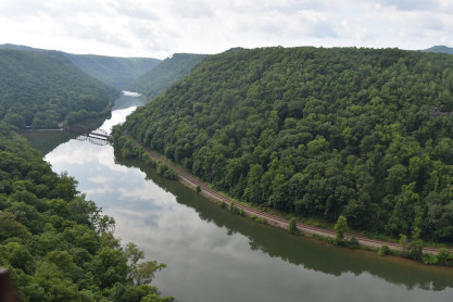
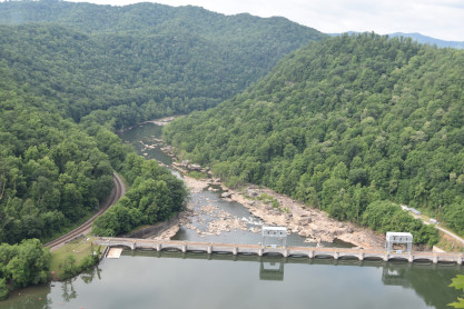
Our next stop was Hawks Nest and we walked out to the viewpoint.
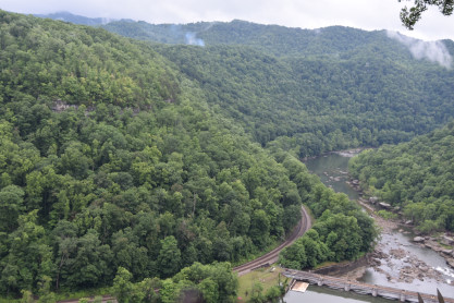
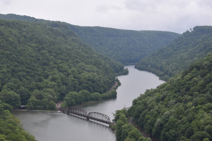
The views from Hawks Nest. Nestled in the heart of whitewater rafting country, Hawks Nest State Park is a 270 acre recreational area with a nature museum, aerial tramway, jetboat rides, hiking trails and one of the most challenging whitewater boating waterways in the nation. Its 31-room lodge offers luxurious rooms, dining and spacious conference and meeting facilities. Located just 10 miles north of the New River Gorge Bridge, Hawks Nest is known for its scenic overlook, which provides a bird's eye view of the rugged New River Gorge National Park and Preserve below.
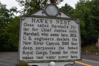
West Virginia Historical Marker Hawks Nest sign. There were no trains in the offing, so we made our way to Prince.
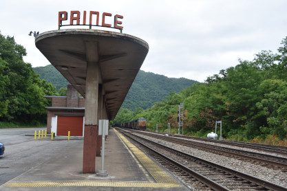
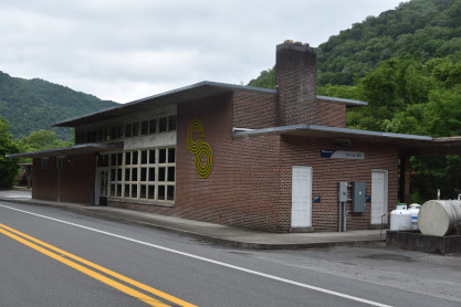
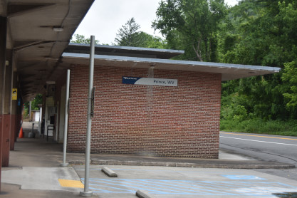
Cheasapeake and Ohio Prince station built in 1946 now used by Amtrak's Cardinal. It serves as the main depot for the Beckley area because it is on the CSX (originally Chesapeake & Ohio Railway) mainline, while Beckley itself is not. The Chesapeake and Ohio Railway built the first facility in 1880 that was enlarged in 1891 to serve both freight and passengers. In 1942, the C&O president, Robert R. Young, saw a need for "a stylish, streamlined and efficient passenger rail system" that led to the development of the current station.
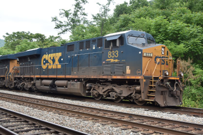
Cheasapeake and Ohio initals on the building. A bonus here was a CSX freight train.
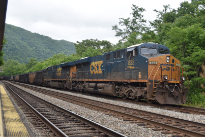
CSX 833 West at Prince.
CSX ES44AC-H 833 built by General Electric in 2008.
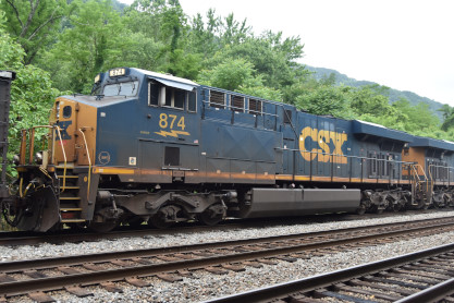
CSX ES44AC-H 874 built by General Electric in 2008. Our car then had the engine overheating warning light come on twice on the way to Beckley, so Elizabeth called Hyundai who sent us to Bailey's Auto Repair, who referred us to Meineke because it was getting late in the day and they could not assist us until tomorrow. Meineke Automotive Repair replaced the radiator clamp as coolant was leaking and refilled the coolant. While we were waiting, I worked on a story while Elizabeth caught up on the Internet then once finished, I drove us to Bob Evans in Summerville for dinner then checked we into the La Quinta for the night.
6/13/2023 After we arose and did the usual morning activities, we returned to Bob Evans for breakfast and I went back to Hawks Nest.
After no trains, I returned, we checked out and stopped at the New River Gorge bridge lookout on the way to Thurmond.
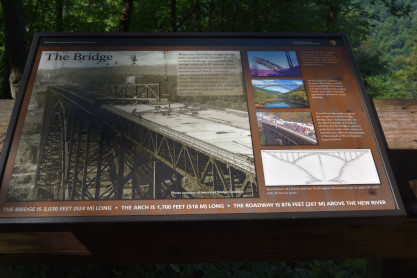
The bridge over the New River board.
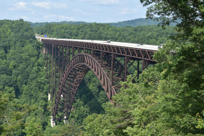
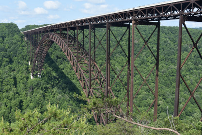
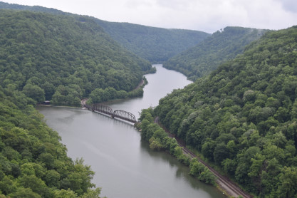
The US Highway 91 bridge across the New River as seen from the Canyon Rim Boardwalk. Established in 1978, New River Gorge National River was redesignated as New River Gorge National Park and Preserve in 2021. The park encompasses over 70,000 acres of land along 53 miles of the New River from Bluestone Dam to Hawk's Nest Lake. A rugged, whitewater river flowing northward through deep and spectacular canyons, the New River is actually among the oldest rivers on Earth. Here in southern West Virginia, the New River has carved and continues to carve the deepest and longest river gorge in the Appalachian Mountains.
The New River Gorge Bridge is a steel arch bridge 3,030 feet long over the New River Gorge near Fayetteville, West Virginia, in the Appalachian Mountains. With an arch 1,700 feet long, the New River Gorge Bridge was the world's longest single-span arch bridge for 26 years; it is now the fifth longest; the longest outside of China. Part of U.S. Route 19, its construction marked the completion of Corridor L of the Appalachian Development Highway System. An average of 16,200 motor vehicles cross the bridge each day. The roadway of the bridge is 876 feet above the New River, making the bridge one of the highest vehicular bridges in the world, it is the third highest in the United States.
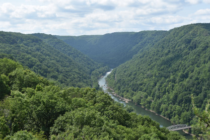
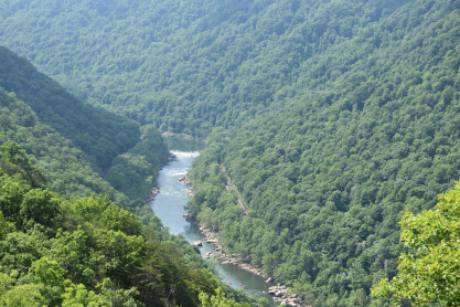
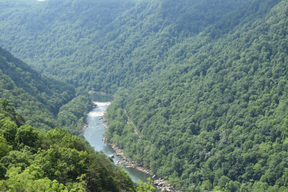
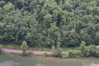
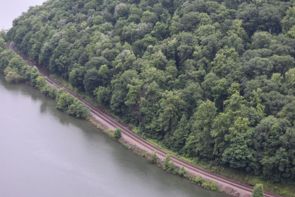
Views of the New River Gorge. We resumed our drive to Thurmond but came upon something completely unexpected as the road and the tracks grew much closer to each other.
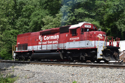
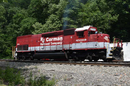
RJ Corman SD40T-2 8718, ex. Union Pacific 8718, nee Southern Pacific 8518, built by Electro-Motive Division in 1978 on the company's West Virginia Line.
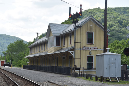
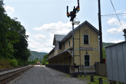
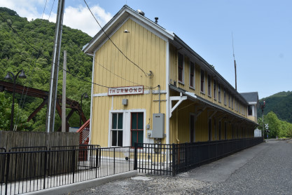
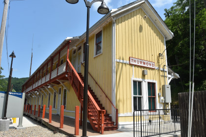
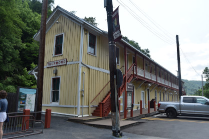
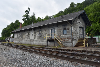
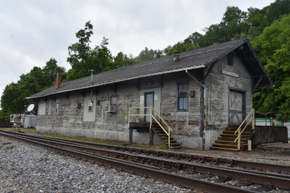
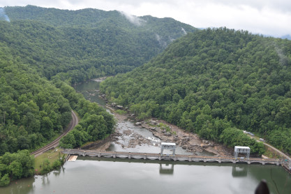
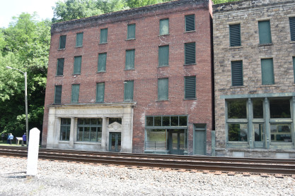
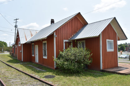
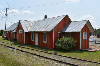
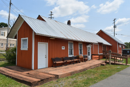
Chesapeake and Ohio Thurmond station built in 1904, a stop on Amtrak's Cardinal. During the first two decades of the 1900's, Thurmond was a classic boomtown. With the huge amounts of coal brought in from area mines, it had the largest revenue on the Chesapeake & Ohio Railway. Having many coal barons among its patrons, Thurmond's banks were the richest in the state. Fifteen passenger trains a day came through town and its depot served as many as 95,000 passengers a year. The town's stores and saloons did a remarkable business and its hotels and boarding houses were constantly overflowing.
With the advent of diesel locomotives, and less coal coming in from local mines, the town began a steady decline. The many businesses closed down and most residents moved on. Today, the town of Thurmond remains surprisingly untouched by modern development. It is a link to our past and a town with many stories to tell. New River Gorge National Park and Preserve invites visitors to experience the impact of the industrial revolution and the National Park Service's mission to preserve our nation's heritage.
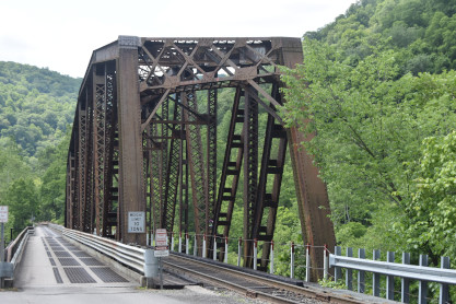
The joint highway/railroad bridge built in 1910 that we crossed both ways to reach here.
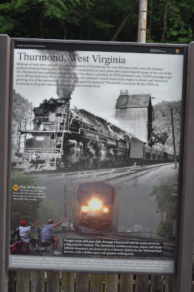
Display board explaining the history of Thurmond.
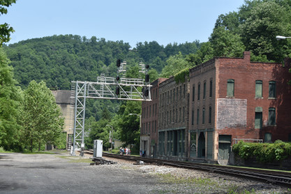
The National Bank of Thurmond.
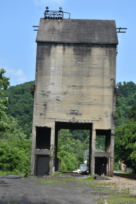
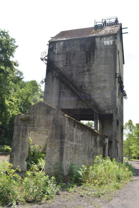
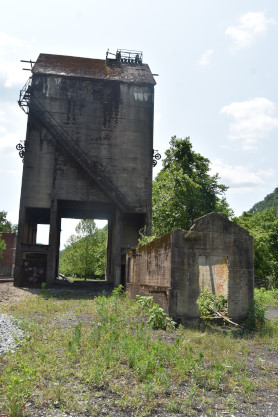
Chesapeake and Ohio coaling tower built by Fairbanks Morse in 1922.
A close-up view of the builder and year.
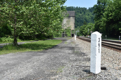
Chesapeake and Ohio Milepost 391 in Thurmond. We then made our way to Oak Hill.
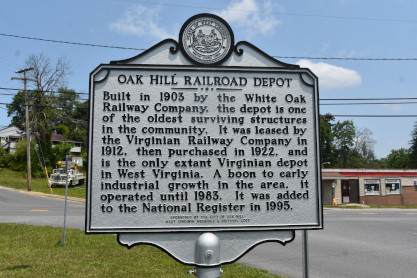
White Oak Railway/Virginian Railway Oak Hill station built in 1903 and is one of the oldest surviving structures in the community. It was leased by the Virginian Railway Company in 1912 then purchased in 1922, and is the only extant Virginian depot in West Virginia. A boon to early industrial growth in the area, it operated until 1983 and was added to the National Register in 1995.
The White Oak Railway was a subsidiary of the White Oak Coal Company. The depot served a line from Glen Jean to coal mines in Summerlee and Lochgelly; it initially served as both a checkpoint for coal cars from these mines and a freight and passenger station for the newly incorporated town of Oak Hill. The station's opening led to a commercial boom in Oak Hill, which transformed from a farming community to a commercial center with multiple banks, hotels and stores. The depot continued to provide passenger and freight service to Oak Hill until after World War II when passenger service to Oak Hill ended. The depot became part of the Norfolk and Western Railway in 1957 and provided freight service for the railway until it closed to trains in 1983.
West Virginia Historical Society Oak Hill Railroad Depot. Next I drove us to the Locust Creek Covered Bridge.
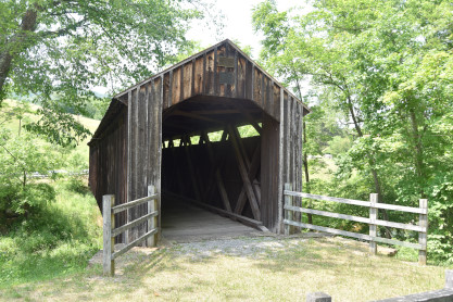
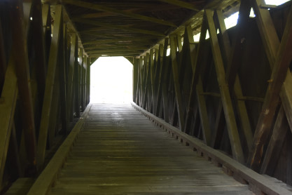
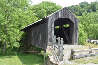
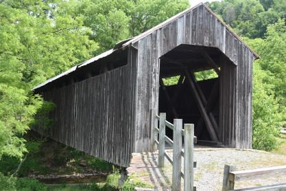
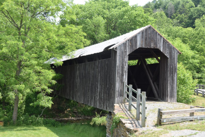
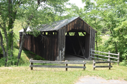
Locust Creek Covered Bridge built in 1870. The most remote of all of the state’s covered bridges, this 13.5-foot-wide, 113.75-foot-long Warren double-intersection truss near Hillsboro once carried vehicles on Pocahontas County 31. R.N. Bruce was hired by the county court to build the bridge for $1,250 plus $75 for extra labor on the abutments. It continued in service for 120 years until it was replaced in 1990 by an adjacent span to carry vehicular traffic. In November 2001, using special covered bridge funding provided in the TEA-21 federal highway program, a $406,936 renovation contract was awarded to Orders Construction Company, Inc. of St. Albans that included removal of previously installed temporary supports and replacement of all materials necessary to restore it to a single-lane pedestrian structure.
 >
>
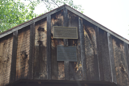
Locust Creek Covered Bridge sign on the bridge. We proceeded to Marlinton for a station.
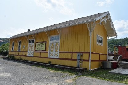
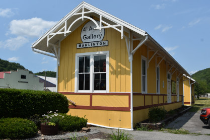
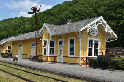
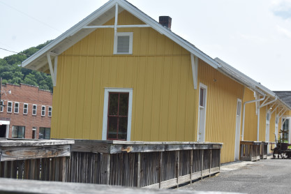
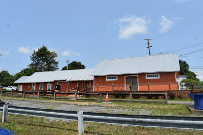
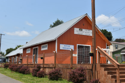
Chesapeake and Ohio Marlinton station built in 1901. The station was a frame, rectangular, one-story building measuring 76 feet by 16 feet and used for both passengers and freight. The bunkhouse is a one-story frame building measuring 24 feet by 16 feet. Both buildings featured vertical board and batten siding and decorative brackets in the wide projecting eave of their gable roofs. Passenger service ended at Marlinton in 1958. Given its location at the trailhead of the Greenbrier River Trail, the station was renovated to house the Pocahontas County Convention and Visitors Bureau. The station was destroyed by fire in 2008; the bunkhouse remains extant.
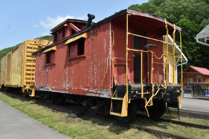
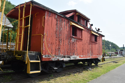
Chesapeake and Ohio caboose 90979 built by Hocking Valley Railroad in 1929.
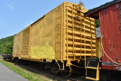
Chesapeake and Ohio box car 16348 built by Pullman-Standard in 1950.
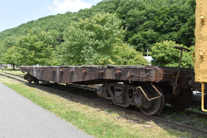
Chesapeake and Ohio 40 foot flat car, number unknown.
Elizabeth drove us to Elkins and we went to the Wingate by Wyndham where we checked in for the night then walked to Scottie's Restaurant for dinner where Elizabeth enjoyed hers but mine was not very good. Later, we called it an early night.
| RETURN TO THE MAIN PAGE |