


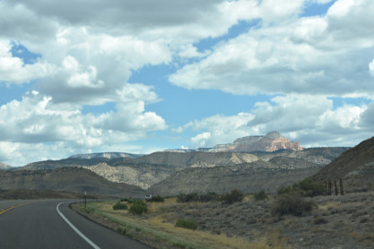
After a rough night due to a hot room and a four-hour power outage, neither of us slept very well. However, we arose at the Days Inn in Panguitch, did our morning routines before we ate a good breakfast at Kenny Rays. I drove us to Bryce Canyon National Park and used my pass to get us in. Each time, we save $35 which is the normal private vehicle rate. After an evening of rainshowers last night, the air was perfectly clear and very comfortable temperature of 53 degrees.
Bryce Canyon National ParkBryce Canyon National Park is an American national park located in southwestern Utah. The major feature of the park is Bryce Canyon, which despite its name, is not a canyon, but a collection of giant natural amphitheaters along the eastern side of the Paunsaugunt Plateau. Bryce is distinctive due to geological structures called hoodoos, formed by frost weathering and stream erosion of the river and lake bed sedimentary rocks. The red, orange and white colors of the rocks provide spectacular views for park visitors. Bryce Canyon National Park is much smaller, and sits at a much higher elevation than nearby Zion National Park. The rim at Bryce varies from 8,000 to 9,000 feet.
The Bryce Canyon area was settled by Mormon pioneers in the 1850s and was named after Ebenezer Bryce, who homesteaded in the area in 1874. The area around Bryce Canyon was originally designated as a national monument by President Warren G. Harding in 1923 and was redesignated as a national park by Congress in 1928. The park covers 35,835 acres and receives substantially fewer visitors than Zion National Park (nearly 4.3 million in 2016) or Grand Canyon National Park (nearly 6 million in 2016), largely due to Bryce's more remote location. In 2018, Bryce Canyon received 2,679,478 recreational visitors, which was an increase of 107,794 visitors from the prior year.
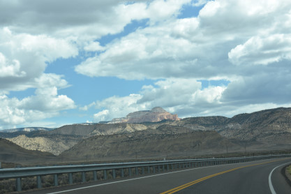
Bryce Canyon National Park lies within the Colorado Plateau geographic province of North America and straddles the southeastern edge of the Paunsaugunt Plateau west of the Paunsaugunt Fault (Paunsaugunt is Paiute for "home of the beaver"). Park visitors arrive from the plateau part of the park and look over the plateau's edge toward a valley containing the fault and the Paria River just beyond it (Paria is Paiute for "muddy or elk water"). The edge of the Kaiparowits Plateau bounds the opposite side of the valley.
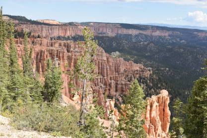
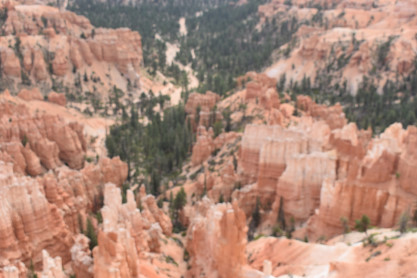
Bryce Canyon was not formed from erosion initiated from a central stream, meaning it technically is not a canyon. Instead headward erosion has excavated large amphitheater-shaped features in the Cenozoic-aged rocks of the Paunsaugunt Plateau. This erosion exposed delicate and colorful pinnacles called hoodoos that are up to 200 feet high. A series of amphitheaters extends more than 20 miles north-to-south within the park. The largest is Bryce Amphitheater, which is 12 miles long, 3 miles wide and 800 feet deep. A nearby example of amphitheaters with hoodoos in the same formation but at a higher elevation, is in Cedar Breaks National Monument, which is 25 miles to the west on the Markagunt Plateau.
Rainbow Point, the highest part of the park at 9,105 feet, is at the end of the 18-mile scenic drive. From there, Aquarius Plateau, Bryce Amphitheater, the Henry Mountains, the Vermilion Cliffs and the White Cliffs can be seen. Yellow Creek, where it exits the park in the north-east section, is the lowest part of the park at 6,620 feet.
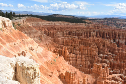
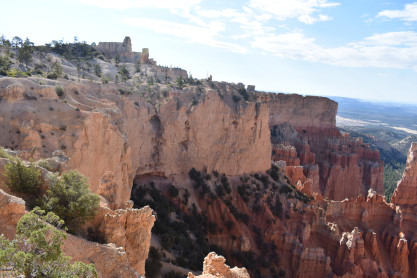
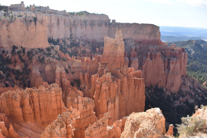
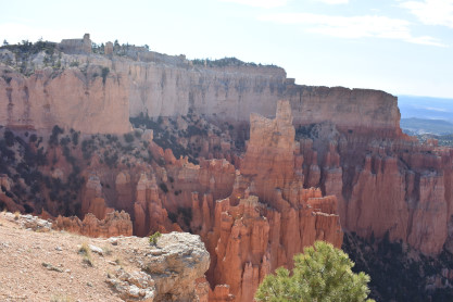
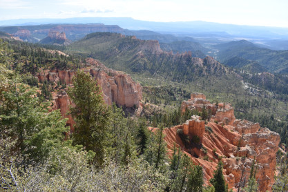
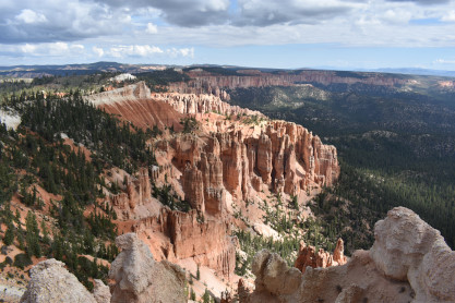
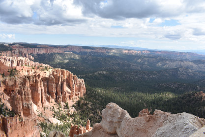
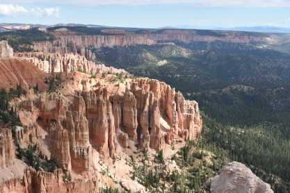
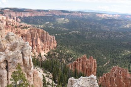
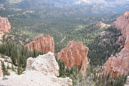
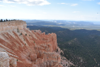
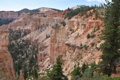
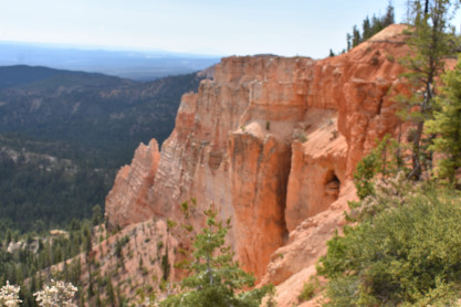
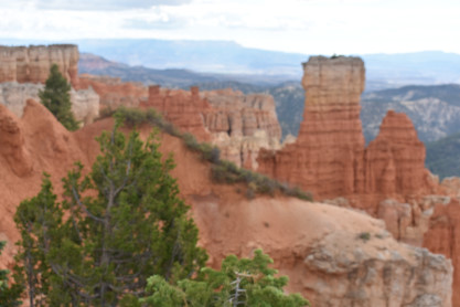
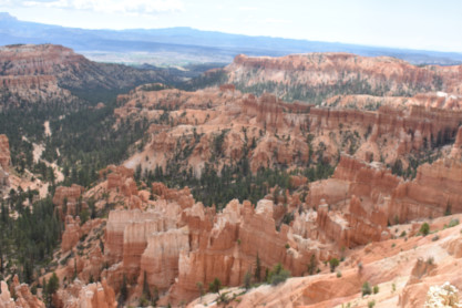
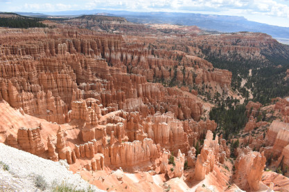
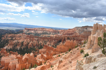
Our VisitWe drove to the Bryce Point viewing area and we walked to the edge.
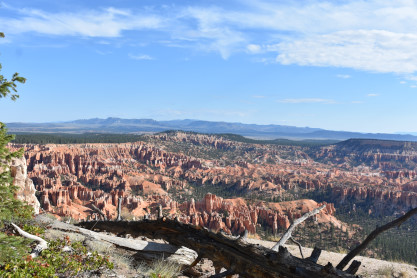
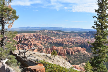
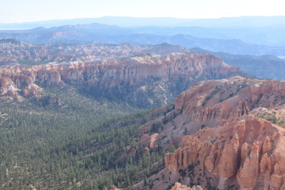
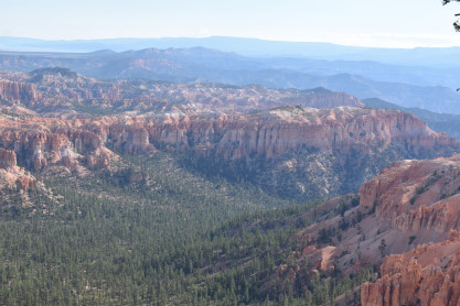
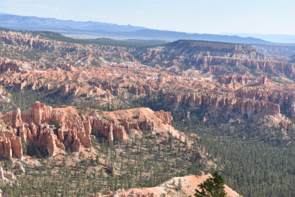
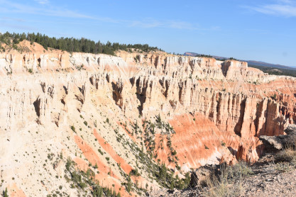
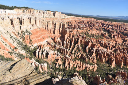
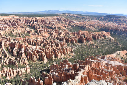
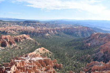
There are many angles you can shoot from at Bryce Point and the formations are incredible. We were both struck by how peaceful and quiet it was.
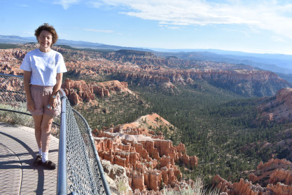
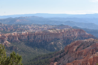
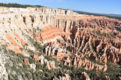
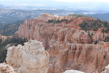
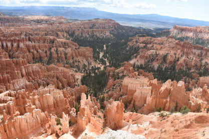
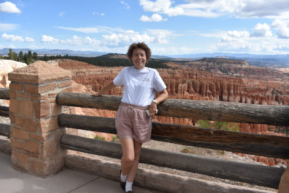
Elizabeth at Bryce Point viewing area. Next we went to Paria View.
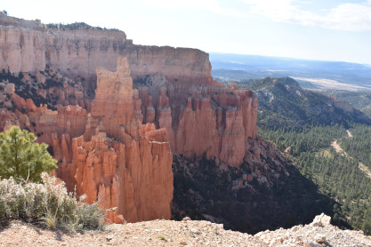
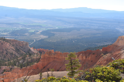
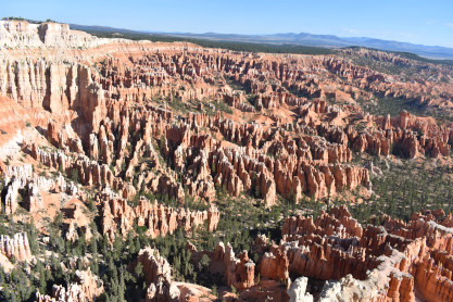
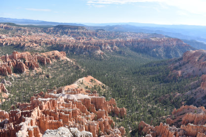
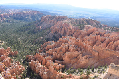
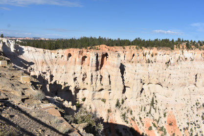
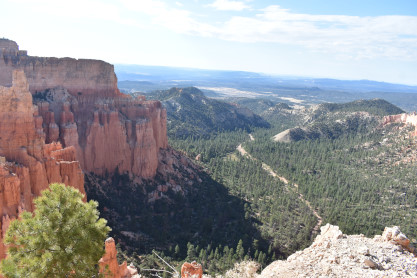
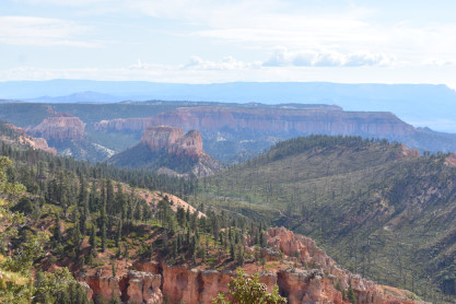
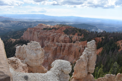
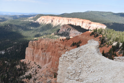
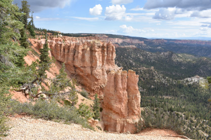
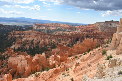
The scenery abounds at Paria View. From here we drove to Farview Point which had a restroom.
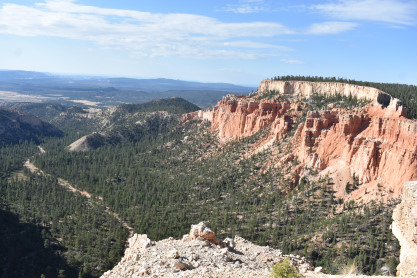
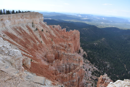
The Farview Point vistas.
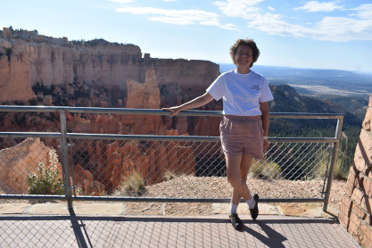
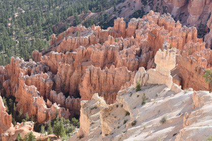
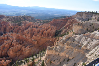
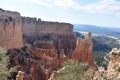
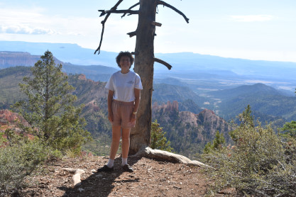
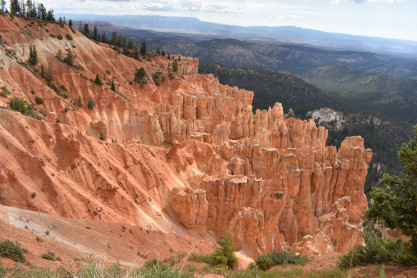
Elizabeth at Farview Point. We walked the short distance to Piracy Point.
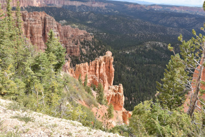
More spectacular scenery at Piracy Point.
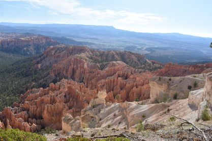
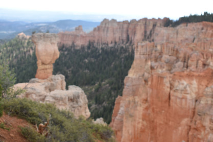
Elizabeth at Piracy Point. From here we drove to the Natural Bridge viewpoint.
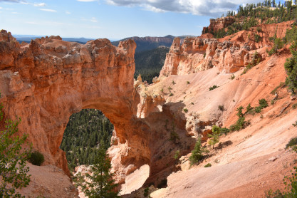
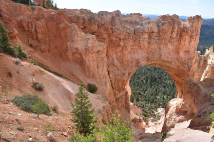
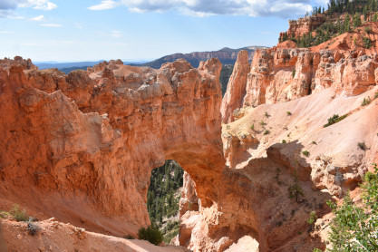
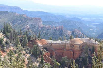
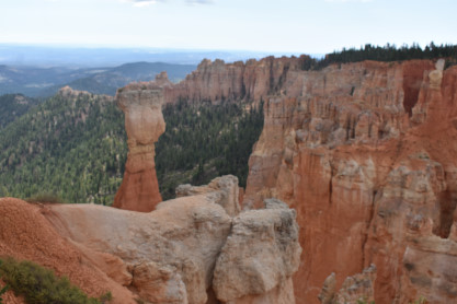
Fabulous views at the Natural Bridge. We then drove to the end of the paved road at Rainbow Point.
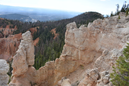
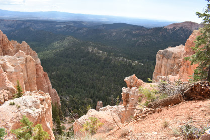
More unique views of Bryce Canyon at Rainbow Point. The two of us walked to Yovimpa Point.
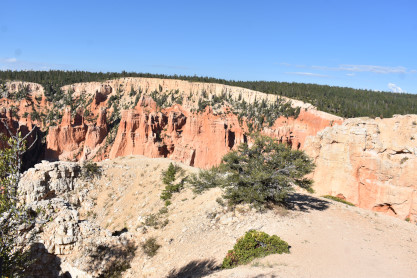
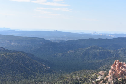
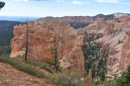
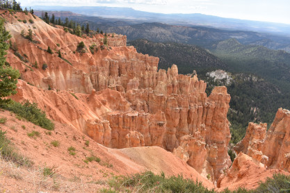
A trio of views from Yovimpa Point. Now we headed north on the highway to Black Birch Canyon.
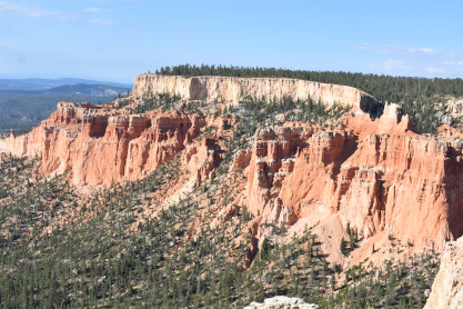
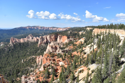
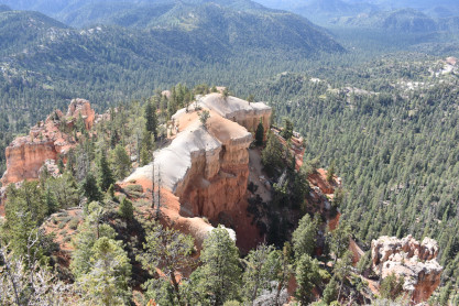
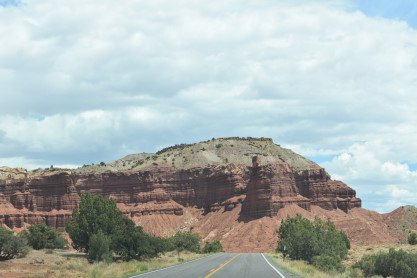
Black Birch Canyon. We next drove to Ponderosa Canyon.
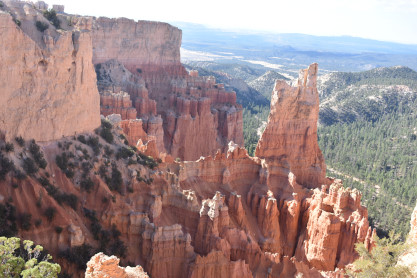
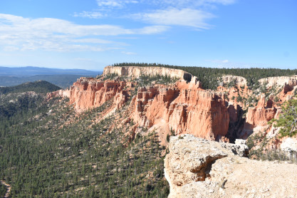
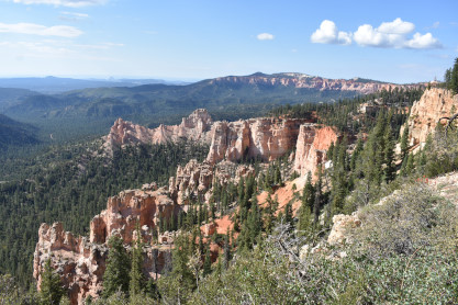
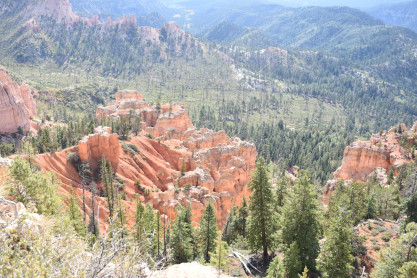
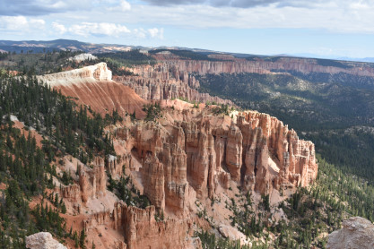
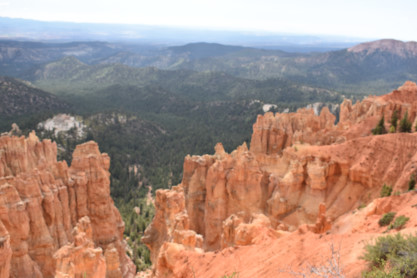
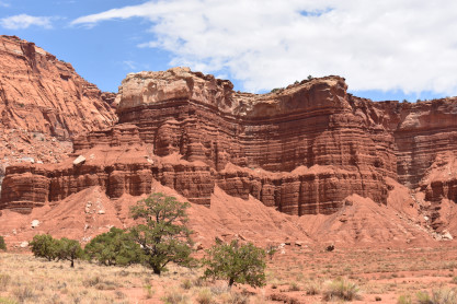
A trio of views from Ponderosa Canyon view point. We continued up the road to Agua Canyon.
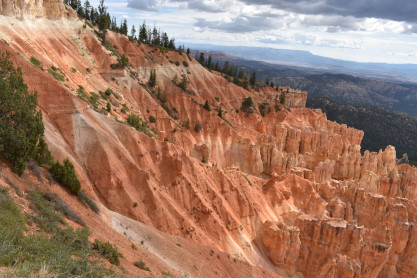
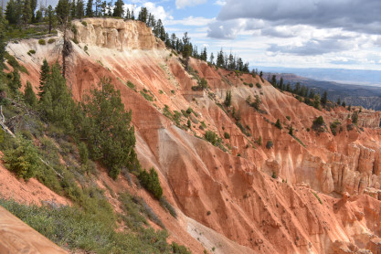
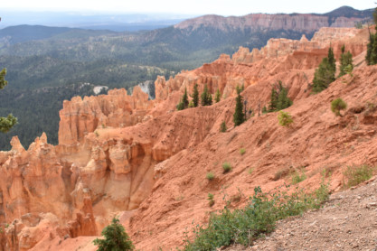
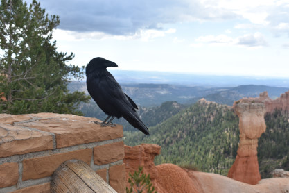
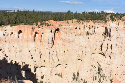
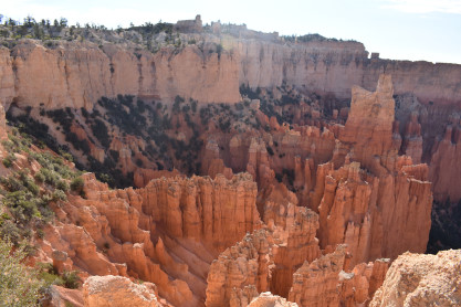
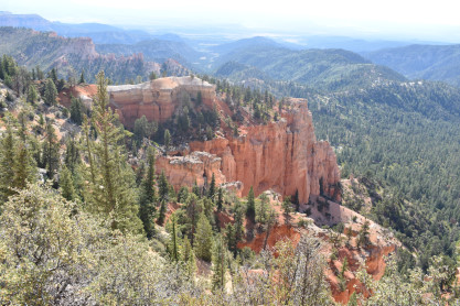
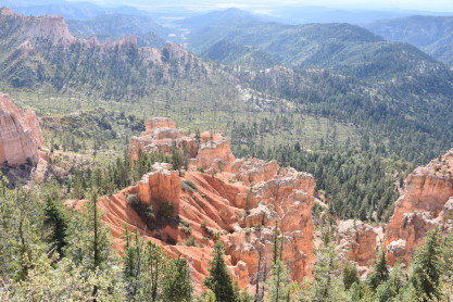
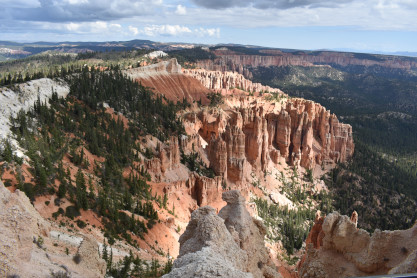
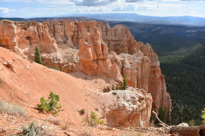
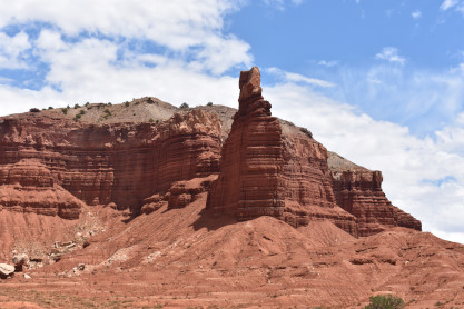
Some of the most spectacular views were at Agua Canyon. The raven was the tamest wild animals I had ever seen in all my travels. He got very close to both of us which was a true treat and a highly unique travel experience. On the way back to Inspiration Point, we encountered a heavy rainstorm that lasted for about five miles. Once we descended from the over 8,000 foot level, the rain stopped and you would not have known it had even rained.
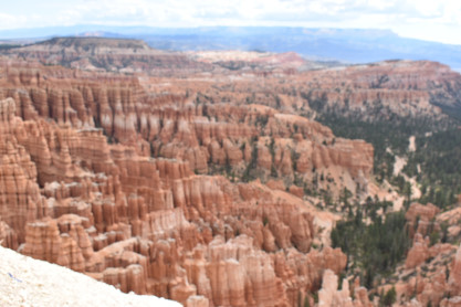
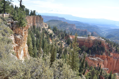
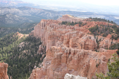
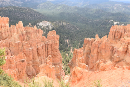
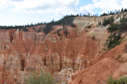
The final fabulous views from Inspiration Point.
My lovely wife Elizabeth at Inspiration Point. We then went to the Visitor Center where Elizabeth acquired a couple of magnets, a lapel pin and a Christmas ornament. We left the park and drove out west to a roundabout where I made a wrong exit and was now on Utah Highway 12, which worked out just fine. This road took us through Tropic, Cannonville and Henrieville.
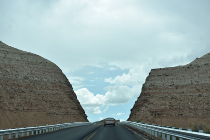
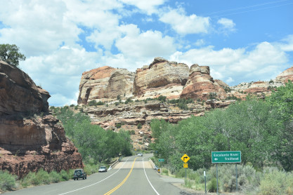
We went through this cut upon leaving Henrieville.
Views on the way to Escalante. We stopped here for lunch at Subway since we did not know what else was along the road.
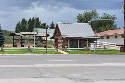
A historic log cabin in Escalante. We continued east down Highway 12.
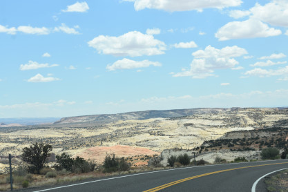
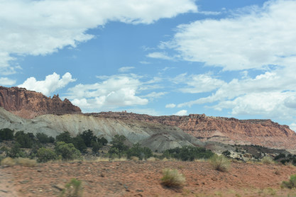
We began descending a grade and then pulled off to enjoy the views.
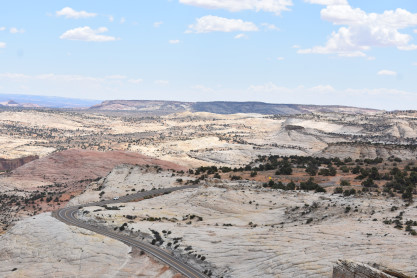
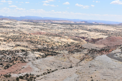
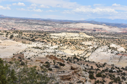
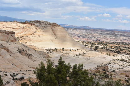
The panoramic views from the Head of the Rocks. From this vantage point, one can see all the way from the Aquarius Plateau along the northern horizon to Navajo Mountains on the Utah-Arizona border. The vista encompasses a maze of deep, winding canyons that form the Escalante River Basin.
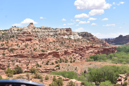
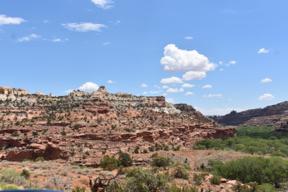
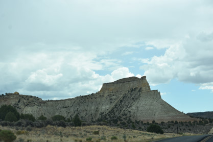
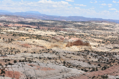
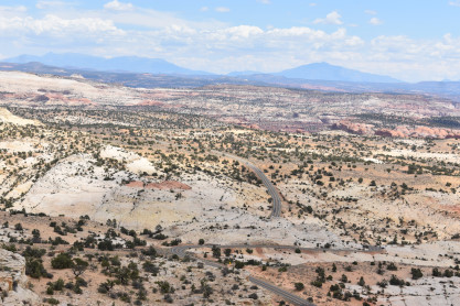
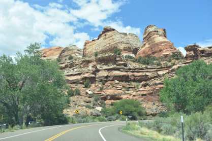
Interesting views along Highway 12.
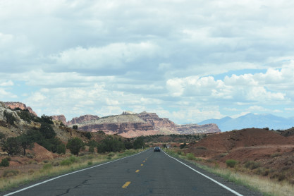
Crossing the Escalanate River. At Torrey, we turned onto Utah Highway 24.
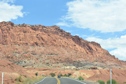
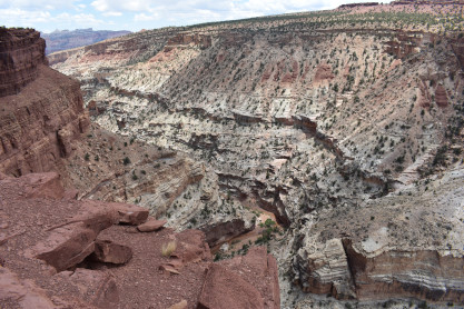
We have entered Capitol Reef National Park. The park is approximately 60 miles long on its north-south axis and just 6 miles wide on average. The park was established in 1971 to preserve 241,904 acres of desert landscape and is open all year, with May through September being the highest visitation months. Partially in Wayne County, Utah, the area was originally named "Wayne Wonderland" in the 1920s by local boosters Ephraim P. Pectol and Joseph S. Hickman. Capitol Reef National Park was designated a national monument on August 2, 1937, by President Franklin D. Roosevelt to protect the area's colorful canyons, ridges, buttes and monoliths; however, it was not until 1950 that the area officially opened to the public. Road access was improved in 1962 with the construction of State Route 24 through the Fremont River Canyon. The majority of the nearly 100 mile long up-thrust formation called the Waterpocket Fold - a rocky spine extending from Thousand Lake Mountain to Lake Powell - is preserved within the park. Capitol Reef is an especially rugged and spectacular segment of the Waterpocket Fold by the Fremont River. The park was named for its whitish Navajo Sandstone cliffs with dome formations - similar to the white domes often placed on capitol buildings - that run from the Fremont River to Pleasant Creek on the Waterpocket Fold. Locally, reef refers to any rocky barrier to land travel, just as ocean reefs are barriers to sea travel.
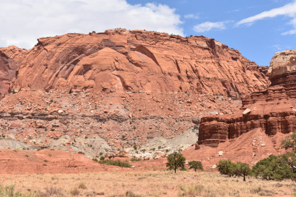
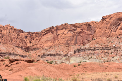
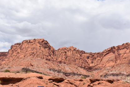
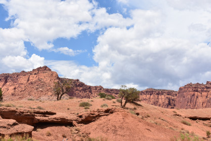
Chimney Rock and another unique geological features at Capitol Reef National Park. Next we drove the one mile dirt road to the Goosenecks.
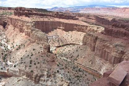
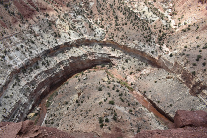
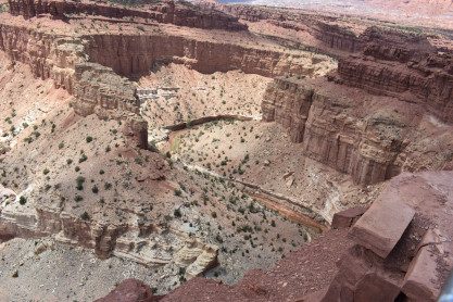
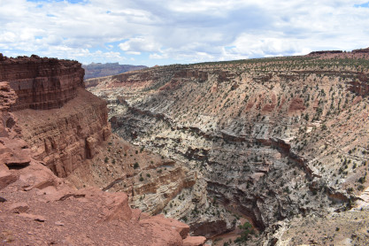
The Goosenecks geographical formations along Sulphur Creek, a tributary of the Colorado River.
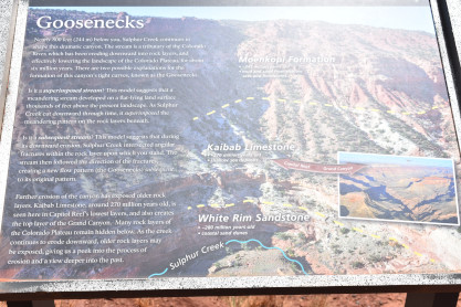
The information board about the Goosenecks. From here we drove east to Hanksville where we filled up the car with petrol then drove north to Green River.
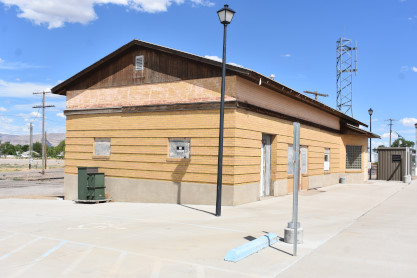
The Green River Denver and Rio Grande Western station now used by the Union Pacific. We drove to Fruita in the hopes of photographing the westbound California Zephyr after it left Grand Junction. However, it never showed up although we knew it was running late. I then drove us the rest of the way to Grand Junction where we checked into the Best Western Grande River Inn. I went next door for KFC and Elizabeth was not hungry. The regular evening activities were done before I wrote the story and called it a night.
| RETURN TO THE MAIN PAGE |