


Robin and I woke up at the Knights Inn in Cedar City and after loading my Ford Focus, we drove to MacDonald's which was under construction so we used the drive through then drove down to the Union Pacific station where we took a picture of the building.
The Cedar City Union Pacific station. After I had consumed my hot cakes and sausage, I drove Utah Highway 130 and 21 to Milford and then Utah 257 where we had a train, but had no way to get a picture of it. So we proceeded on to Delta, taking US 6 to north of Lynndyl, where north of there we had a Union Pacific stack train reversingwith two crew members on the rear platform.
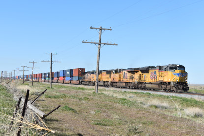
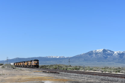
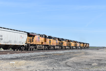
Union Pacific 8377 East would have to back all the way to Lynndyl to set off his bad ordered car. We continued north to near Jericho where I spotted another train coming our way.

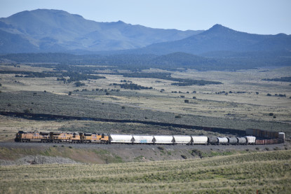
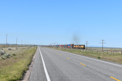
Union Pacific 5569 West near Jericho. We headed north to Mammoth where we turned north onto Utah 36 and a while later stopped for pictures.
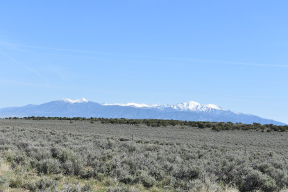
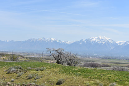
Onaqui Mountains.
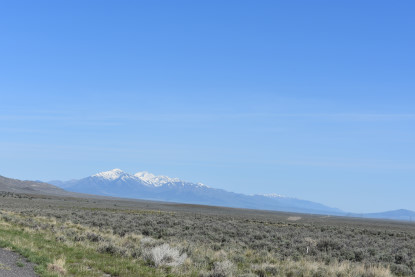
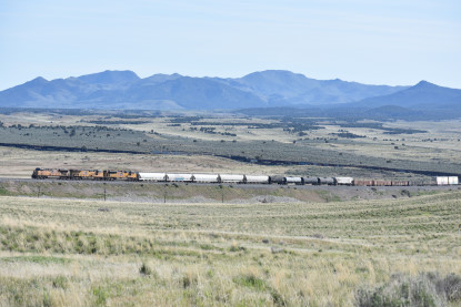
Oquirrh Mountains. After that, we drove to the next grade crossing and just missed a northbound train near Vernon but finally caught up to him at the next grade crossing near Clover Valley.
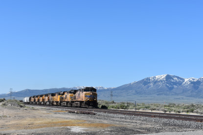
Union Pacific 5673 East near Clover Valley. We then drove into Tooele to our first destination of the morning.
Tooele Valley Railroad MuseumThe Tooele Valley Railway was a railroad founded in 1908 and owned by the Anaconda Copper corporation. The line ran from a connection with the Union Pacific Railroad and the Western Pacific Railroad at Warner Station on the western edge of Tooele, Utah, to a terminus at the International Smelting and Refining Company smelter operations on the eastern edge of Tooele. The line was abandoned around 1982, nearly a decade after the smelter closure and the end of production at the nearby Carr Fork Mine.
The museum is housed in the Tooele Station, which was built in 1909 and was registered on the National Register of Historic Places in 1984 as the Tooele Valley Railroad Complex. The property includes the original depot, the section head's house and a frame maintenance shed. The museum is dedicated to preserving railroad artifacts relating to the Tooele Valley Railway, which was constructed in 1908 by the Anaconda Copper Corporation. The railroad was instrumental in transforming Tooele from a largely agricultural to an industrial base.
The original line ran nearly seven miles from a connection with the Union Pacific and Western Pacific Railroads at Warner Station on the western edge of Tooele, to a terminus at the International Smelter. The smelter processed lead, zinc and copper ores, and the railway delivered raw materials and finished products to and from it, as well as carrying employees and providing a passenger service to Warner. The railroad included a 2.4% grade running up Vine Street from Tooele to the smelter. As was common on many industrial and logging railroads, locomotives pushed, rather than pulled, trains to the smelter. This provided better control of the cars on the steep grades and limited the likelihood of a runaway.
The Tooele Valley Museum and Historic Park comprises three parts. The first is the mining history. Workers at the International Smelter & Refining Company and the Tooele Valley Railway founded the museum and donated our first artifacts. Since then, the museum has collected many artifacts, photos and documents about mining in the county. We always have an exhibit about the smelter and Carr Fork mine. We rotate artifacts into the gallery in special exhibits. The second part of our collection is about the military. We have artifacts and photos that span from World War II to the present. Tooele County has a long military history. The military has been vital to the formation of the county. In return, the military history of the county has played a role in national and international history. We have a permanent display of military items in two Air Force rail cars on the property. The third part of our historical collection is cultural history of the county. We have a collection of items from Tooele city and county government history. We use these materials to teach the fundamentals of local government and urban history. We are building a permanent exhibit for these items in the Station House on our property.
They were having a work cleanup party so we went through the open gate into the museum's grounds.
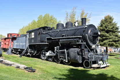
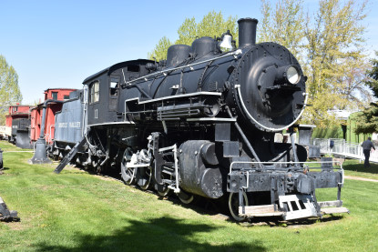
Tooele Valley Railroad 2-8-0 11 is the prized piece of the group. It was built in 1910 by Brooks Locomotive Works for the Buffalo and Susquehanna Railroad but upon their bankruptcy in 1912 both 11 and 12 were sent to the Tooele Valley Railway. Locomotive 11 would be preserved after retirement in 1963. 12 was scrapped in 1956, with the tender being used to mount a snowplow. 11 would be the last steam locomotive in Utah to be used in revenue freight service. First displayed near the intersection of Vine Street and 200 West, 11 was moved to the Tooele Valley Railroad Museum in 1982 via rail. The museum also preserved the snowplow mounted to locomotive 12's tender, several pieces of Maintenance of way equipment, and a pair of caboose from the railway. Locomotive 100 and 104 were sold to new owners. A steam crane preserved at the Nevada Southern Railroad Museum known as "The Crab" likely originated at the Tooele Valley Railway or the smelter before being acquired by the Wasatch Mountain Railroad (modern day Heber Valley Railroad) before moving to its current location in Nevada.
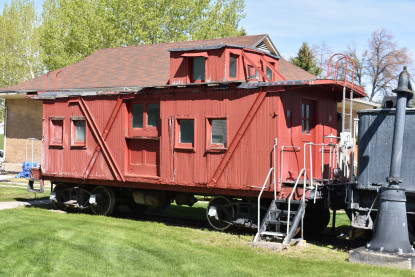
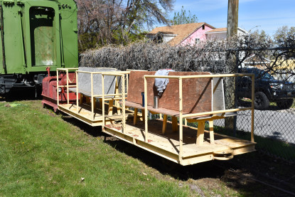
Tooele Valley Railroad outside-braced wooden caboose 3 which was transferred to the Tooele Valley railroad 1937 from the Butte, Anaconda & Pacific Railroad.
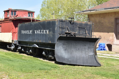
Tooele Valley Railroad snow plow built from the tender of scrapped 2-8-0 12.
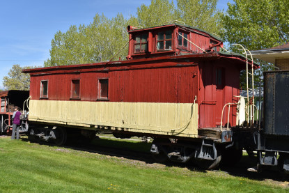
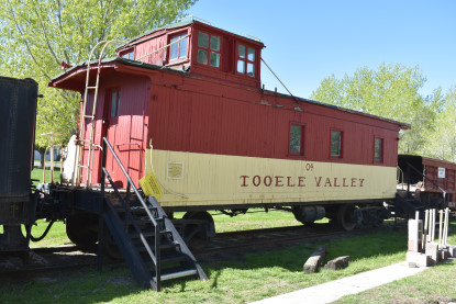
Tooele Valley Railroad wooden caboose 4 built in 1929 as Denver & Rio Grande Western 01100.
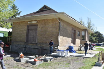
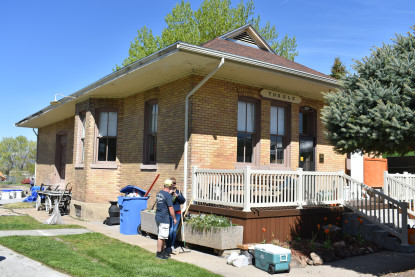
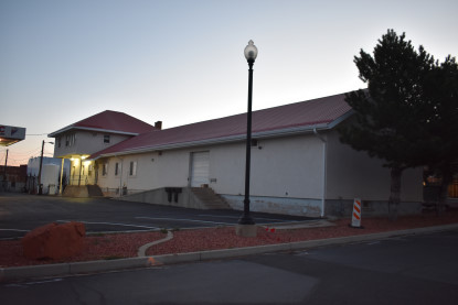
Tooele Valley Railroad station built in 1909.
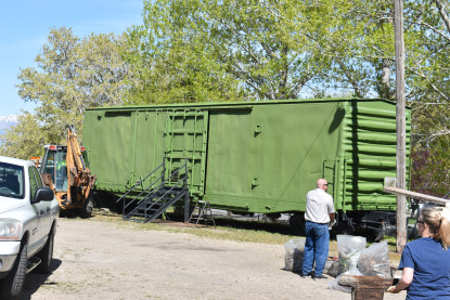
Unknown box car.
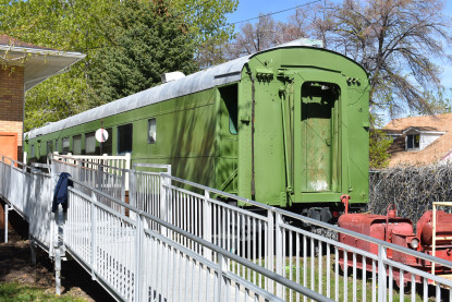
Former U.S. Army Hospital Car 89464, built 1945, from the Tooele Army Depot, that currently houses an HO scale model railroad being built by a local club, the Salt Lake Trackers.
Another former U.S. Army Hospital Car, number unknown, from the Tooele Army Depot.
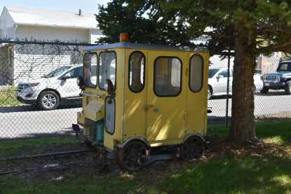
Track speeder.
Track car trailers.
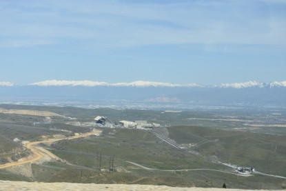
On to Bingham CanyonWe drove north on Utah 36 to Interstate 80 East then to Exit 104 where I saw something across the highway we needed to get pictures of.
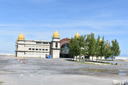
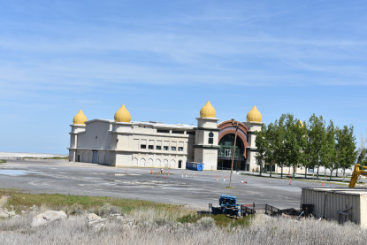
The old Saltair Pavilion. Originally built in 1893 in an anachronistic Indian style complete with domed ceiling and minarets reminiscent of a wooden Taj Mahal, the Saltair entertainment pavilion has been ruined time and again by a number of catastrophes and has been rebuilt each time in order to make the Great Salt Lake seem a little less bleak.
In its original conception, the Saltair resort pavilion was a lush wooden construction that stood out over the lake on over 2,000 wood pylons, providing a picturesque break in the black ring of brine flies that otherwise cover the beach up to the water. The site made use of a commuter train that ferried young couples of the Church of Jesus Christ of Latter-day Saints to the site where they could enjoy a day at the beach free from any worries and gossip their conservative brethren might have. The site was wildly successful during its day, but the wooden construction proved its downfall when a devastating fire tore through the date spot in 1925.
However the Saltair was not down for long and a new pavilion was built on the site just years later. Unfortunately the days of taking a date down to the pungent shore of the Great Salt Lake for some chaste Latter-day Saint bonding were over. Motion pictures had come into vogue among other entertainments located right in Salt Lake City, making the reasonably remote Saltair far less appealing. Like its predecessor, the second Saltair succumbed to an arson fire that once again destroyed the site.
Yet again the Saltair rose from the dead in 1981, this time attempting to capitalize on the nearby highway traffic that had been passing the lake and its burnt husk for years. This new venue was established as a concert hall, trying to attract hipper young acts to the site. Unfortunately a massively damaging flood nearly destroyed the site once again and competition from larger venues made sure that the expected audience never materialized. This newest Saltair sat empty for over a decade until new investors gave the site one last shot, renovating the space and managing to attract popular modern acts that finally made the site a success for the first time in nearly a century. Today the Saltair is still a popular concert venue which, while lacking in some of the architectural grandeur of its predecessors, it has managed to avoid any annihilating fires.
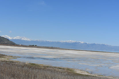
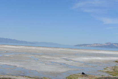
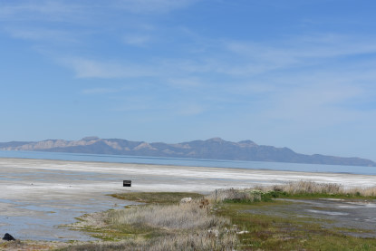
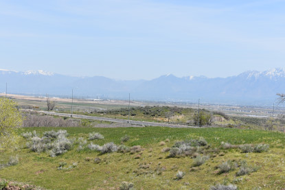
Scenes along the Great Salt Lake.
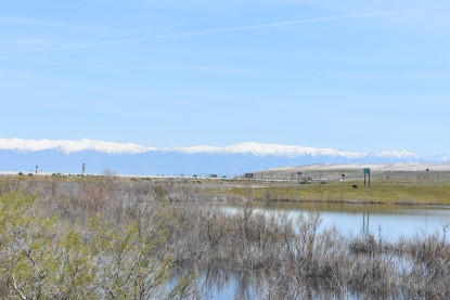
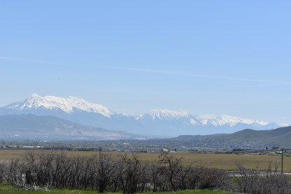
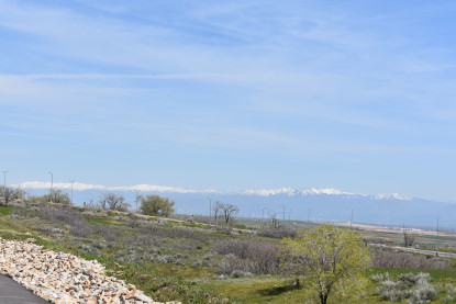
Wasatch Mountains.
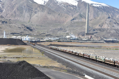
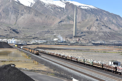
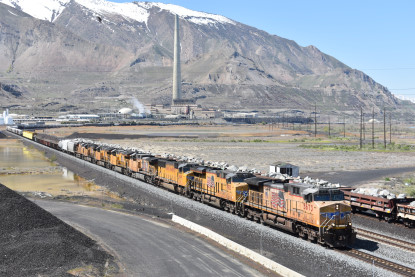
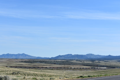
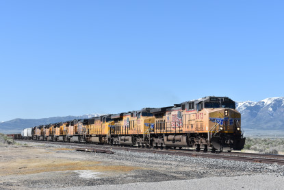
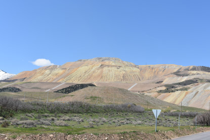
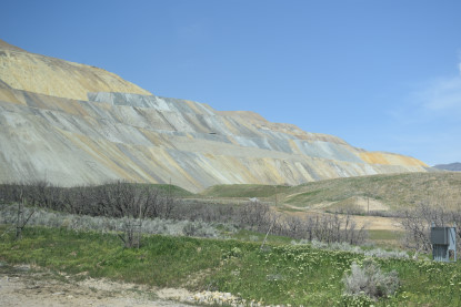
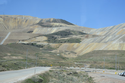
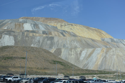
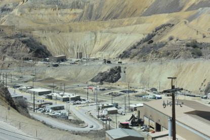
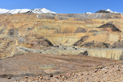
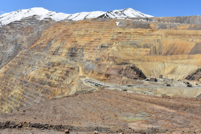
Union Pacific 5673 East at Smelter, Utah. We drove down Utah 111 south to the Rio Tinco Visitor Center and paid $5.00 per person for the 12:30 PM bus tour of Bingham Canyon, where we would board a bus to the old visitor overlook in the world's largest open pit copper mine. I also bought a T-shirt at the gift shop.
Bingham Canyon Copper MineBingham Canyon was a city formerly located in southwestern Salt Lake County, Utah in a narrow canyon on the eastern face of the Oquirrh Mountains. The Bingham Canyon area boomed during the first years of the twentieth century, as rich copper deposits in the canyon began to be developed, and at its peak the city had approximately 15,000 residents. The success of the local mines eventually proved to be the town's undoing, however: by the mid-twentieth century the huge open-pit Bingham Canyon Mine began encroaching on the community, and by the late twentieth century the Bingham townsite had been devoured by the mine. No trace of the former town remains today.
The geographic feature known as Bingham Canyon received its name from the location's two first settlers, the brothers Thomas and Sanford Bingham, who arrived in the canyon in 1848. Initially, the area was utilized for livestock grazing and logging, but the region's economic focus changed with the 1863 discovery of rich gold and silver ore bodies in the canyon. Mining activity in Bingham Canyon boomed after the Bingham Canyon and Camp Floyd Rail Road completed a line to the canyon in 1873, and as the region grew the focus shifted to the high-quality copper ores in the district. As the mines grew, the town of Bingham also expanded, spreading along the narrow and steep canyon floor below the mines.
The Bingham Canyon mines experienced their greatest boom during the first years of the twentieth century, as the district's smaller mines were consolidated under large corporate ownership. The most significant development occurred in 1903, when Daniel C. Jackling organized the Utah Copper Company to begin surface mining at Bingham Canyon. The Utah Copper Company's mine prospered, and this brought a tremendous influx of new residents into the canyon. The town of Bingham Canyon was officially incorporated on February 29, 1904. By the 1920s, the city of Bingham Canyon was at its peak, with perhaps 15,000 inhabitants. Urban development spread for some seven miles along the single, narrow road winding up the steep canyon floor.
As with many western mining towns, the Bingham Canyon area evolved into a collection of diverse neighborhoods, many with pronounced ethnic affiliations. Many Scandinavians lived in the Carr Fork area, while southern and eastern Europeans congregated in Highland Boy, which was in another branch canyon toward the top of the main city. As the mainstreet in the bottom of the canyon grew, Copperfield became the name of the upper section of the main town. Bingham itself attracted British, French, Irish, Puerto Rican, Mexican, and other immigrants and ethnicities. Numerous other small neighborhoods and communities also existed. Most took the name of the mine where they were located. Commercial, Boston Con, and "the Niagara" were the first three communities to be mined away or covered, as the last one was by Galena Gulch waste dumps. Others were the Galena, Old Jordan, and Silver Shield (these three found in Galena Gulch), along with Niagara. Telegraph was in the upper part of the canyon, along with Copperfield, which was threatened when the mining excavating was expanded and a long one-way tunnel was built before 1940 to allow traffic to reach the upper communities. Many names were colorful: Terrace Heights, Dinkeyville, Jap Camp, and Greek camp were sections of Copperfield. The Frisco, Yampa, Phoenix and Apex were in Carr Fork along with Highland Boy. Further down the canyon were Markham, Freeman and Frog Town (lower Bingham).
The size and importance of the Bingham community began to fade as early as the 1920s. The canyon's difficult geography made urban development difficult, while exposing the town to the hazards of fire and avalanche. The first effort to reduce settlement in the canyon came in 1926, when Utah Copper established the town of Copperton on the flats east of the canyon mouth. This was a lovely community with many copper products used in the building of the houses, and the low rent encouraged company employees to live there. In 1956, Kennecott sold the homes to employees for $4,800 to $6,000. Increasing mechanization at the mine also reduced local employment-and hence, Bingham Canyon's population.
By the 1930s it was becoming apparent that the most significant threat to the town of Bingham was the mine itself, whose ever-expanding open pit began encroaching on lands formerly occupied by miners' neighborhoods. The mine continued to eat away at Bingham throughout the middle years of the twentieth century, and by 1971 little of the town remained. That November, Bingham Canyon's 31 remaining residents voted 11-2 to disincorporate the town, and the last buildings at Bingham were razed in 1972. Today, most of the land once occupied by Bingham has been consumed by the Bingham Canyon Mine.
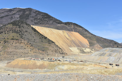
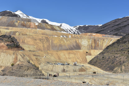
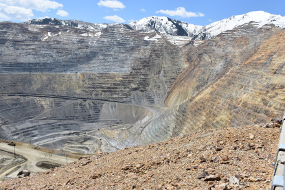
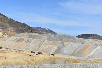
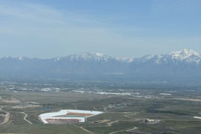
The Bingham Canyon Mine, more commonly known as Kennecott Copper Mine among locals, is an open-pit mining operation extracting a large porphyry copper deposit southwest of Salt Lake City. The mine is the largest man-made excavation in the world and is considered to have produced more copper than any other mine in history - more than 19 million tons. The mine is owned by Rio Tinto Group, a British-Australian multinational corporation. The copper operations at Bingham Canyon Mine are managed through Kennecott Utah Copper Corporation which operates the mine, a concentrator plant, a smelter, and a refinery. The mine has been in production since 1906, and has resulted in the creation of a pit over 0.6 miles deep, 2.5 miles wide, and covering 1,900 acres (3.0 sq mi). It was designated a National Historic Landmark in 1966 under the name Bingham Canyon Open Pit Copper Mine. The mine experienced a massive landslide in April 2013 and a smaller slide in September 2013.
Our visitI started looking around.
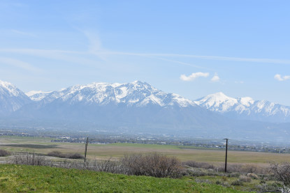
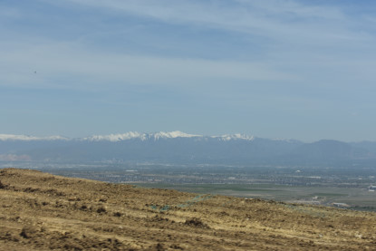
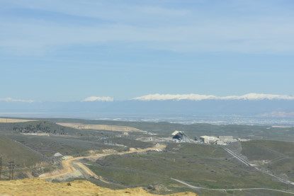
The Wasatch Mountains and Salt Lake Valley.
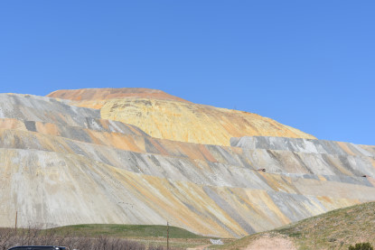
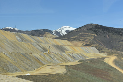
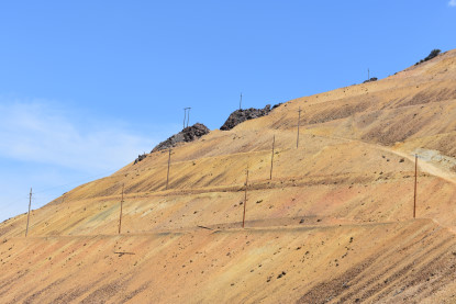
Mine tailings taken from the open pit.
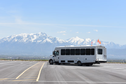
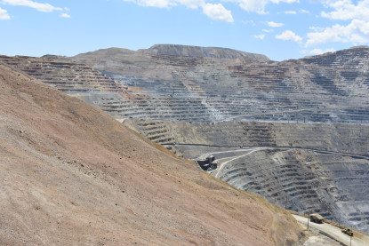
The bus in which we would take our tour. At 12:25 PM they boarded the bus and we watched a safety film about our visit to this unique place.
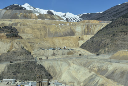
The bus trip into the visitor overlook. Once there, you are on the upper viewpoint although the best pictures are from the lower viewpoint.
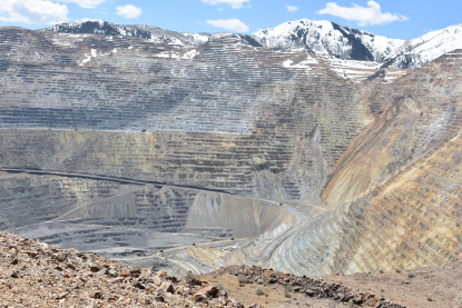
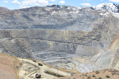
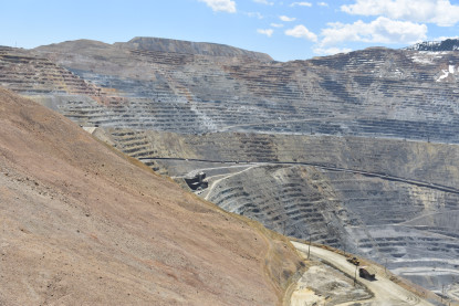
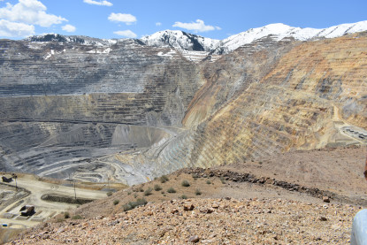
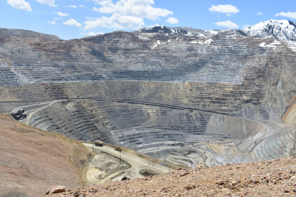
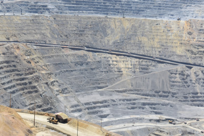
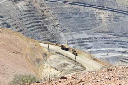
Views from the lower viewpoint of the open pit. I walked back to the upper viewpoint then returned on the first bus I could get on and Robin came back on the next bus.
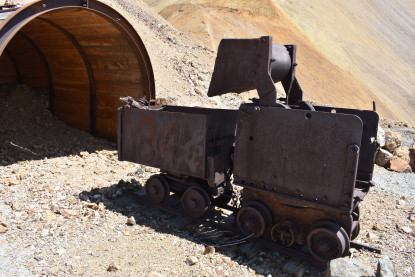
An old mine car and tunnel.
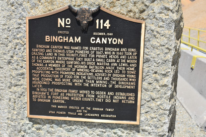
Bingham Canyon History plaque.
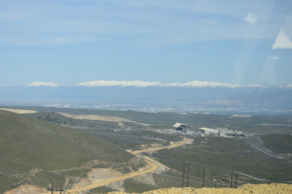
The return trip to the Visitor Center. Robin returned to the car and we headed to Park City next.
On to Park CityWe took Utah 111 to the Old Bingham Highway east to Interstate 15, to Interstate 215, to Interstate 80 East, then US 189 south to Utah 248 into Park City where we reached our first destination.
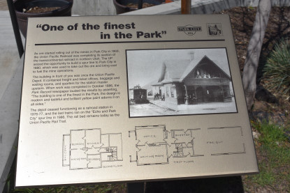
One of the finest in the park.
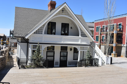
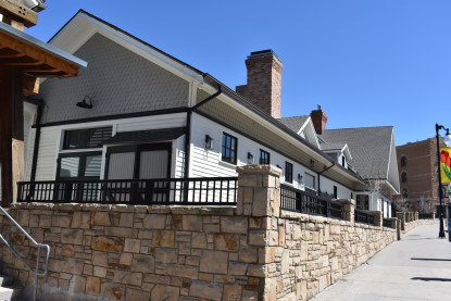

Union Pacific Park City station. We drove to the address of our hotel, but there was no office to check into. I called and she told me it was on Empire Street. Not knowing where we were going, I went into an office where a very nice lady used her phone and gave us directions. After a little trouble, we finally found the offices on Empire Street and got the key which we would have to return to their office on Sunday morning. We went back to where we first been, found their Building One and finally found Building Two where we would be staying. I tripped going down the stairs, luckily not getting hurt, then went into the room for our two-night stay. Robin and I walked over to a cafe for an early dinner where I enjoyed a roast beef sandwich then I returned to the room and found that none of their internet passwords would work. I called twice and after the second time, he reset the building then I had Internet so was able to work on the stories before calling it a night.
| RETURN TO THE MAIN PAGE |