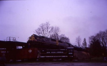
Chris Parker and I arose on this very wet and rainy morning and I was glad that we had taken our equipment pictures in yesterday's sunny afternoon light. We enjoyed a continental breakfast before driving to the Whitewater Valley Railroad station in Connersville and checked in at the station. As usual, I met plenty of my rare mileage friends from all over the country. We kept dry under the overhang, with umbrellas in hand, waiting for our train to arrive.
Whitewater Line HistoryOn January 27, 1836, Indiana Governor Noah Noble signed "An Act to Provide for a General System of Internal Improvements" to create a board to fund and oversee the construction of a number of canals, roadways and railroads throughout the state. The Whitewater Canal received $1.4 million of this funding for its construction. The canal started in Lawrenceburg, on the Ohio River, and originally ended in Cambridge City, but was expanded to Hagerstown after they funded an extension. Construction started on the canal in 1836 at Brookville. The canal's total length was 76 miles, not including a 25 mile spur on into Cincinnati built by the State of Ohio. The canal used 56 locks to climb approximately 500 feet out of the Ohio River Valley.
The Whitewater Canal was the first Indiana canal to be replaced by a railroad. After a series of financial failures and storms, whose damage could not be fully repaired, the White Water Valley Railroad acquired the route in 1865 and reopened it as a railroad on July 21, 1868. The Indianapolis, Cincinnati and Lafayette Railway (created in 1867 from several lines, including the first railroad built in Indiana, as a Cincinnati-to-Indianapolis system) operated the line until 1871. The line was independent until 1875. In 1890, the line was one of many absorbed into the Cleveland, Cincinnati, Chicago and St. Louis system through various leases. The line was fully acquired by the Big Four on June 16, 1915.
Daily passenger service over this line peaked at about a dozen during World War I but service ended in 1933. Commuter trains also once ran between Connersville and Cincinnati. During the late 1920's and early 1930's, the New York Central used a doodlebug motorcar on its daily Connersville-to-Cincinnati round trip, making 22 stops each way on the run.
The line north of Beesons (5.7 miles north of Connersville) and Hagerstown was abandoned in 1931. Freight service was discontinued south of Connersville in 1972 by Penn Central (PC switch service continued between Connersville and Beesons to serve the large Philco-Ford plant until taken over by Indiana Hi-Rail). Since 1974, tourist railroad service has been conducted over nineteen miles of track between Connersville and Metamora by the Whitewater Valley Railroad (they ran on to Brookville that first year but cut the route back to Metamore before the 1975 season). The track on to Brookville was abandoned and the 26 mile line on to Valley Junction was sold to the Indiana and Ohio Railroad in 1979.
The Whitewater Valley bought 18 miles of track in 1984 and then brought the northernmost mile from the Indiana Hi-Rail Corporation. The Whitewater Valley line is all 90 lb. rail, some laid as early as 1897. This indicates the slow progression from Cincinnati-Indianapolis mainline to rural branchline that the railroad experienced.
The train reversing to the station. I walked down for some pictures using my umbrella to keep dry.
The front of our train on this dark rainy morning.
The power was New York Central S-1 9339. We boarded and a few minutes later, proceeded north to the bridge at Milepost 68.9, which is 11th Street and CSX overpass, where we detrained for pictures.
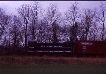
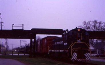
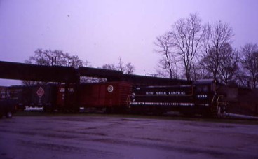
It was announced that a westbound CSX freight would be here in ten minutes. I went under the overhang of a bar to stay dry until the freight was heard and then set up.

The westbound freight arrived and everyone was able to capture the over-under picture. We then reboarded and travelled south back past the Connersville station, the Whitewater Valley Railroad shops and yard to Dearborn Tower for our next runby where we set up our photo lines.
The reverse move.
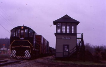
The photo runby at Dearborn Tower, Milepost 67.34. We reboarded and continued south as the rain began to ease off. We crossed Williams Creek at Milepost 65.2 on a double arch bridge which was over a hundred years old then made our way through Nulltown and slowed for our next photo runby at "Nulltown International Airport", where we detrained and lined up in the grass field that is used by the local airport.
The reverse move.

The Nulltown Airport photo runby at Milepost 64.1. Nulltown's name comes from the mill operated here by the Null brothers, Williams and Iseral. The railroad had a siding to the east here as well as some stock pens just to the east of the general store. A fort also once existed in this area during the era of the War of 1812.
Everyone reboarded once more and we then continued south and passed Lock 35, the Berlin Lock, at Milepost 63.1. We ran by Alpine, Conwell's Lock, Garrison's Lock and Hedrick's Lock before traversing though Laurel and a few minutes later, crossing the West Fork of the Whitewater River. We stopped at a grade crossing and detrained for our next photo runby.
The train reversing across the river to North Laurel Bridge 125, after which I relocated to down by river.
Photo runby 2 at the Whitewater River bridge, Milepost 57.35. The train was then posed on bridge and I switched to the west side.
Posed pictures from different angles. We all reboarded and were on our way to our next location at Triple Crossing Curve.
The reverse move.
Photo runby 3.
A photo line at this location.
Reverse move.
Photo runby 4. We then made our way toward Laurel Siding and upon our arrival, some of us detrained and were able to watch the train being rearranged for our northbound return later.
Our power running around our train.
After the power was run around our train, I reboarded while the consist was being switched to put us at the rear of the train.
Passengers taking photographs during this part of the trip. Once everyone was back onboard and the train put back together, we reversed into Metamora and detrained for lunch into the pouring rain. I went to a coffee bar and ordered a pair of hot dogs and a Coca-Cola then decided to explore.
Our train by Metamora Lock at Milepost 52.1.
The engine with the grist mill behind it.
A waterfall next to the Metamora Lock.
The train, the Lock and waterfall.
The rear of our train.
The Metamora Lock and waterfall. I reboarded and we started down toward the end of track.
The Whitewater Canal.
We ran along the Whitewater Canal and passed Lock 24 before passing Hearthstone Restaurant, where we ate last night, then slowly reversed all the way to the end of track. After a few moments there, we started the trip north as the rain continued, making our way along the Whitewater Canal.
We stopped at Lock 24, Milepost 51.4 for posed pictures.
The train with Lock 24.
Back onboard, we continued north back to Connersville as we rolled along the restored Whitewater Canal.
Passing Duck Creek Bridge at Milepost 51.7, built in 1843 for the canal and rebuilt in 1847 after a flood. It is reportedly the only remaining covered aqueduct in the country.
One of our passengers, Ralph, celebrated his 90th birthday aboard our train this weekend.
Later we crossed the Whitewater River as the rain continued to come down. As we neared Connersville, I called Let's Talk Trains and gave a brief report about the trip. We returned early and I detrained into this rainy world for a few last pictures.
Views at the Connersville station.
New York Central 9339 after a fantastic trip aboard the Whitewater Valley Railroad Photo Freight.
The locomotive's builder's plate. I found Chris Parker and we drove north on Highway 1 to US 40, on which we turned west then drove about forty miles to Knightstown and found the station for our next excursion.
| RETURN TO THE MAIN PAGE |